
Mori Atlas logo
Nature reserveNamedyer Werth

Examining the ecological terrain and riparian geography of the Middle Rhine river peninsula.

Namedyer Werth Nature Reserve: A Detailed Atlas Map of Rhineland-Palatinate Floodplain Landscapes

(Naturschutzgebiet Namedyer Werth)

Namedyer Werth represents a distinct floodplain remnant along the Middle Rhine, transitioning from a historical island to a vital nature reserve. This protected landscape preserves softwood forest and riparian habitats while housing the world famous cold-water geyser. The mapped geography reveals a compact terrain defined by river dynamics and transport corridors, offering a clear window into the ecological restoration efforts within the Rhineland-Palatinate region.

river peninsularhine floodplainfloodplain forestnature reservecold-water geyserbird habitat
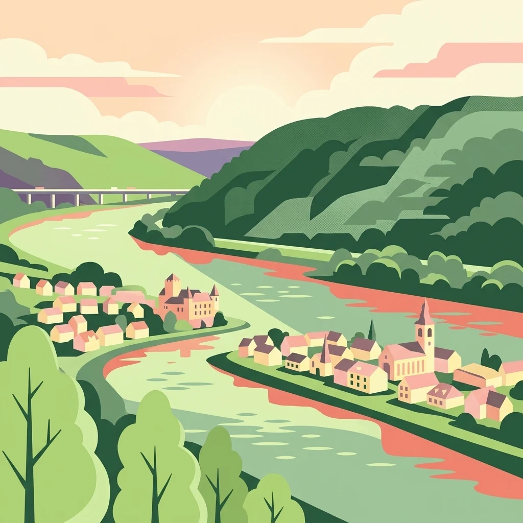
A flat-style vector illustration depicting a wide river flowing through a green valley with small towns nestled on the banks and a bridge in the distance.

Namedyer Werth

Nature reserve

Park overview

Structured park overview, official facts, and landscape profile for Namedyer Werth

Namedyer Werth park facts, protected area profile, and essential visitor context

Review the core facts for Namedyer Werth, including designation, size, terrain, visitor scale, habitats, and operating context in one park-focused overview.

About Namedyer Werth

Namedyer Werth sits in the Middle Rhine valley, the stretch of the Rhine that flows between Bingen and Bonn and is known for its incision through the Rhenish Massif. Although the peninsula itself is only a few dozen hectares in size, it occupies a meaningful ecological and cultural niche. Its transformation from an island into a peninsula during the nineteenth-century Rhine straightening is a visible legacy of how the river was engineered for navigation and flood control.

Ecologically, the site preserves a fragment of Auwald, the softwood floodplain forest that once lined large stretches of the Rhine. Such forests are increasingly rare along heavily regulated rivers, and the Namedyer Werth reserve serves as a refuge for plant and animal species adapted to periodically flooded riverine conditions. Its quiet waters and shallow side channels historically functioned as important spawning grounds for fish, an ecological role that continues in modified form today.

The peninsula is also strongly tied to the town of Andernach, whose old core lies just upstream. The Andernach Geyser, drilled here in 1903 and reactivated in 2006, draws on naturally carbonated mineral water rising from depth and is today a major visitor attraction in its own right. The combination of a small nature reserve, a globally notable cold-water geyser, and a layered medieval-to-modern history gives the location an unusual concentration of interest along an otherwise transit-dominated stretch of the Rhine valley.

Quick facts and research context for Namedyer Werth

Namedyer Werth lies on the left bank of the Middle Rhine between approximately river kilometers 614 and 616.6, just below Andernach in the Landkreis Mayen-Koblenz. The site covers roughly 21 hectares in total, of which about 15 hectares have been formally protected as a nature reserve since 1985, following an original protection proposal from 1937.

The area is classified as a Naturschutzgebiet under German conservation law, with the explicit purpose of preserving floodplain forest habitat and its associated rare plant and animal species, particularly as a resting and breeding area for threatened birds. The Andernach Geyser, the world's tallest cold-water geyser, erupts from a borehole on the peninsula and has been operating in its modern form since 2006.

Protection and recognition

Examining official conservation designations and recorded protection metrics

Namedyer Werth Protection Status and International Recognition Records

Namedyer Werth features documented protection status records compiled from official conservation databases and international registries. Reviewers can examine the verified management scope and designation history associated with this protected natural area.

Protection details

WDPA ID
164752
Park context

Deeper park guide and search-rich context for Namedyer Werth

Namedyer Werth history, landscape, wildlife, and travel context

Explore Namedyer Werth through its history, landscape character, ecosystems, wildlife, conservation priorities, cultural context, and seasonal travel timing in a structured park guide built for atlas discovery and search intent.

Why Namedyer Werth stands out

Namedyer Werth is best known as the site of the Andernach Geyser, a cold-water geyser that reaches up to around 60 meters in height, making it the highest of its type in the world. The geyser, originally called the Namedyer Sprudel, was first drilled in 1903, operated until 1957, and was reactivated after a new borehole in 2006.

A wide panoramic view of the Rhine river with a forested nature reserve on the opposite bank and a town in the foreground.
Panoramic view of the Namedyer Werth nature reserve along the Rhine river, featuring the Andernach Geyser.

Namedyer Werth history and protected-area timeline

The earliest documented reference to the island dates to 859, when the kings Charles the Bald, Louis the German, and Lothar II met on what was then a still-unnamed island in the Rhine. The first recorded name of the island, 'uff dem werde', appears in 1529, using a Middle Low German term meaning 'on the island'. In the same year the alternative name 'Grasswert' is documented, drawing on the Middle High German word for island. Throughout the Middle Ages and into the early modern period, the site followed the regional naming pattern in which most Middle Rhine islands end in '-werth', as seen in nearby Nonnenwerth, Hammersteiner Werth, and Graswerth.

In the late eighteenth century, the island suffered a severe environmental shock when catastrophic ice drift and flooding in February 1784, following the extreme winter of 1783/84, destroyed a celebrated walnut grove that had reportedly been the finest on the Rhine. The exposed soils were subsequently used purely as pasture, and later floods frequently stripped away topsoil from the unprotected ground.

During the nineteenth century the island changed hands and changed names several times, with successive owners including a local Kurtrier court councilor and a merchant family from Leutesdorf. A watermill was erected on the island in 1816 and later converted into an inn. The decisive turning point in the land's physical identity came around 1857, when the great Rhine straightening works attached the island to the left bank, turning it into a peninsula. Since 1985 it has been formally protected as a nature reserve, though a protection proposal had already been put forward in 1937.

Namedyer Werth landscape and geographic character

Namedyer Werth occupies a low-lying position on the left bank of the Middle Rhine, only a few meters above the main river level. Its terrain is essentially flat and shaped by the dynamics of a regulated river, including the side arm that still separates the peninsula from the surrounding floodplain in some seasons. The site is small, compact, and tightly framed by both natural and built features.

To the north and east, the peninsula is bordered by the main flow of the Rhine; to the south and west runs a shallow former channel that can dry out in particularly arid summers, leaving the peninsula effectively merged with the bank. The landscape is dominated by softwood floodplain woodland, riparian shrubs, and open grassy areas, reflecting both the natural regeneration that resumed in the nineteenth century and the deliberate restoration of floodplain habitat within the nature reserve.

The visual character of Namedyer Werth is heavily influenced by infrastructure. A federal highway bridges the length of the reserve, and a railway line runs along its former southern shore. As a result, the landscape is best understood as a narrow ecological ribbon pressed between two transport corridors, with the geyser installation near its upstream end serving as a focal landmark along the river.

Namedyer Werth ecosystems, habitats, and plant life

The nature reserve at Namedyer Werth centers on the preservation of a fragment of Auwald, the softwood floodplain forest ecosystem that once stretched along much of the Rhine. This habitat type depends on periodic flooding, sediment deposition, and the natural dynamics of an active floodplain, all of which have become rare along heavily channelized stretches of the river. The reserve aims to maintain the conditions under which characteristic floodplain species can persist.

In the shallow waters of the former side channel, fish reproduction historically thrived, and the area continues to function as a spawning and nursery environment for native fish species. The combination of woody cover, open water, wet meadows, and transitional edge habitats gives the site a layered ecological structure that supports a wider community of invertebrates, amphibians, and riverine birds.

The reserve's formal purpose, however, emphasizes its role for avifauna rather than its forest composition alone. The floodplain mosaic provides a quiet, sheltered environment that is significant for waterbirds and other species that rely on the Rhine corridor during migration and breeding.

Namedyer Werth wildlife and species highlights

Wildlife interest at Namedyer Werth centers primarily on birdlife, which is explicitly named in the protection designation as the main conservation focus. The reserve is recognized as a resting and breeding site for threatened bird species that use the Rhine valley as a migration corridor and habitat island. The mosaic of woodland, scrub, open water, and seasonally flooded grassland supports a varied bird community, including waterbirds associated with the river and side channels and woodland species nesting in the reconstructed floodplain forest.

The shallow former side channel also continues to support fish populations, providing spawning conditions that have already declined along much of the regulated Rhine. Amphibians and a typical floodplain invertebrate community round out the site's fauna, supported by the wet conditions and sheltered microclimate.

Because the peninsula sits between a busy road and railway line, its wildlife value lies less in spectacle than in its role as a quiet refuge within an otherwise heavily disturbed stretch of the Middle Rhine.

Namedyer Werth conservation status and protection priorities

Namedyer Werth has been protected as a Naturschutzgebiet, a German nature reserve, since 1985, although the case for protection had already been made in 1937. The reserve covers about 15 hectares of the broader 21-hectare landform. Its formal conservation aim is the preservation of softwood floodplain forest as a habitat for rare and threatened plant and animal species, with explicit emphasis on the area's value for resting and breeding birds.

The reserve represents one of the few surviving examples of Auwald along a heavily engineered stretch of the Middle Rhine, where most original floodplain woodland has been lost to river straightening, gravel extraction, agriculture, and urbanization. As such, it functions as a reference site for what the Rhine's natural floodplain once looked like, and as a small but ecologically meaningful refuge within a regional network of protected areas in the Landkreis Mayen-Koblenz.

The site's conservation significance is complicated by the transport infrastructure surrounding it. Road and rail traffic generate noise that affects the wildlife experience, especially for birds, and the nature reserve must be managed as a narrow ecological corridor squeezed between major transport routes.

Namedyer Werth cultural meaning and human context

Namedyer Werth carries a long human history layered onto a small piece of river land. In 859 it hosted a meeting of three Carolingian-era kings, an early signal of its political visibility in the Middle Rhine. Its shifting sequence of names, from 'uff dem werde' to 'Grasswert', 'Schlierswert', 'Meesen-Wert', and eventually 'Namedyer Werth', reflects successive owners and local dialects, and mirrors the broader naming culture of Middle Rhine islands ending in '-werth' or '-wörth'.

The peninsula is also closely tied to the identity of Andernach, which has owned or controlled the land for much of its history. The presence of the Andernach Geyser on the site has become part of the town's modern cultural and tourism profile, and a watermill-turned-inn from 1816 illustrates how the island once supported small-scale economic life.

Beyond signage and references, the peninsula does not host substantial built cultural heritage today, and its cultural relevance is best understood through its historical role in Rhine river life and through the local pride associated with a globally notable cold-water geyser.

Top sights and standout views in Namedyer Werth

Namedyer Werth combines three layers of significance within a very small footprint: a surviving fragment of Rhine floodplain forest, the location of the world's tallest cold-water geyser, and a long-documented island and peninsula history reaching back to a ninth-century royal meeting. Its protected status since 1985 marks it as a formally recognized refuge for floodplain habitat and birdlife along the Middle Rhine.

Despite being bordered by busy road and rail lines, the reserve retains an ecological character unusual for this stretch of the river, where most original Auwald has been lost. The combination of easy access from Andernach, a globally distinctive geothermal feature, and a compact nature reserve makes the site a noteworthy stop in the broader Middle Rhine landscape.

Best time to visit Namedyer Werth

Namedyer Werth can be visited year-round, but the experience varies with the seasons and with river conditions. Spring and early summer are typically the most rewarding periods for birdwatching in the reserve, as migrants and breeding species are active and the floodplain vegetation is at its freshest. Late spring through early autumn also suits visitors who want to combine a walk along the Rhine with a stop at the adjacent Andernach Geyser.

In dry summers the shallow side channel that defines the peninsula can partially or fully dry out, which changes its visual character and may affect waterbird activity. Winter visits are quieter in ecological terms but offer an unobstructed view of the peninsula's flat profile and the surrounding Rhine valley. Visitors sensitive to noise should be aware that road and rail traffic around the reserve is constant throughout the year.

Monthly climate preview

Review measured monthly averages and weather by month for this Rhineland Palatinate location

Namedyer Werth Climate Normals, Long Term Temperature and Precipitation Patterns

Long term representative data for Namedyer Werth captures recorded monthly shifts in average temperature and precipitation across the calendar year. Examining the full twelve month profile provides detailed context on thermal ranges and long term climatological patterns.
Annual mean9 °C
0 °C19 °C
Jan
Feb
Mar
Apr
May13°
Jun16°
Jul19°
Aug18°
Sep14°
Oct
Nov
Dec
Warmest month
July

18.7 °C

Coolest month
January

0 °C

Wettest month
December

2.5 mm/day

Driest month
April

1.6 mm/day

Park location guide

Geography guide, regional context, and park location map for Namedyer Werth

Namedyer Werth park geography, regions, and map view in Germany

Understand where Namedyer Werth sits in Germany through a broader geographic reading of the surrounding landscape, nearby location context, and its mapped position within the national park landscape.

How Namedyer Werth fits into Germany

Germany is a federal republic in Western and Central Europe with a population of over 83 million across sixteen constituent states. It is Europe's largest economy by nominal GDP and a major global exporter and importer. The capital is Berlin, and the country borders Denmark, Poland, Czech Republic, Austria, Switzerland, France, Luxembourg, Belgium, and the Netherlands.

Wider geography shaping Namedyer Werth in Germany

Germany is located in Western and Central Europe, spanning 357,022 km². It borders Denmark to the north, Poland and the Czech Republic to the east, Austria and Switzerland to the south, and France, Luxembourg, Belgium, and the Netherlands to the west. The country has coastlines on the Baltic Sea and North Sea to the north, with the Alps located in the southern region.

Map view of Namedyer Werth

Use this park location map to pinpoint Namedyer Werth in Germany, understand its exact geographic position, and read its mapped placement within the surrounding landscape more clearly.

Pigeon | © OpenStreetMap contributors

Location context for Namedyer Werth

Rhineland-Palatinate

Visual exploration of Rhine floodplain forests, cold water geysers, and riparian habitats

Namedyer Werth Landscape Photos and Protected Area Scenery

Photographic records capture the unique terrain and softwood floodplain forests of Namedyer Werth along the Middle Rhine. Visual documentation reveals the distinctive geography of this protected nature reserve and its rare geothermal features.

A wide panoramic view of the Rhine river with a forested nature reserve on the opposite bank and a town in the foreground.

Park atlas

Compare nearby river valley reserves and connected regional geography

Explore Other Parks Near Namedyer Werth and Surrounding Protected Landscapes

Continue browsing other parks near Namedyer Werth to examine related floodplain ecosystems and protected natural areas across the surrounding region. Comparing adjacent terrain helps place local riparian habitats and river basin geography into a broader conservation context.
A watercolor painting showing a reddish-brown layered geological formation, likely a quarry or volcanic cliff, topped with trees, with softer green hills in the distance.
Nature reserveRhineland-Palatinate
About 3.1 km away#1 closest

Southwest

Nastberg Nature Reserve: Volcanic Geology and Protected Landscapes in Rhineland-Palatinate

Tracing volcanic fissures and scoria cone history in the Middle Rhine region

Nastberg represents a significant geological site within the Vulkanpark network. The nature reserve exposes complex layers of tuff and scoria, documenting a long history of explosive activity. With views extending across the Neuwied Basin toward the Westerwald and Hunsrück, this site offers deep insight into the regional volcanic geography of western Germany.

Relief
Mountain
Climate
Temperate
Access
Easy access
Scope
Terrestrial
Nature reserveRhineland-Palatinate
About 5 km away#2 closest

South

Nettetal Nature Reserve: Geography and Protected Boundaries in Rhineland-Palatinate

Steep-sided valley landscapes and biodiversity corridors.

Nettetal Nature Reserve offers a deep look into the geomorphology of a classic Kerbtal in Rhineland-Palatinate. This protected area along the Nette tributary showcases a rare density of contrasting terrains, from sun-exposed rock formations to damp valley floors, providing a clear window into regional conservation mapping.

Area
7.05 km²
Established
1986
Scope
Terrestrial
Water
Major water bodies
Watercolor painting of a calm lake with a shoreline of green trees and distant, soft-hued rolling hills in the background.
Nature reserveRheinland-Pfalz
About 8.5 km away#3 closest

Southwest

Naturschutzgebiet Laacher See: Volcanic Crater Lake and Protected Regional Landscape

Geographic overview of the Eifel volcanic caldera and nature reserve.

Naturschutzgebiet Laacher See is a significant nature reserve in the Eifel volcanic field, centering on a deep crater lake of great ecological importance. Its protected boundaries encompass surrounding volcanic crater slopes, providing a critical refuge for waterfowl and breeding birds throughout the year. This record details the unique terrain and regional landscape context of this primary Rhineland-Palatinate conservation site.

Area
21.04 km²
Established
1940
IUCN
IV
Nature reserveRheinland-Pfalz
About 11 km away#4 closest

West

Bausenberg Nature Reserve: Geological Scoria Cone and Volcanic Landscape in Rhineland-Palatinate

Protected Eifel volcanic terrain and ancient earthwork geography.

Bausenberg serves as a protected window into eastern Eifel volcanism, showcasing a classic scoria cone and horseshoe-shaped crater profile. Located between Niederzissen and Waldorf, this 127-hectare reserve preserves critical lava-flow remnants and rare habitats, offering a deep look at the volcanic and human history shaped into the landscape of Rhineland-Palatinate.

Area
1.27 km²
Established
1981
Relief
Mountain
Climate
Temperate
A pale, minimalist watercolor painting showing a winding river flowing through a forested valley with rolling hills in the background.
Protected landscapeRhineland-Palatinate
About 12 km away#5 closest

North

Naturpark Rhein-Westerwald: Protected Landscapes of the Middle Rhine and Westerwald Plateaus

A historic protected area spanning Rhine river slopes and volcanic ridges

Naturpark Rhein-Westerwald defines a critical geographic corridor in Rhineland-Palatinate, bridging the gap between the Rhine valley floor and the Westerwald highlands. This protected landscape preserves a sequence of volcanic ridges, dense mixed forests, and deep river valleys that serve as a testament to the region's complex geological history and long-standing conservation efforts.

Area
470 km²
Established
1962
Relief
Upland
Scope
Terrestrial
A watercolor illustration of a river landscape featuring green plains, a winding river, and rolling hills in the background.
Nature reserveRhineland-Palatinate
About 14 km away#6 closest

Northwest

Naturschutzgebiet Mündungsgebiet der Ahr: Protected Delta and Fluvial Landscape

A dynamic nature reserve in the Rhineland-Palatinate river valley

Located in Sinzig, this protected nature reserve preserves the only remaining natural river-mouth delta of a Rhine tributary. The landscape is defined by continuous sediment deposition and erosion, allowing the Ahr to create a fluid, ever-changing environment of sandbanks and gravel bars. This reserve is essential for observing pioneer biocoenoses and floodplain dynamics within the broader context of Western German river geography.

Established
1981
Scope
Terrestrial
Water
Water-dominated
A soft watercolor painting of a green, rolling hillside with trees, set against a pale, light-filled background.
Nature reserveRhineland-Palatinate
About 14 km away#7 closest

Southwest

Hochstein Nature Reserve: Geological Mapping and Protected Eifel Landscape Context

An extinct volcanic cone protected within Rhineland-Palatinate

Hochstein stands as a representative Vulkanberg in the Osteifel, offering a clear visual landmark of Germany's volcanic history. This protected nature reserve encompasses forested slopes, the storied Genoveva Cave, and the surrounding drainage basins of the Nette river system, providing a deep look into the regional geology and conservation boundaries of the Middle Rhine highland.

Area
3.511 km²
Established
1983
Relief
Mountain
Scope
Terrestrial
Nature reserveRhineland-Palatinate
About 15 km away#8 closest

West

Lehrenkopf Nature Reserve: Mapped Volcanic Terrain and Regional Eifel Geography

Geological landscape and protected botanical site in Ahrweiler

Lehrenkopf stands as a compact nature reserve characterized by its 496-meter volcanic hill, which anchors the botanical and geological identity of the site. Spanning across the municipal territories of Kempenich and Brenk, this protected area serves as a focal point for regional conservation within the Eifel, emphasizing the preservation of rare wild plant species and the maintenance of distinct skyline features in the Ahrweiler district.

Area
0.35 km²
Established
1989
IUCN
IV
Relief
Mountain

Common questions about visiting, size, designation, and location context for Namedyer Werth

Namedyer Werth FAQs for park facts, access, geography, and protected area context

Find quick answers about Namedyer Werth, including protected-area facts, park geography, trail and visitor context, and how the park fits into its surrounding country and regional landscape.
MoriAtlas Explorer

Continue Your Protected Areas Search Across the Global Atlas

Deepen your exploration by continuing the structured search for national parks and protected areas worldwide. Utilize the comprehensive filtering capabilities to compare different conservation landscapes and refine your understanding of global park geography. Discover more about the distribution and characteristics of protected natural areas.

Global natural geography