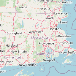
Why Narragansett Bay National Estuarine Research Reserve stands out
The reserve is best known for protecting a multi-island estuarine ecosystem within Narragansett Bay, one of the largest and most studied estuaries in the northeastern United States. Its combination of island terrestrial habitats and surrounding tidal waters makes it a focal site for estuarine research, monitoring, and coastal habitat conservation. The presence of three named islands, Prudence, Patience, and Hope, sets the reserve apart from many shoreline-only protected areas, providing both terrestrial and marine components under a single conservation framework. The reserve's long-standing role within the National Estuarine Research Reserve System also gives it a distinctive identity as a working landscape for estuarine science.
Narragansett Bay National Estuarine Research Reserve history and protected-area timeline
The Narragansett Bay National Estuarine Research Reserve was established in August 1980 under the Coastal Zone Management Act, becoming part of the federal National Estuarine Research Reserve System. Its designation reflected growing recognition of Narragansett Bay as an estuarine system of national significance and the need to protect representative habitats within it through a formal federal and state partnership.
The islands that form the core of the reserve, Prudence, Patience, and Hope, have a much longer human history. During the colonial era, all three islands were used for farming. By the 20th century, agricultural activity had declined, and Prudence Island in particular began to attract summer residents, establishing a seasonal human presence that would shape its communities for decades.
A significant chapter in the islands' history came during and after World War II, when the U.S. military established a presence on Prudence Island. That military activity continued until 1972, when the land was turned over to the state of Rhode Island. This transition from military use to state ownership, followed shortly afterward by formal federal estuarine reserve designation, set the stage for the islands' modern identity as a protected research and conservation landscape.
Governance of the reserve reflects its dual federal and state character. It is managed by the Rhode Island Department of Environmental Management in cooperation with NOAA, embedding the islands within a long-term institutional framework that connects local management with national estuarine research priorities.
Narragansett Bay National Estuarine Research Reserve landscape and geographic character
The landscape of the Narragansett Bay National Estuarine Research Reserve is defined by its island setting within Narragansett Bay. Prudence, Patience, and Hope Islands together form the terrestrial backbone of the reserve, each contributing differing shoreline configurations, interior terrain, and exposure to bay conditions. Rather than a single contiguous landmass, the reserve is a mosaic of islands separated by tidal channels, with the surrounding bay functioning as an integral part of the protected landscape.
The reserve's protected footprint includes both land and water. Approximately 2,353 acres of land sit alongside roughly 1,591 acres of water adjoining the islands, with the water component extending outward to a defined depth. This depth-defined boundary marks a transition from purely terrestrial scenery to an estuarine environment where water depth, tidal flow, and seafloor character begin to shape habitat.
Shorelines along the islands vary from sheltered coves and tidal flats to more wave-exposed edges, creating a range of coastal microhabitats within a relatively compact area. The interior portions of the islands reflect their historical use as farmland and, on Prudence Island, military land, with open expanses, remnant field patterns, and wooded zones intermixed. The combination of open, transitional, and wooded island landscapes with the broad sweep of the bay gives the reserve its distinctive coastal-terrestrial visual character.
Narragansett Bay National Estuarine Research Reserve ecosystems, habitats, and plant life
The Narragansett Bay National Estuarine Research Reserve protects a representative slice of estuarine and coastal ecology within one of the most ecologically important bays in the northeastern United States. The reserve's formal habitat framework emphasizes coastal, estuarine, and tidal zones, an acknowledgement that the ecological value of the site lies as much in its waters and tidal interfaces as in its terrestrial cover.
The bay setting creates a dynamic interface between marine and freshwater influences. Tidal exchange, nutrient cycling, and the mixing of waters from the broader New England watershed with Atlantic marine conditions produce an estuarine environment characterized by variable salinity, productive food webs, and important nursery habitat for marine life. The reserve's location within this system gives it ecological value that extends beyond the islands themselves.
On land, the islands display habitats shaped by generations of human use, including former agricultural areas, successional vegetation, and wooded tracts. This mosaic of open and forested environments, combined with shoreline habitats, supports a range of coastal and estuarine species and adds ecological diversity to the reserve. As part of the National Estuarine Research Reserve System, the site also serves as a long-term reference site for understanding estuarine conditions and change across the region.
Narragansett Bay National Estuarine Research Reserve wildlife and species highlights
Wildlife within the Narragansett Bay National Estuarine Research Reserve reflects the broader ecological character of Narragansett Bay and its island environments. The reserve's combination of island terrestrial habitats and estuarine waters supports a mix of coastal and marine-associated species typical of southern New England.
Estuarine waters and tidal flats around the islands provide habitat for a variety of fish, shellfish, and migratory species that depend on the bay for feeding, refuge, or reproduction. The reserve's protected status contributes to maintaining water quality and shoreline conditions that are important to these species. Surrounding uplands and wooded portions of the islands offer habitat for coastal birdlife and other terrestrial wildlife associated with New England's island and shoreline environments.
Because the reserve is part of the National Estuarine Research Reserve System, the site is regularly used for monitoring wildlife and habitat conditions, making it an important reference point for understanding wildlife patterns in the bay over time. While the reserve is not framed around a single charismatic species, its ecological diversity and research role give it significance for the wider wildlife community of Narragansett Bay.
Narragansett Bay National Estuarine Research Reserve conservation status and protection priorities
The Narragansett Bay National Estuarine Research Reserve holds a distinctive place within the U.S. coastal conservation framework. As a Marine Protected Area and a member of the National Estuarine Research Reserve System, the site is part of a national network designed to protect representative estuarine habitats and to support long-term research, monitoring, and stewardship.
The reserve's establishment under the Coastal Zone Management Act in 1980 reflected the recognition that Narragansett Bay, despite its heavily developed shoreline, retained critical estuarine values worth protecting at a federal level. The inclusion of both island land and surrounding water, extending to a defined depth, was an important conservation choice: it acknowledged that protecting estuarine ecosystems requires attention to the shallow tidal waters where ecological processes are most active.
Through its federal and state partnership between NOAA and the Rhode Island Department of Environmental Management, the reserve integrates national estuarine research priorities with state-level land and water management. This arrangement supports the reserve's role as both a conservation site and a long-term monitoring platform for estuarine health, water quality, and habitat change in one of the Northeast's most closely watched estuaries. The conservation value of the reserve is therefore tied as much to its role in generating scientific understanding of estuarine systems as to the direct protection of its islands and waters.
Narragansett Bay National Estuarine Research Reserve cultural meaning and human context
The cultural context of the Narragansett Bay National Estuarine Research Reserve is closely tied to the layered histories of Prudence, Patience, and Hope Islands. All three islands were used for farming during the colonial era, a shared agricultural heritage that shaped the islands' settlement patterns and land cover for generations.
By the 20th century, farming activity had declined, and Prudence Island became known as a summer destination, drawing seasonal residents and establishing a recreational and residential tradition on the island. This transition from working farmland to seasonal community is part of the cultural texture of the bay's islands and remains visible in the islands' built environment and patterns of land use.
A particularly significant cultural episode came during World War II, when the U.S. military established a presence on Prudence Island. That military activity continued until 1972, when the land was returned to the state of Rhode Island. The eventual transition of these former military lands into a protected estuarine research reserve, beginning in 1980, marks a notable shift in how the islands are understood and used, from sites of strategic activity to landscapes of long-term ecological research and conservation.
Top sights and standout views in Narragansett Bay National Estuarine Research Reserve
The Narragansett Bay National Estuarine Research Reserve stands out for combining island-based terrestrial protection with surrounding estuarine and tidal waters within a single reserve framework. Its three-island core, Prudence, Patience, and Hope Islands, gives it a distinctive multi-island geography uncommon among estuarine reserves in the region.
Its status as part of the National Estuarine Research Reserve System and as a Marine Protected Area places it within an influential national network for estuarine science and conservation. The reserve's long-running federal and state partnership with NOAA and the Rhode Island Department of Environmental Management gives it a stable institutional structure for ongoing research and stewardship.
The layered history of the islands, from colonial farming through 20th-century summer communities and a mid-century military presence to modern conservation use, adds cultural depth to the reserve's natural significance. Together, these qualities make the reserve a meaningful intersection of estuarine ecology, island landscape, and coastal heritage in southern New England.
Best time to visit Narragansett Bay National Estuarine Research Reserve
The character of a visit to the Narragansett Bay National Estuarine Research Reserve is closely tied to the seasonal rhythms of the bay. Warmer months bring more active boating access to Prudence, Patience, and Hope Islands and highlight the reserve's role as a coastal and estuarine environment, with longer days supporting outdoor research, monitoring, and educational activity. These seasons also align with the historical pattern of summer residency on Prudence Island.
Cooler and off-season periods tend to bring a quieter, more contemplative atmosphere, with reduced visitor presence and a stronger sense of the islands' transitional and winter character. For those interested in tidal habitats, estuarine conditions, and the bay's seasonal ecology, timing a visit around tidal cycles and seasonal transitions can enhance the experience. As with all estuarine sites, weather and tidal conditions shape how the islands and waters can be safely enjoyed, and visitors typically benefit from planning around these rhythms rather than around peak tourism windows.