
Mori Atlas logo
Nature reserveGreat Bay National Estuarine Research Reserve

Discover the complex tidal ecosystems and salt marsh habitats across this New Hampshire protected nature reserve

Great Bay National Estuarine Research Reserve: Mapped Protected Landscapes and Estuarine Geography

Great Bay National Estuarine Research Reserve encompasses a significant mosaic of tidal water, salt marshes, and coastal woodlands along the southeastern shore of New Hampshire. The protected boundaries trace a vital estuarine system where freshwater rivers merge with coastal inlets, creating a unique transition between upland terrain and tidal environments. Through detailed mapping, understand the geographical connectivity of this protected landscape as it sustains diverse aquatic life and regional watershed health.

estuarysalt marshcoastal reservetidal habitatNOAA reserveNew Hampshire coast
A flat-design, vector-style illustration of a coastal bay with tall cliffs, evergreen trees, calm water, and small boats under a setting or rising sun.

Great Bay National Estuarine Research Reserve

Nature reserve

Park overview

Structured park overview, official facts, and landscape profile for Great Bay National Estuarine Research Reserve

Great Bay National Estuarine Research Reserve park facts, protected area profile, and essential visitor context

Review the core facts for Great Bay National Estuarine Research Reserve, including designation, size, terrain, visitor scale, habitats, and operating context in one park-focused overview.

About Great Bay National Estuarine Research Reserve

The Great Bay National Estuarine Research Reserve sits at the meeting point of several rivers and the tidal influence of the Atlantic, forming one of the more distinctive estuarine landscapes in northern New England. Great Bay itself is a drowned river valley, where freshwater outflow from rivers such as the Lamprey, the Oyster, and the Bellamy blends with seawater that pushes in and out with the tides.

The reserve's protected lands reflect this blending at every scale. Tidal salt marshes line the inner bay, while higher ground rises into coastal bluffs and patches of woodland. Fields and former agricultural lands along the shore provide open habitat for grassland birds and pollinators, and the tidal creeks and river mouths create sheltered nurseries where marine life can thrive.

This combination of habitats makes the reserve an unusually rich outdoor laboratory. Scientists use it to study water quality, plankton dynamics, salt marsh ecology, and the migration patterns of fish and birds that depend on estuaries. At the same time, the reserve has become a focal point for public learning about estuaries, with boardwalks, interpretive trails, and education centers that allow visitors to step directly into this watery landscape.

The cultural layer is just as important. Long before modern conservation arrived, Great Bay supported fishing, shipping, and commerce for coastal communities. Today the reserve interprets that heritage through exhibits and traditional vessel replica experiences, helping connect today's visitors to the people who first depended on these tidal waters.

Quick facts and research context for Great Bay National Estuarine Research Reserve

The Great Bay National Estuarine Research Reserve encompasses roughly 10,235 acres of estuarine and upland habitats around Great Bay in southeastern New Hampshire. About 7,300 acres of that area consists of open water and tidal wetlands, surrounded by salt marshes, bluffs, woodlands, and fields that reflect the ecological richness of a New England tidewater landscape. Designated in 1989, it is one of the estuarine reserves supported by NOAA's National Estuarine Research Reserve System and is managed by the New Hampshire Fish and Game Department's Marine Fisheries Division.

Protection and recognition

Documented protection scope and establishment records for Great Bay

Great Bay National Estuarine Research Reserve Protection Status and Designation History

Great Bay National Estuarine Research Reserve maintains a documented mixed protection status established in 1989. Structured records compile official designation history and management scope without imported international recognition sources.

Protection details

Protection scope
Mixed
Designated year
1989
Transboundary protection
No
Park context

Deeper park guide and search-rich context for Great Bay National Estuarine Research Reserve

Great Bay National Estuarine Research Reserve history, landscape, wildlife, and travel context

Explore Great Bay National Estuarine Research Reserve through its history, landscape character, ecosystems, wildlife, conservation priorities, cultural context, and seasonal travel timing in a structured park guide built for atlas discovery and search intent.

Why Great Bay National Estuarine Research Reserve stands out

Great Bay NERR is best known for its well-preserved tidal estuary and the patchwork of habitats that converge there: salt marshes flushed by the tides, fringing woodlands, rocky shores, and a network of rivers feeding into the bay. The reserve is also recognized as an important working landscape where estuarine science, conservation management, and public education come together along an historically significant New Hampshire waterway. Visitors and researchers especially associate the reserve with salt marsh ecology and with the broader story of how a centuries-old working estuary continues to function as a living coastal ecosystem. The presence of salmon migration routes, plankton studies, and tidal interpretive programs reinforces its identity as a place where natural processes and human heritage are studied side by side.
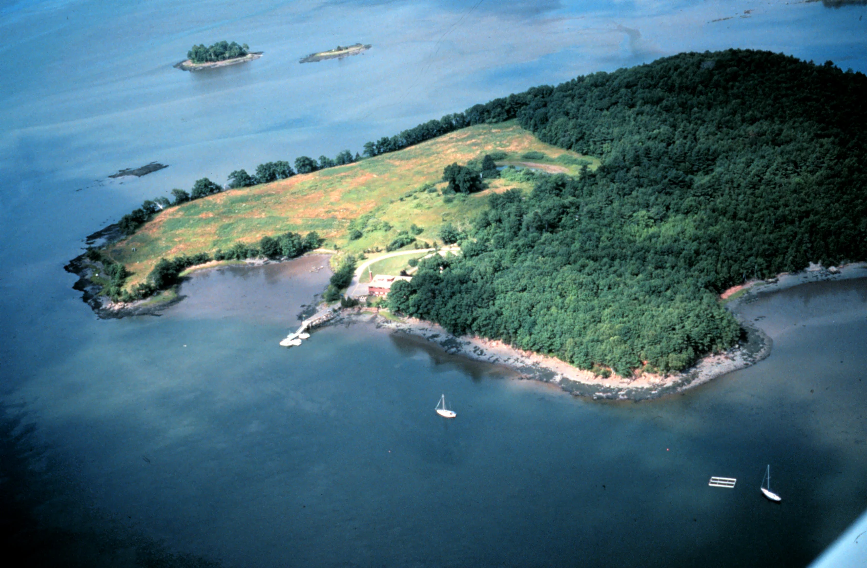
An aerial perspective of a wooded peninsula extending into a large bay, featuring a mix of forest and open grassy areas, with small boats anchored in the surrounding water.
Aerial view of the Great Bay National Estuarine Research Reserve, showing coastal woodlands, tidal flats, and boat moorings.

Great Bay National Estuarine Research Reserve history and protected-area timeline

The estuary has a layered history. Great Bay was the first major commercial waterway developed by early European settlers in the region, supporting fishing, trade, and boatbuilding along the New Hampshire coast. Communities along the bay earned their livelihoods from the same waters that continue to define the region's identity today.

In the late twentieth century, growing awareness of estuarine ecosystems and their vulnerability led to federal action. In 1989, Great Bay was designated as part of the National Estuarine Research Reserve System, a network of state-managed coastal protected areas supported by NOAA within the United States Department of Commerce. This designation recognized the estuary's ecological significance and committed it to long-term research, monitoring, education, and stewardship.

The reserve has been managed by the New Hampshire Fish and Game Department's Marine Fisheries Division, which works to promote the wise use and management of the Great Bay estuary. Over the decades, the site has expanded its public-facing role through the Great Bay Discovery Center, coastal conservation facilities, and outdoor experiences that interpret the area's overlapping natural and cultural history.

Great Bay National Estuarine Research Reserve landscape and geographic character

The landscape of Great Bay NERR is defined by its estuarine character. The bay itself is a broad tidal inlet, fed by a network of rivers whose freshwater intermingles with seawater twice each day. The result is a soft-watered basin surrounded by gently sloping shores, salt marshes, and tidal creeks.

Land-based terrain within the reserve includes coastal bluffs rising above the bay shoreline, rocky shores at the water's edge, woodlands further inland, and open fields that were historically shaped by land use. Together these features create a continuous transition from upland habitats down through salt marsh fringe and into open tidal water, illustrating the layered geography of a New England estuarine system.

Seasonal weather enhances this sense of transition: winters bring ice along quieter tidal reaches, while spring and summer highlight lush marsh growth and active wading bird habitat. Visitors walking the reserve's universally accessible trail and boardwalk pass through this blend of habitats in a relatively short distance, gaining a clear sense of how the bay's edge moves between forest, meadow, marsh, and open water.

Great Bay National Estuarine Research Reserve ecosystems, habitats, and plant life

Great Bay's natural setting is shaped by the daily rhythm of the tides. As saltwater flows in and out of the bay, it sustains extensive salt marshes whose grasses and reeds provide food and shelter for a great variety of organisms. These marshes, along with eelgrass beds and tidal mudflats, are foundational habitats that support the entire food web of the estuary.

Freshwater inputs from the area's rivers contribute nutrients and sediment that help build marsh soils and sustain plankton communities. This blend of fresh and salt water is what makes estuaries such productive places; Great Bay exemplifies that productivity on the New Hampshire coast.

Above the waterline, the reserve's uplands, including woodlands, bluffs, and open fields, add habitats for songbirds, raptors, pollinators, and small mammals. The result is a landscape where aquatic and terrestrial habitats interlock rather than stand apart, allowing species to move between the bay, the marshes, and the surrounding forests throughout the year.

Great Bay National Estuarine Research Reserve wildlife and species highlights

Great Bay's wildlife reflects its status as a tidal ecosystem. The reserve's salt marshes and shallow tidal waters host crabs, shellfish, finfish, and the seasonal migration of species such as striped bass and shad. Local rivers feeding the bay are also important for salmon migration, which is one of the signature wildlife stories highlighted by the reserve's interpretive programs.

Shorebirds and wading birds are among the most visible wildlife users of the estuary, foraging along mudflats and salt marsh edges during migration and breeding seasons. The reserve's open fields and woodland edges further support songbirds and small mammals, while the open waters overhead are used by waterfowl and occasionally raptors.

Plankton, though less visible, are central to the estuarine food web, and they are highlighted through the reserve's research and education efforts. Together, these animals illustrate the interconnected nature of an estuarine ecosystem, where a microscopic drift of life can underpin fish populations, bird migrations, and the workings of coastal communities.

Great Bay National Estuarine Research Reserve conservation status and protection priorities

As part of the National Estuarine Research Reserve System, Great Bay NERR is recognized at the federal level for its ecological value and its contribution to coastal research. The reserve is intended to serve as a living site for long-term monitoring, restoration, and applied science, helping coastal managers understand how estuaries respond to pollution, sea level rise, land use change, and other pressures.

Conservation efforts in the reserve address several interacting issues. Water quality in the bay is a perennial concern, as runoff from inland communities shapes the estuary's chemistry. Salt marsh health, shoreline erosion, and the resilience of tidal habitats are also persistent focal areas. The reserve's protected designation helps create a baseline of natural conditions against which broader regional changes can be measured.

By linking local research with national programs, Great Bay NERR also helps connect New Hampshire's coastal conservation work with broader networks of scientists and coastal reserve sites. This makes it both a local conservation resource and a contributor to the larger picture of how American estuaries are being managed in a changing climate.

Great Bay National Estuarine Research Reserve cultural meaning and human context

Great Bay carries cultural meaning that long predates its conservation status. It was the first major commercial waterway developed by early European settlers in the region, anchoring generations of fishing, shipping, and trade along the New Hampshire coast. Working vessels built for the bay were central to local livelihoods, and the reserve preserves one such vessel tradition through a 19th-century gundalow replica on site.

Indigenous presence in the area is also acknowledged, with a replica Native American camp and gardens at the Discovery Center offering interpretive context for the long human history along the bay's shores. Together, these traditions frame the estuary not just as a natural environment but as a cultural landscape shaped by multiple communities over time.

Top sights and standout views in Great Bay National Estuarine Research Reserve

The reserve's signature qualities include its broad tidal estuary, expansive salt marshes, and a continuous gradient from forested uplands to open water. It also stands out for combining estuarine research, environmental education, and coastal conservation under a single protected designation.

Equally notable is its interpretative experience: visitors can step from the Great Bay Discovery Center onto a universally accessible trail and boardwalk, view a 19th-century gundalow replica, and connect with the cultural heritage of a New Hampshire waterway that has supported coastal communities for centuries.

Best time to visit Great Bay National Estuarine Research Reserve

Spring and fall tend to offer particularly rewarding conditions for visiting Great Bay NERR. In spring, the salt marshes begin greening up, migratory birds return to the shoreline, and the river-fed freshwater pulses mix with rising tides, making the estuary feel alive with activity. Cooler temperatures and emerging foliage along the reserve's bluffs and woodlands add to the sense of awakening habitat.

Fall brings cooler air, dramatic skies over the bay, and peak bird migration, when shorebirds, waterfowl, and raptors move along the estuary. Summer is also attractive, with warmer weather suiting longer walks along the boardwalk and outdoor interpretive programs, though visitors should expect variable tidal conditions that shape the feel of the shoreline. Winter visits are quieter and emphasize the bay's stark, icy character, with fewer programs but a tranquil atmosphere well suited to observation of dormant marsh grasses and winter waterfowl.

Monthly climate preview

Long-term monthly temperature and precipitation rhythm for New Hampshire protected geography

Great Bay National Estuarine Research Reserve Climate Normals and Temperature Patterns

Representative coordinate records show measured monthly temperature and precipitation variations across twelve distinct periods for Great Bay National Estuarine Research Reserve. Detailed records provide full monthly climate normals to analyze annual weather progression and long-term environmental patterns.
Annual mean9 °C
-2 °C20 °C
Jan-2°
Feb-1°
Mar
Apr
May11°
Jun16°
Jul20°
Aug20°
Sep17°
Oct11°
Nov
Dec
Warmest month
August

20.1 °C

Coolest month
January

-1.9 °C

Wettest month
December

4.3 mm/day

Driest month
July

2.8 mm/day

Park location guide

Geography guide, regional context, and park location map for Great Bay National Estuarine Research Reserve

Great Bay National Estuarine Research Reserve park geography, regions, and map view in United States of America

Understand where Great Bay National Estuarine Research Reserve sits in United States of America through a broader geographic reading of the surrounding landscape, nearby location context, and its mapped position within the national park landscape.

How Great Bay National Estuarine Research Reserve fits into United States of America

The United States of America is a federal presidential republic and one of the world's largest countries by area and population. It consists of 50 states across a vast territory spanning multiple time zones, with its capital in Washington, D.C. and largest city in New York City. The nation has a diverse economy, influential political system, and significant cultural and military presence globally.

Wider geography shaping Great Bay National Estuarine Research Reserve in United States of America

The United States occupies a vast territory in North America, bordered by Canada to the north and Mexico to the south. The 48 contiguous states stretch from the Atlantic to the Pacific Ocean, while Alaska occupies the northwestern region and Hawaii is an archipelago in the Pacific. The country encompasses diverse terrain including the Rocky Mountains, Appalachian Mountains, Great Plains, and extensive river systems.

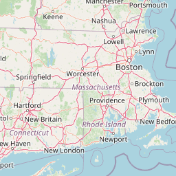
Map view of Great Bay National Estuarine Research Reserve

Use this park location map to pinpoint Great Bay National Estuarine Research Reserve in United States of America, understand its exact geographic position, and read its mapped placement within the surrounding landscape more clearly.

Pigeon | © OpenStreetMap contributors

Location context for Great Bay National Estuarine Research Reserve

New Hampshire

Visualizing the tidal estuaries, salt marshes, and coastal terrain of New Hampshire

Great Bay National Estuarine Research Reserve Photos and Landscape Views

Examine detailed Great Bay National Estuarine Research Reserve photos to observe the complex interplay of tidal waters, fringing salt marshes, and coastal bluffs across the protected estuary. Visual records clarify the distinctive terrain transitions from upland woodlands to open estuarine habitats, revealing the environmental character of the northeastern coastline.

An aerial perspective of a wooded peninsula extending into a large bay, featuring a mix of forest and open grassy areas, with small boats anchored in the surrounding water.

Park atlas

Compare regional coastal reserves, tidal wetlands, and connected New England conservation lands.

Explore Parks Near Great Bay National Estuarine Research Reserve and Surrounding Protected Areas

Browse protected areas and coastal habitats located near Great Bay National Estuarine Research Reserve. Geographic comparison reveals broader regional patterns across northeastern estuaries and wetlands.
A watercolor painting of a green, rolling coastal landscape with gentle hills and trees under a white background.
Protected landscapeMassachusetts
About 82 km away#1 closest

South

Boston Harbor Islands National and State Park: Mapping Coastal Protected Landscapes

A diverse archipelago of islands and tidal harbors in Massachusetts

Boston Harbor Islands National and State Park offers an expansive look at coastal geography within the Massachusetts Bay. Spanning dozens of islands and peninsulas, this protected landscape captures a blend of drumlin terrain, tidal salt marshes, and historic maritime structures set directly against the urban skyline of Boston.

Area
6 km²
Established
1996
Visitors
28.2K annual
Relief
Lowland
Protected landscapeNew Hampshire
About 98 km away#2 closest

North

White Mountain National Forest: Protected Landscape Atlas and Geographic Boundary Context

Mapping the alpine ridges and river valleys of New Hampshire

Delve into the geography of White Mountain National Forest, a primary federal protected landscape in the eastern United States. This overview details the mountainous terrain, including the Presidential Range and Pemigewasset Wilderness, providing a clear window into its spatial scale, watershed boundaries, and regional prominence within the New England landscape.

Area
3,038.59 km²
Established
1918
Relief
Mountain
Climate
Temperate
Watercolor painting of a lush green landscape featuring rolling hills in the distance, a meandering stream in the midground, and wetlands with cattails in the foreground.
Protected landscapeVermont
About 137 km away#3 closest

Northwest

Green Mountain National Forest: Mapped Geography and Protected Landscape Analysis

Examining the wilderness backbone of Vermont's mountainous terrain

Gain insight into the expansive boundaries of Green Mountain National Forest, an essential protected area spanning the Green Mountains of Vermont. This profile details the forest's composition, ranging from high-elevation spruce-fir zones to mixed hardwood slopes and extensive federal wilderness corridors, providing a foundational geographic understanding of this vital northeastern landscape.

Area
1,615.31 km²
Established
1932
Relief
Mountain
Climate
Temperate
Marine protected areaRhode Island
About 166 km away#4 closest

South

Narragansett Bay National Estuarine Research Reserve: Island and Marine Protected Area Overview

A coastal research landscape in Rhode Island

Discover the geographic composition of the Narragansett Bay National Estuarine Research Reserve. This marine protected area spans the terrestrial and aquatic zones of three major islands within the Narragansett Bay system, providing a deep look at estuarine habitat conservation and regional island geography.

Area
15.9 km²
Established
1980
Relief
Lowland
Climate
Temperate
A horizontal watercolor painting depicting a winding river flowing through a lush, forested valley with rolling hills in the background.
Wildlife reserveVermont
About 166 km away#5 closest

West

Lye Brook Wilderness: Protected High Plateau and Forest Geography in Southern Vermont

Mapped wilderness boundaries within the Green Mountain National Forest

Spanning nearly 18,000 acres, Lye Brook Wilderness offers a deep dive into southern Vermont's natural geography. The area features a high forested plateau, complex brook valleys, and elevated ridgelines that characterize this established wilderness reserve. Ideal for those studying the regional landscape and its protected ecosystem, this record provides essential context on the forest cover, glacial terrain, and the geographic significance of this Vermont backcountry unit.

Area
73.34 km²
Established
1975
IUCN
Ib
Protected landscapeVermont
About 168 km away#6 closest

West

Robert T. Stafford White Rocks National Recreation Area: Protected Landscape and Regional Geography

Southern Vermont wilderness, quartzite formations, and Appalachian Trail corridors.

Robert T. Stafford White Rocks National Recreation Area represents a unique fusion of protected forest and rugged geological character in southern Vermont. Known for the quartzite rockslides of Chaos Canyon and its inclusion of two distinct wilderness areas, this territory offers a complex terrain profile. Spanning over 36,000 acres, it serves as a central hub for regional backcountry exploration, blending dense hardwood ecosystems with the prominent rocky outcrops that define its distinct mountainous identity.

Area
147 km²
Established
1984
Water
Major water bodies
Wildlife reserveBennington County
About 174 km away#7 closest

West

George D. Aiken Wilderness: Protected Forest Landscapes and Ridgelines in Vermont

Detailed geographic overview of a Green Mountain wilderness reserve

Spanning over 4,800 acres in Bennington County, the George D. Aiken Wilderness stands as a significant protected area within the southern Green Mountains. The terrain features narrow ridgelines, steep valleys, and a dense canopy of northern hardwoods that remain unmanaged to maintain wilderness standards. This area serves as a primary geographic anchor for Eastern wilderness preservation efforts in the United States.

Area
19 km²
Established
1984
IUCN
Ib
Relief
Mountain
Protected areaAddison County
About 192 km away#8 closest

Northwest

Joseph Battell Wilderness: Mapping Protected Ridges in the Green Mountain National Forest

A high-elevation Appalachian landscape in Addison County, Vermont.

Spanning over twelve thousand acres, the Joseph Battell Wilderness preserves a critical core of the Green Mountains. This protected area features dramatic cliff faces like Mount Horrid and a continuous sequence of summits exceeding three thousand feet. The region provides a deep look at northern hardwood habitats and the geographic influence of the Long Trail within the broader Vermont mountain landscape.

Area
49.92 km²
Established
2006
Relief
Mountain
Climate
Temperate

Common questions about visiting, size, designation, and location context for Great Bay National Estuarine Research Reserve

Great Bay National Estuarine Research Reserve FAQs for park facts, access, geography, and protected area context

Find quick answers about Great Bay National Estuarine Research Reserve, including protected-area facts, park geography, trail and visitor context, and how the park fits into its surrounding country and regional landscape.
MoriAtlas Explorer

Continue Your Protected Areas Search Across the Global Atlas

Deepen your exploration by continuing the structured search for national parks and protected areas worldwide. Utilize the comprehensive filtering capabilities to compare different conservation landscapes and refine your understanding of global park geography. Discover more about the distribution and characteristics of protected natural areas.

Global natural geography