
Mori Atlas logo
Protected landscapeNaturpark Hohe Mark

Exploring the ecological transition between Münsterland parkland and the Lower Rhine lowlands.

Naturpark Hohe Mark Protected Landscape: Geographic Boundaries and Regional Terrain Mapping

Naturpark Hohe Mark serves as a vital protected landscape spanning nearly 2,000 square kilometers within Germany. This region functions as a significant ecological bridge, encompassing a diverse array of terrain types including the forested Hohe Mark ridge, expansive river valleys, and rare raised bog remnants. The geography represents a convergence of distinct natural zones, providing essential habitat corridors and complex landscape patterns that define the region's character.

nature parkNorth Rhine-WestphaliaMünsterlandLower RhineRuhr regionsandy upland forest
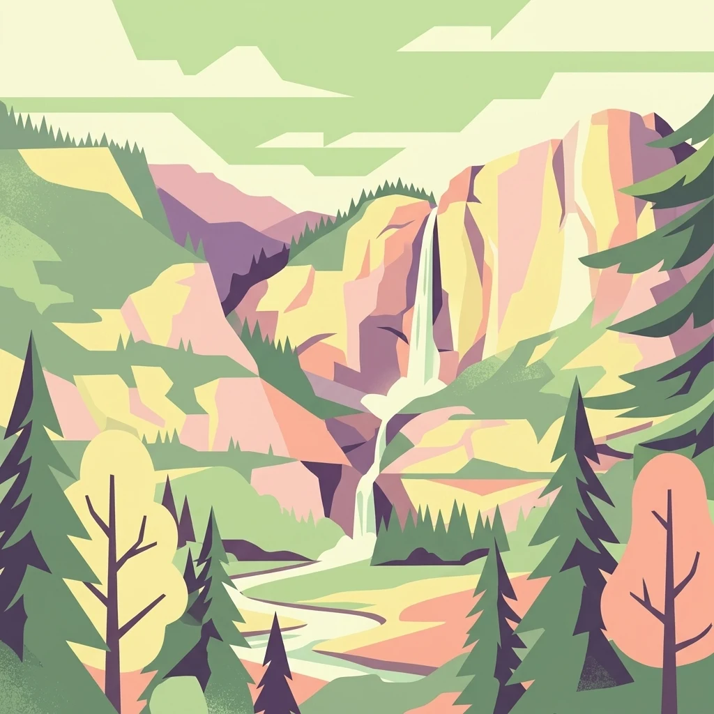
A stylized, flat-design illustration of a mountainous landscape featuring a waterfall cascading into a valley, framed by evergreen trees in the foreground.

Naturpark Hohe Mark

Protected landscape

Park overview

Structured park overview, official facts, and landscape profile for Naturpark Hohe Mark

Naturpark Hohe Mark park facts, protected area profile, and essential visitor context

Review the core facts for Naturpark Hohe Mark, including designation, size, terrain, visitor scale, habitats, and operating context in one park-focused overview.

About Naturpark Hohe Mark

Naturpark Hohe Mark occupies a distinct position among Germany's nature parks because of its sheer size and the way it stitches together three very different regional landscapes. Founded in 1963, it covers about 1,978 square kilometers in the western part of North Rhine-Westphalia, reaching from Bocholt and Wesel in the west to Datteln and Lüdinghausen in the east, and from the Ruhr cities of Bottrop and Oberhausen in the south up to Gescher in the north.

The park effectively serves as a green corridor between the densely populated Ruhr area and the more agricultural Münsterland. The southern tip still bears traces of industrial history: former mining, sand quarrying, and clay extraction have left behind transformed, sometimes surprising post-industrial landscapes that gradually give way to forest and farmland as one moves north.

In the northeast, the landscape opens into the classic Westmünsterland parkland, a mosaic of meadows, pastures, fields, peat areas, and small woodland patches. Further south, this transitions into the wooded upland that forms the park's core: the Hohe Mark itself, flanked by the Rekener Berge, Die Berge, the Haard, and the Borkenberge. The highest point in this forested belt is the Stimberg in the Haard, reaching about 156.9 meters above sea level. West of this central spine, the terrain descends toward the Lippe and Issel lowlands, where rivers, canals, and reservoirs shape a more open, watery landscape.

Culturally, the park is also rich. Heiden is locally associated with the megalithic De Düwelsteene monument on the southern slope of the Rekener Berge, while the Femeiche in Erle (Raesfeld) is a famous natural monument. Beyond these landmarks, the park supports an extensive network of more than 3,000 kilometers of hiking trails, cycling and equestrian routes, and since 2021 the certified long-distance Hohe-Mark-Steig, a 158-kilometer quality trail linking Wesel on the Rhine with Olfen on the Lippe.

Quick facts and research context for Naturpark Hohe Mark

Naturpark Hohe Mark was founded in 1963 and is among the largest nature parks in North Rhine-Westphalia, with an area of about 1,978 square kilometers. It lies in the western part of the state, bridging the Lower Rhine, the Westmünsterland, and the northern edge of the Ruhr area, touching the Dutch border near Isselburg, Bocholt, and Rhede.

The park contains a mix of Münsterland park-like farmland, sandy forest uplands (the Hohe Mark, Haard, and Borkenberge), and the river landscapes of the Lippe, Issel, and Stever. Major waters include the Halterner Stausee and other reservoirs, while the Merfelder Bruch near Dülmen is famous for its wild horse herd. A more than 3,000-kilometer hiking network, the long-distance Hohe-Mark-Steig trail, and one of the largest Nordic walking parks in the state all support outdoor recreation within the park.

Protection and recognition

Documented terrestrial protection metrics and official designation data.

Naturpark Hohe Mark Protection Status and Regional Conservation Scope

Naturpark Hohe Mark maintains a documented terrestrial protection scope within its regional conservation framework. Official records compile available designation details, management parameters, and international recognition standards.

Protection details

Protection scope
Terrestrial
Transboundary protection
No
Park context

Deeper park guide and search-rich context for Naturpark Hohe Mark

Naturpark Hohe Mark history, landscape, wildlife, and travel context

Explore Naturpark Hohe Mark through its history, landscape character, ecosystems, wildlife, conservation priorities, cultural context, and seasonal travel timing in a structured park guide built for atlas discovery and search intent.

Why Naturpark Hohe Mark stands out

Naturpark Hohe Mark is best known for the surprising concentration of contrasting landscapes that fit into one protected area: Münsterland-style parkland with meadows, pastures, fields, and moors; a dry sandy forest upland called the Hohe Mark with the Haard and Borkenberge; and the water landscapes of the Lippe valley and its reservoirs. The park is also recognized for the Merfelder Bruch area near Dülmen, home to one of the last semi-wild horse herds in central Europe, as well as for its partially drained raised bogs, cormorant and grey heron colonies, and the Wesel-Datteln canal corridor. Geologically, it is notable for the Cretaceous quartz sands and iron-cemented Schwartensandstein that shape its hills and have been used as local building stone.
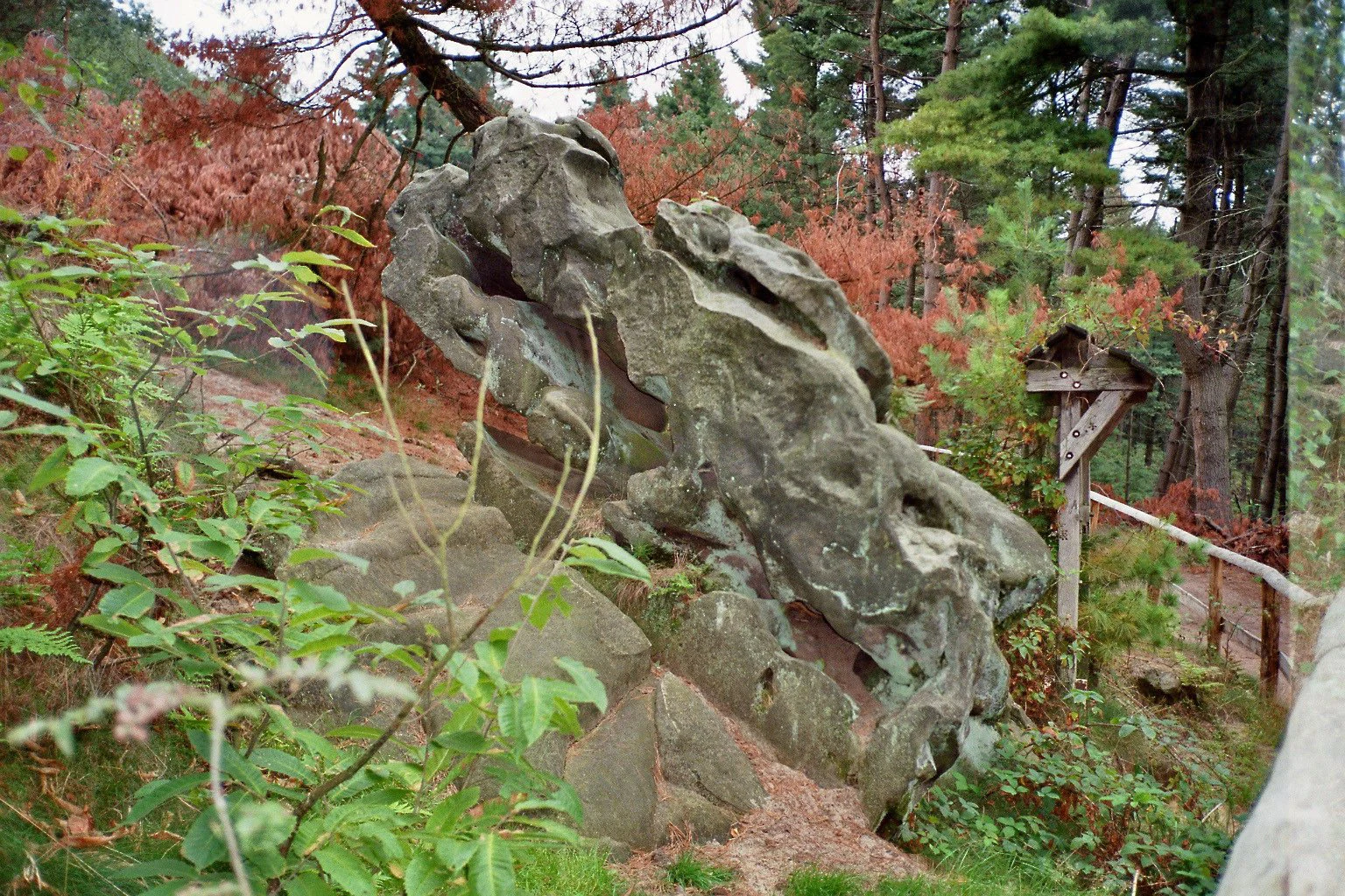
A large, weathered sandstone rock formation sits on a hillside surrounded by trees and autumn-toned foliage, with a small wooden post structure nearby.
Sandstone rock formation at Stimberg in the Haard forest.

Naturpark Hohe Mark history and protected-area timeline

Naturpark Hohe Mark was established in 1963 as one of the designated nature parks of North Rhine-Westphalia, reflecting the mid-twentieth-century German movement to create large, multifunctional protected landscapes that combine nature conservation, recreation, and regional identity.

Its foundations were also shaped by the broader narrative of the Hohe Mark as a 'green bridge' between the industrial Ruhr area and the rural Münsterland, a theme that was already being expressed in regional literature of the 1970s. The park gradually developed its identity around a triad of landscapes: the Münsterland parkland to the northeast, the central wooded upland of the Hohe Mark, and the river-dominated Lower Rhine landscape to the west.

In more recent decades, the park has expanded its role as a recreation hub, with major investments in trail infrastructure. The Hohe-Mark-Steig was conceived jointly by the Sauerländischer Gebirgsverein, the Haard-Trapper Wanderfreunde Datteln 1986, and the Hohe Mark Tourismus association, with its infrastructure built by the Regionalverband Ruhr and officially certified by the German Hiking Association in spring 2021 as a quality long-distance trail.

Naturpark Hohe Mark landscape and geographic character

The park's landscape is defined by a sharp east-to-west transition. In the northeast lies the open, gently undulating parkland of the Münsterland: a patchwork of meadows, pastures, arable fields, small woodlands, and peat areas that has long been shaped by mixed farming.

Toward the south and center, the terrain rises into a forested upland built from Cretaceous quartz sands, locally known as the Halterner Sande. This sandy high country forms the Hohe Mark ridge, the Rekener Berge, Die Berge, the Haard, and the Borkenberge, often collectively referred to as the Halterner Berge. The summit of the Stimberg in the Haard, at about 156.9 meters above sea level, is the highest point in the western part of this belt. On the sunny faces of exposed sandstone outcrops such as those at the Opferstein in the Borkenberge and along the Stimberg, the iron-cemented Schwartensandstein develops a dark 'desert varnish' through weathering.

West of the wooded spine, the park drops into the Lower Rhine lowlands, where the Lippe, Issel, Bocholter Aa, and Stever rivers, together with the Wesel-Datteln canal, create a wet, open water landscape. Large lakes such as the Halterner Stausee, Hullerner Stausee, Heidesee, Heidhofsee, and Torfvennteich interrupt this low country, along with partially drained raised bogs such as the Weißes Venn near Haltern and the Schwarzes Venn near Heiden, parts of which now serve a dual role as military training areas and nature reserves. In the south, where the park meets the Ruhr area, legacies of coal mining, sand quarrying, and clay extraction add a distinctive post-industrial character to the scenery.

Naturpark Hohe Mark ecosystems, habitats, and plant life

Ecologically, Naturpark Hohe Mark is a meeting point of the Westphalian Bight in the east and the Lower Rhine lowlands in the west. The park's habitats range from dry, nutrient-poor sandy heaths and pine forests on the central upland to wet meadows, fens, and raised bogs in the lowland basins, with rivers, reservoirs, and canals providing extensive aquatic and wetland habitat.

The partially drained peatlands around the Weißes Venn and Schwarzes Venn are particularly important for bog conservation, while the wet woodland and meadow complex of the Merfelder Bruch west of Dülmen supports one of the last semi-wild horse herds in central Europe, the Dülmener Wildpferde. Old-growth tree stands and traditional field-boundary oaks also give parts of the park a strong cultural-natural character.

The park's fragmented, transitional geography, sitting between industrial, agricultural, and more natural landscapes, allows it to function as a green corridor linking otherwise heavily modified landscapes and supporting species that depend on large, contiguous open and semi-open habitats.

Naturpark Hohe Mark wildlife and species highlights

The park's wildlife profile is shaped by the contrast between its dry uplands, its wet lowlands, and its semi-open pastoral areas. The Merfelder Bruch area west of Dülmen is internationally known for the Dülmener Wildpferde, a hardy semi-wild horse herd that roams a designated tract of wet woodland and meadow and represents one of the last such free-roaming horse populations in central Europe.

The park's water bodies support significant birdlife, including what is described as the first Westphalian colony of great cormorants, located in the Heubach lowlands near Dülmen, and a grey heron colony on the Overrather Insel in the Halterner Stausee. Reservoirs and canals such as the Halterner Stausee, Hullerner Stausee, and the Wesel-Datteln canal corridor are important feeding and resting habitats for waterbirds.

In the forested uplands, mixed and older deciduous woodlands provide shelter for typical central European forest fauna, while the open farmland and meadow areas sustain meadow-breeding birds, small game, and a range of insects tied to traditional, extensively managed agricultural landscapes.

Naturpark Hohe Mark conservation status and protection priorities

As one of the largest nature parks in North Rhine-Westphalia, Naturpark Hohe Mark plays an important role in protecting a transitional landscape between the industrial Ruhr region, the agricultural Münsterland, and the Lower Rhine lowlands. Its size and continuity make it a significant green corridor in an otherwise heavily used part of western Germany.

Conservation efforts within the park focus especially on its peatland heritage. The Weißes Venn near Haltern and the Schwarzes Venn near Heiden, both partially drained raised bogs, are now managed partly as nature reserves alongside their continued use as military training areas, reflecting an unusual but established dual-use arrangement that has helped preserve large intact bog complexes.

The Merfelder Bruch, with its population of Dülmener Wildpferde, is another conservation centerpiece, maintaining both a culturally distinctive herd and the wet woodland-meadow landscape on which it depends. The park also serves as a habitat island network for waterbirds nesting in the reservoir and canal systems, and as a refuge for old trees and traditional parkland biodiversity that is otherwise declining across the region.

Naturpark Hohe Mark cultural meaning and human context

Naturpark Hohe Mark carries a strong sense of regional identity that ties together the Westmünsterland, the Lower Rhine, and the northern Ruhr area. The park has long been described in regional writing, including Ferdinand Oppenberg's 1974 volume, as a 'green bridge' between the industrial Ruhr and the rural Münsterland, a framing that still shapes how the park is presented locally.

The landscape holds significant cultural memory. The megalithic De Düwelsteene near Heiden and the ancient Femeiche oak in Erle (Raesfeld) connect the park to prehistoric and early historical periods, while the Dülmener Wildpferde represent a living link to older forms of land use and animal husbandry that have largely disappeared from central Europe.

Today, the park is also closely tied to outdoor recreation culture in the region, particularly through long-distance hiking routes such as the certified Hohe-Mark-Steig and the regional cycling, equestrian, and Nordic walking networks that crisscross its varied terrain.

Top sights and standout views in Naturpark Hohe Mark

The park's strongest highlights include the central sandy upland of the Hohe Mark with the Haard and Borkenberge, the irregular yet striking mix of Münsterland parkland and Lower Rhine river landscapes that surround it, and the large water bodies of the Lippe system, especially the Halterner Stausee.

Equally distinctive are the Merfelder Bruch, with its free-roaming Dülmener Wildpferde, the partially drained raised bogs of the Weißes Venn and Schwarzes Venn, and the cultural-natural landmarks of the De Düwelsteene megaliths and the ancient Femeiche oak. Together, these features give the park an unusual blend of ecological, geological, and cultural significance within a relatively compact regional setting.

Best time to visit Naturpark Hohe Mark

Spring and early summer are particularly rewarding in Naturpark Hohe Mark: meadows and field margins come alive, woodland understoreys are fresh, and the wet lowlands around the Merfelder Bruch and the Lippe reservoirs are active with waterbirds and breeding birdlife. Late spring is also a good time to experience the contrast between the green pasture mosaic of the Münsterland side and the freshly flushing deciduous forests of the Hohe Mark.

Autumn brings rich color to the beech and oak stands of the Haard, Borkenberge, and Rekener Berge, and is a pleasant time for hiking the Hohe-Mark-Steig. Winter tends to be quieter, with the open landscapes around the reservoirs and the peat areas offering crisp views and good conditions for observing overwintering waterfowl.

Monthly climate preview

Measured monthly temperature ranges and precipitation patterns for Naturpark Hohe Mark

Naturpark Hohe Mark Climate Normals and Long Term Temperature Rhythms

Historical records from 1991 to 2000 establish long term average monthly temperature extremes and precipitation rates across a representative coordinate in Naturpark Hohe Mark. Detailed month by month climate profiles provide full transparency into multiyear temperature shifts and precipitation normals.
Annual mean10 °C
1 °C19 °C
Jan
Feb
Mar
Apr
May13°
Jun16°
Jul19°
Aug18°
Sep15°
Oct10°
Nov
Dec
Warmest month
July

18.6 °C

Coolest month
January

1.5 °C

Wettest month
December

2.8 mm/day

Driest month
April

1.6 mm/day

Park location guide

Geography guide, regional context, and park location map for Naturpark Hohe Mark

Naturpark Hohe Mark park geography, regions, and map view in Germany

Understand where Naturpark Hohe Mark sits in Germany through a broader geographic reading of the surrounding landscape, nearby location context, and its mapped position within the national park landscape.

How Naturpark Hohe Mark fits into Germany

Germany is a federal republic in Western and Central Europe with a population of over 83 million across sixteen constituent states. It is Europe's largest economy by nominal GDP and a major global exporter and importer. The capital is Berlin, and the country borders Denmark, Poland, Czech Republic, Austria, Switzerland, France, Luxembourg, Belgium, and the Netherlands.

Wider geography shaping Naturpark Hohe Mark in Germany

Germany is located in Western and Central Europe, spanning 357,022 km². It borders Denmark to the north, Poland and the Czech Republic to the east, Austria and Switzerland to the south, and France, Luxembourg, Belgium, and the Netherlands to the west. The country has coastlines on the Baltic Sea and North Sea to the north, with the Alps located in the southern region.

Map view of Naturpark Hohe Mark

Use this park location map to pinpoint Naturpark Hohe Mark in Germany, understand its exact geographic position, and read its mapped placement within the surrounding landscape more clearly.

Pigeon | © OpenStreetMap contributors

Visual reference for sandy forest uplands, river valleys, and diverse regional habitats

Naturpark Hohe Mark Photos and Protected Landscape Scenery

Visual research imagery documents the striking transitional terrain, sandy forest ridges, and wetland ecosystems defining Naturpark Hohe Mark. Detailed photography reveals the protected area character across Münsterland parkland and river floodplains.

A large, weathered sandstone rock formation sits on a hillside surrounded by trees and autumn-toned foliage, with a small wooden post structure nearby.

A vertical view of an exposed yellow sand cliff face with dark tree roots hanging from the top edge and dense green foliage growing at the cliff top and base.

Park atlas

Compare adjacent regional geography, forest uplands, and river wetland corridors.

Exploring Parks Near Naturpark Hohe Mark and Surrounding Protected Landscapes

Visitors comparing Naturpark Hohe Mark can examine adjacent protected areas across the North Rhine-Westphalia transition zone. Broadening the geographic scope reveals how sandy forest ridges, river valleys, and regional parklands connect.
Nature reserveNorth Rhine-Westphalia
About 5.7 km away#1 closest

West

Lichtenhagen Nature Reserve: Protected Lowland Landscapes and Habitat Geography in Wesel

A critical habitat mosaic for regional reptile and amphibian populations.

Lichtenhagen constitutes a distinct protected site within the Lower Rhine region, showcasing a unique ecological transition between heathland, still-water basins, and oak-dominated woodland. This former industrial site provides a protected refuge for the common European adder, smooth snake, and grass snake, representing a crucial case study in landscape restoration and regional conservation within North Rhine-Westphalia.

Area
1.1 km²
Established
1981
IUCN
IV
Watercolor painting of a tranquil pond at Kranenmeer, showing reflective water, distant tree lines, and foreground foliage hanging from the upper right corner.
Nature reserveNordrhein-Westfalen
About 7.1 km away#2 closest

North

Kranenmeer Nature Reserve: Mapped Geography and Protected Wetland Boundaries

A preserved moorland enclave in the Westmünsterland region.

Kranenmeer preserves a fragile mosaic of open water, bog vegetation, and alder carr woodland in a compact site within Nordrhein-Westfalen. Study the mapped protected boundaries and subtle terrain transitions of this significant nature reserve that serves as a vital habitat for rare amphibians and specialized wetland species in the lowland northwest of Germany.

Area
1.4 km²
Established
1950
Relief
Lowland
Climate
Temperate
A watercolor painting showing a soft, stylized forest landscape with rolling hills, evergreen trees, and grasses against a white background.
Nature reserveNorth Rhine-Westphalia
About 17 km away#3 closest

South

Köllnischer Wald: Geographic Analysis of a Protected Nature Reserve in North Rhine-Westphalia

Mapped broadleaf woodland and lowland forest geography.

Köllnischer Wald stands as a 188-hectare nature reserve in North Rhine-Westphalia, representing the largest near-natural broadleaf forest in the Westphalian plain. This site offers an insightful look into how forest ecosystems on diverse geological substrates adapt to anthropogenic shifts in hydrology and landscape management within industrialized areas.

Area
1.879 km²
Established
1988
IUCN
IV
Relief
Lowland
Watercolor painting of a green wetland area with a stream, soft hills in the background, and sparse trees.
Nature reserveNordrhein-Westfalen
About 18 km away#4 closest

Northeast

Heubachwiesen (BOR) Nature Reserve: Exploring the Heubach Stream Floodplain Geography

Wetland ecosystems and protected lowland terrain in western Münsterland.

This nature reserve in Nordrhein-Westfalen consists of four separate parcels characterized by flat wet meadows and shallow water features. As a protected area integrated into the EU Birds Directive, Heubachwiesen (BOR) serves as a vital refuge for threatened bird species and rare plant communities within the open, low-lying landscape of the Heubach floodplain.

Area
4.66 km²
Established
1982
IUCN
IV
Nature reserveNorth Rhine-Westphalia
About 18 km away#5 closest

Southwest

Kaninchenberge Nature Reserve: Inland Dunes and Heathland Geography in North Rhine-Westphalia

Mapped protected landscapes of the Lower Rhine

Kaninchenberge preserves a rare inland dune system and surviving heathland within the North Rhine-Westphalia region. This protected area features a layered mosaic of pine-mixed forests and nutrient-poor grasslands, serving as a critical habitat fragment integrated into the European Natura 2000 network. Gain deeper insight into the geomorphology and protected ecosystem boundaries of this unique German site.

Area
1.06 km²
Established
1989
IUCN
IV
Relief
Lowland
Nature reserveNordrhein-Westfalen
About 19 km away#6 closest

Northeast

Wildpferdebahn Nature Reserve: Geography and Protected Habitat of the Merfelder Bruch

Explore the historic horse range in Nordrhein-Westfalen

Located in the Merfelder Bruch, the Wildpferdebahn protects 500 hectares of diverse terrain ranging from dry grasslands to damp alder woodlands. This nature reserve supports a self-sustaining herd of semi-feral horses, maintaining a landscape character that has persisted for generations. Learn about the reserve's role in conserving Westphalian wilderness traditions alongside sensitive moor and heath habitats.

Area
3.6 km²
Established
1847
Relief
Lowland
Access
Easy access
Nature reserveNorth Rhine-Westphalia
About 23 km away#7 closest

West

Unterer Niederrhein Nature Reserve: Geographic Atlas and Floodplain Landscape Mapping

Riverine wetland ecosystems in North Rhine-Westphalia

Uncover the protected landscape of Unterer Niederrhein, an expansive bird protection area along the German Lower Rhine. The region features a mosaic of sand banks, oxbow lakes, and seasonally flooded grasslands, creating a highly interconnected riverine ecosystem that spans across the districts of Kleve and Wesel.

Area
258.094 km²
Established
1983
Relief
Lowland
Climate
Temperate
A watercolor painting showing a soft, pastoral landscape with green rolling hills, distant pinkish-hued mountains, and small clusters of trees.
Nature reserveNordrhein-Westfalen
About 24 km away#8 closest

Northeast

Kuhlenvenn Nature Reserve: Geographic Insights and Wetland Protection in Germany

A vital bird refuge within the Münsterland landscape

Kuhlenvenn is a 67 hectare nature reserve situated in the western Münsterland. Originally formed through industrial sand extraction, this area now features a rich habitat mosaic of meadows, wet grasslands, and shallow pools. It serves as a key regional center for migratory and breeding bird species, demonstrating how restored landscapes provide essential refuge in the broader North Rhine-Westphalia geography.

Area
0.67 km²
Established
1988
IUCN
IV
Relief
Lowland

Common questions about visiting, size, designation, and location context for Naturpark Hohe Mark

Naturpark Hohe Mark FAQs for park facts, access, geography, and protected area context

Find quick answers about Naturpark Hohe Mark, including protected-area facts, park geography, trail and visitor context, and how the park fits into its surrounding country and regional landscape.
MoriAtlas Explorer

Continue Your Protected Areas Search Across the Global Atlas

Deepen your exploration by continuing the structured search for national parks and protected areas worldwide. Utilize the comprehensive filtering capabilities to compare different conservation landscapes and refine your understanding of global park geography. Discover more about the distribution and characteristics of protected natural areas.

Global natural geography