
Mori Atlas logo
Nature reserveKuhlenvenn

Discover the geographic mosaic of wet meadows, seasonal pools, and lake habitats in Germany

Kuhlenvenn Nature Reserve: Mapping the Protected Wetland Landscapes of Western Münsterland

(Naturschutzgebiet Kuhlenvenn)

Kuhlenvenn represents a significant nature reserve in the Nordrhein-Westfalen region, functioning as a vital habitat for waterbirds and waders. This protected area showcases a complex landscape of open grasslands, shallow seasonal pools, and a central lake formed by historical land use. By examining the terrain and regional geography, it becomes clear how this compact refuge sustains diverse bird populations through careful management of its wetland environment.

nature reservewetlandbirdwatchingwaterfowl refugewadersmeadow birds
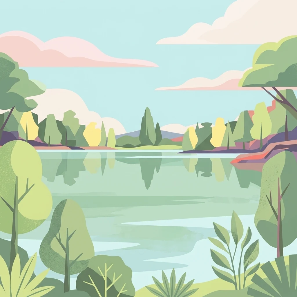
A flat-style digital illustration featuring a calm, reflective lake framed by stylized trees, shrubs, and soft, pastel-colored clouds in the background.

Kuhlenvenn

Nature reserve

Park overview

Structured park overview, official facts, and landscape profile for Kuhlenvenn

Kuhlenvenn park facts, protected area profile, and essential visitor context

Review the core facts for Kuhlenvenn, including designation, size, terrain, visitor scale, habitats, and operating context in one park-focused overview.

About Kuhlenvenn

Kuhlenvenn sits in the Quellregion, or headwater area, of the Heubach, part of the Halterner Mühlenbach system, a few kilometres to the north of the centre of Gescher on the western edge of the Münsterland. It is one of the last surviving pieces of what was once the Weißes Venn, a vast bog complex between Velen and Coesfeld that was the largest moor in Westphalia until the middle of the twentieth century. Almost all of that former raised bog has since been drained, cut for peat and brought into cultivation, so that today only fragmented traces remain in the landscape. Unlike its neighbour, the Fürstenkuhle, Kuhlenvenn has no surviving fragments of the original Hochmoor itself. Instead, it is a nature reserve built on the worked-out aftermath of that landscape.

The modern reserve is a mosaic of open habitats. Roughly half of the area is made up of extensively used meadows and pastures, kept as low-intensity grassland that supports a rich flora and a high density of breeding waders and meadow birds. A network of Blänken, shallow seasonal pools typical of the former bog landscape, breaks up the sward, and the central Abgrabungssee, an artificial lake of about 9 hectares, dominates the middle of the reserve. That lake was unintentionally created: between 1984 and 1988 sand was quarried from the site for motorway construction, including for the A31, and the resulting pit filled with water. What began as an industrial scar has matured into the single most important piece of open water in the area for waterbirds.

In the wider context of the Borken district, with its network of small nature reserves threaded through the remaining fenland and bog remnants, Kuhlenvenn plays an outsized role. The reasonably gentle relief, the patchwork of different wet habitat types, and the care taken by the Biologische Station Zwillbrock and the local NABU chapter to manage water levels and grazing pressure, have turned what could have been an awkward leftover from peat-cutting into one of the most reliable places in the region to see large flocks of wildfowl and waders at almost any time of year.

Quick facts and research context for Kuhlenvenn

Kuhlenvenn is a 67 hectare nature reserve (Naturschutzgebiet) in the Kreis Borken district of North Rhine-Westphalia, Germany, situated near the Hochmoor district of the town of Gescher. It carries the official designation BOR-022 within North Rhine-Westphalia's protected-area system and is classified as an IUCN Category IV Habitat/Species Management Area. The first section, covering 21 hectares, was placed under protection on 18 March 1988, and the southern part was added on 11 January 1994, with the landscape plan for Gescher from 25 February 2004 serving as the overarching framework.

The reserve grew up on former bog ground but no longer holds any of the original Hochmoor. Its modern character is built from extensive meadows, wet grasslands, shallow pools and a roughly 9 hectare artificial lake that resulted from sand extraction for the A31 motorway in the 1980s. Its most notable identity is ornithological: Kuhlenvenn is recognised as an internationally important refuge for waterbirds, waders and meadow birds and is managed by the Biologische Station Zwillbrock with the support of NABU Coesfeld.

Protection and recognition

Terrestrial protection records and official designation context for Kuhlenvenn

Kuhlenvenn Protection Status and Documented Conservation Scope

Kuhlenvenn maintains a documented terrestrial protection scope within international protected area databases. Official records outline the baseline conservation framework without citing external recognition sources.

Protection details

Protection scope
Terrestrial
Transboundary protection
No
WDPA ID
318694
Park context

Deeper park guide and search-rich context for Kuhlenvenn

Kuhlenvenn history, landscape, wildlife, and travel context

Explore Kuhlenvenn through its history, landscape character, ecosystems, wildlife, conservation priorities, cultural context, and seasonal travel timing in a structured park guide built for atlas discovery and search intent.

Why Kuhlenvenn stands out

Kuhlenvenn is best known as one of the most important bird refuges in the western Münsterland, drawing waterbirds, waders and ground-nesting meadow birds from across the region and beyond. The combination of extensive wet grassland, network of shallow pools and an open-water lake produces exactly the kind of habitat mosaic these species need for breeding, feeding, roosting and overwintering, giving the small reserve an outsized role in regional waterbird conservation. Equally distinctive is the story of how the reserve came into being. Rather than protecting an untouched bog, conservationists took over land that had been intensively worked for peat, drained and farmed, and then partially reshaped by industrial sand extraction, and turned it into a functioning wetland complex. The very disturbance history of the site, including the 1984 to 1988 sand mining that inadvertently created the lake, is what makes Kuhlenvenn such rich habitat today.
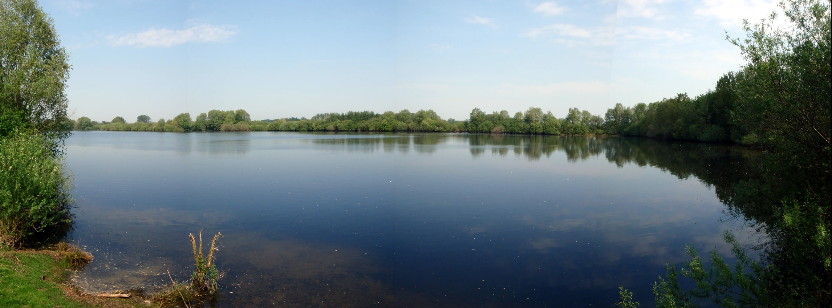
A wide panoramic shot of a still lake surrounded by dense trees and shrubs under a clear blue sky in Kuhlenvenn.
The tranquil excavation lake at the center of the Kuhlenvenn nature reserve.

Kuhlenvenn history and protected-area timeline

The area on which Kuhlenvenn now lies was part of the great Weißes Venn, a Westphalian moor that was the largest in the region until the mid-twentieth century. Starting in the late nineteenth and accelerating through the twentieth century, this bog was systematically drained, cut for peat and converted to agricultural land, leaving behind only fragments such as Kuhlenvenn and the nearby Fürstenkuhle. By the 1980s the original Hochmoor character had been so thoroughly altered that the surviving land was a patchwork of meadows, drains, scrub and worked-out fields rather than bog.

The history of the nature reserve itself began with sand. Between 1984 and 1988, sand was quarried out of what would become the reserve, including for use in constructing the A31 motorway, and the resulting pit steadily filled with water to produce the Abgrabungssee that still defines the site today. Recognising the ecological value of the resulting mosaic of wet grassland, pools and open water, the regional authorities placed the first 21 hectares of the area under protection on 18 March 1988. Six years later, on 11 January 1994, the southern section was added, bringing the reserve to its current size of about 67 hectares. The landscape plan "Gescher", adopted on 25 February 2004, provides the current planning framework for the area.

The Biologische Station Zwillbrock now manages the site, drawing on practical support from the NABU Coesfeld chapter for work parties and bird monitoring. The reserve's modern identity is therefore as much a story of active habitat management and rewetting as it is of formal designation, and it is widely cited locally as an example of how former workings can be turned into functioning wetland habitat.

Kuhlenvenn landscape and geographic character

The landscape of Kuhlenvenn is low, flat and shaped almost entirely by what humans have done to the former bog. The ground sits at around 63.8 metres above sea level at the lake, characteristic of the gently undulating terrain of the western Münsterland. From the surrounding farmland the reserve reads as a quiet depression, a wedge of green and water set among intensively worked fields, threaded by ditches and lined by low hedges.

The central feature is the Abgrabungssee, a calm, shallow lake of about 9 hectares with soft, formerly quarried edges. Around it, the reserve opens out into a wide sweep of meadows and pastures that are kept mostly free of trees, in order to maintain open sightlines for breeding waders and meadow birds. The grass sward is interrupted by Blänken, shallow seasonal pools that hold water at varying heights across the year, turning parts of the reserve into a glittering patchwork of small reflective pools in winter and spring. Shelter and structural variety are provided by Wallhecken, lines of low hedges of hornbeam and rowan, individual tree rows, and scrubby groups of blackthorn, alder, birch, willow, oak and guelder rose that edge the wetter ground.

Kuhlenvenn ecosystems, habitats, and plant life

The natural character of Kuhlenvenn is built on a relatively small but well-arranged set of habitat types. Approximately 33 hectares are given over to nutrient-rich meadows and pastures, kept under extensive management to allow a broad range of grasses and herbs to flower and to support ground-nesting birds. A further roughly 9 hectares is open water in the Abgrabungssee, with its own band of marginal vegetation. Smaller areas are taken up by wet ditches, the Blänken and scrubby field margins, and every habitat type carries its own characteristic plant communities.

The meadows are rich in rushes, sedges and grasses, along with buttercup family plants, a wide variety of herbaceous species and emergent aquatic plants around the lake edges and in the wetter hollows. The hedges, tree rows and scrub patches add structural diversity and host a separate woodland-edge flora, including hornbeam, rowan, blackberry, alder buckthorn, silver birch, common alder, guelder rose, pedunculate oak and various willows. The result is a small but ecologically layered reserve in which open wetland, damp grassland and scrub-mosaic habitats sit within a few hundred metres of each other.

Kuhlenvenn wildlife and species highlights

Wildlife at Kuhlenvenn is dominated by birds, and the reserve has built its reputation entirely on its ornithological importance. Among the most significant breeding and visiting species are the Eurasian curlew, northern lapwing, great cormorant, black-tailed godwit, northern shoveler and little grebe, all of which are considered species of conservation concern. Red-listed raptors such as the red kite, Eurasian sparrowhawk and common kestrel also occur, alongside little owl, meadow pipit and barn swallow, which are likewise listed as threatened in the German Red List.

The reserve attracts a long roll of additional species through the year. Larger flocks of white-fronted goose, bean goose and greylag goose use the area at certain seasons, as do ruff, common snipe, red-throated diver, common greenshank and common redshank, grey heron and great egret, Eurasian oystercatcher, pied wagtail, common coot, common whitethroat, great crested grebe, tufted duck, reed bunting, mallard, marsh warbler and yellow wagtail. The skylark, once a regular breeding species, has been pushed back sharply by rewetting and has not been observed at the reserve since 2009, illustrating how management for wetland species reshapes the bird community.

Beyond the birds, the reserve also supports a modest but characteristic set of other animals. The wet areas and Blänken are home to grass frog, natterjack toad, moor frog and smooth newt, while the Abgrabungssee holds a population of European weatherfish. Reptiles are represented by slowworm and common lizard, and bats are particularly notable: the serotine bat and Daubenton's bat are among the more striking mammal species recorded in the reserve.

Kuhlenvenn conservation status and protection priorities

Kuhlenvenn's conservation importance lies in the way a relatively small site delivers very large benefits for waterbirds, waders and meadow birds. Within the heavily drained and cultivated landscape of the Münsterland, the reserve functions as a stepping stone that retains open water, wet grassland and shallow pools throughout the year. This combination of habitats is increasingly rare in the region, where former bog and fen has been almost universally converted to farmland.

The reserve carries the official designation BOR-022 and is classified as an IUCN Category IV Habitat/Species Management Area, recognising that the site is managed primarily for specific species and habitat mosaics rather than left to natural processes. The Biologische Station Zwillbrock oversees day-to-day management, while NABU Coesfeld provides volunteer support for work parties and for bird counts that feed into regional and national monitoring. The reserve is anchored in the landscape plan "Gescher" of 2004, and its ongoing rewetting work has already changed its species profile, reducing its value for skylark but greatly increasing it for waders and waterbirds.

Kuhlenvenn cultural meaning and human context

Kuhlenvenn lies within a wider cultural landscape shaped by centuries of interaction between people and bog. Names like "Venn" itself, used across the reserve and across its neighbouring protected areas such as Fürstenkuhle, Amtsvenn, Weißes Venn and Zwillbrocker Venn, reflect the long-standing regional identity of these wet, peaty lowlands. For generations local communities grazed cattle on the rough ground, cut peat for fuel, and gradually drained and reclaimed the moors for hay and arable use.

Today the interpretation of that heritage is more nuanced. The very mechanisms that destroyed the original Hochmoor, peat cutting, drainage, sand quarrying and motorway construction, are the same mechanisms that have, by accident or design, produced the habitat mosaic that the reserve now protects. The current cultural thread is one of stewardship and birdwatching, with the NABU Coesfeld chapter and the Biologische Station Zwillbrock mobilising volunteers and policy around the site, and two sturdy hides plus a connecting footpath ensuring that the reserve continues to function as a quiet meeting point between the local community and visiting naturalists.

Top sights and standout views in Kuhlenvenn

Among the strongest points of distinction at Kuhlenvenn is its ornithological weight: a compact 67 hectare reserve that punches well above its size as an internationally recognised refuge for waterbirds, waders and meadow birds. The Abgrabungssee, an unintended lake that arose from sand quarrying in the 1980s, is now the visual and ecological centre of the site and the main draw for visiting birders, framed by a circular footpath with two substantial observation hides at its eastern and western ends.

Equally distinctive is the habitat mosaic itself, an unusually rich arrangement of meadows, wet grasslands, Blänken, scrub groups, hedgerows and open water packed into a small footprint, and the conservation story behind it, in which former industrial workings have been deliberately managed for wildlife through rewetting, extensive grazing and ongoing species monitoring.

Best time to visit Kuhlenvenn

Kuhlenvenn is rewarding in essentially every season, with the bird community shifting gradually through the year rather than dropping away in any one of them. Spring and early summer tend to be the most active period, when breeding waders and meadow birds such as lapwing, curlew and black-tailed godwit are most conspicuous across the meadows, and passerines including skylark, meadow pipit, reed bunting and yellow wagtail are singing on territory. The wetter ground around the Blänken is also at its most varied in spring, supporting amphibians as they move to breed.

Autumn and winter bring a different character. Outside the breeding season, waterfowl and larger flocks of wildfowl, including geese and a wide range of ducks and grebes, gather on the Abgrabungssee and along the wet grassland fringes, often in considerable numbers, and the open landscape makes them easy to read from the hides. Late winters can be quiet and atmospheric, while milder wet winters typically produce the best waterbird viewing, though access may be conditioned on path conditions after heavy rain.

Monthly climate preview

Long-term representative point measurements for monthly weather patterns in Nordrhein-Westfalen

Kuhlenvenn Climate Normals, Annual Temperature and Precipitation Rhythm

Kuhlenvenn exhibits a measured annual temperature and precipitation rhythm derived from long-term representative point observations across twelve distinct monthly intervals. Reviewing the complete twelve-month profile provides deeper analytical context regarding average temperatures and daily precipitation baselines for this location.
Annual mean10 °C
2 °C18 °C
Jan
Feb
Mar
Apr
May13°
Jun16°
Jul18°
Aug18°
Sep15°
Oct10°
Nov
Dec
Warmest month
July

18.4 °C

Coolest month
January

1.6 °C

Wettest month
December

2.5 mm/day

Driest month
April

1.5 mm/day

Park location guide

Geography guide, regional context, and park location map for Kuhlenvenn

Kuhlenvenn park geography, regions, and map view in Germany

Understand where Kuhlenvenn sits in Germany through a broader geographic reading of the surrounding landscape, nearby location context, and its mapped position within the national park landscape.

How Kuhlenvenn fits into Germany

Germany is a federal republic in Western and Central Europe with a population of over 83 million across sixteen constituent states. It is Europe's largest economy by nominal GDP and a major global exporter and importer. The capital is Berlin, and the country borders Denmark, Poland, Czech Republic, Austria, Switzerland, France, Luxembourg, Belgium, and the Netherlands.

Wider geography shaping Kuhlenvenn in Germany

Germany is located in Western and Central Europe, spanning 357,022 km². It borders Denmark to the north, Poland and the Czech Republic to the east, Austria and Switzerland to the south, and France, Luxembourg, Belgium, and the Netherlands to the west. The country has coastlines on the Baltic Sea and North Sea to the north, with the Alps located in the southern region.

Map view of Kuhlenvenn

Use this park location map to pinpoint Kuhlenvenn in Germany, understand its exact geographic position, and read its mapped placement within the surrounding landscape more clearly.

Pigeon | © OpenStreetMap contributors

Location context for Kuhlenvenn

Nordrhein-Westfalen

Explore detailed imagery of the shallow lake, wet meadows, and bird refuge habitats.

Kuhlenvenn Photos and Landscape Scenery: Visualizing the Protected Wetland Habitat

Visual documentation of Kuhlenvenn reveals the flat terrain, open water, and diverse wetland habitats that characterize this protected Münsterland nature reserve. Examining these photographs helps observers understand the environmental composition, low lying topography, and ecological structure of the landscape.

A wide panoramic shot of a still lake surrounded by dense trees and shrubs under a clear blue sky in Kuhlenvenn.

Park atlas

Compare adjacent wetland reserves, wildlife habitats, and regional park geography

Exploring Parks Near Kuhlenvenn and Surrounding Münsterland Protected Areas

Browsing other protected areas near Kuhlenvenn reveals connected wetland networks and diverse lowland habitats across the western Münsterland. Comparing these neighboring nature reserves provides broader geographic context for regional bird conservation and habitat restoration.
Watercolor illustration of a pond in a moorland landscape with soft green hills and trees in the background.
Nature reserveNorth Rhine-Westphalia
About 2.2 km away#1 closest

East

Heidesee Nature Reserve: A Protected Heathland and Bog Mosaic in North Rhine-Westphalia

Geographic landscape mapping of the Coesfelder Heide

Heidesee preserves a compact, high-value ecosystem featuring acidic water, sphagnum moss cushions, and rare carnivorous plants. Located within the glacial-sandy terrain of the Coesfelder Heide, this nature reserve offers a look at preserved wetland habitats and regional biodiversity management in western Germany.

Area
0.052 km²
Established
1985
IUCN
IV
Access
Moderate access
Watercolor painting of a green wetland area with a stream, soft hills in the background, and sparse trees.
Nature reserveNordrhein-Westfalen
About 9.2 km away#2 closest

South

Heubachwiesen (BOR) Nature Reserve: Exploring the Heubach Stream Floodplain Geography

Wetland ecosystems and protected lowland terrain in western Münsterland.

This nature reserve in Nordrhein-Westfalen consists of four separate parcels characterized by flat wet meadows and shallow water features. As a protected area integrated into the EU Birds Directive, Heubachwiesen (BOR) serves as a vital refuge for threatened bird species and rare plant communities within the open, low-lying landscape of the Heubach floodplain.

Area
4.66 km²
Established
1982
IUCN
IV
Nature reserveNordrhein-Westfalen
About 10 km away#3 closest

Southeast

Wildpferdebahn Nature Reserve: Geography and Protected Habitat of the Merfelder Bruch

Explore the historic horse range in Nordrhein-Westfalen

Located in the Merfelder Bruch, the Wildpferdebahn protects 500 hectares of diverse terrain ranging from dry grasslands to damp alder woodlands. This nature reserve supports a self-sustaining herd of semi-feral horses, maintaining a landscape character that has persisted for generations. Learn about the reserve's role in conserving Westphalian wilderness traditions alongside sensitive moor and heath habitats.

Area
3.6 km²
Established
1847
Relief
Lowland
Access
Easy access
Watercolor painting of a tranquil pond at Kranenmeer, showing reflective water, distant tree lines, and foreground foliage hanging from the upper right corner.
Nature reserveNordrhein-Westfalen
About 17 km away#4 closest

Southwest

Kranenmeer Nature Reserve: Mapped Geography and Protected Wetland Boundaries

A preserved moorland enclave in the Westmünsterland region.

Kranenmeer preserves a fragile mosaic of open water, bog vegetation, and alder carr woodland in a compact site within Nordrhein-Westfalen. Study the mapped protected boundaries and subtle terrain transitions of this significant nature reserve that serves as a vital habitat for rare amphibians and specialized wetland species in the lowland northwest of Germany.

Area
1.4 km²
Established
1950
Relief
Lowland
Climate
Temperate
A pale, soft watercolor illustration showing rolling hills, sparse trees, and gentle inland dune slopes under a light sky.
Protected landscapeBerlin
About 21 km away#5 closest

East

Baumberge Protected Landscape: Mapping Berlin's Glacial Sand Dunes and Rare Grassland Habitats

A vital protected ecosystem within the Tegeler Forst region

The Baumberge stand as one of the last remaining open inland dune sites in Berlin, encompassing a fragile 47 hectare mosaic of sand heath and dry grassland. These parabolic dunes provide a critical refuge for warmth-loving invertebrate species and rare flora, anchored by glacial sand deposits dating back to the last ice age. The area offers a significant window into the historical landscape evolution of the northern Berlin glacial valley.

Area
0.47 km²
Relief
Lowland
Climate
Temperate
Access
Easy access
Nature reserveNetherlands
About 22 km away#6 closest

West

Wooldse Veen Nature Reserve: Mapped Geography and Protected Bog Landscapes in the Netherlands

A transboundary peatland system in Gelderland.

Wooldse Veen preserves a rare fragment of raised bog and peatland habitat in the Dutch-German borderlands. The reserve features restored bog pools, historic smugglers paths, and a mosaic of heathland and birch woodland that reflects the regional geography of the Winterswijk National Landscape.

Area
1.5 km²
Established
1949
Relief
Lowland
Climate
Temperate
A watercolor painting showing a soft green rolling landscape, a winding stream in the foreground, and distant hills under a white background.
Protected landscapeGermany
About 24 km away#7 closest

Southwest

Naturpark Hohe Mark: Protected Landscape and Regional Geography Overview

Mapped terrain in North Rhine-Westphalia, Germany.

Gain insight into the complex topography of Naturpark Hohe Mark, an expansive protected area characterized by its transition from sandy upland forests to wetland-rich river valleys. This detailed overview covers the essential landscape features, regional boundaries, and ecological diversity that distinguish the park as a key geographical entity in Germany.

Area
1,978 km²
Established
1963
Relief
Mixed relief
Climate
Temperate
Watercolor painting of a low-lying, marshy landscape with soft green meadows and sparse vegetation against a white background.
Nature reserveNorth Rhine-Westphalia
About 27 km away#8 closest

Northwest

Lüntener Fischteiche Nature Reserve: Geography and Protected Area Landscape Map

A preserved mosaic of Münsterland heath and bog ecosystems

Lüntener Fischteiche is a specialized nature reserve in North Rhine-Westphalia, documented here for its distinct heath-pond character and ecological significance within the German-Dutch borderland. The site preserves remnants of bog and heath vegetation embedded within a pine forest matrix, serving as an important hub for regional waterbird populations and transboundary habitat connectivity.

Area
1.011 km²
Established
1959
IUCN
IV

Common questions about visiting, size, designation, and location context for Kuhlenvenn

Kuhlenvenn FAQs for park facts, access, geography, and protected area context

Find quick answers about Kuhlenvenn, including protected-area facts, park geography, trail and visitor context, and how the park fits into its surrounding country and regional landscape.
MoriAtlas Explorer

Continue Your Protected Areas Search Across the Global Atlas

Deepen your exploration by continuing the structured search for national parks and protected areas worldwide. Utilize the comprehensive filtering capabilities to compare different conservation landscapes and refine your understanding of global park geography. Discover more about the distribution and characteristics of protected natural areas.

Global natural geography