
Mori Atlas logo
Protected landscapeNaturpark Pfälzerwald

A vast protected landscape defined by extensive woodland cover and dramatic red sandstone rock formations

Naturpark Pfälzerwald: Examining the Geographic Boundaries and Forest Landscape of Rhineland-Palatinate

Naturpark Pfälzerwald represents a significant protected area in southern Rhineland-Palatinate, encompassing the largest contiguous woodland tract in Germany. This expansive region spans across three distinct landscape zones and links directly with international forest networks. Explore the diverse terrain features, including deep valleys, isolated rock towers, and the transitional fringe zones bordering the German Wine Route.

pfälzerwaldpalatinate forestbuntsandsteinred sandstonemixed forestbiosphere reserve
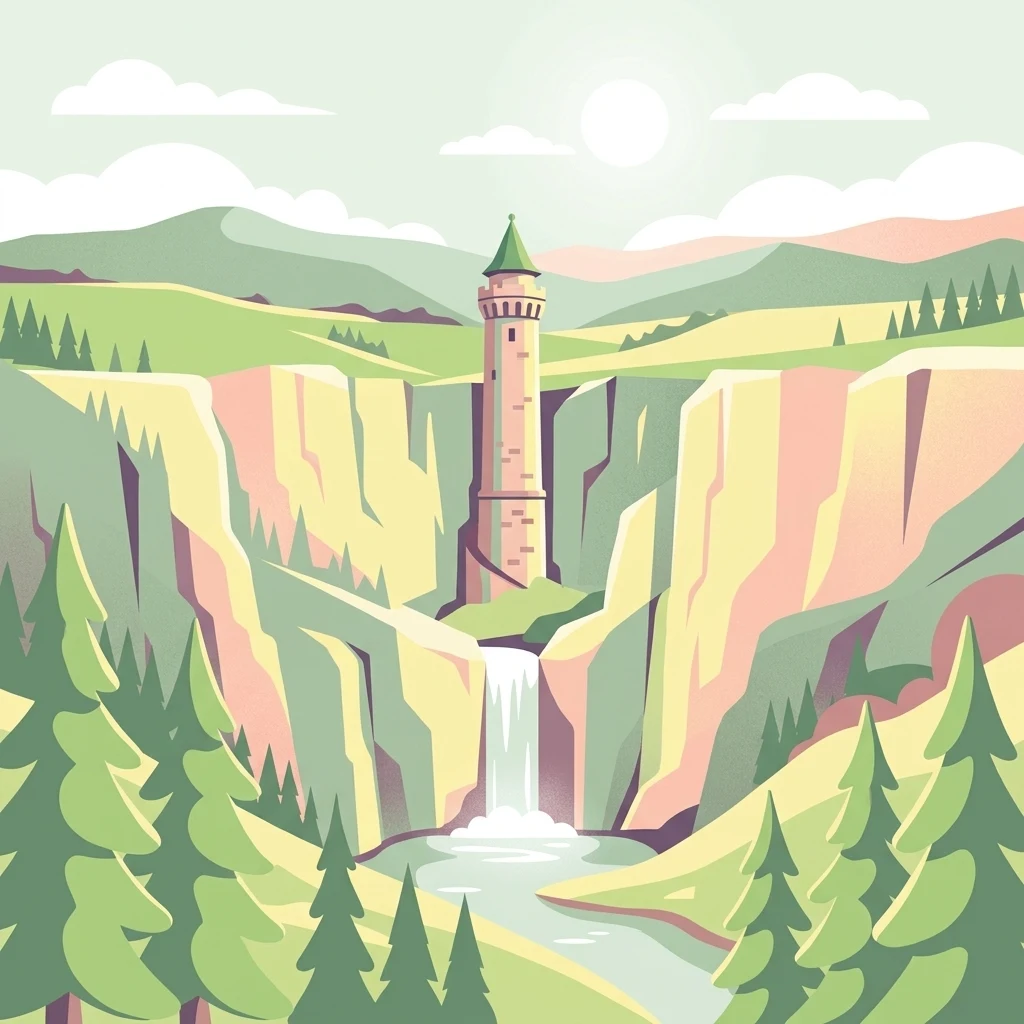
A digital illustration of a cylindrical stone tower perched on a cliff edge above a waterfall, surrounded by tall pine trees and mountain slopes in a soft, light-toned color palette.

Naturpark Pfälzerwald

Protected landscape

Park overview

Structured park overview, official facts, and landscape profile for Naturpark Pfälzerwald

Naturpark Pfälzerwald park facts, protected area profile, and essential visitor context

Review the core facts for Naturpark Pfälzerwald, including designation, size, terrain, visitor scale, habitats, and operating context in one park-focused overview.

About Naturpark Pfälzerwald

Naturpark Pfälzerwald occupies a central position in the geography of the Palatinate region, anchoring a landscape that has long been considered one of Germany's signature woodland areas. Centered on the Pfälzerwald, the park extends across roughly 1,798 square kilometers in the southern part of Rhineland-Palatinate, reaching the French border in the south and the transition to the Upper Rhine Plain in the east. The wooded terrain rises from about 141 meters to peaks of approximately 673 meters, creating a varied relief of forested ridges and narrow valleys.

The defining geological feature of the park is the widespread presence of Buntsandstein, a bright reddish sandstone that forms the rocky cliffs, weathered slabs, and characteristic rock labyrinths that punctuate the forest. These formations give the Pfälzerwald its distinctive visual identity and create habitats for specialized plant and animal communities associated with rocky, sun-exposed terrain. Among the forest cover, mixed woodland dominates, interwoven with smaller valleys, streams, and traditional cultural landscapes, particularly along the eastern edge where the forest meets the vineyards of the Deutsche Weinstraße.

Structurally, the Naturpark is divided into three main areas: the Northern (or Lower) Pfälzerwald, the Middle Pfälzerwald, and the Southern Pfälzerwald. The southern section, together with its French continuation, is known as the Wasgau, with the French counterpart called the Nordvogesen. Within the park, 23 core zones have been delineated under a state ordinance in force since 20 August 2020, each providing strictly protected reference areas for forest development and biodiversity conservation. These zones include large forest areas such as the Wieslauter source region and smaller, more localized rock and valley landscapes such as Bobenthaler Knopf, Stabenberg, and Humberg.

The significance of Naturpark Pfälzerwald extends well beyond its national boundaries. In 1992, it was recognized by UNESCO as a Biosphere Reserve, and in 1998 it was formally joined with the French Regional Nature Park of the Northern Vosges to create the cross-border Biosphere Reserve Pfälzerwald-Nordvogesen (Vosges du Nord-Forêt palatine), one of the first such international biosphere partnerships in Europe. This status reinforces the park's role as a model for integrated conservation, sustainable regional development, and cross-border ecological cooperation.

Quick facts and research context for Naturpark Pfälzerwald

Naturpark Pfälzerwald lies in southern Rhineland-Palatinate, bordering France, and is centered on the Pfälzerwald, possibly the largest connected forest area in Germany. Established in 1958 as a Naturpark under German law, it was designated by UNESCO as a Biosphere Reserve in 1992 and, since 1998, has formed a single cross-border Biosphere Reserve together with the French Parc naturel régional des Vosges du Nord. The park contains 23 core zones (Kernzonen) under special protection and is administered by the Bezirksverband Pfalz, with its office located in Lambrecht in the Palatinate.

Protection and recognition

Documented terrestrial protection history, management scope, and transboundary status

Naturpark Pfälzerwald Protection Status and International Designation Records

Naturpark Pfälzerwald holds documented terrestrial protection status established in nineteen ninety two with confirmed transboundary characteristics. Structured records assemble verified designation history and management parameters for detailed geographic analysis.

Protection details

Protection scope
Terrestrial
Designated year
1992
Transboundary protection
Yes
Park context

Deeper park guide and search-rich context for Naturpark Pfälzerwald

Naturpark Pfälzerwald history, landscape, wildlife, and travel context

Explore Naturpark Pfälzerwald through its history, landscape character, ecosystems, wildlife, conservation priorities, cultural context, and seasonal travel timing in a structured park guide built for atlas discovery and search intent.

Why Naturpark Pfälzerwald stands out

The nature park is especially renowned for its vast, largely unbroken forest landscapes of the Pfälzerwald, dominated by dramatic Buntsandstein (red sandstone) rock formations that rise from forested valleys. It is also known for the transboundary Biosphere Reserve Pfälzerwald-Nordvogesen, the original partnership that made it one of the earliest cross-border UNESCO biosphere reserves in Europe. Beyond its ecological value, the park is recognized for its combination of woodland, vineyard landscapes along the Deutsche Weinstraße, and a network of small valleys, rock outcrops, and protected core zones that together define the natural identity of the Palatinate region.
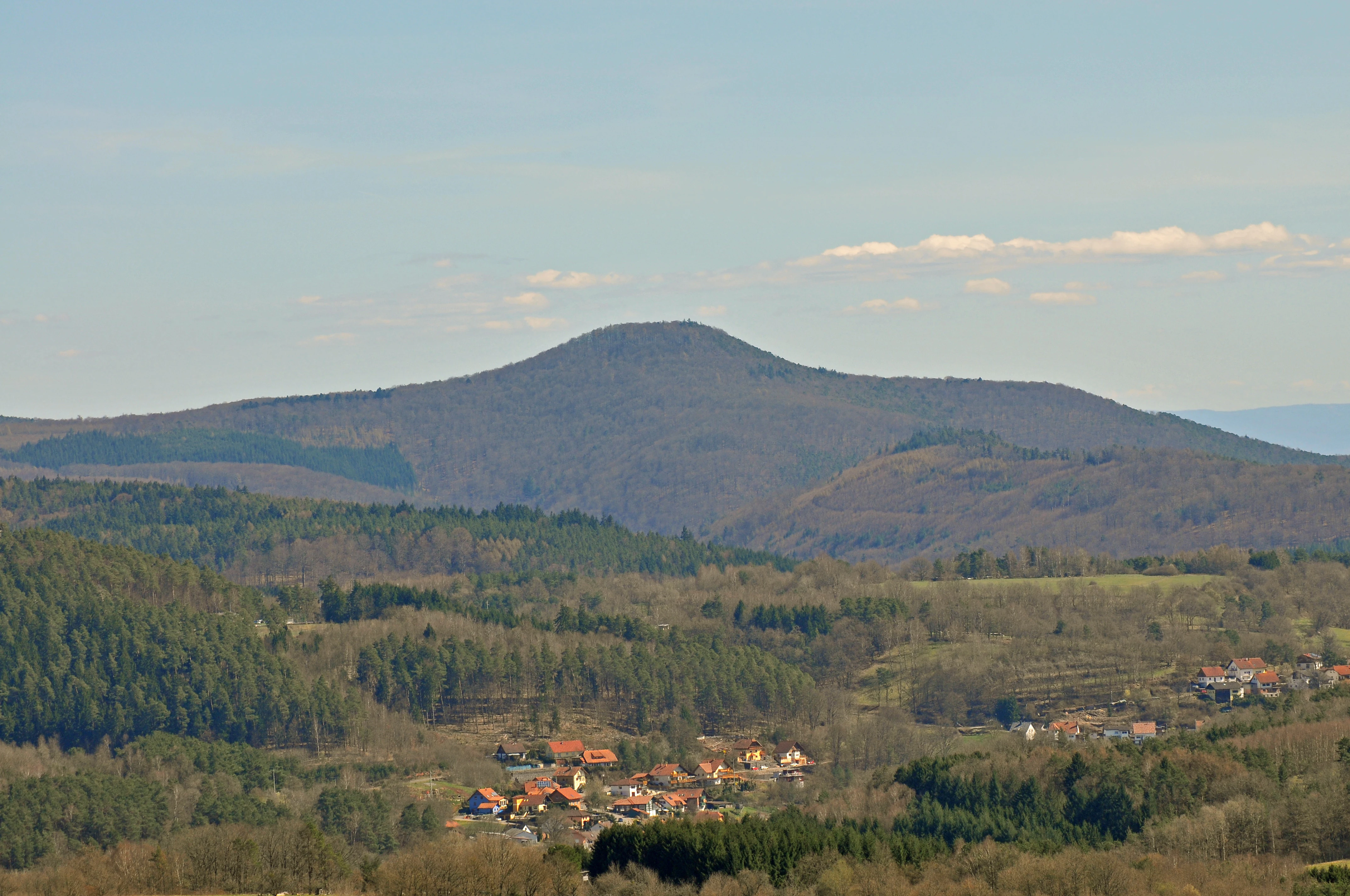
A wide mountain landscape showing a rolling forested hill in the center, a small town with red-roofed buildings in the valley, and distant hills under a clear blue sky.
A view overlooking the valley near Bundenthal towards the Bobenthaler Knopf summit.

Naturpark Pfälzerwald history and protected-area timeline

Naturpark Pfälzerwald was established in 1958, encompassing the existing landscape protection areas of the Pfälzerwald, the Deutsche Weinstraße, and the Eisbach and Eckbach valleys. In 1967, it gained additional legal protection through a state ordinance that designated it as the landscape protection area Naturpark Pfälzerwald, providing a more formal framework for its long-term management.

In 1992, the area was recognized by UNESCO as a Biosphere Reserve, becoming the twelfth such reserve in Germany. Six years later, in 1998, this status was extended through a pioneering partnership with the French Regional Nature Park of the Northern Vosges, forming the transboundary Biosphere Reserve Pfälzerwald-Nordvogesen. This union created one of the earliest cross-border biosphere reserves in Europe and cemented the park's international conservation significance.

From 1982 until the end of 2013, the park was managed by the Trägerverein Naturpark Pfälzerwald e. V., an association that brought together regional counties, cities, and various outdoor, conservation, and hiking organizations. Following a decision on 4 December 2013, the association was dissolved, and its responsibilities were transferred to the Bezirksverband Pfalz. Formal transfer was confirmed on 20 December 2013 at Hambacher Castle, and since 1 January 2014 the Bezirksverband Pfalz has served as the sole trustee of the park, supported by a 22-member committee. The park's administrative office has been based in Lambrecht in the Palatinate since 1997.

Naturpark Pfälzerwald landscape and geographic character

The landscape of Naturpark Pfälzerwald is defined by an extensive, rolling forest plateau deeply scarred by valleys and punctuated by rock outcrops. Geologically, the region is dominated by Buntsandstein, a reddish sandstone that weathers into the cliffs, slabs, and isolated rock towers that give the Pfälzerwald its distinctive scenery. Elevations range from roughly 141 meters along the lower valleys to about 673 meters at the highest points, creating a varied but generally moderate relief that supports extensive continuous forest cover.

The park's structure is conventionally divided into three landscape units. The Northern, or Lower, Pfälzerwald extends from the Nordpfälzer Bergland in the north down to approximately the line of the A6 motorway. The Middle Pfälzerwald continues southward to the Pirmasens-Landau line, while the Southern Pfälzerwald extends from that line to the French border. This southernmost section, shared with the French Nordvogesen, is commonly called the Wasgau and constitutes one of the most scenic and geologically expressive parts of the entire area.

Along its eastern edge, the forest slopes down toward the Upper Rhine Plain, giving way to the protected cultural landscape of the Deutsche Weinstraße. This transition zone links the wild, rocky forest interior with the more open, agricultural and vineyard landscapes typical of the eastern Palatinate.
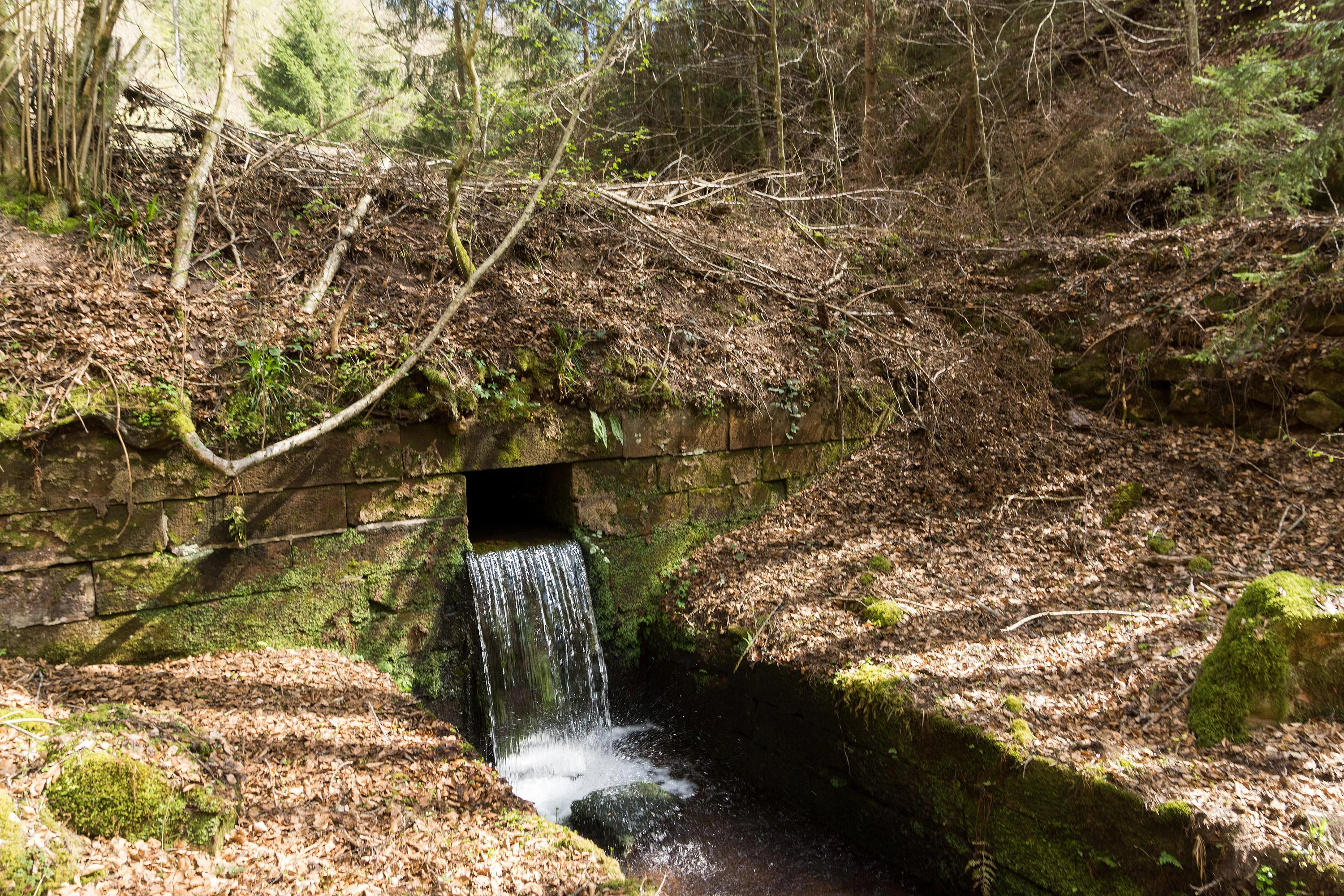
A small stone spillway structure built into a hillside, with water flowing from a rectangular opening into a stream bed, surrounded by a forest floor covered in autumn leaves.
Water flowing from the historic Gambsklause spillway in the Palatine Forest.

Naturpark Pfälzerwald ecosystems, habitats, and plant life

Naturpark Pfälzerwald is fundamentally a forested landscape, with woodland covering approximately three-quarters of its total area. The dominant vegetation consists of mixed deciduous and coniferous forests typical of central European low mountain ranges, shaped by long-standing forestry traditions, varying soil conditions, and the influence of the underlying Buntsandstein substrate. The forest mosaic includes mature beech stands, oak-dominated slopes, conifer plantations, and structurally rich transitions into rocky outcrops and small clearings.

A defining ecological feature of the park is the system of 23 core zones (Kernzonen), which were formally established under a state ordinance effective from 20 August 2020 and serve as strictly protected reference areas for natural forest development. These core zones range in size from just a few hectares to large complexes such as the Quellgebiet der Wieslauter (about 2,400 hectares) and protect representative forest types, valley systems, and rock habitats across the different sub-regions of the park.

The combination of extensive forest, sandstone rock habitats, deeply shaded valleys, and small streams creates a broad habitat mosaic that supports nutrient-poor grassland fragments on sunny rocks, cool and moist microclimates in shaded valleys, and old-growth or near-natural forest stands in the core zones. The eastern transition toward the Deutsche Weinstraße adds semi-open vineyard and orchard habitats to the overall ecological diversity of the park.
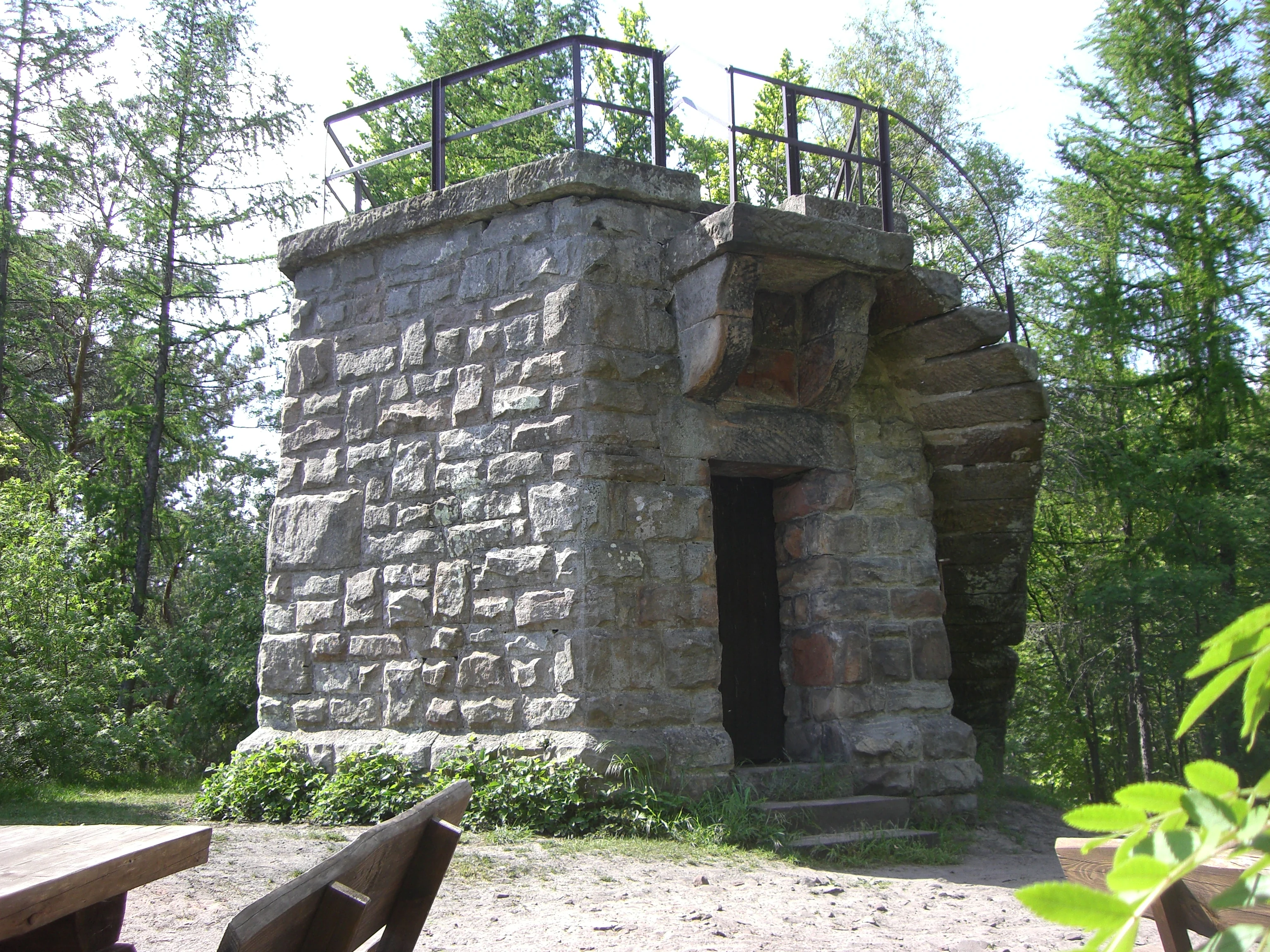
A stone observation tower with a square base and open-air viewing platform, surrounded by forest trees.
The Stabenberg lookout tower, a stone observation point in the Palatine Forest.

Naturpark Pfälzerwald wildlife and species highlights

Naturpark Pfälzerwald supports wildlife communities typical of large central European mixed forests, with the extensive woodland cover providing habitat for forest-dependent species. The mosaic of mature forest, rocky outcrops, and small valleys creates conditions favorable for species that rely on old trees, deadwood, and structurally varied habitats. The 23 core zones play an important role in this regard, offering protected reference areas where natural forest processes can unfold more freely.

The park's sandstone rock formations and valley forests provide habitat for a range of bird species associated with woodland and rocky terrain, while the transition zones toward the vineyards and agricultural lands of the Deutsche Weinstraße support additional edge and open-landscape species. The cold-water streams and source regions, such as those around the Wieslauter, contribute freshwater habitats that complement the terrestrial wildlife value of the area. Together, these features make the park an important refuge for forest-associated biodiversity in southwestern Germany.

Naturpark Pfälzerwald conservation status and protection priorities

Conservation lies at the heart of Naturpark Pfälzerwald's identity, both nationally and internationally. Its designation as a UNESCO Biosphere Reserve in 1992 marked a significant recognition of its ecological value, and its integration with the French Vosges du Nord in 1998 created one of Europe's earliest transboundary biosphere reserves, anchoring the park's role in long-term landscape-scale conservation.

The protection framework is structured in multiple layers. The park itself is anchored by the Naturpark designation introduced in 1958 and reinforced by a 1967 state ordinance as a landscape protection area, providing broad legal protection across its 1,798 square kilometers. Within this larger area, the 23 core zones designated under the 2020 ordinance create a network of strict-protection reference areas free from intensive forestry, where natural forest dynamics can develop with minimal direct human influence. These zones vary in size and habitat type, ranging from small rock and valley sites to extensive forest landscapes such as the Wieslauter source region.

The cross-border Biosphere Reserve adds an additional conservation dimension, requiring international coordination between German and French management structures. This framework supports joint research, monitoring, and conservation strategies that link forest protection with sustainable regional development, traditional land use along the Deutsche Weinstraße, and recreation, embodying the UNESCO model of balancing ecological, economic, and cultural objectives.

Naturpark Pfälzerwald cultural meaning and human context

The Naturpark Pfälzerwald lies at the cultural heart of the Palatinate region, with the surrounding landscape deeply intertwined with local identity, forestry traditions, viticulture, and a strong hiking culture. To the east of the forested interior, the Deutsche Weinstraße represents one of Germany's oldest and most celebrated wine regions, and its protected cultural landscape is integrated into the park's eastern fringe, linking forest conservation with the region's agricultural and gastronomic heritage.

The area has long been associated with outdoor recreation, and the Pfälzerwald-Verein, founded in the 19th century, remains an influential organization promoting hiking and landscape stewardship. Hambacher Castle, a site of major 19th-century German democratic history, also lies within the broader region and reflects the park's connection to wider cultural narratives. The partnership with France, formalized through the cross-border Biosphere Reserve, adds a further cultural dimension, highlighting the park's role as a meeting point between German and French regional identities in the Upper Rhine area.

Top sights and standout views in Naturpark Pfälzerwald

Among the most distinctive features of Naturpark Pfälzerwald is the sheer scale of continuous forest cover, anchored by the Pfälzerwald and complemented by dramatic sandstone rock landscapes of the Buntsandstein.

Equally significant is the cross-border Biosphere Reserve Pfälzerwald-Nordvogesen, which links the German Palatinate Forest with the French Northern Vosges in one of Europe's earliest international biosphere partnerships. The 23 designated core zones, ranging from small rock habitats to the extensive Wieslauter source region, form a network of strict-protection forest areas, while the eastern edge of the park connects this wild forest interior with the cultural and viticultural landscapes of the Deutsche Weinstraße.

Best time to visit Naturpark Pfälzerwald

Spring and early summer are favorable for visiting Naturpark Pfälzerwald, when fresh green foliage highlights the contrast between the dense forest and the bright sandstone rocks, and mild temperatures make forest hiking comfortable. This is also a period when wildflowers and bird activity are most visible in valleys and along woodland edges.

Late summer and autumn bring a different but equally attractive character to the park, with warm light filtering through the canopy and the forests turning color, accompanied by harvest activity in the adjacent vineyards along the Deutsche Weinstraße. Winter can be quieter and atmospheric, though conditions on rocky sections can be challenging after frost or snow, making spring through autumn the most generally accessible seasons for exploring the full range of the park's landscapes.


Monthly climate preview

Long-term monthly precipitation and temperature records across representative coordinate samples

Naturpark Pfälzerwald Climate Normals and Average Temperature Patterns

Representative point records from NASA POWER outline the measured annual temperature and precipitation rhythm for Naturpark Pfälzerwald between 1991 and 2020. Detailed monthly climate normals offer deeper statistical context for tracking long-term weather variations across the protected landscape.
Annual mean10 °C
0 °C20 °C
Jan
Feb
Mar
Apr
May14°
Jun18°
Jul20°
Aug20°
Sep15°
Oct10°
Nov
Dec
Warmest month
July

20.4 °C

Coolest month
January

0.3 °C

Wettest month
July

2.2 mm/day

Driest month
April

1.4 mm/day

Park location guide

Geography guide, regional context, and park location map for Naturpark Pfälzerwald

Naturpark Pfälzerwald park geography, regions, and map view in Germany

Understand where Naturpark Pfälzerwald sits in Germany through a broader geographic reading of the surrounding landscape, nearby location context, and its mapped position within the national park landscape.

How Naturpark Pfälzerwald fits into Germany

Germany is a federal republic in Western and Central Europe with a population of over 83 million across sixteen constituent states. It is Europe's largest economy by nominal GDP and a major global exporter and importer. The capital is Berlin, and the country borders Denmark, Poland, Czech Republic, Austria, Switzerland, France, Luxembourg, Belgium, and the Netherlands.

Wider geography shaping Naturpark Pfälzerwald in Germany

Germany is located in Western and Central Europe, spanning 357,022 km². It borders Denmark to the north, Poland and the Czech Republic to the east, Austria and Switzerland to the south, and France, Luxembourg, Belgium, and the Netherlands to the west. The country has coastlines on the Baltic Sea and North Sea to the north, with the Alps located in the southern region.

Map view of Naturpark Pfälzerwald

Use this park location map to pinpoint Naturpark Pfälzerwald in Germany, understand its exact geographic position, and read its mapped placement within the surrounding landscape more clearly.

Pigeon | © OpenStreetMap contributors

Location context for Naturpark Pfälzerwald

Rhineland-Palatinate

Exploring the red sandstone rock formations, continuous mixed forests, and protected core zones of the Palatinate region

Naturpark Pfälzerwald Photos and Landscape Scenery Visual Reference

Visual documentation captures the vast woodland terrain, dramatic sandstone cliffs, and deep valleys that define the protected landscape. Examining these field photographs reveals the distinctive environmental character and natural features preserved across the transboundary biosphere reserve.

A wide mountain landscape showing a rolling forested hill in the center, a small town with red-roofed buildings in the valley, and distant hills under a clear blue sky.

A tall stone observation tower with a green pointed roof stands in a forest, framed by leafless tree branches against a clear blue sky.

A small stone spillway structure built into a hillside, with water flowing from a rectangular opening into a stream bed, surrounded by a forest floor covered in autumn leaves.

A stone observation tower with a square base and open-air viewing platform, surrounded by forest trees.

Park atlas

Compare adjacent forest reserves, cross-border biosphere terrain, and regional park geography.

Parks Near Naturpark Pfälzerwald and Surrounding Protected Landscapes

Browsing other protected areas near Naturpark Pfälzerwald reveals connected woodland terrain, sandstone geology, and international border reserves. Examining nearby regional parks provides valuable context for understanding the broader Palatinate natural region.
Nature reserveRheinland-Pfalz
About 10 km away#1 closest

South

Falkenburg-Tiergarten Nature Reserve: Geographic Overview and Protected Landscape Mapping

A historic Zeugenberg landscape in the Palatinate hill country

Falkenburg-Tiergarten is a compact nature reserve in Rhineland-Palatinate, Germany, defined by the prominent Schloßberg castle ruin and surrounding natural features. The reserve protects a distinct mix of north-slope woodland, cliff-dwelling rock vegetation, and stream-fed wetland hollows, serving as a key example of historical land management and regional ecological conservation.

Area
0.36 km²
Established
1984
IUCN
IV
A soft, light watercolor painting of a rolling rural landscape featuring rows of vineyards in the foreground and tree-covered hills in the distance.
Nature reserveRheinland-Pfalz
About 12 km away#2 closest

East

Haardtrand Nature Reserve: Geographic Overview and Protected Landscape Mapping

Bird protection area within the Rheinland-Pfalz region.

Spanning roughly 14,700 hectares, Haardtrand serves as a critical link between the Palatinate Forest and the Rhine valley. This nature reserve is composed of a distinctive mosaic of habitat types, including mature broadleaf woodlands, traditional orchard meadows, and sandy terraces, which together create a highly structured environment for diverse raptors and forest-dwelling bird species.

Area
147.28 km²
Established
2004
Nature reserveRheinland-Pfalz
About 18 km away#3 closest

Northwest

Täler und Verlandungszone am Gelterswoog: Nature Reserve and Wetland Geography

A mosaic of lakes, mires, and stream valleys in Rheinland-Pfalz

Located in the Palatinate Forest, this protected nature reserve centers on the western shores of the Gelterswoog lake. It conserves a rare assembly of habitats including peat-forming moorland, reeds, and narrow forested valleys that provide essential breeding grounds for protected dragonfly species.

Area
0.554 km²
Established
1997
Nature reserveRheinland-Pfalz
About 18 km away#4 closest

East

Naturschutzgebiet Am Wolfsberg: Protected Nature Reserve and Botanical Landscape Atlas

Ecological terrain and geological layers in the Palatinate Forest

Naturschutzgebiet Am Wolfsberg is a specialized nature reserve in Rheinland-Pfalz, characterized by its steep, sun-exposed sandstone slopes and rare dry grassland vegetation. This protected area serves as an essential site for studying submediterranean flora and the interplay between historical quarry workings and forest ecosystems. The reserve provides a distinct glimpse into the climatic and geological variety of the Haardt massif.

Area
0.03 km²
Established
1984
Relief
Mountain
Climate
Temperate
Watercolor painting of a rolling landscape with green fields, forested hills in the distance, and soft hazy lighting.
Nature reserveRheinland-Pfalz
About 19 km away#5 closest

Northeast

Drachenfels Nature Reserve: Geography and Protected Landscapes of the Palatinate Forest

A sandstone summit and protected ecosystem in Rheinland-Pfalz

The Drachenfels massif is a classic blocky sandstone summit located in the Palatinate Forest, characterized by its 13-hectare protected summit plateau and weathered rock outcrops. This area provides a look into the region's complex sedimentary history, where Bunter sandstone cliffs meet dense forest slopes. The site serves as a distinct landmark within the broader landscape of the Middle Palatinate Forest, showcasing geological features and natural terrain patterns that define the local environment.

Area
0.125 km²
Established
1972
Relief
Mountain
Climate
Temperate
Watercolor painting of a heathland landscape with rolling hills, purple heather, and scattered pine trees.
Nature reserveRhineland-Palatinate
About 19 km away#6 closest

North

Mehlinger Heide Nature Reserve: Geography and Protected Heathland Atlas of Rhineland-Palatinate

A rare mosaic of inland sandy heath and dry grassland habitats

Spanning over 400 hectares in Rhineland-Palatinate, Mehlinger Heide offers a distinctive protected area featuring inland dunes and dwarf-shrub heath. This nature reserve presents an unusual ecological environment within Germany, supporting specialised insect and bird populations through its open pioneer habitats and remnants of historic military training grounds. Explore the mapped terrain and natural boundaries of this significant conservation site.

Area
3.99 km²
Established
2001
IUCN
IV
Relief
Upland
Nature reserveRheinland-Pfalz
About 19 km away#7 closest

Northwest

Naturschutzgebiet Vogelwoog-Schmalzwoog: An Urban-Edge Wetland and Forest Mosaic in Germany

Protected nature reserve in the Rheinland-Pfalz region.

Naturschutzgebiet Vogelwoog-Schmalzwoog represents a significant micro-landscape characterized by the Vogelwoog lake and surrounding peat bogs. This protected area contains a dense concentration of ecosystems ranging from wet meadows to sand grasslands, showcasing the importance of small-scale conservation within the Hammerbach valley. Access map-driven details on the varied terrain that defines this unique Rhineland-Palatinate nature reserve.

Area
0.22 km²
Established
1996
Relief
Lowland
Climate
Temperate
Nature reserveRhineland-Palatinate
About 20 km away#8 closest

Southwest

Moosbachtal Nature Reserve: Protected Valley Geography and Ecosystem Map in Rhineland-Palatinate

A historic pond and stream mosaic in the southern Palatinate

Moosbachtal stands as a significant protected nature reserve in Rhineland-Palatinate, encompassing a unique 111-hectare mix of sandy slopes, stream-fed meadows, and historic impoundment ponds. This mapped habitat mosaic illustrates the complex successional stages of southern Palatinate forest valleys, offering clear insight into the regional conservation landscape and the connectivity between riparian systems and forested ridges.

Area
1.11 km²
Established
1984
IUCN
IV
Relief
Upland

Common questions about visiting, size, designation, and location context for Naturpark Pfälzerwald

Naturpark Pfälzerwald FAQs for park facts, access, geography, and protected area context

Find quick answers about Naturpark Pfälzerwald, including protected-area facts, park geography, trail and visitor context, and how the park fits into its surrounding country and regional landscape.
MoriAtlas Explorer

Continue Your Protected Areas Search Across the Global Atlas

Deepen your exploration by continuing the structured search for national parks and protected areas worldwide. Utilize the comprehensive filtering capabilities to compare different conservation landscapes and refine your understanding of global park geography. Discover more about the distribution and characteristics of protected natural areas.

Global natural geography