
Mori Atlas logo
Nature reserveNaturschutzgebiet Alert

A rare cultural landscape relic defined by rocky Devonian slate and traditional grazing habitats

Naturschutzgebiet Alert: Mapping the Protected Juniper Heath of the High Sauerland Region

Naturschutzgebiet Alert sits as a distinct nature reserve on a southwestern spur of the Alert hill within the High Sauerland. Spanning two hectares, the protected landscape preserves a rare mosaic of juniper heath, nutrient-poor grassland, and oak field-forest remnants. The site functions as a living archive of older agricultural traditions, with exposed Middle Devonian tentaculite slate ridges that mark the geological character of the plateau.

juniper heathWacholderheidenutrient-poor grasslandDevonian slateoak field-woodlandHigh Sauerland
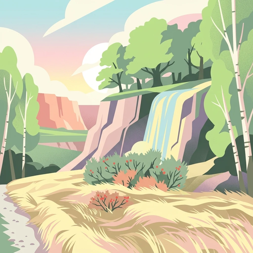
A digital illustration of a nature reserve featuring a waterfall cascading down a cliff face, surrounded by birch trees and scrubby, juniper-like shrubs in a heathland setting.

Naturschutzgebiet Alert

Nature reserve

Park overview

Structured park overview, official facts, and landscape profile for Naturschutzgebiet Alert

Naturschutzgebiet Alert park facts, protected area profile, and essential visitor context

Review the core facts for Naturschutzgebiet Alert, including designation, size, terrain, visitor scale, habitats, and operating context in one park-focused overview.

About Naturschutzgebiet Alert

Naturschutzgebiet Alert is a small, habitat-focused nature reserve in the heart of the High Sauerland, the rolling, forested upland region along the southern edge of North Rhine-Westphalia. The reserve sits within the municipal area of Meschede, on the southwestern flank of the Alert hill, east of the small settlement of Schederberge. Despite its modest size, it captures one of the rarer and more culturally meaningful landscape types of the wider region: a juniper heath, known in German as Wacholderheide, that grew up on shallow, nutrient-poor soils under long-standing grazing pressure.

Within its compact footprint, the reserve brings together a striking range of micro-landscapes. Open stands of juniper are intermingled with species-poor, nutrient-poor grassland, scattered shrubs of broom and heather, lichen- and moss-rich ground layers, and a denser patch of oak field-woodland in the southern portion of the site. Near the middle of the reserve, narrow rocky ribs of Middle Devonian tentaculite slate break through the soil, anchoring the vegetation in a clearly defined geological setting and creating the dry, thin-soiled conditions that the juniper heath depends on.

The reserve is significant not only for its ecology but also as a relic of historical land use. Juniper heaths were once widespread across the High Sauerland, where sheep and goats grazed the thin soils above the bedrock, but they have become extremely rare as land use has shifted toward denser woodland or more intensive agriculture. The Alert reserve therefore preserves both a habitat and a visible trace of how the local landscape was shaped for centuries.

Management of the site reflects the practical challenges of keeping such a relic alive. Encroaching scrub and woodland have to be kept in check through regular cutting of woody growth, while grazing, ideally with sheep and goats, is used to maintain the open, nutrient-poor character of the grassland. The reserve's formal protection purpose explicitly identifies it as a high-priority relic of historic land use that should remain visibly distinct from the intensively used surroundings and continue to anchor the regional landscape identity.

In practical terms, the Alert reserve stands as a textbook example of the kind of small, targeted nature reserve that defines much of Germany's protected-area network: tiny in area, sharply focused on one habitat type, and heavily dependent on continued management to survive.

Quick facts and research context for Naturschutzgebiet Alert

Naturschutzgebiet Alert lies in the city of Meschede in the Hochsauerlandkreis district of North Rhine-Westphalia, in the High Sauerland region of western Germany. It is a small nature reserve of approximately 2 hectares on the southwestern spur of the Alert hill, east of the locality of Schederberge. The site's main ecological value lies in its surviving juniper heath vegetation, which combines nutrient-poor grassland, juniper, and a small oak field-woodland on shallow Devonian slate soils.

The reserve was first legally designated in 1994 as part of the Meschede Landscape Plan and was renewed and slightly enlarged when the plan was updated. It is administered under the German Naturschutzgebiet framework and is recorded in the state of North Rhine-Westphalia's protected-area system under the code HSK-111.

Protection and recognition

Explore terrestrial protection records and official conservation designations

Naturschutzgebiet Alert Protection Status and Designated Conservation Scope

Naturschutzgebiet Alert maintains documented terrestrial protection status within official conservation frameworks. Official records assemble baseline designation parameters and management scope for environmental analysis.

Protection details

Protection scope
Terrestrial
Park context

Deeper park guide and search-rich context for Naturschutzgebiet Alert

Naturschutzgebiet Alert history, landscape, wildlife, and travel context

Explore Naturschutzgebiet Alert through its history, landscape character, ecosystems, wildlife, conservation priorities, cultural context, and seasonal travel timing in a structured park guide built for atlas discovery and search intent.

Why Naturschutzgebiet Alert stands out

Naturschutzgebiet Alert is best known for preserving a remnant juniper heath, an exceptionally rare habitat in the High Sauerland and a vivid relic of the region's older farming and grazing traditions. The reserve concentrates several typical elements of this habitat type within a tiny footprint: open juniper on a rocky hilltop, species-poor nutrient-poor grassland, scattered broom and heather, and a denser oak scrub patch that illustrates the woodland edge such heaths often grade into. The site also illustrates the geological and cultural backdrop of these heaths, with shallow Middle Devonian tentaculite slate bedrock pushing through the surface as low rock ridges. Together, the plants, the rocky substrate, and the visible signs of past grazing give the reserve a strongly identity-forming character within the wider Meschede landscape, even though it is just a few hectares in size.
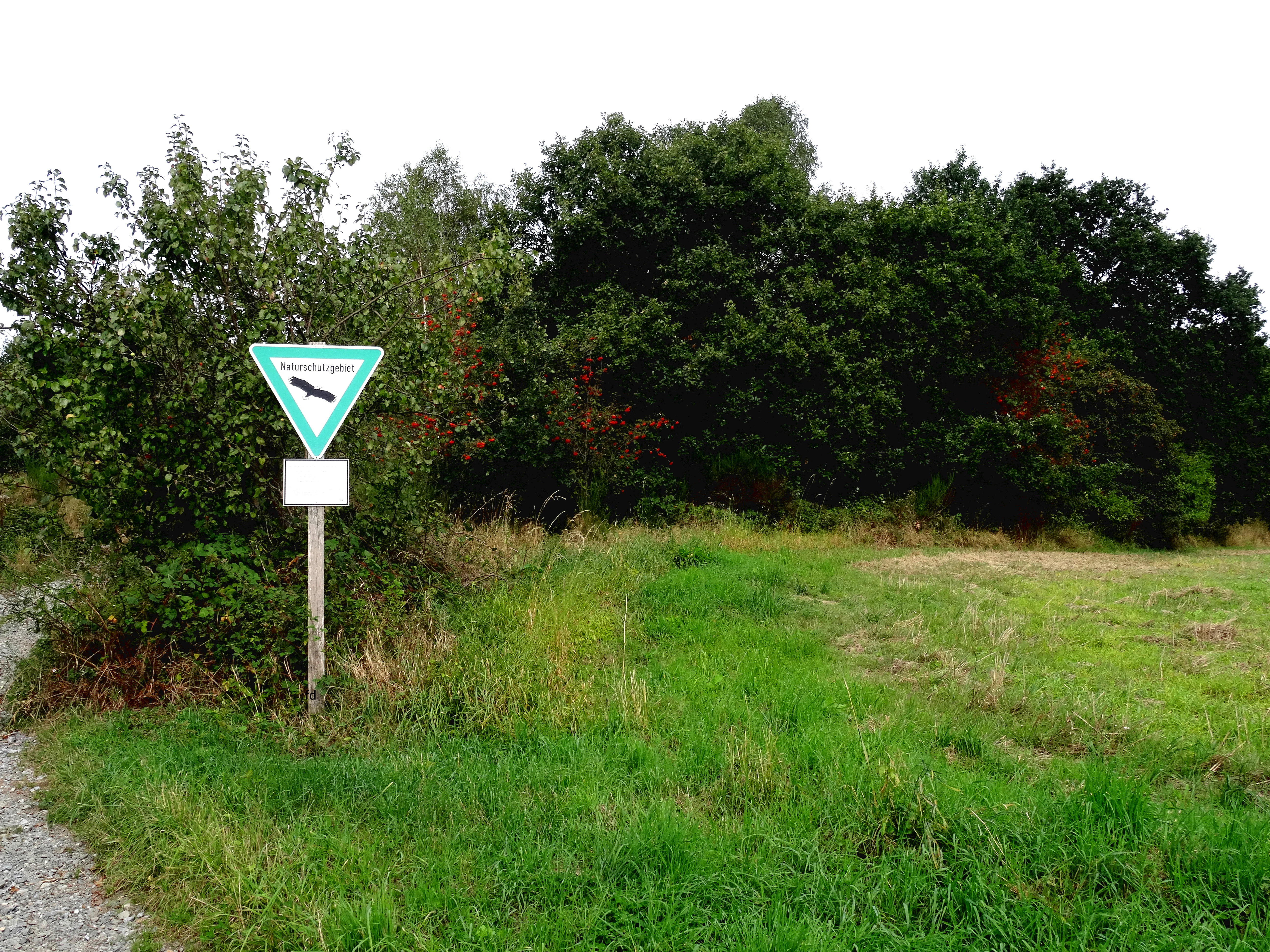
A triangular nature reserve sign with a bird silhouette on a post at the edge of a grassy field and dense trees.
A nature reserve boundary sign marks the entrance to the Naturschutzgebiet Alert.

Naturschutzgebiet Alert history and protected-area timeline

The area that would become Naturschutzgebiet Alert was, for centuries, simply part of the grazed hill landscape east of Schederberge, with juniper and nutrient-poor grassland maintained by livestock on the shallow soils of the Alert hill. As agricultural intensification and woodland regrowth spread through the High Sauerland during the twentieth century, sites like Alert lost most of their open character and ecological distinctiveness.

The reserve was first formally designated in 1994, when the Hochsauerlandkreis established the Meschede Landscape Plan and, through a resolution of the district council (Kreistag), set aside approximately two hectares on the southwestern spur of the Alert hill as a Naturschutzgebiet. The original designation cited the protection of a juniper heath as an extremely rare habitat and a highly worthy relic of historical land use.

When the Meschede Landscape Plan was subsequently revised and updated, the Alert reserve was reaffirmed rather than dissolved. In that process, the protected area was slightly enlarged and its management framework was renewed, ensuring that the site continued to be treated as a working example of how cultural relics such as juniper heaths can be conserved through targeted habitat management.

Naturschutzgebiet Alert landscape and geographic character

The landscape of Naturschutzgebiet Alert is defined by the Alert hill itself, a low, rocky prominence on the edge of the High Sauerland plateau. The reserve occupies the southwestern spur of this hill, where the terrain rises gently above the surrounding countryside around the settlement of Schederberge and then drops away toward Meschede. Because the hill rises above flatter agricultural lowlands, the reserve has a clearly defined topographic identity, sitting as an open, rocky shoulder between denser woodland slopes and the wider valley.

Geology plays a defining role on the ground. The hill is built on Middle Devonian tentaculite slate, a fine-grained, easily weathered bedrock that produces thin, stony, nutrient-poor soils. These soils are too poor to support intensive agriculture or dense forest, which is precisely why juniper and species-poor grassland survived here in the first place. Near the center of the reserve, narrow rocky ribs of this slate break through the surface, creating the stony, dry-looking exposures that give the site much of its visual character.

Above this rocky substrate, the surface of the reserve is a fine mosaic of open juniper clusters, low grasses and herbs, and scattered shrubs. Toward the southern part of the protected area, this open vegetation thickens into an almost continuous oak field-forest, marking a clear transition from open heath to denser woodland within the same small site. The overall impression is of a compact, highly textured hilltop landscape, visibly older in character than the surrounding fields and forests.

Naturschutzgebiet Alert ecosystems, habitats, and plant life

Ecologically, Naturschutzgebiet Alert is built around a single dominant habitat type, the juniper heath, and the closely linked plant communities that grow with it. Junipers of varying age form the structural backbone, scattered across the slope in a pattern that recalls the open grazed landscapes of past centuries. Between and beneath the junipers, the ground layer consists of nutrient-poor grassland with low productivity, in which small sedges and fine grasses dominate and tall, vigorous herbs are largely absent.

The open juniper mosaic also supports a typical heath understorey. Broom, common heather, and bilberry add seasonal color and structure, while patches of mosses and lichens colonize the thin soils and the exposed slate surfaces. The denser oak field-woodland in the southern part of the reserve represents the next stage in the successional sequence: where grazing stops and scrub is not cut back, juniper heath gradually becomes oak-dominated woodland.

This combination of features, open juniper on poor soils, a thin and species-poor grassland layer, low shrubs and heather, and an obvious edge toward oak woodland, is precisely what makes the habitat both culturally and ecologically interesting. It is also what makes it fragile: without active management, encroaching scrub rapidly shades out the open juniper and grassland communities, and the distinctive mosaic is lost within only a few years.

Naturschutzgebiet Alert wildlife and species highlights

The wildlife profile of Naturschutzgebiet Alert is shaped by its small size and its very open, sunny habitat structure. There is no separate species list in the source material, and there are no large charismatic mammals or breeding bird colonies specifically documented for the site.

What little is mentioned highlights the role the habitat plays for typical heath and edge species: the open juniper and dry grassy slopes offer shelter and feeding grounds for the kind of invertebrates, reptiles, and small ground-nesting birds that favor warm, sparse vegetation on shallow soils, while the adjoining oak field-woodland adds habitat for woodland birds and small woodland mammals. Because the real ecological significance of the reserve lies in its habitat rather than its individual species, a separate wildlife section adds limited value beyond what is already covered in the nature section.

Naturschutzgebiet Alert conservation status and protection priorities

Naturschutzgebiet Alert is, in conservation terms, a small but high-priority site. Its formal protection purpose explicitly identifies the juniper heath as one of the rarest habitat types in the region and as a high-value relic of historical land use, justifying dedicated protection under the North Rhine-Westphalia nature conservation framework.

The reserve's conservation importance rests on three linked points. First, it preserves a habitat, juniper heath on shallow Devonian slate, that historically occurred widely in the High Sauerland but is now extremely rare across the region. Second, it keeps that habitat at a recognizable scale, with juniper, nutrient-poor grassland, heath shrubs, and a juniper-to-oak transition zone all present within a few hectares, rather than as isolated fragments. Third, it anchors this habitat visually and culturally in the wider Meschede landscape, standing out from more intensively used surroundings and reinforcing a sense of place grounded in older farming traditions.

The reserve is also a working example of active conservation management. Documented measures include periodic removal of encroaching shrubs and trees to hold back natural succession, targeted grazing with sheep and goats to maintain the open grassland character, and proposals to relocate an intersecting farm track to one side of the reserve so that the entire area can be consistently fenced and grazed. Without these interventions, the site would in the medium term lose most of its open character and revert to closed oak forest.

Naturschutzgebiet Alert cultural meaning and human context

The cultural significance of Naturschutzgebiet Alert is closely bound up with the history of the High Sauerland as a grazing landscape. Juniper heaths developed over centuries in this region because sheep, goats, and later sheep-cattle mixed grazing kept thin-soiled hilltops open and prevented them from being swallowed by woodland. Many local place names, field patterns, and tracks in the Sauerland only make sense in the context of this older pastoral economy.

The reserve therefore functions as a small outdoor museum of that older land use. Its open juniper on a rocky spur above Schederberge is not just an ecological curiosity but a visible reminder of how the pre-industrial High Sauerland looked and worked. At the same time, the current management framework, with cutting of scrub and renewed emphasis on sheep and goat grazing, represents a deliberate attempt to restore the cultural practices that originally maintained the habitat, rather than relying on passive protection alone.

Top sights and standout views in Naturschutzgebiet Alert

Naturschutzgebiet Alert's standout feature is its surviving juniper heath on the rocky southwestern spur of the Alert hill, a habitat type that is now extremely rare in the High Sauerland and that packs an unusually wide range of ecological detail into a footprint of about two hectares. The reserve combines open juniper, nutrient-poor grassland, low heath shrubs, and an oak field-woodland edge within a single, easily readable landscape.

Equally distinctive is the way the reserve is managed: shrub cutting and targeted grazing are used to prevent succession into closed woodland, and there is an explicit intent to keep the site visibly distinct from the more intensively used surroundings. The result is a compact reserve that works both as a habitat refuge and as a living illustration of the older grazing landscape that shaped the High Sauerland.

Best time to visit Naturschutzgebiet Alert

Naturschutzgebiet Alert is most rewarding to visit in late spring and summer, when the dry grassland between the junipers is in active growth and typical heath shrubs such as broom and heather add color to the hilltop. In these months, the open structure of the reserve reads clearly from the surrounding farm tracks and the contrast between juniper heath and adjoining oak woodland is easiest to see.

Autumn can also work well, when juniper foliage darkens and bilberry leaves take on color, and the rocky slate ribs near the center of the site become more visible against thinner vegetation. Winter visits bring the open structure into even sharper focus, with bare branches making the patchwork of juniper, oak scrub, and exposed rock easy to read. The reserve is small and low-lying, so it is generally accessible year-round, and its look shifts more with vegetation than with severe seasonal weather.

Monthly climate preview

Long-term temperature and precipitation averages across representative park coordinates

Naturschutzgebiet Alert Climate Normals and Monthly Temperature Patterns

Historical climate records for Naturschutzgebiet Alert outline measured monthly temperature shifts alongside consistent precipitation patterns across the protected landscape. Reviewing these long-term averages provides essential baseline context for understanding the broader environmental rhythms defining the terrain.
Annual mean9 °C
0 °C18 °C
Jan
Feb
Mar
Apr
May12°
Jun16°
Jul18°
Aug18°
Sep14°
Oct
Nov
Dec
Warmest month
July

18.2 °C

Coolest month
January

0.3 °C

Wettest month
December

2.7 mm/day

Driest month
April

1.7 mm/day

Park location guide

Geography guide, regional context, and park location map for Naturschutzgebiet Alert

Naturschutzgebiet Alert park geography, regions, and map view in Germany

Understand where Naturschutzgebiet Alert sits in Germany through a broader geographic reading of the surrounding landscape, nearby location context, and its mapped position within the national park landscape.

How Naturschutzgebiet Alert fits into Germany

Germany is a federal republic in Western and Central Europe with a population of over 83 million across sixteen constituent states. It is Europe's largest economy by nominal GDP and a major global exporter and importer. The capital is Berlin, and the country borders Denmark, Poland, Czech Republic, Austria, Switzerland, France, Luxembourg, Belgium, and the Netherlands.

Wider geography shaping Naturschutzgebiet Alert in Germany

Germany is located in Western and Central Europe, spanning 357,022 km². It borders Denmark to the north, Poland and the Czech Republic to the east, Austria and Switzerland to the south, and France, Luxembourg, Belgium, and the Netherlands to the west. The country has coastlines on the Baltic Sea and North Sea to the north, with the Alps located in the southern region.

Map view of Naturschutzgebiet Alert

Use this park location map to pinpoint Naturschutzgebiet Alert in Germany, understand its exact geographic position, and read its mapped placement within the surrounding landscape more clearly.

Pigeon | © OpenStreetMap contributors

Location context for Naturschutzgebiet Alert

North Rhine-Westphalia

Visualizing rare juniper heath habitats and rocky terrain across the High Sauerland reserve

Naturschutzgebiet Alert Photos and Protected Landscape Scenery

Visual documentation reveals the distinctive rocky terrain, juniper clusters, and rare grassland habitats preserved within the protected nature reserve. Examining these landscape photographs helps researchers understand the geological character and historical grazing ecology that define the site.

A triangular nature reserve sign with a bird silhouette on a post at the edge of a grassy field and dense trees.

A grassy, dry field bordered by a dirt path on the left and a dense line of mature green trees in the background.

Park atlas

Compare adjacent nature reserves and regional conservation areas across the High Sauerland

Explore Other Parks Near Naturschutzgebiet Alert and Surrounding Protected Landscapes

Browse protected areas near Naturschutzgebiet Alert to examine similar rocky habitats and rare regional juniper heaths. Comparing adjacent terrain reveals the wider ecological context and land use patterns of the surrounding Meschede region.
A watercolor painting of a serene landscape featuring rolling green hills in the distance, a line of trees in the middle ground, and a small winding stream in the foreground.
Protected landscapeHochsauerlandkreis
About 3.8 km away#1 closest

East

Landschaftsschutzgebiet Bestwig: Mapped Protected Landscape in the Hochsauerland District

Geography, forest ridges, and historic mining terrain

Landschaftsschutzgebiet Bestwig covers significant portions of the central Sauerland, integrating forest crests and river valley slopes into a single protected area. The geography reveals a complex interaction between agricultural plantation land, unpopulated northern forest ridges, and historic mining remnants that define this distinct German landscape.

Area
49.12 km²
Established
2008
Relief
Mountain
Water
Minor water
Nature reserveHochsauerlandkreis
About 3.9 km away#2 closest

Northeast

Naturschutzgebiet Ostenberg: Protected Nature Reserve and Cave System Geography

Upland forest terrain and karst geology in Hochsauerlandkreis

Naturschutzgebiet Ostenberg is a significant 21-hectare nature reserve that safeguards a complex of steep-slope forests and a multi-level limestone cave system. The site offers a detailed view into the karst processes and mature woodland ecology characteristic of the Sauerland region, providing a protected habitat for forest flora and wintering bat colonies.

Area
0.211 km²
Established
2008
Relief
Upland
Climate
Temperate
A soft, pastel-toned watercolor painting of a rolling rural landscape with low hills, sparse trees, and a winding path.
Nature reserveNorth Rhine-Westphalia
About 4.9 km away#3 closest

Northwest

Naturschutzgebiet Schnettenberg: Protected Juniper Heath and Ridge Geography in Sauerland

Historic German nature reserve in North Rhine-Westphalia

Covering more than 1,000 metres of ridge terrain, this nature reserve maintains essential dry grassland and juniper communities within the Hochsauerlandkreis. The area provides a vital study of transition zones between open farmland and wooded valley slopes, illustrating the ongoing conservation of light-dependent habitats in modern Germany.

Area
0.045 km²
Established
1938
IUCN
IV
Nature reserveHochsauerlandkreis
About 5.7 km away#4 closest

South

Naturschutzgebiet Piepenbruchsiepen: Protected Landscape and Mountain Brook Geography

Mapping nature reserves in the Hochsauerlandkreis region

This nature reserve covers a steep, forested valley in the Hochsauerlandkreis, showcasing a classic Sauerland Siepen. The terrain is defined by a rocky mountain brook, seeping springs, and structurally rich beech forests that preserve native biodiversity within a heavily managed timber landscape.

Area
0.077 km²
Established
2020
Relief
Mountain
Scope
Terrestrial
A horizontal watercolor illustration depicting a soft, impressionistic landscape with rolling hills, meadows, and trees in shades of green, pink, and light grey.
Nature reserveHochsauerlandkreis
About 6.9 km away#5 closest

Southeast

Naturschutzgebiet Plästerlegge, Auf’m Kipp: Protected Nature Reserve and Gorge Geography

Mapped ravine forests and high moor terrain in Hochsauerlandkreis

This protected area centers on the Plästerlegge waterfall and its steep slate gorge within the Sauerland mountains. The reserve offers a rare look at humid microclimate flora, silverleaf ravine forests, and a high-elevation peatland basin. Explore the precise landscape boundaries and ecological terrain that define this protected forest mosaic in western Germany.

Area
0.285 km²
Established
1952
Relief
Upland
Climate
Temperate
Nature reserveNordrhein-Westfalen
About 7.1 km away#6 closest

South

Naturschutzgebiet Oegmannsholz: Protected Forest and Geological Landscapes in Nordrhein-Westfalen

A dense nature reserve featuring beech woodland, rock formations, and valley springs.

Naturschutzgebiet Oegmannsholz represents a concentrated protected area within the Sauerland region of Germany. This reserve safeguards diverse forest microhabitats, including mature beech stands and steep drainage lines known as Kerbtalsiepen. Its structural variety, from rocky outcrops to flowing springs, creates a distinct natural terrain within the broader North Rhine-Westphalia conservation network.

Area
0.113 km²
Established
2008
IUCN
IV
Nature reserveNorth Rhine-Westphalia
About 7.5 km away#7 closest

North

Naturschutzgebiet Oberes Lörmecketal: Protected Valley Landscapes in North Rhine-Westphalia

Swamp woodland and brook headwater geography

Delve into the landscape composition of Naturschutzgebiet Oberes Lörmecketal, a small yet ecologically significant nature reserve in the Sauerland. This record details the spring-fed valley terrain, alder-dominated wetlands, and the protected brook corridor that serves as a vital connecting point within the regional Natura 2000 network.

Area
0.03 km²
Established
1994
Relief
Upland
Climate
Temperate
Nature reserveHochsauerlandkreis
About 7.7 km away#8 closest

West

Schürenbachtal Nature Reserve: Geographic Landscape and Protected Area Mapping

A meadow valley and stream corridor in the Hochsauerland district

Discover the geographic structure of the Schürenbachtal nature reserve, a 41-hectare protected area in the Hochsauerland district. This detailed overview highlights the stream's natural meanders, alder-lined banks, and the surrounding patchwork of meadows and copses that define this Sauerland highland ecosystem.

Area
0.414 km²
Established
2020
Water
Major water bodies

Common questions about visiting, size, designation, and location context for Naturschutzgebiet Alert

Naturschutzgebiet Alert FAQs for park facts, access, geography, and protected area context

Find quick answers about Naturschutzgebiet Alert, including protected-area facts, park geography, trail and visitor context, and how the park fits into its surrounding country and regional landscape.
MoriAtlas Explorer

Continue Your Protected Areas Search Across the Global Atlas

Deepen your exploration by continuing the structured search for national parks and protected areas worldwide. Utilize the comprehensive filtering capabilities to compare different conservation landscapes and refine your understanding of global park geography. Discover more about the distribution and characteristics of protected natural areas.

Global natural geography