Why Naturschutzgebiet Oberes Lörmecketal stands out
The reserve is particularly known for protecting the source area and upper course of the Lörmecke brook and the swampy alder-birch woodland (Bruchwald) that surrounds the spring. It represents a textbook example of a small, ecologically valuable headwater valley in the Sauerland, integrated into a much larger Natura 2000 valley system.
Naturschutzgebiet Oberes Lörmecketal history and protected-area timeline
Naturschutzgebiet Oberes Lörmecketal was established as a formally protected area in 1994, when the council (Kreistag) of the Hochsauerlandkreis designated it as a Naturschutzgebiet within the framework of the Meschede landscape plan (Landschaftsplan Meschede). At that time, the reserve covered an area of 3.0 hectares. The original designation was tied to the broader regional landscape-planning effort of the early 1990s, when many small stream and valley habitats across the Sauerland received formal protection status.
When the Landschaftsplan Meschede was later revised and updated, the nature reserve was re-designated under the new plan. During this process, the area was slightly reduced to its current extent of 2.96 hectares. The re-designation confirmed the ongoing ecological importance of the site and reconfirmed its role within the regional network of protected areas. The most recent reference landscape plan for Meschede, issued in 2020, continues to list the reserve among those protecting the source area of the Lörmecke.
Information about the reserve's prior land use is limited in the available sources, but the present-day protection arguments explicitly emphasize that the valley retains its character due to very low levels of human disturbance. This suggests that the area has long functioned as a quiet, water-driven forest environment that escaped the more intensive agricultural or forestry uses that shaped much of the surrounding Sauerland.
Naturschutzgebiet Oberes Lörmecketal landscape and geographic character
The landscape of Naturschutzgebiet Oberes Lörmecketal is a textbook example of a small Sauerland headwater valley. The terrain is gently shaped by the slow, spring-fed cutting action of the Lörmecke, with the brook essentially carving the reserve's contours from a shallow, waterlogged basin. To the north, the valley ends abruptly at the municipal boundary between Meschede and the city of Warstein, while to the south the protected zone opens toward the broader landscape and the nearby Lörmecke-Turm observation tower.
Relief in the area is subtle. Mountains and high ridges are absent; instead, the reserve sits within the rolling, forested uplands typical of the Rothaargebirge foothills. The defining landform element is not altitude, but water: the soft, peaty ground of the spring depression, the saturated soils along the brook margins, and the narrow, sinuous floodplain that channels the first cold, clear waters of the Lörmecke on their journey toward the wider valley system.
Above and around the immediate wet zone, the slopes are cloaked in the mixed forest typical of the region. The contrast between the bright, moist spring basin with its alder-birch woodland and the more upland, drier forest stands a short distance away gives the area a distinct landscape signature despite its modest size. The valley is best appreciated on foot, following the small watercourse through the reserve and onward toward downstream protected stretches.
Naturschutzgebiet Oberes Lörmecketal ecosystems, habitats, and plant life
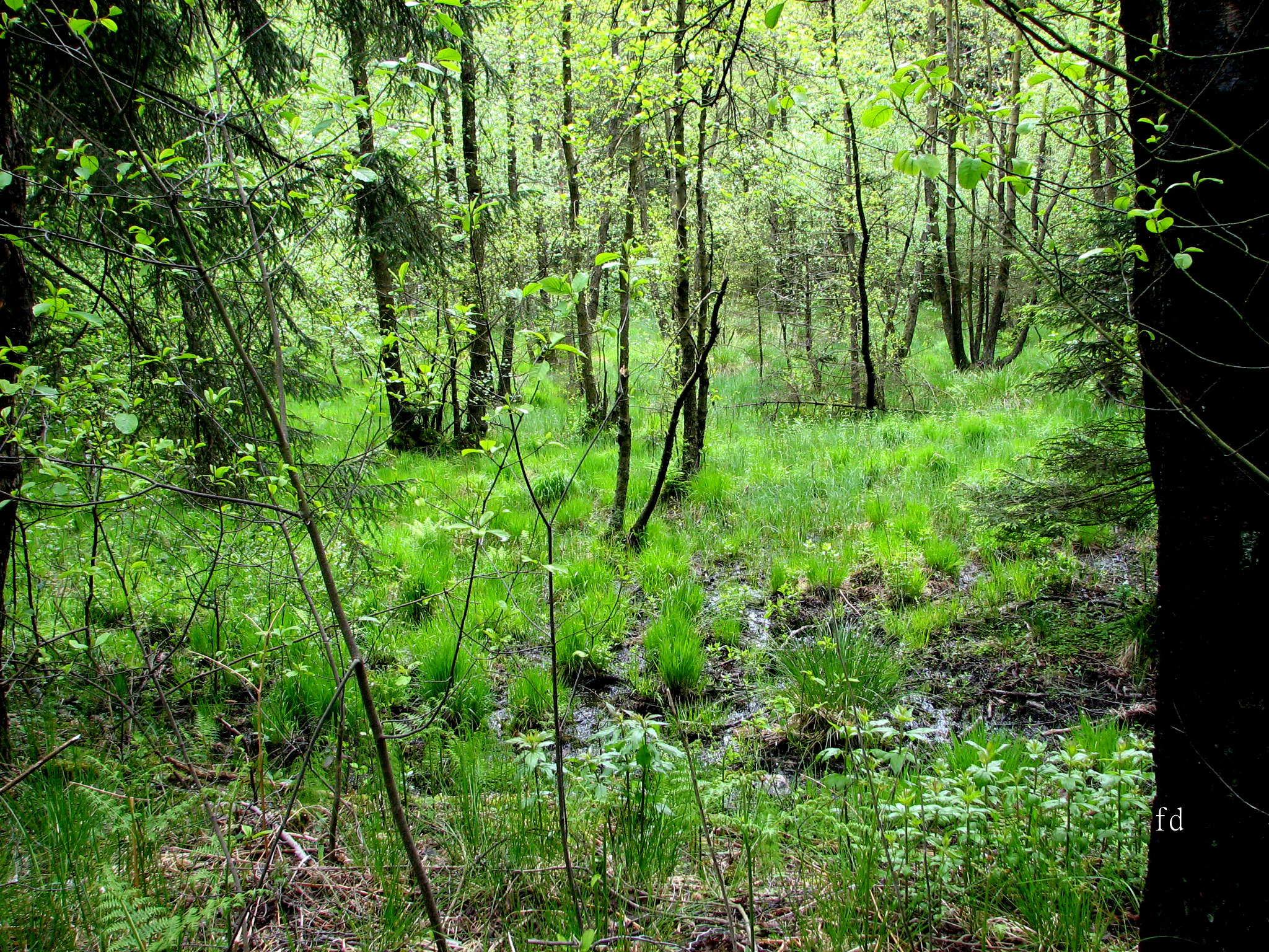
Ecologically, Naturschutzgebiet Oberes Lörmecketal is defined by its combination of a near-natural, spring-fed brook and the wetland forest communities that have developed around the source. The most distinctive habitat is the local Bruchwald, or swamp woodland, that occupies the immediate spring area. This community is composed primarily of black alder (Rot-Erle), which thrives along the streambanks and in permanently moist soils, and bog birch (Moor-Birke), which has adapted to the acidic, peat-influenced conditions of the uppermost valley floor. Together, these species form a soft, water-loving forest that shades the source and stabilizes the saturated soils.
The streambed itself is a near-natural flowing-water habitat, with a varied structure of pools, riffles, mossy stones, leaf litter, and woody debris. Such undisturbed headwater brooks are unusually valuable in heavily managed Central European landscapes because they maintain stable temperatures, high oxygen levels, and clean substrates for aquatic invertebrates, amphibians, and other moisture-dependent species. Bank-side vegetation and the saturated floodplain soils further extend the moist habitat zone outward from the brook, producing a gradient from open water through wet forest edge to higher, drier woodland.
Within this habitat mosaic, rare plant and animal species associated with low-disturbance, moisture-rich valley environments are documented in the protected area. The reserve also plays an important role in connecting downstream protected sections of the same valley, including the Naturschutzgebiet Lörmecketalsystem in Bestwig and Naturschutzgebiet Lörmecketal in Kreis Soest, allowing species and ecological processes to move along the entire length of the Lörmecke.
Naturschutzgebiet Oberes Lörmecketal wildlife and species highlights
Although the reserve is very small, it provides habitat for rare and characteristic species tied to near-natural headwater streams and wet woodlands. The combination of cool spring water, dense alder-birch cover, undisturbed streambed structure, and saturated floodplain soils offers refuge for moisture-dependent animals that have become scarce across much of the surrounding landscape.
The near-natural brook supports the aquatic and amphibious fauna typical of Sauerland headwater streams, including aquatic invertebrates that depend on clean gravel and leaf-litter substrates, as well as amphibian species that rely on shallow, unshaded spawning areas and adjacent moist forest. The damp forest floor and decaying wood of the alder-birch swamp woodland provide shelter and feeding grounds for forest-dwelling invertebrates, while the dense, shaded canopy and saturated soils create microclimates that support a wider community of wet-forest specialists.
By integrating this reserve into the broader Natura 2000 FFH site that follows the entire course of the Lörmecke, the area helps maintain wildlife connectivity along the valley. Species recorded or expected in such connected headwater-to-mouth stream systems can move between the source protection here and the more extensive downstream reserves, strengthening populations that would be vulnerable in any single, isolated patch.
Naturschutzgebiet Oberes Lörmecketal conservation status and protection priorities
The conservation significance of Naturschutzgebiet Oberes Lörmecketal lies in its role as the protected headwater of a much larger valley system. The official protection purpose explicitly aims to safeguard the source and floodplain of the Lörmecke as a component of a major valley with minimal human disturbance and high ecological site quality. By doing so, it preserves the uppermost element of a hydrological and ecological continuum that extends downstream into other nature reserves and, ultimately, into the broader landscape.
A central conservation focus is the wet woodland and near-natural flowing-water habitats. The reserve's varied stand of moist forest, dominated by black alder and bog birch, together with structurally rich streambed habitats, supports a community of rare plant and animal species that depend on continuously available clean water, undisturbed banks, and stable microclimate. These conditions are difficult to maintain elsewhere in the intensively used German uplands.
Equally important is the reserve's role within the European protected-area network. The entire course of the Lörmecke from the source area here to its confluence is designated as the FFH site Lörmecketal (DE-4516-301) under the EU Habitats Directive. The reserve therefore contributes directly to Natura 2000 coherence objectives, helps optimize ecological connectivity with adjacent protected areas, and provides a strengthened basis for restoring or improving understocked forest sections elsewhere in the valley.
Naturschutzgebiet Oberes Lörmecketal cultural meaning and human context
The broader cultural context of Naturschutzgebiet Oberes Lörmecketal is rooted in the traditional land-use patterns of the Sauerland. The region has long been characterized by small-scale farming, forestry, and the careful management of water resources, with small brooks like the Lörmecke historically serving local mills, livestock, and domestic water supplies. The fact that the upper Lörmecke valley has retained a near-natural character suggests it escaped the most intensive transformations that altered many other valleys in the area.
The nearby Lörmecke-Turm observation tower reflects the modern cultural role of the valley as a local recreation and scenic resource, while the protected status of the brook and its valley across three separate administrative jurisdictions (Meschede, Bestwig, and Kreis Soest) demonstrates the regional importance attached to preserving a coherent natural landscape rather than fragmenting protection by municipal boundaries. Together, these features place the reserve within a wider Sauerland identity of closely interlinked nature, forestry, water management, and outdoor recreation.
Top sights and standout views in Naturschutzgebiet Oberes Lörmecketal
Compact protection of the source and uppermost course of the Lörmecke, a Sauerland brook whose full length is also a Natura 2000 FFH site. A small but ecologically dense area of black-alder and bog-birch swamp woodland (Bruchwald) around a spring basin, with rare plant and animal species tied to near-natural, low-disturbance valley conditions. An important connecting piece within a network of valley nature reserves extending downstream through Bestwig and Kreis Soest, embedded in the forested, gently rolling uplands of the Hochsauerlandkreis.
Best time to visit Naturschutzgebiet Oberes Lörmecketal
The reserve can be appreciated throughout the year in calm, low-impact fashion, but visits in late spring and early summer are particularly rewarding, when alder and birch foliage is fully out, the brook runs reliably, and the surrounding forest is vivid with greenery. Autumn visits, with lower water levels and changing leaf colors, offer a quieter, more atmospheric experience and good visibility into the valley structure. Winter visits, when deciduous trees have shed their leaves, allow clearer views across the wet woodland and stream course, although paths can be wet and chilly.