
Mori Atlas logo
Nature reserveNaturschutzgebiet Oberes Möhnetal

Understanding the ecological mosaic and riparian geography of this Sauerland nature reserve

Naturschutzgebiet Oberes Möhnetal: Protected Floodplain and River Restoration Landscape

Naturschutzgebiet Oberes Möhnetal represents a vital protected floodplain in the Sauerland region of Nordrhein-Westfalen. This reserve showcases a managed mosaic of wet meadows, alder-dominated stream forests, and bog woodland, framed by an extensive river renaturation project that re-meandered the upper Möhne channel. It serves as a significant site within the broader Natura 2000 network for regional biodiversity.

floodplainriver valleyriver restorationwet meadowsalder forestNatura 2000
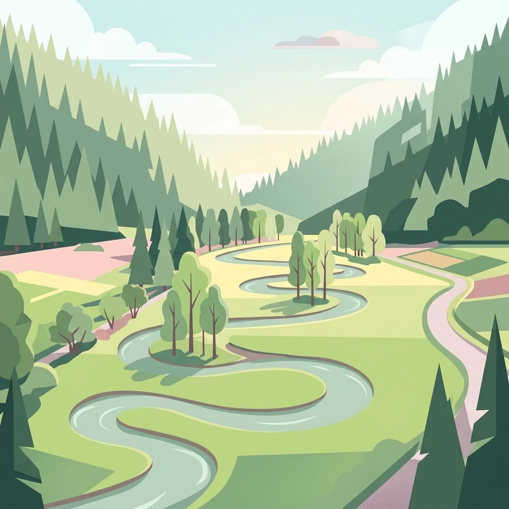
An illustration showing a winding river flowing through a lush green valley flanked by coniferous forests and hills.

Naturschutzgebiet Oberes Möhnetal

Nature reserve

Park overview

Structured park overview, official facts, and landscape profile for Oberes Möhnetal Nature Reserve

Oberes Möhnetal Nature Reserve park facts, protected area profile, and essential visitor context

Review the core facts for Oberes Möhnetal Nature Reserve, including designation, size, terrain, visitor scale, habitats, and operating context in one park-focused overview.

About Oberes Möhnetal Nature Reserve

Oberes Möhnetal is a focused floodplain conservation area in the eastern Sauerland, where the Möhne river begins to carve its way through the landscape north-west of Brilon. Although it is modest in size, the reserve punches above its weight ecologically because it guards the headwater character of the Möhne and acts as a buffer for the downstream Natura 2000 corridor.

The protected landscape is best understood as a recovering mosaic. The Möhne valley here once supported continuous grassland stretching back to the 1950s, sustained by a patchwork of drainage and irrigation. Over later decades, much of that agricultural use collapsed: fields were abandoned, drained meadows were planted with dense stands of Norway spruce, the river itself was straightened, and its banks were reinforced with stone and other hard structures. The result was a simplified, ecologically impoverished corridor.

Since 2008 the area has been formally recognised as a Naturschutzgebiet, and the broader Briloner Hochfläche landscape plan has framed its purpose as preserving an important, structurally diverse grassland valley with relics of floodplain and bog woodland, brookside alder stands, and species-rich meadows. Downstream of the Scharfenberger Bahnhof the protection merges seamlessly into the FFH area Möhne-Oberlauf, creating a continuous zone of high conservation value along the upper river. In 2023 the site was additionally incorporated into the larger Diemel- and Hoppecketal bird protection area, extending its significance for breeding and foraging birds.

What makes Oberes Möhnetal particularly interesting is the deliberate effort to rebuild natural river processes rather than simply fence them off. Between 2010 and 2014, a LIFE+ project led by the lower landscape authority of Kreis Soest together with the Biologische Station Hochsauerlandkreis reshaped the river itself, digging side channels, encouraging new meanders, and removing bank protections. Dead wood was placed in the channel to increase structural variety, while spruce plantations on the floodplain were cleared and converted back to grassland, and abandoned plots were reinstated as meadows. Several old fish ponds were also removed from the floodplain, allowing the river's natural hydrology to reassert itself.

The reserve is not a remote wilderness. It lies within walking distance of nearby villages and the former Scharfenberger Bahnhof, and its meadows remain in active agricultural use under management contracts that link conservation to traditional grassland husbandry. This combination of legal protection, ecological restoration, and continuing low-intensity land use gives the valley a layered, working character that distinguishes it from more strictly excluded nature reserves.

Quick facts and research context for Oberes Möhnetal Nature Reserve

Oberes Möhnetal is a floodplain nature reserve of roughly 81 hectares located northwest of Wülfte in the municipality of Brilon, in the Hochsauerland district of North Rhine-Westphalia. The reserve was designated in 2008 under the Briloner Hochfläche landscape plan, and from 2023 it also lies within the Diemel- and Hoppecketal European bird protection area. Downstream of the former Scharfenberger Bahnhof it forms part of the FFH site Möhne-Oberlauf, linking it to the larger Möhne valley Natura 2000 network.

The protected area centres on the upper course of the Möhne river and its floodplain, where wet grassland, alder forests, and bog woodland remnants replace the formerly drained and straightened farmland. A dedicated LIFE+ project between 2010 and 2014 rewilded large sections of the river and its meadows, turning the reserve into one of the more active lowland river restoration sites in the Sauerland.

Park context

Deeper park guide and search-rich context for Oberes Möhnetal Nature Reserve

Oberes Möhnetal Nature Reserve history, landscape, wildlife, and travel context

Explore Oberes Möhnetal Nature Reserve through its history, landscape character, ecosystems, wildlife, conservation priorities, cultural context, and seasonal travel timing in a structured park guide built for atlas discovery and search intent.

Why Oberes Möhnetal Nature Reserve stands out

The reserve is best known for the renaturation of the upper Möhne river. Where the channel had once been straightened, embanked, and flanked by old spruce plantations, a coordinated LIFE+ project re-meandered the course, removed bank reinforcements, introduced dead wood to enhance natural dynamics, and converted conifer stands and abandoned fields back into wet grassland and alder forest. Equally distinctive is the floodplain's mosaic of habitats: small fragments of alluvial and bog woodland, brookside alder stands, wet and moist meadows including Borstgrasrasen, and a network of side channels and oxbow-like features. The valley is also recognised for its rich botanic diversity, hosting a long list of meadow, wetland, and forest indicator species documented by the North Rhine-Westphalian state agency for nature, environment and consumer protection.
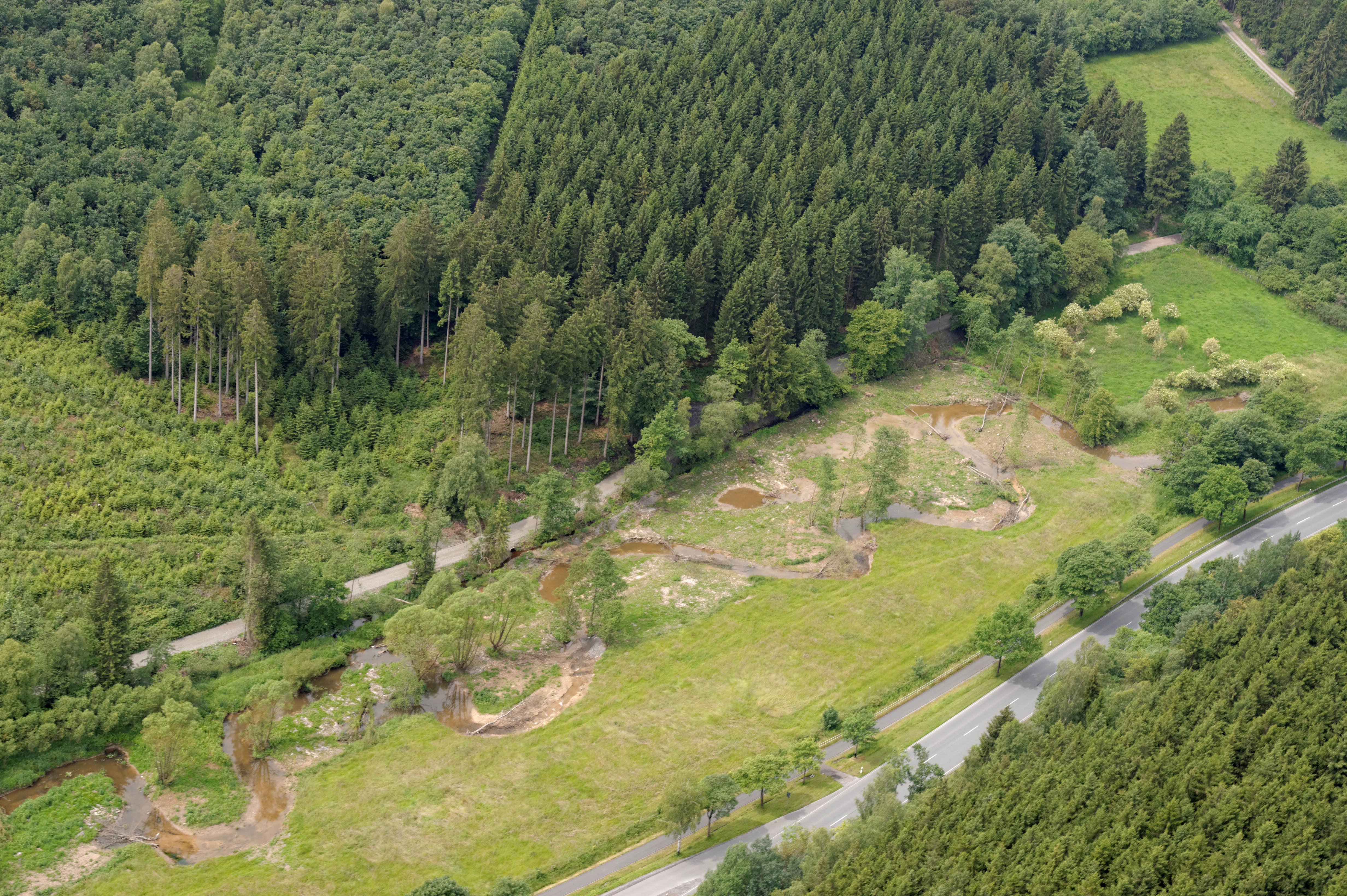
Aerial view of a narrow river flowing through a green river valley, with forests on both sides and a road running parallel to the water.
An aerial view of the renatured Möhne River winding through the Oberes Möhnetal nature reserve, bordered by forest and a road.

Oberes Möhnetal Nature Reserve history and protected-area timeline

The valley's recent ecological story begins in the mid-twentieth century, when the Möhne floodplain around Brilon was still managed as continuous grassland. Farmers maintained the meadows through a combination of drainage and controlled flooding, producing an open, herb-rich agricultural landscape dependent on regular cutting and grazing.

From the 1960s and 1970s onward, that pattern broke down. Drainage ditches lowered the water table, many fields were abandoned, and large parts of the floodplain were replanted with Norway spruce in the hope of commercial timber returns. At the same time, the Möhne itself was straightened and its banks stabilised, severing the hydrological connection between river and meadow that had shaped the valley's biodiversity.

Formal conservation arrived in 2008, when the Hochsauerlandkreis designated the area a Naturschutzgebiet under the Briloner Hochfläche landscape plan. The plan's stated purpose was to preserve and optimise a regionally important grassland valley, including its special sites of wet meadow, floodplain woodland relicts, bog woodland fragments, Borstgrasrasen, and brookside alder forest.

A second phase of intervention followed between 2010 and 2014 under the EU LIFE+ programme. The project was led locally by the Untere Landschaftsbehörde of Kreis Soest and the Biologische Station Hochsauerlandkreis, and focused on a stretch of the Möhneaue from the Scharfenberger Bahnhof downstream toward the Möhne reservoir. The project explicitly aimed to restore the river's natural dynamics and to rebuild the valley's ecotone between water and meadow.

In 2023 the reserve was further recognised when it became part of the larger European Vogelschutzgebiet for the Diemel and Hoppecke valleys, strengthening its role for breeding birds such as kingfisher, dipper, and red-backed shrike.

Today, Oberes Möhnetal stands as an example of layered conservation work: formal legal protection, large-scale hydrological rewilding, and the continued use of contract-based meadow management to keep the floodplain open and species-rich.

Oberes Möhnetal Nature Reserve landscape and geographic character

The reserve is defined by the valley of the upper Möhne and its low-lying floodplain. The river meanders through a shallow trough that broadens and narrows between gentle valley shoulders, with meadows spreading out on either side of the channel. The terrain is predominantly lowland in character, especially within the river's own corridor, although the surrounding Sauerland uplands provide the catchment context from which the Möhne gathers its flow.

A key feature of the current landscape is the restored river itself. Where the Möhne once ran in a stiffened, straight channel between reinforced banks, it now follows a longer, more sinuous course shaped by deliberate re-meandering. Side channels cut with excavators give the floodplain a braided appearance in places, and the introduction of large woody debris has created pools, riffles, and small sediment bars along the riverbed.

On the valley floor, the landscape is a finely grained patchwork. Small rises and depressions alternate with old ditches, relict channels, and shallow depressions where water lingers after rain. The meadows range from drier, herb-rich grassland on slightly higher ground to permanently moist and wet swards in the lowest parts of the floodplain. Old fish ponds that once occupied wet sections have been removed, opening up former pond basins to natural flooding again.

Woodland elements are deliberately modest. Narrow strips and patches of alder-dominated stream forest line the banks and seepage zones, with occasional relics of bog woodland and alluvial forest tucked into corners of the floodplain. Beyond the river corridor, the surrounding slopes still carry larger blocks of forest, including conifer stands that contrast with the open floodplain below.
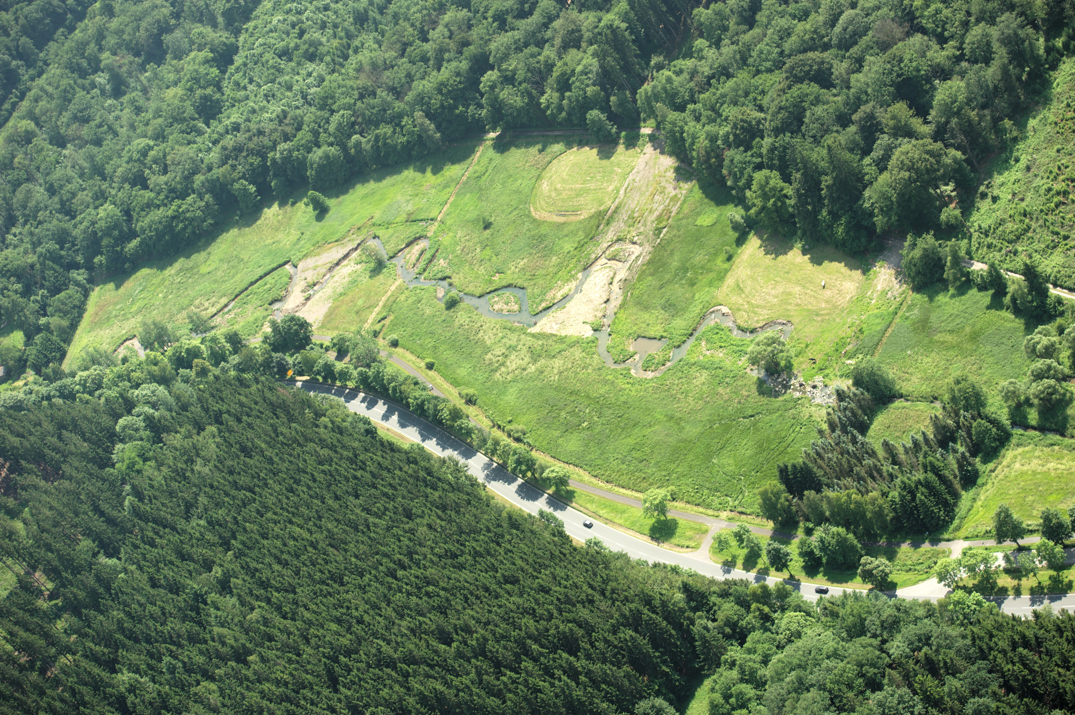
An aerial shot showing a winding river segment in a green valley, surrounded by dense forest, with a road running along the lower edge.
Aerial view of a renatured section of the Möhne river flowing through its valley.

Oberes Möhnetal Nature Reserve ecosystems, habitats, and plant life

The reserve's ecological identity rests on the floodplain mosaic. Brookside alder woodland, residual floodplain and bog woodland fragments, and a layered complex of moist and wet open grassland together produce a high habitat diversity within a small footprint. The Briloner Hochfläche landscape plan describes the valley as an important grassland valley whose site diversity gives it a high, though only partially realised, ecological potential.

Wet and moist meadows (Feucht- und Nassgrünländer) are at the heart of this mosaic. They are complemented by Borstgrasrasen (mat-grass swards) on slightly more acidic, drier ground, together with field-edge communities and reed stands along the water's edge. The combination supports a rich herb flora, with species such as Sumpf-Dotterblume, Bachbunge, Bach-Nelkenwurz, Echtes Mädesüß, Blutwurz, Fieberklee, Breitblättriges Knabenkraut, Teufelsabbiss, Heidelbeere and Besenheide documented by the state nature agency.

The river itself and its immediate margins add a second ecological dimension. Side channels, re-meandered bends, dead wood accumulations, and the removal of bank reinforcement together provide a more dynamic lotic system than existed before the LIFE+ project. Aquatic and bankside bryophyte diversity is correspondingly notable, with multiple peat moss (Sphagnum) species, including Girgensohnsches Torfmoos, Kahnblättriges Torfmoos, and Spitzblättriges Torfmoos, recorded alongside brook mosses and feather mosses like Schönes Frauenhaarmoos.

Although the reserve lies within a generally forested upland region, its ecological value is essentially lowland floodplain in character. The open, dynamic valley provides a striking contrast to the surrounding woodland matrix and functions as a refuge for meadow, wetland, and riparian communities that have largely disappeared from more intensively farmed landscapes.

Oberes Möhnetal Nature Reserve wildlife and species highlights

The reserve supports a small but characteristic set of specialist valley species. The river's restored structure, with dead wood, undercut banks and shallow gravelly stretches, hosts fish such as Groppe (bullhead/cottus) and Bachneunauge (brook lamprey), both of which depend on clean, well-oxygenated gravel beds.

Birdlife is one of the reserve's strongest public-facing assets. Breeding species include Eisvogel (kingfisher), Wasseramsel (dipper) and Neuntöter (red-backed shrike), while the Schwarzstorch (black stork) has been recorded as a foraging visitor. The 2023 incorporation of the site into the Diemel- and Hoppecketal Vogelschutzgebiet formally recognises its role within a wider breeding bird network.

Insects and other invertebrates also benefit from the restored floodplain. Dragonflies such as Heidelibelle species, grasshoppers like Sumpfschrecke, and butterflies including the Mädesüß-Perlmuttfalter have been documented. The combination of open meadows, slow-flowing water bodies, alder stands and reed patches provides the varied microhabitats that these groups require.

Larger mammals are not the focus of the reserve's protection regime, but the structural diversity of woodland strips, wet openings, and adjacent forest makes the valley attractive to typical Sauerland mammal communities, including roe deer and various smaller predators, while amphibians and wetland invertebrates find suitable conditions in the wet meadow complexes and restored side channels.

Oberes Möhnetal Nature Reserve conservation status and protection priorities

Oberes Möhnetal is protected on multiple, overlapping levels. It is a designated Naturschutzgebiet under North Rhine-Westphalian nature conservation law, anchored in the Briloner Hochfläche landscape plan of 2008. Downstream of the former Scharfenberger Bahnhof, the protected river corridor also lies within the European FFH site Möhne-Oberlauf, integrating the area into the Natura 2000 network; from 2023 the whole reserve additionally falls under the Diemel- and Hoppecketal Vogelschutzgebiet.

The conservation rationale is unusually concrete for such a small site. The landscape plan identifies the valley as an important grassland valley of outstanding site diversity, harbouring wet and moist meadows, floodplain and bog woodland relicts, Borstgrasrasen, and brookside alder forest, and it explicitly frames protection as both preservation and optimisation. The aim is to maintain traditional grassland management on holdings vulnerable to abandonment by offering management contracts, supporting the diverse biotope mosaic and associated landscape character.

Beyond static protection, the reserve is a major restoration case study. The 2010 to 2014 LIFE+ project treated the Möhne as a living system rather than a fixed channel. Re-meandering, side-channel creation, dead wood placement, bank reinforcement removal, spruce clearance, fish pond removal, and grassland reinstatement together rebuilt the ecological infrastructure of the valley, reversing the mid-twentieth century shift from open, herb-rich floodplain to straightened, conifer-dominated channel.

The combination of formal designation, Natura 2000 status, EU-funded restoration, and ongoing contract-based land management gives Oberes Möhnetal a layered conservation profile. Rather than being valued simply for being 'protected', it functions as a working example of how river hydrology, traditional grassland use, and modern conservation instruments can be combined in a small but ecologically rich Sauerland valley.

Oberes Möhnetal Nature Reserve cultural meaning and human context

There is no strongly documented cultural landscape story around Oberes Möhnetal itself, but the broader context is typical of the Briloner Hochfläche. Traditional land use in this part of the Sauerland combined small-scale grassland farming with stream-side meadows along rivers like the Möhne. Wet meadows were valuable hay resources, and the floodplain's open structure depended on continuous cutting and grazing.

The reserve's current management regime consciously preserves that inheritance. By offering Vertragsangebote (contractual land-use arrangements) to farmers willing to maintain traditional grassland practices on holdings at risk of abandonment, the landscape plan links present-day conservation to a continuing agricultural tradition rather than replacing it with strict exclusion.

The nearby former Scharfenberger Bahnhof provides a modest industrial-historical echo in the landscape. A former railway station, it now sits close to the start of the LIFE+ project's rewilded river corridor, marking the point at which the protected valley transitions into the larger FFH area Möhne-Oberlauf that extends toward the Möhnetalsperre downstream.

Top sights and standout views in Oberes Möhnetal Nature Reserve

A small but ecologically intense Sauerland floodplain, Oberes Möhnetal combines three layers of value. Its habitat mosaic of wet meadows, alluvial and bog woodland relicts, Borstgrasrasen, and brookside alder forest packs remarkable site diversity into a modest footprint. Its formal protection spans a Naturschutzgebiet designation, an FFH area, and a 2023 inclusion in the Diemel- and Hoppecketal European bird protection zone, stitching it firmly into the regional Natura 2000 network.

Above all, the reserve is defined by its restoration story: a multi-year LIFE+ effort that re-meandered the Möhne, removed bank fortification, reintroduced dead wood, cleared spruce plantations, reinstated wet meadows, and removed old fish ponds, transforming a formerly straightened, coniferised valley into a dynamic working floodplain. For visitors interested in European river restoration and Sauerland biodiversity, Oberes Möhnetal offers a compact, clearly documented case study in process-based conservation.

Best time to visit Oberes Möhnetal Nature Reserve

Oberes Möhnetal reads most clearly in late spring and early summer, when wet meadows are at their floristic peak and breeding birds along the river are most active. Kingfisher, dipper, and red-backed shrike are easiest to observe during this season, and dragonflies and butterflies become more conspicuous along side channels and meadow margins.

Summer continues to offer rich meadow colour and active insect life, though the open floodplain then has fewer canopy-level bird observations. Visiting in quieter conditions, such as early morning or outside peak holiday weekends, generally gives the best chance of seeing wildlife along the restored river sections.

In autumn and winter, the reserve loses much of its floral display but gains a different visual character: the re-meandered river becomes more visible in its bare-season form, and dead wood structures, exposed banks, and grazing patterns in the meadows become easier to read. Walkers interested in river morphology rather than flowers often find the colder months especially informative.

Monthly climate preview

Track monthly temperature variations and precipitation averages across the protected landscape

Naturschutzgebiet Oberes Möhnetal Climate Normals and Annual Weather Rhythm

Long-term data records reveal a measured annual temperature range from sub-zero winter minimums to warm summer maximums alongside steady monthly precipitation rates. Detailed climate comparisons provide deeper insight into multi-year meteorological patterns at the sampled coordinate.
Annual mean9 °C
0 °C18 °C
Jan
Feb
Mar
Apr
May12°
Jun15°
Jul18°
Aug18°
Sep14°
Oct
Nov
Dec
Warmest month
July

18 °C

Coolest month
January

-0.2 °C

Wettest month
July

2.6 mm/day

Driest month
April

1.7 mm/day

Park location guide

Geography guide, regional context, and park location map for Oberes Möhnetal Nature Reserve

Oberes Möhnetal Nature Reserve park geography, regions, and map view in Germany

Understand where Oberes Möhnetal Nature Reserve sits in Germany through a broader geographic reading of the surrounding landscape, nearby location context, and its mapped position within the national park landscape.

How Oberes Möhnetal Nature Reserve fits into Germany

Germany is a federal republic in Western and Central Europe with a population of over 83 million across sixteen constituent states. It is Europe's largest economy by nominal GDP and a major global exporter and importer. The capital is Berlin, and the country borders Denmark, Poland, Czech Republic, Austria, Switzerland, France, Luxembourg, Belgium, and the Netherlands.

Wider geography shaping Oberes Möhnetal Nature Reserve in Germany

Germany is located in Western and Central Europe, spanning 357,022 km². It borders Denmark to the north, Poland and the Czech Republic to the east, Austria and Switzerland to the south, and France, Luxembourg, Belgium, and the Netherlands to the west. The country has coastlines on the Baltic Sea and North Sea to the north, with the Alps located in the southern region.

Map view of Oberes Möhnetal Nature Reserve

Use this park location map to pinpoint Oberes Möhnetal Nature Reserve in Germany, understand its exact geographic position, and read its mapped placement within the surrounding landscape more clearly.

Pigeon | © OpenStreetMap contributors

Location context for Oberes Möhnetal Nature Reserve

Nordrhein-Westfalen

Visual reference guide to the protected river valley, wet meadows, and restoration zones

Naturschutzgebiet Oberes Möhnetal Photos and Landscape Scenery

Photographic collections reveal the complex terrain, meandering river channels, and distinct habitat mosaic defining Naturschutzgebiet Oberes Möhnetal. Visual inspection provides clear documentation of wetland regeneration, alder stream forests, and floodplain character across the Sauerland region.

Aerial view of a narrow river flowing through a green river valley, with forests on both sides and a road running parallel to the water.

A small, winding river flows through a vibrant green, deciduous forest in spring, with trees lining the riverbanks.

An aerial shot showing a winding river segment in a green valley, surrounded by dense forest, with a road running along the lower edge.

Park atlas

Discover adjacent valley reserves and connected regional landscapes

Explore Protected Areas Near Naturschutzgebiet Oberes Möhnetal

Browse neighbouring protected areas and connected river valleys surrounding Naturschutzgebiet Oberes Möhnetal to examine broader regional conservation networks. Comparing adjacent lowland habitats and restored floodplains reveals wider ecological patterns across the surrounding Sauerland uplands.
A soft watercolor painting of a rolling rural landscape with distant hills, scattered trees, and pastoral fields in shades of green, yellow, and red.
Protected landscapeHochsauerlandkreis
About 4.9 km away#1 closest

Southwest

Landschaftsschutzgebiet Briloner Kalkplateau und Randhöhen: Protected Area Geography

Limestone plateau and mining heritage in Hochsauerlandkreis

Discover the geographic character of Landschaftsschutzgebiet Briloner Kalkplateau und Randhöhen, a significant protected area covering upland forests and limestone terrain. Analyze its role as a buffer zone and the historical influence of regional mining on its mapped surface and natural landscape structure.

Area
16.578 km²
Established
2008
Relief
Upland
Climate
Temperate
A watercolor landscape illustration showing gentle green hills, clusters of trees, and soft pink and yellow clouds in the background.
Nature reserveNordrhein-Westfalen
About 5 km away#2 closest

Northeast

Naturschutzgebiet Almetal: Landscape Geography and Protected Nature Reserve Mapping

A diverse river valley corridor in North Rhine-Westphalia

Naturschutzgebiet Almetal protects a narrow, structurally varied floodplain along the Alme river. The area is defined by its contrast between open wet meadows, alder woodland, and forested uplands, forming an essential ecological link within the Sauerland region of North Rhine-Westphalia.

Area
0.938 km²
Established
2008
IUCN
IV
Relief
Lowland
A horizontal watercolor painting showing rolling, abstract hills with patches of green, yellow, and soft red, accented with stylized coniferous forest lines.
Nature reserveNordrhein-Westfalen
About 5.8 km away#3 closest

Northeast

Leiberger Wald Nature Reserve: Protected Woodland and Stream Geography in Paderborn

A mapped forest complex within the Nordrhein-Westfalen landscape

Leiberger Wald encompasses an extensive series of beech forests and riparian habitats that form a key protected node in the Kreis Paderborn. As a significant nature reserve, the area supports a wide range of woodland and aquatic species, serving as a critical refuge within the broader ecological network of western Germany.

Area
17.86 km²
Established
1994
IUCN
IV
A wide, pale watercolor illustration showing rolling green and yellow hills with scattered trees.
Nature reserveHochsauerlandkreis
About 6 km away#4 closest

Southeast

Naturschutzgebiet Scheffelberg / Kalberstert: Mapped Limestone Hill Landscape

Nature reserve located within the Hochsauerlandkreis regional geography

Analyze the topographic features of the Naturschutzgebiet Scheffelberg / Kalberstert, including its conical rock outcrops and expansive dry grasslands. This protected area offers a clear look at the limestone hill systems defining this part of Hochsauerlandkreis, highlighting the intersection of beech woodland and open rocky terrain through detailed geographic mapping.

Area
0.456 km²
Established
2008
Relief
Upland
Climate
Temperate
Nature reserveNorth Rhine-Westphalia
About 7.3 km away#5 closest

South

Naturschutzgebiet Poppenberg: A Detailed Geographic Overview of this Nature Reserve

Exploring Limestone Cliff Habitats and Regional Forest Ecosystems

Naturschutzgebiet Poppenberg represents an essential ecological link within the Brilon limestone hill network. This nature reserve offers a concentrated study in geology and ecology, showcasing exposed rock formations, historical mining traces, and a diverse range of woodland habitats compressed into a compact, protected area within North Rhine-Westphalia.

Area
0.007 km²
Established
2008
Relief
Upland
Climate
Temperate
A watercolor painting showing a soft, peaceful landscape with a small body of water in the foreground, surrounded by grassy banks and low hills in the distance.
Nature reserveHochsauerlandkreis
About 8.4 km away#6 closest

Southeast

Naturschutzgebiet Schwarzes Haupt: A Protected Limestone Landscape in Hochsauerlandkreis

Mapped calcareous grasslands and orchid-rich beech forests.

This nature reserve covers 9.8 hectares of the Schwarze Haupt hill, featuring a layered terrain of rocky outcrops, former quarry remnants, and rare grassland habitats. It serves as a critical site for regional biodiversity, linking calcareous ecosystems within the eastern Sauerland through its specialized beech forests and limestone cliff formations.

Area
0.098 km²
Established
2008
Relief
Upland
Scope
Terrestrial
A wide watercolor-style illustration of a soft landscape featuring rolling green hills, scattered forest patches, and pale pink mountains in the background with a light sky.
Nature reserveNorth Rhine-Westphalia
About 9 km away#7 closest

Southeast

Hollenloch Nature Reserve: Karst Cave Systems and Protected Limestone Woodland Geography

Exploration of subterranean geology and regional karst habitats

Hollenloch stands as one of the longest and deepest cave systems within the Sauerland, developed inside dense Upper Devonian reef limestone. This protected site integrates surface karst features like the Schwalgloch with specialized forest ecosystems, providing a vital subterranean refuge for diverse bat species and a rich record of prehistoric human activity.

Area
0.032 km²
Established
2001
Relief
Upland
Climate
Temperate
Nature reserveNordrhein-Westfalen
About 11 km away#8 closest

Southwest

Naturschutzgebiet Ochsenberg: Landscape and Geographic Profile of a German Nature Reserve

Examining forest reclamation on historic slate mine terrain

Located in the Hochsauerlandkreis, Naturschutzgebiet Ochsenberg serves as a case study in ecological succession. The reserve features an intricate mosaic of oak and beech woodland established over old spoil tips, while its abandoned mine tunnels remain essential for regional biodiversity as wintering habitats for protected bat species.

Area
0.124 km²
Established
2004
Relief
Upland
Scope
Terrestrial

Common questions about visiting, size, designation, and location context for Oberes Möhnetal Nature Reserve

Oberes Möhnetal Nature Reserve FAQs for park facts, access, geography, and protected area context

Find quick answers about Oberes Möhnetal Nature Reserve, including protected-area facts, park geography, trail and visitor context, and how the park fits into its surrounding country and regional landscape.
MoriAtlas Explorer

Continue Your Protected Areas Search Across the Global Atlas

Deepen your exploration by continuing the structured search for national parks and protected areas worldwide. Utilize the comprehensive filtering capabilities to compare different conservation landscapes and refine your understanding of global park geography. Discover more about the distribution and characteristics of protected natural areas.

Global natural geography