
Mori Atlas logo
Nature reserveNaturschutzgebiet Schwarzes Haupt

Explore the mapped boundaries of this limestone nature reserve in the Hochsauerlandkreis region.

Naturschutzgebiet Schwarzes Haupt: Protected Landscape and Calcareous Hillside Geography

Naturschutzgebiet Schwarzes Haupt represents a compact, ecologically significant protected landscape located on the slopes of the Schwarze Haupt hill near Rösenbeck. This area showcases a distinct mosaic of calcareous dry grasslands, orchid-rich beech woodland, and limestone outcrops that define the local terrain. As a vital component of the broader Kalkkuppen bei Brilon conservation network, the site preserves unique habitat connectivity within the Hochsauerlandkreis district.

nature reservecalcareous grasslandorchid-rich beech forestbeech woodlandlimestone cliffsdry grassland
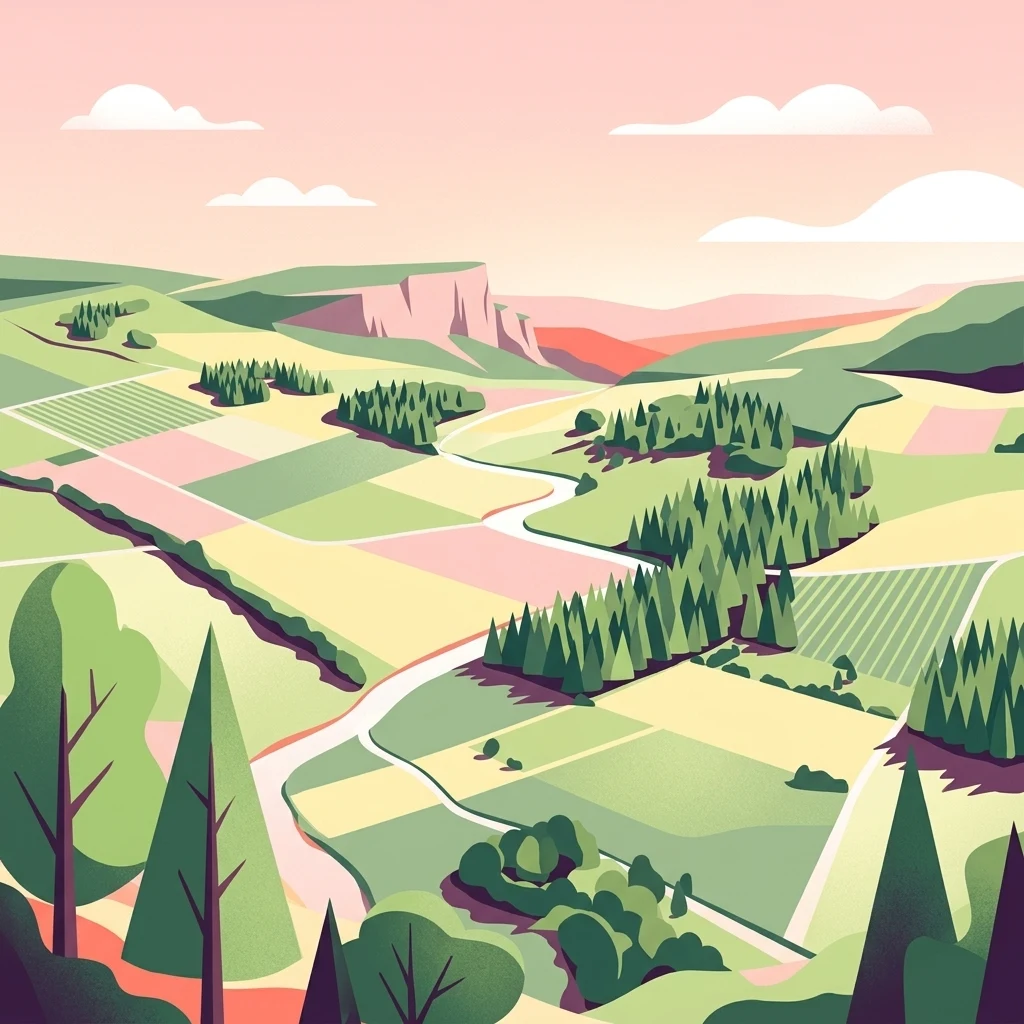
A stylized vector illustration of a German nature reserve landscape, featuring rolling green hills, patches of forest, farmland, and a winding path under a soft, pastel-colored sunset sky.

Naturschutzgebiet Schwarzes Haupt

Nature reserve

Park overview

Structured park overview, official facts, and landscape profile for Schwarzes Haupt Nature Reserve

Schwarzes Haupt Nature Reserve park facts, protected area profile, and essential visitor context

Review the core facts for Schwarzes Haupt Nature Reserve, including designation, size, terrain, visitor scale, habitats, and operating context in one park-focused overview.

About Schwarzes Haupt Nature Reserve

Schwarzes Haupt Nature Reserve is a small but ecologically rich protected area in the eastern Sauerland region of North Rhine-Westfalen, Germany. It lies on the slopes of the Schwarze Haupt hill, west of the village of Rösenbeck and within the broader municipal area of Brilon. Despite its modest size, the reserve captures several distinct habitat types typical of the calcareous hill landscapes (Kalkkuppen) that dot the area between Brilon and the Diemel valley.

The site combines open grassland on dry, warm soils with mature beech woodland, small limestone cliffs, and the remains of a former quarry in the southern part of the area. The exposed rocky faces, which face northwest, are carpeted with characteristic moss and small fern communities, giving the reserve a layered landscape of grassland, woodland edge, cliff, and scree-like habitats within a very compact footprint.

The reserve was formally designated in 2008 through the Hoppecketal landscape plan and is administratively part of a much larger network of protected areas in the Hochsauerlandkreis. Most of its land area lies within the FFH site Kalkkuppen bei Brilon, and the entire site became part of the larger Diemel- und Hoppecketal bird protection area in 2023, reinforcing its role as a stepping stone in regional habitat connectivity.

Quick facts and research context for Schwarzes Haupt Nature Reserve

Schwarzes Haupt Nature Reserve covers roughly 9.8 hectares on the slopes of the Schwarze Haupt hill, west of Rösenbeck in the city area of Brilon, in the Hochsauerland district of North Rhine-Westfalen. The site was designated as a Naturschutzgebiet in 2008 through the Hoppecketal landscape plan by the Hochsauerlandkreis.

The reserve includes calcareous dry grassland, orchid-rich beech forest, woodland on limestone, and small exposed rocky outcrops on warm, south- and north-facing slopes. It is largely included in the Natura 2000 FFH site Kalkkuppen bei Brilon (DE 4617-303) and became part of the Diemel- and Hoppecketal bird protection area in 2023.

Protection and recognition

Documented terrestrial protection scope and official conservation baseline data

Naturschutzgebiet Schwarzes Haupt Protection Status and Recognition Data

Naturschutzgebiet Schwarzes Haupt maintains a documented terrestrial protection scope within the regional conservation inventory. Fact-based management parameters and recognition records provide transparent reference metrics for the protected landscape.

Protection details

Protection scope
Terrestrial
Park context

Deeper park guide and search-rich context for Schwarzes Haupt Nature Reserve

Schwarzes Haupt Nature Reserve history, landscape, wildlife, and travel context

Explore Schwarzes Haupt Nature Reserve through its history, landscape character, ecosystems, wildlife, conservation priorities, cultural context, and seasonal travel timing in a structured park guide built for atlas discovery and search intent.

Why Schwarzes Haupt Nature Reserve stands out

The reserve is best known for its concentration of rare calcareous habitats on a single small hill, including orchid-bearing beech forest on limestone, dry grasslands rich in wildflowers, and warm rocky outcrops with moss and fern vegetation. It is also notable for its large historical population of the parasitic wildflower Nelken-Sommerwurz, recorded on a fallow area within the reserve, and for documented populations of two rare butterfly species: the Schachbrettfalter (Marbled White) and the Schwarzspanner.
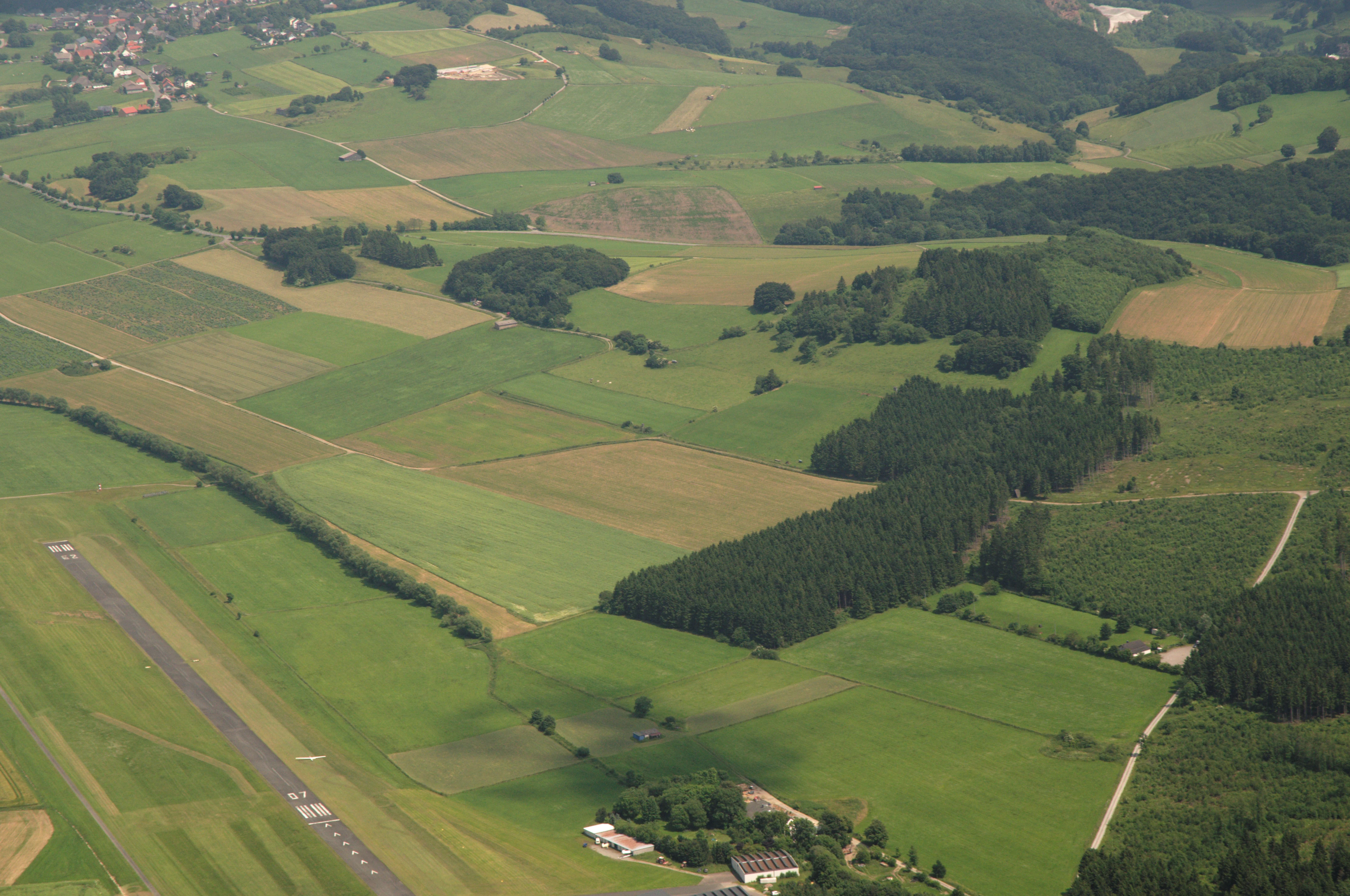
High angle aerial photograph showing a patchwork of green agricultural fields, small wooded areas, and a paved airfield runway in the lower left corner.
Aerial view of the landscape surrounding Naturschutzgebiet Schwarzes Haupt, showing the transition between agricultural fields, forest patches, and the adjacent airfield.

Schwarzes Haupt Nature Reserve history and protected-area timeline

Schwarzes Haupt Nature Reserve was formally designated as a Naturschutzgebiet by the Hochsauerlandkreis through the Hoppecketal landscape plan, with the designation taking effect in 2008.

Its conservation purpose was shaped by recognition that the dry, warm slopes of the Schwarze Haupt hill support rare plant and animal communities, particularly on calcareous substrates. From the outset, the reserve was framed as a complement to the nearby Sticklenberg / Schwarze Haupt Nature Reserve roughly 200 meters to the southwest, extending the network of calcareous habitats west of Rösenbeck and Messinghausen.

A second important institutional step came in 2023, when the site was incorporated into the Vogelschutzgebiet Diemel- und Hoppecketal mit angrenzenden Wäldern. This added a bird-protection dimension to the reserve's earlier designation within the Kalkkuppen bei Brilon FFH site and tied it more firmly into the pan-European Natura 2000 network.

Schwarzes Haupt Nature Reserve landscape and geographic character

The reserve occupies parts of the south- and north-facing slopes of the Schwarze Haupt hill, giving it a distinctive topographic character within the broader plain around Brilon and Rösenbeck. The slopes create the warm, dry microclimate that supports the reserve's calcareous grasslands and orchid-rich beech stands.

Within this small area, the landscape includes open rocky outcrops with moss-covered limestone cliffs facing northwest, the remaining cut walls and rubble of an old quarry in the south, and a continuous mosaic of dry grassland, woodland edge, and beech forest. Small stone-clearing piles and anthills further break up the grassland in the southern part of the reserve.

Together, these features produce a layered terrain where open rocky ledges, sloping meadows, and closed woodland meet within a short distance, giving the site a visually diverse character that is unusual for a reserve of this size.

Schwarzes Haupt Nature Reserve ecosystems, habitats, and plant life

Schwarzes Haupt is characterized by a small-scale mosaic of calcareous habitats typical of the Kalkkuppen landscape near Brilon. Documented biotope types include Trespen-Schwingel-Kalktrockenrasen (a broom-fescue calcareous dry grassland), Kalkfelsen mit Felsspaltenvegetation (limestone cliffs with fissure vegetation), Orchideen-Kalk-Buchenwald (orchid-bearing beech forest on limestone), and Waldmeister-Buchenwald (woodruff-type beech forest).

The open dry grasslands contain Magerrasenrelikte, remnants of species-rich nutrient-poor grassland that are often the most botanically valuable component of such reserves. In the southern part, these grasslands are traditionally grazed by a wandering sheep flock, a management approach that helps maintain the open, species-rich structure of the habitat.

A fallow area within the reserve is notable for hosting a large population of the parasitic wildflower Nelken-Sommerwurz, associated with the disturbed and partially bare calcareous soils typical of the site.

Schwarzes Haupt Nature Reserve wildlife and species highlights

The reserve's most distinctive wildlife values come from insects associated with its warm, dry calcareous habitats. Two butterfly species of conservation interest have been formally documented by the North Rhine-Westfalen State Agency for Nature, Environment and Consumer Protection: the Schachbrettfalter (Melanargia galathea, the Marbled White) and the Schwarzspanner (Odezia atrata).

In addition to these butterfly records, the structure of the habitats, including species-rich dry grasslands, orchid-rich woodland, and rocky cliffs, provides niches for a wider community of invertebrates, while the surrounding landscape mosaic supports typical woodland and edge fauna of the eastern Sauerland.

Schwarzes Haupt Nature Reserve conservation status and protection priorities

Schwarzes Haupt Nature Reserve was established to protect dry-warm grassland and woodland habitats and the species assemblages they support. Its conservation purpose recognizes the rarity, special character, and landscape value of the area, and emphasizes the importance of maintaining habitat functioning for threatened plant species.

Beyond protecting individual species, the reserve is a critical link in the wider conservation landscape west of Rösenbeck and Messinghausen, complementing the nearby Sticklenberg / Schwarze Haupt Nature Reserve and strengthening the conservation value of the broader complex of calcareous hills in the Brilon area.

Through inclusion in the FFH site Kalkkuppen bei Brilon and, since 2023, the Vogelschutzgebiet Diemel- und Hoppecketal mit angrenzenden Wäldern, the reserve contributes directly to the European Natura 2000 ecological network and to the long-term preservation of calcareous habitats and associated species in the eastern Sauerland.

Schwarzes Haupt Nature Reserve cultural meaning and human context

The reserve's cultural context is closely tied to traditional land use on the calcareous soils of the eastern Sauerland. The southern dry-grassland part is grazed by a Wanderschafherde, a wandering sheep flock typical of the region, whose traditional grazing management is integral to maintaining the species-rich Magerrasen of the site.

The presence of an old quarry in the south also reflects the small-scale historical extraction of limestone in the broader Brilon landscape, a feature shared by many of the Kalkkuppen hills around the town. The reserve thus preserves not only ecological but also small-scale cultural landscape features characteristic of the area.

Top sights and standout views in Schwarzes Haupt Nature Reserve

A compact 9.8-hectare reserve on a calcareous hill near Rösenbeck combining dry grasslands, orchid-bearing beech forest, limestone cliffs, and an old quarry.

The site is formally integrated into both the Kalkkuppen bei Brilon FFH site and the larger Diemel- und Hoppecketal bird protection area, and is closely linked to the neighboring Sticklenberg / Schwarze Haupt Nature Reserve.

Documented highlights include orchid-rich beech forest on limestone, rare butterfly species such as the Marbled White and Schwarzspanner, and a historical mass occurrence of the parasitic wildflower Nelken-Sommerwurz.

Best time to visit Schwarzes Haupt Nature Reserve

The reserve's character varies with the seasons in ways typical of calcareous grassland and beech woodland landscapes. Late spring and early summer are likely the most rewarding periods for visitors interested in dry-grassland wildflowers, butterfly activity, and orchid-rich beech stands, when warm slopes support peak insect and flowering diversity.

Late summer and early autumn bring a different appeal, with mature vegetation in the grasslands and beech mast in the forests, while winter offers a quieter window for observing the reserve's rocky outcrops, anthills, and the structural contrast between open grassland and beech canopy without foliage cover.

Monthly climate preview

Long-term monthly temperature and precipitation rhythm for protected terrain

Naturschutzgebiet Schwarzes Haupt Climate Normals and Temperature Patterns

Representative coordinates record measured monthly temperature fluctuations alongside consistent daily precipitation normals from 1991 to 2020. Examining the complete twelve-month dataset reveals broader meteorological patterns across this protected area.
Annual mean9 °C
0 °C18 °C
Jan
Feb
Mar
Apr
May12°
Jun15°
Jul18°
Aug18°
Sep14°
Oct
Nov
Dec
Warmest month
July

18 °C

Coolest month
January

-0.2 °C

Wettest month
July

2.6 mm/day

Driest month
April

1.7 mm/day

Park location guide

Geography guide, regional context, and park location map for Schwarzes Haupt Nature Reserve

Schwarzes Haupt Nature Reserve park geography, regions, and map view in Germany

Understand where Schwarzes Haupt Nature Reserve sits in Germany through a broader geographic reading of the surrounding landscape, nearby location context, and its mapped position within the national park landscape.

How Schwarzes Haupt Nature Reserve fits into Germany

Germany is a federal republic in Western and Central Europe with a population of over 83 million across sixteen constituent states. It is Europe's largest economy by nominal GDP and a major global exporter and importer. The capital is Berlin, and the country borders Denmark, Poland, Czech Republic, Austria, Switzerland, France, Luxembourg, Belgium, and the Netherlands.

Wider geography shaping Schwarzes Haupt Nature Reserve in Germany

Germany is located in Western and Central Europe, spanning 357,022 km². It borders Denmark to the north, Poland and the Czech Republic to the east, Austria and Switzerland to the south, and France, Luxembourg, Belgium, and the Netherlands to the west. The country has coastlines on the Baltic Sea and North Sea to the north, with the Alps located in the southern region.

Map view of Schwarzes Haupt Nature Reserve

Use this park location map to pinpoint Schwarzes Haupt Nature Reserve in Germany, understand its exact geographic position, and read its mapped placement within the surrounding landscape more clearly.

Pigeon | © OpenStreetMap contributors

Location context for Schwarzes Haupt Nature Reserve

Hochsauerlandkreis

Visualizing limestone cliffs, dry grasslands, and orchid beech forests

Naturschutzgebiet Schwarzes Haupt Photos and Landscape Scenery

Visual documentation of Naturschutzgebiet Schwarzes Haupt reveals the rugged topography and delicate habitat mosaics characterizing the reserve. Examining authentic terrain photography helps researchers interpret calcareous slopes, rocky outcrops, and protected woodland environments across the Sauerland region.

High angle aerial photograph showing a patchwork of green agricultural fields, small wooded areas, and a paved airfield runway in the lower left corner.

Park atlas

Compare nearby regional reserves and connected limestone hill habitats across the eastern Sauerland.

Explore Other Parks Near Naturschutzgebiet Schwarzes Haupt and Surrounding Protected Landscapes

Browsing other parks near Naturschutzgebiet Schwarzes Haupt reveals wider patterns in regional conservation and limestone terrain. Exploring these adjacent protected areas provides deeper context for the unique calcareous grasslands and beech woodlands of the surrounding region.
A wide watercolor-style illustration of a soft landscape featuring rolling green hills, scattered forest patches, and pale pink mountains in the background with a light sky.
Nature reserveNorth Rhine-Westphalia
About 1.7 km away#1 closest

Northeast

Hollenloch Nature Reserve: Karst Cave Systems and Protected Limestone Woodland Geography

Exploration of subterranean geology and regional karst habitats

Hollenloch stands as one of the longest and deepest cave systems within the Sauerland, developed inside dense Upper Devonian reef limestone. This protected site integrates surface karst features like the Schwalgloch with specialized forest ecosystems, providing a vital subterranean refuge for diverse bat species and a rich record of prehistoric human activity.

Area
0.032 km²
Established
2001
Relief
Upland
Climate
Temperate
A wide, pale watercolor illustration showing rolling green and yellow hills with scattered trees.
Nature reserveHochsauerlandkreis
About 3.1 km away#2 closest

West

Naturschutzgebiet Scheffelberg / Kalberstert: Mapped Limestone Hill Landscape

Nature reserve located within the Hochsauerlandkreis regional geography

Analyze the topographic features of the Naturschutzgebiet Scheffelberg / Kalberstert, including its conical rock outcrops and expansive dry grasslands. This protected area offers a clear look at the limestone hill systems defining this part of Hochsauerlandkreis, highlighting the intersection of beech woodland and open rocky terrain through detailed geographic mapping.

Area
0.456 km²
Established
2008
Relief
Upland
Climate
Temperate
A soft watercolor painting of a serene natural landscape with rolling hills, a central body of water, and green trees against a pale, warm-toned sky.
Nature reserveWaldeck-Frankenberg
About 4.4 km away#3 closest

Southeast

Naturschutzgebiet Diemelsee Nature Reserve: Geographic Atlas and Protected Landscape

Waldeck-Frankenberg Wetland and Reservoir Margin Analysis

Located in northern Hesse, Naturschutzgebiet Diemelsee serves as a crucial protected sanctuary where the Itter stream enters the reservoir. This reserve features a distinctive mosaic of mudflats, reed beds, and swamp-like woodland, shaped by annual water level changes that create a unique habitat for local birdlife and pioneer flora within the broader Sauerland foothills.

Area
0.187 km²
Established
1965
Relief
Lowland
Scope
Terrestrial
Nature reserveNorth Rhine-Westphalia
About 6.2 km away#4 closest

Southwest

Naturschutzgebiet Poppenberg: A Detailed Geographic Overview of this Nature Reserve

Exploring Limestone Cliff Habitats and Regional Forest Ecosystems

Naturschutzgebiet Poppenberg represents an essential ecological link within the Brilon limestone hill network. This nature reserve offers a concentrated study in geology and ecology, showcasing exposed rock formations, historical mining traces, and a diverse range of woodland habitats compressed into a compact, protected area within North Rhine-Westphalia.

Area
0.007 km²
Established
2008
Relief
Upland
Climate
Temperate
A soft watercolor illustration of a landscape featuring layered green hills, a distant forest silhouette, and pale sky, rendered in a light, minimalist style.
Nature reserveHochsauerlandkreis
About 7.3 km away#5 closest

East

Naturschutzgebiet Oberes Diemeltal: Protected Floodplain and River Geography in Hochsauerlandkreis

Mapped riparian landscapes and riverine conservation corridors

Naturschutzgebiet Oberes Diemeltal preserves an undeveloped section of the upper Diemel river valley. The landscape is defined by its branching river network, wet meadows, and rare floodplain vegetation, offering a clear window into the riverine geography of the eastern Sauerland region in Germany.

Area
1.87 km²
Established
2001
Scope
Terrestrial
Water
Major water bodies
A horizontal watercolor painting showing rolling, abstract hills with patches of green, yellow, and soft red, accented with stylized coniferous forest lines.
Nature reserveNordrhein-Westfalen
About 7.9 km away#6 closest

North

Leiberger Wald Nature Reserve: Protected Woodland and Stream Geography in Paderborn

A mapped forest complex within the Nordrhein-Westfalen landscape

Leiberger Wald encompasses an extensive series of beech forests and riparian habitats that form a key protected node in the Kreis Paderborn. As a significant nature reserve, the area supports a wide range of woodland and aquatic species, serving as a critical refuge within the broader ecological network of western Germany.

Area
17.86 km²
Established
1994
IUCN
IV
A horizontal watercolor painting showing a green valley with a winding river, rolling hills in the background, and grassy foreground.
Nature reserveNordrhein-Westfalen
About 8.4 km away#7 closest

Northwest

Naturschutzgebiet Oberes Möhnetal: Protected Floodplain and River Corridor Geography

A restored riparian landscape in Nordrhein-Westfalen

Located in the Sauerland, Naturschutzgebiet Oberes Möhnetal preserves an 81-hectare floodplain characterized by its successful LIFE+ river restoration. The area features a complex transition from meandered stream channels to wet meadows and alluvial woodlands, illustrating process-based conservation within the regional Natura 2000 corridor.

Area
0.812 km²
Established
2008
A watercolor landscape illustration showing soft, rolling green hills, coniferous trees, and a hazy background.
Nature reserveHochsauerlandkreis
About 8.4 km away#8 closest

East

Naturschutzgebiet Padberg: A Protected Landscape in the Hochsauerlandkreis Region

Diabas geology and forest habitat mapping

Naturschutzgebiet Padberg protects a compact but ecologically rich landscape of beech forests and craggy rock cliffs. Its position above the Diemel valley highlights the relationship between volcanic Diabas topography and woodland development within the Hochsauerlandkreis district.

Area
0.467 km²
Established
2001
Relief
Upland
Climate
Temperate

Common questions about visiting, size, designation, and location context for Schwarzes Haupt Nature Reserve

Schwarzes Haupt Nature Reserve FAQs for park facts, access, geography, and protected area context

Find quick answers about Schwarzes Haupt Nature Reserve, including protected-area facts, park geography, trail and visitor context, and how the park fits into its surrounding country and regional landscape.
MoriAtlas Explorer

Continue Your Protected Areas Search Across the Global Atlas

Deepen your exploration by continuing the structured search for national parks and protected areas worldwide. Utilize the comprehensive filtering capabilities to compare different conservation landscapes and refine your understanding of global park geography. Discover more about the distribution and characteristics of protected natural areas.

Global natural geography