
Mori Atlas logo
Nature reserveNaturschutzgebiet Oberes Sprockhöveler Bachtal

Discover the geographic structure of this stream-fed valley and its diverse riparian landscape.

Naturschutzgebiet Oberes Sprockhöveler Bachtal: A Protected Nature Reserve in Nordrhein-Westfalen

(Naturschutzgebiet Oberes Sprockhöveler Bachtal (EN-017))

Naturschutzgebiet Oberes Sprockhöveler Bachtal serves as a vital protected area in Nordrhein-Westfalen, defined by the winding course of the Sprockhöveler Bach. This 16-hectare reserve preserves a distinct mosaic of wet meadows, moist fallow land, and deciduous beech woodland within the foothills of the Ruhr area. The valley remains a significant site for observing near-natural stream dynamics, riparian vegetation galleries, and spring-fed habitat corridors.

stream valleylowland brookriparian woodlandwet meadowsbeech forestnature reserve
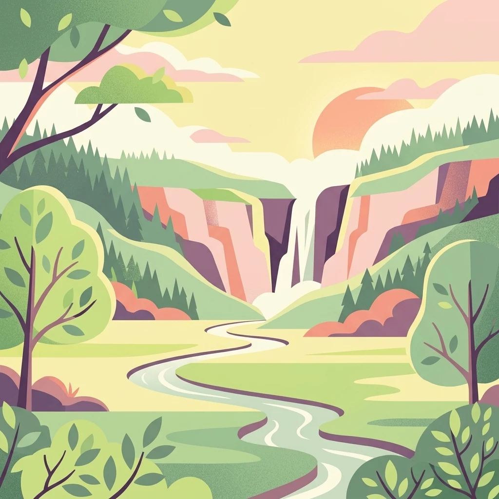
Digital illustration of a serene valley scene with a waterfall cascading between cliffs, a winding stream in the foreground, and stylized trees.

Naturschutzgebiet Oberes Sprockhöveler Bachtal

Nature reserve

Park overview

Structured park overview, official facts, and landscape profile for Naturschutzgebiet Oberes Sprockhöveler Bachtal

Naturschutzgebiet Oberes Sprockhöveler Bachtal park facts, protected area profile, and essential visitor context

Review the core facts for Naturschutzgebiet Oberes Sprockhöveler Bachtal, including designation, size, terrain, visitor scale, habitats, and operating context in one park-focused overview.

About Naturschutzgebiet Oberes Sprockhöveler Bachtal

Naturschutzgebiet Oberes Sprockhöveler Bachtal lies in the southwestern part of the town of Sprockhövel, just outside the town centre, where the upper reaches of the Sprockhöveler Bach have carved a small, clearly defined valley into the surrounding farmland and forest landscape. Despite its modest area of around 16 hectares, the reserve concentrates a remarkable variety of habitat types typical of the lower hill country at the southern edge of the Ruhr region: a near-natural lowland stream, wet meadows, moist fallow land, spring mires, fish ponds, gallery woods, and beech forest.

The Sprockhöveler Bach is the central element of the protected area. In much of the reserve it flows in a meandering course over a stony bed, framed by mature willows and alders whose trunks reach stem diameters of 20 to 30 centimetres, with occasional steep banks cutting into the adjacent grassland. North of the bridge under the L 551 district road, however, the stream has historically been straightened and pushed to the edge of the meadow, a change that disrupted its natural hydrology and partly explains why the broad bed now often carries only a narrow trickle. Several tributaries join the main brook within the protected area. West of Sirrenberg, two near-natural seepage springs emerge, each with characteristic spring vegetation, and these feed a series of ponds used for fish farming. Another tributary rises in the southwest within the grassland itself and is dominated by floating sweet-grass.

The valley floor itself shifts in character along its length. On the northern part of the reserve, the brook is bordered by intensively used meadows and pastures, in which older wet meander loops of the former stream are still visible, populated by reed canary grass and rushes. Moving south toward the area called Im Hülsen, the valley is dominated by a valuable tall-herb wet fallow, a habitat of special conservation interest. Photographs and surveys associated with the reserve document a beech forest west of the L 551, wet meadows crossed by the brook, and views toward the hamlet of Bossel at the southwest end of the protected area. Together, these features make the reserve a textbook example of a small-scale but ecologically rich stream valley protected area in the region.

Quick facts and research context for Naturschutzgebiet Oberes Sprockhöveler Bachtal

Naturschutzgebiet Oberes Sprockhöveler Bachtal is a designated nature reserve in North Rhine-Westphalia, Germany, located on the territory of the town of Sprockhövel in the Ennepe-Ruhr-Kreis. It carries the official code EN-017 and was placed under protection in 1995, planned within the framework of the 1998 landscape plan for the Hattingen/Sprockhövel area.

The reserve covers approximately 15.79 hectares and follows the upper valley of the Sprockhöveler Bach at elevations between roughly 155 and 200 metres. It is split into two sections by the L 551 road. Management is handled by the lower landscape authority of the Ennepe-Ruhr-Kreis, supported by the Biologische Station EN.

Protection and recognition

Examine documented protected area records, management scope, and conservation status designations.

Naturschutzgebiet Oberes Sprockhöveler Bachtal Protection Status and Records

Protected area records for Naturschutzgebiet Oberes Sprockhöveler Bachtal bring together documented protection status and official database identifiers. Conservation research benefits from structured oversight data, management metrics, and verified regional geographic entries.

Protection details

WDPA ID
318892
Park context

Deeper park guide and search-rich context for Naturschutzgebiet Oberes Sprockhöveler Bachtal

Naturschutzgebiet Oberes Sprockhöveler Bachtal history, landscape, wildlife, and travel context

Explore Naturschutzgebiet Oberes Sprockhöveler Bachtal through its history, landscape character, ecosystems, wildlife, conservation priorities, cultural context, and seasonal travel timing in a structured park guide built for atlas discovery and search intent.

Why Naturschutzgebiet Oberes Sprockhöveler Bachtal stands out

The reserve is best known for its near-natural, meandering stream course and its clearly structured small valley landscape, where a narrow brook, wet meadows, moist fallow land, and beech forest form a connected ecological unit. The Sprockhöveler Bach within the protected area is a defining feature: about 1.5 to 2 metres wide, with a stony bed, locally steep banks, and a gallery of mature willows and alders along its banks. The reserve is also notable for its spring-fed tributaries, fish-pond headwaters near Sirrenberg, and old, recognisable meander loops embedded in the surrounding grassland.
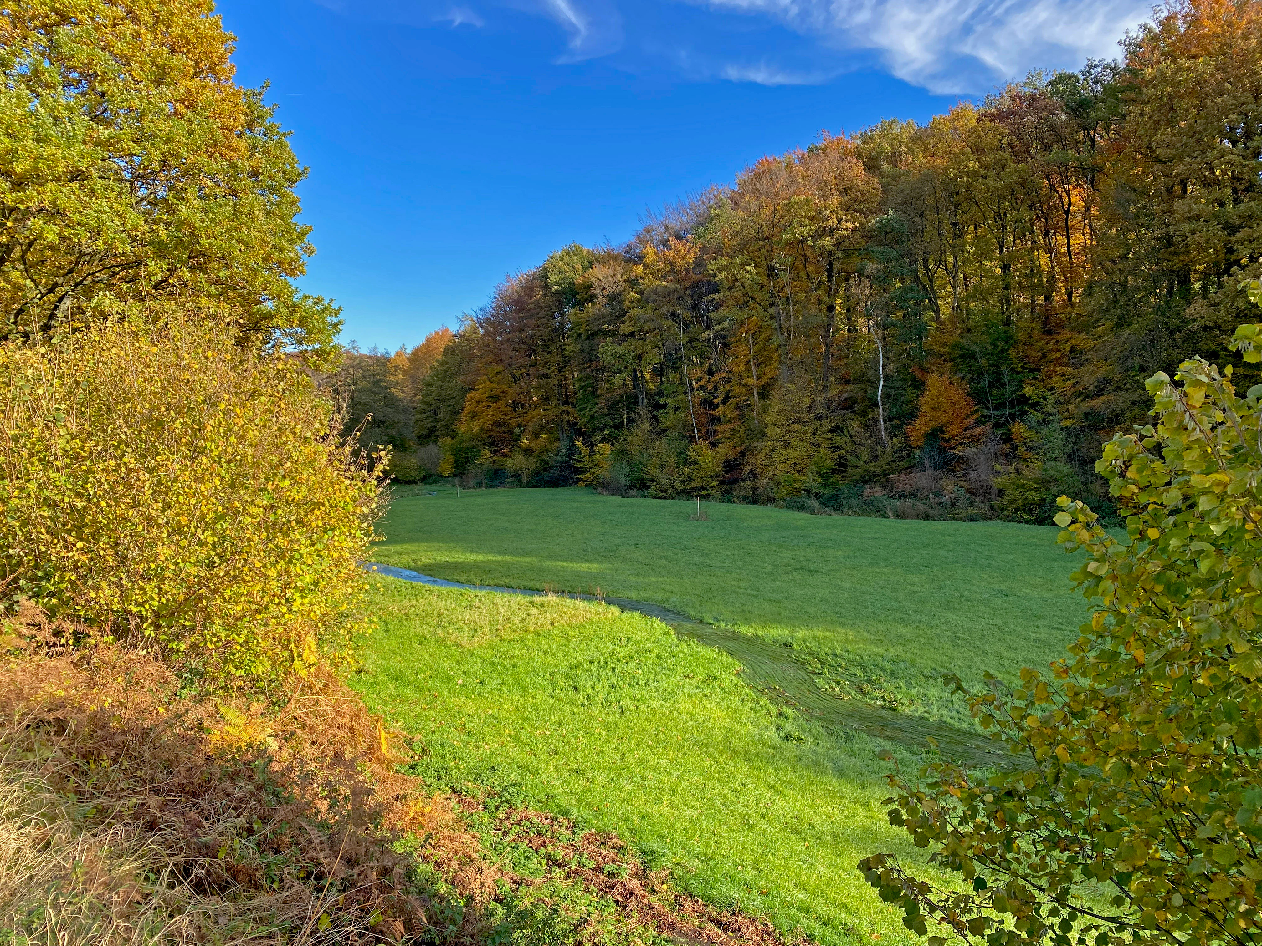
A green, open meadow in a valley bordered by autumn-colored trees under a clear blue sky, with a small stream winding through the grass.
A scenic view of the Oberes Sprockhöveler Bachtal nature reserve during autumn, showing the stream valley and surrounding deciduous woodland.

Naturschutzgebiet Oberes Sprockhöveler Bachtal history and protected-area timeline

The area was placed under formal nature protection in 1995 under the designation EN-017. It was subsequently integrated into the landscape plan (Landschaftsplan) for the Ennepe-Ruhr-Kreis, covering the Hattingen/Sprockhövel planning area, which was adopted in 1998. Since then, management responsibility has rested with the lower landscape authority (Untere Landschaftsbehörde) of the Ennepe-Ruhr-Kreis, with on-the-ground care provided through the Biologische Station EN.

The designation explicitly responds to three factors: the rarity, distinctive character, and outstanding scenic beauty of the small stream valley; its scientific and natural-history value; and the need to protect habitat communities and habitat structures of partly threatened plant and animal species. A parallel protection goal is the restoration of a near-natural stream valley with extensive forms of land use, especially given the strong disturbance of the brook's natural water regime caused by the construction of a canalisation roughly a decade before the initial assessment, which had reduced parts of the stream to intermittent flow.

Naturschutzgebiet Oberes Sprockhöveler Bachtal landscape and geographic character

The reserve occupies a compact, clearly shaped valley landscape typical of the southern foothills of the Ruhr area. Elevations range roughly from 155 to 200 metres, with an average near 177 metres, producing gentle, low-relief terrain. The valley floor is the dominant topographic feature: a narrow, sinuous corridor carved by the Sprockhöveler Bach and its small tributaries, with locally steeper banks where the stream undercuts the meadow edges.

Along the valley, the land alternates between open wet grassland, moist fallow land rich in tall herbs, and stretches of closed woodland dominated by beech on the western slopes of the L 551. The eastern side of the road carries more shaded stretches along the relocated, straightened section of the brook. Spring seeps and small fish ponds near Sirrenberg add further surface-water elements, and the confluence pattern of the Wiesen-Quellbach with the main brook is itself a distinctive landscape feature, with the spring-fed tributary occasionally swelling into a meadow brook that runs parallel to the main stream before joining it.
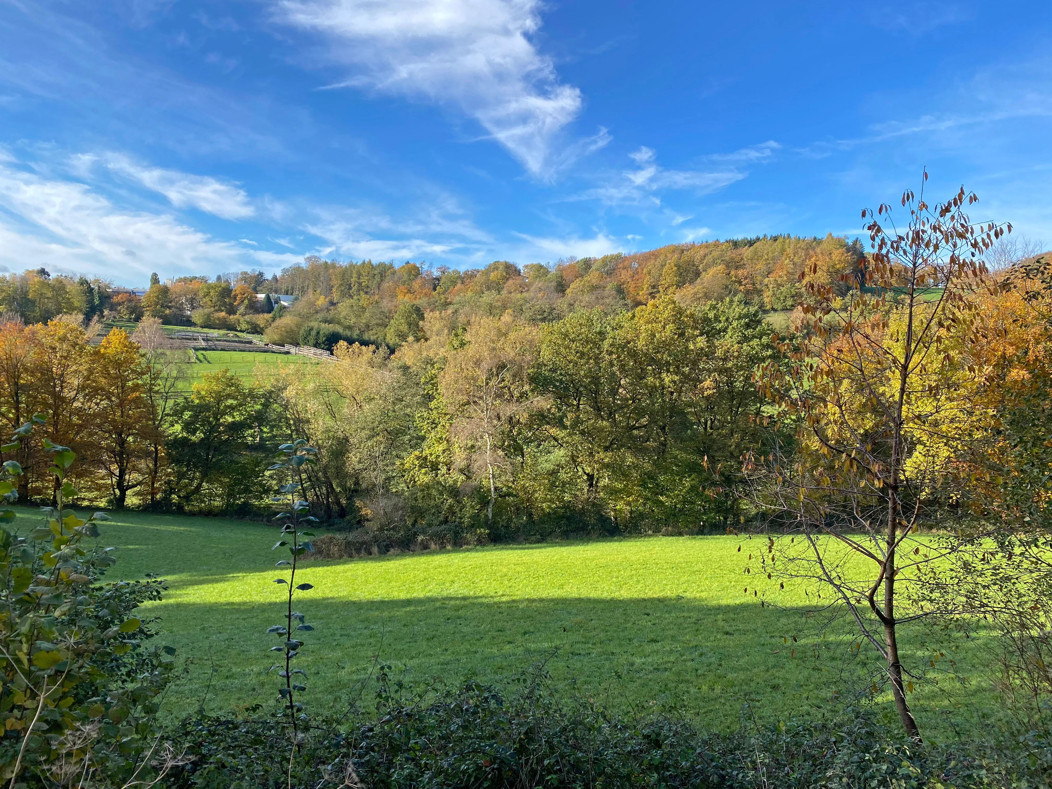
A wide shot of a valley featuring a vibrant green meadow in the foreground and a forested hillside with autumn foliage in the background under a blue sky.
A scenic view of the Oberes Sprockhöveler Bachtal nature reserve in autumn.

Naturschutzgebiet Oberes Sprockhöveler Bachtal ecosystems, habitats, and plant life

The protected area combines several interconnected lowland habitats in a small space. Riparian woodland of willows (Salix) and alders (Alnus) traces the meandering sections of the Sprockhöveler Bach, with mature individuals reaching stem diameters of 20 to 30 centimetres. Along the wet grassland, reed canary grass (Rohrglanzgras) and rushes (Binsen) occupy former stream loops, while a tall-herb wet fallow rich in moisture-loving plants occupies the southern part of the valley near Im Hülsen.

The stream itself supports a near-natural community structure: a stony bed, varied flow, and locally shaded margins. Spring-fed tributaries near Sirrenberg carry typical seepage-source vegetation, and one southwestern tributary is dominated by floating sweet-grass. On the slopes above the valley, beech forest forms a contrasting, drier habitat, and on the northern edge of the reserve the brook meets more intensively used, nutrient-rich meadows and pastures. Together, these elements form a functional mosaic of aquatic, wet-grassland, fallow, and forest habitats within a few hundred metres of valley.
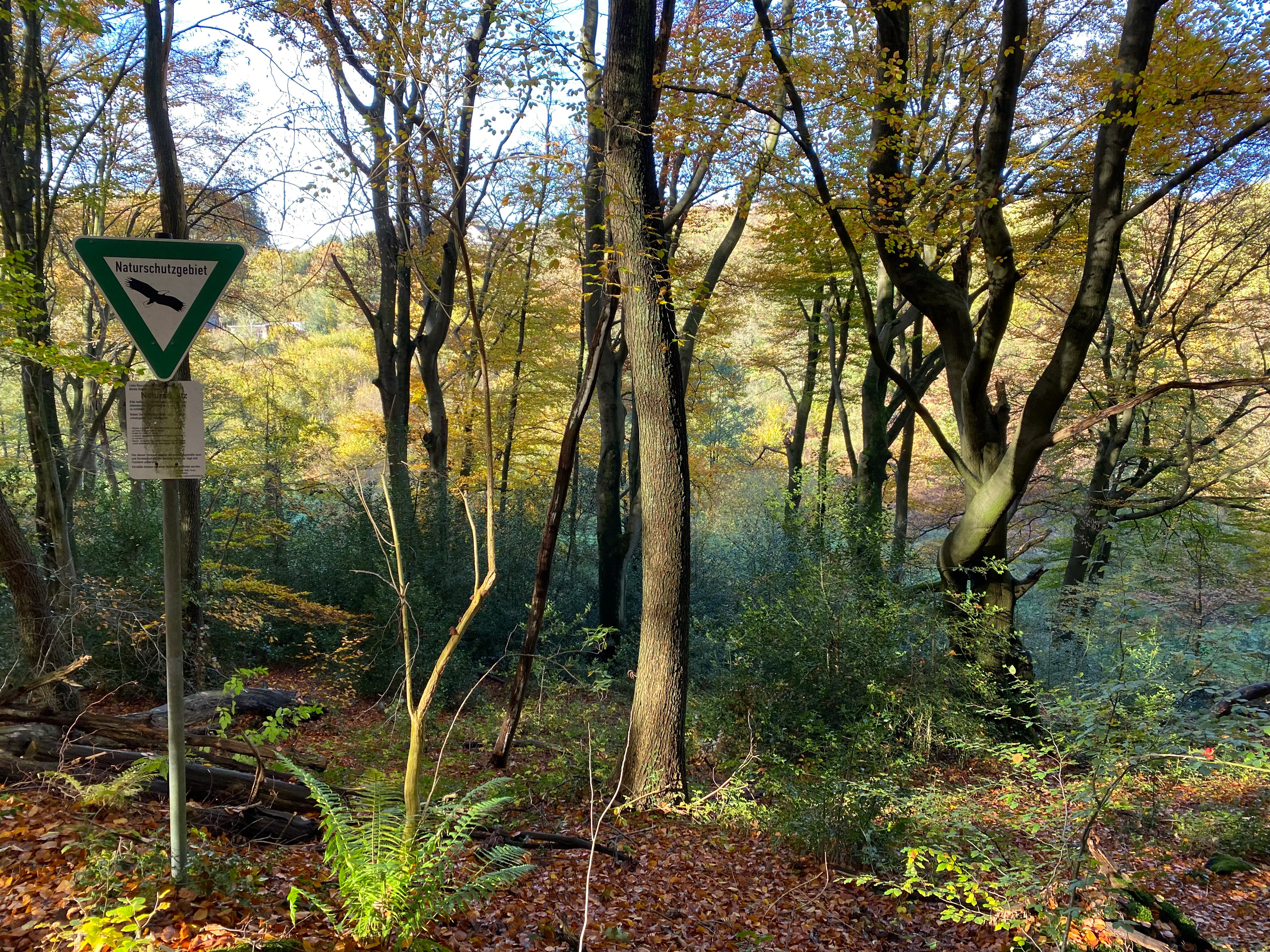
A triangular green nature reserve sign on a metal pole stands in a deciduous forest during autumn.
A nature reserve sign located within the forest at Naturschutzgebiet Oberes Sprockhöveler Bachtal.

Naturschutzgebiet Oberes Sprockhöveler Bachtal wildlife and species highlights

The source material does not enumerate specific animal species in detail, but the habitat structure described points clearly to the kinds of wildlife the reserve is intended to support. The meandering, shaded, near-natural brook with stony bed provides habitat for stream invertebrates, fish in the deeper pools, and amphibians along the wet margins. The willow and alder gallery offers nesting and shelter for typical riparian birds, while the wet meadows, reed-canary-grass stands, and rushes are characteristic habitats for insects, including dragonflies and damselflies, and for marsh-associated bird species.

The conservation rationale, focused on the protection of partly threatened plant and animal species and their habitats, confirms that the mix of stream, wet fallow, and deciduous forest is meant to function as a refuge within a predominantly agricultural and settled landscape.
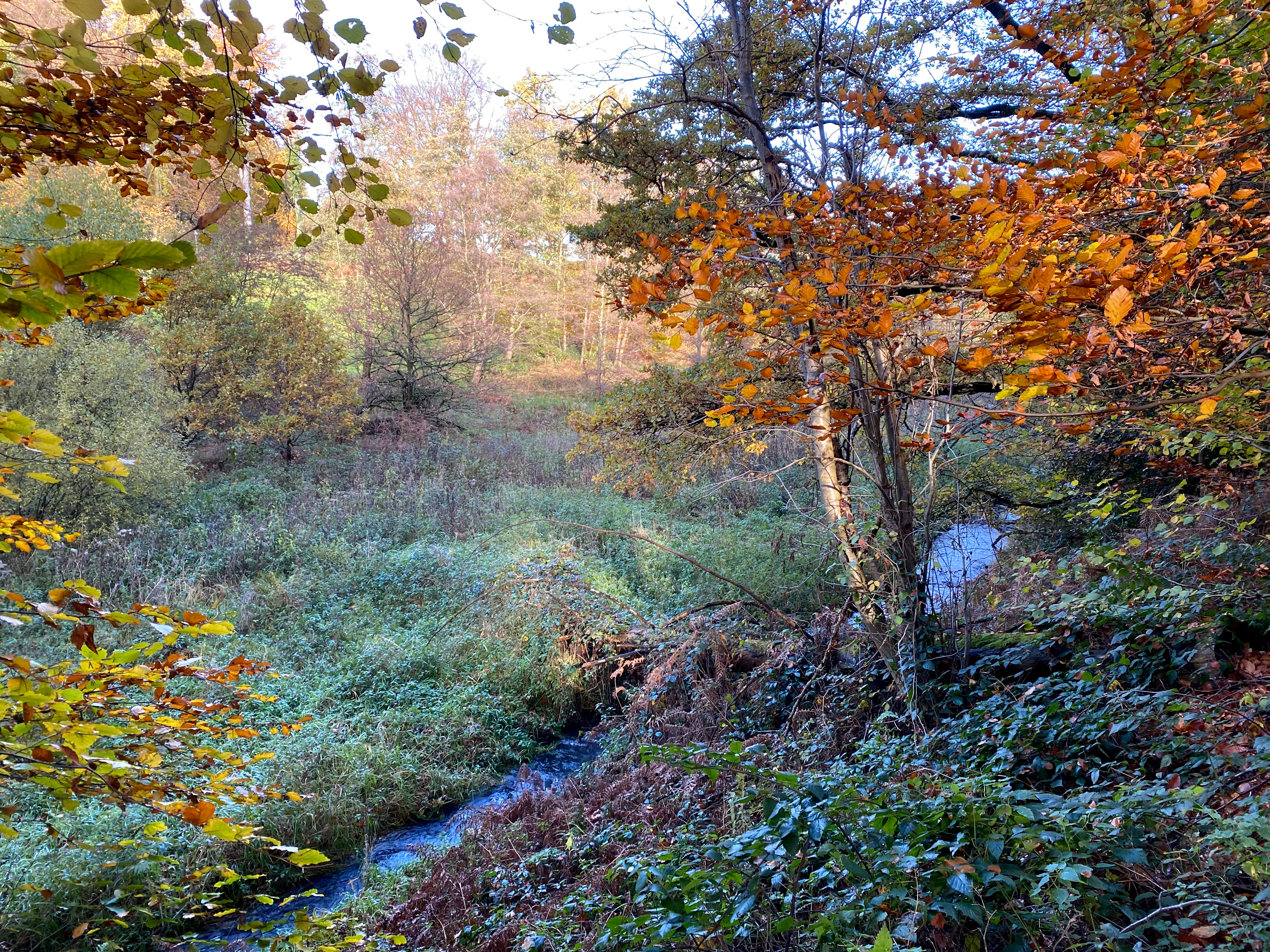
A small blue stream flowing through a lush, wooded valley with autumn leaves on the trees.
A small stream winding through the wooded landscape of the Oberes Sprockhöveler Bachtal nature reserve in autumn.

Naturschutzgebiet Oberes Sprockhöveler Bachtal conservation status and protection priorities

The reserve's protection is grounded in three formally stated reasons: the rarity, distinctive character, and outstanding scenic beauty of the small stream valley; its scientific and natural-history value; and the need to protect habitat communities and habitat structures of partly threatened plants and animals. As a result, two parallel conservation goals apply.

The first is the preservation of existing valuable habitat, including the meandering brook, its willow and alder gallery, the wet meadows with their old stream loops, the tall-herb wet fallow near Im Hülsen, the spring zones near Sirrenberg, and the beech forest on the western slope.

The second is the restoration of a near-natural stream valley with extensive land-use forms. The brook's water regime has been strongly disturbed by the construction of a canalisation roughly a decade before the assessment that underpinned the designation, leaving parts of the riverbed only intermittently wet. Restoring a more natural flow is described as urgent, and the broader conservation aim is to re-establish extensive, low-intensity management of the valley's grassland and fallow habitats so that the ecological mosaic can function more completely.

Naturschutzgebiet Oberes Sprockhöveler Bachtal cultural meaning and human context

The landscape is shaped by centuries of low-intensity, valley-side land use, including hay meadows, pasture, and fish ponds around the spring headwaters near Sirrenberg. The surviving old wet meander loops and the tall-herb fallow near Im Hülsen reflect how the traditional valley use pattern once followed the natural form of the brook. The presence of a named hamlet (Bossel) at the southwest end of the reserve and the rural toponym Im Hülsen indicate long-standing local settlement and farming embedded in this stream valley landscape.
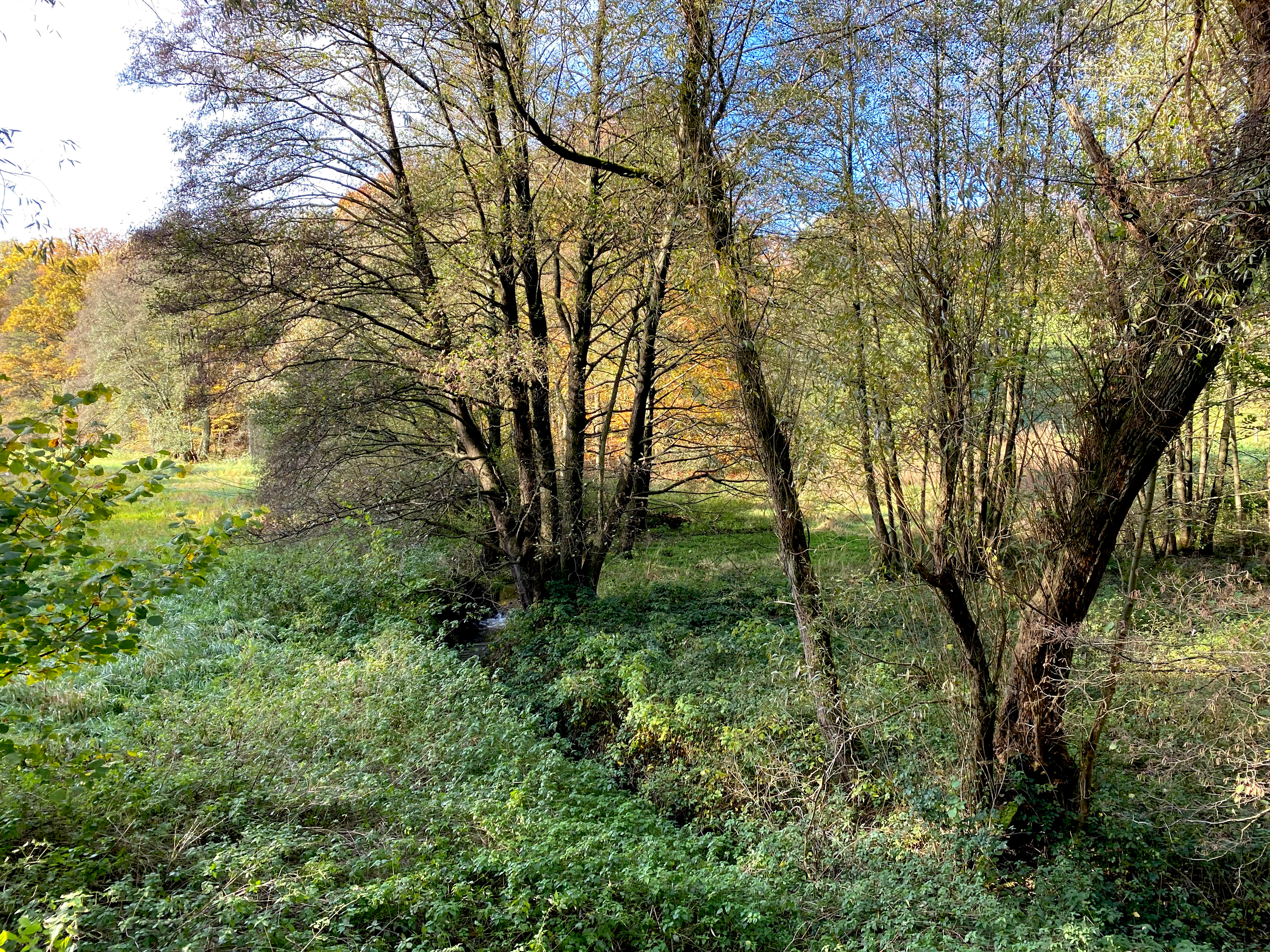
A small stream flows through a forested valley with dense undergrowth and deciduous trees during autumn.
A peaceful stream winds through the lush, wooded valley of the Oberes Sprockhöveler Bachtal nature reserve.

Top sights and standout views in Naturschutzgebiet Oberes Sprockhöveler Bachtal

A near-natural, meandering lowland brook in a small valley just south of Sprockhövel; a gallery of mature willows and alders along the Sprockhöveler Bach; a tall-herb wet fallow near Im Hülsen; spring seeps and fish-pond headwaters near Sirrenberg; beech forest on the slopes west of the L 551; and a mosaic of wet grassland, fallow land, and deciduous forest in a compact area of roughly 16 hectares.
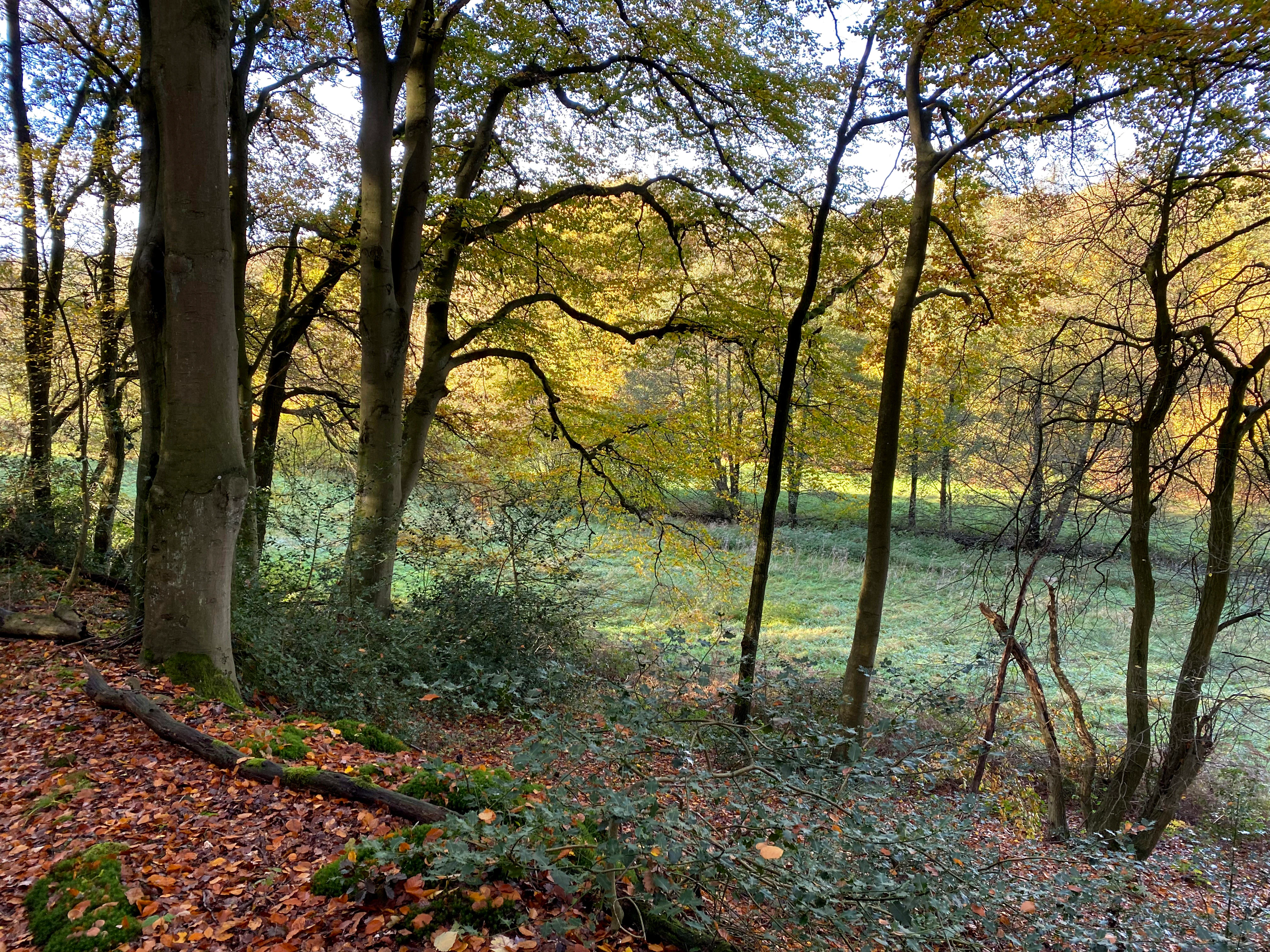
A view through a line of trees into a forest clearing during autumn, with orange and brown leaves covering the ground and yellowing foliage on the trees.
Autumn foliage in the Naturschutzgebiet Oberes Sprockhöveler Bachtal.

Best time to visit Naturschutzgebiet Oberes Sprockhöveler Bachtal

The reserve is best appreciated in late spring and early summer, when the wet meadows and tall-herb fallow are at their richest, and when the contrast between the green valley floor and the beech forest is most visible. Autumn can also be rewarding for its colours along the stream corridor and the beech stands. Visiting in dry or very warm periods will make the impact of past hydrological disturbance more visible, as parts of the otherwise wide brook bed may carry only a narrow flow.

Monthly climate preview

Long-term monthly temperature and precipitation rhythm from representative coordinate data

Naturschutzgebiet Oberes Sprockhöveler Bachtal Climate and Weather Normals

Temperature and precipitation measurements track the multi-year climate rhythm across representative park coordinates from 1991 to 2020. The complete monthly profile provides detailed context for average high and low temperature variations through the year.
Annual mean9 °C
1 °C19 °C
Jan
Feb
Mar
Apr
May13°
Jun16°
Jul19°
Aug18°
Sep14°
Oct10°
Nov
Dec
Warmest month
July

18.5 °C

Coolest month
January

0.9 °C

Wettest month
December

3 mm/day

Driest month
April

1.7 mm/day

Park location guide

Geography guide, regional context, and park location map for Naturschutzgebiet Oberes Sprockhöveler Bachtal

Naturschutzgebiet Oberes Sprockhöveler Bachtal park geography, regions, and map view in Germany

Understand where Naturschutzgebiet Oberes Sprockhöveler Bachtal sits in Germany through a broader geographic reading of the surrounding landscape, nearby location context, and its mapped position within the national park landscape.

How Naturschutzgebiet Oberes Sprockhöveler Bachtal fits into Germany

Germany is a federal republic in Western and Central Europe with a population of over 83 million across sixteen constituent states. It is Europe's largest economy by nominal GDP and a major global exporter and importer. The capital is Berlin, and the country borders Denmark, Poland, Czech Republic, Austria, Switzerland, France, Luxembourg, Belgium, and the Netherlands.

Wider geography shaping Naturschutzgebiet Oberes Sprockhöveler Bachtal in Germany

Germany is located in Western and Central Europe, spanning 357,022 km². It borders Denmark to the north, Poland and the Czech Republic to the east, Austria and Switzerland to the south, and France, Luxembourg, Belgium, and the Netherlands to the west. The country has coastlines on the Baltic Sea and North Sea to the north, with the Alps located in the southern region.

Map view of Naturschutzgebiet Oberes Sprockhöveler Bachtal

Use this park location map to pinpoint Naturschutzgebiet Oberes Sprockhöveler Bachtal in Germany, understand its exact geographic position, and read its mapped placement within the surrounding landscape more clearly.

Pigeon | © OpenStreetMap contributors

Location context for Naturschutzgebiet Oberes Sprockhöveler Bachtal

Nordrhein-Westfalen

Visual exploration of riparian woodland, meandering streams, and valley habitats

Naturschutzgebiet Oberes Sprockhöveler Bachtal Photos and Landscape Scenery

Photographic documentation reveals the intricate valley terrain, winding brook corridors, and wetland mosaics defining Naturschutzgebiet Oberes Sprockhöveler Bachtal. Visual records provide essential reference for observing the protected habitats, mature willow galleries, and low relief topography of the reserve.

A green, open meadow in a valley bordered by autumn-colored trees under a clear blue sky, with a small stream winding through the grass.

A peaceful stream winds through a green meadow surrounded by autumn-colored trees and dense woodland.

A wide shot of a valley featuring a vibrant green meadow in the foreground and a forested hillside with autumn foliage in the background under a blue sky.

A triangular green nature reserve sign on a metal pole stands in a deciduous forest during autumn.

A small blue stream flowing through a lush, wooded valley with autumn leaves on the trees.

A small, quiet stream meanders through a wooded area with a large, mossy fallen tree trunk partially submerged in the water.

A small stream flows through a forested valley with dense undergrowth and deciduous trees during autumn.

A view through a line of trees into a forest clearing during autumn, with orange and brown leaves covering the ground and yellowing foliage on the trees.

A wide view of an open green meadow bordered by a line of deciduous trees with autumn foliage under a blue sky.

A paved road runs alongside a vibrant green meadow bordered by a forest with autumn foliage under a bright blue sky.

A small, shallow stream winds through a wooded area with yellow-leaved autumn trees and a grassy bank in the background.

A small, shallow stream winds through a green, grassy valley with deciduous trees framing the view during autumn.

A small, winding stream flows through a rural valley, flanked by lush green trees and shrubs with a grassy hillside in the background during autumn.

Park atlas

Compare nearby regional nature reserves and connected lowland stream valley landscapes.

Other Parks Near Naturschutzgebiet Oberes Sprockhöveler Bachtal and Surrounding Protected Areas

Visitors exploring Naturschutzgebiet Oberes Sprockhöveler Bachtal can continue browsing other protected areas located throughout the surrounding Ruhr foothills region. Extending the geographic scope reveals similar riparian valley habitats, meandering lowland streams, and protected forest reserves.
A horizontal watercolor painting depicting a meandering stream flowing through open, green, and pink-toned marshy grasslands bordered by a distant treeline.
Nature reserveNordrhein-Westfalen
About 13 km away#1 closest

South

Spreeler Bachtal Nature Reserve: Geography and Protected Valley Landscapes

An upland nature reserve in the Bergisches Land region of Germany.

This nature reserve centers on the meandering Spreeler Bach, a gravel-bedded stream defining a diverse protected area in North Rhine-Westphalia. The terrain includes wet meadows, spring-fed grassland, and managed deciduous forests on steeply rising valley slopes. It serves as a prime example of targeted habitat conservation within the larger slate landscapes of the Bergisches Land, straddling administrative boundaries between Radevormwald and Ennepetal.

Area
0.21 km²
Established
2019
IUCN
IV
Nature reserveOberbergischer Kreis
About 16 km away#2 closest

South

Wupper bei Radevormwald: Protected River Valley and Riparian Woodland Geography

Nature reserve landscape in the Oberbergischer Kreis region

Wupper bei Radevormwald serves as a critical protected area within the Wupper river corridor, featuring a mosaic of beech-oak forests and floodplain alder stands. The reserve highlights the contrast between calm, impounded reaches and energetic, meandering water sections, providing an essential study of river valley morphology and natural recovery in the Bergisches Land.

Area
1.208 km²
Established
2003
IUCN
IV
Relief
Upland
Nature reserveNordrhein-Westfalen
About 16 km away#3 closest

South

Wilhelmsthaler und Haller Bachtal Nature Reserve: Bergisches Land Landscape and Map

A study of protected stream valleys and habitat mosaics in North Rhine-Westphalia.

Located in Remscheid, the Wilhelmsthaler und Haller Bachtal nature reserve protects a diverse array of interconnected stream-side and grassland habitats. This area demonstrates the ecological value of traditional valley landscapes in the Bergisches Land, providing essential connectivity for rare flora and local stream ecosystems through its unique relief and water corridors.

Area
0.103 km²
Established
2003
IUCN
IV
Relief
Upland
A wide watercolor illustration showing a winding river flowing through a green valley with pink and purple flowers in the foreground and soft yellow hills in the background.
Nature reserveNordrhein-Westfalen
About 17 km away#4 closest

South

Leyerbachtal Nature Reserve: A Protected Valley and Industrial Heritage Site in Remscheid

An alluvial landscape and low-mountain stream corridor in Germany

Leyerbachtal serves as a vital protected corridor featuring a meandering brook, expansive gravel banks, and species-rich wet meadows. Located in the heart of the Bergisches Land, this nature reserve integrates high-value ecological habitats with the historic industrial remnants of Remscheid's water-powered past.

Area
0.151 km²
Established
2003
IUCN
IV
Watercolor painting of a rolling rural landscape with distant purple hills, green meadows, and trees, with a soft yellow sky.
Nature reserveNordrhein-Westfalen
About 17 km away#5 closest

South

Naturschutzgebiet Oelingrather und Grunder Bachtal: Regional Valley Conservation Atlas

Deep-dive into the stream networks of Nordrhein-Westfalen

Naturschutzgebiet Oelingrather und Grunder Bachtal is defined by its two parallel V-shaped valleys and diverse aquatic habitats. This reserve preserves a vital mosaic of wet meadows, nutrient-poor grasslands, and deciduous forests that function as an essential stepping-stone within the regional ecological network of the Bergisches Land.

Area
0.222 km²
Established
2003
IUCN
IV
Relief
Upland
A horizontal watercolor illustration depicting rolling green hills, patches of forest, and distant purple-hued slopes under a pale sky.
Protected landscapeGermany
About 17 km away#6 closest

East

Landschaftsschutzgebiet Eilper Berg/Langenberg: Mapped Protected Landscape in North Rhine-Westphalia

A vital green corridor of forest ridges and stream valleys

Landschaftsschutzgebiet Eilper Berg/Langenberg serves as a crucial ecological link near Hagen, Germany. This protected landscape features a rugged mosaic of ridge-and-valley terrain, supporting diverse bird species and historic cultural sites like the Wallburg Ambrock, while maintaining a green connection into the rural landscape.

Area
7.543 km²
Established
1994
Relief
Upland
Scope
Terrestrial
A wide watercolor illustration showing a green riverbank, a stream, distant purple hills, and a cluster of green trees on the right.
Nature reserveNorth Rhine-Westphalia
About 17 km away#7 closest

North

Naturschutzgebiet Oberes Oelbachtal: Geography of a North Rhine-Westphalia Nature Reserve

Protected stream valley and wetland landscape map

Covering 37 hectares near the border of Bochum and Dortmund, Naturschutzgebiet Oberes Oelbachtal protects a connected valley landscape of reedbeds and floodplain vegetation. This record details the reserve's topography, including the Harpener Bach stream and its role as a significant ecological corridor in the urbanized Ruhr area.

Area
0.37 km²
Relief
Lowland
Climate
Temperate
Access
Easy access
A watercolor-style illustration showing a purple stream winding through a forest floor with green vegetation, tree trunks and exposed roots on the left, and soft pink and yellow light in the background.
Nature reserveNordrhein-Westfalen
About 18 km away#8 closest

North

Naturschutzgebiet Oelbachtal: Geography and Protected Area Context in North Rhine-Westphalia

A dense mosaic of stream-side wetlands and woodland habitats

Naturschutzgebiet Oelbachtal sits as a critical nature reserve along the border of Dortmund and Bochum. This 21.8-hectare protected area showcases a complex stream-valley topography, characterized by alternating wet meadows, hedgerows, and pond systems that support high habitat diversity in a compact, historically significant corridor.

Area
0.218 km²
Established
1986
IUCN
IV

Common questions about visiting, size, designation, and location context for Naturschutzgebiet Oberes Sprockhöveler Bachtal

Naturschutzgebiet Oberes Sprockhöveler Bachtal FAQs for park facts, access, geography, and protected area context

Find quick answers about Naturschutzgebiet Oberes Sprockhöveler Bachtal, including protected-area facts, park geography, trail and visitor context, and how the park fits into its surrounding country and regional landscape.
MoriAtlas Explorer

Continue Your Protected Areas Search Across the Global Atlas

Deepen your exploration by continuing the structured search for national parks and protected areas worldwide. Utilize the comprehensive filtering capabilities to compare different conservation landscapes and refine your understanding of global park geography. Discover more about the distribution and characteristics of protected natural areas.

Global natural geography