
Why Eilper Berg / Langenberg Protected Landscape stands out
The protected landscape is best known as a large, forest-dominated green corridor on the outskirts of Hagen, valued for its mix of ecologically important woodland communities, valley habitats used by protected and threatened bird species, and its role as a recreation-oriented landscape stretching close to the heart of Eilpe. It is also notable for the combination of natural and cultural features within a single protected area: medieval earthworks (Wallburg Ambrock), an actively worked greywacke quarry, and the surrounding network of small stream valleys that define much of its scenery.
Eilper Berg / Langenberg Protected Landscape history and protected-area timeline
The protected landscape's modern history begins in 1994, when the city council of Hagen adopted the Landschaftsplan der Stadt Hagen, the municipal landscape plan that set out the framework for landscape protection across the city's territory. As part of that plan, the Eilper Berg / Langenberg area was formally designated as a Landschaftsschutzgebiet.
At the time of designation, the plan explicitly addressed concerns about the Eilper Feld, where Schrebergärten (allotment gardens) were being considered, signalling an early intent to preserve agricultural and open space alongside the surrounding forest. Designation also confirmed the ongoing presence of the Ambrock greywacke quarry as a permitted land use within the protected area, while at the same time recognizing Wallburg Ambrock as a cultural monument requiring protection within the wider landscape.
Since 1994, the protected landscape has remained part of Hagen's network of landscape protection areas, operating alongside neighbouring designations such as Rafflenbeuler Kopf, Asmecker Bachtal, and the Breckerfeld and westlich Priorei protected landscapes to the south.
Eilper Berg / Langenberg Protected Landscape landscape and geographic character
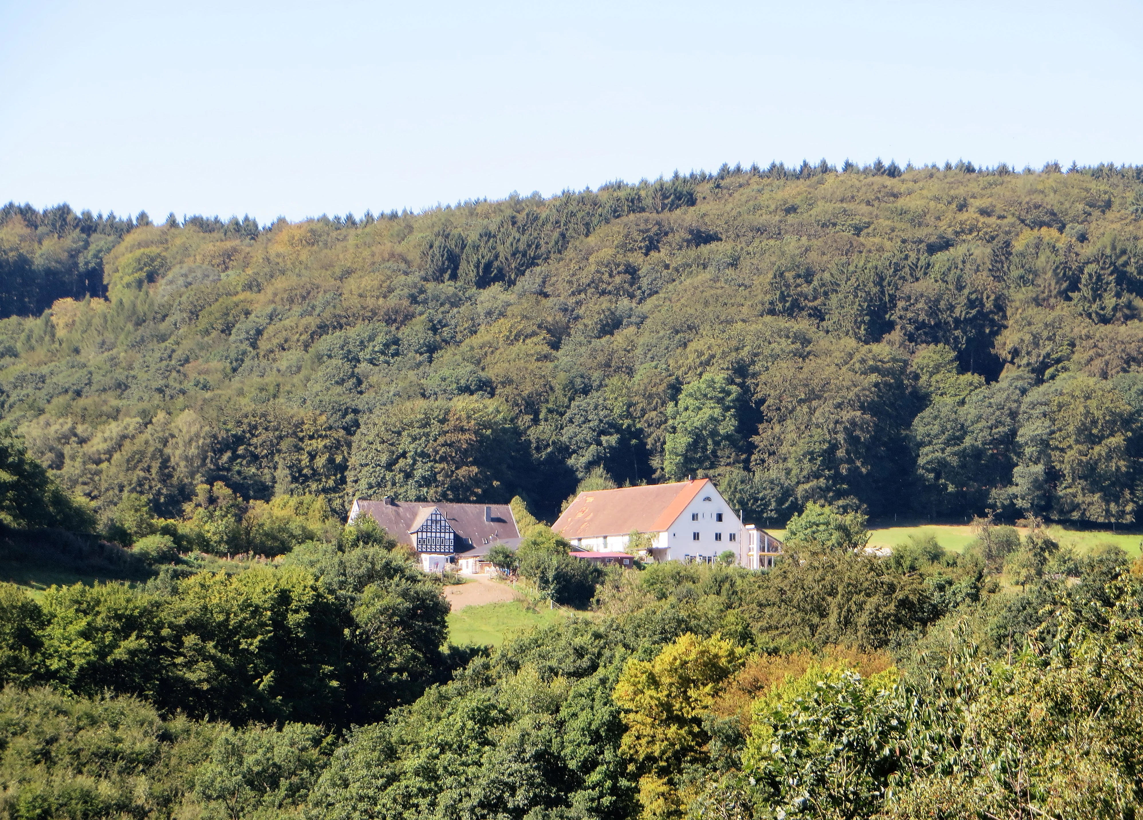
The landscape of Eilper Berg / Langenberg is defined by a heavily wooded ridge-and-valley system typical of the southern Ruhr foothills. Although the protected area covers roughly 754 hectares, the terrain reads as a continuous green space because the dominant features are stands of forest cross-cut by small, branching stream valleys associated with local brooks (Bäche) such as those at Mäckinger and Selbecker.
The woodland is interrupted by smaller clearings and traditionally farmed parcels, including the open Eilper Feld. Relief is moderate rather than dramatic, shaped more by the folds of the valleys and the way the streams have cut into the landscape than by any single dominant summit. The Ambrock greywacke quarry adds a more visible scar of human-modified terrain near Dahl, while the medieval Wallburg Ambrock, sitting on higher ground above the village, marks one of the most visually prominent points in the protected area.
The B 54 corridor along the eastern edge and the built-up margins of Eilpe along the north define perceptibly more anthropogenic boundaries, while the southern continuations into the Breckerfeld and westlich Priorei protected landscapes keep the green corridor unbroken into the countryside beyond Hagen.
Eilper Berg / Langenberg Protected Landscape ecosystems, habitats, and plant life
Ecologically, the protected landscape is built around its forest communities, which the official designation language singles out as "ökologisch wertvolle Waldgesellschaften," or ecologically valuable woodland assemblages. These forests are not uniform; rather they form a mosaic shaped by soil differences, slope, and the way the stream valleys cut across the terrain, supporting varied habitat conditions within a relatively compact area.
The stream valleys running through the forest are particularly important for habitat structure. Because they create cooler, moister microclimates and a richer edge habitat along the watercourses, they support a richer community of breeding and resident birds than the surrounding woodland plateaus alone. The protected area also includes patches of open agricultural land, which add structural diversity and offer different feeding habitats for birds and other fauna.
Taken together, the protected landscape represents a combined forest-and-valley ecosystem at the edge of a densely populated region, functioning as a green lung and ecological stepping stone between Hagen's urban fabric and the surrounding countryside.
Eilper Berg / Langenberg Protected Landscape wildlife and species highlights
The protected area's wildlife profile is most clearly developed around its bird communities. The official Schutzzweck (conservation purpose) explicitly highlights the importance of the area's special habitats for "zahlreiche geschützte und gefährdete Vogelarten," a wide range of protected and threatened bird species. The mix of closed-canopy forest, valley-edge habitat along the brooks, and open agricultural clearings creates the structural variety that supports this bird diversity.
The forest itself provides habitat for typical woodland songbirds and other forest-dependent species, while the stream valleys, with their denser undergrowth and moister conditions, offer more specialized breeding and feeding conditions. The open parcels around the Eilper Feld add a contrasting habitat for species that prefer field edges and semi-open countryside. This combination of habitats within a single protected area gives the landscape an outsized ornithological importance relative to its size.
Eilper Berg / Langenberg Protected Landscape conservation status and protection priorities
Conservation recognition for the Eilper Berg / Langenberg Protected Landscape rests on three core arguments recorded in the designation's Schutzzweck: maintaining and restoring the performance of the natural balance, safeguarding ecologically valuable forest communities, and protecting the special habitats used by numerous protected and threatened bird species.
Beyond biodiversity, the designation also foregrounds the visual and recreational value of the landscape. The official purpose notes the diversity, character, and beauty of the area, especially as a large, predominantly forested zone with varied woodland communities, and recognizes the green corridor's particular importance for nature-oriented recreation (Naturerlebnis) reaching all the way into central Eilpe.
Functionally, the protected area acts as a buffer between Hagen's urban fabric, the B 54 corridor, and the more rural protected landscapes to the south, including Breckerfeld and westlich Priorei. Preservation of the Wallburg Ambrock as a cultural monument adds a heritage-conservation layer that complements the natural-protection goals.
Eilper Berg / Langenberg Protected Landscape cultural meaning and human context
For all its natural-focus designation, the protected landscape carries a clear cultural footprint. The most visible element is the Wallburg Ambrock, a medieval Fliehburg (refuge fortification) near Dahl. These hilltop refuge castles were built as communal shelters in periods of conflict and remain characteristic features of the Westphalian cultural landscape. Ambrock's earthworks are officially recognized as a cultural monument, putting the protected area at the intersection of natural and heritage protection.
The Ambrock greywacke quarry within the protected area is another marker of long-running human use of the local geology; greywacke is a hard, dense sandstone common in the Rhenish Massif and has been quarried locally for building and road stone. The planned Schrebergärten at the Eilper Feld, mentioned at the time of designation, also reflect the area's proximity to the city and the everyday cultural pressures of urban-adjacent land. Together, these features make the protected landscape a place where forest, fields, medieval archaeology, and modern industry all coexist within a single planning framework.
Top sights and standout views in Eilper Berg / Langenberg Protected Landscape
A forested, valley-rich protected landscape of about 754 hectares forming a green corridor into central Eilpe.
Notable for its ecologically valuable woodland communities and stream-valley habitats that support protected and threatened bird species.
Distinctive layered features: the medieval Wallburg Ambrock, the active Ambrock greywacke quarry, and the Helios Klinik Hagen-Ambrock sit within its boundaries.
Functions as a connective protected landscape, linking Hagen's urban fringe with neighbouring designations such as Rafflenbeuler Kopf, Asmecker Bachtal, Breckerfeld, and westlich Priorei.
Best time to visit Eilper Berg / Langenberg Protected Landscape
Because the protected area is a forested landscape of stream valleys and small open fields near Hagen, seasons that bring active foliage, milder walking temperatures, and stronger bird activity tend to make its character most vivid. Spring and early summer are particularly rewarding for birdwatching, when the valley habitats used by protected and threatened species are most active, while late summer and early autumn highlight the agricultural clearings around the Eilper Feld and the broader forest palette.
Winter visits emphasize the area's structural relief: the bare woodland opens up views across the stream valleys and the Ambrock earthworks, and the light tones of greywacke at the working quarry become more visually prominent. At any time of year, the protected area's appeal lies in its mixed forest atmosphere rather than in any single peak spectacle, so visits should be planned around weather and comfort rather than a narrow seasonal window.