
Mori Atlas logo
Protected landscapeLandschaftsschutzgebiet Eilper Berg/Langenberg

Tracing the forest corridors and stream valley terrain of a vital protected landscape near Hagen

Landschaftsschutzgebiet Eilper Berg/Langenberg Protected Landscape and Regional Geography in Germany

Landschaftsschutzgebiet Eilper Berg/Langenberg encompasses 754 hectares of woodland and ridge systems on the southern outskirts of Hagen, Germany. This protected landscape functions as a continuous green corridor, linking complex stream valley habitats with cultural landmarks like the medieval Wallburg Ambrock. The area showcases a diverse interaction between ecological conservation, active greywacke quarrying, and historic earthworks within the Ruhr foothills.

protected landscapemixed foreststream valleysbird habitatmedieval earthworksgreywacke quarry
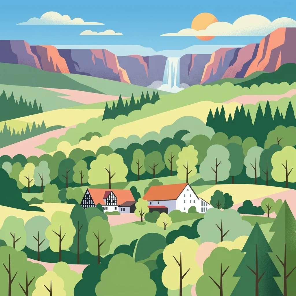
Digital vector-style illustration of a valley landscape with traditional half-timbered houses in the foreground, rolling green hills and forests in the midground, and cliffs with a cascading waterfall in the background under a sunny sky.

Landschaftsschutzgebiet Eilper Berg/Langenberg

Protected landscape

Park overview

Structured park overview, official facts, and landscape profile for Eilper Berg / Langenberg Protected Landscape

Eilper Berg / Langenberg Protected Landscape park facts, protected area profile, and essential visitor context

Review the core facts for Eilper Berg / Langenberg Protected Landscape, including designation, size, terrain, visitor scale, habitats, and operating context in one park-focused overview.

About Eilper Berg / Langenberg Protected Landscape

The Eilper Berg / Langenberg Protected Landscape is one of the larger contiguous protected areas in and around Hagen, a city in the southern Ruhr area of North Rhine-Westphalia. It was designated in 1994 under Hagen's landscape plan and has since functioned both as a conservation area and as a nearby natural escape for residents of the surrounding districts.

Geographically, the protected area lies to the south and southwest of central Hagen, bordering the Eilpe district. To the west, the valley of the Mäckinger Bach separates it from the Rafflenbeuler Kopf Protected Landscape; to the northwest the Selbecker Bach forms a natural boundary, while built-up parts of Eilpe mark the northern edge. The busy B 54 federal road and the Asmecker Bachtal Protected Landscape run along the eastern boundary, and to the south the protected area connects with the Breckerfeld Protected Landscape (in the town of Breckerfeld) and the westlich Priorei Protected Landscape. The Helios Klinik Hagen-Ambrock sits like an island within the protected area, an unusual feature among Germany's landscape protection zones.

The interior of the protected landscape is heavily wooded, with the forest cut through by a network of small stream valleys that shape both the terrain and the visual character of the area. Mixed with the woodland are smaller, traditionally managed agricultural parcels, including the Eilper Feld, which was at risk of conversion to allotment gardens (Schrebergärten) at the time the landscape plan was drawn up.

Cultural and industrial layers are also part of the area's identity. Near the village of Dahl stands the Wallburg Ambrock, a medieval hilltop refuge (Fliehburg) that is recognized as a listed cultural monument. Nearby lies the Ambrock greywacke quarry, which was actively being worked at the time of designation, illustrating the coexistence of resource extraction and landscape protection. Together, these features give the Eilper Berg / Langenberg Protected Landscape a layered character: a forested, valley-rich conservation area that also preserves local heritage and continues to host light industrial use.

Quick facts and research context for Eilper Berg / Langenberg Protected Landscape

The Eilper Berg / Langenberg Protected Landscape is a roughly 754 hectare Landschaftsschutzgebiet within the city of Hagen, in the German federal state of North Rhine-Westphalia. It was designated in 1994 as part of Hagen's municipal landscape plan (Landschaftsplan der Stadt Hagen).

The protected area is predominantly forested, carved by multiple small stream valleys, and includes smaller zones of agricultural land. It hosts the medieval Wallburg Ambrock (a hilltop refuge fortification near Dahl) and the active Ambrock greywacke quarry, and it borders several other protected landscapes around Hagen including Rafflenbeuler Kopf, Asmecker Bachtal, Breckerfeld, and westlich Priorei.

Protection and recognition

Explore the terrestrial conservation scope and official designation established in 1994.

Landschaftsschutzgebiet Eilper Berg/Langenberg Protection Status and Designation History

Landschaftsschutzgebiet Eilper Berg/Langenberg maintains a documented terrestrial protection status established in 1994. Verified conservation records track the official designation framework and administrative scope without international recognition sources.

Protection details

Protection scope
Terrestrial
Designated year
1994
Transboundary protection
No
Park context

Deeper park guide and search-rich context for Eilper Berg / Langenberg Protected Landscape

Eilper Berg / Langenberg Protected Landscape history, landscape, wildlife, and travel context

Explore Eilper Berg / Langenberg Protected Landscape through its history, landscape character, ecosystems, wildlife, conservation priorities, cultural context, and seasonal travel timing in a structured park guide built for atlas discovery and search intent.

Why Eilper Berg / Langenberg Protected Landscape stands out

The protected landscape is best known as a large, forest-dominated green corridor on the outskirts of Hagen, valued for its mix of ecologically important woodland communities, valley habitats used by protected and threatened bird species, and its role as a recreation-oriented landscape stretching close to the heart of Eilpe. It is also notable for the combination of natural and cultural features within a single protected area: medieval earthworks (Wallburg Ambrock), an actively worked greywacke quarry, and the surrounding network of small stream valleys that define much of its scenery.
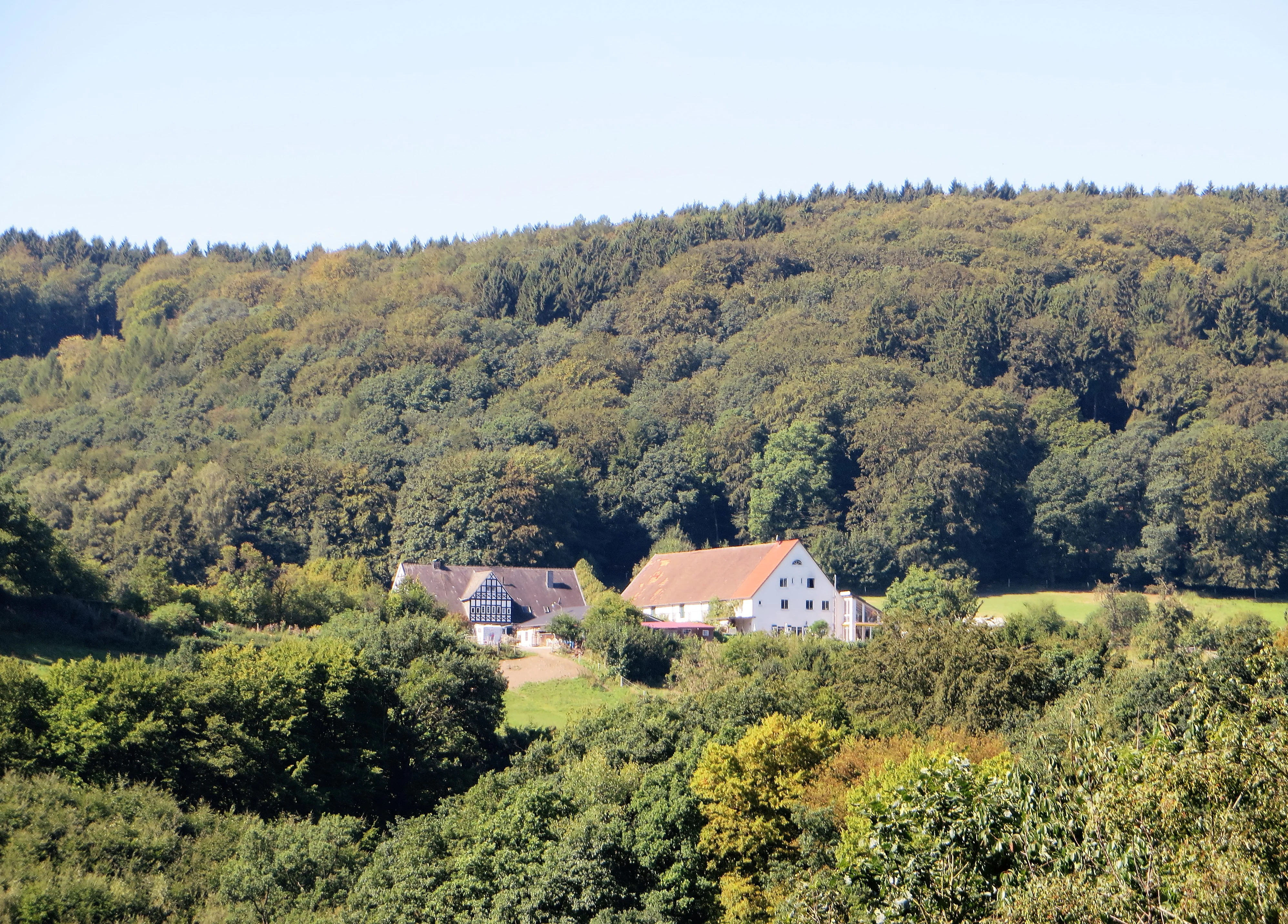
A white farmstead with red roofs set against a backdrop of dense, rolling deciduous forest.
The Ribberthof farmstead situated within the protected landscape area of Eilper Berg/Langenberg.

Eilper Berg / Langenberg Protected Landscape history and protected-area timeline

The protected landscape's modern history begins in 1994, when the city council of Hagen adopted the Landschaftsplan der Stadt Hagen, the municipal landscape plan that set out the framework for landscape protection across the city's territory. As part of that plan, the Eilper Berg / Langenberg area was formally designated as a Landschaftsschutzgebiet.

At the time of designation, the plan explicitly addressed concerns about the Eilper Feld, where Schrebergärten (allotment gardens) were being considered, signalling an early intent to preserve agricultural and open space alongside the surrounding forest. Designation also confirmed the ongoing presence of the Ambrock greywacke quarry as a permitted land use within the protected area, while at the same time recognizing Wallburg Ambrock as a cultural monument requiring protection within the wider landscape.

Since 1994, the protected landscape has remained part of Hagen's network of landscape protection areas, operating alongside neighbouring designations such as Rafflenbeuler Kopf, Asmecker Bachtal, and the Breckerfeld and westlich Priorei protected landscapes to the south.

Eilper Berg / Langenberg Protected Landscape landscape and geographic character

The landscape of Eilper Berg / Langenberg is defined by a heavily wooded ridge-and-valley system typical of the southern Ruhr foothills. Although the protected area covers roughly 754 hectares, the terrain reads as a continuous green space because the dominant features are stands of forest cross-cut by small, branching stream valleys associated with local brooks (Bäche) such as those at Mäckinger and Selbecker.

The woodland is interrupted by smaller clearings and traditionally farmed parcels, including the open Eilper Feld. Relief is moderate rather than dramatic, shaped more by the folds of the valleys and the way the streams have cut into the landscape than by any single dominant summit. The Ambrock greywacke quarry adds a more visible scar of human-modified terrain near Dahl, while the medieval Wallburg Ambrock, sitting on higher ground above the village, marks one of the most visually prominent points in the protected area.

The B 54 corridor along the eastern edge and the built-up margins of Eilpe along the north define perceptibly more anthropogenic boundaries, while the southern continuations into the Breckerfeld and westlich Priorei protected landscapes keep the green corridor unbroken into the countryside beyond Hagen.

Eilper Berg / Langenberg Protected Landscape ecosystems, habitats, and plant life

Ecologically, the protected landscape is built around its forest communities, which the official designation language singles out as "ökologisch wertvolle Waldgesellschaften," or ecologically valuable woodland assemblages. These forests are not uniform; rather they form a mosaic shaped by soil differences, slope, and the way the stream valleys cut across the terrain, supporting varied habitat conditions within a relatively compact area.

The stream valleys running through the forest are particularly important for habitat structure. Because they create cooler, moister microclimates and a richer edge habitat along the watercourses, they support a richer community of breeding and resident birds than the surrounding woodland plateaus alone. The protected area also includes patches of open agricultural land, which add structural diversity and offer different feeding habitats for birds and other fauna.

Taken together, the protected landscape represents a combined forest-and-valley ecosystem at the edge of a densely populated region, functioning as a green lung and ecological stepping stone between Hagen's urban fabric and the surrounding countryside.

Eilper Berg / Langenberg Protected Landscape wildlife and species highlights

The protected area's wildlife profile is most clearly developed around its bird communities. The official Schutzzweck (conservation purpose) explicitly highlights the importance of the area's special habitats for "zahlreiche geschützte und gefährdete Vogelarten," a wide range of protected and threatened bird species. The mix of closed-canopy forest, valley-edge habitat along the brooks, and open agricultural clearings creates the structural variety that supports this bird diversity.

The forest itself provides habitat for typical woodland songbirds and other forest-dependent species, while the stream valleys, with their denser undergrowth and moister conditions, offer more specialized breeding and feeding conditions. The open parcels around the Eilper Feld add a contrasting habitat for species that prefer field edges and semi-open countryside. This combination of habitats within a single protected area gives the landscape an outsized ornithological importance relative to its size.

Eilper Berg / Langenberg Protected Landscape conservation status and protection priorities

Conservation recognition for the Eilper Berg / Langenberg Protected Landscape rests on three core arguments recorded in the designation's Schutzzweck: maintaining and restoring the performance of the natural balance, safeguarding ecologically valuable forest communities, and protecting the special habitats used by numerous protected and threatened bird species.

Beyond biodiversity, the designation also foregrounds the visual and recreational value of the landscape. The official purpose notes the diversity, character, and beauty of the area, especially as a large, predominantly forested zone with varied woodland communities, and recognizes the green corridor's particular importance for nature-oriented recreation (Naturerlebnis) reaching all the way into central Eilpe.

Functionally, the protected area acts as a buffer between Hagen's urban fabric, the B 54 corridor, and the more rural protected landscapes to the south, including Breckerfeld and westlich Priorei. Preservation of the Wallburg Ambrock as a cultural monument adds a heritage-conservation layer that complements the natural-protection goals.

Eilper Berg / Langenberg Protected Landscape cultural meaning and human context

For all its natural-focus designation, the protected landscape carries a clear cultural footprint. The most visible element is the Wallburg Ambrock, a medieval Fliehburg (refuge fortification) near Dahl. These hilltop refuge castles were built as communal shelters in periods of conflict and remain characteristic features of the Westphalian cultural landscape. Ambrock's earthworks are officially recognized as a cultural monument, putting the protected area at the intersection of natural and heritage protection.

The Ambrock greywacke quarry within the protected area is another marker of long-running human use of the local geology; greywacke is a hard, dense sandstone common in the Rhenish Massif and has been quarried locally for building and road stone. The planned Schrebergärten at the Eilper Feld, mentioned at the time of designation, also reflect the area's proximity to the city and the everyday cultural pressures of urban-adjacent land. Together, these features make the protected landscape a place where forest, fields, medieval archaeology, and modern industry all coexist within a single planning framework.

Top sights and standout views in Eilper Berg / Langenberg Protected Landscape

A forested, valley-rich protected landscape of about 754 hectares forming a green corridor into central Eilpe.

Notable for its ecologically valuable woodland communities and stream-valley habitats that support protected and threatened bird species.

Distinctive layered features: the medieval Wallburg Ambrock, the active Ambrock greywacke quarry, and the Helios Klinik Hagen-Ambrock sit within its boundaries.

Functions as a connective protected landscape, linking Hagen's urban fringe with neighbouring designations such as Rafflenbeuler Kopf, Asmecker Bachtal, Breckerfeld, and westlich Priorei.

Best time to visit Eilper Berg / Langenberg Protected Landscape

Because the protected area is a forested landscape of stream valleys and small open fields near Hagen, seasons that bring active foliage, milder walking temperatures, and stronger bird activity tend to make its character most vivid. Spring and early summer are particularly rewarding for birdwatching, when the valley habitats used by protected and threatened species are most active, while late summer and early autumn highlight the agricultural clearings around the Eilper Feld and the broader forest palette.

Winter visits emphasize the area's structural relief: the bare woodland opens up views across the stream valleys and the Ambrock earthworks, and the light tones of greywacke at the working quarry become more visually prominent. At any time of year, the protected area's appeal lies in its mixed forest atmosphere rather than in any single peak spectacle, so visits should be planned around weather and comfort rather than a narrow seasonal window.

Monthly climate preview

Long-term representative point measurements for temperature and precipitation patterns

Landschaftsschutzgebiet Eilper Berg/Langenberg Climate Normals and Annual Weather Rhythm

Historical climatology data details the measured monthly temperature range and daily precipitation rhythm across Landschaftsschutzgebiet Eilper Berg/Langenberg from 1991 to 2020. Examining the complete twelve-month record provides deeper insight into long-term environmental averages at this sampled elevation.
Annual mean9 °C
1 °C19 °C
Jan
Feb
Mar
Apr
May13°
Jun16°
Jul19°
Aug18°
Sep14°
Oct10°
Nov
Dec
Warmest month
July

18.5 °C

Coolest month
January

0.9 °C

Wettest month
December

3 mm/day

Driest month
April

1.7 mm/day

Park location guide

Geography guide, regional context, and park location map for Eilper Berg / Langenberg Protected Landscape

Eilper Berg / Langenberg Protected Landscape park geography, regions, and map view in Germany

Understand where Eilper Berg / Langenberg Protected Landscape sits in Germany through a broader geographic reading of the surrounding landscape, nearby location context, and its mapped position within the national park landscape.

How Eilper Berg / Langenberg Protected Landscape fits into Germany

Germany is a federal republic in Western and Central Europe with a population of over 83 million across sixteen constituent states. It is Europe's largest economy by nominal GDP and a major global exporter and importer. The capital is Berlin, and the country borders Denmark, Poland, Czech Republic, Austria, Switzerland, France, Luxembourg, Belgium, and the Netherlands.

Wider geography shaping Eilper Berg / Langenberg Protected Landscape in Germany

Germany is located in Western and Central Europe, spanning 357,022 km². It borders Denmark to the north, Poland and the Czech Republic to the east, Austria and Switzerland to the south, and France, Luxembourg, Belgium, and the Netherlands to the west. The country has coastlines on the Baltic Sea and North Sea to the north, with the Alps located in the southern region.

Map view of Eilper Berg / Langenberg Protected Landscape

Use this park location map to pinpoint Eilper Berg / Langenberg Protected Landscape in Germany, understand its exact geographic position, and read its mapped placement within the surrounding landscape more clearly.

Pigeon | © OpenStreetMap contributors

Visualizing woodland terrain, stream valleys, and conservation habitats across the protected area

Landschaftsschutzgebiet Eilper Berg/Langenberg Photos and Protected Landscape Scenery

Examine detailed photographs of Landschaftsschutzgebiet Eilper Berg/Langenberg to observe its heavily forested ridges, branching stream valleys, and mixed rural terrain. Visual documentation provides clear insight into the park environment, local habitats, and the distinct geography defining this protected green corridor.

A white farmstead with red roofs set against a backdrop of dense, rolling deciduous forest.

Park atlas

Compare connected woodland corridors, stream valleys, and neighboring reserves across the regional terrain

Parks Near Landschaftsschutzgebiet Eilper Berg/Langenberg and Surrounding Protected Areas

Browse other protected areas and forest reserves located near Landschaftsschutzgebiet Eilper Berg/Langenberg to examine the wider regional green corridor. Comparing adjacent valley habitats and woodland terrain helps trace continuous conservation zones across the southern Ruhr foothills.
A soft, minimalist watercolor painting showing rolling green hills, a small grouping of trees, and muted yellow and pink ground tones against a white background.
Protected landscapeNordrhein-Westfalen
About 2.5 km away#1 closest

East

Landschaftsschutzgebiet Asmecker Bachtal: A Protected Woodland Mosaic in North Rhine-Westphalia

Mapped stream valley, forest corridors, and heritage sites near Hagen

Landschaftsschutzgebiet Asmecker Bachtal protects a significant 569-hectare tract defined by its namesake stream valley and mature forest communities. This area acts as a vital landscape buffer between urban Hagen and regional transport infrastructure, preserving a mix of valley woodlands, historic agricultural sites, and a former quarry that anchors the local topography.

Area
5.693 km²
Established
1994
IUCN
V
Protected landscapeNordrhein-Westfalen
About 3.2 km away#2 closest

Northeast

Landschaftsschutzgebiet Egge: Exploring the Karst Geography and Forested Hills of Hagen

A structured overview of protected terrain and regional landscape boundaries

Landschaftsschutzgebiet Egge encompasses an extensive system of wooded hills, including the Egge, Piepenbrink, and Franzosenschanze summits. This protected area offers a look at unusual geomorphological features, such as limestone-formed dry valleys and swallow holes, serving as a vital natural asset within the urban landscape of Nordrhein-Westfalen.

Area
5.397 km²
Established
1994
Relief
Upland
Climate
Temperate
A watercolor painting of a rolling green countryside with gentle hills, clusters of trees, and a soft, hazy horizon under a pale, warm sky.
Protected landscapeNorth Rhine-Westphalia
About 7.8 km away#3 closest

Northeast

Landschaftsschutzgebiet Berchumer Heide, Reher Heide Protected Area and Landscape Profile

Regional landscape protection zone in North Rhine-Westphalia

Explore the structured geography of Landschaftsschutzgebiet Berchumer Heide, Reher Heide, a diverse protected area in Hagen. The landscape features a distinct contrast between dense forest ravines, small woodland pools, and open agricultural meadows, serving as a vital ecological corridor connected to adjacent nature reserves.

Area
6.227 km²
Established
1994
Relief
Upland
Water
Minor water
A soft watercolor illustration of a wide river landscape with rolling green hills in the background and grassy riverbanks in the foreground.
Nature reserveNordrhein-Westfalen
About 11 km away#4 closest

East

Naturschutzgebiet Pragpaul: Nature Reserve and Protected Lenne Valley Landscapes

Geographic atlas and protected area boundary overview

Naturschutzgebiet Pragpaul preserves a narrow, steeply sloping strip of forest between Altena and Nachrodt-Wiblingwerde. The site integrates rocky cliff outcrops, dense beech woodlands, and near-natural riverine sections along the Lenne, forming a vital component of the Schluchtwälder im Lennetal protected network.

Area
0.7 km²
Established
1999
IUCN
IV
A horizontal watercolor painting depicting a meandering stream flowing through open, green, and pink-toned marshy grasslands bordered by a distant treeline.
Nature reserveNordrhein-Westfalen
About 16 km away#5 closest

Southwest

Spreeler Bachtal Nature Reserve: Geography and Protected Valley Landscapes

An upland nature reserve in the Bergisches Land region of Germany.

This nature reserve centers on the meandering Spreeler Bach, a gravel-bedded stream defining a diverse protected area in North Rhine-Westphalia. The terrain includes wet meadows, spring-fed grassland, and managed deciduous forests on steeply rising valley slopes. It serves as a prime example of targeted habitat conservation within the larger slate landscapes of the Bergisches Land, straddling administrative boundaries between Radevormwald and Ennepetal.

Area
0.21 km²
Established
2019
IUCN
IV
A watercolor painting showing a soft landscape with a stream winding through green meadows toward distant hills, framed by trees on the left.
Nature reserveNordrhein-Westfalen
About 17 km away#6 closest

West

Naturschutzgebiet Oberes Sprockhöveler Bachtal: Protected Valley and Stream Geography

A nature reserve in the Ruhr foothills of Nordrhein-Westfalen

Examine the mapped boundaries and natural terrain of Naturschutzgebiet Oberes Sprockhöveler Bachtal, a compact reserve featuring a near-natural lowland brook. This habitat supports wet grassland, alder-willow galleries, and beech forest slopes that together form a protected ecological unit within the regional landscape of Nordrhein-Westfalen.

Area
0.158 km²
Established
1995
IUCN
IV
Nature reserveOberbergischer Kreis
About 19 km away#7 closest

Southwest

Wupper bei Radevormwald: Protected River Valley and Riparian Woodland Geography

Nature reserve landscape in the Oberbergischer Kreis region

Wupper bei Radevormwald serves as a critical protected area within the Wupper river corridor, featuring a mosaic of beech-oak forests and floodplain alder stands. The reserve highlights the contrast between calm, impounded reaches and energetic, meandering water sections, providing an essential study of river valley morphology and natural recovery in the Bergisches Land.

Area
1.208 km²
Established
2003
IUCN
IV
Relief
Upland
Nature reserveNordrhein-Westfalen
About 20 km away#8 closest

Southwest

Wilhelmsthaler und Haller Bachtal Nature Reserve: Bergisches Land Landscape and Map

A study of protected stream valleys and habitat mosaics in North Rhine-Westphalia.

Located in Remscheid, the Wilhelmsthaler und Haller Bachtal nature reserve protects a diverse array of interconnected stream-side and grassland habitats. This area demonstrates the ecological value of traditional valley landscapes in the Bergisches Land, providing essential connectivity for rare flora and local stream ecosystems through its unique relief and water corridors.

Area
0.103 km²
Established
2003
IUCN
IV
Relief
Upland

Common questions about visiting, size, designation, and location context for Eilper Berg / Langenberg Protected Landscape

Eilper Berg / Langenberg Protected Landscape FAQs for park facts, access, geography, and protected area context

Find quick answers about Eilper Berg / Langenberg Protected Landscape, including protected-area facts, park geography, trail and visitor context, and how the park fits into its surrounding country and regional landscape.
MoriAtlas Explorer

Continue Your Protected Areas Search Across the Global Atlas

Deepen your exploration by continuing the structured search for national parks and protected areas worldwide. Utilize the comprehensive filtering capabilities to compare different conservation landscapes and refine your understanding of global park geography. Discover more about the distribution and characteristics of protected natural areas.

Global natural geography