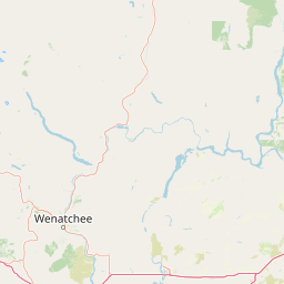
Mountain saddles
Old Blewett Pass
1,241 m

Detailed analysis of mountain terrain, forest cover, and recorded natural features
Access the comprehensive geographic dataset for Okanogan–Wenatchee National Forest, covering its 6066.33 square kilometer boundary across Washington. This profile details the physical landscape, including mountain ranges, coniferous forests, alpine meadows, and associated water features contained within the protected area.
A vast Cascade Range forest spanning dry eastern steppe to wet western old growth
The Okanogan–Wenatchee National Forest is a large U.S. National Forest in north-central Washington state, straddling the eastern slopes of the Cascade Range and extending into the Okanogan highlands along the Canadian border. Managed by the U.S. Forest Service from its headquarters in Wenatchee, the combined forest is one of the most extensive in the Pacific Northwest and contains significant portions of multiple designated wilderness areas, including the Pasayten Wilderness and the Lake Chelan-Sawtooth Wilderness. The forest's landscapes contrast sharply from west to east, transitioning from moist coniferous forests and alpine lake country in the Cascades to arid high-elevation steppe in the Okanogan region. This gradient supports a wide range of ecological communities, including substantial tracts of old-growth lodgepole pine, mixed conifer forests, glacial peaks, and remote wilderness lakes. Natural fire has long shaped the ecology of the area, with several major wildfire complexes in recent decades influencing both forest management and regional air quality. The Okanogan–Wenatchee is significant for its ecological diversity, its wilderness character, and its role connecting the North Cascades ecosystem with the broader interior Pacific Northwest. It serves as a major landscape for hiking, horseback travel, backcountry solitude, and conservation of the transitional forests that define the eastern Cascades.
National forest location data spanning the United States and Washington
Interactive protected boundary geometry and derived area metrics
Mountain classification and recorded peaks, lakes, and valleys
Mountain saddles
1,241 m
Mountain saddles
1,486 m
Mountain saddles
Mountain saddles
1,502 m
Mountain saddles
1,803 m
Mountain saddles
1,898 m
Temperate mountain relief, forest cover, and aquatic systems across recorded zones
Mountains · Valleys · Cliffs · Forest · Lakes · Rivers · Glacier
Temperate coniferous forest · Alpine meadow · Steppe
Compare adjacent protected landscapes, mountain ranges, and regional forest geography

Northwest

Mountainous terrain and ecological transitions in southern British Columbia
Spanning the cross section of the Canadian Cascades, E. C. Manning Provincial Park preserves a high-elevation landscape of wildflowers, glacial valleys, and mountain ridges. The protected area links temperate coastal rainforests with the arid interior, providing a study in regional hydrology and subalpine ecology defined by the Hozameen Range and the northern reaches of the Pacific Crest Trail.

Southwest

Mapping volcanic peaks, deep river canyons, and old-growth wilderness corridors
Gifford Pinchot National Forest represents a major protected expanse in the Washington Cascades, characterized by a complex volcanic topography that includes active craters, cinder cones, and rugged lava fields. This atlas entry details the forest's primary geographic features, from the high-elevation alpine terrain of the Goat Rocks to the river-carved valleys of the Lewis and Cowlitz systems, providing essential context on this integral Pacific Northwest protected landscape.

Southwest
A detailed look at one of the most remote volcanic reserves in the Cascade Range.
Defined by the presence of an isolated stratovolcano and extensive glacial systems, Glacier Peak Wilderness represents a significant protected area within the Washington Cascades. This overview details the rugged landscape, from the deeply incised river valleys of the Chiwawa and Suiattle to the high-alpine rock and ice environment at the peak summit, providing essential geographic context for this roadless wilderness.
Southwest
Glacial terrain and remote mountain valleys in Chelan County
Lake Chelan National Recreation Area protects a rare transition of alpine environments and river-carved valleys in north-central Washington. The terrain is dominated by the long, deep waters of the lake and the steep ridges of the North Cascades, creating an isolated habitat for wild landscapes and historic inland communities. Explore the physical boundaries and topographic features that define this rugged recreation area.
South
North Cascades Wilderness in Washington State
Located in the north-central Cascade Range of Washington, this protected wilderness area contains 63 glacial lakes and extensive alpine terrain. The region offers a complex landscape of cirques, subalpine meadows, and forested valleys that connect directly to the larger North Cascades protected network. Use this atlas to examine its mountainous geography and defined conservation boundaries.

Southwest
Exploratory atlas of Washington's primary Cascade Range wilderness
Delve into the structural geography of Mount Baker, Snoqualmie National Forest. This protected area corridor serves as a major ecological transition zone between the Puget Sound lowlands and the interior Cascades, characterized by extensive glaciers, wild river systems, and iconic stratovolcanoes that define the regional landscape of Washington state.
Southwest
Explore its protected landscape and regional geography.
Mount Rainier National Park represents a core protected area within Washington State, offering rich opportunities for geographic discovery through its mapped boundaries and natural terrain. As a designated national park, it contributes significantly to the atlas of United States protected lands. This destination allows for detailed exploration of its landscape context, making it an essential point of reference for understanding regional geography and conservation areas.
Northwest
Explore mapped boundaries and regional Washington geography.
Gain insight into North Cascades National Park, a vital US National Park located in Washington. This entry focuses on its protected land status, mapped geographic extent, and its role within the regional atlas. Users seeking to understand the park's landscape character, natural terrain, and its specific location in Washington will find this an essential point for detailed park geography exploration and protected area discovery.
Continue mapping the complex terrain and protected boundaries of one of Washington's largest forest estates. Through the MoriAtlas database, investigate the transition from lush alpine environments to dry mountain steppe and uncover the geographic reach of the Pasayten and Lake Chelan-Sawtooth wilderness areas.