
Mori Atlas logo
Marine protected areaPadilla Bay National Estuarine Research Reserve

A dynamic marine protected area featuring expansive tidal mudflats and coastal corridors

Padilla Bay National Estuarine Research Reserve: Mapping the Salish Sea Coastal Landscape

Padilla Bay National Estuarine Research Reserve represents a critical marine protected area located within the Salish Sea of northwestern Washington. This site preserves an extensive tidal estuary where freshwater influences and saltwater cycles converge, creating a productive habitat for migratory birds and marine life. The geography of the reserve reflects a complex interplay between open mudflats, diked agricultural margins, and nearby island channels, providing a unique landscape for studying estuarine ecological processes.

estuarytidal mudflatsSalish Seamigratory birdsshorebirdscoastal reserve
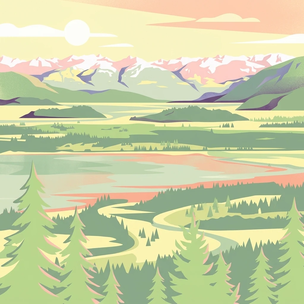
A stylized digital illustration of a scenic estuarine landscape featuring pine trees in the foreground, calm tidal waters, marshlands, and snow-capped mountains under a soft-toned sunset sky.

Padilla Bay National Estuarine Research Reserve

Marine protected area

Park overview

Structured park overview, official facts, and landscape profile for Padilla Bay National Estuarine Research Reserve

Padilla Bay National Estuarine Research Reserve park facts, protected area profile, and essential visitor context

Review the core facts for Padilla Bay National Estuarine Research Reserve, including designation, size, terrain, visitor scale, habitats, and operating context in one park-focused overview.

About Padilla Bay National Estuarine Research Reserve

The Padilla Bay National Estuarine Research Reserve sits at the heart of one of the most ecologically productive estuarine systems on the Pacific coast of North America. Bordered by Fidalgo Island and Guemes Island to the west, and connected to the broader Salish Sea through the Guemes Channel and Rosario Strait, the reserve preserves a landscape where tides, freshwater inputs, and coastal topography combine to create rich habitat. The bay itself is shallow, often only a few meters deep even near features like Hat Island, and its exposed mudflats constitute the ecological centerpiece of the protected area.

Beyond the natural estuary, the reserve also encompasses tracts of land that were once modified by diking for agriculture, including areas within the Skagit Valley drainage. This combination of native tidal flats and reclaimed farmland gives the reserve a layered story, illustrating how human activity has reshaped estuaries in the region and how conservation managers now work to preserve the surviving natural functions of these systems. The reserve's shoreline, dikes, and surrounding habitats support a remarkable diversity of invertebrates, fish, and shorebirds, while also providing accessible places for visitors to experience the estuary firsthand.

What makes Padilla Bay stand out among protected areas in the Pacific Northwest is the integration of conservation, scientific research, and public engagement. The reserve is a federal-state partnership within the National Estuarine Research Reserve system, managed on the ground by the Washington Department of Ecology, with academic ties to Western Washington University and the University of Washington. Its trail network, observation deck, beach access points, and the Breazeale Interpretive Center allow visitors to engage with estuarine ecology in a hands-on way, while ongoing research ensures the site continues to contribute to scientific understanding of how estuaries function and how they can be protected into the future.

Quick facts and research context for Padilla Bay National Estuarine Research Reserve

The Padilla Bay National Estuarine Research Reserve occupies roughly 8,000 acres of estuarine habitat in Skagit County, northwestern Washington, and forms part of the larger Salish Sea ecosystem between the mainland and the San Juan Islands. It was incorporated into the federal National Estuarine Research Reserve system in 1980 and is managed by the Washington Department of Ecology. The reserve combines natural tidal mudflats with diked areas reclaimed for agriculture, illustrating the layered history of the Skagit Valley estuary while continuing to function as a center for research, education, and public access along the Salish Sea shoreline.

Protection and recognition

Examine the documented marine protection status and establishment history for this protected area.

Padilla Bay National Estuarine Research Reserve Protection Status and Designation History

Padilla Bay National Estuarine Research Reserve maintains a documented marine protection status established in the year 1980. Structured records detail the official designation history and management scope associated with this protected area.

Protection details

Protection scope
Marine
Designated year
1980
Transboundary protection
No
Park context

Deeper park guide and search-rich context for Padilla Bay National Estuarine Research Reserve

Padilla Bay National Estuarine Research Reserve history, landscape, wildlife, and travel context

Explore Padilla Bay National Estuarine Research Reserve through its history, landscape character, ecosystems, wildlife, conservation priorities, cultural context, and seasonal travel timing in a structured park guide built for atlas discovery and search intent.

Why Padilla Bay National Estuarine Research Reserve stands out

Padilla Bay is best known for its expansive tidal mudflats, which are exposed at low tide and serve as essential habitat for migratory waterfowl, shorebirds, and a wide range of marine invertebrates. The reserve's shallow waters, fluctuating tidal cycles, and connection to the Skagit River system make it one of the most ecologically productive estuaries in the Pacific Northwest, and that productivity is the central reason the area has been protected and studied for decades. Equally defining is the reserve's role as a working partnership between science and public education. Through the Breazeale Interpretive Center, the National Estuarine Research Reserve designation, and its long-running research relationship with universities, Padilla Bay has become a leading place to observe, teach about, and investigate estuarine ecology in the Salish Sea.
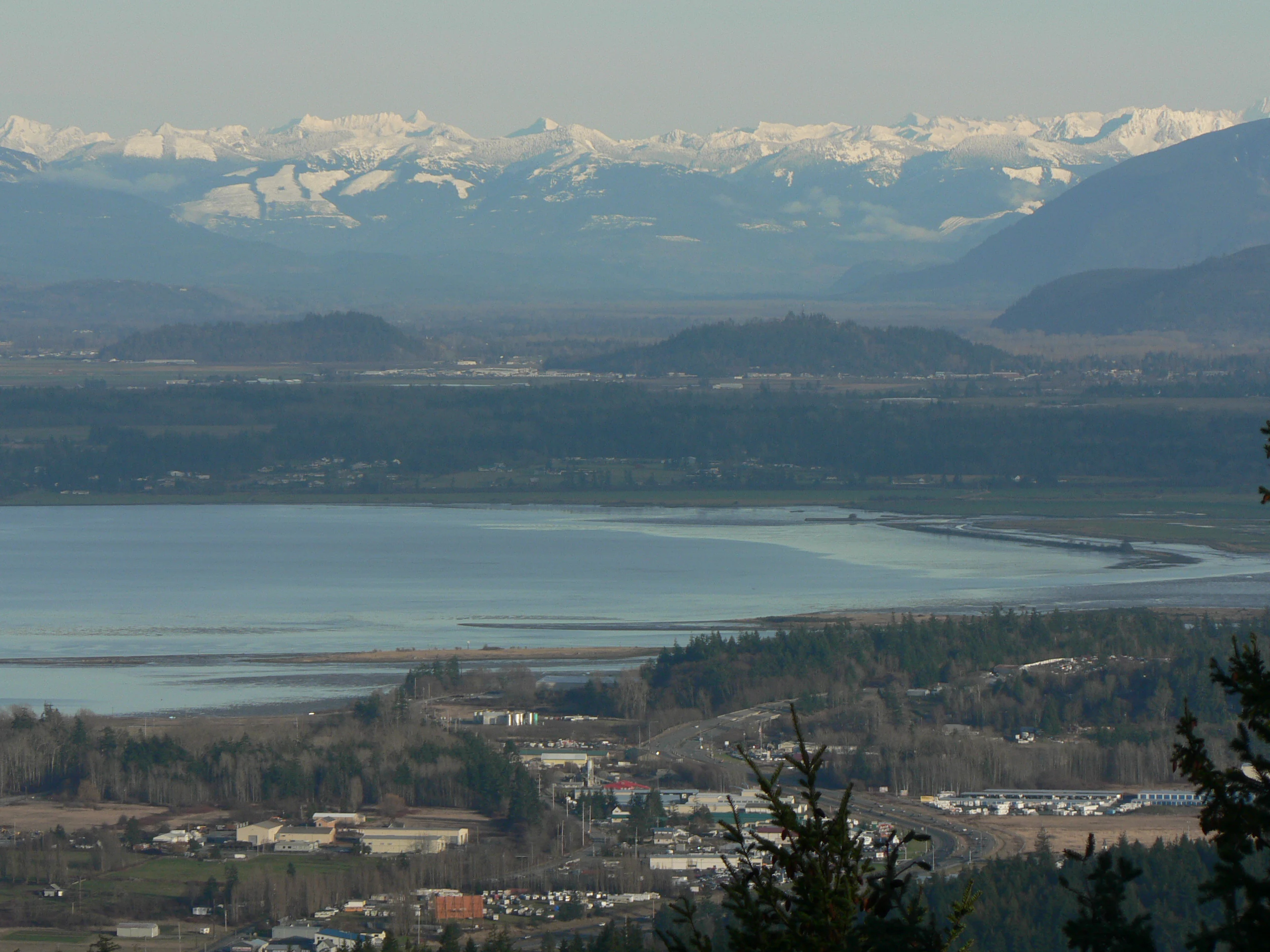
A wide aerial view showing Padilla Bay in the middle distance, with a flat valley floor and snow-capped mountain range spanning the horizon.
View of Padilla Bay with the Skagit River Valley and the North Cascade Range in the background.

Padilla Bay National Estuarine Research Reserve history and protected-area timeline

Padilla Bay carries a long human history that long predates its modern protected status. In 1791, the Spanish explorer José María Narváez sailed through the surrounding waters and named the bay Seno Padillo, honoring Juan Vicente de Güemes Padilla Horcasitas, the viceroy of New Spain. This Spanish-era naming reflects the early European exploration of the inland marine waters of the Pacific Northwest and gave the bay the name it still carries today.

In the modern era, the bay's history shifted toward environmental recognition and conservation. Padilla Bay was incorporated into the National Estuarine Research Reserve system in 1980, marking a turning point in which the area was formally recognized as a site of national importance for estuarine science and protection. The reserve is managed by the Washington Department of Ecology, which oversees a landscape that includes both relatively untouched tidal mudflats and areas whose character has been shaped by previous diking for farmland and by the altered flow patterns of the Skagit River system.

The development of the Breazeale Interpretive Center, classroom and research facilities, and public trails reflects the reserve's evolution from a designated site into a working hub for scientific research, graduate study, and environmental education. Today, the reserve stands as both a product of regional conservation policy and a continuing site for hands-on engagement with the estuary's natural and cultural history.

Padilla Bay National Estuarine Research Reserve landscape and geographic character

Padilla Bay's landscape is defined above all by water, tide, and flat. The bay is extremely shallow; even near Hat Island the water reaches only about four meters in depth. At high tide, the estuary is completely covered by saltwater carried in from the broader Salish Sea, while at low tide vast stretches of soft mudflat emerge, transforming the bay into one of the largest visible tidal landscapes in northwestern Washington.

Surrounding this tidal core is a distinctive island-fringed geography. Fidalgo Island and Guemes Island sit to the west, with Guemes Channel threading between them and connecting Padilla Bay to Rosario Strait beyond. Samish Island lies to the north, marking the transition from Padilla Bay toward Samish Bay and eventually Bellingham Bay. The Swinomish Channel, a saltwater passage between Fidalgo Island and the Skagit County mainland, links Skagit Bay to the south with Padilla Bay to the north, weaving the reserve into a wider network of marine channels and embayments.

The terrestrial edges of the reserve are equally distinctive. Much of the shoreline has been modified by dikes built to convert tidal mudflats into farmland, particularly around the Skagit Valley. These dikes now form raised edges that frame the estuary and support a trail system, including a 2.25-mile shoreline trail and a wheelchair-accessible route to an observation deck. Together, the open mudflats, tidal channels, diked margins, and surrounding forested islands create a hybrid landscape where natural tidal processes and human-built infrastructure coexist.

Padilla Bay National Estuarine Research Reserve ecosystems, habitats, and plant life

The reserve's natural character is fundamentally estuarine, defined by the daily rhythm of tides and the rich biological productivity that arises where saltwater, freshwater, sediment, and sunlight meet. The expansive mudflats at low tide form the foundation of the ecosystem, hosting dense communities of invertebrates that in turn support enormous populations of fish, crabs, and birds. Because the bay is shallow and well mixed by the tides, nutrients are continually cycled through the system, sustaining one of the most productive habitats for waterfowl and shorebirds in the region.

Vegetation patterns around the reserve reflect the transitional nature of estuarine margins. Higher ground supports coastal forest typical of the Puget Sound and Salish Sea region, while lower elevations give way to saltmarsh, transitional wetlands, and the open flats themselves. Even the diked portions of the reserve, originally agricultural land, contribute to habitat diversity by offering drier edges, transitional zones, and managed areas where native plant communities can be restored or studied alongside active human use.

Padilla Bay National Estuarine Research Reserve wildlife and species highlights

Padilla Bay is best known for its birdlife, which is one of the region's defining ecological attractions. The exposed mudflats provide rich feeding grounds for migratory waterfowl and shorebirds that travel along the Pacific Flyway, while the surrounding tidal channels and emergent wetlands extend habitat opportunities throughout the year. The reserve has long been recognized as a major stopover and wintering area for birds in the Salish Sea ecosystem.

Beyond birds, the reserve's mudflats and shallow waters support a wealth of invertebrates, including clams, worms, crabs, and other small organisms that thrive in the nutrient-rich sediments. These invertebrates form the base of the estuarine food web, sustaining fish populations such as salmonids as well as larger predators. The combination of shallow water, tidal flushing, and diverse habitat types gives Padilla Bay a wildlife character defined less by a few charismatic species than by the sheer abundance of life supported across an entire estuarine landscape.

Padilla Bay National Estuarine Research Reserve conservation status and protection priorities

The conservation significance of Padilla Bay rests on its role within the National Estuarine Research Reserve system, a federal-state partnership that protects estuarine areas of national importance for science, education, and long-term monitoring. By being incorporated into this network in 1980, Padilla Bay gained formal recognition as a site where the ecological function of an estuarine system deserves to be preserved and studied over time.

The reserve also matters because estuaries like Padilla Bay are among the most heavily affected ecosystems in the United States, where diking for agriculture, port development, and shoreline modification have dramatically reduced natural tidal habitat over the past century. By maintaining a substantial area of functioning mudflat, channel, and marsh, the reserve protects a living example of an estuarine system that historically extended across much of the Skagit Valley. Managed by the Washington Department of Ecology and supported by ongoing university research, the reserve also functions as a monitoring site where scientists can study how Pacific Northwest estuaries respond to environmental change and how conservation strategies can be refined for similar systems elsewhere.

Padilla Bay National Estuarine Research Reserve cultural meaning and human context

Long before its designation as a research reserve, Padilla Bay was part of the broader cultural and economic life of the Skagit Valley and the Salish Sea. The bay's name itself dates to 1791, when Spanish explorer José María Narváez mapped and named these waters during early European exploration of the Pacific Northwest. The reserve also sits within a region long used by Indigenous peoples of the Salish Sea, including communities whose historical ties to the surrounding waters and shorelines continue to shape the cultural geography of the area.

In the more recent past, the diked portions of the bay reflect the agricultural transformation of the Skagit Valley, where generations of farmers converted tidal flats into productive farmland. The reserve's trails and interpretive exhibits acknowledge this layered history, allowing visitors to consider both the ecological significance of the estuary and the human stories that have shaped how it appears today.

Top sights and standout views in Padilla Bay National Estuarine Research Reserve

A truly substantial portion of protected Pacific Northwest tidal mudflat accessible to the public, with seasonal vistas that shift dramatically between high tide and low tide. Among the most important estuarine sites in the Salish Sea for both migratory bird conservation and long-term scientific monitoring.

A working reserve where ecological research, graduate study, and public education all converge around a single estuary, anchored by the Breazeale Interpretive Center and an extensive trail network. A powerful example of how a federally protected estuary can coexist with a landscape shaped by earlier agricultural diking, offering a real-world picture of Pacific Northwest coastal conservation in action.

Best time to visit Padilla Bay National Estuarine Research Reserve

Padilla Bay offers a different experience in every season, and the character of a visit is closely tied to what happens on the tides. Spring and fall are among the most rewarding periods for wildlife enthusiasts, when migratory shorebirds and waterfowl are traveling along the Pacific Flyway and the mudflats host especially high concentrations of birdlife. These transitional seasons also tend to bring comfortable weather for walking the shoreline trail and exploring the interpretive center outdoors.

Summer offers warmer, drier conditions and the longest daylight hours for visiting the trails, observation deck, and beach access areas, and it is when many of the reserve's educational programs and events are scheduled. Winter has its own appeal for birdwatchers, as the bay becomes important wintering habitat for waterfowl and the bare, exposed mudflats make large numbers of birds especially visible. Because the reserve is centered on the tides rather than any single season, visitors who time their walks around low tide will generally experience the most dramatic views of the estuary in any month of the year.

Monthly climate preview

Long-term temperature and precipitation averages across the representative coordinate

Padilla Bay National Estuarine Research Reserve Climate Normals and Weather by Month

Historical climate normals for Padilla Bay National Estuarine Research Reserve outline a measured annual progression of average temperatures and daily precipitation rates from 1991 to 2020. Examining the full twelve-month weather record reveals detailed patterns in regional temperature ranges and precipitation distribution.
Annual mean10 °C
4 °C17 °C
Jan
Feb
Mar
Apr
May12°
Jun14°
Jul17°
Aug17°
Sep15°
Oct10°
Nov
Dec
Warmest month
August

17.2 °C

Coolest month
December

3.6 °C

Wettest month
November

6.8 mm/day

Driest month
July

1 mm/day

Park location guide

Geography guide, regional context, and park location map for Padilla Bay National Estuarine Research Reserve

Padilla Bay National Estuarine Research Reserve park geography, regions, and map view in United States of America

Understand where Padilla Bay National Estuarine Research Reserve sits in United States of America through a broader geographic reading of the surrounding landscape, nearby location context, and its mapped position within the national park landscape.

How Padilla Bay National Estuarine Research Reserve fits into United States of America

The United States of America is a federal presidential republic and one of the world's largest countries by area and population. It consists of 50 states across a vast territory spanning multiple time zones, with its capital in Washington, D.C. and largest city in New York City. The nation has a diverse economy, influential political system, and significant cultural and military presence globally.

Wider geography shaping Padilla Bay National Estuarine Research Reserve in United States of America

The United States occupies a vast territory in North America, bordered by Canada to the north and Mexico to the south. The 48 contiguous states stretch from the Atlantic to the Pacific Ocean, while Alaska occupies the northwestern region and Hawaii is an archipelago in the Pacific. The country encompasses diverse terrain including the Rocky Mountains, Appalachian Mountains, Great Plains, and extensive river systems.

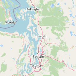
Map view of Padilla Bay National Estuarine Research Reserve

Use this park location map to pinpoint Padilla Bay National Estuarine Research Reserve in United States of America, understand its exact geographic position, and read its mapped placement within the surrounding landscape more clearly.

Pigeon | © OpenStreetMap contributors

Visual reference collection highlighting tidal mudflats, estuarine habitats, and coastal terrain.

Padilla Bay National Estuarine Research Reserve Photos and Protected Landscape Scenery

Visual records capture the expansive tidal mudflats, shallow saltwater channels, and protected shoreline environments of Padilla Bay National Estuarine Research Reserve. Photographic documentation reveals how fluctuating tides transform the estuarine terrain and shape the protected coastal ecosystem.

A wide aerial view showing Padilla Bay in the middle distance, with a flat valley floor and snow-capped mountain range spanning the horizon.

Park atlas

Compare connected protected landscapes and regional coastal geography.

Explore Other Parks Near Padilla Bay National Estuarine Research Reserve

Browse nearby national parks and protected areas sharing the tidal estuarine geography of the Salish Sea. Expand regional park discovery to compare surrounding marine channels, mudflats, and coastal reserves.
A watercolor painting showing a panoramic view of mountain peaks in the distance above green foothills and plains.
Protected landscapeWashington
About 42 km away#1 closest

Southeast

Mount Baker, Snoqualmie National Forest: Mapped Geography and Protected Landscape Analysis

Exploratory atlas of Washington's primary Cascade Range wilderness

Delve into the structural geography of Mount Baker, Snoqualmie National Forest. This protected area corridor serves as a major ecological transition zone between the Puget Sound lowlands and the interior Cascades, characterized by extensive glaciers, wild river systems, and iconic stratovolcanoes that define the regional landscape of Washington state.

Area
6,978 km²
Established
1974
Relief
Mountain
Climate
Alpine
A horizontal watercolor painting showing a range of purple-tinted mountain peaks above a green forest and a light pinkish shoreline.
Wildlife reserveWashington
About 45 km away#2 closest

Northeast

Mount Baker Wilderness: Mapped Volcanic Peaks and Glacial Geography in Washington State

Protected wilderness boundaries in the Northern Cascades

Mount Baker Wilderness encompasses a vast mountain landscape characterized by an active stratovolcano and significant permanent snowfields. The terrain features a vertical gradient from dense west side conifer forests to exposed alpine summits, creating a distinct ecological corridor connected to neighboring protected areas in the Pacific Northwest.

Area
485.58 km²
Established
1984
IUCN
Ib
Relief
Mountain
National parkBritish Columbia
About 48 km away#3 closest

Northwest

Gulf Islands National Park Reserve: British Columbia National Park Protected Area

Mapped boundaries and regional geographic context.

Delve into the protected landscape of Gulf Islands National Park Reserve, a significant national park located in British Columbia. This entry provides detailed insights into its mapped boundaries, regional geographic setting, and its identity as a protected area. Understand the park's place within the natural terrain and atlas of Canada, offering a clear geographic overview for focused discovery and landscape context.

Area
36 km²
Established
2003
IUCN
VI
Visitors
28.4K annual
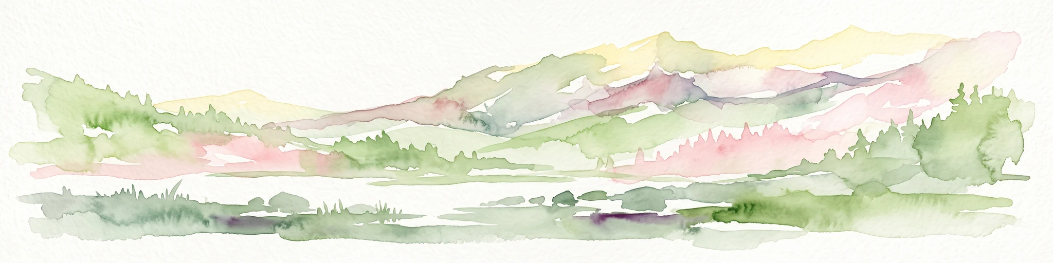
A watercolor painting showing a range of mountains in the background with soft pink, green, and yellow hues, with forest vegetation in the midground and foreground on a white background.
Protected landscapeWashington
About 54 km away#4 closest

Northeast

Mount Baker National Recreation Area: An Atlas of Washington's Volcanic Terrain

Exploration of a remote, roadless Cascade protected landscape

The Mount Baker National Recreation Area provides a unique geographic window into the volcanic heart of the Pacific Northwest. Characterized by its glacier-clad massif and network of subalpine trails, the area serves as a vital protected habitat for elk, mountain goats, and diverse conifer forests. This record details the park's topography, ranging from deep glacial valleys to high-elevation ridges that overlook the broader North Cascades region.

Area
34.29 km²
Established
1984
Relief
Mountain
Climate
Alpine
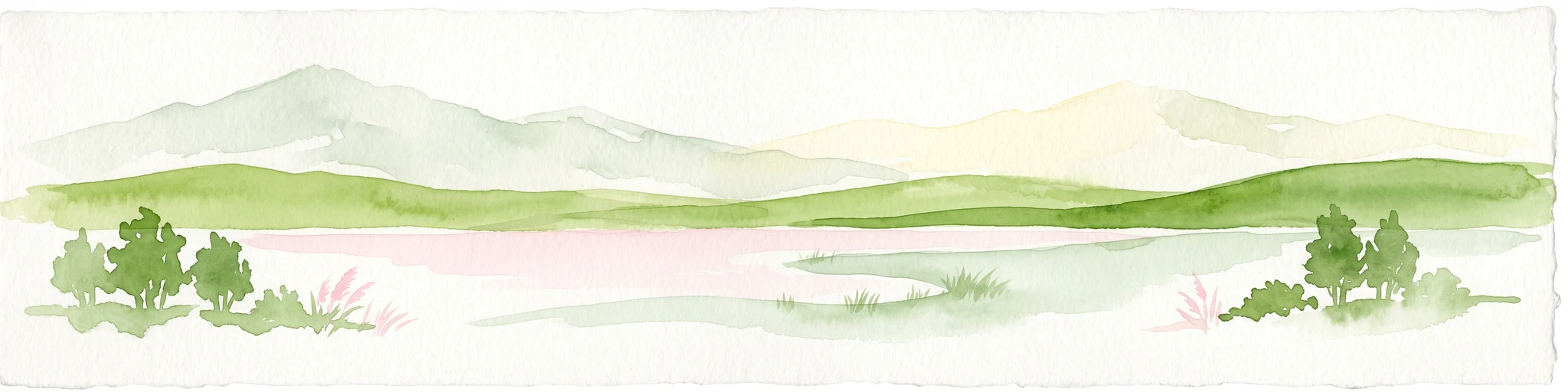
A horizontal watercolor painting depicting a soft-toned landscape with green trees, rolling hills, a calm body of water, and distant pale mountains.
State or regional parkBritish Columbia
About 56 km away#5 closest

North

Peace Arch Park: Mapped Geography and Protected Landscapes of the Canada and US Border

Coastal binational protected area in British Columbia

Peace Arch Park is a notable protected landscape positioned directly on the international border. This site acts as a continuous green space between Canada and the United States, offering an unusual study of territorial boundaries and coastal geography. Spanning manicured terrain and historic monument grounds, the park provides an essential vantage point for understanding land-based connectivity in the Pacific Northwest region.

Area
0.17 km²
Established
1939
Visitors
500K annual
Access
Easy access
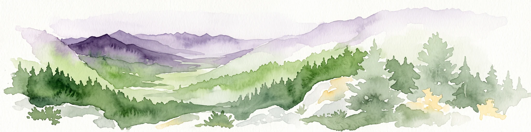
A watercolor painting showing a panoramic view of rolling mountain ranges and dense evergreen forests with a soft, misty aesthetic.
Protected landscapeWashington
About 66 km away#6 closest

Southwest

Olympic National Forest: Atlas and Geographic Overview of Washington Protected Lands

Temperate rainforests, alpine ridges, and fjord shorelines

Olympic National Forest defines the outer reaches of the Olympic Mountains, featuring a massive expanse of old-growth conifers and high-precipitation temperate rainforests. This protected area connects diverse ecosystems ranging from the brackish waters of Hood Canal to rugged, snow-dusted subalpine ridges. Our detailed geographic mapping highlights the forest's role as a vital buffer and wilderness corridor within the broader Pacific Northwest landscape.

Area
2,541.89 km²
Established
1897
Relief
Mountain
Climate
Temperate
National parkWashington
About 72 km away#7 closest

East

North Cascades National Park: US National Park Protected Landscape and Geographic Context

Explore mapped boundaries and regional Washington geography.

Gain insight into North Cascades National Park, a vital US National Park located in Washington. This entry focuses on its protected land status, mapped geographic extent, and its role within the regional atlas. Users seeking to understand the park's landscape character, natural terrain, and its specific location in Washington will find this an essential point for detailed park geography exploration and protected area discovery.

Area
2,042.26 km²
Established
1968
IUCN
II
Visitors
16.5K annual
Nature reserveBritish Columbia
About 78 km away#8 closest

West

Race Rocks Ecological Reserve: Protected Marine Landscape and Island Geography

Nature reserve in the Strait of Juan de Fuca, British Columbia

Race Rocks Ecological Reserve is a geographically distinct protected area consisting of low-lying rocky islets and surrounding high-current marine waters. Located in the Strait of Juan de Fuca, the reserve is recognized for its intense tidal mixing, which supports productive food webs and diverse marine mammals. This site provides a vital window into the ecological dynamics of the Pacific coast through its role as a dedicated research and conservation zone.

Area
2.27 km²
Established
1980
IUCN
Ia
Relief
Lowland

Common questions about visiting, size, designation, and location context for Padilla Bay National Estuarine Research Reserve

Padilla Bay National Estuarine Research Reserve FAQs for park facts, access, geography, and protected area context

Find quick answers about Padilla Bay National Estuarine Research Reserve, including protected-area facts, park geography, trail and visitor context, and how the park fits into its surrounding country and regional landscape.
MoriAtlas Explorer

Continue Your Protected Areas Search Across the Global Atlas

Deepen your exploration by continuing the structured search for national parks and protected areas worldwide. Utilize the comprehensive filtering capabilities to compare different conservation landscapes and refine your understanding of global park geography. Discover more about the distribution and characteristics of protected natural areas.

Global natural geography