Mori Atlas logo
National parkGulf Islands National Park Reserve

Mapped boundaries and regional geography for this key Canadian National Park.

Gulf Islands National Park Reserve: British Columbia's Protected Landscape Atlas

Gulf Islands National Park Reserve stands as a significant protected area within the diverse geography of British Columbia. This page offers a focused exploration of its status as a national park, detailing its mapped protected boundaries and its role within the broader regional landscape. Discover the geographic identity and atlas context of this unique Canadian natural space, providing a foundational understanding for further landscape exploration.

Mediterranean ClimateCoastal IslandsMarine ReserveGarry Oak WoodlandsDouglas-fir ForestCoastal Hiking

Gulf Islands National Park Reserve

National park

Park overview

Structured park overview, official facts, and landscape profile for Gulf Islands National Park Reserve

Gulf Islands National Park Reserve park facts, protected area profile, and essential visitor context

Review the core facts for Gulf Islands National Park Reserve, including designation, size, terrain, visitor scale, habitats, and operating context in one park-focused overview.

About Gulf Islands National Park Reserve

Gulf Islands National Park Reserve occupies a distinctive position in Canada's national park system as the representative of the Strait of Georgia Lowlands, a coastal natural region shaped by sedimentary folding and glacial erosion. The islands stretch through the Strait of Georgia, Haro Strait, and Boundary Pass, forming a scattered archipelago that sits directly north of the international border with the United States. Unlike most Canadian national parks that protect wilderness far from population centres, this park exists in a landscape where over 75 percent of the Gulf Islands remain in private hands, making the protected areas especially important for preserving ecological integrity. The park encompasses a remarkable diversity of terrain, from the long sandy spits of Sidney Island to the sandstone shores of Saturna Island, from the forested ridges of Pender Island to the tidal reefs connecting Tumbo and Cabbage Islands. Water covers approximately 6 square kilometres of the park's total area, recognizing that the marine environment is inseparable from the terrestrial islands in this coastal protected area.

Quick facts and research context for Gulf Islands National Park Reserve

Gulf Islands National Park Reserve spans 36 km² across 16 islands and over 30 islets and reefs in the southern Gulf Islands archipelago. Located in British Columbia near the town of Sidney on Vancouver Island, the park was established May 9, 2003 and is the sixth smallest national park in Canada. The park lies within the Coastal Douglas-fir Biogeoclimatic Zone and features the northernmost extent of Garry oak and arbutus trees in Canada. Annual precipitation averages 838 mm, with most falling between October and February.

Protection and recognition

Tracing the documented management scope and official conservation boundaries of the coastal reserve

Gulf Islands National Park Reserve Protection Status and Designation Frameworks

Explorers can browse the verified protection status and administrative designation records for Gulf Islands National Park Reserve. Reviewing documented boundaries and management frameworks assists in evaluating how coastal marine zones are organized for systematic conservation.

Protection details

Protection scope
Mixed
Transboundary protection
No
Park context

Deeper park guide and search-rich context for Gulf Islands National Park Reserve

Gulf Islands National Park Reserve history, landscape, wildlife, and travel context

Explore Gulf Islands National Park Reserve through its history, landscape character, ecosystems, wildlife, conservation priorities, cultural context, and seasonal travel timing in a structured park guide built for atlas discovery and search intent.

Why Gulf Islands National Park Reserve stands out

Gulf Islands National Park Reserve is best known for its unique Mediterranean climate, the only such climate in Canada, which supports an unusual blend of temperate and sub-Mediterranean vegetation. The park protects rare Garry oak and arbutus woodlands at their northern limits, diverse marine ecosystems with orca and seal populations, and a chain of scenic islands with sandy spits, sandstone cliffs, and coastal Douglas-fir forests. The park also preserves several historic sites including a former leper colony on D'Arcy Island, the Active Pass Lighthouse dating to 1885, and Coast Salish archaeological sites including clam gardens.

Gulf Islands National Park Reserve history and protected-area timeline

The establishment of Gulf Islands National Park Reserve represents decades of conservation effort in the face of intensive private development on the Gulf Islands. Early conservation initiatives focused on establishing provincial marine parks, including D'Arcy Island Marine Park and Princess Margaret Marine Park, while the Islands Trust was created with a mandate to preserve the unique amenities and environment of the Gulf Islands. Federal interest emerged in 1971 when local MP David Anderson advocated for organized conservation, leading to a feasibility study for a marine park. The 1973 joint feasibility study with the United States explored a transboundary protected area spanning the San Juan Islands and Point Roberts. Progress remained stalled until 1995 when the Canada-British Columbia Pacific Marine Heritage Legacy program committed $30 million from each level of government for land acquisition. A pivotal donation of ecologically sensitive land on Saturna Island by Ulla Ressner and John Fry in July 2002 helped catalyze the formal park announcement on May 9, 2003. In April 2004, the province transferred nine former provincial parks, two ecological reserves, and additional Crown lands to Parks Canada.

Gulf Islands National Park Reserve landscape and geographic character

The Gulf Islands landscape is defined by its archipelagic character, with islands arranged in a northwesterly-southeasterly alignment shaped by geological forces including sedimentary folding within the Nanaimo Group and glacial erosion during the last ice age when 1.5 kilometres of ice covered the land. Post-glacial rebound continues to influence the terrain today. The islands feature varied topography including the sandy spits that create Sidney Island's long beaches and sheltered lagoon, the sandstone cliffs and coastal bluffs of Saturna Island, the forested ridges of Mount Norman on Pender Island, and the rolling terrain leading to viewpoints overlooking Boundary Pass and the San Juan Islands. The landscape transitions from second-growth forest at the SMONEĆTEN Campground to old-growth Douglas-fir on Georgeson Island's sandstone ridge, from salt marshes and shell middens to open meadows and forested uplands.

Gulf Islands National Park Reserve ecosystems, habitats, and plant life

The ecological character of Gulf Islands National Park Reserve is defined by the Coastal Douglas-fir Biogeoclimatic Zone, representing the northernmost extent of this typically more southerly ecosystem. The forest community is dominated by coastal Douglas-fir, with western red cedar and grand fir in wetter areas, while drier sites support arbutus and Garry oak, the northernmost populations of these drought-tolerant species. The understory features salal, Oregon-grape, oceanspray, and a diverse fern community including sword fern and lady fern. Wetland areas support salmonberry, false lily of the valley, vanilla-leaf, and skunk cabbage. The marine environment encompasses eelgrass beds in Sidney Island's lagoon and productive waters supporting numerous fish species. This Mediterranean climate zone creates conditions that support species assemblages found nowhere else in Canada.

Gulf Islands National Park Reserve wildlife and species highlights

The park supports diverse wildlife both terrestrial and marine. The largest land animal is the black-tailed deer, while introduced fallow deer from the islands' history as private hunting grounds also persist. Smaller mammals include mink, river otters, raccoons, and deer mice. The marine waters are home to orcas, porpoises, seals, salmon, lingcod, shiner perch, saddleback gunnel, and three-spined stickleback. The avifauna includes cormorants, bald eagles, red-tailed hawks, falcons, turkey vultures, rhinoceros auklets, Brant geese, great blue herons, Hermann's gulls, and oystercatchers. The Belle Chain Islets serve as seal and sea lion haulouts, while Georgeson Island supports old-growth forest that provides habitat for various species.

Gulf Islands National Park Reserve conservation status and protection priorities

Gulf Islands National Park Reserve plays a crucial conservation role in protecting the only Mediterranean climate ecosystem in Canada and representing the Strait of Georgia Lowlands, the smallest and most urbanized of Canada's 39 natural regions. The park preserves rare Garry oak and arbutus woodland at their northern global limits, protects significant marine habitat including eelgrass beds and productive fishing grounds, and maintains coastal ecosystems in a region where over 75 percent of land has been converted to private use. The transfer of former provincial parks and ecological reserves to federal management consolidated protection across multiple islands and islets, while the inclusion of Brackman Island as a special preservation area reflects heightened ecological sensitivity. The park works in conjunction with the Islands Trust conservation mandate and nearby American San Juan Islands National Monument to provide transboundary ecological continuity.

Gulf Islands National Park Reserve cultural meaning and human context

The Gulf Islands have been inhabited by Coast Salish peoples for millennia, as evidenced by archaeological sites including midden deposits on Portland Island and the foreshore clam garden on Russell Island, demonstrating traditional First Nations marine resource management. Several islands bear traces of more recent European settlement, including the ruins of a leper colony on D'Arcy Island from 1891 to 1924, the abandoned 1892 sandstone settler's house at Taylor Point on Saturna Island, and the historical brickworks operation on Sidney Island from 1906 to 1915. Place names reflect the islands' diverse heritage, from the French Isle-de-Lis (formerly Rum Island for its rum-running history during U.S. Prohibition) to the W̱SÁNEĆ place name SMONEĆTEN applied to the campground in 2021 through collaboration with the W̱SÁNEĆ Leadership Council. Russell Island was owned by a Native Hawaiian family from 1886 to 1959, and Portland Island was given to Princess Margaret during her 1958 tour of British Columbia before becoming a marine park.

Top sights and standout views in Gulf Islands National Park Reserve

The park's standout features include the Mediterranean-climate ecosystem found nowhere else in Canada, the rare Garry oak and arbutus woodlands at their northern limits, the scenic sandy spits and lagoons of Sidney Island, the sandstone cliffs and lighthouse at East Point on Saturna Island, and the marine paddling routes linking islands past seal haulouts and through island chains. The diverse campground network ranges from the accessible drive-in SMONEĆTEN Campground to backcountry sites reachable only by kayak on islands like D'Arcy Island and Isle-de-Lis. Historic elements including the 1885 Active Pass Lighthouse, the leper colony ruins on D'Arcy Island, and Coast Salish archaeological sites add cultural depth to the natural landscape.

Best time to visit Gulf Islands National Park Reserve

The Gulf Islands experience a Mediterranean climate with dry, sunny summers and mild, wet winters, making late spring through early fall the most popular visiting period. Summer months offer warm, mostly clear weather ideal for camping, hiking, kayaking, and beach activities, though this coincides with peak season. The should season brings pleasant temperatures and fewer visitors while still providing access to most facilities. Winter visits offer a quieter experience with the landscape's character transformed by higher rainfall and storm activity, though some facilities may have reduced services. The climate monitoring station on Saturna Island has operated since 1989, recording the approximately 838 millimetres of annual precipitation with most falling between October and February.
Park guides

Targeted answers for navigating the Mediterranean climate archipelago

Gulf Islands National Park Reserve Published Guides and Focused Resources

Focused editorial resources help readers explore specific environmental questions across the Strait of Georgia island chain. Published guides examine optimal visitor timing for coastal exploration and remote island access.
Monthly climate preview

Analyzing thirty year average temperatures and daily precipitation trends across coastal British Columbia

Gulf Islands National Park Reserve Weather by Month and Climate Profile

Long-term measurements at a representative coordinate show average temperatures peaking near 18 degrees Celsius alongside a distinct summer dry period. Accessing the complete twelve-month profile reveals historical minimums, maximums, and daily precipitation patterns for Gulf Islands National Park Reserve.
Annual mean10 °C
4 °C18 °C
Jan
Feb
Mar
Apr
May12°
Jun15°
Jul18°
Aug18°
Sep15°
Oct10°
Nov
Dec
Warmest month
August

18.4 °C

Coolest month
December

3.5 °C

Wettest month
November

4.7 mm/day

Driest month
July

0.9 mm/day

Park location guide

Geography guide, regional context, and park location map for Gulf Islands National Park Reserve

Gulf Islands National Park Reserve park geography, regions, and map view in Canada

Understand where Gulf Islands National Park Reserve sits in Canada through a broader geographic reading of the surrounding landscape, nearby location context, and its mapped position within the national park landscape.

How Gulf Islands National Park Reserve fits into Canada

Canada is a federal parliamentary constitutional monarchy spanning North America from the Atlantic to the Pacific and Arctic Oceans. With a population of over 41 million, it is officially bilingual in English and French at the federal level. The country gained independence from the United Kingdom through a gradual process culminating in 1982.

Wider geography shaping Gulf Islands National Park Reserve in Canada

Canada occupies the northern portion of North America, sharing its longest international border with the United States. The country extends from the Atlantic Ocean to the Pacific Ocean and northward into the Arctic Ocean, giving it the longest coastline of any nation.

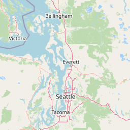
Map view of Gulf Islands National Park Reserve

Use this park location map to pinpoint Gulf Islands National Park Reserve in Canada, understand its exact geographic position, and read its mapped placement within the surrounding landscape more clearly.

Pigeon | © OpenStreetMap contributors

Location context for Gulf Islands National Park Reserve

British Columbia
Natural feature types

Explore the Natural Landmarks and Geographic Features of Gulf Islands National Park Reserve

Examine the diverse landforms and coastal terrain associated with Gulf Islands National Park Reserve through our structured MoriAtlas collection. Investigate the geological makeup, forest structures, and marine features that distinguish this unique Canadian archipelago.
Recorded earthquake history

Explore Recorded Seismic Activity for Gulf Islands National Park Reserve

Browse the chronological catalogue of documented earthquakes associated with the geography of Gulf Islands National Park Reserve. MoriAtlas provides this structured view of historical seismic data to assist with geographic exploration and understanding of regional activity patterns in the Strait of Georgia.

Gulf Islands National Park Reserve Earthquake History

Catalogued events

63 events

Strongest magnitude

Magnitude 5.1

Most recent event

Mar 3, 2025

This history includes earthquakes recorded inside the park or within 50 km of its borders

Park atlas

Trace the geographic spread of protected landscapes and marine ecosystems throughout coastal British Columbia.

Explore National Parks and Protected Areas Near Gulf Islands National Park Reserve

Browse national parks and protected areas adjacent to Gulf Islands National Park Reserve, revealing diverse coastal and island landscapes along British Columbia's Strait of Georgia. This geographic overview provides valuable context for comparing distinct protected-area features, tracing regional conservation efforts, and understanding the unique ecosystems across the region.
State or regional parkBritish Columbia
31 km away#1 closest

East

Peace Arch Park: Mapped Geography and Protected Landscapes of the Canada and US Border

Coastal binational protected area in British Columbia

Peace Arch Park is a notable protected landscape positioned directly on the international border. This site acts as a continuous green space between Canada and the United States, offering an unusual study of territorial boundaries and coastal geography. Spanning manicured terrain and historic monument grounds, the park provides an essential vantage point for understanding land-based connectivity in the Pacific Northwest region.

Area
0.17 km²
Established
1939
Visitors
500K annual
Access
Easy access
Nature reserveBritish Columbia
About 35 km away#2 closest

South

Race Rocks Ecological Reserve: Protected Marine Landscape and Island Geography

Nature reserve in the Strait of Juan de Fuca, British Columbia

Race Rocks Ecological Reserve is a geographically distinct protected area consisting of low-lying rocky islets and surrounding high-current marine waters. Located in the Strait of Juan de Fuca, the reserve is recognized for its intense tidal mixing, which supports productive food webs and diverse marine mammals. This site provides a vital window into the ecological dynamics of the Pacific coast through its role as a dedicated research and conservation zone.

Area
2.27 km²
Established
1980
IUCN
Ia
Relief
Lowland
State or regional parkBritish Columbia
44 km away#3 closest

Northwest

Morden Colliery Historic Provincial Park: Heritage Infrastructure and Regional Coal Mining History

Industrial landscape and historic rail corridor in British Columbia

Located near Nanaimo, this heritage site preserves the substantial concrete remains of the Morden Colliery. The park serves as a physical archive of southern Vancouver Island industrial life, contrasting engineering landmarks with local forest environments and interpretive trails along former coal railway alignments.

Area
0.04 km²
Established
1972
Relief
Lowland
Scope
Terrestrial
Marine protected areaUnited States of America
About 48 km away#4 closest

Southeast

Padilla Bay National Estuarine Research Reserve: Coastal Protected Area Geography

A significant tidal estuary and marine protected landscape in Washington

This marine protected area encompasses large, shallow tidal mudflats and salt marshes within the Salish Sea. It serves as a essential hub for ecological research and conservation, framing a hybrid environment where historical diked farmlands meet protected coastal terrain. The reserve offers deep insight into the regional geography of Washington, detailing how tidal processes and human history have shaped this productive Pacific Northwest estuarine landscape.

Area
32 km²
Established
1980
Relief
Lowland
Access
Easy access
State or regional parkBritish Columbia
About 50 km away#5 closest

Northwest

Petroglyph Provincial Park: Protected Indigenous Heritage and Coastal Geography

Cultural landscape and bedrock carvings in British Columbia

Petroglyph Provincial Park preserves a remarkable concentration of ancient carvings etched into the sandstone bedrock of the Nanaimo River estuary. This protected area on Vancouver Island provides a rare look at how Indigenous traditions integrated with powerful natural features, offering a unique geographic context for studying historical rock art in the Pacific Northwest.

Area
0.02 km²
Established
1948
IUCN
III
Relief
Lowland
National parkWashington
52 km away#6 closest

South

Olympic National Park National Park: Geographic Atlas and Protected Landscape Discovery

Explore its unique Washington landscape and mapped protected areas.

Olympic National Park serves as a key protected area within Washington, offering rich opportunities for geographic exploration. This detail page provides essential context on its designation as a national park, its mapped boundaries, and its contribution to the regional geography. Understand the park's specific landscape character and its role within the atlas of protected lands, facilitating a structured approach to discovering its natural terrain and geographic significance.

Area
3,733.8 km²
Established
1938
IUCN
II
Visitors
3.7M annual
Protected landscapeWashington
58 km away#7 closest

South

Olympic National Forest: Atlas and Geographic Overview of Washington Protected Lands

Temperate rainforests, alpine ridges, and fjord shorelines

Olympic National Forest defines the outer reaches of the Olympic Mountains, featuring a massive expanse of old-growth conifers and high-precipitation temperate rainforests. This protected area connects diverse ecosystems ranging from the brackish waters of Hood Canal to rugged, snow-dusted subalpine ridges. Our detailed geographic mapping highlights the forest's role as a vital buffer and wilderness corridor within the broader Pacific Northwest landscape.

Area
2,541.89 km²
Established
1897
Relief
Mountain
Climate
Temperate
State or regional parkBritish Columbia
About 60 km away#8 closest

North

Plumper Cove Marine Provincial Park: Protected Marine Geography and Coastal Landscapes in Howe Sound

Exploring the forested trails and sheltered marine anchorages of Keats Island.

Plumper Cove Marine Provincial Park represents a vital protected landscape on the coast of British Columbia, defined by its blend of upland coastal forest and intimate, boat-accessed marine anchorages. This geography-focused profile traces the park's terrain, including its rocky shorelines, forest-covered bluffs, and the trail networks that connect visitors to the broader Howe Sound maritime environment.

Area
0.66 km²
Established
1960
IUCN
II
Relief
Upland

Common questions about visiting, size, designation, and location context for Gulf Islands National Park Reserve

Gulf Islands National Park Reserve FAQs for park facts, access, geography, and protected area context

Find quick answers about Gulf Islands National Park Reserve, including protected-area facts, park geography, trail and visitor context, and how the park fits into its surrounding country and regional landscape.
MoriAtlas Explorer

Continue Your Protected Areas Search Across the Global Atlas

Deepen your exploration by continuing the structured search for national parks and protected areas worldwide. Utilize the comprehensive filtering capabilities to compare different conservation landscapes and refine your understanding of global park geography. Discover more about the distribution and characteristics of protected natural areas.

Global natural geography