
Why Palaui Island Protected Landscape and Seascape stands out
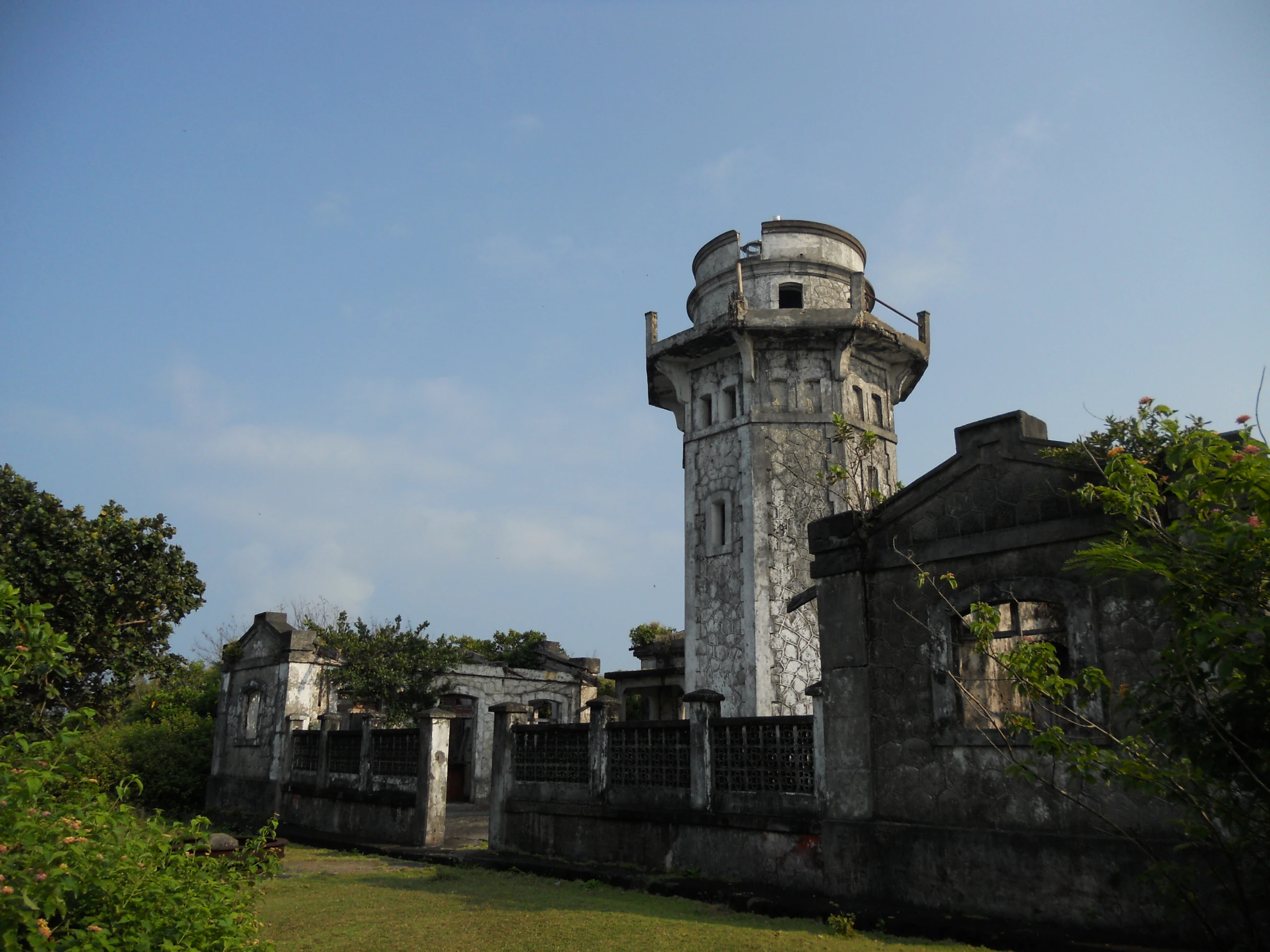
Palaui Island Protected Landscape and Seascape is best known for its raw, rugged coastal scenery, including the historic Cape Engaño Lighthouse perched on the island's northern bluff and the white-sand coves that earned the island a place among CNN's World's 100 Best Beaches. The park is also distinguished by the combination of an inland grassland plateau, forested bluffs, and offshore islets and reefs that together define the protected landscape. A second important identity is its role as a migratory bird sanctuary and a marine reserve harboring coral communities and commercial fish species. These ecological attributes, paired with its recognition as a model of community-led sustainable tourism, give Palaui a uniquely layered profile that blends scenery, wildlife, and local stewardship.
Palaui Island Protected Landscape and Seascape history and protected-area timeline
Palaui Island was first given formal protection as a National Marine Reserve on August 28, 1994, with the declaration covering an area of approximately 7,145 hectares of surrounding waters. This early designation recognized the importance of the island's coral reefs and commercial fish species, establishing a baseline of marine protection around the island. A broader terrestrial and marine protected area was later established on August 16, 1994, encompassing roughly 8,048 hectares and bringing the island's land habitats into the country's protected landscape system as well.
On June 22, 2018, the protected area was formally elevated to national park status under the Expanded National Integrated Protected Areas System (ENIPAS) Act, or Republic Act No. 11038. This step consolidated the island's combined terrestrial and marine protections under a single national designation. The park is administered through the Philippines' Department of Environment and Natural Resources as the governing body.
In January 2019 the island received the ASEAN Community-Based Tourism Award for 2019 to 2021, recognizing the work of the local Palaui Environmental Protectors Association in promoting sustainable tourism. The community-driven focus on conservation has become an integral part of Palaui's modern protection story, complementing the formal designations and adding a strong local-stewardship dimension to the park's history.
Palaui Island Protected Landscape and Seascape landscape and geographic character
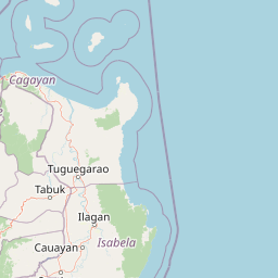
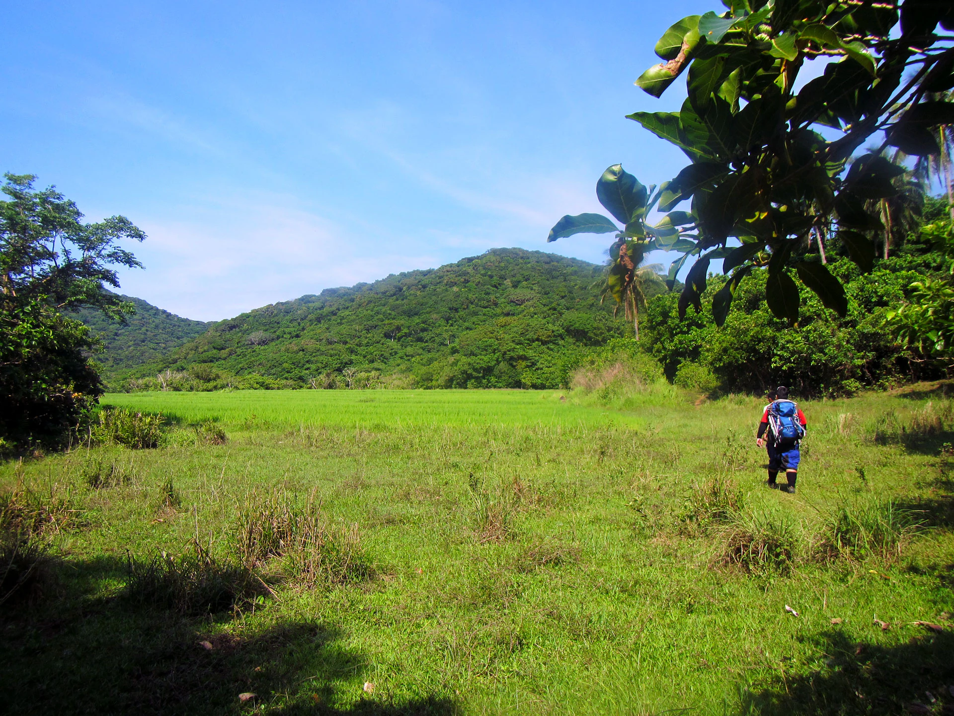
The landscape of Palaui Island Protected Landscape and Seascape is defined by a high, irregular island rising from the waters off northeastern Luzon, paired with a constellation of smaller islets, reefs, and coastal bluffs. The main island measures roughly 10 kilometers along its long axis and about 5 kilometers across, with a moderately elevated interior that supports both forested slopes and open grassland. From the sea, this inland plateau gives the island a dramatic silhouette that contrasts with the steeper coastal cliffs along its western and northern shores.
The southwestern end of the island is anchored by Puerto Point, a high wooded bluff. The northern extremity, Cape Engaño, is the most iconic landscape feature, crowned by the historic Cape Engaño Lighthouse and ringed by the Dos Hermanos Islets and exposed rock formations to the northeast. Gran Laja Island, a low rocky islet surrounded by breakers, lies further out to sea, while Rona Island and Escucha Islet contribute additional wooded and rocky forms to the east and southeast.
The park's marine landscapes are equally central to its identity. A fringing reef projects about 2.4 kilometers from the eastern shore of Palaui and wraps around Escucha Islet at a distance of roughly 0.8 kilometers. Coral communities, rocky shoals, and white-sand coves such as those at Engaño Cove combine with the terrestrial landforms to create a layered coastal scenery of cliffs, beaches, reefs, and offshore rocks within a single protected boundary.
Palaui Island Protected Landscape and Seascape ecosystems, habitats, and plant life
The habitats of Palaui Island Protected Landscape and Seascape span both terrestrial and marine environments, creating a compact mosaic of forest, grassland, cliff, reef, and shoreline. Inland, the island carries a mix of wooded cover along its slopes and exposed grassland across its plateau, producing clear ecological gradients from forested ridges to open areas. The inland terrain supports birdlife including migratory species that use the island as a seasonal sanctuary, contributing to its broader ecological importance.
Around the island, the marine component adds coral reefs, rocky reefs, and open-water habitats that together form a productive coastal ecosystem. The waters around Palaui harbor an estimated 21 commercial fish species, supported by approximately 50 hectares of undisturbed coral cover that anchors the reef-associated biodiversity. Smaller islets such as Escucha, Rona, and Dos Hermanos contribute additional nesting and roosting environments, especially for seabirds and migrants that rely on isolated coastal landforms.
The combination of inland forest-grassland habitat, cliffs, offshore islets, and reef-fringed shoreline makes the protected area a textbook example of a high island ecosystem paired with a fringing reef system. This ecological diversity within a relatively small geographic frame gives the park significant conservation value beyond its individual species counts.
Palaui Island Protected Landscape and Seascape wildlife and species highlights
Palaui Island Protected Landscape and Seascape is recognized primarily as a sanctuary for migratory and seabird life. The island serves as a refuge for an estimated 90 migratory bird species that use the area as part of their seasonal movements across the East Asian flyway. The mosaic of forested slopes, open grasslands, rocky headlands, and isolated offshore islets provides a varied set of roosting, feeding, and resting habitats for both migrant and resident bird populations.
Beneath the surface, the marine environment around the island supports a rich assemblage of reef-associated life. The waters contain about 21 commercial species of fishes, alongside roughly 50 hectares of undisturbed coral cover that form the structural backbone of the reef ecosystem. Smaller islets like Escucha, Rona, and the Dos Hermanos rocks contribute shoreline and pelagic wildlife values, including feeding areas for seabirds and reef-dependent species near the breaking rocks at Gran Laja Island.
Together, the bird sanctuary function and the reef-fish ecosystem give Palaui a profile that bridges terrestrial ornithology with marine biodiversity. The combination is central to why the area has warranted successive layers of protection, from its 1994 marine reserve declaration through its 2018 national park designation.
Palaui Island Protected Landscape and Seascape conservation status and protection priorities
Conservation significance on Palaui Island is rooted in the area's long history of layered protection. The waters around the island were first protected as a National Marine Reserve in 1994, safeguarding around 7,145 hectares of marine habitat and the coral reef and fish communities within them. This marine reserve status was followed by broader landscape protection covering approximately 8,048 hectares across land and sea, and culminated in 2018 when the area was formally designated a national park under the Expanded National Integrated Protected Areas System Act.
The park matters from a conservation perspective because it protects a relatively compact but ecologically diverse island-and-reef system. Approximately 50 hectares of undisturbed coral, an assemblage of 21 commercial fish species, and a sanctuary for roughly 90 migratory bird species together represent substantial biodiversity value concentrated within a small geographic area. The combination of high island terrestrial habitats and offshore reefs gives the protected area both ecological resilience and a strong profile for research and monitoring.
A defining conservation feature of Palaui is its strong community-driven stewardship model. The work of the Palaui Environmental Protectors Association, recognized through the ASEAN Community-Based Tourism Award, has helped embed local communities in the protection of the island. This combination of formal legal protection and active grassroots conservation makes the park a notable example of integrated landscape and seascape management in the Philippines.
Palaui Island Protected Landscape and Seascape cultural meaning and human context
Cultural identity on Palaui Island is closely tied to its coastal setting in Santa Ana, Cagayan, and to the role of local communities in safeguarding the island's natural values. The Palaui Environmental Protectors Association, a community-based environmental group on the island, has become a central part of the area's modern story and was instrumental in Palaui's international recognition through the ASEAN Community-Based Tourism Award.
The island's most recognizable cultural landmark is the Cape Engaño Lighthouse at the northern tip, a historic navigational structure that has come to symbolize Palaui both for residents and for visitors. Combined with the island's role as a sustainable tourism destination and its use as a filming location for international television productions, these elements contribute to a cultural fabric in which the community, the lighthouse, and the protected landscape are intertwined in local identity.
Top sights and standout views in Palaui Island Protected Landscape and Seascape
The defining highlights of Palaui Island Protected Landscape and Seascape include the historic Cape Engaño Lighthouse crowning the island's northern bluff, the rugged cliffs and white-sand coves that led to the island's inclusion among CNN's World's 100 Best Beaches, and the offshore constellation of islets such as Dos Hermanos, Escucha, Rona, and Gran Laja. The protected area's blend of high island terrain, fringing reefs, and coastal scenery gives it a layered visual identity uncommon among Philippine protected areas.
Equally important are the ecological highlights: a sanctuary for around 90 migratory bird species, roughly 50 hectares of undisturbed coral cover, and an assemblage of 21 commercial fish species. Paired with the ASEAN-recognized community-led tourism model and the 2018 national park designation, these highlights combine scenery, biodiversity, and local stewardship into a single, distinctive protected destination.
Best time to visit Palaui Island Protected Landscape and Seascape
Palaui Island Protected Landscape and Seascape is best approached with an awareness of the dry and wet seasons that shape northern Luzon's climate. The dry season generally offers more dependable conditions for boat travel from the Port of San Vicente, clearer views of the cliffs and offshore islets, and calmer seas around the fringing reefs and Engaño Cove. These conditions tend to favor hiking to Cape Engaño, exploring the lighthouse area, and accessing the island's white-sand coves.
Migratory bird presence on the island shifts across the year, with seasonal variations that can influence the experience for visitors interested in birdwatching. Calm seas also tend to improve the visibility and enjoyment of the reef and marine waters that form the seascape component of the protected area. Timing a visit around favorable weather windows generally supports both the terrestrial scenery of Palaui and the clarity of its surrounding waters.