
Mori Atlas logo
Protected landscapePřírodní park Berounka

Mapping the dramatic river canyon, forested slopes, and cultural mosaic within the Plzeňský kraj corridor

Přírodní park Berounka: A Comprehensive Geographic Atlas of a Western Bohemian Protected Landscape

Přírodní park Berounka spans a deeply incised river valley through the Plzeňský kraj region of western Bohemia. This protected landscape preserves a scenic corridor where steep forested slopes and rocky outcrops intersect with historic agricultural land. Through detailed map analysis, observe how the Berounka river defines the terrain, linking various nature reserves and cultural sites within a unified conservation framework.

river valleynatural parkBohemian landscaperocky outcropsmixed forestriver canyon
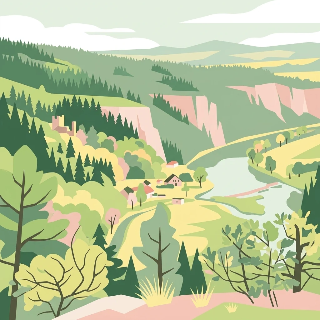
A flat-style digital illustration showing a winding river flowing through a lush green valley with coniferous trees, rocky cliffs, and a small group of village buildings.

Přírodní park Berounka

Protected landscape

Park overview

Structured park overview, official facts, and landscape profile for Přírodní park Berounka

Přírodní park Berounka park facts, protected area profile, and essential visitor context

Review the core facts for Přírodní park Berounka, including designation, size, terrain, visitor scale, habitats, and operating context in one park-focused overview.

About Přírodní park Berounka

Přírodní park Berounka is a regional protected landscape situated in central-western Bohemia, in the Czech Republic. It covers a significant stretch of the upper Berounka River, flowing generally westward through districts associated with the Plzeň Region. The park's territory is anchored on the river corridor itself, but extends outward to include the surrounding slopes, tributary valleys, woodlands, fields, and the settlements whose histories are closely tied to the valley.

The defining feature of the park is the deep, scenic valley of the Berounka, one of the notable river canyons of the Bohemian landscape system. Its slopes carry mixed forest and exposed rocky outcrops, while the valley floor accommodates meanders, gravel banks, riparian habitats, and the villages and farms that line the river. Above the valley, the landscape transitions into a mosaic of woodland, agricultural land, and small historic settlements, with cultural landmarks such as chapels, farmsteads, and castle sites contributing to the park's overall character.

The park's purpose, as set out at its establishment, is the protection of this combined natural and cultural landscape character. Rather than designating a strict core zone of wilderness, it operates on the principle that scenic value, biodiversity, and human heritage are intertwined here, with the river valley serving as the connective spine. The protection criteria emphasize the aesthetic quality of deeply incised river landscapes, prominent rock formations, the surrounding forest complexes, the agricultural setting, and the architectural heritage of villages within the park.

The area is also a recreational landscape easily accessible from Plzeň, with numerous hiking trails and several themed educational paths running through the park. These routes connect natural highlights with cultural and historical points of interest, including paths dedicated to local painters, mining history, and the work of regional nature figures. The combination of geological interest, ecological value, cultural heritage, and accessible outdoor recreation makes Přírodní park Berounka one of the more prominent natural parks in the Plzeň Region.

Quick facts and research context for Přírodní park Berounka

Přírodní park Berounka is a regional natural park covering roughly 13,100 hectares of the upper Berounka River valley in western Bohemia. It lies within the Plzeň Region and spans three administrative districts: Plzeň-město, Plzeň-sever, and Rokycany. The park was formally established by the Plzeň Regional Council in 2021 and at the same time absorbed two earlier natural parks in overlapping territory.

The protected landscape centers on the deeply cut valley of the Berounka River and its tributaries, together with forested slopes, rocky outcrops, agricultural land, and a string of historic villages. Within the park, seven smaller protected areas (nature reserves and natural monuments) preserve especially valuable habitats and geological sites. The park also contains a network of marked hiking trails and several educational nature paths linking the river corridor to surrounding cultural and historical landmarks.

Protection and recognition

Examine the documented conservation framework and official designation history for Přírodní park Berounka.

Přírodní park Berounka Protection Status and Recognition Records

Review the documented protection status, management scope, and official recognition records assembled for Přírodní park Berounka. Access verified administrative parameters and conservation datasets structured for analytical park discovery.

Protection details

Transboundary protection
No
Park context

Deeper park guide and search-rich context for Přírodní park Berounka

Přírodní park Berounka history, landscape, wildlife, and travel context

Explore Přírodní park Berounka through its history, landscape character, ecosystems, wildlife, conservation priorities, cultural context, and seasonal travel timing in a structured park guide built for atlas discovery and search intent.

Why Přírodní park Berounka stands out

Přírodní park Berounka is best known for the long, narrow, and scenically dramatic valley of the upper Berounka River, where forested slopes, rock outcrops, and small historic villages converge along a single winding watercourse. The park's identity is shaped by this river canyon and the way the landscape alternates between wild, rocky stretches and gentler agricultural land. It is also recognized for its role as a consolidating protected landscape. By merging earlier, smaller natural parks in the same region, Přírodní park Berounka created a unified management corridor for the upper Berounka valley, giving stronger coherence to conservation efforts and visitor planning across a sizable portion of western Bohemia.
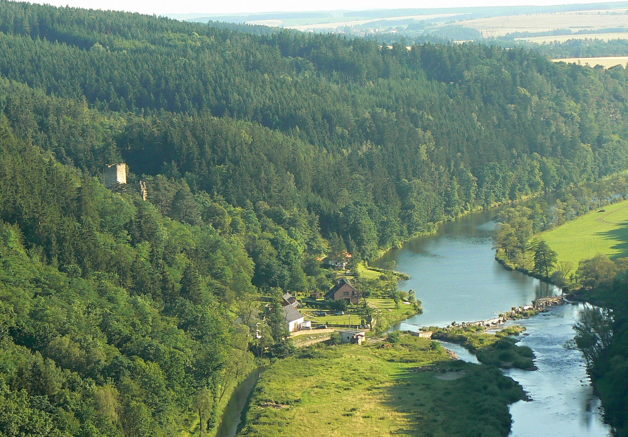
An aerial view of a river bending through a deep, tree-covered valley, with small structures visible on the riverbank and a ruin situated on the forested slope.
The Berounka River winding through the forested landscape of Přírodní park Berounka.

Přírodní park Berounka history and protected-area timeline

Přírodní park Berounka was formally established in 2021 by a decision of the Plzeň Regional Council. The park's creation brought together and replaced two previously designated natural parks that had existed in overlapping parts of the upper Berounka valley: Přírodní park Horní Berounka and Přírodní park Hřešihlavská. Their integration under the new, larger Berounka park effectively reset the regional protected-area framework along this stretch of the river.

The establishment of the park reflected an evolving effort to manage the upper Berounka valley as a single coherent landscape rather than as separate, partially overlapping designations. By unifying protection across the districts of Plzeň-město, Plzeň-sever, and Rokycany, the new park created a continuous protected framework linking key natural features and cultural sites along the river.

Within the park, several smaller protected areas already existed before 2021 and continue to function as distinct conservation units. These include nature reserves such as Zábělá, Háj, Krašov, and Chlumská stráň, as well as natural monuments including Malochova skalka, Kateřina, and Třímanské skály. The 2021 framework effectively embedded these older, smaller sites within a broader landscape-scale protected area.

Přírodní park Berounka landscape and geographic character

The landscape of Přírodní park Berounna is dominated by the deeply incised valley of the Berounka River, which cuts a long, curving course through the gently rolling terrain of western Bohemia. The river has carved a relatively narrow canyon flanked by steeper slopes, and these slopes are punctuated by rocky outcrops, cliff sections, and exposed bedrock that contribute much of the valley's scenic identity. The transition from the river floor to the surrounding plateau is often abrupt, creating a landscape where woodland, rock, and farmland meet within a short distance.

Along the valley, the river is accompanied by gravel banks, meanders, and small floodplain pockets that contrast with the steeper, more wooded slopes above. Tributary streams join the Berounka through their own smaller valleys, each with its own combination of rock, forest, and meadow. Above the canyon rim, the terrain levels into farmland and forest patches, with small villages and historic farmsteads set into the agricultural mosaic.

A defining feature of the landscape is the visual interplay between natural and cultural elements: rock formations and forest stands framed by fields, orchards, village architecture, and the occasional castle site or chapel. This combination of dramatic river scenery and a working rural landscape is central to what the park is intended to protect.
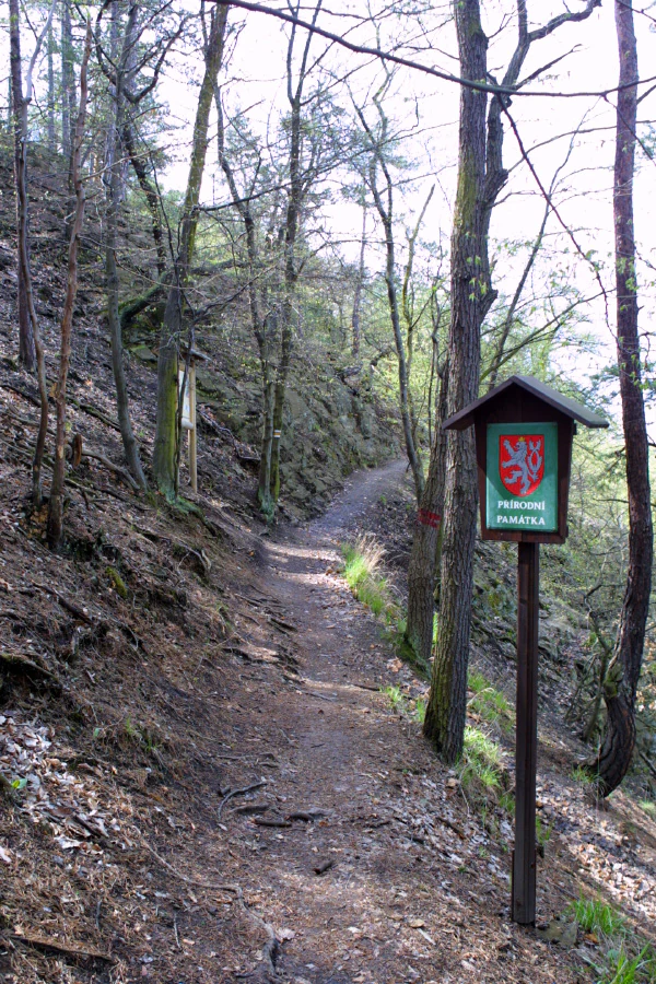
A dirt hiking trail winding through a forest, with a wooden sign featuring the Czech Republic's double-tailed lion emblem on the right.
A narrow hiking trail marking the entrance to a protected natural area near Malochova skalka.

Přírodní park Berounka ecosystems, habitats, and plant life

Přírodní park Berounka encompasses a varied mosaic of habitats typical of Bohemian river-valley landscapes. The core ecological environment is the Berounka River itself and its immediate banks, where aquatic and riparian habitats support species adapted to flowing freshwater, gravel substrates, and seasonally shifting water levels. Riverbank vegetation, including gallery-like bands of trees and shrubs, complements these habitats and connects them to the broader forest cover on the valley slopes.

The forested slopes above the river carry mixed woodland communities, with transitions between drier, rock-associated vegetation on exposed outcrops and more mesic forest in sheltered positions. Rocky habitats host distinctive flora adapted to thin soils and sun-exposed stone surfaces, while shaded rock faces and boulder fields provide refuge for mosses, ferns, and other moisture-loving plants. Tributary valleys add smaller-scale habitats such as springs, moist meadows, and narrow wooded ravines.

Landscape-scale diversity is reinforced by the agricultural mosaic surrounding the river corridor. Fields, meadows, orchards, hedgerows, and village habitats all contribute ecological gradients that connect the more strictly natural sections to the cultural landscape. The park's ecological significance lies less in any single habitat type than in the way these habitats are arranged along the river corridor and its tributaries.
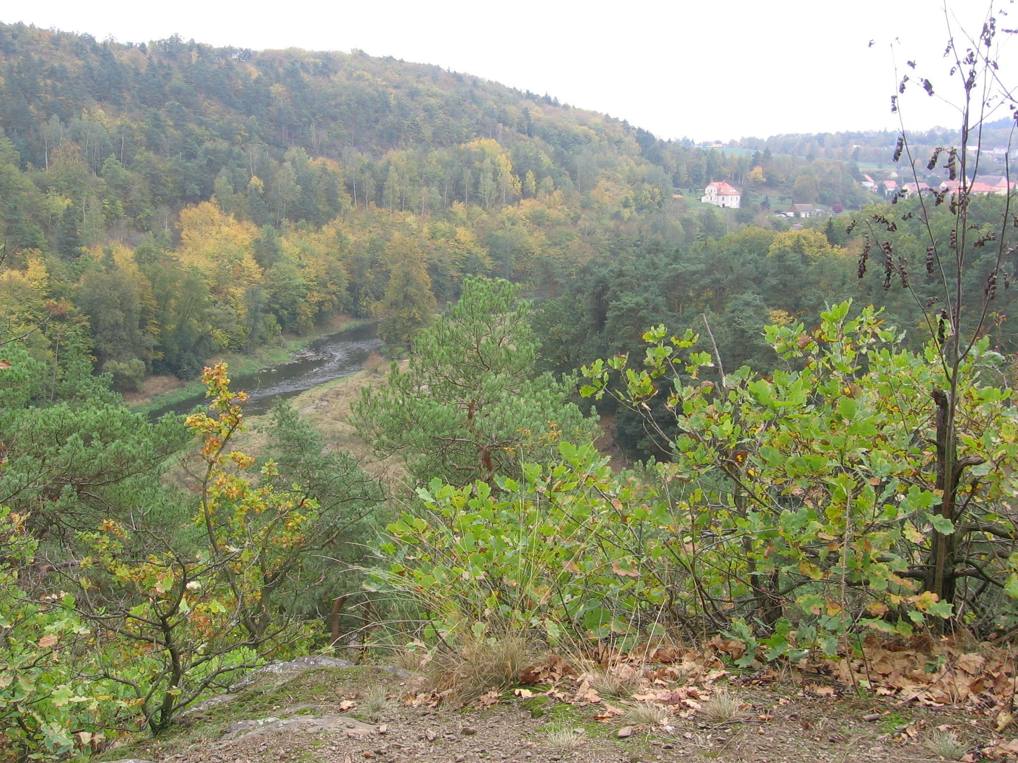
A high angle view of a river valley with forested slopes showing autumn foliage, with a small building visible in the distant hillside.
A view overlooking the Berounka river valley in the Zabela area.

Přírodní park Berounka wildlife and species highlights

The Berounka River and its valley provide habitat for a range of species associated with clean flowing water, forested slopes, and rocky terrain. The river and its banks are home to the Eurasian otter, a species that depends on undisturbed waterways and is among the most notable large mammals in the park. The same general habitat network supports the fire salamander in damp, shaded forest sections, while exposed rock and cliffs provide nesting or roosting sites for the Eurasian eagle-owl, one of the area's most prominent birds of prey.

Wetland and waterside habitats along the river and its tributaries are also important for birds strongly associated with freshwater environments, including the common kingfisher. Reptile life is supported by warm, sun-exposed rocky slopes and clearings within the forest; the rock formations and their associated microhabitats are noted for their reptile populations, including at protected site level in the park's smaller reserves. The mosaic of woodland, field, and settlement adds smaller-scale habitat for common woodland and farmland species.
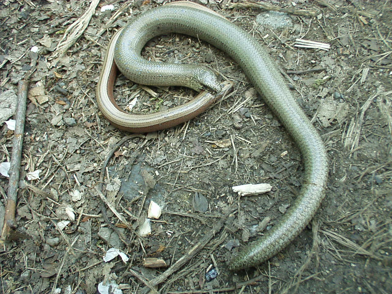
A brown, legless slow worm resting on a dirt ground covered with scattered twigs and leaf debris.
A slow worm, a legless lizard found in the Zabela reserve of the Berounka region.

Přírodní park Berounka conservation status and protection priorities

The primary conservation goal of Přírodní park Berounka is the protection of the landscape character of the upper Berounka valley, defined by the combination of a deeply incised river, forested slopes, rocky outcrops, agricultural land, and culturally significant architecture. As a nature park, it operates within the Czech system of regional protected landscapes, where the emphasis is on preserving scenic, ecological, and cultural values together rather than on strict reserves.

Within the broader park, a layered system of smaller protected areas provides more focused conservation for particular sites. Nature reserves such as Zábělá, Háj, Krašov, and Chlumská stráň, together with natural monuments including Malochova skalka, Kateřina, and Třímanské skály, safeguard habitats and geological features of particular importance, including rock communities, relict flora, reptile habitat, and forest stands. The park is also recognized for supporting species of conservation interest such as the Eurasian otter, the fire salamander, the eagle-owl, and the kingfisher.

By consolidating earlier, partly overlapping natural parks into a single framework, the 2021 designation also strengthened landscape-scale planning for the valley. It allows conservation efforts, visitor management, and habitat protection to be coordinated across district boundaries, supporting the long-term integrity of the river corridor and the ecological processes tied to it.

Přírodní park Berounka cultural meaning and human context

The cultural landscape of Přírodní park Berounka is closely tied to the river valley and to the long history of settlement along the upper Berounka. The villages within the park, including places such as Chrást, Liblín, Zvíkovec, Nadryby, Břasy, Bušovice, Smědčice, Kozojedy, and Kaceřov, form part of the protected landscape character, with their historic architecture considered an integral element of what the park was established to safeguard.

The valley has a layered human history. It carries evidence of mining activity in parts of the region, of agricultural use of the surrounding plateaus, and of cultural figures whose work was inspired by the local landscape. Educational trails within the park link visitors to themes such as the legacy of the painter František Maloch, the work of regional naturalist Bohumil Konečný, and the history of mining in the Břasy area. Together, these features show that the park is conceived not only as a natural landscape but as a long-inhabited cultural corridor whose identity is inseparable from the river that runs through it.

Top sights and standout views in Přírodní park Berounka

Přírodní park Berounka's principal highlight is the long, scenic stretch of the upper Berounka canyon, where forested slopes, rock formations, and small villages trace the river's curve. This river corridor is the park's defining feature and the thread linking its natural and cultural elements.

Supporting highlights include the system of smaller nature reserves and natural monuments nested within the park, such as Zábělá, Háj, Krašov, Chlumská stráň, Malochova skalka, Kateřina, and Třímanské skály, each protecting particular habitats or geological expressions of the valley. Complementing these natural features is a network of thematic hiking and educational trails connecting the river canyon to local history, art, and mining heritage, giving the park both ecological and cultural depth.

Best time to visit Přírodní park Berounka

The upper Berounka valley can be visited throughout much of the year, but the most rewarding seasons are spring and early autumn. In spring, rising water levels, fresh green foliage on the valley slopes, and active birdlife, including species such as the kingfisher along the river, give the landscape a particularly lively character. Early autumn brings stable weather, clear light over the canyon, and warm colors across the mixed forests on the valley slopes.

Summer visits are viable but can be warm in the exposed rocky and agricultural upper sections of the park, while the deeper, forested parts of the canyon remain relatively cool. Winter visits offer quieter conditions and stark scenic contrast along the river valley, though some trails can be slippery on rock and snow-affected slopes. Overall, spring and autumn tend to provide the most balanced combination of comfortable conditions, accessible trails, and strong scenic character.

Monthly climate preview

Long term temperature and precipitation patterns across representative coordinates

Přírodní park Berounka Climate Normals and Monthly Weather Records

Přírodní park Berounka exhibits a recorded annual temperature rhythm ranging from sub-zero winter minimums to warm summer maximums alongside measured monthly precipitation variations. Reviewing the complete twelve-month climate profile provides detailed historical data for understanding long-term environmental patterns at this location.
Annual mean8 °C
-2 °C19 °C
Jan-2°
Feb-1°
Mar
Apr
May13°
Jun17°
Jul19°
Aug19°
Sep14°
Oct
Nov
Dec-1°
Warmest month
July

19.2 °C

Coolest month
January

-2.4 °C

Wettest month
June

2.6 mm/day

Driest month
February

1.1 mm/day

Park location guide

Geography guide, regional context, and park location map for Přírodní park Berounka

Přírodní park Berounka park geography, regions, and map view in Czechia

Understand where Přírodní park Berounka sits in Czechia through a broader geographic reading of the surrounding landscape, nearby location context, and its mapped position within the national park landscape.

How Přírodní park Berounka fits into Czechia

Czech Republic is a landlocked Central European country with a population of approximately 10.9 million people. The nation was established as an independent state on January 1, 1993, following the dissolution of Czechoslovakia. Its capital and largest city is Prague, with other major urban centers including Brno, Ostrava, Plzeň, and Liberec.

Wider geography shaping Přírodní park Berounka in Czechia

The Czech Republic is a landlocked country in Central Europe. It is bordered by Germany to the west, Austria to the south, Poland to the northeast, and Slovakia to the southeast. The landscape is predominantly hilly, with the territory covering 78,871 square kilometers.

Map view of Přírodní park Berounka

Use this park location map to pinpoint Přírodní park Berounka in Czechia, understand its exact geographic position, and read its mapped placement within the surrounding landscape more clearly.

Pigeon | © OpenStreetMap contributors

Location context for Přírodní park Berounka

Plzeňský kraj

Visualizing the river canyon, rocky outcrops, and protected habitats of western Bohemia

Přírodní park Berounka Photos and Landscape Scenery

Visual records reveal the deeply incised river valley, steep forested slopes, and rocky outcrops that define the terrain of Přírodní park Berounka. Examining these protected area views helps researchers and visitors understand the complex topography and scenic character of the Bohemian landscape.

An aerial view of a river bending through a deep, tree-covered valley, with small structures visible on the riverbank and a ruin situated on the forested slope.

Close-up view of vibrant green moss growing in patches on a weathered, light-colored rocky outcrop.

A dirt hiking trail winding through a forest, with a wooden sign featuring the Czech Republic's double-tailed lion emblem on the right.

A high angle view of a river valley with forested slopes showing autumn foliage, with a small building visible in the distant hillside.

A brown, legless slow worm resting on a dirt ground covered with scattered twigs and leaf debris.

Park atlas

Compare adjacent river valleys, forested ridges, and western Bohemian natural landscapes

Explore Other Parks Near Přírodní park Berounka and Surrounding Regional Protected Areas

Continue exploring protected areas near Přírodní park Berounka to examine related regional ecosystems and similar river valley terrain. Comparing adjacent natural landscapes provides broader context for western Bohemian conservation corridors and valley geography.
Natural monumentPlzen Region
About 14 km away#1 closest

Southwest

Malochova skalka Natural Monument: Geographic Profile and Protected Landscape Identity

Unique spilite rock formations in the Plzen Region

Located in the Plzen Region, Malochova skalka is a protected natural monument defined by steep spilite cliffs and rare botanical assemblages. This site offers insight into the complex interaction between volcanic-derived bedrock, river valley topography, and oak-hornbeam forest, serving as a concentrated example of the varied natural terrain found throughout this section of the Czech Republic.

Area
0.015 km²
Established
1970
IUCN
IV
Relief
Upland
A watercolor illustration of a rolling, green landscape with distant, faint hills and small ponds or water bodies in the foreground.
Natural monumentPlzeňský kraj
About 16 km away#2 closest

South

Rokycanská stráň Natural Monument: Geological Exposures and Regional Protected Landscapes

Stratigraphic reference site in the Plzeňský kraj, Czech Republic

Rokycanská stráň represents a key geological protected area situated on the outskirts of Rokycany. The site protects the Klabava Formation stratotype and fossil-rich shales, functioning as a benchmark for Ordovician geology in the Barrandian area. Its four distinct parcels illustrate the interface between urban development and important paleontological research sites in the Plzeň region.

Area
0.208 km²
Established
1981
IUCN
IV
Relief
Upland
A pale, soft watercolor illustration of a green meadow, a winding stream, and gentle, hazy rolling hills in the background.
Natural monumentPlzeň-sever District
About 17 km away#3 closest

West

Malenický pramen: Protected Natural Monument, Mining History, and Forest Geography

A study in mineral-rich hydrology and forested valley restoration

Located in the Plzeň-sever District, Malenický pramen is a site where geology and history intersect to create a distinctive protected habitat. The monument protects an iron-rich spring flowing through a steep forested valley, revealing traces of 19th-century pyrite mining. Its small, layered landscape serves as a focal point for understanding how mining heritage and forest ecology coexist within the broader framework of the Bohemian Massif's natural terrain.

Area
0.002 km²
Established
2010
IUCN
IV
Relief
Upland
A wide watercolor illustration showing a winding river, a line of green trees, and soft rolling hills in pastel green, pink, and purple tones against a white background.
Natural monumentStředočeský kraj
About 20 km away#4 closest

Northeast

Skryjsko-týřovické kambrium: A Scientific Natural Monument and Geological Landmark

Paleontological heritage in the central Bohemian hills.

Skryjsko-týřovické kambrium provides essential protection for fossil-bearing Cambrian strata in the Czech Republic. This landmark, managed as a natural monument within the Středočeský kraj, remains a foundational reference site for international researchers exploring early Paleozoic marine life, characterized by its unique rock outcrops along the Berounka river valley.

Area
0.3 km²
Established
2011
IUCN
IV
Relief
Upland
A soft, light watercolor illustration of a rocky outcrop surrounded by evergreen trees against a hazy, distant mountainous background.
Natural monumentPlzeňský kraj
About 20 km away#5 closest

Southwest

Malesická skála Natural Monument and Geological Heritage in Plzeňský kraj

Protecting rare sedimentary rock formations and oak-pine forest habitats

Malesická skála serves as a significant geological reserve, protecting a unique elliptical rock pillar that reveals the history of Carboniferous stream currents. Visitors can study the complex surface textures formed by iron-bearing cementation, including dramatic rock caps and weathered ledge systems. The surrounding woodland, characterized by an oak-pine bilberry forest, provides an essential natural context for this rare Bohemian landmark.

Established
1974
IUCN
III
Relief
Upland
Climate
Temperate
Natural monumentCentral Bohemian Region
About 23 km away#6 closest

Northeast

Valachov Natural Monument: Geological and Historical Landscape Analysis in Central Bohemia

Mineralogical type locality and industrial-archaeological protected area.

Valachov is a small yet significant natural monument located in the Central Bohemian Region, serving as the primary type locality for the mineral slavíkit. Beyond its mineralogical importance, the hill preserves physical evidence of medieval lead and nineteenth-century pyrite mining, including shafts and adits embedded within a diverse forested ecosystem of the Křivoklátsko protected landscape area.

Area
0.03 km²
Established
1977
IUCN
III
Relief
Upland
A soft watercolor painting of a rolling, hilly landscape with hints of forest, rendered in muted green, pink, and yellow tones on a white background.
Natural monumentCentral Bohemia Region
About 24 km away#7 closest

North

Malý Uran Natural Monument: Protected Rocky Valley Slopes in the Central Bohemia Region

Geological and Botanical Conservation Area

Malý Uran represents a compact but significant natural monument defined by its steep valley slopes and Precambrian bedrock. The site protects a localized juniper habitat flourishing on skeletal soils above the Kosobodský stream, providing a clear example of how rare geological substrates influence regional plant life and landscape structure.

Area
0.159 km²
Established
1996
IUCN
IV
Water
Minor water
A watercolor painting showing a river valley with coniferous trees, rocky riverbanks, and distant rolling hills in a soft, pastel palette.
Protected landscapeCzechia
About 27 km away#8 closest

Northwest

Přírodní park Horní Střela: Protected Landscape and Geography in Czechia

Geological canyons and basalt uplands in western Bohemia

Přírodní park Horní Střela showcases a layered landscape shaped by the Střela River. The area features deep canyons, rocky slate slopes, and characteristic basalt-topped summits that create a diverse ecological mosaic within the Czech landscape.

Area
99.92 km²
Established
1978
Relief
Upland
Climate
Temperate

Common questions about visiting, size, designation, and location context for Přírodní park Berounka

Přírodní park Berounka FAQs for park facts, access, geography, and protected area context

Find quick answers about Přírodní park Berounka, including protected-area facts, park geography, trail and visitor context, and how the park fits into its surrounding country and regional landscape.
MoriAtlas Explorer

Continue Your Protected Areas Search Across the Global Atlas

Deepen your exploration by continuing the structured search for national parks and protected areas worldwide. Utilize the comprehensive filtering capabilities to compare different conservation landscapes and refine your understanding of global park geography. Discover more about the distribution and characteristics of protected natural areas.

Global natural geography