
Mori Atlas logo
Protected landscapePřírodní park Horní Střela

Understanding the geological architecture and river valley geography of this Czech protected area

Přírodní park Horní Střela: A Protected Landscape of Canyons and Basalt Ridges in Western Bohemia

Přírodní park Horní Střela represents a significant protected landscape centered on the deep, meandering valley of the Střela River in western Bohemia. This area offers a complex mosaic of terrain, ranging from cool river canyons cut into phyllitic slates to warm, dry basalt summits like Vladař that host distinct thermophilous vegetation. By tracing these river dynamics and tectonic shifts, the region provides a compelling look at the intersection of geological heritage, historic slate quarrying, and varied forest ecosystems.

nature parkCzech protected landscaperiver canyonStřela river valleybasalt hillsrocky slopes
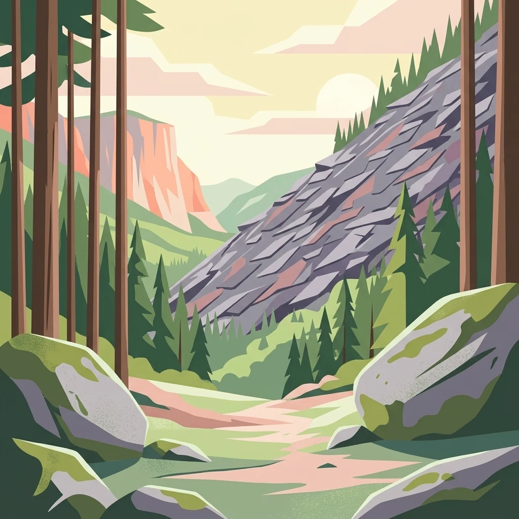
A graphic illustration depicting a forested valley with a rocky slope, tall trees, and large mossy boulders in the foreground under a soft sky.

Přírodní park Horní Střela

Protected landscape

Park overview

Structured park overview, official facts, and landscape profile for Horní Střela Nature Park

Horní Střela Nature Park park facts, protected area profile, and essential visitor context

Review the core facts for Horní Střela Nature Park, including designation, size, terrain, visitor scale, habitats, and operating context in one park-focused overview.

About Horní Střela Nature Park

Horní Střela Nature Park is a regional protected landscape situated in western Bohemia, between the Plzeň and Karlovy Vary regions of the Czech Republic. Although modest in international profile, it is a well-rounded example of how Czech nature parks function: they knit together a distinctive river landscape, ecologically valuable habitats, and an inhabited rural setting whose villages lie inside or along the boundary of the protected area.

Geologically, the park sits on a foundation of very old, weakly metamorphosed slates, including phyllitic, graphitic, and pyrite-rich varieties. These slates were historically exploited as high-quality roofing material; the famous `pokrývačské břidlice` quarried near Rabštejn nad Střelou and Manětín were used on buildings as significant as St. Vitus Cathedral in Prague and Karlštejn Castle, and even exported internationally. The northern flank of the park is touched by magmatic rocks of the Čistecko-Jesenice massif, while the northwestern portion features Tertiary basalt intrusions, the most visible being the flat-topped Vladař hill.

The Střela River is the central artery of the park. Below Chyše it cuts sharply into terrain, forming a pronounced canyon-like valley around Rabštejn nad Střelou. Hydrologically, much of the park drains ultimately to the Berounka River system, with only a small northern portion draining to the Ohře. Smaller tributaries such as the Manětínský potok and Hrádecký potok contribute to the local network of streams, while tectonic lineaments like the Žihelská brázda influence both drainage patterns and the location of characteristic granite rock cities with boulder fields.

Ecologically, the area is a mosaic rather than a single dominant ecosystem. Managed spruce and pine forests cover much of the terrain, but rocky edges preserve relict pine stands, stream corridors carry alder galleries, and patches of original broadleaved trees such as Norway maple, sycamore maple, hornbeam, beech, pedunculate and sessile oak, and small- and large-leaved linden survive locally. On isolated basalt hills one finds the most prized vegetation, including dry-loving and thermophilous communities with species such as entire-leaved cotoneaster, martagon lily, and small scabious.

In terms of human presence, the park is unmistakably a lived-in landscape. Marking villages such as Štichovice, Česká Doubravice, Brdo, Vysočany, Kotaneč, Radotín, Vladořice, Kolešov, Chyše, Podštěly, Žďárek, Tis u Blatna, Žihle, Hluboká, Kalec, Velká Černá Hať, Strážiště, Mladotice, and Křečov define its perimeter, while Rabštejn nad Střelou forms a cultural and historical core at the heart of the protected area. Educational trails including Cesta za pověstí, Rabštejn-Střela, and Sklárna connect these settlements with the park's natural and historical sites, making Horní Střela both a conservation area and a regional recreation landscape.

Quick facts and research context for Horní Střela Nature Park

Horní Střela is a Czech nature park designated in 1978, originally covering about 6,813 hectares in the Plzeň-sever district and expanded in 1997 by roughly 3,179 hectares into the Karlovy Vary district, giving it a present-day area near 9,992 hectares. The park is centered on the Střela River valley and stretches across districts that border the Tepelská vrchovina upland. Its highest point is the basalt hill Vladař at 693 meters, and its lowest point lies along the Střela River near Strážiště at about 346 meters, producing a relief of roughly 350 meters.

Protection and recognition

Terrestrial protected area conservation scope and recognition metrics

Přírodní park Horní Střela Protection Status and Designation Data

Přírodní park Horní Střela maintains a documented terrestrial conservation scope outlining its official protected area status. Regional management metrics and designation records provide structured insight into the landscape framework.

Protection details

Protection scope
Terrestrial
Transboundary protection
No
Park context

Deeper park guide and search-rich context for Horní Střela Nature Park

Horní Střela Nature Park history, landscape, wildlife, and travel context

Explore Horní Střela Nature Park through its history, landscape character, ecosystems, wildlife, conservation priorities, cultural context, and seasonal travel timing in a structured park guide built for atlas discovery and search intent.

Why Horní Střela Nature Park stands out

The park is especially known for the deep, meandering canyon that the Střela River has carved into a landscape of phyllitic slates, and for the contrasting dry, sun-loving plant communities that grow on isolated basalt outcrops such as Vladař. These two ingredients, a cold, shaded river gorge and warm, rocky basalt ridge tops, produce an unusually diverse mosaic of vegetation within a relatively small area. Historical slate quarrying, particularly the production of so-called roofing slates used on major Bohemian landmarks, adds a distinctive cultural layer to the otherwise natural setting.
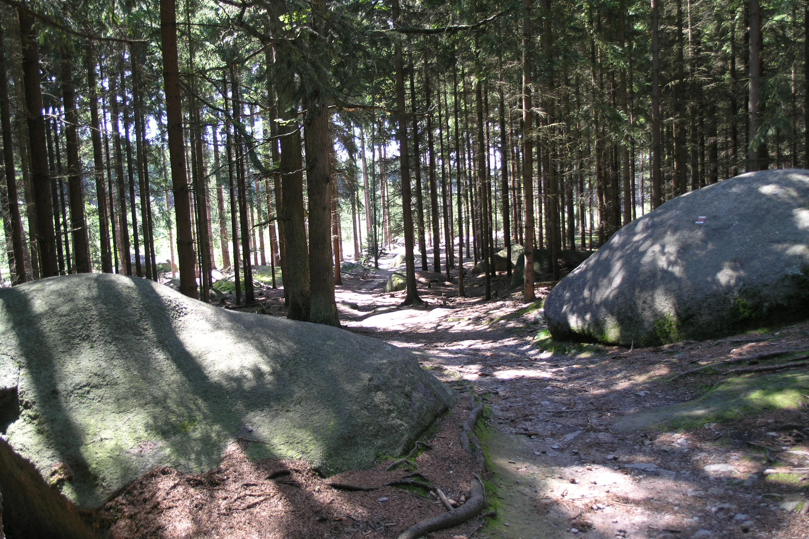
A forest trail winding through a dense coniferous forest, flanked by two large, mossy grey granite boulders in the foreground.
A shaded forest path framed by large granite boulders in Přírodní park Horní Střela.

Horní Střela Nature Park history and protected-area timeline

The area now known as Horní Střela Nature Park was first given protected status in 1978, when it was designated as an area of quiet, an `oblast klidu`, in the Plzeň-sever district. The original declaration covered 6,813 hectares and was focused on the deep, meandering valley of the Střela River and the forested rocky slopes around it.

In 1997, a second protected zone of 3,179 hectares was added on the southeastern margin of the original area in the Karlovy Vary district. Together these two declarations created the present-day park of nearly 9,992 hectares. The two-phase establishment reflects how the park was built outward from its core river valley to embrace adjacent hill landscapes, rather than being planned as a single unified block from the outset.

Beyond formal designation, the region's history is closely tied to its geology. The fine-grained phyllitic slates have been quarried for centuries as roofing material, and historical records connect this production to significant buildings inside and outside the Czech lands. Old quarry sites, such as the slate workings on the southern edge of Rabštejn nad Střelou, remain visible today as part of the broader cultural landscape of the park.

Horní Střela Nature Park landscape and geographic character

The landscape of Horní Střela is shaped above all by the contrast between a deeply incised river valley and a series of rounded, often basalt-capped hills above it. The Střela River has cut a pronounced canyon-like course into phyllitic slates, especially in the stretch below Chyše and around Rabštejn nad Střelou, creating steep, rocky slopes that fall directly into the water.

Above the river, the terrain rises into the Tepelská vrchovina upland. The most distinctive single landform is Vladař, a Tertiary basalt hill reaching 693 meters with a characteristic flat summit, a typical base-rich rocky habitat perched above the surrounding slate landscape. Other significant summits include Kanešův kopec at 633 meters, Jezerský vrch at 589 meters, and Gamberk at 538 meters, while the lowest elevation in the park lies along the Střela near Strážiště at about 346 meters. This relief of roughly 350 meters within a single protected area creates a strong vertical differentiation of microclimates and vegetation.

Along tectonic fault lines, particularly the Žihelská brázda, the geology shifts toward granite, producing small rock cities with prominent boulder fields. The northern edge of the park transitions into magmatic rocks associated with the Čistecko-Jesenice massif, adding further geological variety. Seen together, these elements produce a landscape that feels layered: a cold river canyon at the bottom, gentle forested slopes in the middle, and warm, dry rocky ridges at the top.

Horní Střela Nature Park ecosystems, habitats, and plant life

Ecologically, Horní Střela is best described as a mosaic rather than a uniform habitat. The dominant forest cover consists of managed spruce and pine stands typical of much of the Bohemian uplands, but these managed forests are broken up by more ecologically valuable patches along rocky edges, stream valleys, and isolated basalt hills.

On the rocky slopes and terraces above the river, relict pinewoods survive as small, dry, sun-exposed enclaves. Along the streams, including the Střela itself and its tributaries such as the Manětínský potok and Hrádecký potok, alder galleries line the banks, providing shaded, humid corridors through the otherwise drier landscape. Scattered remnants of original broadleaved woodland persist in places and include Norway maple, sycamore maple, hornbeam, beech, pedunculate oak, sessile oak, and small- and large-leaved lime, contributing to a more diverse canopy than the conifer plantations alone would suggest.

The richest botanical interest, however, lies on isolated basalt hills and rocky outcrops. These areas support thermophilous and subxerophilous plant communities that contrast sharply with the cooler, more acidic substrates elsewhere in the park. This juxtaposition of warm, dry rocky habitats next to cool, humid river gorges, all within a relatively compact area, gives Horní Střela much of its ecological interest

Horní Střela Nature Park wildlife and species highlights

The wildlife profile of Horní Střela is shaped by its mix of forest, rocky slopes, and riverine habitats. Among mammals, ungulates such as red deer are common, wild boar are frequently recorded, and the Střela River supports a notable population of Eurasian otters, reflecting the relatively clean and structurally complex character of the watercourse.

Amphibians and reptiles are well represented thanks to the combination of stream valleys and warmer rocky slopes. Common toad, fire salamander, grass snake, and common European adder are all recorded in the area. Birdlife is also a highlight: the park is noted for its owls and birds of prey, with eagle owl, little owl, tawny owl, and long-eared owl regularly mentioned among the species of interest. This mix of forest interior birds, cliff- and slope-nesting raptors, and river-associated fauna gives the park a varied and ecologically coherent wildlife profile.

Horní Střela Nature Park conservation status and protection priorities

Horní Střela is meaningful from a conservation perspective because it safeguards a relatively compact but unusually varied landscape in western Bohemia. By protecting the deep valley of the Střela River, the surrounding forest mosaic, scattered relict broadleaved stands, and isolated dry rocky habitats on basalt outcrops, the park maintains a diversity of vegetation types that would be hard to preserve in a more uniform forested reserve.

The park also functions as a regional stepping stone and habitat network. The river corridor of the Střela is important for species such as the Eurasian otter, while the rocky slopes and basalt hills support thermophilous communities that are rare in the broader Bohemian forest context. Within the park, smaller protected sites including the Střela Nature Reserve, Vladař Nature Reserve, and the Jezerský vrch and U Báby-U Lomu natural monuments provide tighter protection for specific localities of particular ecological value.

A notable figure is the Nučická lípa, a protected memorial tree that is the only such tree within the park and represents an additional layer of natural heritage. Together, the park and its embedded small-scale reserves protect not only habitats but also individual features of landscape memory, which is consistent with the broader Czech nature park model of integrating nature protection with cultural landscape values.

Horní Střela Nature Park cultural meaning and human context

Although it is a nature park, Horní Střela carries a strong cultural and historical dimension. The most tangible layer is the legacy of slate quarrying. The phyllitic slates quarried around Rabštejn nad Střelou and Manětín were historically used as high-quality roofing material and can be found on major Czech monuments including St. Vitus Cathedral in Prague and Karlštejn Castle, and they were even exported internationally. Abandoned quarry sites, such as the slate workings on the southern edge of Rabštejn nad Střelou, remain visible in the present-day landscape.

Architectural and archaeological heritage is also significant. The small town of Rabštejn nad Střelou sits at the cultural heart of the park, offering both a castle and a chateau among its notable structures. The medieval Church of St. Martin in Strážiště and the Vladař hillfort site, an early Slavic fortified settlement perched on the basalt summit of Vladař, add to the cultural layering of the area. Educational trails such as Cesta za pověstí, Rabštejn-Střela, and Sklárna link these sites into a coherent story of landscape, quarrying, settlement, and legend.

The surrounding villages, from Chyše and Žihle to Mladotice and Křečov, are part of the protected area by design, reflecting the Czech approach in which nature parks serve both biodiversity and the preservation of traditional rural landscapes.

Top sights and standout views in Horní Střela Nature Park

Horní Střela's most distinctive feature is the Střela River canyon around Rabštejn nad Střelou, a dramatic cut through ancient slates that supplies both scenery and ecological contrast within the park. Equally distinctive are the dry, basalt-topped hills such as Vladař, which host unusual thermophilous vegetation found almost nowhere else in the immediate region. The combination of canyon, basalt uplands, granite rock cities along the Žihelská brázda, and inhabited villages encircling the whole area gives the park a layered identity that rewards both casual visitors and more focused naturalists.

The embedded small-scale reserves, including the Střela Nature Reserve, Vladař Nature Reserve, and the Jezerský vrch and U Báby-U Lomu natural monuments, mark the highest-priority ecological zones, while the Nučická lípa protected tree rounds out the natural heritage. Together these elements combine into a compact but content-rich protected landscape that feels more diverse and storied than its relatively modest area would suggest.

Best time to visit Horní Střela Nature Park

Spring and early summer are generally rewarding in Horní Střela, when deciduous trees along the river and in residual broadleaved stands come into leaf, the Střela corridor is at its most atmospheric, and thermophilous plants on the basalt outcrops begin to flower. Late spring and early summer are also favorable for birdwatching, especially owls and raptors associated with the forested slopes and rocky edges.

Late summer and early autumn bring drier conditions that make the dry-loving vegetation on basalt ridges more visible and produce warm, stable weather for hiking between the park's dispersed cultural sites. Winter can be quieter and visually striking, with snow on the canyon slopes and clearer views of the rocky landforms, though visitors should expect shorter days and cooler temperatures in this upland setting. Across the year, the park is best suited to visitors interested in combining moderate hiking with geology, botany, river landscapes, and small-scale cultural heritage.

Monthly climate preview

Long term temperature and precipitation averages for representative coordinates

Přírodní park Horní Střela Climate Normals and Annual Weather Patterns

Representative coordinates record measured monthly temperature swings and daily precipitation averages spanning the entire annual cycle. Detailed twelve month climate statistics provide complete context for long term meteorological patterns across the protected landscape.
Annual mean8 °C
-3 °C19 °C
Jan-3°
Feb-2°
Mar
Apr
May12°
Jun16°
Jul19°
Aug18°
Sep13°
Oct
Nov
Dec-2°
Warmest month
July

18.6 °C

Coolest month
January

-2.8 °C

Wettest month
June

2.5 mm/day

Driest month
February

1.2 mm/day

Park location guide

Geography guide, regional context, and park location map for Horní Střela Nature Park

Horní Střela Nature Park park geography, regions, and map view in Czechia

Understand where Horní Střela Nature Park sits in Czechia through a broader geographic reading of the surrounding landscape, nearby location context, and its mapped position within the national park landscape.

How Horní Střela Nature Park fits into Czechia

Czech Republic is a landlocked Central European country with a population of approximately 10.9 million people. The nation was established as an independent state on January 1, 1993, following the dissolution of Czechoslovakia. Its capital and largest city is Prague, with other major urban centers including Brno, Ostrava, Plzeň, and Liberec.

Wider geography shaping Horní Střela Nature Park in Czechia

The Czech Republic is a landlocked country in Central Europe. It is bordered by Germany to the west, Austria to the south, Poland to the northeast, and Slovakia to the southeast. The landscape is predominantly hilly, with the territory covering 78,871 square kilometers.

Map view of Horní Střela Nature Park

Use this park location map to pinpoint Horní Střela Nature Park in Czechia, understand its exact geographic position, and read its mapped placement within the surrounding landscape more clearly.

Pigeon | © OpenStreetMap contributors

Explore visual documentation of the river valley, rocky slopes, and protected habitats across western Bohemia.

Přírodní park Horní Střela Photos and Landscapes: Visualizing the River Canyon and Basalt Hills

Visual documentation captures the dramatic contrast between the deep Střela River canyon and sun-warmed basalt summits across the protected landscape. Examining these field photographs reveals the varied terrain, forest communities, and geological formations that define the region.

A forest trail winding through a dense coniferous forest, flanked by two large, mossy grey granite boulders in the foreground.

A steep embankment covered in loose, flat dark grey slate fragments, with a single green spruce tree growing on the right side.

Park atlas

Compare regional geography, river valleys, and nearby protected areas across western Bohemia

Explore Other Parks Near Přírodní park Horní Střela and Surrounding Protected Landscapes

Continue geographic discovery by comparing Přírodní park Horní Střela with adjacent protected areas and river valley reserves throughout the surrounding region. Examining connected terrain units provides deeper context into regional geology, basalt uplands, and woodland ecosystems.
Natural monumentKarlovy Vary District
About 12 km away#1 closest

North

Valečské sklepy Natural Monument and Protected Bat Hibernation Site in Karlovy Vary

Volcanic terrain and critical wildlife infrastructure in western Bohemia

Valečské sklepy represents a unique form of protected landscape in the Karlovy Vary District, where historical underground cellars function as a specialized natural monument. The site maintains a crucial role as a winter hibernation refuge for the critically endangered western barbastelle, embedded within the volcanic geomorphology of the Doupovské hory region.

Established
2016
IUCN
III
Relief
Mountain
Climate
Temperate
Natural monumentKarlovarský kraj
About 13 km away#2 closest

Northwest

Valeč Natural Monument: Geologic and Ecological Landscapes in the Karlovarský kraj

Tracing volcanic terrain and fossil sites in the Doupovské Hory

Valeč Natural Monument offers a deep look into the volcanic geology and protected wilderness of western Bohemia. Known for its historical paleontological finds and diverse forest cover, this landscape provides an essential case study for mineralogical research and habitat preservation within the wider regional geography.

Area
5.436 km²
Established
1992
IUCN
IV
Relief
Mountain
Natural monumentÚstí nad Labem Region
About 13 km away#3 closest

North

Vrbina u Nové Vsi Natural Monument: Protected Habitat Mapping and Geographic Overview

Wetland and meadow conservation in the Ústí nad Labem Region

Vrbina u Nové Vsi provides a deep look into the habitat mosaic of the Doupov Mountains foothills. This protected area stands out for its concentrated distribution of ten distinct biotopes, ranging from wet alder woodlands to orchid-rich meadows, providing a comprehensive example of lowland conservation within a larger volcanic terrain context.

Area
0.113 km²
Established
2016
IUCN
IV
Relief
Upland
A soft watercolor painting of a rolling, hilly landscape with hints of forest, rendered in muted green, pink, and yellow tones on a white background.
Natural monumentCentral Bohemia Region
About 16 km away#4 closest

East

Malý Uran Natural Monument: Protected Rocky Valley Slopes in the Central Bohemia Region

Geological and Botanical Conservation Area

Malý Uran represents a compact but significant natural monument defined by its steep valley slopes and Precambrian bedrock. The site protects a localized juniper habitat flourishing on skeletal soils above the Kosobodský stream, providing a clear example of how rare geological substrates influence regional plant life and landscape structure.

Area
0.159 km²
Established
1996
IUCN
IV
Water
Minor water
A pale, soft watercolor illustration of a green meadow, a winding stream, and gentle, hazy rolling hills in the background.
Natural monumentPlzeň-sever District
About 17 km away#5 closest

South

Malenický pramen: Protected Natural Monument, Mining History, and Forest Geography

A study in mineral-rich hydrology and forested valley restoration

Located in the Plzeň-sever District, Malenický pramen is a site where geology and history intersect to create a distinctive protected habitat. The monument protects an iron-rich spring flowing through a steep forested valley, revealing traces of 19th-century pyrite mining. Its small, layered landscape serves as a focal point for understanding how mining heritage and forest ecology coexist within the broader framework of the Bohemian Massif's natural terrain.

Area
0.002 km²
Established
2010
IUCN
IV
Relief
Upland
A soft, painterly watercolor illustration of a rolling green landscape with distant hills, grassy meadows, and patches of trees.
Protected landscapeChomutov District
About 20 km away#6 closest

North

Doupovská pahorkatina Nature Park: Mapped Geography and Protected Landscape Features

Upland volcanic terrain and steppe grasslands in Czech Republic.

Doupovská pahorkatina Nature Park protects a significant stretch of forest-steppe mosaics and rolling volcanic terrain in the southwestern part of the Chomutov District. This area stands out for its high density of dry grassland communities and wetland pockets along the Liboc river, providing a critical study of transitional geomorphology between the Doupov Mountains and the Žatecká pánev basin.

Area
47.7 km²
Established
1996
A minimalist watercolor painting depicting rolling hills and a meadow landscape in soft shades of green and pink.
Natural monumentÚstí nad Labem Region
About 22 km away#7 closest

Northeast

Soběchlebské terasy Natural Monument: Geography and Protected Ravine Landscapes

Regional protected area analysis in the Ústí nad Labem Region

Soběchlebské terasy is a specialized natural monument situated in the Louny district, protecting a deep, narrow stream valley carved by the Černocký stream. The landscape is characterized by its steep, terraced woodland slopes, providing an essential thermophilic environment for rare orchids and oak-dominated forest fragments within the northwestern Czech Republic.

Area
0.026 km²
Established
2011
IUCN
IV
Relief
Upland
Natural monumentKarlovarský kraj
About 26 km away#8 closest

West

Viklan Natural Monument: A Geological Landmark in the Karlovarský kraj Landscape

Exploring the historic balancing granite boulder and surrounding pastoral terrain

Viklan functions as a compact yet iconic natural monument, shielding a prominent 3.5 meter granite boulder from modern disturbance. Set amidst the rolling, short-grass pastures of the Karlovarský kraj, the site serves as a vital point for geological mapping and historical study, documenting both natural weathering processes and long-standing regional folklore tied to this unusual stone formation.

Established
1979
IUCN
III
Relief
Upland
Access
Easy access

Common questions about visiting, size, designation, and location context for Horní Střela Nature Park

Horní Střela Nature Park FAQs for park facts, access, geography, and protected area context

Find quick answers about Horní Střela Nature Park, including protected-area facts, park geography, trail and visitor context, and how the park fits into its surrounding country and regional landscape.
MoriAtlas Explorer

Continue Your Protected Areas Search Across the Global Atlas

Deepen your exploration by continuing the structured search for national parks and protected areas worldwide. Utilize the comprehensive filtering capabilities to compare different conservation landscapes and refine your understanding of global park geography. Discover more about the distribution and characteristics of protected natural areas.

Global natural geography