Mori Atlas logo
Nearby park discovery

Regional mapping and geographic analysis of surrounding protected land corridors

Protected Areas and Natural Landscapes Situated Near Přírodní park Berounka

Explore the collection of protected natural areas surrounding the river valley and forest mosaic of Přírodní park Berounka. This data provides geographic context for understanding the distribution of protected landscapes across the Plzeňský kraj region and adjacent terrain. Examine relative locations and regional clusters of conservation land to understand the broader connectivity of the local riverine and agricultural geography.

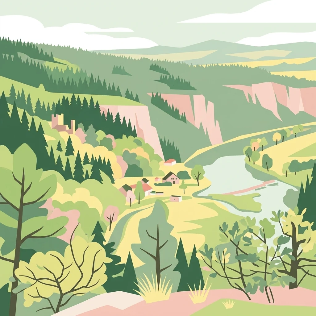
A flat-style digital illustration showing a winding river flowing through a lush green valley with coniferous trees, rocky cliffs, and a small group of village buildings.

A protected landscape corridor along the upper Berounka River valley in western Bohemia.

Přírodní park Berounka

Přírodní park Berounka is a large protected landscape area in the Czech Republic that follows the upper course of the Berounka River through parts of the Plzeň-město, Plzeň-sever, and Rokycany districts of western Bohemia. Established by the Plzeň Region in 2021, it merged and replaced the earlier Horní Berounka and Hřešihlavská natural parks that had occupied overlapping stretches of the same river corridor. The park protects a deeply incised river valley defined by rocky outcrops, forested slopes, and a mosaic of farmland and historic villages. Its purpose is to preserve the scenic character, natural value, and cultural identity of this landscape rather than to create a strict wilderness reserve. Within the park, several smaller nature reserves and natural monuments safeguard particularly important habitats and geological features. The river valley, its tributaries, and the surrounding countryside form the backbone of the park, supporting diverse plant and animal life while also hosting an extensive network of hiking trails and educational paths. The combination of dramatic canyon scenery, accessible trails, and proximity to the city of Plzeň makes the park a significant regional landscape and a meaningful protected area in the Czech system of natural parks.

Location
Czechia
Park type
Protected landscape
Established
2021
Area
131 km²
Přírodní park Berounka Protected Landscape Map
Regional park map

See the ranked park cluster in its geographic setting

Nearby parks around Přírodní park Berounka

This regional map shows the same 20 nearby parks ranked below around Přírodní park Berounka. Select a ranked marker to highlight that park’s boundary where boundary data is available.
Reference park: Přírodní park BerounkaRanked nearby park20 nearby parks shown
20 nearby parks

Distance separation and regional environmental comparison across surrounding terrain

Geographically Ranked Protected Areas and Parks Near Přírodní park Berounka

Geographic proximity metrics organize surrounding protected areas by linear separation from Přírodní park Berounka to establish structured regional comparison signals. Recorded environmental attributes and country context outline broader landscape patterns without implying shared habitats or direct travel routes.
Natural monumentPlzen Region
About 14 km away#1 closest

Southwest

Malochova skalka Natural Monument: Geographic Profile and Protected Landscape Identity

Unique spilite rock formations in the Plzen Region

Located in the Plzen Region, Malochova skalka is a protected natural monument defined by steep spilite cliffs and rare botanical assemblages. This site offers insight into the complex interaction between volcanic-derived bedrock, river valley topography, and oak-hornbeam forest, serving as a concentrated example of the varied natural terrain found throughout this section of the Czech Republic.

Area
0.015 km²
Established
1970
IUCN
IV
Relief
Upland
A watercolor illustration of a rolling, green landscape with distant, faint hills and small ponds or water bodies in the foreground.
Natural monumentPlzeňský kraj
About 16 km away#2 closest

South

Rokycanská stráň Natural Monument: Geological Exposures and Regional Protected Landscapes

Stratigraphic reference site in the Plzeňský kraj, Czech Republic

Rokycanská stráň represents a key geological protected area situated on the outskirts of Rokycany. The site protects the Klabava Formation stratotype and fossil-rich shales, functioning as a benchmark for Ordovician geology in the Barrandian area. Its four distinct parcels illustrate the interface between urban development and important paleontological research sites in the Plzeň region.

Area
0.208 km²
Established
1981
IUCN
IV
Relief
Upland
A pale, soft watercolor illustration of a green meadow, a winding stream, and gentle, hazy rolling hills in the background.
Natural monumentPlzeň-sever District
About 17 km away#3 closest

West

Malenický pramen: Protected Natural Monument, Mining History, and Forest Geography

A study in mineral-rich hydrology and forested valley restoration

Located in the Plzeň-sever District, Malenický pramen is a site where geology and history intersect to create a distinctive protected habitat. The monument protects an iron-rich spring flowing through a steep forested valley, revealing traces of 19th-century pyrite mining. Its small, layered landscape serves as a focal point for understanding how mining heritage and forest ecology coexist within the broader framework of the Bohemian Massif's natural terrain.

Area
0.002 km²
Established
2010
IUCN
IV
Relief
Upland
A wide watercolor illustration showing a winding river, a line of green trees, and soft rolling hills in pastel green, pink, and purple tones against a white background.
Natural monumentStředočeský kraj
About 20 km away#4 closest

Northeast

Skryjsko-týřovické kambrium: A Scientific Natural Monument and Geological Landmark

Paleontological heritage in the central Bohemian hills.

Skryjsko-týřovické kambrium provides essential protection for fossil-bearing Cambrian strata in the Czech Republic. This landmark, managed as a natural monument within the Středočeský kraj, remains a foundational reference site for international researchers exploring early Paleozoic marine life, characterized by its unique rock outcrops along the Berounka river valley.

Area
0.3 km²
Established
2011
IUCN
IV
Relief
Upland
A soft, light watercolor illustration of a rocky outcrop surrounded by evergreen trees against a hazy, distant mountainous background.
Natural monumentPlzeňský kraj
About 20 km away#5 closest

Southwest

Malesická skála Natural Monument and Geological Heritage in Plzeňský kraj

Protecting rare sedimentary rock formations and oak-pine forest habitats

Malesická skála serves as a significant geological reserve, protecting a unique elliptical rock pillar that reveals the history of Carboniferous stream currents. Visitors can study the complex surface textures formed by iron-bearing cementation, including dramatic rock caps and weathered ledge systems. The surrounding woodland, characterized by an oak-pine bilberry forest, provides an essential natural context for this rare Bohemian landmark.

Established
1974
IUCN
III
Relief
Upland
Climate
Temperate
Natural monumentCentral Bohemian Region
About 23 km away#6 closest

Northeast

Valachov Natural Monument: Geological and Historical Landscape Analysis in Central Bohemia

Mineralogical type locality and industrial-archaeological protected area.

Valachov is a small yet significant natural monument located in the Central Bohemian Region, serving as the primary type locality for the mineral slavíkit. Beyond its mineralogical importance, the hill preserves physical evidence of medieval lead and nineteenth-century pyrite mining, including shafts and adits embedded within a diverse forested ecosystem of the Křivoklátsko protected landscape area.

Area
0.03 km²
Established
1977
IUCN
III
Relief
Upland
A soft watercolor painting of a rolling, hilly landscape with hints of forest, rendered in muted green, pink, and yellow tones on a white background.
Natural monumentCentral Bohemia Region
About 24 km away#7 closest

North

Malý Uran Natural Monument: Protected Rocky Valley Slopes in the Central Bohemia Region

Geological and Botanical Conservation Area

Malý Uran represents a compact but significant natural monument defined by its steep valley slopes and Precambrian bedrock. The site protects a localized juniper habitat flourishing on skeletal soils above the Kosobodský stream, providing a clear example of how rare geological substrates influence regional plant life and landscape structure.

Area
0.159 km²
Established
1996
IUCN
IV
Water
Minor water
A watercolor painting showing a river valley with coniferous trees, rocky riverbanks, and distant rolling hills in a soft, pastel palette.
Protected landscapeCzechia
About 27 km away#8 closest

Northwest

Přírodní park Horní Střela: Protected Landscape and Geography in Czechia

Geological canyons and basalt uplands in western Bohemia

Přírodní park Horní Střela showcases a layered landscape shaped by the Střela River. The area features deep canyons, rocky slate slopes, and characteristic basalt-topped summits that create a diverse ecological mosaic within the Czech landscape.

Area
99.92 km²
Established
1978
Relief
Upland
Climate
Temperate
A horizontal watercolor illustration depicting rolling green hills, scattered trees, and foreground flowers with soft mountains in the distance.
Nature reserveStředočeský kraj
About 32 km away#9 closest

East

Na horách Nature Reserve: Geographic Context and Protected Landscape Discovery

Středočeský kraj, Czech Republic

Na horách serves as a protected landmark for thermophilous vegetation within the Brdy Highlands. This nature reserve provides a clear window into how skeletal soils and historic land management sustain unique dry-grassland plant assemblages across a sloping, varied Bohemian terrain.

Area
0.049 km²
Established
1997
IUCN
IV
Relief
Upland
Natural monumentCzechia
About 35 km away#10 closest

East

Vinice Natural Monument: Geological Heritage and Cambrian Stratigraphy in Central Czechia

Protected xeric woodlands and ancient marine sedimentary records

Vinice serves as a vital protected area in the Příbram district, safeguarding one of the world's most important Cambrian fossil sites. Its steep, south-facing slope above the Litavka River offers a visual map of geological history, where exposed rock sequences meet diverse forest and grassland habitats. This site remains a key reference for understanding Bohemian natural heritage and the long-term evolution of local terrain.

Area
0.423 km²
Established
1999
Relief
Upland
Climate
Temperate
A minimalist watercolor painting depicting rolling hills and a meadow landscape in soft shades of green and pink.
Natural monumentÚstí nad Labem Region
About 36 km away#11 closest

North

Soběchlebské terasy Natural Monument: Geography and Protected Ravine Landscapes

Regional protected area analysis in the Ústí nad Labem Region

Soběchlebské terasy is a specialized natural monument situated in the Louny district, protecting a deep, narrow stream valley carved by the Černocký stream. The landscape is characterized by its steep, terraced woodland slopes, providing an essential thermophilic environment for rare orchids and oak-dominated forest fragments within the northwestern Czech Republic.

Area
0.026 km²
Established
2011
IUCN
IV
Relief
Upland
Natural monumentKarlovy Vary District
About 38 km away#12 closest

Northwest

Valečské sklepy Natural Monument and Protected Bat Hibernation Site in Karlovy Vary

Volcanic terrain and critical wildlife infrastructure in western Bohemia

Valečské sklepy represents a unique form of protected landscape in the Karlovy Vary District, where historical underground cellars function as a specialized natural monument. The site maintains a crucial role as a winter hibernation refuge for the critically endangered western barbastelle, embedded within the volcanic geomorphology of the Doupovské hory region.

Established
2016
IUCN
III
Relief
Mountain
Climate
Temperate
A soft, painterly watercolor illustration of a wetland scene with gentle green fields, faint distant hills, and low-growing vegetation in the foreground against a white background.
Natural monumentStředočeský kraj
About 38 km away#13 closest

Northeast

Na Novém rybníce Natural Monument: Wetland Geography and Protected Area Atlas

A diverse protected mosaic of meadows and pond basins

Examine the detailed landscape of Na Novém rybníce, an ecologically rich natural monument in the Středočeský kraj. This protected area showcases a compact assemblage of pond, reed marsh, and rare fen meadow vegetation that illustrates the unique character of lowland Bohemian wetlands.

Area
0.054 km²
Established
1990
IUCN
III
Relief
Lowland
Natural monumentÚstí nad Labem Region
About 39 km away#14 closest

Northwest

Vrbina u Nové Vsi Natural Monument: Protected Habitat Mapping and Geographic Overview

Wetland and meadow conservation in the Ústí nad Labem Region

Vrbina u Nové Vsi provides a deep look into the habitat mosaic of the Doupov Mountains foothills. This protected area stands out for its concentrated distribution of ten distinct biotopes, ranging from wet alder woodlands to orchid-rich meadows, providing a comprehensive example of lowland conservation within a larger volcanic terrain context.

Area
0.113 km²
Established
2016
IUCN
IV
Relief
Upland
Natural monumentKarlovarský kraj
About 40 km away#15 closest

Northwest

Valeč Natural Monument: Geologic and Ecological Landscapes in the Karlovarský kraj

Tracing volcanic terrain and fossil sites in the Doupovské Hory

Valeč Natural Monument offers a deep look into the volcanic geology and protected wilderness of western Bohemia. Known for its historical paleontological finds and diverse forest cover, this landscape provides an essential case study for mineralogical research and habitat preservation within the wider regional geography.

Area
5.436 km²
Established
1992
IUCN
IV
Relief
Mountain
A horizontal watercolor painting showing rolling green hills, scattered trees, and soft mountain silhouettes in the distance against a white background.
Protected landscapePlzeňský kraj
About 40 km away#16 closest

South

Přírodní park Buková hora, Chýlava: Geographic Atlas and Protected Landscape Overview

Forested uplands and industrial heritage in western Bohemia.

Focusing on the 28 square kilometer expanse of Přírodní park Buková hora, Chýlava, this overview details the park's acidophilous oak forests, sedimentary bedrock, and inclusion of the Chejlava National Nature Reserve. Understand the site's role as a protected upland framed by the Úslava watershed and historic mining settlements in the Plzeňský kraj region.

Area
28 km²
Established
1983
Relief
Upland
Climate
Temperate
A soft, light-toned watercolor painting depicting a green, hilly landscape with a winding path in the foreground.
Protected landscapeStředočeský kraj
About 43 km away#17 closest

North

Přírodní park Džbán: Geography and Protected Landscape Analysis of the Džbán Ridge

Forested highland and hydrological center of Středočeský kraj

Přírodní park Džbán encompasses a significant Cretaceous plateau and mixed-woodland system that functions as a triple watershed for three major river basins. The park preserves a rich mosaic of thermophilic plants and woodland fauna while maintaining the characteristic opuka geological features that define the vernacular architecture of this central Bohemian region.

Area
416 km²
Established
1994
Relief
Upland
Climate
Temperate
Watercolor painting of a rolling Czech landscape featuring meadow flowers in the foreground, forest in the midground, and distant hazy hills.
Natural monumentStředočeský kraj
About 45 km away#18 closest

Northeast

Markův mlýn Natural Monument: Exploring the Geography and Protected Flora of Central Bohemia

A rare botanical reserve featuring unique rock-steppe plant communities

Markův mlýn is a protected natural monument situated in the Středočeský kraj region, characterized by its rare combination of dry, thin-soil hillside meadows and stream-influenced valley terrain. The area serves as a critical habitat for specialized steppe flora, including the protected Bohemian pasqueflower. This record offers a detailed look at the site's compact geography and the specific environmental conditions that sustain its unusual plant communities.

Area
0.001 km²
Established
1987
IUCN
III
Relief
Lowland
A watercolor illustration of a rolling forest landscape with soft green ridgelines and hazy, pale hills in the background.
Protected landscapeCentral Bohemian Region
About 45 km away#19 closest

East

Přírodní park Hřebeny: Geographic Overview of the Central Bohemian Forested Ridge

Mapped protected landscape and regional upland terrain

Analyze the territorial structure of Přírodní park Hřebeny, a vast protected area in the Czech Republic covering 184 square kilometers. This detailed overview covers the park's ridgeline geography, forested composition including beech and mixed stands, and its strategic placement within the broader landscape of the Central Bohemian Region.

Area
184 km²
Established
2009
Relief
Mountain
Climate
Temperate
A soft, painterly watercolor illustration of a rolling green landscape with distant hills, grassy meadows, and patches of trees.
Protected landscapeChomutov District
About 46 km away#20 closest

Northwest

Doupovská pahorkatina Nature Park: Mapped Geography and Protected Landscape Features

Upland volcanic terrain and steppe grasslands in Czech Republic.

Doupovská pahorkatina Nature Park protects a significant stretch of forest-steppe mosaics and rolling volcanic terrain in the southwestern part of the Chomutov District. This area stands out for its high density of dry grassland communities and wetland pockets along the Liboc river, providing a critical study of transitional geomorphology between the Doupov Mountains and the Žatecká pánev basin.

Area
47.7 km²
Established
1996
Distance methodology

Geographic measurements, not driving distances

How nearby park distances are calculated

Distances use park boundaries whenever the available geometry allows it. When one or both boundaries are missing, the mapped park locations provide a clearly labelled estimate. Every value represents straight-line geographic separation and does not use roads or routing.

Boundary distance

Calculated between the nearest points of both park boundaries.

Location-to-boundary estimate

Estimated from one mapped park location to the nearest boundary of the other park.

Mapped-location estimate

Estimated between the mapped locations of both parks.

MoriAtlas Explorer

Explore the Mapped Geography and Protected Landscapes of Přírodní park Berounka

Deepen your understanding of Přírodní park Berounka by examining its river valley structure, rocky outcrops, and riparian habitats. MoriAtlas provides a focused view into the geography of this essential western Bohemian protected area, connecting the river corridor to its surrounding regional context.