
Mori Atlas logo
Nature reserveRéserve naturelle nationale de la frayère d'Alose

Examining the ecological geography and riverbed dynamics of this essential Garonne migratory fish site

Réserve naturelle nationale de la frayère d'Alose: Protected River Landscapes and Spawning Habitats

(Réserve naturelle nationale de la frayère d'Alose (RNN52))

The Réserve naturelle nationale de la frayère d'Alose preserves a precisely bounded stretch of the Garonne River in southwestern France. As a dedicated nature reserve, it safeguards the gravel beds and varying current zones that facilitate the spawning of the allis shad, alongside populations of sturgeon and lamprey. This site functions as a long-term scientific reference for monitoring migratory fish communities within an intensively managed river environment.

national nature reserveriver reserveGaronne rivermigratory fishallis shad spawning groundfreshwater habitat
A flat-style digital illustration depicting a rocky canyon with multiple cascading waterfalls, surrounded by a coniferous forest under a soft sun.

Réserve naturelle nationale de la frayère d'Alose

Nature reserve

Park overview

Structured park overview, official facts, and landscape profile for Réserve naturelle nationale de la frayère d'Alose

Réserve naturelle nationale de la frayère d'Alose park facts, protected area profile, and essential visitor context

Review the core facts for Réserve naturelle nationale de la frayère d'Alose, including designation, size, terrain, visitor scale, habitats, and operating context in one park-focused overview.

About Réserve naturelle nationale de la frayère d'Alose

The Réserve naturelle nationale de la frayère d'Alose is a small but ecologically focused national nature reserve on the Garonne river in southwestern France. Created in 1981, it represents a targeted French conservation response to the dramatic decline of the allis shad, a migratory fish species that once ascended rivers across western Europe to spawn in fresh water but whose populations have collapsed in modern times, leaving France as the country hosting the largest remaining wild populations.

Spatially, the reserve is unusually precise. It does not protect a broad landscape, a forest massif, or a mountainous zone. Instead, it safeguards a precisely delineated segment of the Garonne between two fixed landmarks, from about 800 meters upstream of the historic Pont de Pierre at Agen downstream to the upstream end of the Agen pont-canal. Lateral boundaries coincide with the river itself and explicitly exclude the riverbanks (berges) and the riparian woodland (ripisylve), concentrating protection on the aquatic habitat where shad reproduction occurs.

This narrow but strategically placed protection zone was chosen because of the combination of riverbed substrates, depths, and current patterns that make this part of the Garonne particularly favorable to shad spawning. By keeping these habitat conditions undisturbed, the reserve has, since its creation, supported a gradual recolonization of upstream stretches of the Garonne by spawning aloses, contributing to the recovery of the species along a corridor that extends toward the hydroelectric and nuclear installations of Golfech.

Beyond its shad-specific mission, the reserve also hosts about twenty other fish species and typical riverbank birdlife, and over time it has become a key monitoring site for the Garonne's larger migratory fish communities, including sturgeon and lamprey. It is administered by a dedicated local association, the Association Gestion Frayère d'Alose, working within the broader French national nature reserves framework and IUCN category IV.

Quick facts and research context for Réserve naturelle nationale de la frayère d'Alose

The Réserve naturelle nationale de la frayère d'Alose is a national nature reserve located in the Lot-et-Garonne department, in the Nouvelle-Aquitaine region of southwestern France. It occupies a section of the Garonne river between Agen and Le Passage, covering roughly 48 hectares of water surface over approximately 2.31 kilometers of watercourse, from 800 meters upstream of the Pont de Pierre to the Agen pont-canal.

Created by decree on 13 May 1981 and modified by a further decree on 26 August 1986, the reserve is administered by the Association Gestion Frayère d'Alose and classified as a national nature reserve (Réserve naturelle nationale) under the French protected-areas system. Its perimeter matches that of the ZNIEFF type I site known as the frayère d'Alose d'Agen, and the site plays a central role in monitoring migratory fish populations in the Agen, Golfech, and Lamagistère stretch of the Garonne.

Protection and recognition

Examine terrestrial protection metrics and official database registry records

Protection Status and Official Designation Details for Réserve naturelle nationale de la frayère d'Alose

Terrestrial protection status and formal registry metrics outline the conservation framework assigned to Réserve naturelle nationale de la frayère d'Alose. Structured database records provide verifiable baseline parameters for tracking official protected area designations.

Protection details

Protection scope
Terrestrial
Transboundary protection
No
WDPA ID
106714
Park context

Deeper park guide and search-rich context for Réserve naturelle nationale de la frayère d'Alose

Réserve naturelle nationale de la frayère d'Alose history, landscape, wildlife, and travel context

Explore Réserve naturelle nationale de la frayère d'Alose through its history, landscape character, ecosystems, wildlife, conservation priorities, cultural context, and seasonal travel timing in a structured park guide built for atlas discovery and search intent.

Why Réserve naturelle nationale de la frayère d'Alose stands out

The reserve is best known as one of the last major protected spawning grounds for Grande alose, the allis shad, on the Garonne river. In the early 1980s the site was one of the few remaining French strongholds for natural reproduction of this anadromous migratory species, and preserving that habit is the principal reason the reserve was created. The site is also recognized as a reference area for monitoring the broader status of large migratory fish in the Garonne, including sturgeon and lamprey. The combination of varied riverbed substrates and current patterns along this stretch of the Garonne is the ecological foundation that gives the reserve its distinctive conservation identity.
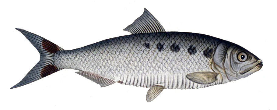
Scientific illustration of an Allis shad fish on a plain white background, showing its silver scales and distinctive row of dark spots along its side.
An illustration of the Allis shad, a species protected by the Réserve naturelle nationale de la frayère d'Alose.

Réserve naturelle nationale de la frayère d'Alose history and protected-area timeline

The reserve's establishment in 1981 was a direct response to the fragile conservation status of the allis shad, a fish that was historically abundant across the Garonne but whose reproductive populations had by the late twentieth century shrunk to a few functional zones. France emerged as the only European country hosting significant remaining populations, even as those populations continued to decline.

The decision to create a dedicated national nature reserve along this specific reach of the Garonne reflected two converging concerns: the need to protect the most ecologically valuable shad spawning grounds from further degradation, and the recognition that without protected refuge zones, the species' reproduction in the wild could be lost entirely in this part of its range. The original protection decree was issued on 13 May 1981, with a subsequent revision on 26 August 1986 adjusting the regulatory framework around the reserve.

After designation, the reserve functioned both as a conservation unit and as a scientific reference site. Long-term monitoring of alose populations on the protected stretch has provided essential data on the species' dynamics in the Garonne system, particularly within the Agen, Golfech, and Lamagistère corridor. In recent years, monitoring has revealed a sharply declining trend in shad numbers, prompting ongoing discussion about expanding the perimeter or refocusing protection to address new challenges facing migratory fish such as sturgeon and lamprey.

The reserve's management has been entrusted from the outset to the Association Gestion Frayère d'Alose, a structure dedicated specifically to safeguarding the site's ecological function. This continuity of local stewardship has helped maintain the reserve's role as both a practical conservation tool and a benchmark site for migratory fish research in France.

Réserve naturelle nationale de la frayère d'Alose landscape and geographic character

The reserve's landscape is fundamentally an aquatic one, defined by a short but ecologically rich stretch of the Garonne, the great river that flows from the Pyrenees through southwestern France toward the Atlantic. Within the reserve's perimeter, the river displays the kind of variability that large lowland European rivers commonly show when left in a near-natural state: alternating zones of gravel, sand, and finer sediments, varying depths, and a mosaic of current strengths ranging from slow pools to swifter riffles.

This stretch of the Garonne lies just upstream of Agen, where the river runs between the historic Pont de Pierre and the more modern pont-canal d'Agen. Although the reserve explicitly excludes the banks and the riparian woodland from its core protection, the surrounding landscape nevertheless includes the typical southern French riverbanks, with associated vegetation and human-modified riverfront infrastructure such as bridges and walkways that mark the boundary between urban Agen, Le Passage, and the water itself.

The topography here is gentle and characteristic of the Garonne valley, with no dramatic relief; the reserve's landscape interest lies not in altitude or rock formations but in the subtle yet ecologically important variation of the riverbed itself. It is the texture, depth, and dynamics of that riverbed that define the reserve's physical character.
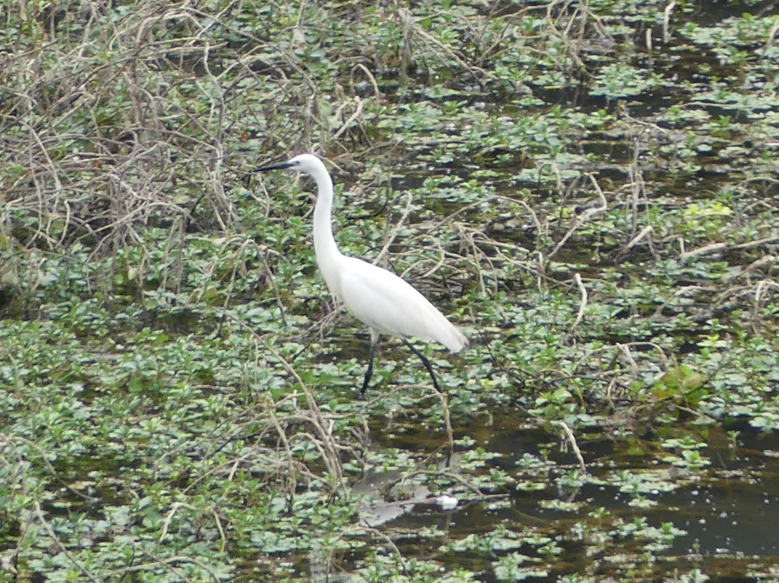
A white little egret standing in a shallow marshy area filled with dense green vegetation and tangled branches.
A little egret walking through the marshy vegetation on the banks of the Garonne river.

Réserve naturelle nationale de la frayère d'Alose ecosystems, habitats, and plant life

From an ecological perspective, the reserve is best understood as a functional refuge on a heavily used river rather than a closed wilderness. The protected water body maintains habitat conditions favorable to large migratory fish, while the wider riverside environment supports a characteristic Garonne-valley fauna and flora.

The site's ecological value is closely tied to its role within the broader Garonne ecosystem. The reserve's perimeter coincides exactly with a ZNIEFF type I site, the ZNIEFF frayère d'Alose d'Agen, indicating formal recognition of its ecological importance at the regional level. Just upstream of the reserve, additional ZNIEFF sites related to sturgeon spawning along the Garonne underline the cumulative importance of this stretch of the river for migratory species.

By limiting direct human pressures on the spawning area, the reserve helps maintain a range of microhabitats across the riverbed: gravel zones required for shad and other lithophilic spawners, quieter pools where juveniles can rest, and flowing stretches that support oxygenation and the transport of eggs and larvae. This functional diversity is what allows the site to support not only its primary target species but also a rich assemblage of accompanying freshwater fauna.
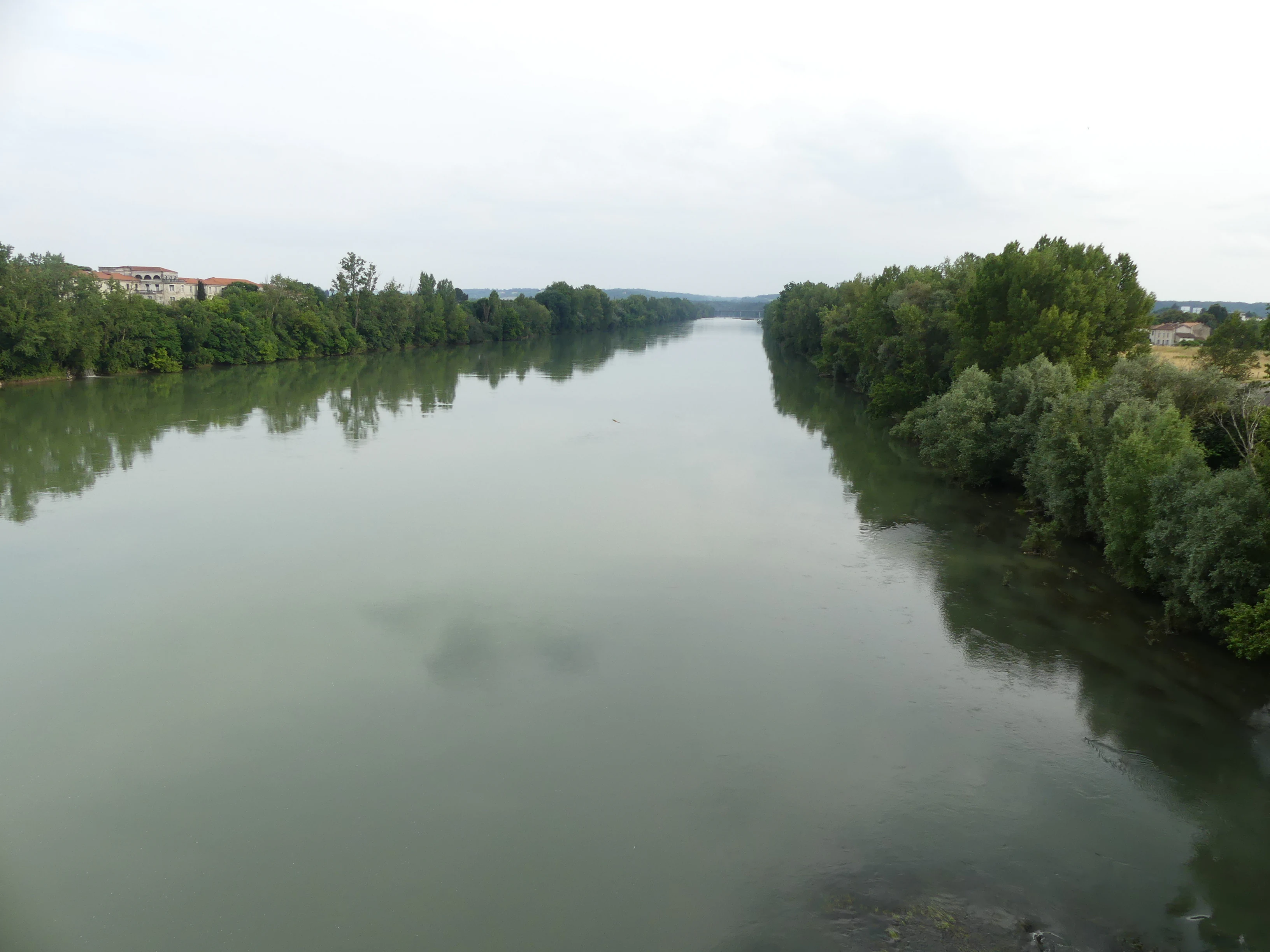
A wide view of a calm, wide river flowing through a lush, tree-lined landscape under a soft, overcast sky, taken from a bridge vantage point.
The Garonne River in the Réserve naturelle nationale de la frayère d'Alose, viewed from the Pont de Pierre near Agen.

Réserve naturelle nationale de la frayère d'Alose wildlife and species highlights

Wildlife interest at the reserve is dominated by freshwater species, especially fish, reflecting the protected area's essentially riverine character. The Grande alose is the focal species, with its presence dictating management priorities and the wording of the reserve's conservation mandate; every management plan is oriented toward maintaining the riverbed conditions that alose require for spawning.

In addition to the shad, surveys in the late 1990s recorded roughly twenty other fish species on the reserve's stretch of the Garonne, including common barbel, common bream, common carp, chub, European eel-related taxa, flounder, roach, gudgeon, northern pike, ruffe, thick-lipped grey mullet, perch, pumpkinseed sunfish, rudd, pikeperch, wels catfish, tench, and brown trout. This diverse fish fauna reflects the Garonne's position as a lowland river that connects Alpine, southern French, and Atlantic influences.

The reserve also supports a typical riverside avifauna. Eleven bird species have been documented, including little egret, grey wagtail, mallard, tawny owl, common moorhen, Caspian gull, grey heron, great spotted woodpecker, common chaffinch, water rail, and Eurasian nuthatch. While the bird list is modest by national standards, it reflects the assemblage characteristic of the banks, walkways, and nearby riparian woodland along an urban-edge stretch of the Garonne.
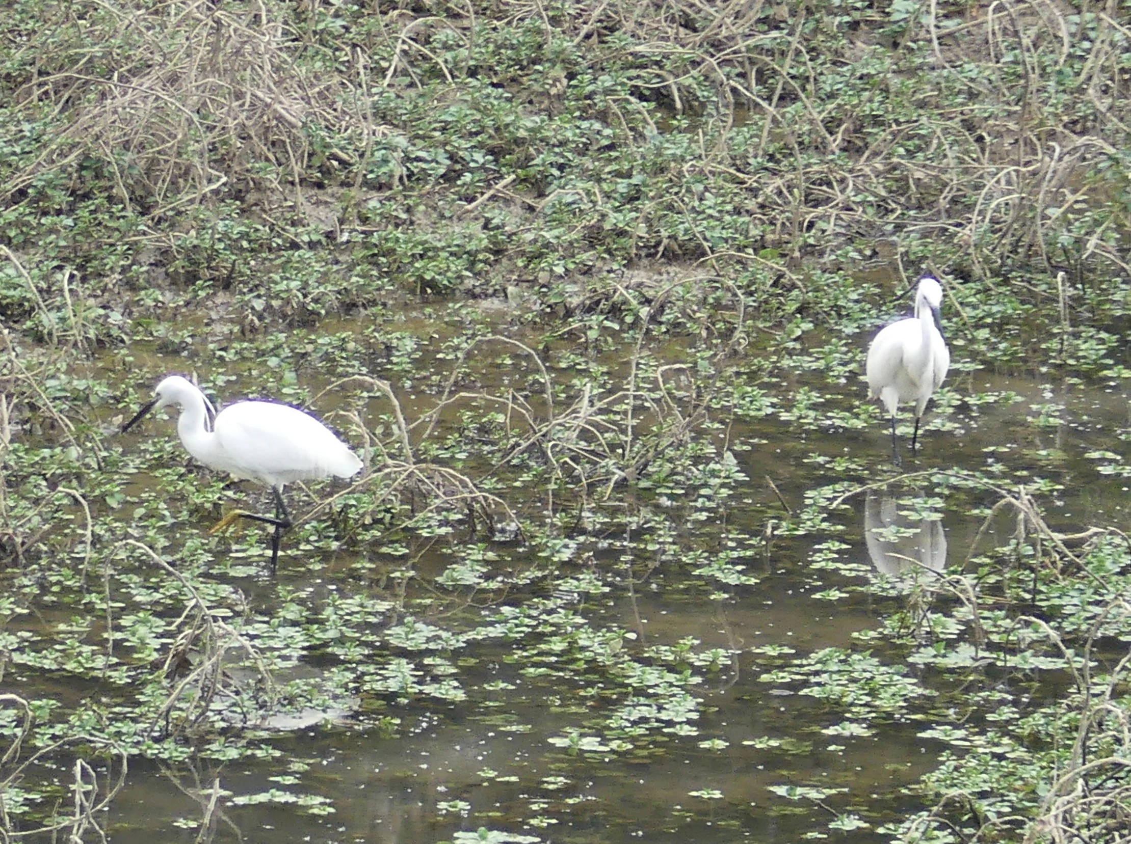
Two white little egrets wading through shallow water and dense shoreline vegetation.
Two little egrets foraging in the shallow riverine vegetation of the Garonne River.

Réserve naturelle nationale de la frayère d'Alose conservation status and protection priorities

The reserve's conservation significance lies primarily in its role as one of the last dedicated protected spawning areas for the Grande alose in France. By focusing protection on a precise and ecologically critical zone of the Garonne, the reserve contributes directly to the long-term survival of a migratory fish species that is otherwise in serious decline across its range.

Its creation in 1981 was a landmark decision in French inland-water conservation, recognizing that protecting a single, well-chosen stretch of habitat could yield outsized benefits for a migratory species whose reproduction depends on very specific substrate and flow conditions. The documented recolonization of upstream stretches of the Garonne toward Golfech since the reserve's establishment is one of the most direct illustrations of its conservation value.

At the broader institutional level, the reserve functions as a recognized biodiversity reference site, with its perimeter matching a ZNIEFF type I area. It also serves as a long-term monitoring platform for sturgeon, lamprey, and shad, and is currently informing ongoing discussions about adjusting protected-area boundaries to better reflect the evolving situation of migratory fish in the Garonne system.

Réserve naturelle nationale de la frayère d'Alose cultural meaning and human context

The reserve sits along one of the most historically significant stretches of the Garonne, immediately adjacent to Agen, a city with deep Roman and medieval roots, and just downstream of the Pont de Pierre and the iconic pont-canal d'Agen, an aqueduct bridge that is part of the region's industrial and transport heritage. While the reserve itself is a scientific and ecological site, its location ties it directly to centuries of human interaction with the Garonne.

The Garonne has long been a corridor for commerce, navigation, and fishing, and Agen has historically been associated with river-based livelihoods. The choice to protect a section of the river rather than terrestrial habitat reflects both ecological priorities and the practical reality of working within a heavily used and historically significant waterway. Today, the reserve's coexistence with bridges, urban riverfronts, and walkways, such as the passerelle where little egrets are observed, illustrates how modern conservation can be embedded in a long-standing cultural landscape.

Top sights and standout views in Réserve naturelle nationale de la frayère d'Alose

A defining highlight of the reserve is that it safeguards a precisely bounded stretch of the Garonne whose physical characteristics; substrate variety, depth profile, and current patterns, make it one of the rare remaining functional alose spawning areas in France. This combination of specificity and ecological importance is at the heart of the reserve's identity.

Another highlight is the reserve's role as a long-term scientific reference site for large migratory fish. Through decades of monitoring, it has provided data that support conservation strategies reaching well beyond its own perimeter, including the recolonization of the Garonne upstream toward Golfech and the wider management of migratory species such as sturgeon, lamprey, and shad along the river.

Best time to visit Réserve naturelle nationale de la frayère d'Alose

The reserve is fundamentally a working conservation site rather than a traditional visitor destination, and large sections of it exist primarily for ecological monitoring rather than recreational access. For observers interested in riverside wildlife, late spring and early summer tend to coincide with the peak of migratory fish activity and the most active birdlife along the banks, while the surrounding pont-canal and Pont de Pierre remain readily visible from public walkways year-round. Any visit should respect the reserve's protection status, which excludes the banks and riparian woodland from the core protected zone.

Monthly climate preview

Long-term representative monthly temperature and precipitation cycles across the protected terrain

Réserve naturelle nationale de la frayère d'Alose Climate Normals and Annual Temperature Rhythm

Representative coordinate records show average monthly temperatures ranging from 4.97 °C in winter to 22.94 °C in summer alongside steady year-round precipitation rates. Examining the full twelve-month profile reveals detailed baseline climate variations across the protected landscape.
Annual mean13 °C
5 °C23 °C
Jan
Feb
Mar
Apr12°
May16°
Jun20°
Jul23°
Aug23°
Sep19°
Oct14°
Nov
Dec
Warmest month
August

22.9 °C

Coolest month
January

5 °C

Wettest month
May

2.3 mm/day

Driest month
July

1.5 mm/day

Park location guide

Geography guide, regional context, and park location map for Réserve naturelle nationale de la frayère d'Alose

Réserve naturelle nationale de la frayère d'Alose park geography, regions, and map view in France

Understand where Réserve naturelle nationale de la frayère d'Alose sits in France through a broader geographic reading of the surrounding landscape, nearby location context, and its mapped position within the national park landscape.

How Réserve naturelle nationale de la frayère d'Alose fits into France

France is a unitary semi-presidential republic and one of the world's largest economies. It borders Belgium, Luxembourg, Germany, Switzerland, Italy, Monaco, Andorra, and Spain, with a maritime border to the United Kingdom. The country is known for its cultural influence, art, cuisine, and political history spanning centuries.

Wider geography shaping Réserve naturelle nationale de la frayère d'Alose in France

France is located in Western Europe. Metropolitan France extends from the Rhine to the Atlantic Ocean and from the Mediterranean Sea to the English Channel and North Sea. The country borders Belgium, Luxembourg, Germany, Switzerland, Italy, Monaco, Andorra, Spain, and has a maritime border with the United Kingdom.

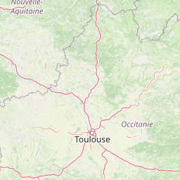
Map view of Réserve naturelle nationale de la frayère d'Alose

Use this park location map to pinpoint Réserve naturelle nationale de la frayère d'Alose in France, understand its exact geographic position, and read its mapped placement within the surrounding landscape more clearly.

Pigeon | © OpenStreetMap contributors

Explore protected river habitats, gravel beds, and aquatic scenery along the Garonne.

Visualizing Réserve naturelle nationale de la frayère d'Alose Photos and Landscapes

Visual records reveal the physical character of Réserve naturelle nationale de la frayère d'Alose through detailed imagery of its protected aquatic environments and riverbed terrain. Photographic documentation offers clear insight into the specialized habitats and natural conditions supporting migratory fish populations.

Scientific illustration of an Allis shad fish on a plain white background, showing its silver scales and distinctive row of dark spots along its side.

A wide, calm river flowing through a lush, tree-lined landscape under a cloudy sky.

A white little egret standing in a shallow marshy area filled with dense green vegetation and tangled branches.

A wide view of a calm, wide river flowing through a lush, tree-lined landscape under a soft, overcast sky, taken from a bridge vantage point.

Two white little egrets wading through shallow water and dense shoreline vegetation.

Park atlas

Compare surrounding river reserves and connected aquatic habitats across the Garonne valley.

Parks Near Réserve naturelle nationale de la frayère d'Alose and Regional Protected Areas

Browsing other protected areas near Réserve naturelle nationale de la frayère d'Alose reveals broader regional conservation networks across southwestern France. Comparing adjacent river reserves and aquatic habitats helps contextualize local migratory fish populations within larger watershed landscapes.
A soft, horizontal watercolor painting depicting a gentle, rolling landscape with green hills, sparse trees, and a hazy background in pale green and pink tones.
Regional parkOccitanie
About 71 km away#1 closest

Northeast

Parc naturel régional des Causses du Quercy: Protected Karst Plateaus and River Valleys

Geographic atlas of the Causses du Quercy karst landscapes

An essential look at the geography of Parc naturel régional des Causses du Quercy. This protected area in Occitanie features an expansive network of limestone plateaus and carved river gorges. Learn about the karst terrain, sedimentary history, and the natural boundaries that define this French regional park and internationally recognized geopark.

Area
1,855 km²
Established
1999
IUCN
V
A wide, soft-focus watercolor painting showing a winding river through a lush green valley with rolling hills in the background.
Nature reserveOccitanie
About 99 km away#2 closest

Southeast

Réserve naturelle régionale Confluence Garonne-Ariège: Protected Riverine Geography and Mapping

A significant riparian landscape in the Occitanie region

Discover the protected river corridors and diverse natural terrain of the Réserve naturelle régionale Confluence Garonne-Ariège. This regional nature reserve marks the confluence of the Garonne and Ariège rivers, showcasing a complex mosaic of alluvial forest, riparian wetlands, and dry hillside woodlands that characterize the geography south of Toulouse.

Area
5.791 km²
Established
2015
IUCN
IV
Relief
Mixed relief
Nature reserveNouvelle-Aquitaine
About 108 km away#3 closest

Northwest

Réserve naturelle nationale géologique de Saucats et la Brède: Geological Nature Reserve Atlas

Protected strata and Miocene fossil landscapes in Nouvelle-Aquitaine

This protected area serves as a primary European reference site for Cenozoic geology. It features distinct Miocene marine sand outcrops, fossil-rich faluns, and stream-cut sections that reveal the complex history of the Aquitaine Basin across multiple geographic sectors.

Area
0.755 km²
Established
1982
IUCN
III
Protected areaLot
About 113 km away#4 closest

Northeast

Vallée de la Dordogne quercynoise: Regional Protected Area and River Valley Geography

A detailed geographic study of limestone slopes and riparian corridors in the Lot department.

Spanning 5,567 hectares across the Lot department, this protected area preserves the ecological integrity of the Dordogne river. The region is marked by its transition from narrow, hill-enclosed upstream stretches to broader floodplain zones, creating a complex habitat mosaic of alluvial meadows, travertine springs, and rocky chasmophytic slopes that support important European biodiversity.

Area
55.67 km²
Established
2007
Relief
Upland
Climate
Temperate
Nature reserveOccitanie
About 117 km away#5 closest

Northeast

Réserve naturelle régionale du marais de Bonnefont: Protected Wetland and Regional Atlas

Exploring the largest reedbed in the Lot department.

Situated in the heart of the Causses du Quercy, this protected nature reserve shelters the most significant reedbed in the Lot department of Occitanie. The site serves as a vital hydrological marker, demonstrating a rare transition between wetland habitats and the characteristic dry limestone plateaus of the region. This overview examines the geography, terrain, and structural importance of the reserve within the broader French protected lands network.

Area
0.42 km²
Established
2011
IUCN
IV
Relief
Lowland
Protected areaNouvelle-Aquitaine
About 121 km away#6 closest

North

Vallée de la Tude Protected Area: Regional Geography and Alluvial Landscape Map

Exploring the river valley networks of Nouvelle-Aquitaine

The Vallée de la Tude is a significant protected area located in the Charente department of southwestern France. This site features a series of wet meadows, lowland brooks, and woodland fragments that form an essential ecological network. Our atlas entry provides a detailed look at the geographic distribution and landscape composition of this unique alluvial valley.

Area
15.57 km²
Established
2006
Relief
Upland
Climate
Temperate
Nature reserveNouvelle-Aquitaine
About 125 km away#7 closest

North

Vallée de la Nizonne Nature Reserve: Mapped Geography and Protected Wetland Landscapes

A critical river corridor and Natura 2000 conservation zone in Nouvelle-Aquitaine.

Discover the geographic structure of the Vallée de la Nizonne, a protected area shaped by the flow of the Nizonne and Lizonne rivers. This landscape mosaic features peatlands, wet meadows, and alluvial forests that serve as a refuge for rare species. Gain insight into the regional terrain and conservation boundaries that define this important French wetland corridor.

Area
33.91 km²
Established
2016
Relief
Upland
Climate
Temperate
Nature reserveOccitanie
About 140 km away#8 closest

Southeast

Réserve naturelle régionale de Cambounet-sur-le-Sor: Protected Wetland Geography

Alluvial floodplain habitat in the Tarn, Occitanie

Situated in the Tarn department of Occitanie, this nature reserve guards a dense wetland habitat shaped by the confluence of the Sor and Agout rivers. The area stands as an ecological centerpiece, providing sheltered riparian woodland and marshy terrain for more than one hundred and seventy recorded bird species, making it a distinct study in French riverine conservation.

Area
0.309 km²
Established
1990
IUCN
IV
Relief
Lowland

Common questions about visiting, size, designation, and location context for Réserve naturelle nationale de la frayère d'Alose

Réserve naturelle nationale de la frayère d'Alose FAQs for park facts, access, geography, and protected area context

Find quick answers about Réserve naturelle nationale de la frayère d'Alose, including protected-area facts, park geography, trail and visitor context, and how the park fits into its surrounding country and regional landscape.
MoriAtlas Explorer

Continue Your Protected Areas Search Across the Global Atlas

Deepen your exploration by continuing the structured search for national parks and protected areas worldwide. Utilize the comprehensive filtering capabilities to compare different conservation landscapes and refine your understanding of global park geography. Discover more about the distribution and characteristics of protected natural areas.

Global natural geography