
Mori Atlas logo
Nature reserveRéserve naturelle nationale du val d'Allier

A vital river corridor and ecological sanctuary within the Allier department of central France

Réserve naturelle nationale du val d'Allier: Mapping the Dynamic Alluvial Floodplain Landscapes

The Réserve naturelle nationale du val d'Allier protects a twenty-kilometer stretch of one of the few remaining free-flowing rivers in Europe. This nature reserve serves as an essential ecological corridor where the Allier River continuously reshapes its floodplain. Users can study the mapped distribution of gravel bars, abandoned river channels, and dense riparian forests that characterize this varied alluvial ecosystem.

river corridoralluvial floodplainfree-flowing rivergravel barsriparian forestbird sanctuary
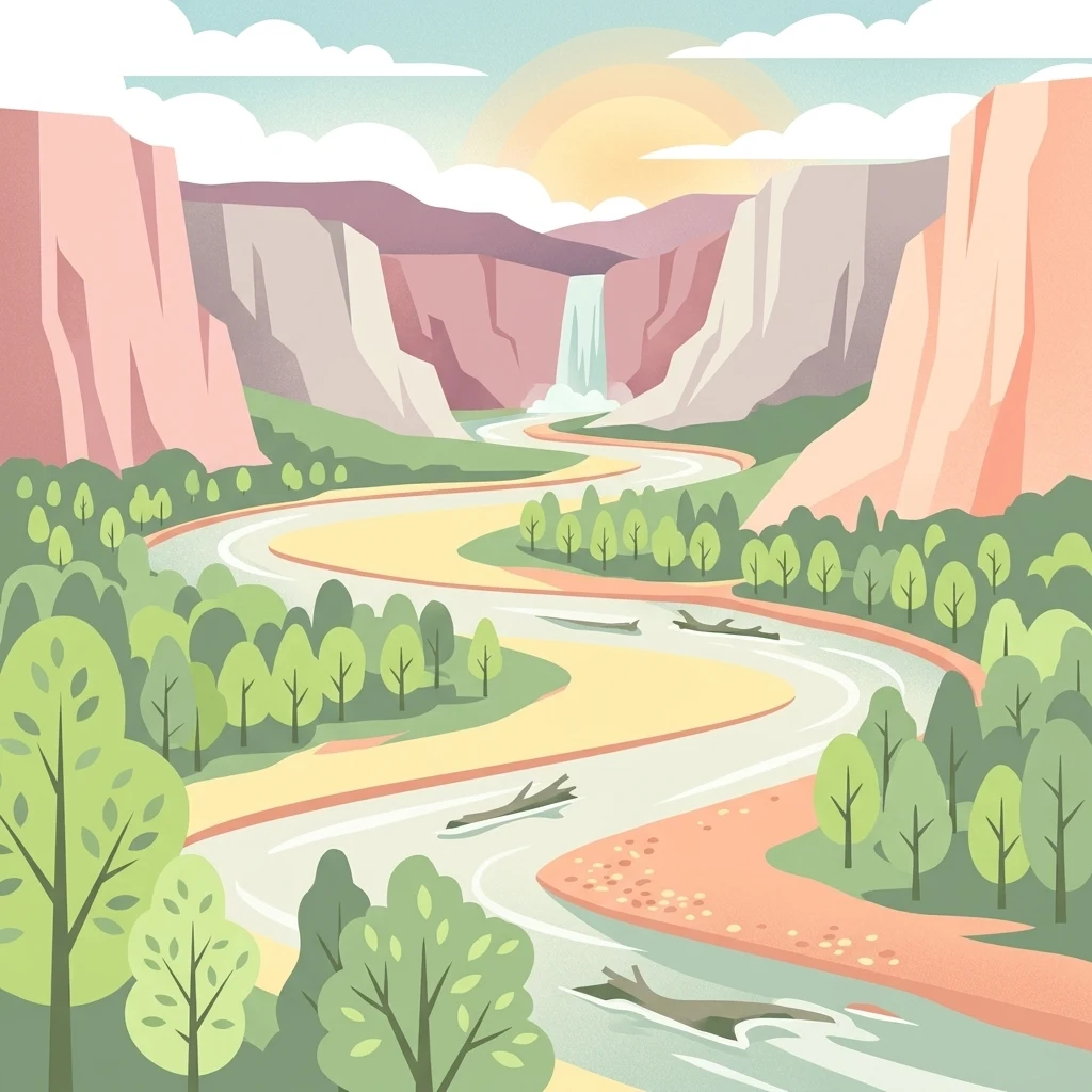
A stylized flat illustration of a river winding through a valley flanked by trees and tall cliffs, with a small waterfall in the distance under a sunrise.

Réserve naturelle nationale du val d'Allier

Nature reserve

Park overview

Structured park overview, official facts, and landscape profile for Val d'Allier National Nature Reserve

Val d'Allier National Nature Reserve park facts, protected area profile, and essential visitor context

Review the core facts for Val d'Allier National Nature Reserve, including designation, size, terrain, visitor scale, habitats, and operating context in one park-focused overview.

About Val d'Allier National Nature Reserve

The Val d'Allier National Nature Reserve is centred on a roughly twenty-kilometer-long stretch of the Allier River in the department of Allier, just upstream of the prefecture town of Moulins. It includes the two banks of the river and the floodplain strip that varies from about 400 meters to 2 kilometers wide. The reserve crosses nine communes: Bessay-sur-Allier, Bressolles, Châtel-de-Neuvre, Chemilly, Contigny, La Ferté-Hauterive, Monétay-sur-Allier, Saint-Loup, and Toulon-sur-Allier. Together, these territories form one of the most dynamic alluvial landscapes still preserved in central France.

The defining characteristic of the reserve is the behavior of the Allier itself. Among Europe's larger rivers, the Allier is remarkable for remaining almost entirely free from heavy channelization and damming on this section. It continues to erode laterally, to cut new banks, to deposit fresh sand and gravel bars, and to rearrange its islands and dead arms. The result is a habitat mosaic aligned along the river that includes active channels, side arms, gravel beds, pioneer vegetation, softwood alluvial forest, and more mature riparian woodland.

This rare dynamism is the reason the site was protected. Decades of gravel extraction in the riverbed had visibly degraded the system, and the preparation of the Allier's water-management scheme during the late 1980s and early 1990s prompted a broad conservation movement. Combined with the existence of hunting reserves on the site since 1977, this led to a national nature reserve classification procedure that began around 1990 and culminated in the official creation of the reserve on 25 March 1994. The first management plan ran from 1995 to 2007, followed by a second plan covering 2009 to 2013, both focused on preserving habitat diversity, landscape unity, and the natural river process itself.

The reserve is administered jointly by two well-known French conservation bodies: LPO Auvergne, the regional branch of the Ligue pour la Protection des Oiseaux focused on birdlife and biodiversity, and the Office National des Forêts through its Berry Bourbonnais unit, which manages the forested portion of the floodplain. With more than twenty public access points, the reserve is also promoted as one of the most accessible national nature reserves in France, allowing visitors to experience a large, functioning alluvial landscape at close range while keeping the core protected habitats intact.

Quick facts and research context for Val d'Allier National Nature Reserve

The Val d'Allier National Nature Reserve (code RNN119) lies in the Allier department of the Auvergne-Rhône-Alpes region in central France, on the Allier River upstream of Moulins. It was created on 25 March 1994 and covers about 1,450 hectares spread across about twenty kilometers of river and its floodplain, including both banks. It is classified as a national nature reserve under IUCN Category IV, and is managed jointly by LPO Auvergne and the Office National des Forêts (ONF Berry Bourbonnais). The reserve's purpose is to conserve a free-flowing, dynamic river landscape that includes gravel bars, islands, dead arms, and alluvial vegetation, while functioning as a major ecological corridor for birds, mammals, fish, insects, and plants in the region.

Protection and recognition

Examine terrestrial protection metrics and official registry records for this designated area.

Réserve naturelle nationale du val d'Allier Protection Status and Conservation Data

Terrestrial protection status records for Réserve naturelle nationale du val d'Allier outline the documented scope of management parameters. Official conservation inventories compile baseline administrative metrics to clarify the regulatory framework governing the terrain.

Protection details

Protection scope
Terrestrial
Transboundary protection
No
WDPA ID
106724
Park context

Deeper park guide and search-rich context for Val d'Allier National Nature Reserve

Val d'Allier National Nature Reserve history, landscape, wildlife, and travel context

Explore Val d'Allier National Nature Reserve through its history, landscape character, ecosystems, wildlife, conservation priorities, cultural context, and seasonal travel timing in a structured park guide built for atlas discovery and search intent.

Why Val d'Allier National Nature Reserve stands out

The Val d'Allier reserve is best known for protecting one of the last almost completely free-flowing large rivers in Europe, the Allier, and the extraordinary habitat diversity that comes with it. Its shifting mosaic of gravel bars, large islands, dead arms, and riparian vegetation supports an exceptionally rich community of breeding and migratory birds, including species such as the Eurasian stone-curlew, little tern, common tern, little ringed plover, white stork, black kite, sand martin, and European golden oriole. Wildlife observers have recorded more than 260 bird species in the reserve, roughly four-fifths of the total avifauna of the former Auvergne region. Equally important is the reserve's role as a continuous ecological corridor along the river, where natural erosion and deposition continuously renew habitats for plants, fish, beavers, otters, wild cats, dragonflies, and beetles. The combination of a still-natural river, a large protected floodplain, and easy public access has made the Val d'Allier a flagship site for alluvial river conservation in France.
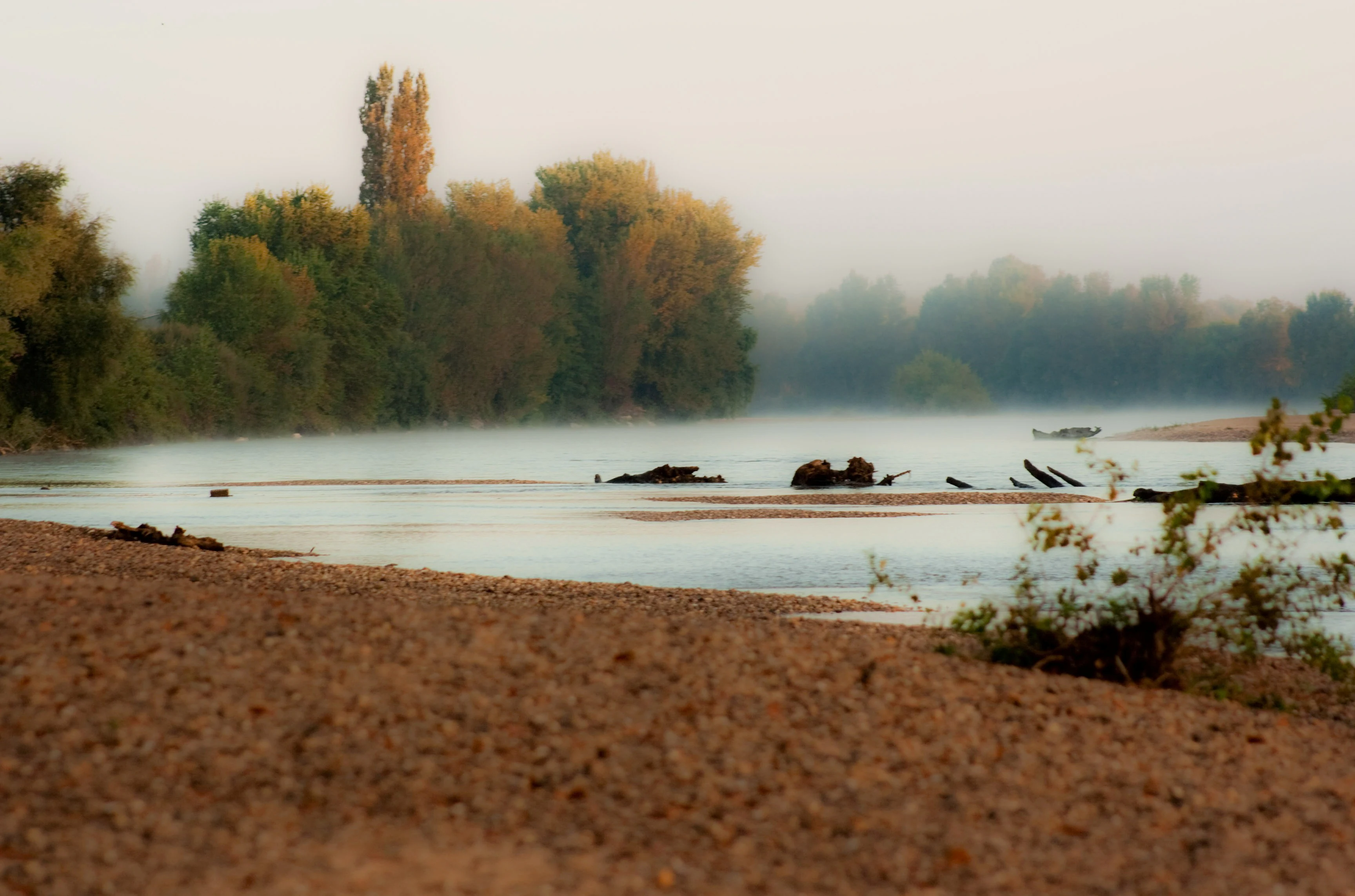
A peaceful, misty view of the Allier River at dawn, showing a sandy foreground, calm water, and trees along the riverbank.
Morning mist over the Allier River.

Val d'Allier National Nature Reserve history and protected-area timeline

The history of the Val d'Allier reserve begins well before its formal protection. From 1977 onward, hunting reserves were established along this stretch of the river, giving local stakeholders an early institutional foothold and a reason to manage the area more carefully. By the late 1980s, however, the Allier itself was under serious pressure: decades of large-scale gravel extraction from the riverbed were altering the channel, while the development of the Schéma d'Aménagement des Eaux, or water-management master plan, for the Allier raised the prospect of further intervention.

These converging pressures triggered a coordinated conservation response. Beginning around 1990, a classification procedure for a national nature reserve was initiated, aiming to lock in long-term protection for the river and its floodplain. The procedure succeeded on 25 March 1994, when the reserve was officially created as Réserve naturelle nationale du val d'Allier, with the code RNN119. It was one of several French national nature reserves established in this period to safeguard large, functional natural systems rather than just small, isolated sites.

Once created, the reserve moved quickly into structured management. The first management plan covered 1995 to 2007 and set the basic framework for habitat monitoring, public access, and protection of the river dynamics. A second plan was adopted for the 2009 to 2013 period, with renewed emphasis on maintaining habitat diversity and preserving the visual and ecological unity of the alluvial landscape. Throughout this period, management has been shared between LPO Auvergne and the Office National des Forêts, combining ornithological and forest expertise to address the wide range of habitats present.

The deeper history of the site is also written by the river itself. Because the Allier continues to erode, deposit, and reshape its bed freely, the landscape that the reserve protects is not a snapshot but an ongoing process. The reserve's history is therefore not just a record of administrative decisions: it is the cumulative record of how a moving river has, over centuries, built the islands, banks, and floodplains that today's conservation framework exists to defend.

Val d'Allier National Nature Reserve landscape and geographic character

The landscape of the Val d'Allier reserve is a textbook example of a free large-river floodplain. The Allier has not been straightened or heavily channelized in this section, and it continues to migrate across its valley floor, cutting into one bank here, building a new gravel bar there, and abandoning old channels that turn into quiet dead arms and ponds. This continuous geomorphic activity is the engine of the entire landscape.

The protected strip runs about twenty kilometers in length but changes shape constantly along the way. In some sectors, the active floodplain is only around 400 meters wide from one valley edge to the other, while elsewhere it broadens to roughly two kilometers. These wider zones typically contain the most complex mosaic of islands, side channels, and riparian forest. The riverbed itself is varied, with extensive sand and gravel deposits, exposed banks rich in pebbles, and freshly eroded cliffs of alluvial sediment on the outside of meanders.

Vegetation follows the geomorphic patterns closely. Youngest gravel bars host only the most pioneering plants, while slightly higher and more stable surfaces support dense thickets of willow and other softwoods. Behind these belts, more mature alluvial forest develops, forming a graded sequence from open river to closed woodland. Wherever old meanders have been cut off, still-water habitats appear, creating wetland patches that add another layer of diversity. Together, these elements create a landscape read as a series of ribbons of sand, water, willow, and forest, all parallel to the flowing river.
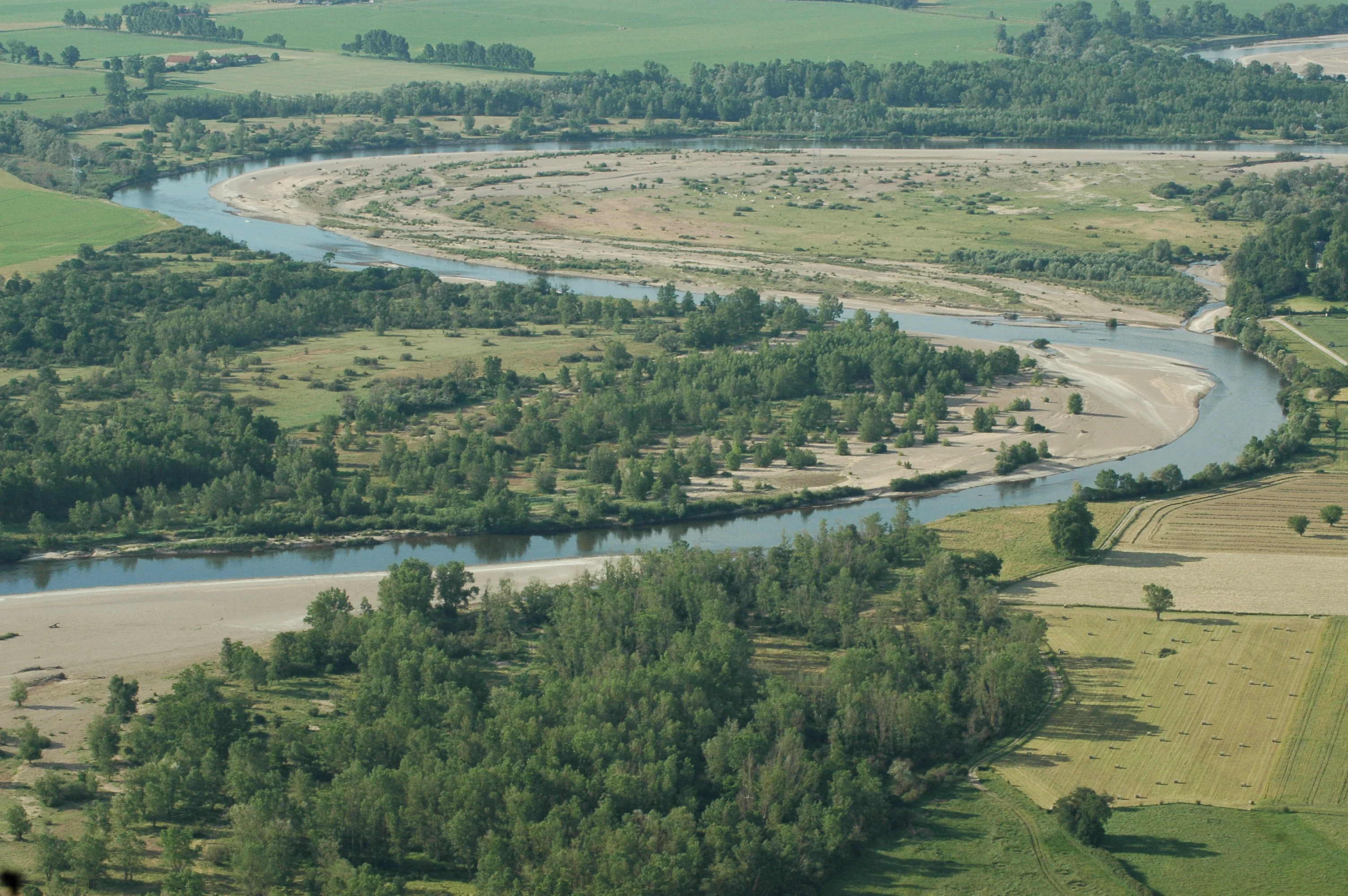
An aerial shot showing a meandering river with gravel bars surrounded by green riparian forests and agricultural fields.
An aerial view of the meandering Allier River within the Réserve naturelle nationale du val d'Allier.

Val d'Allier National Nature Reserve ecosystems, habitats, and plant life

Ecologically, the reserve is best understood as a long, narrow alluvial ecosystem running across the floor of an inland valley, in which habitat types are distributed according to the river's own dynamics rather than human land use. The mosaic includes active channels, gravel and sand bars, pioneer herbaceous vegetation, softwood alluvial thickets dominated by willows, and higher alluvial forest, all interleaved with dead arms and connected wetlands. This pattern of regularly renewed habitats alongside more stable forest patches is unusual in lowland Europe, where most large rivers have been heavily regulated.

Because habitats are continuously recreated and abandoned by the river, the reserve hosts an unusually large number of plant communities within a small area. Botanists have recorded well over 600 plant species, including some whose seeds and fragments have traveled down from higher-elevation landscapes in Auvergne and the Cévennes and have germinated in the new alluvial soils closer to Moulins. Fungal diversity is also notable, with around 200 species recorded.

The Val d'Allier reserve also functions as a critical ecological corridor. The river valley links upstream mountainous and rural landscapes with downstream regions, and the protected floodplain provides a continuous path for plants, invertebrates, fish, birds, and mammals to disperse through a region otherwise dominated by agriculture and forestry. Because the habitats repeat and shift with the river flow, the corridor itself is dynamic, but its role in maintaining connectivity across central France is consistent and recognized at the regional level.

Val d'Allier National Nature Reserve wildlife and species highlights

Despite covering only about 1,450 hectares, the Val d'Allier reserve supports an exceptionally dense and varied animal community, reflecting the diversity of habitats along the river. Birdlife is the most prominent feature. With more than 100 breeding species and over 260 species observed in total, the reserve hosts roughly four-fifths of the bird species recorded in the entire former Auvergne region, and in this respect has been compared to France's most iconic wetland site, the Camargue. Typical and notable species include the Eurasian stone-curlew, little tern and common tern on the gravel bars, little ringed plover along the bare shores, white stork, black kite overhead, sand martin nesting in exposed banks, and the European golden oriole in the riparian trees.

Mammals are also well represented, with around 45 species recorded in the reserve, including nine bat species. Three mammals in particular signal the value of this alluvial system: the Eurasian beaver, the European otter, and the European wildcat. Beavers in particular benefit from the combination of slow-moving dead arms, abundant willow, and quiet banks. The reserve's riverbed and side channels host an exceptionally rich fish fauna, with about forty species, including migratory species of high conservation interest such as Atlantic salmon, allis shad, and sea lamprey.

Reptiles and amphibians add another layer, with twelve amphibian species recorded. Invertebrate diversity is also remarkable. The reserve is home to 49 dragonfly species, including protected species such as the Mercury bluet and the green snaketail, and to more than 1,000 beetle species, making the lower trophic levels of this alluvial ecosystem unusually rich and providing the abundance of insects that supports much of the bird and bat life above.

Val d'Allier National Nature Reserve conservation status and protection priorities

The reservation of the Val d'Allier site is primarily a conservation response to the threat of losing one of Europe's last large, free-flowing lowland rivers. Decades of aggregate extraction from the riverbed and the prospect of large-scale water-management works in the early 1990s had begun to alter the river's natural behavior. The reserve was created to halt that trajectory and to lock in long-term protection for the river's dynamic processes, not just for individual species.

Its conservation significance operates at several scales. Locally, the reserve protects habitats that are continuously renewed by river dynamics, including pioneer, transitional, and mature stages of alluvial forest. Regionally, the protected floodplain acts as an ecological corridor linking mountainous and lowland environments in central France. Nationally and at the European scale, the reserve safeguards rare features such as a self-regulating gravel-bed river, relict populations of beaver and otter, migratory fish species such as salmon and sea lamprey, and breeding bird assemblages typical of undisturbed river systems.

Top sights and standout views in Val d'Allier National Nature Reserve

The reserve's defining highlights are a free-flowing river still able to shape its own floodplain, a continuous twenty-kilometer corridor of gravel bars, islands, and alluvial forest, and an extraordinary concentration of breeding and migratory birdlife for such a relatively small area. Visitors and researchers can see the same kind of river process that shaped most of Europe's floodplains before large-scale engineering, and observe at close range species such as little terns, stone-curlew, otter, beaver, and wildcat, alongside a fish fauna of about forty species.

Best time to visit Val d'Allier National Nature Reserve

Spring and early summer are widely considered the most rewarding seasons to experience the Val d'Allier reserve. Migratory and breeding birds are at their most conspicuous, with little terns, common terns, and little ringed plovers active on freshly exposed gravel bars, sand martins nesting in eroded banks, and woodland species such as golden oriole in the riparian trees. Vegetation is also at its richest, making the patchwork of pioneer plants, willow thickets, and alluvial forest especially visible.

Late summer and autumn bring quieter conditions, lower water levels, and the chance to see beaver and otter activity more clearly along the calmer dead arms and side channels. Winter can be cold and exposed along the river, but also brings larger numbers of waterfowl and raptors using the corridor. In all seasons, visitors should expect weather conditions typical of an inland valley in central France, and should be prepared for changeable conditions since the river landscape itself is open and exposed.
Monthly climate preview

Long-term representative temperature and precipitation measurements across twelve monthly cycles

Réserve naturelle nationale du val d'Allier Climate Normals and Annual Weather Rhythm

Historical data records mean monthly temperatures ranging from 2.54 degrees Celsius in January to 20.58 degrees Celsius in August alongside consistent daily precipitation patterns. Examining the complete monthly profile provides deeper insight into measured thermal ranges and long-term climatic variations at the representative coordinate.
Annual mean11 °C
3 °C21 °C
Jan
Feb
Mar
Apr10°
May14°
Jun18°
Jul21°
Aug21°
Sep16°
Oct12°
Nov
Dec
Warmest month
August

20.6 °C

Coolest month
January

2.5 °C

Wettest month
May

2.5 mm/day

Driest month
March

1.5 mm/day

Park location guide

Geography guide, regional context, and park location map for Val d'Allier National Nature Reserve

Val d'Allier National Nature Reserve park geography, regions, and map view in France

Understand where Val d'Allier National Nature Reserve sits in France through a broader geographic reading of the surrounding landscape, nearby location context, and its mapped position within the national park landscape.

How Val d'Allier National Nature Reserve fits into France

France is a unitary semi-presidential republic and one of the world's largest economies. It borders Belgium, Luxembourg, Germany, Switzerland, Italy, Monaco, Andorra, and Spain, with a maritime border to the United Kingdom. The country is known for its cultural influence, art, cuisine, and political history spanning centuries.

Wider geography shaping Val d'Allier National Nature Reserve in France

France is located in Western Europe. Metropolitan France extends from the Rhine to the Atlantic Ocean and from the Mediterranean Sea to the English Channel and North Sea. The country borders Belgium, Luxembourg, Germany, Switzerland, Italy, Monaco, Andorra, Spain, and has a maritime border with the United Kingdom.

Map view of Val d'Allier National Nature Reserve

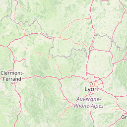
Use this park location map to pinpoint Val d'Allier National Nature Reserve in France, understand its exact geographic position, and read its mapped placement within the surrounding landscape more clearly.

Pigeon | © OpenStreetMap contributors

Location context for Val d'Allier National Nature Reserve

AllierAuvergne-Rhône-Alpes
Recorded earthquake history

View Recorded Seismic Activity Near Réserve naturelle nationale du val d'Allier

Consult the historical earthquake database to review recorded seismic events associated with the geography of the Réserve naturelle nationale du val d'Allier. MoriAtlas provides these records to assist with understanding the documented regional seismic history near this protected natural landscape.

Réserve naturelle nationale du val d'Allier Earthquake History

Catalogued events

14 events

Strongest magnitude

Magnitude 5.3

Most recent event

Feb 1, 2008

This history includes earthquakes recorded inside the park or within 50 km of its borders

Visual exploration of alluvial floodplain habitats, gravel bars, and river corridors

Réserve naturelle nationale du val d'Allier Photos and Landscape Scenery

Photographic archives reveal the dynamic terrain and shifting river channels that define the protected landscape of Réserve naturelle nationale du val d'Allier. Detailed visual records help researchers and observers examine riparian forests, wetland mosaics, and specialized wildlife habitats across the floodplain.

A peaceful, misty view of the Allier River at dawn, showing a sandy foreground, calm water, and trees along the riverbank.

A close-up shot of a bright blue damselfly with delicate, transparent wings perched horizontally on a thin green plant stem against a soft-focus green background.

An aerial shot showing a meandering river with gravel bars surrounded by green riparian forests and agricultural fields.

Park atlas

Compare adjacent river corridors, alluvial floodplains, and regional habitats across central France

Other Parks Near Réserve naturelle nationale du val d'Allier and Surrounding Protected Areas

Browsing nearby national parks and protected areas provides broader regional context for the dynamic alluvial floodplains surrounding Réserve naturelle nationale du val d'Allier. Comparing adjacent river corridors and wetland habitats reveals patterns of protected landscape conservation across central France.
Nature reserveAuvergne-Rhône-Alpes
About 30 km away#1 closest

Northeast

Réserve naturelle régionale du val de Loire Bourbonnais Protected Area and Atlas View

Riverine geography and floodplain landscapes in Allier, France

Examine the geographic profile of the Réserve naturelle régionale du val de Loire Bourbonnais. This site protects a significant stretch of the Loire River characterized by active meanders and alluvial deposits, representing a key example of riverine conservation in the Bourbonnais region of central France.

Area
3.08 km²
Established
2015
IUCN
IV
Watercolor painting of the Loire river showing trees along the banks and soft pink clouds in the background.
Nature reserveBourgogne-Franche-Comté
About 33 km away#2 closest

Northeast

Réserve naturelle régionale de la Loire bourguignonne: Regional Nature Reserve Map

Protected fluvial geography in Bourgogne-Franche-Comté

Located in the Nièvre department, this reserve protects an essential section of the Loire river. The landscape offers a rich mosaic of 31 natural habitats, featuring exposed gravel banks and riparian woodlands that support rare endemic flora and diverse ground-nesting bird populations.

Area
7.397 km²
Established
2015
IUCN
IV
Relief
Lowland
Nature reserveAuvergne-Rhône-Alpes
About 54 km away#3 closest

West

Espace naturel sensible de la Vauvre Protected Wetland Reserve and Geographic Landscape

Mapping wetland conservation in the Allier department

Covering 46 hectares of reclaimed terrain, this protected nature reserve provides a critical sanctuary for birds and wetland species. The site functions as a documented mosaic of ponds and damp grasslands, offering a clear example of localized ecological restoration within the broader context of the Cher valley geography.

Area
0.46 km²
Established
1996
IUCN
IV
Relief
Lowland
A soft watercolor painting of a wide, rolling landscape with green hills, pale mountain silhouettes in the background, and a faint reddish-brown foreground, presented on a white background.
Natural monumentAuvergne-Rhône-Alpes
56 km away#4 closest

South

Chaîne des Puys - faille de Limagne: Mapping Volcanic and Tectonic Protected Landscapes

Geological exploration of the Auvergne-Rhône-Alpes volcanic chain

Spanning a rhythmic skyline of roughly eighty volcanoes, the Chaîne des Puys - faille de Limagne represents a premier site for studying continental rifting and volcanic landforms. This protected monument offers a clear view into the interplay between the ancient mountain basement, the massive Limagne fault, and the resulting volcanic edifices that define the regional identity of the Auvergne-Rhône-Alpes area.

Area
242.23 km²
Established
2018
Relief
Mountain
Climate
Temperate
Nature reservePuy-de-Dôme
58 km away#5 closest

South

Réserve naturelle régionale des cheires et grottes de Volvic: Volcanic Landscapes and Bat Habitats

A regional nature reserve within the Puy-de-Dôme volcanic terrain

This protected area captures the geological signature of the Puy de la Nugère, where trachy-andésite lava flows form a stark surface landscape known as cheires. Beneath these flows, an extensive network of abandoned quarries provides stable cavities for diverse bat species, creating a dual-layered ecological site within the Chaîne des Puys.

Area
0.613 km²
Established
2014
IUCN
IV
Visitors
100K annual
A horizontal watercolor painting showing a green landscape with a winding stream, patches of marshy water, and distant hills, with soft light and green trees on the sides.
Nature reserveBourgogne-Franche-Comté
About 74 km away#6 closest

North

Réserve naturelle régionale des Mardelles de Prémery: Protected Wetland and Forest Geography

Mapping the peatland depressions of the Prémery forest

This nature reserve protects a rare assemblage of mardelles, shallow forest pools set within the Prémery state forest. The landscape serves as a vital ecological archive, with peat deposits documenting environmental changes over 15 millennia. Explore the unique hydrological and botanical features of this protected lowland habitat nestled in the heart of the Nièvre department.

Area
2.525 km²
Established
2015
IUCN
IV
Nature reserveAuvergne-Rhône-Alpes
About 76 km away#7 closest

South

Réserve naturelle régionale du Puy de Marmant: Volcanic Geography and Protected Terrain

Regional nature reserve in the Auvergne-Rhône-Alpes landscape.

This protected site preserves a prominent volcanic hill and its surrounding dry grasslands within the Limagne basin. The reserve serves as an ecologically significant island, maintaining specialized thermophilous plants and rare geological formations composed of basalt and peperite. It remains an essential reference for understanding the volcanic heritage and unique botanical diversity of the Puy-de-Dôme department.

Area
0.203 km²
Established
1985
IUCN
IV
Relief
Upland
A horizontal watercolor painting depicting a wide river valley with grassy banks and distant hills in soft pastel shades of green, yellow, and muted pink.
Nature reserveBourgogne-Franche-Comté
About 84 km away#8 closest

North

Réserve naturelle nationale du val de Loire: Protected River Geography and Map

An active alluvial landscape in the French river corridor

The Réserve naturelle nationale du val de Loire preserves one of the most representative segments of a free-flowing river system in Europe. This protected corridor showcases an exceptionally active dynamic, featuring shifting sandbanks, calm backwaters, and diverse alluvial forests that define the valley floor. Learn about the geographic boundaries and the natural terrain that characterize this essential French nature reserve.

Area
14.54 km²
Established
1995
IUCN
IV
Relief
Lowland

Common questions about visiting, size, designation, and location context for Val d'Allier National Nature Reserve

Val d'Allier National Nature Reserve FAQs for park facts, access, geography, and protected area context

Find quick answers about Val d'Allier National Nature Reserve, including protected-area facts, park geography, trail and visitor context, and how the park fits into its surrounding country and regional landscape.
MoriAtlas Explorer

Continue Your Protected Areas Search Across the Global Atlas

Deepen your exploration by continuing the structured search for national parks and protected areas worldwide. Utilize the comprehensive filtering capabilities to compare different conservation landscapes and refine your understanding of global park geography. Discover more about the distribution and characteristics of protected natural areas.

Global natural geography