
Mori Atlas logo
Nature reserveRéserve naturelle régionale de la tourbière de la Grande Pile

A vital peatland archive and regional nature reserve within the French landscape

Réserve naturelle régionale de la tourbière de la Grande Pile: Protected Wetland Geography

(Réserve naturelle régionale de la tourbière de la Grande Pile (RNR313))

The Réserve naturelle régionale de la tourbière de la Grande Pile in the Haute-Saône department represents a critical protected landscape in eastern France. This site protects a rare concentration of wetland evolutionary stages, ranging from acidic minerotrophic marshes to raised sphagnum and wooded bogs. It functions as an essential palaeoclimatic archive, preserving a continuous stratigraphic record of vegetation and climate transitions spanning the last 135,000 years of the Pleistocene.

peatlandpeat bogwetland reserveregional nature reservepalaeoclimate archivePleistocene record
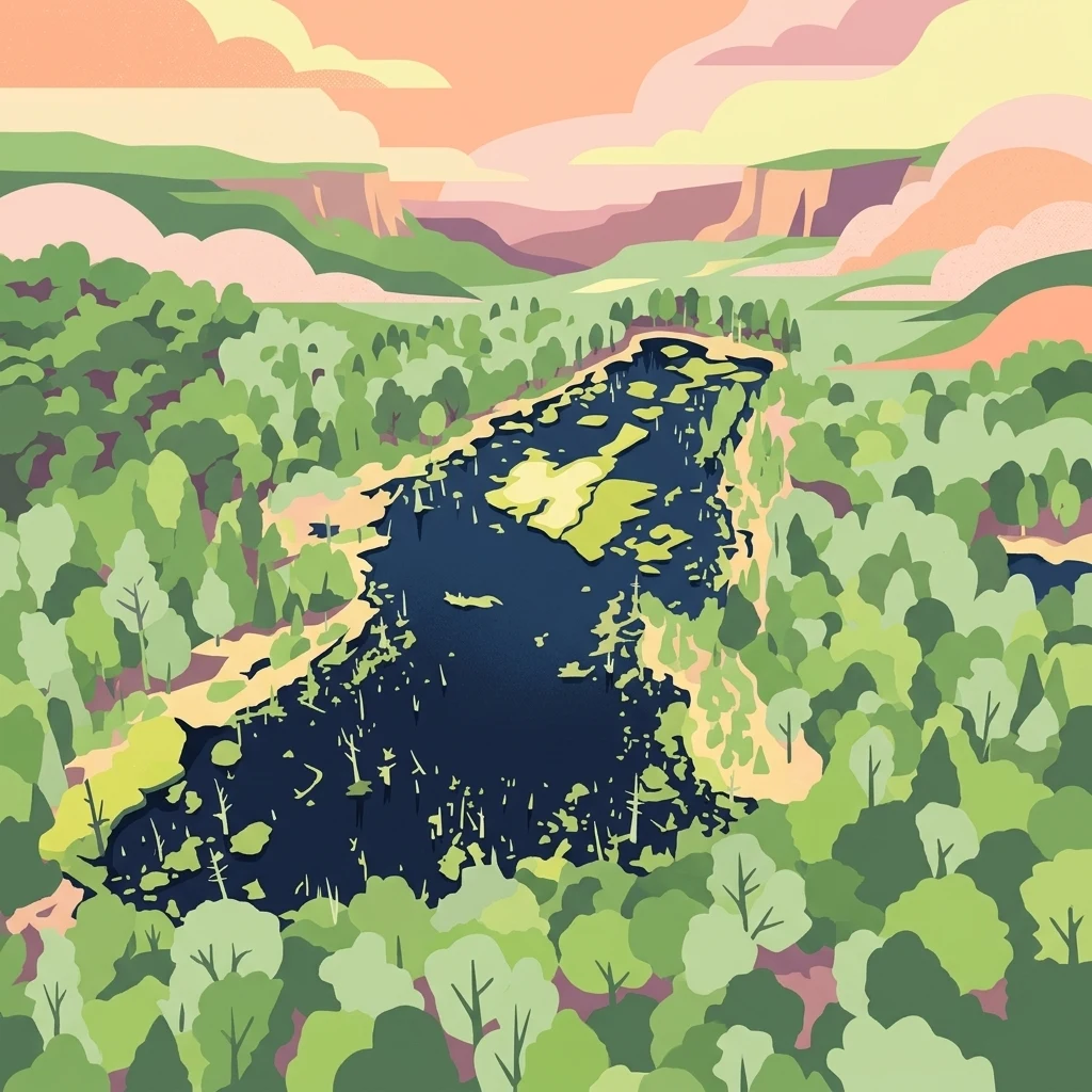
A colorful digital illustration showing a dark blue body of water with green vegetation patches, surrounded by a forest of green trees, with layered pink and purple cliffs and clouds in the distance.

Réserve naturelle régionale de la tourbière de la Grande Pile

Nature reserve

Park overview

Structured park overview, official facts, and landscape profile for Réserve naturelle régionale de la tourbière de la Grande Pile

Réserve naturelle régionale de la tourbière de la Grande Pile park facts, protected area profile, and essential visitor context

Review the core facts for Réserve naturelle régionale de la tourbière de la Grande Pile, including designation, size, terrain, visitor scale, habitats, and operating context in one park-focused overview.

About Réserve naturelle régionale de la tourbière de la Grande Pile

The Réserve naturelle régionale de la tourbière de la Grande Pile is a small but exceptionally rich wetland reserve in the eastern part of France, in the Haute-Saône department of Bourgogne-Franche-Comté. It lies within the commune of Saint-Germain, at the foot of the Vosges saônoises and within the well-known Région des Mille étangs, a landscape characterised by a remarkable density of small ponds and peatlands. The reserve itself covers about 59 hectares and is composed of three separate units: the crescent-shaped Grande Pile peatland, a portion of the Bois de Question to the northeast, and the northern tip of the Étang du Grand Saint-Maurice to the southeast.

Beyond its modest size, the reserve holds an importance that strongly exceeds its footprint. The Grande Pile peat bog is internationally recognised for its near-continuous sediment record covering roughly 135,000 years of climate history, providing one of the most important Pleistocene reference sequences for western Europe. The site has been the subject of major pollen-analytical and palaeoclimatic studies since the late twentieth century and continues to be cited as a benchmark in Quaternary research.

At the same time, the reserve is a living ecosystem rather than a purely geological monument. Its peatland supports nearly every developmental phase of a bog: acidic low marsh, raised sphagnum bog, and increasingly wooded bog communities such as birch and alder on peat. Additional habitats include reedbeds, marshy alder woodland, and acidophilous oak-beech forest on better-drained soils. Together these habitats shelter species of flora and fauna that are highly localised in France, several of which are more typically associated with montane or northern environments. The combination of scientific heritage, ecological rarity, and regional landscape setting makes the Grande Pile reserve a distinctive node within the broader network of protected wetlands in eastern France.

Quick facts and research context for Réserve naturelle régionale de la tourbière de la Grande Pile

The Réserve naturelle régionale de la tourbière de la Grande Pile is a French regional nature reserve formally classified on 1 July 2016 by the Conseil régional de Bourgogne-Franche-Comté. It covers roughly 59 hectares in the commune of Saint-Germain, Haute-Saône, at about 330 metres of altitude, on the edge of the Région des Mille étangs.

Its core site is the Grande Pile peat bog, a crescent-shaped wetland that holds one of the most complete Pleistocene pollen and climate records in northern Europe, documenting roughly 135,000 years of climatic fluctuations. The territory also includes a section of the Bois de Question and the northern end of the Étang du Grand Saint-Maurice, and lies within the Natura 2000 area of the Plateau des Mille étangs and the perimeter of the Parc naturel régional des Ballons des Vosges.

Protection and recognition

Documented terrestrial protection scope, management records, and formal designation data

Réserve Naturelle Régionale de la Tourbière de la Grande Pile Protection Status

Terrestrial protection status, management scope, and official designation records for Réserve naturelle régionale de la tourbière de la Grande Pile appear alongside verified WDPA database entries. Structured conservation records provide clear reference points for protected area governance and regional status without external assumptions.

Protection details

Protection scope
Terrestrial
Transboundary protection
No
WDPA ID
555597269
Park context

Deeper park guide and search-rich context for Réserve naturelle régionale de la tourbière de la Grande Pile

Réserve naturelle régionale de la tourbière de la Grande Pile history, landscape, wildlife, and travel context

Explore Réserve naturelle régionale de la tourbière de la Grande Pile through its history, landscape character, ecosystems, wildlife, conservation priorities, cultural context, and seasonal travel timing in a structured park guide built for atlas discovery and search intent.

Why Réserve naturelle régionale de la tourbière de la Grande Pile stands out

The Grande Pile peat bog is best known internationally as a continuous, high-resolution archive of Pleistocene climate change in western Europe. Its sediments have yielded one of the most important Pleistocene stratotypes in northern Europe, allowing scientists to reconstruct roughly 135,000 years of temperature shifts, vegetation change, and glacial-interglacial transitions. At a regional scale, the reserve is equally valued for having all the evolutionary stages of a peatland represented in a single compact site, from acidic minerotrophic marsh and raised sphagnum bog to birch- and alder-dominated wooded bog. This rare combination of palaeoclimate record and living bog ecosystem is what defines the site's scientific and ecological identity.
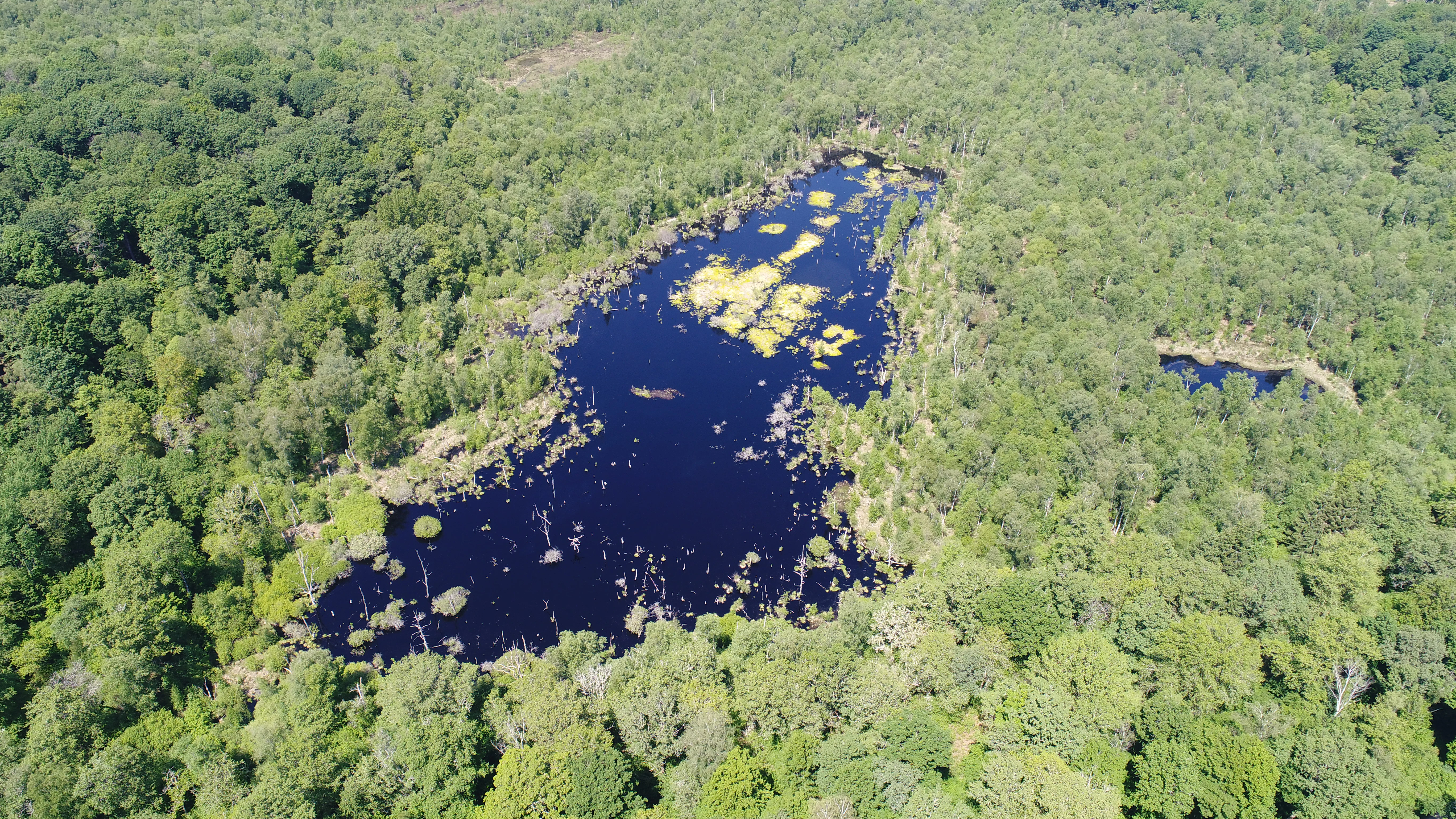
An aerial photograph showing a dark blue peat bog with patches of yellow-green aquatic vegetation, surrounded by a dense green forest.
Aerial view of the Grande Pile peatland showing dark bog water surrounded by dense forest.

Réserve naturelle régionale de la tourbière de la Grande Pile history and protected-area timeline

Peat has been extracted at the Grande Pile site and at the nearby Tourbière des Monts Reveaux since at least 1866, when both bogs were exploited commercially for their peat deposits. This early extraction activity shaped the physical structure of the peatland long before any formal protection existed.

The site was first recognised for its broader natural value through the ZNIEFF inventory by the Inventaire national du patrimoine naturel, which listed it as a zone naturelle d'intérêt écologique, faunistique et floristique. Beginning in 1998, the Conservatoire d'espaces naturels de Franche-Comté, working with the commune of Saint-Germain, launched a process to acquire land and gain control over the site, with the first on-the-ground conservation actions starting in 2002.

In 2009, these partners jointly requested formal classification as a régional nature reserve. After several years of preparation, the Conseil régional de Bourgogne-Franche-Comté officially created the Réserve naturelle régionale de la tourbière de la Grande Pile on 1 July 2016. The reserve also falls within the Natura 2000 area of the Plateau des Mille étangs and within the perimeter of the Parc naturel régional des Ballons des Vosges, embedding it in a wider regional framework of landscape and habitat protection. A walking trail with interpretation panels was developed in the early twenty-first century, and in October 2022 the Conservatoire d'espaces naturels installed a new educational installation called the 'balade à 1000 temps'.

Réserve naturelle régionale de la tourbière de la Grande Pile landscape and geographic character

The reserve sits at around 330 metres of altitude near the edge of the Vosges saônoises, in the transitional zone between upland forests and the more ponded country of the Région des Mille étangs. The terrain is gentle, dominated by low rounded landforms with waterlogged depressions rather than dramatic relief, but the mosaic of bog, woodland, and open water creates strong visual contrast within a small footprint.

The central landscape feature is the crescent-shaped Grande Pile peatland, surrounded and partly penetrated by woodland. Much of the visible surface is wooded bog, with alder and birch growing directly on peat, while open, raised sphagnum bog occurs in the more central and wettest sectors. To the northeast lies a section of the larger Bois de Question forest, and to the southeast the reserve extends into the northern end of the Étang du Grand Saint-Maurice, adding an open-water element to the reserve's composition. Together, these elements make the site feel both intimate and structurally diverse, with clear seasonal variation between flooded summer surfaces, frosted winter bogs, and the green flush of spring vegetation.
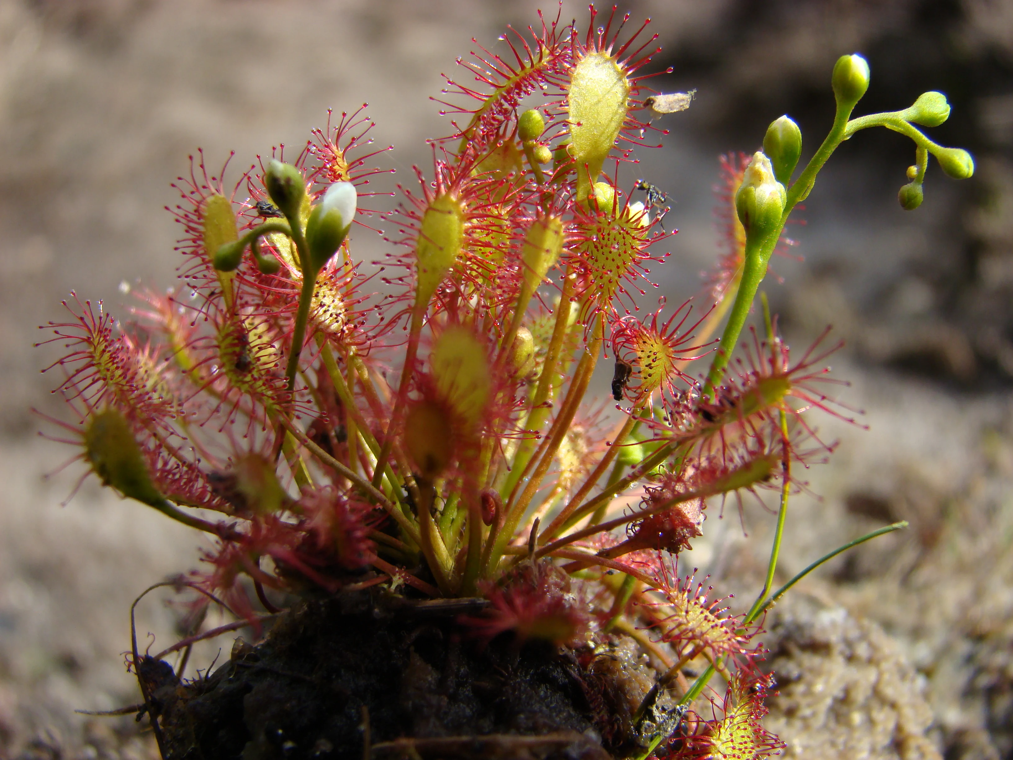
A close-up photograph of a blooming oblong-leaved sundew plant with reddish, hair-like tentacles and small green and white flower buds rising from a dark, mossy base.
A blooming oblong-leaved sundew (Drosera intermedia) displaying its characteristic reddish, glandular leaves and flower buds.

Réserve naturelle régionale de la tourbière de la Grande Pile ecosystems, habitats, and plant life

Ecologically, the reserve is defined by its exceptional peatland sequence. In a single compact area it preserves nearly all the evolutionary phases of a bog: acidic minerotrophic marsh at the earliest stage, raised sphagnum bog where peat accumulation lifts the surface above the influence of groundwater, and increasingly wooded bog communities dominated by birch and alder on decomposed peat. Surrounding and interspersed are reedbeds, marshy alder stands, and, on better-drained ground, acidophilous oak and beech forest.

This habitat diversity is matched by an unusual concentration of plant species with strong relict or montane affinities. Sphagnum-dominated raised bog hosts bog rosemary, pale yellow bladderwort, round-leaved and intermediate sundews, scheuchzeria, cranberry, and a range of sedges, while the woodland fringes and wooded bog support more typical lowland species. The result is a peatland that reads as both a functional living bog ecosystem and a botanical refuge, with conditions that allow species normally found further north or higher in elevation to persist at modest altitude in eastern France.
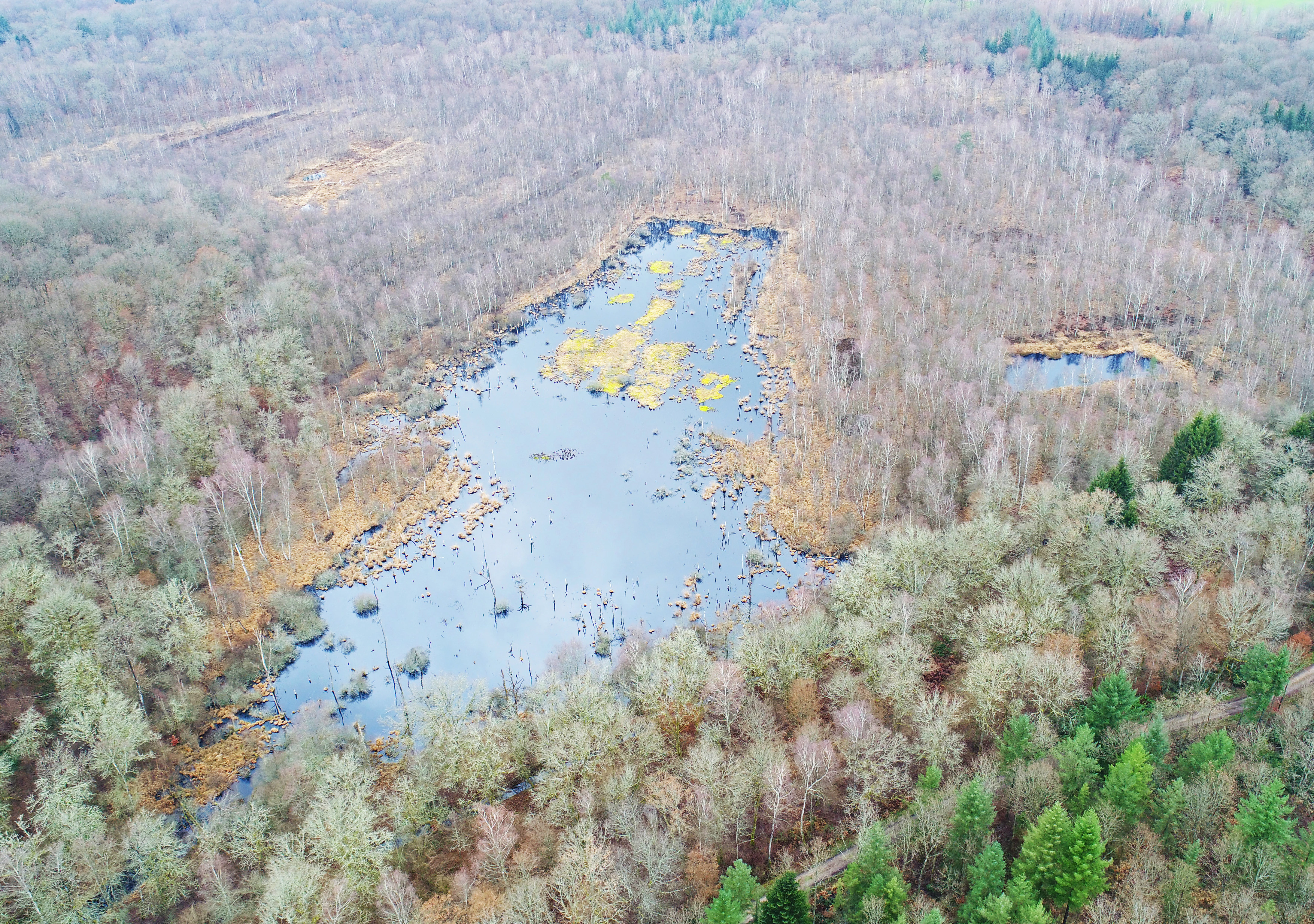
An aerial photograph showing a peat bog with a central body of water and yellowish vegetation, surrounded by a dense forest of mostly bare trees.
Aerial view of the Grande Pile peat bog surrounded by forest in December 2019.

Réserve naturelle régionale de la tourbière de la Grande Pile wildlife and species highlights

Despite its small area, the Grande Pile reserve is one of the richest dragonfly sites in the Haute-Saône department and is regionally significant for insect conservation. Numerous species of national or regional conservation priority have been recorded, including the yellow-spotted whiteface, the small whiteface, the scarce emerald damselfly, the robust spreadwing, the scarce blue-tailed damselfly, and the northern emerald. Several of these are considered regionally priority species, while the yellow-spotted whiteface benefits from both national and European protection.

The reserve is also notable for its amphibian and reptile fauna. The common frog and the viviparous lizard are both present and are listed as threatened on regional red lists. The combination of acidic bog pools, marshy woodland, and heath-like bog margins provides a range of breeding and foraging conditions for these groups, reinforcing the site's reputation as a disproportionately rich wetland reserve for its size.
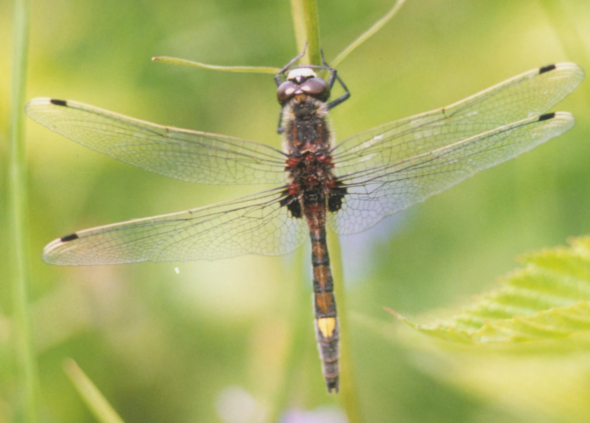
A close-up, top-down view of a dragonfly with transparent wings and a dark body with yellow markings, perched vertically on a thin green plant stem against a blurred green background.
Male Leucorrhinia pectoralis dragonfly perched on a plant stem.

Réserve naturelle régionale de la tourbière de la Grande Pile conservation status and protection priorities

The Grande Pile reserve protects a peatland that is simultaneously a living ecosystem and a globally significant palaeoclimatic archive. From a conservation perspective, this dual role is unusual and elevates the importance of the site well beyond its modest surface area. Loss or degradation of the bog would erase both an active habitat for rare species and a sediment record that cannot be reconstructed elsewhere.

The bird's-eye conservation objectives include preserving the full peatland successional sequence, maintaining the hydrological regime that supports sphagnum communities, and protecting rare relict and montane plant species that depend on these stable, acidic, waterlogged conditions. Indirectly, the reserve contributes to broader landscape-level conservation because it lies within the Natura 2000 zone of the Plateau des Mille étangs and within the perimeter of the Parc naturel régional des Ballons des Vosges, both of which reinforce regional wetland and forest protection. Long-term protection is managed through the formal regional nature reserve designation of 2016, with the Conservatoire d'espaces naturels de Franche-Comté playing a central role in land management, monitoring, and public engagement.

Réserve naturelle régionale de la tourbière de la Grande Pile cultural meaning and human context

The Grande Pile peatland has been part of the local economy since at least the nineteenth century, with peat extraction documented from 1866 onward. This long history of low-intensity use, rather than industrial-scale drainage, has helped preserve both the bog structure and the surrounding woodlands, giving the reserve a cultural background rooted in traditional rural land use.

In the wider landscape, the site is embedded in the identity of the Région des Mille étangs, a historical region defined by thousands of small artificial ponds created over centuries for fish farming and water management. The reserve's educational trail and, more recently, the 2022 'balade à 1000 temps' installation, whose themed panels use clocks, gears, sundials, and chronological timelines, reflect an effort to make the site's deep climate history tangible to local visitors and to connect the peatland to a broader regional narrative of landscape and time.
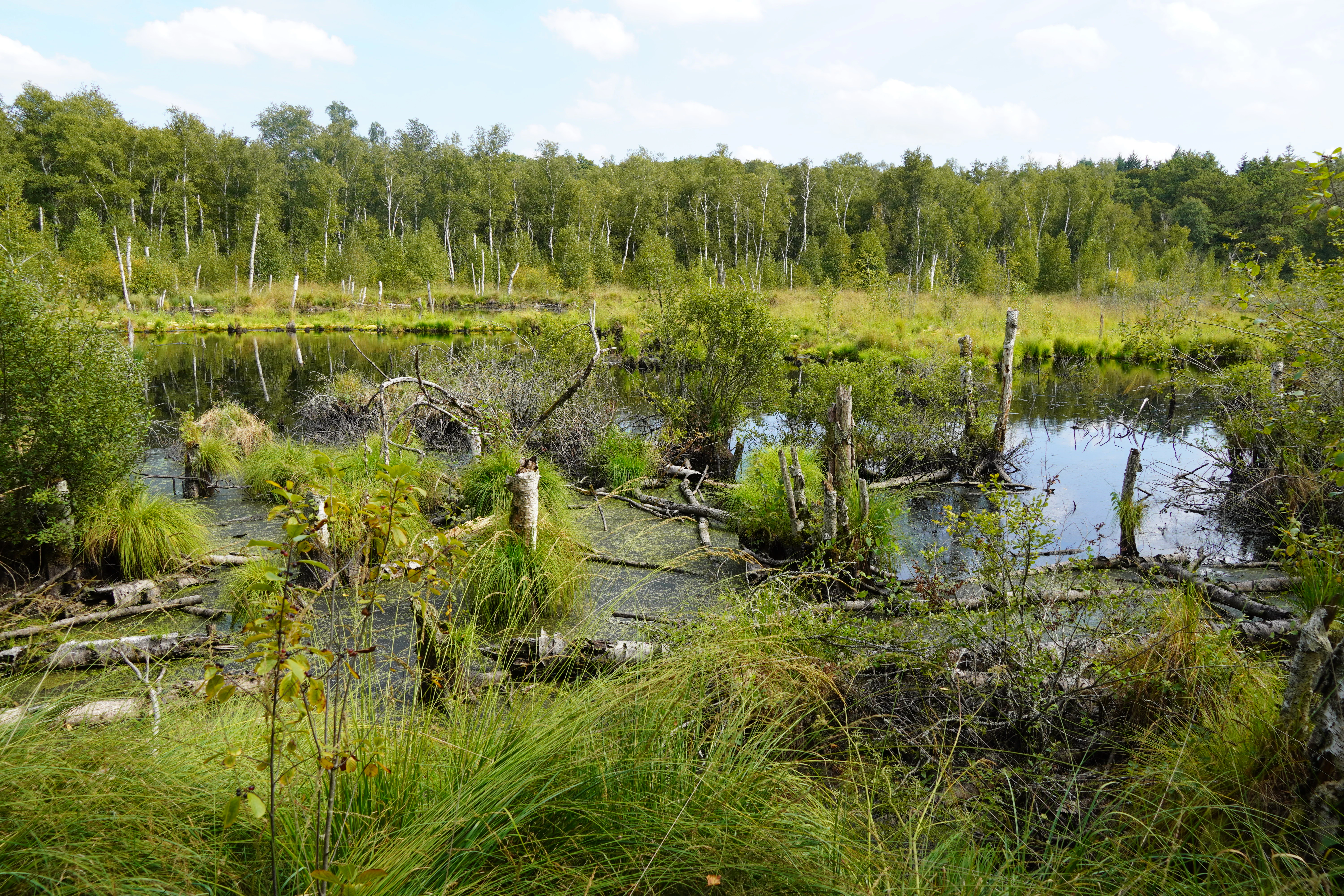
A landscape view of a wetland with standing water, dead tree trunks, and green grasses in the foreground, backed by a forest under a partly cloudy sky.
A flooded area within the Grande Pile peatland, featuring standing water, dead tree stumps, and surrounding vegetation.

Top sights and standout views in Réserve naturelle régionale de la tourbière de la Grande Pile

Internationally significant 135,000-year Pleistocene pollen and climate record in a small French peatland.

Near-complete representation of all evolutionary phases of a peatland within a single reserve, from acidic marsh to raised sphagnum bog and wooded bog.

Disproportionately rich dragonfly assemblages for the Haute-Saône department, including species under national and European protection.

Important refuge for relict and montane-affinity bog plants, including sundews, bog rosemary, scheuchzeria, and cranberry at unusually low altitude.
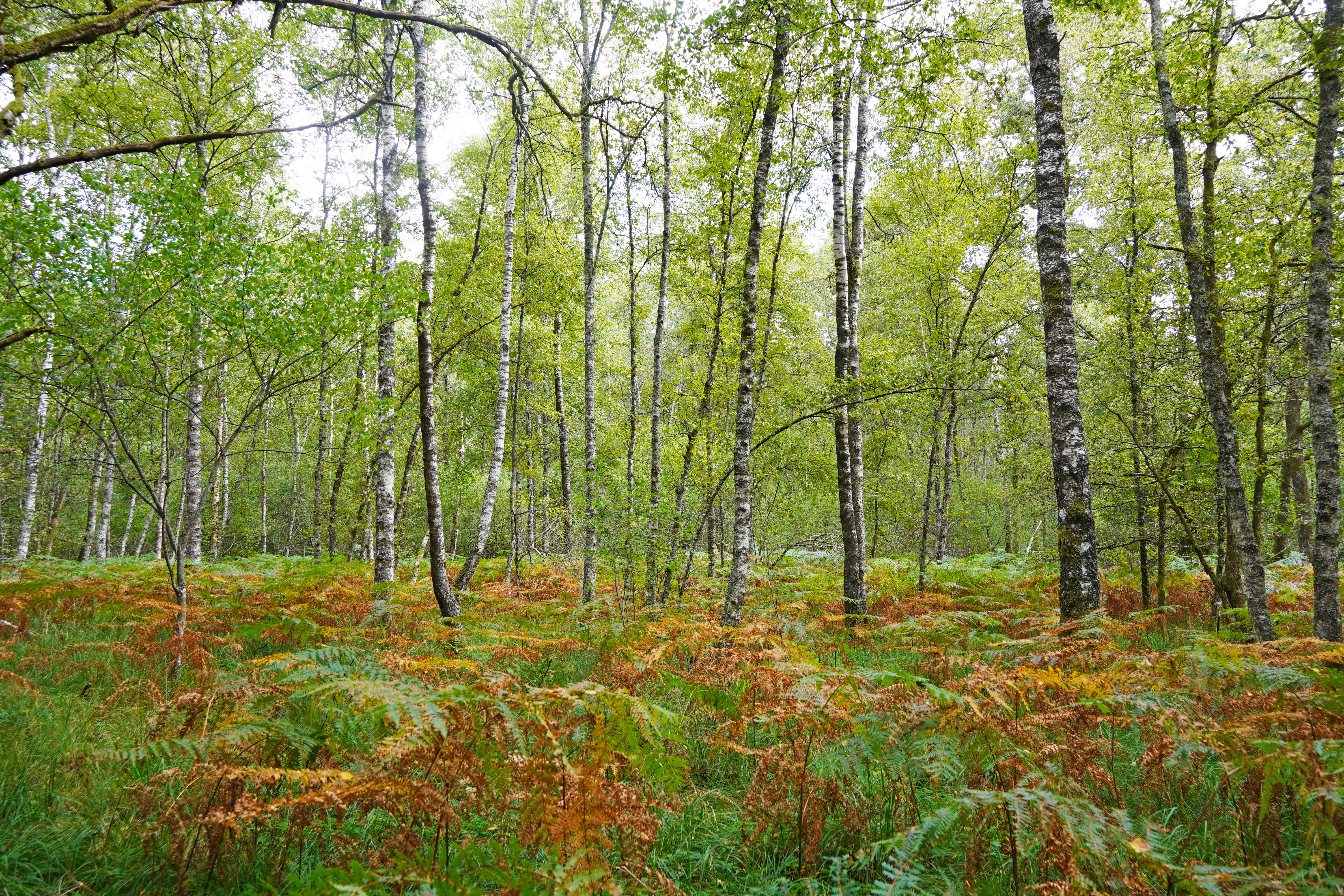
A forest scene showing slender birch trees with white bark standing among green and orange ferns covering the ground
Birch and alder trees rising above a fern-covered forest floor in the Grande Pile peatland

Best time to visit Réserve naturelle régionale de la tourbière de la Grande Pile

The reserve can be appreciated throughout much of the year, but seasons strongly shape what a visitor sees. Spring brings the fresh green flush of bog vegetation and active dragonfly emergence, while summer highlights the open flooded areas of the peatland. Autumn offers rich bog colours and the chance to see sphagnum hummocks and cranberry at their most vivid, and winter exposes the overall structure of the wetland from the air, with frosted bogs and bare birches revealing the site's characteristic crescent shape.

Monthly climate preview

Long-term temperature and monthly precipitation normals across a representative coordinate

Réserve naturelle régionale de la tourbière de la Grande Pile Climate and Weather by Month

Measured long-term averages reveal a steady annual rhythm in temperature and daily precipitation across the representative coordinate. Detailed twelve-month records provide complete monthly climate normals for deeper climatological comparison.
Annual mean10 °C
1 °C19 °C
Jan
Feb
Mar
Apr
May13°
Jun17°
Jul19°
Aug19°
Sep15°
Oct10°
Nov
Dec
Warmest month
July

19.3 °C

Coolest month
January

0.9 °C

Wettest month
December

3.2 mm/day

Driest month
April

2.3 mm/day

Park location guide

Geography guide, regional context, and park location map for Réserve naturelle régionale de la tourbière de la Grande Pile

Réserve naturelle régionale de la tourbière de la Grande Pile park geography, regions, and map view in France

Understand where Réserve naturelle régionale de la tourbière de la Grande Pile sits in France through a broader geographic reading of the surrounding landscape, nearby location context, and its mapped position within the national park landscape.

How Réserve naturelle régionale de la tourbière de la Grande Pile fits into France

France is a unitary semi-presidential republic and one of the world's largest economies. It borders Belgium, Luxembourg, Germany, Switzerland, Italy, Monaco, Andorra, and Spain, with a maritime border to the United Kingdom. The country is known for its cultural influence, art, cuisine, and political history spanning centuries.

Wider geography shaping Réserve naturelle régionale de la tourbière de la Grande Pile in France

France is located in Western Europe. Metropolitan France extends from the Rhine to the Atlantic Ocean and from the Mediterranean Sea to the English Channel and North Sea. The country borders Belgium, Luxembourg, Germany, Switzerland, Italy, Monaco, Andorra, Spain, and has a maritime border with the United Kingdom.

Map view of Réserve naturelle régionale de la tourbière de la Grande Pile

Use this park location map to pinpoint Réserve naturelle régionale de la tourbière de la Grande Pile in France, understand its exact geographic position, and read its mapped placement within the surrounding landscape more clearly.

Pigeon | © OpenStreetMap contributors

Visualizing the peat bog habitats, wetland terrain, and protected environments of eastern France

Réserve naturelle régionale de la tourbière de la Grande Pile Photos and Landscape Scenery

Visual documentation of Réserve naturelle régionale de la tourbière de la Grande Pile reveals the intricate mosaic of sphagnum bogs, wooded wetlands, and glacial depressions that define the protected landscape. Examining these field photographs helps researchers and visitors interpret the terrain, habitat structure, and ecological character of the reserve more deeply.

An aerial photograph showing a dark blue peat bog with patches of yellow-green aquatic vegetation, surrounded by a dense green forest.

Aerial photograph showing a dark blue peat bog with patches of yellow-green vegetation, completely surrounded by a dense green forest.

A close-up photograph of a blooming oblong-leaved sundew plant with reddish, hair-like tentacles and small green and white flower buds rising from a dark, mossy base.

An aerial photograph showing a peat bog with a central body of water and yellowish vegetation, surrounded by a dense forest of mostly bare trees.

A close-up, top-down view of a dragonfly with transparent wings and a dark body with yellow markings, perched vertically on a thin green plant stem against a blurred green background.

A close-up photograph of a single pink cranberry flower with a drooping head on a thin reddish stem, surrounded by green moss and small leaves in a bog environment.

A landscape view of a wetland with standing water, dead tree trunks, and green grasses in the foreground, backed by a forest under a partly cloudy sky.

A forest scene showing slender birch trees with white bark standing among green and orange ferns covering the ground

A flooded peat bog in winter with bare birch trees and clumps of brown grass emerging from the water under an overcast sky.

Aerial photograph showing two irregular brownish-gray peat bog clearings surrounded by dense green deciduous forest.

A wide shot of a green, grassy wetland with small pools of water and a dense line of trees in the background under a bright sky.

Park atlas

Compare surrounding wetland reserves, forest lands, and regional protected landscapes across eastern France

Parks Near Réserve naturelle régionale de la tourbière de la Grande Pile and Regional Protected Areas

Browse nearby protected areas and regional nature reserves located around the Vosges saônoises and the surrounding department. Comparing adjacent park geography provides broader context on wetland habitats, woodland patches, and regional conservation terrain.
A watercolor painting showing a soft, panoramic landscape of a peat bog or wetland with light green vegetation, scattered trees, and distant rolling hills on a white background.
Nature reserveGrand Est
About 29 km away#1 closest

Northeast

Réserve naturelle régionale de la tourbière des Charmes: Protected Mountain Peatland Geography

High Vosges mountain wetland and subalpine forest landscape

Located on the granite ridges of the Vosges mountains in the Grand Est region, this nature reserve preserves a vast, perched mountain peatland. Its distinct geographic character includes deep peat deposits and a habitat gradient transitioning from acidic wetland to mature fir and spruce forest, serving as a critical study area for specialized flora and cold-adapted wildlife.

Area
0.68 km²
Established
2008
IUCN
IV
Relief
Mountain
A horizontal watercolor painting showing a soft, impressionistic landscape with layers of green hills and trees against a pale, light background.
Nature reserveBourgogne-Franche-Comté
About 29 km away#2 closest

Southwest

Réserve naturelle nationale du Sabot de Frotey: Geographic and Protected Area Overview

Limestone plateau and calcareous grasslands in Haute-Saône

Located near Vesoul, the Réserve naturelle nationale du Sabot de Frotey features a prominent southwest-facing cliff and a rich expanse of dry grassland. This nature reserve provides critical habitat for orchids and diverse butterfly assemblages within a landscape defined by erosion-shaped monoliths and Mediterranean-edge flora.

Area
0.98 km²
Established
1981
IUCN
IV
Relief
Upland
Nature reserveBourgogne-Franche-Comté
About 32 km away#3 closest

South

Réserve naturelle régionale des Grottes du Cirque: Regional Nature Reserve and Karst Network

Protected limestone valley and bat hibernation site in Bourgogne-Franche-Comté

Located in the pre-Jura hills, this regional nature reserve features a compact reculée landscape defined by six limestone caves. These protected underground habitats serve as vital wintering grounds for various bat species and contain significant prehistoric fossil remains, marking the site as a key area for both geological and ecological study in eastern France.

Area
0.153 km²
Established
2015
IUCN
IV
Relief
Upland
Nature reserveBourgogne-Franche-Comté
About 33 km away#4 closest

Southwest

Réserve naturelle régionale de la grotte de la Baume: Regional Nature Reserve Atlas

Mapping karst cave systems and bat habitats in Haute-Saône

The Réserve naturelle régionale de la grotte de la Baume protects a limestone cave system on the edge of the plateau near Échenoz-la-Méline. Its small but intensive protected perimeter serves as a vital hibernation site and autumn transit corridor, forming part of a broader ecological network across the Franche-Comté landscape.

Area
0.175 km²
Established
2015
IUCN
IV
Relief
Upland
A wide watercolor painting depicting a calm river or lake flanked by green and purple vegetation, with distant mountains under a soft pink and yellow sky.
Nature reserveDoubs
About 34 km away#5 closest

Southeast

Réserve naturelle régionale de la basse vallée de la Savoureuse: Regional Nature Reserve

Protected alluvial floodplain geography in Doubs, France.

This nature reserve safeguards a significant fragment of the Savoureuse river floodplain. The protected area offers a complete alluvial sequence within 42 hectares, including active gravel bars and mature ash-alder woodlands, providing a high-density ecological core amidst an industrial landscape in the Doubs department.

Area
0.419 km²
Established
2008
IUCN
IV
Relief
Lowland
Nature reserveHaute-Saône
About 36 km away#6 closest

West

Réserve naturelle nationale de la grotte du Carroussel: Limestone Cave and Bat Reserve

Protected underground landscapes in the Haute-Saône region

Investigate the unique geographic setting of the Réserve naturelle nationale de la grotte du Carroussel. Located on a forested limestone plateau in the Val de Saône, this nature reserve serves as an essential maternity and hibernation site. Learn about its cave morphology, protected forest boundaries, and role within the regional ecological network.

Area
0.023 km²
Established
1990
IUCN
IV
Relief
Upland
A soft watercolor painting of a rolling landscape with green hills, light blue distant mountains, and patches of pink and yellow vegetation.
Nature reserveGrand Est
About 38 km away#7 closest

East

Réserve naturelle régionale de la forêt des volcans de Wegscheid: Geological Protected Area

Mapping volcanic terrain in the Grand Est region of eastern France.

Located in the Haut-Rhin, this regional nature reserve preserves a distinct volcanic landscape characterized by rocky promontories, basalt columns, and mature forest stands. The protected terrain features varied elevation from 700 meters to the Rossberg ridge, showcasing geological formations that have remained largely untouched by intensive historical forestry.

Area
1.015 km²
Established
2008
IUCN
IV
Relief
Mountain
A pale, soft-focus watercolor illustration depicting a limestone cliff landscape with gentle rolling hills and light vegetation.
Nature reserveBourgogne-Franche-Comté
About 45 km away#8 closest

Southeast

Réserve naturelle régionale du Crêt des Roches: Protected Landscape and Geography Atlas

Lomont range limestone corniche and regional nature reserve map

Situated southeast of Pont-de-Roide-Vermondans, this regional nature reserve preserves a compact forty-three hectare area of Jurassic limestone cliffs and mesophilic forests. The site provides a critical reference point for studying Mediterranean-margin flora, including rare relict plant populations, and stands as a major topographical observation corridor for autumn bird migrations in eastern France.

Area
0.434 km²
Established
2009
IUCN
IV
Relief
Upland

Common questions about visiting, size, designation, and location context for Réserve naturelle régionale de la tourbière de la Grande Pile

Réserve naturelle régionale de la tourbière de la Grande Pile FAQs for park facts, access, geography, and protected area context

Find quick answers about Réserve naturelle régionale de la tourbière de la Grande Pile, including protected-area facts, park geography, trail and visitor context, and how the park fits into its surrounding country and regional landscape.
MoriAtlas Explorer

Continue Your Protected Areas Search Across the Global Atlas

Deepen your exploration by continuing the structured search for national parks and protected areas worldwide. Utilize the comprehensive filtering capabilities to compare different conservation landscapes and refine your understanding of global park geography. Discover more about the distribution and characteristics of protected natural areas.

Global natural geography