
Mori Atlas logo
Nature reserveRéserve naturelle régionale de la tourbière des Charmes

A High Vosges mountain nature reserve showcasing intricate peatland geography and subalpine forest mosaics

Réserve naturelle régionale de la tourbière des Charmes: Protected Peatland and Mountain Landscape

The Réserve naturelle régionale de la tourbière des Charmes constitutes a significant protected landscape in the Vosges massif of the Grand Est region. This 68-hectare mountain reserve is defined by its deep, glacially formed peat bogs, which reach depths of seven metres, and a surrounding mosaic of old-growth subalpine forest. This site represents a vital geographic anchor for studying high-altitude wetland ecosystems and acidic soil gradients within northeastern France.

peatlandbogmountain wetlandsphagnum mosssubalpine forestVosges mountains
A digital illustration showing a tranquil peat bog with reflective water pools, surrounded by coniferous and deciduous trees, with distant mountains under a soft pink sunset sky.

Réserve naturelle régionale de la tourbière des Charmes

Nature reserve

Park overview

Structured park overview, official facts, and landscape profile for Réserve naturelle régionale de la tourbière des Charmes

Réserve naturelle régionale de la tourbière des Charmes park facts, protected area profile, and essential visitor context

Review the core facts for Réserve naturelle régionale de la tourbière des Charmes, including designation, size, terrain, visitor scale, habitats, and operating context in one park-focused overview.

About Réserve naturelle régionale de la tourbière des Charmes

Réserve naturelle régionale de la tourbière des Charmes is a regional nature reserve set on the upper ridges of the Vosges mountains, in the commune of Rupt-sur-Moselle in the Grand Est region. The protected area climbs from about 685 metres at its lowest point up to roughly 880 metres where the main peatland sits, occupying a crest-and-plateau setting typical of the High Vosges landscape.

The reserve's defining feature is a glacially formed peatland covering around 40 hectares within a total protected perimeter of 68 hectares. This peat mass, where organic deposits can reach seven metres in thickness, is the second largest of its kind in the High Vosges and is the reason the reserve was created. Surrounding the open bog is a varied altitude forest composed of birch, beech, old firs, and spruce, providing a natural buffer and contributing to the site's ecological diversity.

Ecologically, the reserve preserves a set of rare, often boreal, habitats. Acidic peat pools sustain sphagnum mosses, cottongrass, bog asphodel elements, and insectivorous sundews, while the surrounding forest supports classic subalpine species. Birdlife is rich, with several protected species nesting in the area, including woodpeckers and owls associated with mature coniferous forest. Cold, acidic bog pools also host specialised dragonflies, while rare fungi flourish in the undisturbed peat.

The peatland was historically exploited for over a century, leaving extraction pits that are now slowly being recolonised by sphagnum mosses. This long human interaction shaped both the visible landscape and the modern conservation context, in which former extraction areas function as natural laboratories for peat recovery. Protection efforts began in the late 1980s, formalised as a voluntary nature reserve in 2000 and reclassified as a regional nature reserve in 2008.

Quick facts and research context for Réserve naturelle régionale de la tourbière des Charmes

The Réserve naturelle régionale de la tourbière des Charmes is a 68-hectare regional nature reserve in the Vosges mountains of northeastern France. It was classified on 28 March 2008 and protects a mountain peatland of glacial origin sitting at roughly 880 metres in altitude. The reserve is administered by the Conservatoire d'espaces naturels de Lorraine and forms part of the regional nature reserve network of Grand Est.

Protection and recognition

Documented terrestrial protection history and designation records

Réserve naturelle régionale de la tourbière des Charmes Protection Status

Terrestrial protection status for Réserve naturelle régionale de la tourbière des Charmes spans a designated establishment year of 2008. Official records compile formal protected area data without imported international recognition sources.

Protection details

Protection scope
Terrestrial
Designated year
2008
Transboundary protection
No
WDPA ID
555514378
Park context

Deeper park guide and search-rich context for Réserve naturelle régionale de la tourbière des Charmes

Réserve naturelle régionale de la tourbière des Charmes history, landscape, wildlife, and travel context

Explore Réserve naturelle régionale de la tourbière des Charmes through its history, landscape character, ecosystems, wildlife, conservation priorities, cultural context, and seasonal travel timing in a structured park guide built for atlas discovery and search intent.

Why Réserve naturelle régionale de la tourbière des Charmes stands out

The reserve is best known for hosting one of the largest and most intact mountain peat bogs in the High Vosges, with peat deposits reaching seven metres thick and a habitat mosaic that combines open acidic peatland with old-growth subalpine forest. It is distinctive among Vosges protected areas for the depth and continuity of its peat mass, the richness of its sphagnum communities, and the presence of rare bog specialists such as round-leaved sundew, bog cotton, and white beak-sedge. The site is also notable for its associated wildlife: boreal birds such as the black woodpecker and Eurasian pygmy owl, dragonflies adapted to cold acidic peat pools, and a rare coprophilous fungus linked to capercaillie droppings. Together, these qualities give the reserve a distinctly northern and relict character unusual for this part of France.
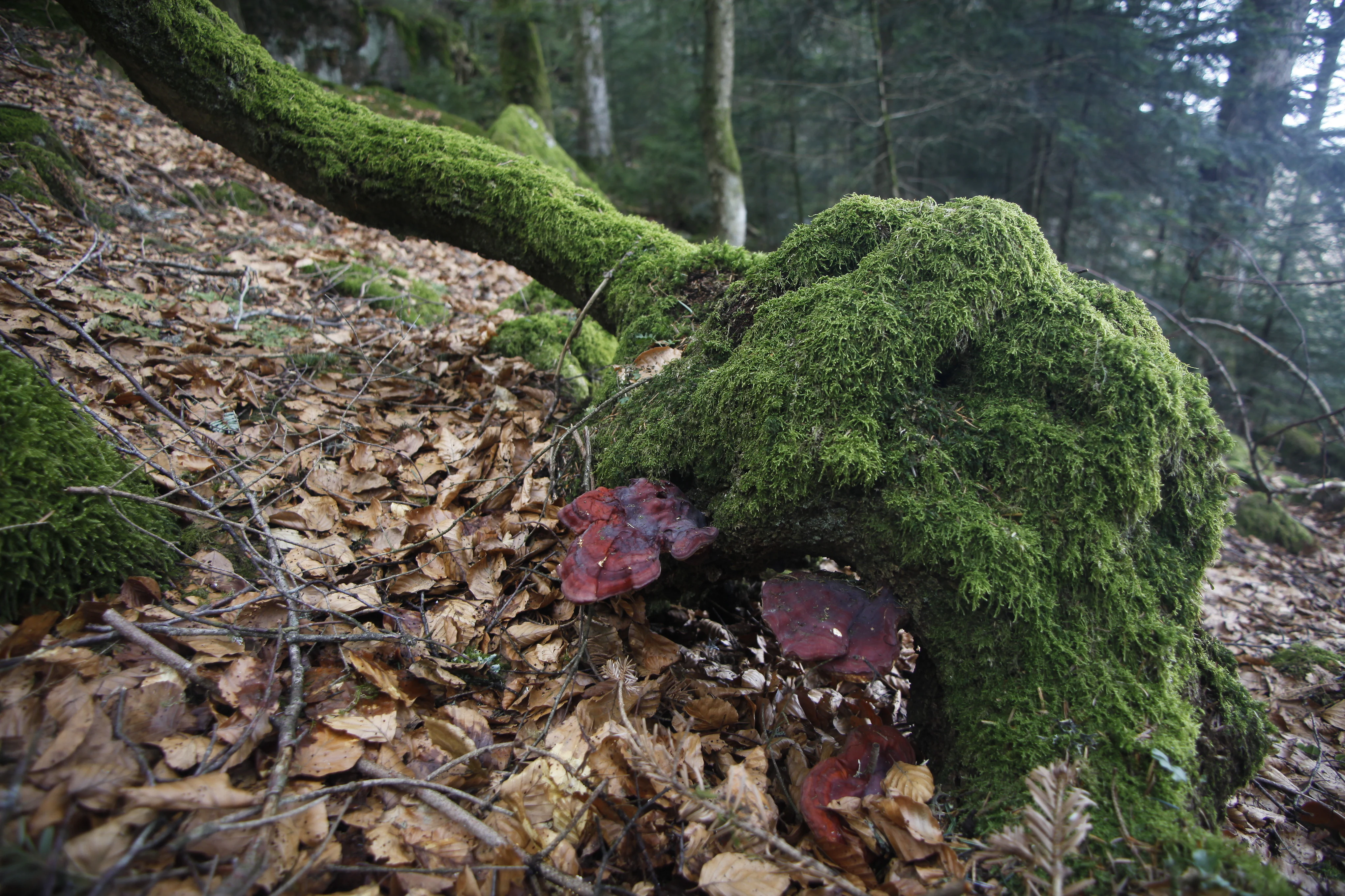
A weathered tree stump covered in vibrant green moss and fungi, situated on a slope covered with dry fallen leaves in a forest.
A moss-covered tree stump with fungi in the Tourbiere des Charmes nature reserve.

Réserve naturelle régionale de la tourbière des Charmes history and protected-area timeline

The peatland at the heart of the reserve was exploited for more than a hundred years, and the old extraction pits now form part of the visible landscape. These pits are gradually being recolonised by sphagnum mosses, and the surrounding forests, once damaged by wartime shelling that left trees scarred, have been allowed to develop without intervention, giving them an unusually aged character.

Protection of the site was initiated in the late 1980s by local naturalists and the commune of Thiéfosse, who recognised the exceptional value of the peatland. Since 1990, the Conservatoire d'espaces naturels de Lorraine has managed part of the site through land ownership covering roughly 20 hectares.

In 2000 the area was formally designated as a voluntary nature reserve by ministerial order, providing a first legal layer of protection. This was followed in 2008 by a regional council deliberation of 28 March 2008, which reclassified the area as a Régionale réserve naturelle régionale, expanding protection to the private lands of CEN Lorraine and to surrounding peatland and forest zones belonging to the commune of Thiéfosse.

Réserve naturelle régionale de la tourbière des Charmes landscape and geographic character

The reserve sits on the northeastern ridge of Rupt-sur-Moselle in the Vosges massif, on a granite plateau with sandstone outcrops. The terrain rises from about 685 metres in its lower reaches to 880 metres along the crest, with the bog itself perched on a long, relatively flat summit ridge.

The dominant landscape feature is the open peatland, a vast expanse of mosses, pools, and scattered bog vegetation surrounded by a varied subalpine forest. On the edges, birch woods give way progressively to denser stands of beech, mature firs, and spruce, producing a landscape mosaic that shifts visibly with altitude and soil conditions. Two small cols, Col de Xiard from the north and the Rue de la Charme access from Rupt-sur-Moselle to the south, frame the reserve and shape how visitors approach the site.
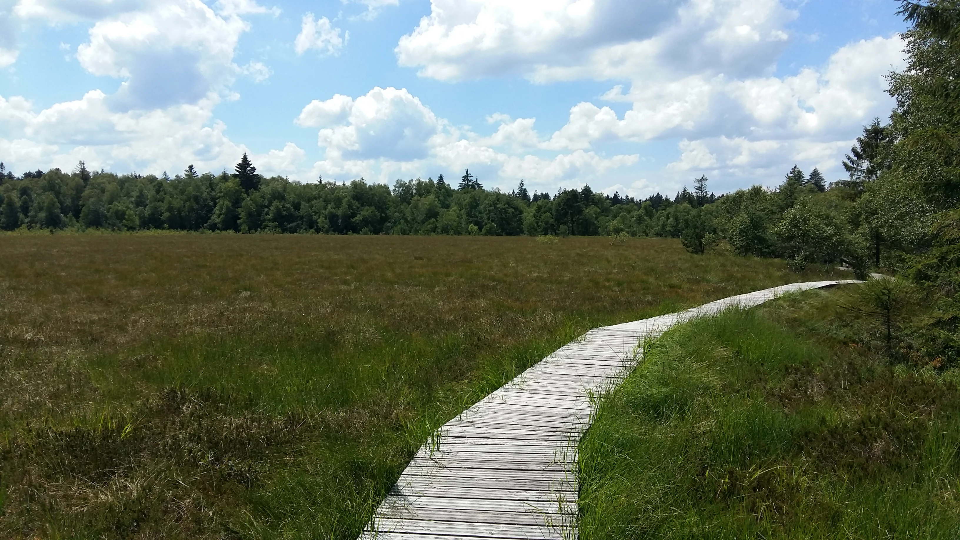
A wooden boardwalk path meanders through a green and brown marshy peat bog landscape under a blue sky with scattered clouds.
A wooden boardwalk winding through the Charmes peat bog in July.

Réserve naturelle régionale de la tourbière des Charmes ecosystems, habitats, and plant life

Ecologically, the reserve protects an exceptionally well-preserved glacial peatland complex within a tight altitudinal band of the High Vosges. The combination of a 40-hectare open bog and surrounding old-growth forest creates a strong ecological contrast between wet acidic peatland habitats and dry montane woodland, which is unusual at this latitude in France.

Forty-four moss species have been recorded, including sixteen sphagnum species, several of which dominate the recolonising extraction pits. The bog flora is composed almost entirely of specialists of acidic, nutrient-poor habitats: Andromeda polifolia, round-leaved and intermediate sundews, hare's-tail cottongrass, white beak-sedge, Scheuchzeria palustris, and the spotted orchid all form part of a community that elsewhere typically belongs to much more northern or alpine environments.

The surrounding forest plays a complementary ecological role, providing habitat continuity, structural diversity, and a transition zone between the open bog and the wider Vosges forest landscape. This combination of fragile wetland and resilient forest gives the reserve a particularly layered ecological character.
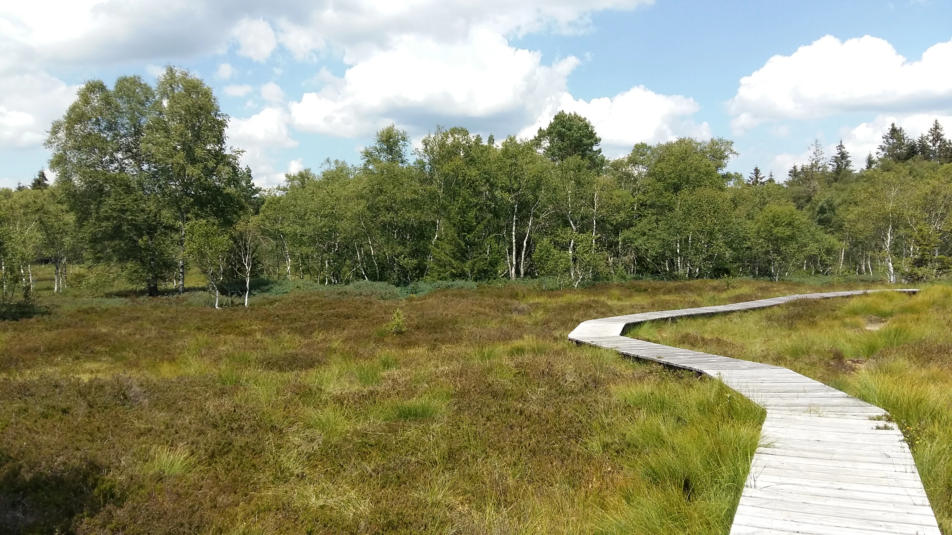
A winding wooden boardwalk stretches into a sunlit, grassy peat bog, framed by a dense forest of birch and evergreen trees under a cloudy sky.
A wooden boardwalk winding through the open peat bog and birch forest of the Tourbière des Charmes.

Réserve naturelle régionale de la tourbière des Charmes wildlife and species highlights

Wildlife is one of the reserve's most distinctive features. The avifauna includes 28 protected bird species, of which 23 are breeding locally. Notable forest and bog species include the black woodpecker, Tengmalm's owl, the Eurasian pygmy owl, the northern wheatear, the spotted nutcracker, and the red crossbill, reflecting the site's mature coniferous forest and open ridge habitats.

Bats are also represented, with five species recorded on the site. The bog pools support a specialised dragonfly fauna: 15 species frequent the cold, acidic waters, including the subarctic hawker, the alpine emerald, the spearhead bluet, the black darter, and the rare white-faced darter. Butterflies include the cranberry fritillary, the scarce copper, and the chequered skipper, all of which depend on bog-associated host plants.

The reserve also harbours rare fungi, including Pseudombrophila petrakii, a species that grows on capercaillie droppings and is considered exceptionally uncommon; its presence indicates that the wider forested landscape remains healthy enough to support this threatened bird.

Réserve naturelle régionale de la tourbière des Charmes conservation status and protection priorities

From a conservation standpoint, the reserve safeguards one of the two largest peatlands of the High Vosges, an ecosystem that is particularly vulnerable to drainage, trampling, peat extraction, and atmospheric deposition. Its perched position, with peat reaching seven metres deep, makes it a long-term carbon store and a key reference site for understanding the glacial and post-glacial history of the Vosges.

The official designation as a regional nature reserve in 2008 confirmed the site's protected status within the French regional network of nature reserves. It is also recorded as a ZNIEFF type I site, recognising its outstanding ecological interest for national biodiversity inventories. Conservation management is led by the Conservatoire d'espaces naturels de Lorraine, which has held land and managed portions of the site since 1990, and which balances the recovery of former extraction pits, the protection of the surrounding forest, and the limitation of damaging public access.

Because the bog surface is highly fragile, public access is restricted to a designated trail that runs along the reserve, reducing erosion and protecting deep peat deposits. This combination of legal protection, long-term land ownership, and active ecological management gives the reserve strong conservation significance beyond its modest size.

Réserve naturelle régionale de la tourbière des Charmes cultural meaning and human context

Although the reserve is primarily valued for its natural character, its landscape carries visible traces of human activity that have shaped the peatland for more than a century. Sustained peat extraction left a network of excavation pits that now form part of the contemporary landscape, and wartime damage to surrounding forests still leaves marks on surviving old trees. These features give the site a dual identity as both a working cultural landscape and a recovering natural habitat.

The local communes of Rupt-sur-Moselle and Thiéfosse have played an early and decisive role in protecting the bog, raising awareness of its value among naturalists and local decision-makers from the late 1980s onward. This grassroots engagement continues to underpin the reserve's management philosophy today.

Top sights and standout views in Réserve naturelle régionale de la tourbière des Charmes

A perched mountain peatland with peat up to seven metres thick, surrounded by old-growth subalpine forest, and supporting one of the most distinctive bog communities in the High Vosges. The reserve combines fragile acidic wetland habitat, rare flora such as sphagnum mosses and sundews, and a rich avifauna that includes boreal species like the Eurasian pygmy owl, alongside specialised bog-pool dragonflies and rare bog-linked fungi, all within a compact 68-hectare perimeter.

Best time to visit Réserve naturelle régionale de la tourbière des Charmes

Spring and early summer are generally favourable for visiting the wider Vosges ridges around the reserve, when wildflowers and bog flora are most visible and the weather is more reliably accessible on foot. Late spring in particular is a good moment for birdwatching, as many of the protected breeding species are most active. As the reserve's small bog surface is highly sensitive, any visit should be limited to the designated trail to limit erosion and disturbance across the seasons.

Monthly climate preview

Representative long-term temperature and monthly precipitation patterns

Réserve naturelle régionale de la tourbière des Charmes Climate Normals

Representative coordinate records show measured long-term temperature ranges and monthly precipitation patterns across the protected landscape. Detailed twelve-month climate profiles provide complete statistical breakdowns for comparative ecological research.
Annual mean9 °C
0 °C18 °C
Jan
Feb
Mar
Apr
May13°
Jun16°
Jul18°
Aug18°
Sep14°
Oct
Nov
Dec
Warmest month
July

18.1 °C

Coolest month
January

-0.1 °C

Wettest month
May

3 mm/day

Driest month
April

2 mm/day

Park location guide

Geography guide, regional context, and park location map for Réserve naturelle régionale de la tourbière des Charmes

Réserve naturelle régionale de la tourbière des Charmes park geography, regions, and map view in France

Understand where Réserve naturelle régionale de la tourbière des Charmes sits in France through a broader geographic reading of the surrounding landscape, nearby location context, and its mapped position within the national park landscape.

How Réserve naturelle régionale de la tourbière des Charmes fits into France

France is a unitary semi-presidential republic and one of the world's largest economies. It borders Belgium, Luxembourg, Germany, Switzerland, Italy, Monaco, Andorra, and Spain, with a maritime border to the United Kingdom. The country is known for its cultural influence, art, cuisine, and political history spanning centuries.

Wider geography shaping Réserve naturelle régionale de la tourbière des Charmes in France

France is located in Western Europe. Metropolitan France extends from the Rhine to the Atlantic Ocean and from the Mediterranean Sea to the English Channel and North Sea. The country borders Belgium, Luxembourg, Germany, Switzerland, Italy, Monaco, Andorra, Spain, and has a maritime border with the United Kingdom.

Map view of Réserve naturelle régionale de la tourbière des Charmes

Use this park location map to pinpoint Réserve naturelle régionale de la tourbière des Charmes in France, understand its exact geographic position, and read its mapped placement within the surrounding landscape more clearly.

Pigeon | © OpenStreetMap contributors

Location context for Réserve naturelle régionale de la tourbière des Charmes

Grand EstVosges

Photographic reference for mountain peatlands, sphagnum bogs, and subalpine forest habitats

Visual Explorer and Scenery of Réserve naturelle régionale de la tourbière des Charmes

Visual records illustrate the unique terrain and protected landscape character of Réserve naturelle régionale de la tourbière des Charmes. Photographic documentation reveals the dense subalpine woodland mosaic and glacial peat deposits defining the reserve environment.

A weathered tree stump covered in vibrant green moss and fungi, situated on a slope covered with dry fallen leaves in a forest.

A wide view of a snowy, marshy peat bog landscape with coniferous trees in the foreground and a line of forest in the distant horizon.

A wooden boardwalk path meanders through a green and brown marshy peat bog landscape under a blue sky with scattered clouds.

A winding wooden boardwalk stretches into a sunlit, grassy peat bog, framed by a dense forest of birch and evergreen trees under a cloudy sky.

Park atlas

Compare surrounding regional nature reserves and mountain wetland landscapes across the Vosges massif.

Parks Near Réserve naturelle régionale de la tourbière des Charmes and Related Protected Areas

Browse other parks near Réserve naturelle régionale de la tourbière des Charmes to examine connected mountain wetland habitats and regional protected landscapes. Comparing adjacent conservation areas reveals broader ecological patterns across the high altitude terrain of northeastern France.
A watercolor painting showing a wide panoramic view of green rolling hills and mountain ridges under a soft light.
Nature reserveGrand Est
About 21 km away#1 closest

East

Réserve naturelle régionale des hautes-chaumes du Rothenbach: Protected Geography in the Vosges

A regional nature reserve in Grand Est, France.

This protected area provides a representative profile of the high Vosges mountains, spanning elevations from 900 to 1,300 metres. The terrain is characterized by an open mosaic of primary and secondary grasslands, known as chaumes, along with acidic heathlands and subalpine forests. Managed to preserve its fragile biodiversity, the site offers a deep look into the regional geography and the historical land use patterns that define the crests of Alsace.

Area
0.942 km²
Established
2008
IUCN
IV
Relief
Mountain
A soft watercolor painting of a rolling landscape with green hills, light blue distant mountains, and patches of pink and yellow vegetation.
Nature reserveGrand Est
About 26 km away#2 closest

Southeast

Réserve naturelle régionale de la forêt des volcans de Wegscheid: Geological Protected Area

Mapping volcanic terrain in the Grand Est region of eastern France.

Located in the Haut-Rhin, this regional nature reserve preserves a distinct volcanic landscape characterized by rocky promontories, basalt columns, and mature forest stands. The protected terrain features varied elevation from 700 meters to the Rossberg ridge, showcasing geological formations that have remained largely untouched by intensive historical forestry.

Area
1.015 km²
Established
2008
IUCN
IV
Relief
Mountain
A wide watercolor painting showing a body of water in the foreground, green trees along the banks, and rolling hills and mountains in soft pink, yellow, and green hues in the background.
Nature reserveFrance
About 29 km away#3 closest

Southwest

Réserve naturelle régionale de la tourbière de la Grande Pile: Regional Nature Reserve

Protected peatland ecosystems and climate archive in eastern France

This regional nature reserve provides a compact study of peatland development and palaeo-environmental history. It preserves diverse wetland habitats at the edge of the Vosges saônoises, offering a rich environment for rare flora and dragonfly species within the wider Région des Mille étangs.

Area
0.593 km²
Established
2016
Relief
Lowland
Climate
Temperate
Nature reserveGrand Est
About 32 km away#4 closest

Northeast

Réserve naturelle nationale du Tanet-Gazon du Faing: Grand Est Protected Landscape Map

High-altitude heathlands and glacial granite ridges

The Réserve naturelle nationale du Tanet-Gazon du Faing protects a critical upland mosaic in the Vosges massif, defined by its subarctic-style flora, sprawling peat bogs, and rugged granite boulder fields. This high-elevation geography provides essential habitat for montane species and offers a clear example of post-glacial landscape development across the Grand Est region.

Area
5.05 km²
Established
1988
IUCN
IV
Relief
Mountain
Nature reserveGrand Est
About 42 km away#5 closest

East

Réserve naturelle régionale des collines de Rouffach: Protected Hills and Dry Grasslands

A Mediterranean-influenced nature reserve in the Alsace foothills.

Located in the Grand Est region, this reserve preserves Bollenberg and Strangenberg hills through a mosaic of downy oak woodland and xerobrometum grasslands. The site functions as a botanical refuge where limestone geology creates an exceptionally warm, arid environment rare for northeastern France.

Area
0.44 km²
Established
2013
IUCN
IV
A panoramic watercolor painting depicting a calm wetland or marsh with pink and yellow reeds in the foreground, green trees in the midground, and soft purple mountains in the background.
Nature reserveHaut-Rhin
About 45 km away#6 closest

Southeast

Réserve naturelle régionale des marais et landes du Rothmoos Protected Landscape and Geography

Regional nature reserve in the Haut-Rhin department of Alsace

The Réserve naturelle régionale des marais et landes du Rothmoos encompasses a rare inland saline habitat complex within the Nonnenbruch forest. Its terrain is defined by stable pools created from mining subsidence, transitioning into heathland and oak forests. This protected area stands as an ecological refuge for migratory waterbirds and specialized aquatic species within an industrial-legacy environment.

Area
1.457 km²
Established
1988
IUCN
IV
Relief
Lowland
Nature reserveGrand Est
About 49 km away#7 closest

East

Réserve naturelle régionale de l'Eiblen et l'Illfeld: Alsace Floodplain Protected Area

Geographic context of regional alluvial habitats in Haut-Rhin

Located in the Alsace plain, this nature reserve preserves a rare cross-section of original river floodplain geography. The area provides a critical look at alluvial ecosystems and sediment-rich lowland terrain that defines the historical character of the Upper Rhine plain within France.

Area
0.66 km²
Established
1992
A wide watercolor painting depicting a calm river or lake flanked by green and purple vegetation, with distant mountains under a soft pink and yellow sky.
Nature reserveDoubs
About 49 km away#8 closest

South

Réserve naturelle régionale de la basse vallée de la Savoureuse: Regional Nature Reserve

Protected alluvial floodplain geography in Doubs, France.

This nature reserve safeguards a significant fragment of the Savoureuse river floodplain. The protected area offers a complete alluvial sequence within 42 hectares, including active gravel bars and mature ash-alder woodlands, providing a high-density ecological core amidst an industrial landscape in the Doubs department.

Area
0.419 km²
Established
2008
IUCN
IV
Relief
Lowland

Common questions about visiting, size, designation, and location context for Réserve naturelle régionale de la tourbière des Charmes

Réserve naturelle régionale de la tourbière des Charmes FAQs for park facts, access, geography, and protected area context

Find quick answers about Réserve naturelle régionale de la tourbière des Charmes, including protected-area facts, park geography, trail and visitor context, and how the park fits into its surrounding country and regional landscape.
MoriAtlas Explorer

Continue Your Protected Areas Search Across the Global Atlas

Deepen your exploration by continuing the structured search for national parks and protected areas worldwide. Utilize the comprehensive filtering capabilities to compare different conservation landscapes and refine your understanding of global park geography. Discover more about the distribution and characteristics of protected natural areas.

Global natural geography