
Mori Atlas logo
Nature reserveRéserve naturelle régionale des hautes-chaumes du Rothenbach

Mapping the summit grasslands, acidic heaths, and subalpine forests of the Alsace region.

Réserve naturelle régionale des hautes-chaumes du Rothenbach: A Protected High-Vosges Landscape

The Réserve naturelle régionale des hautes-chaumes du Rothenbach encompasses a distinctive high-altitude corridor along the ridge linking the Rainkopf, Rothenbachkopf, and Batteriekopf summits. This nature reserve protects a vital vertical gradient of habitats, from expansive summit chaumes maintained by traditional grazing to dense beech and ash woodlands. By tracing its mapped boundaries, observers can identify the complex transition between windswept highland pastures, rocky outcrops, and relict subalpine forests defining the Vosges range.

mountain grasslandsVosgesAlsaceregional nature reservesummit habitatsheathlands
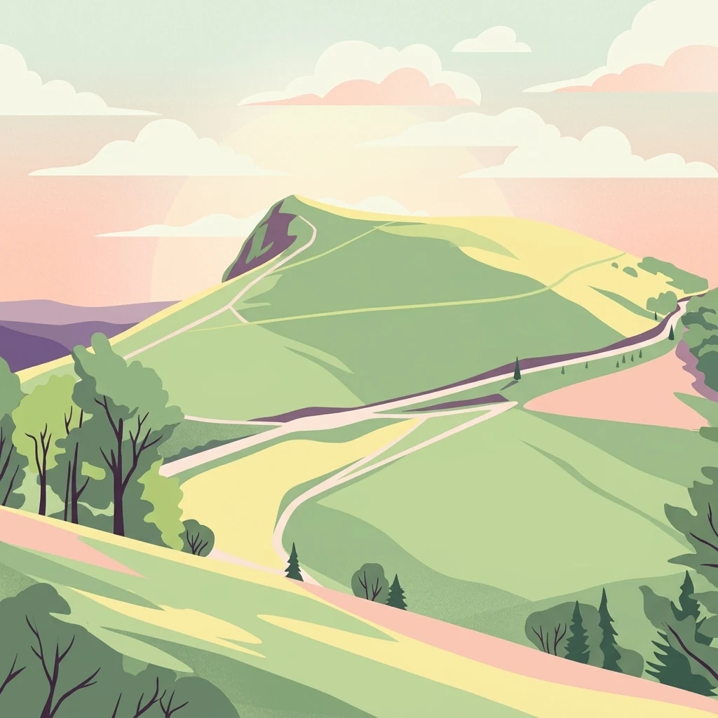
A digital illustration of a rolling green mountain landscape with trails winding up a peak under a soft sunset sky.

Réserve naturelle régionale des hautes-chaumes du Rothenbach

Nature reserve

Park overview

Structured park overview, official facts, and landscape profile for Réserve naturelle régionale des hautes-chaumes du Rothenbach

Réserve naturelle régionale des hautes-chaumes du Rothenbach park facts, protected area profile, and essential visitor context

Review the core facts for Réserve naturelle régionale des hautes-chaumes du Rothenbach, including designation, size, terrain, visitor scale, habitats, and operating context in one park-focused overview.

About Réserve naturelle régionale des hautes-chaumes du Rothenbach

The Réserve naturelle régionale des hautes-chaumes du Rothenbach is a compact but ecologically rich regional nature reserve set high in the Vosges mountains of Alsace. It occupies the western flank of a ridge that climbs from the Rainkopf in the north through the Rothenbachkopf to the Batteriekopf in the south, forming part of the long crest line traced by the Route des Crêtes. Located entirely within the commune of Wildenstein in the Haut-Rhin department, the reserve spans about 94 hectares and stretches for roughly 3.5 kilometres along the slope, between approximately 900 and 1,300 metres of elevation.

At its core, the reserve protects a layered mosaic of Vosges summit landscapes. The upper part of the slope is dominated by open summital grasslands, locally known as hautes chaumes, growing on acidic soils and interspersed with patches of heath dominated by ericaceous shrubs. Botanists distinguish between primary chaumes, which have remained open since ancient times without major human intervention, and secondary chaumes that originated from historical clearance of forest. Below these open areas, the slope transitions into subalpine beech forest, with further pockets of ash and sycamore maple woodland on more sheltered ground.

The reserve was formally classified in 2008 under the regional nature reserve framework and has been managed since then by the Conservatoire des Sites Alsaciens, a long-standing Alsatian conservation organization. Its creation reflects a wider French regional strategy of protecting smaller but ecologically significant mid-elevation sites that would otherwise be vulnerable to abandonment, reforestation, or unregulated development. Because the open habitats of the Vosges summits depend on continued grazing, the reserve actively supports traditional extensive pasturing by Vosgienne cattle, an ancient local breed well adapted to high-altitude pasture.

Beyond its immediate ecological importance, the reserve functions as an accessible outdoor classroom. The nearby Rothenbach nature and environment discovery centre offers guided activities, and footpaths running along the crest provide open panoramas across the ridges and valleys of the high Vosges. These educational and recreational dimensions complement the reserve's conservation role and make it one of the more approachable examples of high-Vosges natural heritage within the Grand Est region.

Quick facts and research context for Réserve naturelle régionale des hautes-chaumes du Rothenbach

The Réserve naturelle régionale des hautes-chaumes du Rothenbach is a regional nature reserve located in the Grand Est region of France, in the Haut-Rhin department on the territory of the commune of Wildenstein. It sits along the Route des Crêtes in the high Vosges, occupying about 94 hectares at elevations between approximately 900 and 1,300 metres on the western slope of the Rainkopf to Batteriekopf ridge. Classified on 28 March 2008, it is managed by the Conservatoire des Sites Alsaciens and is registered internationally under WDPA ID 555514326 and IUCN Category IV.

Protection and recognition

Explore documented terrestrial protection metrics and conservation scope.

Réserve naturelle régionale des hautes-chaumes du Rothenbach Protection Status

Terrestrial protection status and designated management scope outline the conservation framework established for Réserve naturelle régionale des hautes-chaumes du Rothenbach. Documented records aggregate available administrative metrics to clarify the operational boundaries governing this protected area.

Protection details

Protection scope
Terrestrial
Transboundary protection
No
WDPA ID
555514326
Park context

Deeper park guide and search-rich context for Réserve naturelle régionale des hautes-chaumes du Rothenbach

Réserve naturelle régionale des hautes-chaumes du Rothenbach history, landscape, wildlife, and travel context

Explore Réserve naturelle régionale des hautes-chaumes du Rothenbach through its history, landscape character, ecosystems, wildlife, conservation priorities, cultural context, and seasonal travel timing in a structured park guide built for atlas discovery and search intent.

Why Réserve naturelle régionale des hautes-chaumes du Rothenbach stands out

The reserve is best known for protecting a classic high-Vosges landscape of summit grasslands, acidic heaths, and subalpine forests along the Route des Crêtes. It preserves both primary chaumes that have been open since ancient times and secondary chaumes that originated from historical clearing. The site is also recognized for the continued practice of extensive grazing by Vosgienne cattle, which keeps these fragile high-altitude habitats intact and supports characteristic flora such as Alpine pasqueflower and martagon lily, along with chamois, red deer, and a breeding bird community that includes the ring ouzel.
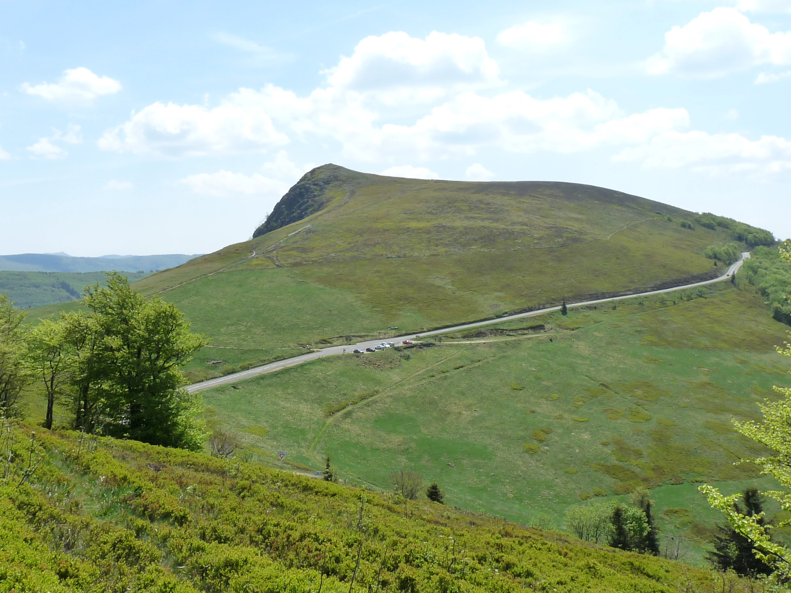
A wide shot of a rounded mountain peak covered in green grass, with a paved road curving along the slope and a small parking area in the distance.
A view of the Rothenbachkopf summit and surrounding high-altitude grasslands in the Vosges mountains.

Réserve naturelle régionale des hautes-chaumes du Rothenbach history and protected-area timeline

The high pastures of the Vosges, known as chaumes, have been grazed since ancient times, and this long-standing human activity has shaped the open character of the upper slopes. By the early 2000s, regional conservation authorities in Alsace sought formal protection for the most representative examples of these summit grasslands, recognising both their ecological value and the traditional land-use systems that keep them open.

The reserve was officially created on 28 March 2008 by a deliberation of the Conseil régional d'Alsace, classifying the site as a regional nature reserve under French law. Since its creation, it has been managed by the Conservatoire des Sites Alsaciens, which continues to oversee extensive grazing practices, habitat monitoring, and public engagement. The establishment of the reserve marked an important step in safeguarding a small but representative piece of the high-Vosges landscape for future generations.

Réserve naturelle régionale des hautes-chaumes du Rothenbach landscape and geographic character

The reserve's landscape is defined by the long western flank of a Vosges ridge that links the Rainkopf, Rothenbachkopf, and Batteriekopf summits. From around 900 metres at its lower edge to roughly 1,300 metres at the crest, the slope presents a vertical sequence of distinct highland environments: open summit grasslands blanket the upper part, while denser subalpine forests clothe the lower reaches of the protected area.

Open, grassy, and windswept upper slopes alternate with low heaths on acidic soils. Rock outcrops emerge along the crestline, giving way abruptly to forested hillsides lower down. The famous Route des Crêtes, one of the most scenic drives in the Vosges, runs through the reserve, offering broad panoramic views across the range. This combination of grassland, heath, rock, and forest in a short elevational span gives the protected area one of the most characteristic high-Vosges profiles in Alsace.

Réserve naturelle régionale des hautes-chaumes du Rothenbach ecosystems, habitats, and plant life

Ecologically, the reserve is a textbook example of high-Vosges summit habitat. The protected zone centres on acidic summit grasslands, sometimes called primary chaumes where they have been open since ancient times, and secondary chaumes that emerged from historical clearance. Where soils are thinner or more exposed, heaths dominated by ericaceous plants replace the grass cover, creating a mosaic of vegetation types that break up the otherwise open slope.

Réserve naturelle régionale des hautes-chaumes du Rothenbach wildlife and species highlights

The reserve supports a diverse community of high-Vosges wildlife. Alpine chamois frequent the rocky faces on the Alsatian side of the crest, while red deer prefer the more closed forest environments below. Reptiles include the viviparous lizard, one of the species most tolerant of cold high-altitude conditions in the range. The avifauna is comparatively rich for such a small site, with breeding populations of typical high-Vosges species. Wetland sections of the reserve also harbour butterflies of conservation interest, including the Scarce Copper, which depends on the bistort-rich moist grasslands of the area.

Réserve naturelle régionale des hautes-chaumes du Rothenbach conservation status and protection priorities

From a conservation perspective, the reserve protects a small but ecologically significant piece of the high-Vosges landscape that is vulnerable to abandonment, reforestation, and unregulated land use. Its summit grasslands and acidic heaths host specialised plant communities that are increasingly rare at this elevation in central Europe, while the surrounding subalpine forest acts as a buffer and ecological complement.

The protected area also illustrates the importance of maintaining traditional extensive grazing by Vosgienne cattle: without this land use, the open chaumes would gradually be reclaimed by forest, and the habitat mosaic that supports distinctive flora and fauna would be lost. By formalising protection and anchoring continued grazing, the reserve safeguards both a natural heritage and a cultural practice that has shaped these summits for centuries. It is registered internationally in the World Database on Protected Areas under WDPA ID 555514326 and classified as an IUCN Category IV habitat/species management area.

Réserve naturelle régionale des hautes-chaumes du Rothenbach cultural meaning and human context

The landscape protected by the reserve carries strong regional identity in Alsace. The high chaumes of the Vosges have a long pastoral tradition tied to the Vosgienne cattle breed, an ancient local breed well adapted to high-altitude grazing. This grazing heritage is not merely a backdrop to the protected area; it is actively maintained as part of the reserve's management and remains an essential part of how local communities understand and value these summits.

Top sights and standout views in Réserve naturelle régionale des hautes-chaumes du Rothenbach

The reserve's most distinctive highlights include its primary summit grasslands that have remained open since ancient times, contrasted with secondary chaumes born of historical clearing, both preserved through active extensive grazing. Below them, the protected slope descends into subalpine beech forest and mixed ash and sycamore maple woodland, producing a complete high-Vosges habitat gradient in a compact area. Chamois on the rocks, red deer in the forest, the ring ouzel among 59 recorded bird species, and the Scarce Copper butterfly in moist areas add to the reserve's conservation credentials, while the Route des Crêtes provides a defining scenic backdrop.

Best time to visit Réserve naturelle régionale des hautes-chaumes du Rothenbach

Summer and early autumn are generally the most rewarding seasons to experience the reserve, when the summit grasslands are at their most colourful and grazing cattle are visible on the open slopes. Late spring can showcase flowering species typical of the high-Vosges flora, while cooler autumn days often bring clearer panoramic views along the Route des Crêtes. Winter conditions can be severe at these elevations, and snow and ice may limit access to the crestline paths.

Monthly climate preview

Long-term representative monthly temperature and precipitation patterns across the protected landscape

Climate Normals and Annual Temperature Rhythm for Réserve naturelle régionale des hautes-chaumes du Rothenbach

Recorded baseline measurements indicate a shifting annual thermal range alongside stable precipitation distribution at the representative coordinate. Examining the complete twelve-month climatology dataset clarifies detailed monthly variations across the protected terrain.
Annual mean9 °C
0 °C18 °C
Jan
Feb
Mar
Apr
May13°
Jun16°
Jul18°
Aug18°
Sep14°
Oct
Nov
Dec
Warmest month
July

18.1 °C

Coolest month
January

-0.1 °C

Wettest month
May

3 mm/day

Driest month
April

2 mm/day

Park location guide

Geography guide, regional context, and park location map for Réserve naturelle régionale des hautes-chaumes du Rothenbach

Réserve naturelle régionale des hautes-chaumes du Rothenbach park geography, regions, and map view in France

Understand where Réserve naturelle régionale des hautes-chaumes du Rothenbach sits in France through a broader geographic reading of the surrounding landscape, nearby location context, and its mapped position within the national park landscape.

How Réserve naturelle régionale des hautes-chaumes du Rothenbach fits into France

France is a unitary semi-presidential republic and one of the world's largest economies. It borders Belgium, Luxembourg, Germany, Switzerland, Italy, Monaco, Andorra, and Spain, with a maritime border to the United Kingdom. The country is known for its cultural influence, art, cuisine, and political history spanning centuries.

Wider geography shaping Réserve naturelle régionale des hautes-chaumes du Rothenbach in France

France is located in Western Europe. Metropolitan France extends from the Rhine to the Atlantic Ocean and from the Mediterranean Sea to the English Channel and North Sea. The country borders Belgium, Luxembourg, Germany, Switzerland, Italy, Monaco, Andorra, Spain, and has a maritime border with the United Kingdom.

Map view of Réserve naturelle régionale des hautes-chaumes du Rothenbach

Use this park location map to pinpoint Réserve naturelle régionale des hautes-chaumes du Rothenbach in France, understand its exact geographic position, and read its mapped placement within the surrounding landscape more clearly.

Pigeon | © OpenStreetMap contributors

Location context for Réserve naturelle régionale des hautes-chaumes du Rothenbach

Grand Est

Visual exploration of summit grasslands, acidic heaths, and subalpine forests in the Vosges mountains

Réserve Naturelle Régionale des Hautes-Chaumes du Rothenbach Photos and Landscapes

Visual records capture the distinctive topography of high-altitude pastures, rocky ridges, and forested slopes across Réserve naturelle régionale des hautes-chaumes du Rothenbach. Photographic documentation reveals the delicate mosaic of protected habitats and regional scenery along the Vosges crest.

A wide shot of a rounded mountain peak covered in green grass, with a paved road curving along the slope and a small parking area in the distance.

Park atlas

Compare nearby protected landscapes and regional mountain terrain across the Vosges range.

Parks Near Réserve Naturelle Régionale Des Hautes-Chaumes Du Rothenbach

Browsing other protected areas near Réserve naturelle régionale des hautes-chaumes du Rothenbach reveals connected high altitude habitats across the Vosges range. Examining surrounding mountain terrain provides deeper geographic context for regional conservation landscapes and ridge ecosystems.
Nature reserveGrand Est
About 14 km away#1 closest

Northeast

Réserve naturelle nationale du Tanet-Gazon du Faing: Grand Est Protected Landscape Map

High-altitude heathlands and glacial granite ridges

The Réserve naturelle nationale du Tanet-Gazon du Faing protects a critical upland mosaic in the Vosges massif, defined by its subarctic-style flora, sprawling peat bogs, and rugged granite boulder fields. This high-elevation geography provides essential habitat for montane species and offers a clear example of post-glacial landscape development across the Grand Est region.

Area
5.05 km²
Established
1988
IUCN
IV
Relief
Mountain
A soft watercolor painting of a rolling landscape with green hills, light blue distant mountains, and patches of pink and yellow vegetation.
Nature reserveGrand Est
About 19 km away#2 closest

South

Réserve naturelle régionale de la forêt des volcans de Wegscheid: Geological Protected Area

Mapping volcanic terrain in the Grand Est region of eastern France.

Located in the Haut-Rhin, this regional nature reserve preserves a distinct volcanic landscape characterized by rocky promontories, basalt columns, and mature forest stands. The protected terrain features varied elevation from 700 meters to the Rossberg ridge, showcasing geological formations that have remained largely untouched by intensive historical forestry.

Area
1.015 km²
Established
2008
IUCN
IV
Relief
Mountain
A watercolor painting showing a soft, panoramic landscape of a peat bog or wetland with light green vegetation, scattered trees, and distant rolling hills on a white background.
Nature reserveGrand Est
About 21 km away#3 closest

West

Réserve naturelle régionale de la tourbière des Charmes: Protected Mountain Peatland Geography

High Vosges mountain wetland and subalpine forest landscape

Located on the granite ridges of the Vosges mountains in the Grand Est region, this nature reserve preserves a vast, perched mountain peatland. Its distinct geographic character includes deep peat deposits and a habitat gradient transitioning from acidic wetland to mature fir and spruce forest, serving as a critical study area for specialized flora and cold-adapted wildlife.

Area
0.68 km²
Established
2008
IUCN
IV
Relief
Mountain
Nature reserveGrand Est
About 22 km away#4 closest

East

Réserve naturelle régionale des collines de Rouffach: Protected Hills and Dry Grasslands

A Mediterranean-influenced nature reserve in the Alsace foothills.

Located in the Grand Est region, this reserve preserves Bollenberg and Strangenberg hills through a mosaic of downy oak woodland and xerobrometum grasslands. The site functions as a botanical refuge where limestone geology creates an exceptionally warm, arid environment rare for northeastern France.

Area
0.44 km²
Established
2013
IUCN
IV
Nature reserveGrand Est
About 30 km away#5 closest

Southeast

Réserve naturelle régionale de l'Eiblen et l'Illfeld: Alsace Floodplain Protected Area

Geographic context of regional alluvial habitats in Haut-Rhin

Located in the Alsace plain, this nature reserve preserves a rare cross-section of original river floodplain geography. The area provides a critical look at alluvial ecosystems and sediment-rich lowland terrain that defines the historical character of the Upper Rhine plain within France.

Area
0.66 km²
Established
1992
A panoramic watercolor painting depicting a calm wetland or marsh with pink and yellow reeds in the foreground, green trees in the midground, and soft purple mountains in the background.
Nature reserveHaut-Rhin
About 31 km away#6 closest

Southeast

Réserve naturelle régionale des marais et landes du Rothmoos Protected Landscape and Geography

Regional nature reserve in the Haut-Rhin department of Alsace

The Réserve naturelle régionale des marais et landes du Rothmoos encompasses a rare inland saline habitat complex within the Nonnenbruch forest. Its terrain is defined by stable pools created from mining subsidence, transitioning into heathland and oak forests. This protected area stands as an ecological refuge for migratory waterbirds and specialized aquatic species within an industrial-legacy environment.

Area
1.457 km²
Established
1988
IUCN
IV
Relief
Lowland
Nature reserveGrand Est
About 41 km away#7 closest

East

Réserve naturelle régionale de la forêt de Mequillet Le Hardtwald Geographic Atlas and Map

Protected dry forest and steppe habitat in Grand Est

Situated on the elevated terraces of the Rhine floodplain, this nature reserve protects 249 hectares of distinct dry woodland and open clearings. The landscape offers a rare example of continental flora and saproxylic beetle habitats, set within the broader agricultural context of the Alsace plain. This record provides a comprehensive view of the park boundaries and ecological geography found within this significant French conservation area.

Area
2.49 km²
Established
2012
IUCN
IV
Relief
Lowland
Nature reserveGrand Est
About 44 km away#8 closest

Southeast

Réserve naturelle régionale Im'Berg: Mapping a Unique Protected Nature Reserve in France

A rare calcareous grassland habitat in the Grand Est region.

Réserve naturelle régionale Im'Berg preserves a sun-drenched limestone slope in the commune of Tagolsheim. Known as the Buxberg, this protected area guards one of the most significant natural boxwood populations in Europe alongside specialized dry-habitat flora. The reserve functions as an essential geographic reference for studying how steep, calcareous terrain creates isolated, warm microclimates within the broader Alsatian landscape.

Area
0.017 km²
Established
2013
IUCN
IV

Common questions about visiting, size, designation, and location context for Réserve naturelle régionale des hautes-chaumes du Rothenbach

Réserve naturelle régionale des hautes-chaumes du Rothenbach FAQs for park facts, access, geography, and protected area context

Find quick answers about Réserve naturelle régionale des hautes-chaumes du Rothenbach, including protected-area facts, park geography, trail and visitor context, and how the park fits into its surrounding country and regional landscape.
MoriAtlas Explorer

Continue Your Protected Areas Search Across the Global Atlas

Deepen your exploration by continuing the structured search for national parks and protected areas worldwide. Utilize the comprehensive filtering capabilities to compare different conservation landscapes and refine your understanding of global park geography. Discover more about the distribution and characteristics of protected natural areas.

Global natural geography