
Mori Atlas logo
Nature reserveRéserve naturelle régionale de l'étang d'Amel

Examining the ecological boundaries and wetland geography of France's first regional nature reserve

Réserve naturelle régionale de l'étang d'Amel: An Essential Protected Landscape in Grand Est

(Réserve naturelle régionale de l'étang d'Amel (RNR180))

Réserve naturelle régionale de l'étang d'Amel preserves 147 hectares of wetland habitat within the historic Woëvre plain of northeastern France. This site represents a unique mosaic of open water, extensive reedbeds, and wet meadows that historically characterized the region. Recognized as the first regional nature reserve ever established in France, the protected area functions as a critical refuge for bird populations and amphibian communities amidst the surrounding agricultural terrain.

wetlandregional nature reservereedbedpondwaterfowlamphibians
A stylized flat-design illustration showing a tranquil pond surrounded by tall grasses, willow trees, and gentle hills under a soft sun.

Réserve naturelle régionale de l'étang d'Amel

Nature reserve

Park overview

Structured park overview, official facts, and landscape profile for Réserve naturelle régionale de l'étang d'Amel

Réserve naturelle régionale de l'étang d'Amel park facts, protected area profile, and essential visitor context

Review the core facts for Réserve naturelle régionale de l'étang d'Amel, including designation, size, terrain, visitor scale, habitats, and operating context in one park-focused overview.

About Réserve naturelle régionale de l'étang d'Amel

The Réserve naturelle régionale de l'étang d'Amel centers on a historic pond in the Woëvre, a lowland plain in the Meuse department of the Grand Est region. Although it covers only about 147 hectares, it preserves one of the most ecologically meaningful wetland complexes left in this intensively farmed part of Lorraine. The pond itself is the heart of the reserve, fringed by reedbeds and surrounded by wet meadows, peripheral pools, and small wooded patches that together form a coherent mosaic of freshwater habitat.

Designated in 2006 by the Regional Council of Lorraine, the reserve holds a special place in French conservation history as the country's very first Regional Nature Reserve, the first site classified under the regional-level protection framework that has since become a major tool in France's biodiversity strategy. Its management is entrusted to the Conservatoire d'espaces naturels de Lorraine, which purchased the pond and adjacent meadows in 1998 to secure them before formal classification.

Ecologically, the reserve is notable for its reedbed-dependent avifauna and amphibian assemblages. The waterbodies and surrounding vegetation support an estimated one hundred bird species, thirty-four dragonfly species, and several protected amphibian populations. Five protected plant species have also been documented, including species tied to specific pond and marsh habitats. Together these features make Amel a small but disproportionately important refuge within the broader Spincourt forests and wetlands Special Protection Area.

Beyond conservation, the reserve is designed for public engagement. A marked discovery trail circles the pond and includes two observation points that let visitors experience the wetland without disturbing sensitive wildlife. The site thus operates simultaneously as a protected area, a historical landmark of regional conservation policy, and a teaching ground for understanding wetland biodiversity.

Quick facts and research context for Réserve naturelle régionale de l'étang d'Amel

The Réserve naturelle régionale de l'étang d'Amel is a French Regional Nature Reserve (IUCN Category IV) located in the Meuse department within the Grand Est region, near the town of Étain. It spans approximately 146.59 hectares across the communes of Amel-sur-l'Étang and Senon, and was classified on 30 June 2006 for an initial renewable duration of 12 years.

It is distinguished as the first Regional Nature Reserve created in France and is administered by the Conservatoire d'espaces naturels de Lorraine. The site also falls within the Zone de protection spéciale 'Forêts et Zones Humides du Pays de Spincourt', reinforcing its significance for bird conservation at the European level.

Protection and recognition

Documented conservation status, management records, and protected area designation details

Protection Status and International Recognition for Réserve naturelle régionale de l'étang d'Amel

Protected area records for Réserve naturelle régionale de l'étang d'Amel outline documented conservation status and formal designation parameters. Official database metrics provide verified baseline context for evaluating regional protection history and management frameworks.

Protection details

WDPA ID
555514376
Park context

Deeper park guide and search-rich context for Réserve naturelle régionale de l'étang d'Amel

Réserve naturelle régionale de l'étang d'Amel history, landscape, wildlife, and travel context

Explore Réserve naturelle régionale de l'étang d'Amel through its history, landscape character, ecosystems, wildlife, conservation priorities, cultural context, and seasonal travel timing in a structured park guide built for atlas discovery and search intent.

Why Réserve naturelle régionale de l'étang d'Amel stands out

The reserve is best known for protecting one of the last relatively wild ponds of the Woëvre plain, with extensive reedbeds (roselières) that shelter rare and protected bird species such as the Eurasian bittern, the little bittern, the marsh harrier, and the great reed warbler. It is equally recognized as the first Regional Nature Reserve ever classified in France, giving it an institutional landmark status in the history of French conservation policy. Equally important is the pond's medieval origin: it was created in the 13th century by monastic communities for fish farming, and the reserve today merges that long cultural heritage with active wetland conservation, amphibian protection, and public education through a discovery trail with observation hides.
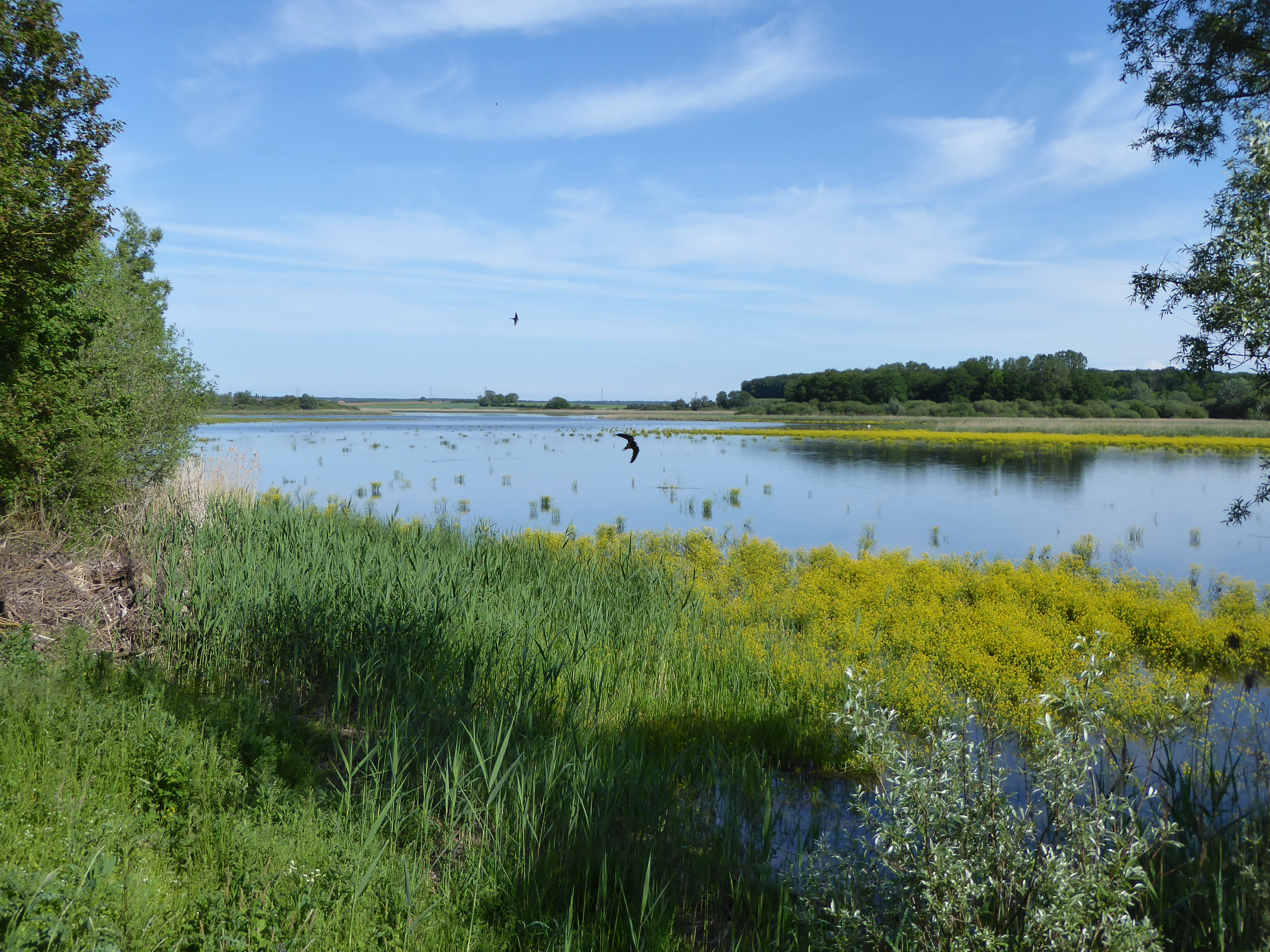
A wide view of a calm pond under a blue sky with light clouds. In the foreground, tall green grasses and yellow flowers grow along the water's edge. A small bird is flying above the water in the distance.
A view of the pond at Réserve naturelle régionale de l'étang d'Amel, featuring surrounding wetland vegetation.

Réserve naturelle régionale de l'étang d'Amel history and protected-area timeline

The pond at the heart of the reserve has a long human history. It was first established in the 13th century by monastic communities who built and managed it for fish farming, taking advantage of the naturally waterlogged soils of the Woëvre plain. This medieval piscicultural origin still shapes the pond's character and its surrounding meadows today.

In 1998, the Conservatoire d'espaces naturels de Lorraine acquired the pond and a set of adjoining riverside meadows, securing key ecological parcels before they could be lost to agricultural intensification or drainage. This acquisition laid the groundwork for formal protection.

On 30 June 2006, the Regional Council of Lorraine officially classified the site as a Réserve naturelle régionale, granting it protection for an initial twelve-year renewable period. This classification was historically significant: the Amel reserve was the very first Regional Nature Reserve created in France under the country's evolving regional protection framework. The reserve combines lands owned by the Conservatoire d'espaces naturels de Lorraine, communal parcels from Senon and Amel-sur-l'Étang, and additional privately owned plots.

A management plan covering the period 2012-2017 was validated by the regional scientific council (CSRPN) on 3 July 2012, formalising ongoing conservation, monitoring, and visitor infrastructure on the site.

Réserve naturelle régionale de l'étang d'Amel landscape and geographic character

The landscape of the reserve is defined by the flat topography of the Woëvre, one of the historic marshland belts of Lorraine. The pond, ringed by extensive reedbeds, forms the visual and ecological centre of the reserve, while peripheral marshes, wet meadows, and small seasonal pools extend the wetland character outward into the surrounding agricultural plain.

Topographically the area is gentle and low-lying, reflecting the poorly drained nature of the Woëvre soils. The combination of open water, tall emergent vegetation, and damp grassland gives the site a layered visual structure: water in the middle, dense reeds along the edges, and meadows and hedgerows further out. This mosaic is relatively rare today, since most of the Woëvre has been drained for arable farming.

The reserve's confinement to about 147 hectares makes it a compact landscape, but within that footprint it preserves a notably complete picture of a traditional Lorraine pond ecosystem, including the kinds of peripheral pools (mares) that historically dotted the Woëvre and that today are critical refuges for amphibians.

Réserve naturelle régionale de l'étang d'Amel ecosystems, habitats, and plant life

Ecologically, the reserve belongs to the freshwater wetland habitat family, with open water, emergent reedbeds, marshes, and wet meadows forming the principal vegetation types. Its ecological interest is heightened by its position within an intensively cultivated region, making the protected area an unusually complete example of a Woëvre wetland.

The pond was historically used for fish farming, but today it supports semi-natural vegetation communities. Reedbeds dominated by reed and sedge species form the most ecologically valuable habitat, providing nesting and shelter for birds and amphibians and acting as filters for the water. Surrounding wet meadows maintain traditional grassland flora adapted to seasonal flooding, while the peripheral pools add structural diversity and breeding habitat for newts and frogs.

Five plant species benefit from legal protection in this mosaic, including species tied specifically to stable pond and marsh conditions. Conservation management by the Conservatoire d'espaces naturels de Lorraine focuses on maintaining water levels, preserving reedbed extent, and supporting the traditional meadows that bridge aquatic and terrestrial habitats.

Réserve naturelle régionale de l'étang d'Amel wildlife and species highlights

The reserve's wildlife profile is dominated by wetland-dependent species. Its avifauna includes roughly one hundred bird species, among them several that are of high conservation concern because they depend on extensive reedbeds: the Eurasian bittern, the little bittern, the marsh harrier, and the great reed warbler. These species are particularly sensitive to reedbed degradation, making the reserve's protection directly meaningful for their regional survival.

The amphibian fauna is also exceptional for a site of this size. Several protected species are present, including the European tree frog, the common frog, the common toad, and four newt species: the smooth newt, the Alpine newt, the great crested newt, and the palmate newt. The peripheral pools (mares) play a crucial role in supporting these breeding populations.

The site also hosts thirty-four species of dragonflies, reflecting the quality of its aquatic habitats, and notable butterflies such as the marsh fritillary, a species closely tied to wetland meadows. Together, the bird, amphibian, and invertebrate communities give the reserve an unusually rich fauna for a comparatively small protected area, and one tightly linked to the integrity of its pond, reedbeds, and surrounding wet meadows.

Réserve naturelle régionale de l'étang d'Amel conservation status and protection priorities

From a conservation perspective, the reserve is significant on two levels. Regionally, it preserves one of the last relatively wild ponds of the Woëvre plain, in a landscape where most natural wetlands have been drained for arable farming. The reedbeds and wet meadows around the Amel pond function as a refuge for species that have largely disappeared from the wider countryside.

At the national scale, the reserve has symbolic importance: it was the first Regional Nature Reserve ever classified in France, marking the beginning of the country's regional-level protection framework and serving as a precedent for many similar reserves that followed. The site's inclusion in the 'Forêts et Zones Humides du Pays de Spincourt' Zone de protection spéciale also ties it into the Natura 2000 network, strengthening its role in European bird conservation.

Management by the Conservatoire d'espaces naturels de Lorraine combines habitat conservation (maintaining water levels, reedbed structure, and traditional meadows) with species-focused actions for protected birds, amphibians, and plants. A formal management plan was approved for 2012-2017, providing the structured guidance for these conservation efforts.

Réserve naturelle régionale de l'étang d'Amel cultural meaning and human context

The cultural dimension of the reserve is rooted in its medieval monastic origin. The pond was shaped in the 13th century by monks who developed it for fish farming, embedding the site into centuries of rural Lorraine heritage. This long history of human management is part of what gives the pond its current ecological character, since medieval fishponds often created habitat mosaics that have since disappeared from intensively modernised landscapes.

The reserve is also a marker of regional conservation identity. As the first Regional Nature Reserve ever created in France, it carries institutional memory for the Lorraine region and for the country's broader conservation community. Its visitor infrastructure, including a discovery trail and two observation hides, reflects an effort to share this heritage, both natural and cultural, with the public.

Top sights and standout views in Réserve naturelle régionale de l'étang d'Amel

The reserve's strongest distinguishing points are its protected reedbed-dependent bird species, including bitterns, marsh harriers, and the great reed warbler, and its unusually rich amphibian community of frogs, toads, and four newt species. Its compact 147-hectare footprint nonetheless preserves a representative Woëvre wetland, a landscape type that has largely vanished from the surrounding agricultural plain.

Its second defining highlight is institutional: it is the first Regional Nature Reserve ever classified in France, giving the site a foundational role in the country's regional conservation framework. Combined with its inclusion in a Special Protection Area and its management by the Conservatoire d'espaces naturels de Lorraine, this makes the Amel reserve as notable for conservation policy as it is for its wildlife.

Best time to visit Réserve naturelle régionale de l'étang d'Amel

The reserve's character changes with the seasons in ways typical of temperate lowland wetlands. Spring and early summer are the most lively periods for amphibian breeding and for hearing the calls of frogs and newts around the peripheral pools, and they bring active bird song from the reedbeds. This is also when dragonflies become most visible around the pond margins.

Late spring through summer is generally the best window for observing the reserve's rich birdlife, when reedbed species are most vocal and active. Autumn can offer quieter conditions and a different atmosphere of still water and fading vegetation, while winter may bring additional waterbird visitors and crisper views across the open water. In all seasons, visitors are encouraged to use the marked discovery trail and observation hides to minimise disturbance to sensitive species.


Monthly climate preview

Long term temperature ranges and precipitation averages across twelve recorded intervals

Climate Normals and Annual Weather Patterns for Réserve naturelle régionale de l'étang d'Amel

Representative coordinate records show measured annual temperature and precipitation rhythms across the protected area. Reviewing the complete monthly climate normals provides detailed context on long term averages.
Annual mean9 °C
0 °C18 °C
Jan
Feb
Mar
Apr
May13°
Jun16°
Jul18°
Aug18°
Sep14°
Oct
Nov
Dec
Warmest month
July

18.4 °C

Coolest month
January

0.5 °C

Wettest month
December

3.1 mm/day

Driest month
April

1.8 mm/day

Park location guide

Geography guide, regional context, and park location map for Réserve naturelle régionale de l'étang d'Amel

Réserve naturelle régionale de l'étang d'Amel park geography, regions, and map view in France

Understand where Réserve naturelle régionale de l'étang d'Amel sits in France through a broader geographic reading of the surrounding landscape, nearby location context, and its mapped position within the national park landscape.

How Réserve naturelle régionale de l'étang d'Amel fits into France

France is a unitary semi-presidential republic and one of the world's largest economies. It borders Belgium, Luxembourg, Germany, Switzerland, Italy, Monaco, Andorra, and Spain, with a maritime border to the United Kingdom. The country is known for its cultural influence, art, cuisine, and political history spanning centuries.

Wider geography shaping Réserve naturelle régionale de l'étang d'Amel in France

France is located in Western Europe. Metropolitan France extends from the Rhine to the Atlantic Ocean and from the Mediterranean Sea to the English Channel and North Sea. The country borders Belgium, Luxembourg, Germany, Switzerland, Italy, Monaco, Andorra, Spain, and has a maritime border with the United Kingdom.

Map view of Réserve naturelle régionale de l'étang d'Amel

Use this park location map to pinpoint Réserve naturelle régionale de l'étang d'Amel in France, understand its exact geographic position, and read its mapped placement within the surrounding landscape more clearly.

Pigeon | © OpenStreetMap contributors

Location context for Réserve naturelle régionale de l'étang d'Amel

Grand Est

Visualizing the wetlands, reedbeds, and protected habitats of the Woëvre plain

Réserve naturelle régionale de l'étang d'Amel Photos and Landscape Scenery

Visual documentation of Réserve naturelle régionale de l'étang d'Amel reveals the flat topography and wetland mosaic of the historic Lorraine plain. Examining these protected habitats clarifies the ecological structure of open water, dense reedbeds, and damp meadows.

A wide view of a calm pond under a blue sky with light clouds. In the foreground, tall green grasses and yellow flowers grow along the water's edge. A small bird is flying above the water in the distance.

Park atlas

Compare nearby wetland reserves and regional landscapes across northeastern France.

Parks Near Réserve Naturelle Régionale de l'Étang d'Amel and Surrounding Protected Areas

Browsing other protected areas near Réserve naturelle régionale de l'étang d'Amel reveals connected wetland ecosystems and lowland natural reserves across the Woëvre plain. Expanding the search helps travelers and researchers compare similar regional conservation sites and regional habitat preservation efforts.
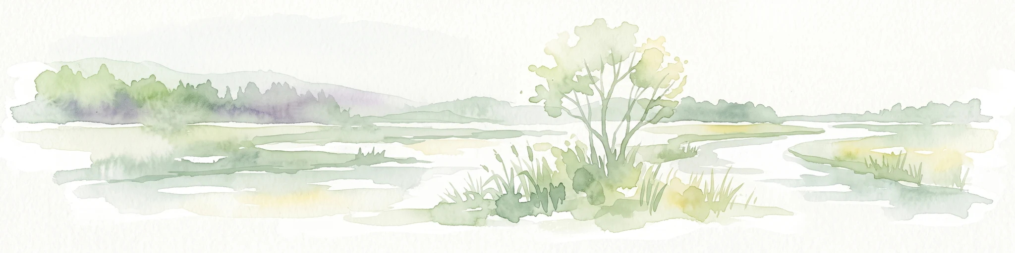
Watercolor illustration of a landscape with rolling hills, a river, and green vegetation
Protected areaProvince of Luxembourg
About 26 km away#1 closest

North

Gaume Natural Park: A Protected Area Defining the Landscape of Province of Luxembourg

Explore its mapped natural landscape and geographic context.

Gaume Natural Park is a protected area offering a unique perspective on the natural landscapes found within Belgium's Province of Luxembourg. As a key geographic entity, it provides a vital component for atlas exploration, showcasing distinct mapped boundaries and regional terrain. Understand its significance as a protected natural space contributing to the Ardennes region's extensive geography, making it an essential point for structured discovery of protected lands.

Area
581.04 km²
Established
2014
IUCN
V
Relief
Lowland
A watercolor painting showing a soft, panoramic view of a marshland with a winding stream, a small island of reeds, and distant trees on a pale background.
Nature reserveGrand Est
About 30 km away#2 closest

Southeast

Réserve naturelle régionale de Lachaussée: Geography, Wetlands, and Protected Map Data

Protected landscape and historic pond geography in the Meuse department

Focusing on the Étang de Lachaussée, this entry maps the protected boundaries and wetland terrain of a significant regional nature reserve in northeastern France. Observe the intersection of medieval engineering and contemporary ecological conservation through a detailed look at the pond, reedbeds, and surrounding mosaic of habitats that define the Woëvre plain landscape.

Area
6.072 km²
Established
2009
IUCN
IV
Relief
Lowland
Nature reserveLuxembourg
About 34 km away#3 closest

Northeast

Ellergronn Nature Reserve: Mapping Protected Woodland and Industrial Collapse Terrain

An atlas of reclaimed post industrial habitats in southern Luxembourg

Ellergronn Nature Reserve acts as a case study in landscape reclamation, transforming former ironstone mining pits into a deep network of collapse ponds and diverse woodland. This protected area offers a look at how subsidence and quarrying have resulted in a unique mosaic of calcareous grasslands and forest pools, providing a clear map of Luxembourg's industrial environmental history.

Area
1.104 km²
Established
1988
Scope
Terrestrial
Water
Minor water
Watercolor painting of a green, rolling landscape with scattered trees and soft hills against a light background.
Nature reserveLuxembourg
About 38 km away#4 closest

Northeast

Brucherbierg-Lallengerbierg Nature Reserve: Industrial Heritage and Protected Geography in Luxembourg

A restored Minett mining landscape and thriving dry-grassland ecosystem.

Brucherbierg-Lallengerbierg offers a window into the evolution of post-industrial terrain. Spanning 267 hectares in southern Luxembourg, the reserve protects a rugged landscape of cliffs, stony basins, and terraces that have been reclaimed by pioneer vegetation. Through careful ecological maintenance, the site serves as a prime example of habitat conservation, preserving a rare, open dry-meadow environment within the broader Minett industrial corridor.

Area
2.67 km²
Established
2016
Relief
Upland
Water
Minor water
A horizontal watercolor painting showing a quiet wetland with light green vegetation, a shallow pool of water reflecting soft purples, and gentle hills in the background on a white background.
Nature reserveSchifflange
About 38 km away#5 closest

Northeast

Brill Nature Reserve: Wetland Geography and River Restoration in Schifflange

Exploring the protected Alzette River floodplain and riparian habitat mosaic

Brill Nature Reserve stands as an ecologically significant protected area within the heavily developed valley of Schifflange, Luxembourg. This wetland sanctuary showcases a successful river restoration project, creating a dense network of ponds, reedbeds, and river-delta woodlands that function as a crucial refuge for wildlife amidst urban surroundings.

Area
0.197 km²
Established
1988
Relief
Lowland
Scope
Terrestrial
A minimalist watercolor illustration featuring rolling green hills, patches of trees, and a soft, light-toned foreground against a white background.
Nature reserveLuxembourg
About 39 km away#6 closest

Northeast

Naturschutzgebitt Haard: Exploring Luxembourg's Largest Reclaimed Nature Reserve

Geography of a transformed iron-mining industrial landscape

Naturschutzgebitt Haard encompasses vast quarry faces and pioneer meadows, serving as a critical biodiversity hub within southern Luxembourg. The area offers an intricate landscape mosaic of calcareous grassland, recovering forest, and dramatic mining cliffs, providing a window into how post-industrial ground evolves into a protected refuge for specialized orchid and butterfly species.

Area
5.943 km²
Established
1994
Relief
Upland
Climate
Temperate
Nature reserveLuxembourg
About 44 km away#7 closest

Northeast

Naturschutzgebitt Däerebësch-Waal-Hellengerbësch: Protected Forest and Transboundary Geography

Nature reserve profile and regional landscape connectivity

Spanning 222 hectares across Bettembourg, Dudelange, and Frisange, this nature reserve preserves a contiguous forest landscape essential to the Natura 2000 network. The site is defined by its role as a cross-border ecological corridor, connecting Luxembourgish woodlands with the Forêt domaniale de Zoufftgen in France through a sophisticated wildlife bridge.

Area
2.223 km²
Established
2023
Relief
Upland
Climate
Temperate
Nature reserveLuxembourg
About 45 km away#8 closest

Northeast

Beetebuerger Bësch: Nature Reserve and Protected Woodland Mapping in Luxembourg

A crucial reference site for forest ecology in southern Luxembourg

Beetebuerger Bësch stands as a designated nature reserve within the communes of Bettembourg, Leudelange, and Roeser. This protected forest landscape is managed to allow natural woodland development, providing researchers and visitors with a view of old growth dynamics, saproxylic invertebrate habitats, and restored riparian zones along the Koleschgriecht stream.

Area
2.373 km²
Established
2005
Relief
Lowland
Climate
Temperate

Common questions about visiting, size, designation, and location context for Réserve naturelle régionale de l'étang d'Amel

Réserve naturelle régionale de l'étang d'Amel FAQs for park facts, access, geography, and protected area context

Find quick answers about Réserve naturelle régionale de l'étang d'Amel, including protected-area facts, park geography, trail and visitor context, and how the park fits into its surrounding country and regional landscape.
MoriAtlas Explorer

Continue Your Protected Areas Search Across the Global Atlas

Deepen your exploration by continuing the structured search for national parks and protected areas worldwide. Utilize the comprehensive filtering capabilities to compare different conservation landscapes and refine your understanding of global park geography. Discover more about the distribution and characteristics of protected natural areas.

Global natural geography