Mori Atlas logo
Protected areaGaume Natural Park

Understand the geographic context and protected boundaries of this natural landscape.

Gaume Natural Park: A Protected Area with Distinct Mapped Landscape in Province of Luxembourg

(Parc Naturel de Gaume)

Gaume Natural Park represents a key protected area within the Province of Luxembourg, offering a distinct natural landscape defined by the Ardennes region's geography. This page serves as the authoritative atlas entry for the park, detailing its mapped boundaries and geographic setting. Explore how this protected land contributes to the regional context of southern Belgium, providing a foundation for understanding its place within the broader natural atlas.

Nature ParkWalloniaForested LandscapeRural HeritageWalking TrailsProtected Area

Gaume Natural Park

Protected area

Park overview

Structured park overview, official facts, and landscape profile for Gaume Natural Park

Gaume Natural Park park facts, protected area profile, and essential visitor context
Review the core facts for Gaume Natural Park, including designation, size, terrain, visitor scale, habitats, and operating context in one park-focused overview.

About Gaume Natural Park

Gaume Natural Park represents a significant conservation initiative in the southern part of Belgium, established to protect and enhance the unique character of the Gaume region. As the largest natural park in Wallonia, it encompasses a substantial territory of 58,104 hectares, integrating multiple municipalities in a collaborative protection and development framework. The park's creation reflects a recognition that natural conservation in this region cannot be separated from the cultural and social dimensions that define Gaume's identity. The area features a mosaic of forests, farmland, meadows, and settlements that together create a landscape of significant ecological and cultural value. The governing approach emphasizes local participation and sustainable development, recognizing that long-term conservation success depends on the involvement and support of resident communities. Rather than restricting human activity, the park works to coordinate initiatives, share resources, and help project managers develop activities that strengthen both environmental stewardship and economic vitality in the region.

Quick facts and research context for Gaume Natural Park

Gaume Natural Park spans 58,104 hectares across nine municipalities in Belgium's Province of Luxembourg, near the towns of Florenville and Virton. It was established in December 2014 by the Walloon government and serves as the largest natural park in Wallonia. The park's governance involves coordination among multiple municipalities with the Walloon Region overseeing the protected area. The region of Gaume is known for its distinctive landscape character that differs from the rest of Belgium, featuring more varied topography and a unique ecological character shaped by its transition between different climatic and geographic influences.

Park context

Deeper park guide and search-rich context for Gaume Natural Park

Gaume Natural Park history, landscape, wildlife, and travel context
Explore Gaume Natural Park through its history, landscape character, ecosystems, wildlife, conservation priorities, cultural context, and seasonal travel timing in a structured park guide built for atlas discovery and search intent.

Why Gaume Natural Park stands out

Gaume Natural Park is best known as Wallonia's largest protected area and a model for integrated regional conservation that balances natural preservation with community development. The park is recognized for its role in preserving the cultural identity of Gaume, a region that maintains distinct traditions and landscape characteristics within Belgium. It serves as a bridge between ecological protection and sustainable rural development, helping to maintain the viability of small villages and agricultural communities while safeguarding natural treasures. The park also stands out for its network of walking trails that traverse the diverse landscapes of southern Belgium.

Forest trail intersection with leaf-covered ground and tall trees under a clear sky
Trail intersection with multiple hiking paths in Gaume Natural Park

Gaume Natural Park history and protected-area timeline

Gaume Natural Park was officially created on 18 December 2014 when the Walloon government granted it the status of a natural park. The establishment followed recognition that the Gaume region possessed both significant natural assets and a distinctive cultural identity that warranted coordinated protection and promotion. The decision to designate this large territory as a natural park reflected a growing understanding in Wallonia that effective conservation required approaches that integrated ecological concerns with regional development goals. The park's formation involved collaboration among the nine municipalities that comprise its territory, each contributing to the shared vision of preserving Gaume's character while creating sustainable opportunities for local populations. This institutional framework built upon earlier regional conservation efforts while expanding the scope of protection to encompass the broader landscape character and community wellbeing of the region.

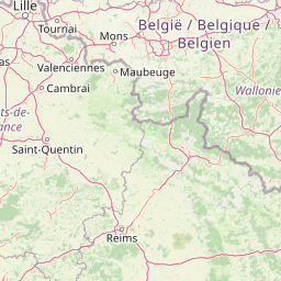
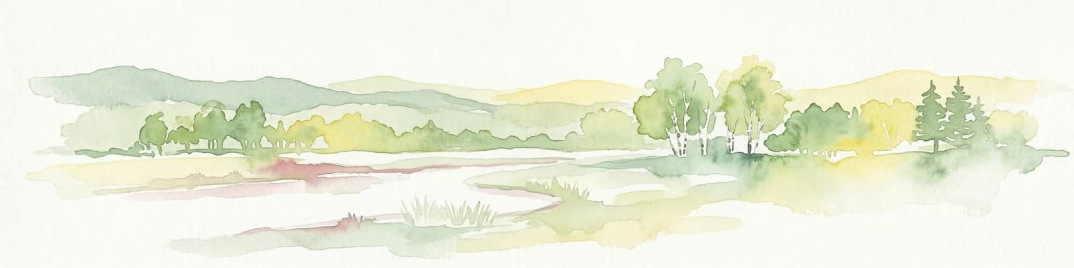
Gaume Natural Park landscape and geographic character

The landscape of Gaume Natural Park encompasses the rolling hills and varied terrain that characterize the southern Belgian region of Gaume. The territory sits in the Province of Luxembourg, Belgium's southernmost province, where the topography becomes more pronounced than in the northern parts of the country. The area features extensive forested zones, agricultural lands cultivated in both valleys and upland areas, and numerous small watercourses that drain the terrain. Traditional villages scattered throughout the park maintain the agricultural character of the landscape, with buildings and land use patterns that reflect centuries of rural occupation. The combination of forest cover, farmland, and settlement creates a mosaic landscape typical of rural Wallonia but with distinctive qualities that set Gaume apart from surrounding regions.

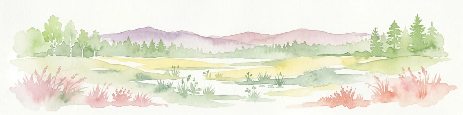
Gaume Natural Park ecosystems, habitats, and plant life

The natural character of Gaume Natural Park reflects the geographic position of Gaume at the ecological transition between different regional influences. The forests within the park contain species compositions that reflect both the Atlantic and continental influences on Belgian ecology. The varied terrain supports diverse habitats ranging from woodland to open farmland, meadows, and riparian zones along streams. The park's large area and municipal composition mean that it encompasses significant ecological diversity within a single protected framework. The conservation approach recognizes that maintaining this natural diversity depends on sustained management of the agricultural matrix that surrounds and connects the more natural areas, making the park an integrated conservation model rather than a strict preservation zone.

Gaume Natural Park conservation status and protection priorities

Gaume Natural Park represents an integrated conservation model that seeks to balance ecological protection with sustainable regional development in Wallonia. The park's conservation significance lies not only in protecting specific natural areas but in maintaining the broader landscape character and ecological processes that define Gaume. By encompassing multiple municipalities and large territories of mixed land use, the park provides a framework for coordinated conservation that extends beyond isolated protected sites. The approach emphasizes that long-term preservation of natural values depends on maintaining viable rural communities and sustainable land management practices throughout the region. This model reflects evolving understanding that effective conservation in populated European landscapes requires integrating human activities and environmental goals rather than separating them.

Gaume Natural Park cultural meaning and human context

Gaume Natural Park is deeply intertwined with the cultural identity of the Gaume region, which maintains a distinctive character within Belgium. The park's objectives explicitly include valuing the local identity, natural resources, and human heritage of this southern region. Gaume has historically maintained cultural traditions and linguistic characteristics that distinguish it from other parts of Belgium, and the park designation reflects a commitment to preserving this regional identity. The protection framework aims to support social cohesion and quality of life in the villages that comprise the park, recognizing that cultural preservation and ecological conservation are complementary goals. The park works to help young people remain in Gaume by supporting employment opportunities that utilize regional knowledge and resources, reinforcing the connection between community wellbeing and landscape stewardship.

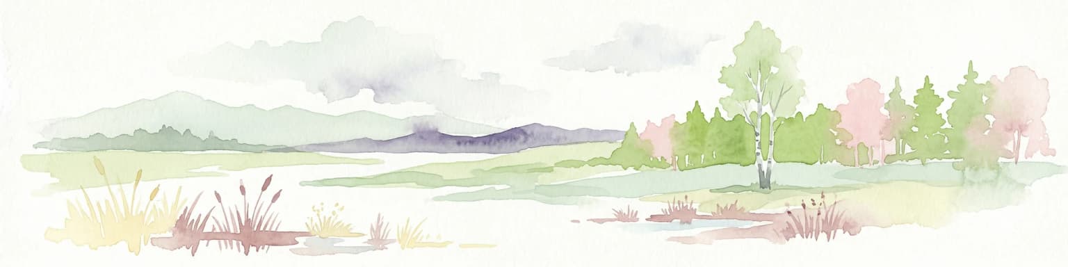
Top sights and standout views in Gaume Natural Park

Gaume Natural Park stands as Wallonia's largest protected area and a pioneering example of integrated regional conservation in Belgium. The park's extensive trail network provides access to the distinctive landscapes of Gaume, allowing visitors to explore forests, farmland, and traditional villages. Its governance model brings together nine municipalities in a collaborative framework that addresses both conservation and development objectives. The park serves as a living landscape where ecological preservation works alongside maintained agricultural activity and community vitality. As a relatively recent establishment from 2014, it represents contemporary approaches to protected area management that recognize the interdependence of natural and cultural values in European rural landscapes.

Best time to visit Gaume Natural Park

Gaume Natural Park can be explored throughout the year, with each season offering different qualities for visitors. The spring and summer months provide ideal conditions for walking the extensive trail network, with longer daylight hours and landscapes in full vegetative growth. Autumn offers another appealing season when forest colors transform the appearance of the wooded areas. Winter, while less conducive to extensive walking, reveals the underlying structure of the landscape and the character of the villages. The park's design for year-round outdoor activity means that visitors can experience the changing character of Gaume across seasons, though the specific timing of visits may depend on whether visitors prefer active trail exploration or a more contemplative experience of the landscape.

Park location guide

Geography guide, regional context, and park location map for Gaume Natural Park

Gaume Natural Park park geography, regions, and map view in Belgium
Understand where Gaume Natural Park sits in Belgium through a broader geographic reading of the surrounding landscape, nearby location context, and its mapped position within the national park landscape.

How Gaume Natural Park fits into Belgium

Belgium is a parliamentary constitutional monarchy and federal state in Northwestern Europe. Located in the Low Countries, it borders the Netherlands, Germany, Luxembourg, France, and the North Sea. The country has three autonomous regions and three official languages, with Brussels as both the capital and largest city. Belgium is a founding member of the European Union and hosts its de facto capital in Brussels.

Wider geography shaping Gaume Natural Park in Belgium

Belgium occupies a coastal lowland region in Northwestern Europe known as the Low Countries. It is bordered by the Netherlands to the north, Germany to the east, Luxembourg to the southeast, France to the south, and the North Sea to the west. The country also shares a maritime boundary with the United Kingdom to the northwest.

Map view of Gaume Natural Park

Use this park location map to pinpoint Gaume Natural Park in Belgium, understand its exact geographic position, and read its mapped placement within the surrounding landscape more clearly.

Pigeon | © OpenStreetMap contributors

Location context for Gaume Natural Park

Province of Luxembourg

Explore the distinct landscapes of Gaume Natural Park: its rolling hills, dense forests, agricultural fields, and traditional villages.

Gaume Natural Park Imagery: Discover Belgium's Largest Protected Landscape and Distinct Scenery
Browse a curated collection of photos showcasing Gaume Natural Park's distinctive rolling hills, extensive forests, and agricultural landscapes in southern Belgium. These images provide essential visual context for understanding the park's unique blend of natural habitats, rural heritage, and integrated protected area character.

Forest trail intersection with leaf-covered ground and tall trees under a clear sky

Park atlas

Map the regional protected landscapes and compare park characteristics throughout the Province of Luxembourg.

Explore Related Protected Areas and Natural Parks Beyond Gaume Natural Park
After exploring Gaume Natural Park, browse other protected areas and nature parks situated within the surrounding Gaume region and the wider Province of Luxembourg. Comparing these neighboring conservation landscapes offers valuable insights into regional park geography, enabling discovery of distinct protected-area management approaches across southern Belgium.
Protected areaBelgium

Burdinale Protected Area: Explore its Mapped Landscape and Geographic Context in Belgium

Mapped protected area discovery within Belgium's geography.

Burdinale Protected Area serves as a key point for understanding Belgium's protected lands from an atlas perspective. This page details the park's specific geographic setting and mapped natural landscape, providing essential context for regional geography exploration. Discover the protected boundaries and terrain features that define Burdinale, contributing to a structured overview of conservation areas.

Scope
Mixed
Water
Major water bodies
Watercolor illustration of rolling green hills and meadows with patches of pink and yellow flowers
National parkNorth Rhine-Westphalia

Eifel National Park: North Rhine-Westphalia Protected Area Atlas

Explore mapped boundaries and regional geography.

Gain a structured understanding of Eifel National Park, a key protected area within Germany's North Rhine-Westphalia region. This page focuses on its geographic identity, detailing mapped boundaries and offering context within the state's broader natural landscapes. MoriAtlas enhances your exploration by presenting Eifel National Park as a distinct entity within a larger geographic framework, ideal for atlas-based research and understanding protected land distribution.

Area
107 km²
Established
2004
IUCN
II
Relief
Upland
National parkLimburg

Hoge Kempen National Park: National Park Protected Landscape and Limburg Geographic Context

Explore mapped boundaries within the Limburg region.

Gain a comprehensive understanding of Hoge Kempen National Park as a distinct protected national park. This resource provides critical insights into its geographic setting within the Limburg region, detailing its mapped boundaries and overall landscape context. It serves as an essential point for atlas exploration, allowing users to appreciate the park's role as a protected natural area and its place within the regional geography of Belgium.

Area
67 km²
Established
2006
IUCN
II
Watercolor painting of a landscape featuring a stream, trees, and rolling hills
National parkLimburg

De Meinweg National Park: Unique Terraced Landscape and Protected Area in Limburg

National Park with exceptional reptile and amphibian biodiversity.

De Meinweg National Park is a remarkable protected landscape located in the Dutch province of Limburg, distinguished by its rare terraced topography unlike any other in the Netherlands. This national park, covering 1,800 hectares, is a key component of the transboundary Grenspark Maas-Swalm-Nette, bordering Germany. Its ecological significance is underscored by its status as a Natura 2000 site, with notable biodiversity, particularly among reptiles and amphibians, and regenerating raised bogs. MoriAtlas offers a map-centric view of this unique protected area, detailing its geographic context and landscape features for structured discovery.

Area
18 km²
Established
1995
IUCN
II
Relief
Upland
Watercolor painting of a peat bog ecosystem featuring green trees, pink and yellow vegetation, a body of water, and distant mountains
National park

De Groote Peel National Park: Mapped Boundaries of a Unique Raised Bog & Wetland

Protected area with exceptional birdlife and peat landscape.

De Groote Peel National Park represents a crucial protected landscape in the Netherlands, renowned as one of the last substantial raised bogs in Western Europe. Its terrain is characterized by a distinct blend of open lakes formed by historical peat extraction, heathland expanses, and sensitive peat swamps. This Ramsar-designated wetland is a vital habitat for numerous bird species, offering unique opportunities for landscape context and atlas exploration of its ecological significance and mapped geographic features.

Area
13.4 km²
Established
1993
IUCN
II
Relief
Lowland
National park

De Zoom, Kalmthoutse Heide Cross-Border Park: Transboundary National Park & Heathland Atlas

Explore mapped protected boundaries and regional geography.

This page details the De Zoom, Kalmthoutse Heide Cross-Border Park, a significant national park that merges Belgian and Dutch protected territories. It is recognized for its expansive heathland, a crucial ecosystem in the Benelux region, offering a rich visual and ecological study. The park's mapped landscape context reveals its unique geography, from dry heathlands to Ramsar-designated wetlands, providing valuable insight for atlas-based exploration of protected areas. Understand the park's protected area identity and its role within the regional landscape.

Area
37.5 km²
Established
2001
IUCN
II
National park

Forêts National Park: A Protected Landscape of Lowland Deciduous Forests

Explore its unique geography and protected forest ecosystems.

Delve into Forêts National Park, a significant protected area in northeastern France dedicated to preserving lowland deciduous forests and their associated biodiversity. This park represents a unique atlas entry for understanding mapped protected lands, featuring extensive broad-leaved forest tracts, diverse wetlands, and limestone grasslands across the Grand Est and Bourgogne-Franche-Comté regions. Discover the geographic identity of this conservation landscape and its role within the Paris Basin's terrain.

Area
560 km²
Established
2019
IUCN
II
Relief
Lowland
National parkLimburg

De Maasduinen National Park: Mapping the Longest River Dune System in the Netherlands

Protected Landscape and Dune Terrain in Limburg

Delve into the geographic identity of De Maasduinen National Park, a vital protected area in Limburg. This page offers detailed insights into its remarkable dune landscape, heathlands, and forests, emphasizing its role within the Dutch natural atlas and its connections to surrounding conservation areas.

Area
45 km²
Established
1996
IUCN
II

Common questions about visiting, size, designation, and location context for Gaume Natural Park

Gaume Natural Park FAQs for park facts, access, geography, and protected area context
Find quick answers about Gaume Natural Park, including protected-area facts, park geography, trail and visitor context, and how the park fits into its surrounding country and regional landscape.
MoriAtlas Explorer

Continue Your Protected Areas Search Across the Global Atlas

Deepen your exploration by continuing the structured search for national parks and protected areas worldwide. Utilize the comprehensive filtering capabilities to compare different conservation landscapes and refine your understanding of global park geography. Discover more about the distribution and characteristics of protected natural areas.

Global natural geography