Mori Atlas logo
National parkDe Zoom–Kalmthoutse Heide Cross-Border Park

Discover a unique transboundary protected area showcasing extensive heathland ecosystems and regional geography.

De Zoom–Kalmthoutse Heide Cross-Border Park: A Mapped National Park of Benelux Heathland Landscapes

(Grenspark De Zoom - Kalmthoutse Heide)

De Zoom–Kalmthoutse Heide Cross-Border Park represents a significant protected landscape straddling the Belgian-Dutch border, famed for its extensive heathland ecosystems. This national park is a key component of the Benelux's natural heritage, offering a vast mapped terrain composed of dry and wet heath, interspersed with wetlands and reforested areas. Its establishment as a collaborative transboundary conservation effort highlights its importance in regional geography and landscape preservation. Users can explore the park's unique protected boundaries and discover the mapped context of this rare, large-scale heathland complex.

Cross-border protected areaHeathlandNature reserveNational parkRamsar siteBird sanctuary

De Zoom–Kalmthoutse Heide Cross-Border Park

National park

Park overview

Structured park overview, official facts, and landscape profile for De Zoom, Kalmthoutse Heide Cross-Border Park

De Zoom, Kalmthoutse Heide Cross-Border Park park facts, protected area profile, and essential visitor context
Review the core facts for De Zoom, Kalmthoutse Heide Cross-Border Park, including designation, size, terrain, visitor scale, habitats, and operating context in one park-focused overview.

About De Zoom, Kalmthoutse Heide Cross-Border Park

De Zoom–Kalmthoutse Heide Cross-Border Park represents a remarkable example of transboundary nature conservation in western Europe. Straddling the border between the Netherlands and Belgium, the park creates a continuous habitat that transcends national boundaries, managed through a unique bilateral commission that brings together Flemish and Dutch organizations. The landscape encompasses the characteristic heathlands that once covered much of this region of northwestern Europe, though modern agricultural intensification and forestry have reduced such areas to fragments. Within this context, the park preserves one of the most significant remaining heathland complexes, its heather, gorse, and acidic grasslands supporting a distinctive suite of species adapted to these historically human-shaped ecosystems.

The Belgian portion, centered around the municipalities of Kalmthout and Essen in Antwerp province, contains the core of the original Kalmthoutse Heide reserve that received landscape protection status in 1941. The Dutch portion extends from the border into the Woensdrecht municipality of North Brabant, encompassing former heath areas that were progressively reforested during the nineteenth and twentieth centuries. The establishment of the unified cross-border park in 2001, initially covering roughly 4,000 hectares before expansion added another 2,000 hectares a decade later, created an administrative framework that allows ecological processes to operate across the entire landscape regardless of the international boundary.

The park's management reflects its cross-border character, with the Bijzondere Commissie "Grenspark De Zoom-Kalmthoutse Heide" coordinating activities across both national jurisdictions. This collaborative approach addresses the challenge of maintaining ecological connectivity across a frontier that was, until recently, a largely impermeable barrier to wildlife movement.

Quick facts and research context for De Zoom, Kalmthoutse Heide Cross-Border Park

The park spans the border between the Netherlands (North Brabant province, municipality of Woensdrecht) and Belgium (Antwerp province, municipalities of Kalmthout and Essen). It was formally established as a cross-border park in 2001, though the Belgian side received landscape protection status as early as 1941. The area has been a Ramsar Wetland site since 1986, recognizing its international importance as a wetland ecosystem. The Flemish portion was designated a bird sanctuary in 1988, with the Dutch portion following shortly thereafter. Ownership is shared between the Flemish state, the municipality of Kalmthout, Dutch nature management organizations Staatsbosbeheer and Natuurmonumenten, and several private landowners.

Park context

Deeper park guide and search-rich context for De Zoom, Kalmthoutse Heide Cross-Border Park

De Zoom, Kalmthoutse Heide Cross-Border Park history, landscape, wildlife, and travel context
Explore De Zoom, Kalmthoutse Heide Cross-Border Park through its history, landscape character, ecosystems, wildlife, conservation priorities, cultural context, and seasonal travel timing in a structured park guide built for atlas discovery and search intent.

Why De Zoom, Kalmthoutse Heide Cross-Border Park stands out

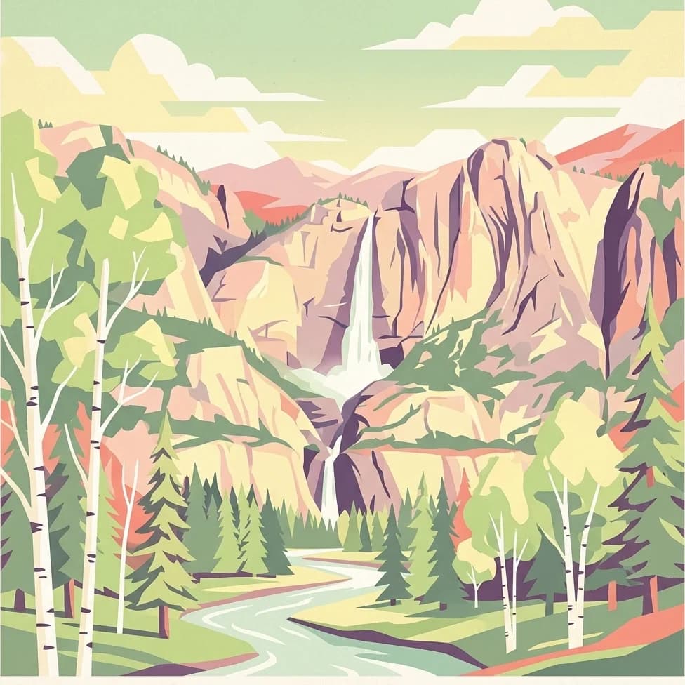
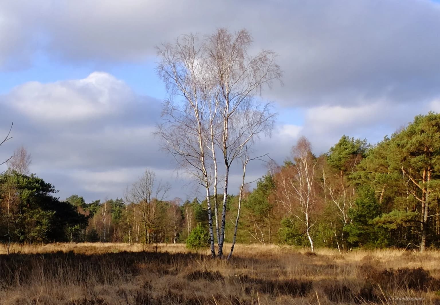
The park is renowned for its extensive heathland, one of the largest remaining heath ecosystems in the Benelux region. The purple heather-covered landscapes, particularly striking during the late summer flowering season, define the visual identity of the reserve. The cross-border nature of the park, combining Dutch and Belgian territories into a unified conservation area, makes it distinctive in European protected area management. The Ramsar-designated wetlands within the park add further ecological significance to this already notable landscape.

De Zoom, Kalmthoutse Heide Cross-Border Park history and protected-area timeline

The ecological character of the De Zoom–Kalmthoutse Heide landscape reflects a complex history of human interaction with the land. Originally, the area supported the deciduous forests typical of Central Europe's temperate climate zone. However, centuries of sustained grazing by cattle and sheep progressively depleted the forest understory and, eventually, the tree layer itself. The removal of sods—a practice common during the Middle Ages—further accelerated soil degradation, as these nutrient-rich turves were harvested together with animal manure to fertilize surrounding agricultural fields. This combination of overgrazing and nutrient export created the conditions for heathland expansion, as the nutrient-poorer soils could no longer support the more demanding grassland and forest species.

From the thirteenth century onward, local communities began draining the region's bogs to extract peat for fuel, further transforming the landscape. By the mid-nineteenth century, as agricultural intensification accelerated across Europe, many remaining heathlands were either planted with coniferous forests or converted to cropland. The Belgian portion of what would become the modern park escaped such complete transformation, and in 1941 it received formal designation as a landscape protection area—among the earliest recognition of heathland conservation value in the region.

The international significance of the area was recognized in 1986 when Kalmthoutse Heide was designated a Ramsar Wetland site, acknowledging its importance as a wetland ecosystem. In October 1988, the Flemish portion became a bird sanctuary under Dutch bird protection legislation, with the Dutch side following a few years later. The formal establishment of the cross-border park in 2001 represented the culmination of nearly a decade of planning, creating a unified management structure for the reserves on both sides of the border and securing the Dutch portion's national park status.

De Zoom, Kalmthoutse Heide Cross-Border Park landscape and geographic character

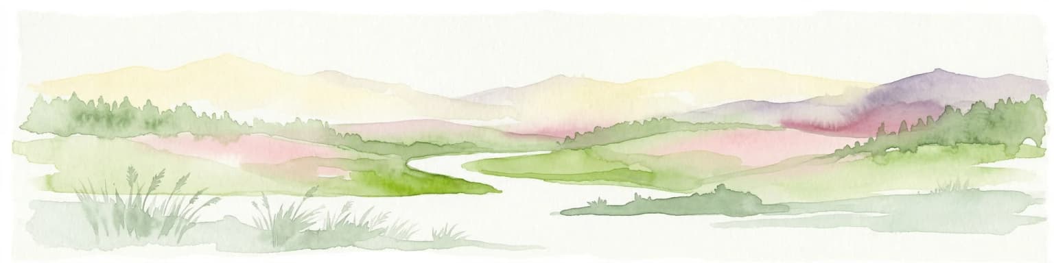
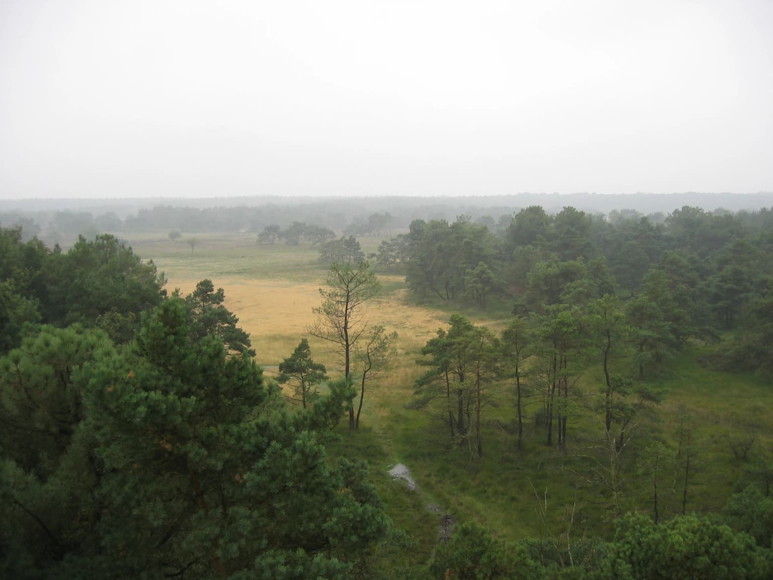
The physical landscape of De Zoom–Kalmthoutse Heide reflects the glacial and post-glacial history of the Benelux region combined with centuries of human land use. The terrain consists largely of gently undulating sand deposits left by Pleistocene ice sheets, creating a terrain of low relief with isolated hills and depressions. The sandy, nutrient-poor soils that developed on these deposits are fundamentally responsible for the heathland character of the landscape, as such soils cannot support the more productive forests and grasslands found on richer substrates.

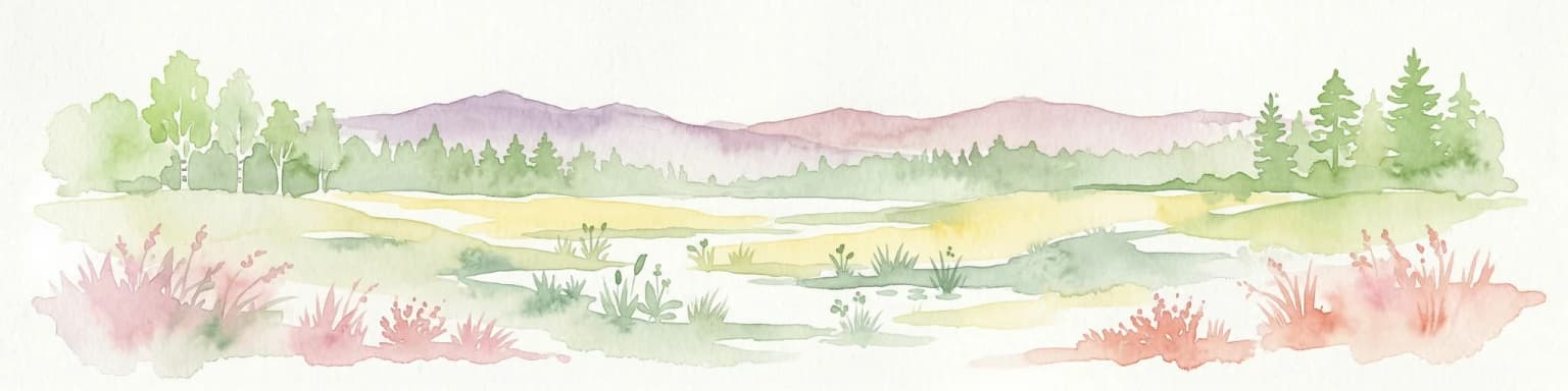
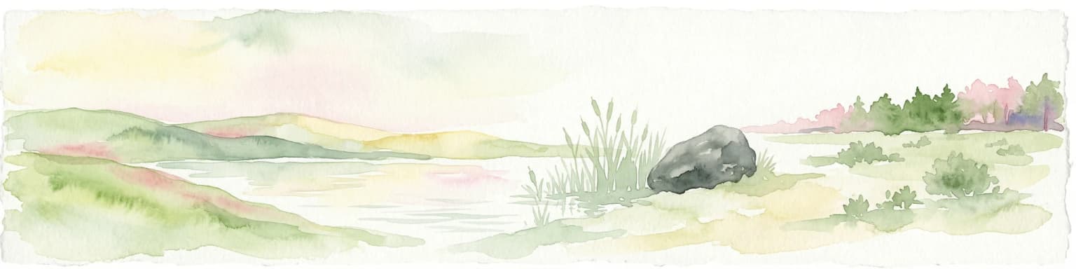
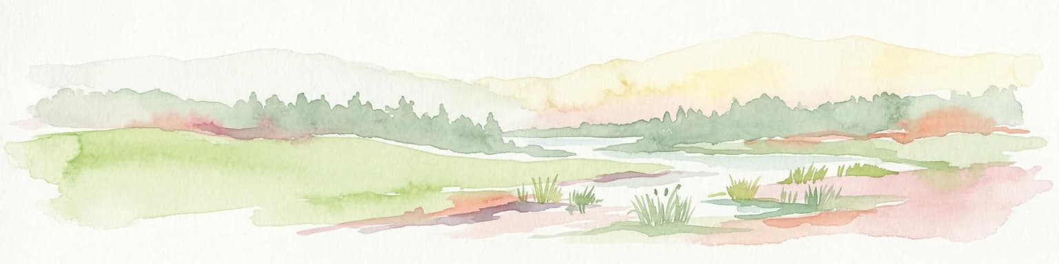
The park encompasses a mosaic of heath vegetation types, from dry heather communities on the higher ground to wet heath and boggy areas in depressions where water accumulates. The transition zones between heath and the remaining forest patches create additional habitat diversity. In the Dutch portion particularly, the results of nineteenth-century reforestation efforts are visible as coniferous plantations, though these are progressively being managed to restore more natural woodland character. The landscape is dotted with small water bodies, meres, and marshy areas that add further ecological and visual variety to the heathland matrix.

De Zoom, Kalmthoutse Heide Cross-Border Park ecosystems, habitats, and plant life

The ecological significance of De Zoom–Kalmthoutse Heide stems primarily from its extensive heathland habitats, now rare across western Europe. Heath ecosystems develop on acidic, nutrient-poor sandy soils where the combination of climate, topography, and historical human disturbance prevents the re-establishment of forest. The characteristic vegetation is dominated by heather species, particularly common heather (Calluna vulgaris) and cross-leaved heath (Erica tetralix), along with gorse (Ulex spp.) and a range of specialized grasses and herbs.

The heathland exists in multiple states depending on management history and environmental conditions. Dry heath occurs on well-drained slopes and ridges, while wet heath occupies depressions and areas with higher water tables. Where peat accumulation has been sufficient, bog communities develop with their own distinctive species. This habitat heterogeneity supports a correspondingly diverse plant community, with many species specifically adapted to the harsh conditions of heath environments. The Ramsar designation recognizes the wetland components of the park, which include the boggy areas and seasonal water bodies that provide crucial habitat during different phases of the annual cycle.

De Zoom, Kalmthoutse Heide Cross-Border Park wildlife and species highlights

The heathland and wetland habitats of De Zoom–Kalmthoutse Heide support a distinctive fauna adapted to these semi-natural landscapes. The bird community includes several species strongly associated with heathland, including the nightjar, woodlark, and stonechat, which require the open, heath-covered terrain for breeding. The wetter areas attract waders such as curlew and snipe, while the scrubby margins provide nesting habitat for species like as Whitethroat and Dartford warbler. The bird sanctuary designations reflect the international significance of these populations, particularly for species of European conservation concern.

The reptile and amphibian community includes sand lizard and smooth snake in the drier heath areas, with common toad and several frog species associated with the wetland components. Invertebrates are exceptionally diverse in heathland ecosystems, with many species dependent on specific host plants or microhabitats. The heathland spider fauna, in particular, includes several species with restricted distributions in this region. The mosaic of habitats, combined with the park's size and relative isolation from intensive agriculture, allows these communities to persist at viable population levels.

De Zoom, Kalmthoutse Heide Cross-Border Park conservation status and protection priorities

De Zoom–Kalmthoutse Heide represents one of the most important heathland conservation areas in the Benelux, a region where such habitats have been dramatically reduced by agricultural intensification and forestry over the past two centuries. The Ramsar designation in 1986 acknowledged the international importance of the wetland components, while the subsequent bird sanctuary designations recognized the significance of the area for breeding bird populations. The cross-border status of the park adds further conservation value by maintaining ecological connectivity across what was historically a significant barrier to wildlife movement.

Management of the park balances active intervention to maintain the open heathland character—with periodic controlled burning or mechanical vegetation management—against allowing natural processes to operate where possible. The challenge of maintaining heathland, which is a semi-natural habitat requiring ongoing disturbance to prevent succession to woodland, reflects the broader conservation dilemma in European lowlands where most landscapes have been shaped by human activity over millennia. The collaborative management structure, bringing together Flemish and Dutch authorities and organizations, provides a model for transboundary conservation in densely populated western Europe.

De Zoom, Kalmthoutse Heide Cross-Border Park cultural meaning and human context

The cultural landscape of De Zoom–Kalmthoutse Heide reflects the long history of human interaction that created the heathland itself. The term "heide" (heath) in the toponymy of the region directly references this landscape, which was shaped not by natural processes alone but by the combined effects of grazing, sod extraction, and peat cutting over centuries. This traditional land use, while superficially destructive, actually created the conditions for a distinctive cultural ecosystem that persisted as the agricultural basis for rural communities.

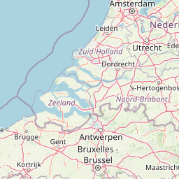
The border between the Netherlands and Belgium, which runs through the park, reflects relatively recent political boundaries superimposed on a landscape that had long been continuous. The municipalities of Kalmthout and Essen on the Belgian side and Woensdrecht on the Dutch side share cultural and historical connections that predate the modern border. The collaborative management of the park today can be seen as an acknowledgment that the ecological reality of this landscape transcends the political divisions imposed upon it.

Top sights and standout views in De Zoom, Kalmthoutse Heide Cross-Border Park

The cross-border nature of De Zoom–Kalmthoutse Heide makes it distinctive among European protected areas, combining Dutch and Belgian territories into a single managed landscape. The extensive heathland, among the largest remaining in the Benelux, provides a visual and ecological experience increasingly rare in modern Europe. The Ramsar wetland designation and bird sanctuary status underline the international conservation significance of the area. The collaborative management structure represents a model for transboundary conservation in densely populated regions.

Best time to visit De Zoom, Kalmthoutse Heide Cross-Border Park

The park offers distinct seasonal experiences throughout the year. Late summer, particularly August and early September, brings the heather into full purple bloom, creating the most visually spectacular display and attracting many visitors specifically to witness this phenomenon. Spring and early summer provide excellent conditions for observing breeding birds, with the heath alive with song and activity during the core breeding season. The shoulder seasons of spring and autumn offer milder temperatures for walking and exploring the network of trails that traverse the park. Winter, while less visually dramatic, reveals the skeletal structure of the heathland and can be rewarding for those interested in the park's ecology during the dormant season.

Park location guide

Geography guide, regional context, and park location map for De Zoom, Kalmthoutse Heide Cross-Border Park

De Zoom, Kalmthoutse Heide Cross-Border Park park geography, regions, and map view in Belgium
Understand where De Zoom, Kalmthoutse Heide Cross-Border Park sits in Belgium through a broader geographic reading of the surrounding landscape, nearby location context, and its mapped position within the national park landscape.

Map view of De Zoom, Kalmthoutse Heide Cross-Border Park

Use this park location map to pinpoint De Zoom, Kalmthoutse Heide Cross-Border Park in Belgium, understand its exact geographic position, and read its mapped placement within the surrounding landscape more clearly.

Pigeon | © OpenStreetMap contributors

Location context for De Zoom, Kalmthoutse Heide Cross-Border Park

AntwerpNorth Brabant
Park atlas

Explore connected protected landscapes and regional park geography, tracing the unique heathland ecosystems across the Benelux border region.

Explore Other National Parks and Protected Areas Near De Zoom–Kalmthoutse Heide Cross-Border Park
Explore other protected areas and national parks surrounding De Zoom–Kalmthoutse Heide Cross-Border Park, including significant heathland landscapes and transboundary conservation zones across the Benelux region. This curated geographic view allows for direct comparison of park features, ecological profiles, and management approaches within similar northwestern European terrain.
Watercolor illustration of a coastal landscape with marshy areas, calm water, and distant hills
National parkZeeland

Oosterschelde National Park: A Dynamic Tidal Marine Ecosystem in Zeeland, Netherlands

Explore the geography of Netherlands' largest protected tidal landscape.

Oosterschelde National Park represents a unique intersection of natural dynamism and human engineering within the Zeeland province. As the Netherlands' largest national park, it safeguards a vast tidal lagoon system characterized by its profound tidal flats and sandbanks that transform landscape twice daily. This protected area offers a remarkable case study in coastal geography and marine conservation, with its rich ecosystems supporting diverse wildlife and providing excellent opportunities for sport diving and birdwatching. Delve into the mapped context of this significant Dutch protected landscape.

Area
370 km²
Established
2002
IUCN
II
Relief
Lowland
Watercolor illustration showing a network of rivers, trees, and hills in a wetland landscape
National park

De Biesbosch National Park: A Dutch National Park Mapping Tidal Wetlands and Flood Forests

Explore mapped waterways and diverse protected landscapes.

Delve into the geography of De Biesbosch National Park, a remarkable protected area in the Netherlands renowned for its extensive freshwater tidal wetlands. This national park showcases a unique landscape defined by intricate river systems, dominant willow flood forests, and vital reed beds, serving as a critical habitat for migratory birds and a prime example of wetland restoration. Understand its place within the regional geography through our atlas-driven approach to protected land discovery.

Area
90 km²
Established
1994
IUCN
II
Relief
Lowland
Watercolor artwork showing sand dunes, scattered trees, distant mountains, and soft sky
National park

De Loonse en Drunense Duinen National Park: Explore Dutch Protected Sand Drift Landscapes and Heathlands

National Park with unique living sand drift and dune terrain.

Navigate the geographic contours and protected land boundaries of De Loonse en Drunense Duinen National Park, a premier Dutch natural area. This national park is celebrated for its extensive living sand drift, one of the largest in Northern Europe, alongside significant heathlands and coniferous forests. Gain a structured understanding of its landscape character and its role within regional geography through detailed map context and atlas exploration tools.

Area
35 km²
Established
2002
IUCN
II
Relief
Lowland
Watercolor illustration of rolling hills, a winding river, and fields with distant mountains
National parkNorth Brabant

Van Gogh National Park: National Park in North Brabant with Dune Landscapes

Explore mapped protected areas and regional geography.

Van Gogh National Park is a significant protected landscape in North Brabant, Netherlands, covering approximately 1,200 square kilometers. This national park is distinguished by its extensive drift sand dune systems, notable heathlands, and wooded valleys, offering a diverse terrain within the Dutch context. Named in tribute to Vincent van Gogh, it merges rich natural landscapes with cultural heritage, serving as a model for collaborative conservation and regional development, all mapped for detailed atlas exploration.

Area
1,200 km²
Established
2024
IUCN
II
Relief
Lowland
Nature reserveBelgium

Zwin Nature Reserve: Belgium's Coastal Wetland and Historic Tidal Inlet Landscape

Mapped protected area boundaries and coastal wetland geography.

Delve into the Zwin Nature Reserve, a significant protected landscape on Belgium's North Sea coast. This area preserves the unique geography of a historical tidal creek system, characterized by extensive salt marshes, mudflats, and specialized coastal vegetation. As a vital habitat for diverse bird species and a showcase of tidal dynamics, Zwin offers a compelling case study in coastal conservation and landscape evolution, providing rich context for geographic and atlas-based exploration.

Area
1.58 km²
Established
1952
Relief
Lowland
Climate
Temperate
Watercolor painting of a peat bog ecosystem featuring green trees, pink and yellow vegetation, a body of water, and distant mountains
National park

De Groote Peel National Park: Mapped Boundaries of a Unique Raised Bog & Wetland

Protected area with exceptional birdlife and peat landscape.

De Groote Peel National Park represents a crucial protected landscape in the Netherlands, renowned as one of the last substantial raised bogs in Western Europe. Its terrain is characterized by a distinct blend of open lakes formed by historical peat extraction, heathland expanses, and sensitive peat swamps. This Ramsar-designated wetland is a vital habitat for numerous bird species, offering unique opportunities for landscape context and atlas exploration of its ecological significance and mapped geographic features.

Area
13.4 km²
Established
1993
IUCN
II
Relief
Lowland
National parkLimburg

Hoge Kempen National Park: National Park Protected Landscape and Limburg Geographic Context

Explore mapped boundaries within the Limburg region.

Gain a comprehensive understanding of Hoge Kempen National Park as a distinct protected national park. This resource provides critical insights into its geographic setting within the Limburg region, detailing its mapped boundaries and overall landscape context. It serves as an essential point for atlas exploration, allowing users to appreciate the park's role as a protected natural area and its place within the regional geography of Belgium.

Area
67 km²
Established
2006
IUCN
II
Watercolor landscape showing green hills, forests, and a small stream with grassy patches
National parkUtrecht Province

Utrechtse Heuvelrug National Park: Mapped Protected Landscape and Geographic Atlas

Discover Utrecht Province's glacial ridge and diverse natural terrain.

Utrechtse Heuvelrug National Park is a significant protected natural area located in Utrecht Province, renowned for its unique glacial ridge topography. This entry provides detailed information about its mapped boundaries, diverse landscapes including heathlands and forests, and its importance as an ecological corridor within the Netherlands. Explore the park's distinct geography and its role in regional conservation through our structured atlas view.

Area
100 km²
Established
2003
IUCN
II
Visitors
1M annual

Common questions about visiting, size, designation, and location context for De Zoom, Kalmthoutse Heide Cross-Border Park

De Zoom, Kalmthoutse Heide Cross-Border Park FAQs for park facts, access, geography, and protected area context
Find quick answers about De Zoom, Kalmthoutse Heide Cross-Border Park, including protected-area facts, park geography, trail and visitor context, and how the park fits into its surrounding country and regional landscape.
MoriAtlas Explorer

Continue Your Protected Areas Search Across the Global Atlas

Deepen your exploration by continuing the structured search for national parks and protected areas worldwide. Utilize the comprehensive filtering capabilities to compare different conservation landscapes and refine your understanding of global park geography. Discover more about the distribution and characteristics of protected natural areas.

Global natural geography