Mori Atlas logo
National parkDe Meinweg National Park

Discover the mapped boundaries and unique terrain of this Dutch National Park.

De Meinweg National Park: A Terraced Landscape Protected Area in Limburg

(Nationaal Park De Meinweg)

De Meinweg National Park, situated in the Limburg region of the Netherlands near Roermond, represents a geologically rare terraced landscape formed by ancient river systems and fault lines. Spanning approximately 1,800 hectares, this protected area is a Natura 2000 site and a vital part of the transboundary Grenspark Maas-Swalm-Nette. MoriAtlas provides an atlas-driven perspective on De Meinweg National Park, highlighting its unique terrain, rich amphibian and reptile biodiversity, and its ecological significance within the Dutch and German conservation landscape.

National ParkHeathlandTerraced LandscapeTransboundary Protected AreaNatura 2000Reptiles
Stylized illustration of a forest landscape with a waterfall, lake, trees, and mountains under a colorful sky

De Meinweg National Park

National park

Park overview

Structured park overview, official facts, and landscape profile for De Meinweg National Park

De Meinweg National Park park facts, protected area profile, and essential visitor context
Review the core facts for De Meinweg National Park, including designation, size, terrain, visitor scale, habitats, and operating context in one park-focused overview.

About De Meinweg National Park

De Meinweg National Park occupies a distinctive place in the Dutch protected area network due to its unusual topography and ecological character. Unlike most of the Netherlands, which consists largely of flat or gently undulating terrain, the park features a series of distinct river terraces separated by steep slopes—a landscape shaped by the ancient dynamics of the Meuse and Rhine rivers. Three geological fault lines, including the Peelrandbreuk, traverse the park, adding to its geological interest. The highest point, the Wolfsplateau, rises to approximately 80 meters above sea level, providing sweeping views across the heathlands and forests below. The park is enclosed by Germany on three sides, creating an international character that is reflected in its management as part of the Grenspark Maas-Swalm-Nette. This transboundary cooperation enables conservation of species and habitats that move across the border, while also presenting challenges related to external pressures such as groundwater extraction from German brown coal mining operations. The visitor center, De Boshut, provides educational resources and serves as the starting point for exploring the network of walking routes that traverse the park's varied habitats.

Quick facts and research context for De Meinweg National Park

De Meinweg National Park lies in the municipality of Roerdalen in Limburg, approximately 18 kilometers east of Roermond. The park's defining physical feature is its terraced landscape with steep transitions between river terraces, reaching its highest point at the Wolfsplateau at approximately 80 meters above sea level. Two streams, the Rode Beek and Boschbeek, traverse the park, carrying water from the plateaus down to the Roer River. The park is part of a larger cross-border conservation network with Germany and is designated under both the EU Habitats Directive and Birds Directive. The area has a rich human history, having been under common ownership of fourteen surrounding villages—a usage pattern that gave the area its name, as "mein" means communal in the local dialect.

Park context

Deeper park guide and search-rich context for De Meinweg National Park

De Meinweg National Park history, landscape, wildlife, and travel context
Explore De Meinweg National Park through its history, landscape character, ecosystems, wildlife, conservation priorities, cultural context, and seasonal travel timing in a structured park guide built for atlas discovery and search intent.

Why De Meinweg National Park stands out

De Meinweg is best known for its exceptional reptile and amphibian biodiversity, which is unique within the Netherlands. The park hosts five species of reptiles, including adders, smooth snakes, sand lizards, viviparous lizards, and slow worms, along with seven amphibian species, including the rare garlic toad. The park is also famous for its regenerating raised bogs in the pond areas, where active restoration efforts are bringing back peat-forming vegetation. The terraced landscape itself is a defining characteristic, representing one of the few examples of this geological formation in the Dutch lowlands. Additionally, the park's position as part of a transboundary protected area with Germany makes it significant for cross-border conservation efforts.

A calm pond reflecting trees and sky surrounded by green vegetation and trees in a national park setting
A serene wetland landscape in De Meinweg National Park's Rolvennen area with calm water reflecting trees and sky

De Meinweg National Park history and protected-area timeline

The history of De Meinweg is deeply intertwined with human use and ownership patterns that span centuries. The area existed as common land belonging to fourteen surrounding villages, a communal tenure system reflected in the name "Meinweg" itself, derived from the word for common or shared. This traditional grazing and gathering land gradually changed character over time, with parts of the area converted to oak coppice woodland. Between 1954 and 1962, the Staatsmijn Beatrix coal mine was established within the area, though operations ceased after completing two shafts. Following the end of mining activity, large areas were planted with pine trees to provide mine timber, fundamentally altering the original heathland and raised bog vegetation. The area was formally designated as a nature reserve in 1990 by the Dutch Minister of Agriculture, Nature Management, and Fisheries, and was subsequently established as a national park in 1995. The former colonial history is also preserved in the landscape through the remains of Kolleg St. Ludwig, a monastery that later became home to Maharishi Mahesh Yogi, founder of Transcendental Meditation, from 1990 until its demolition in 2015.

De Meinweg National Park landscape and geographic character

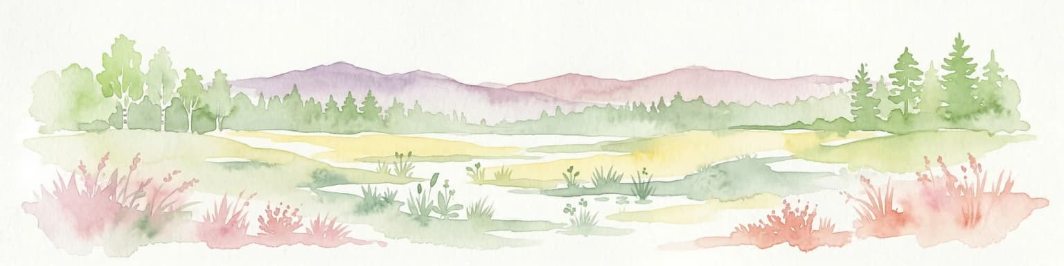
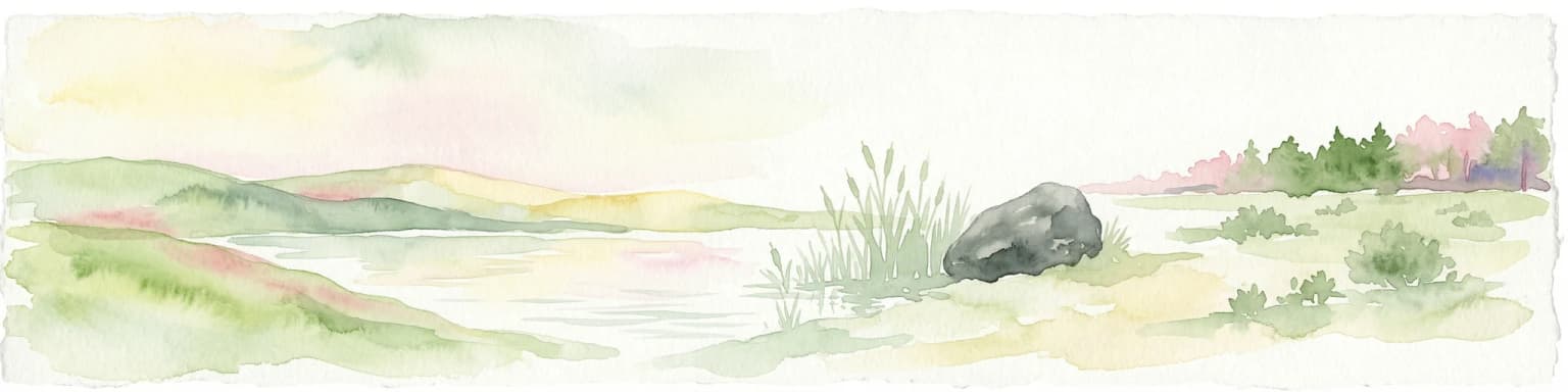
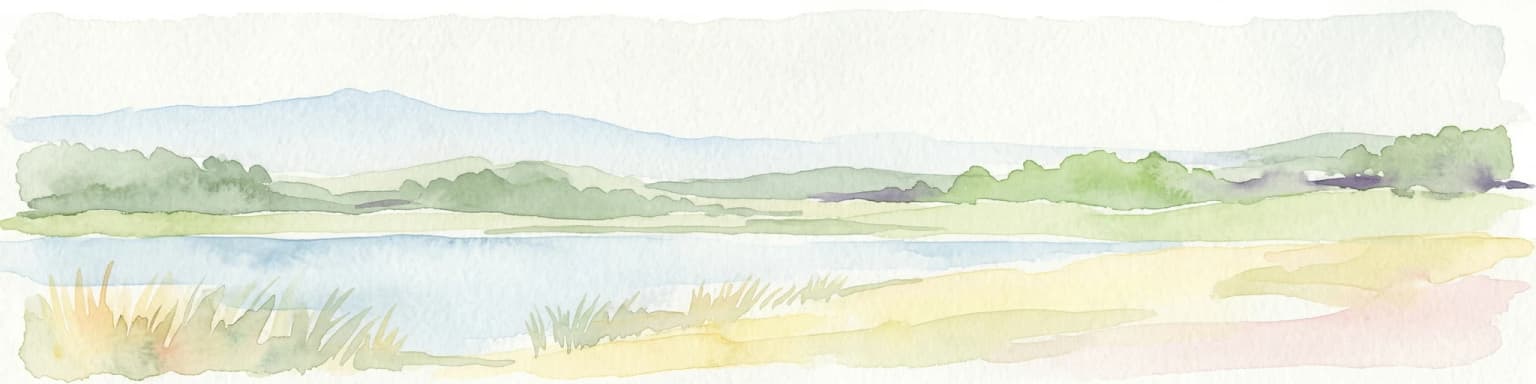
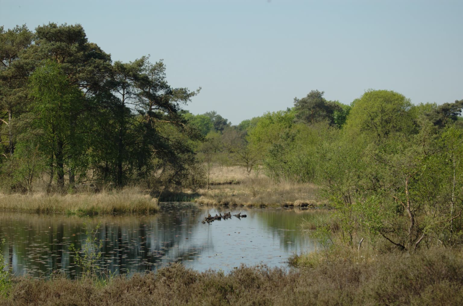
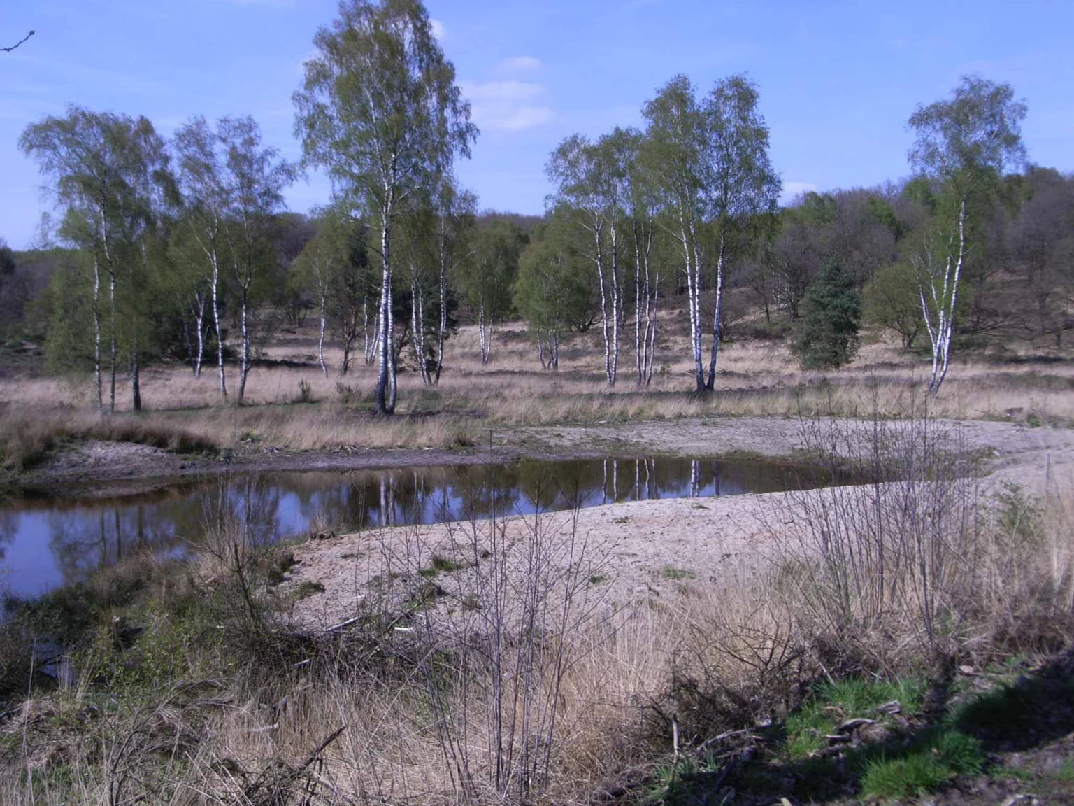
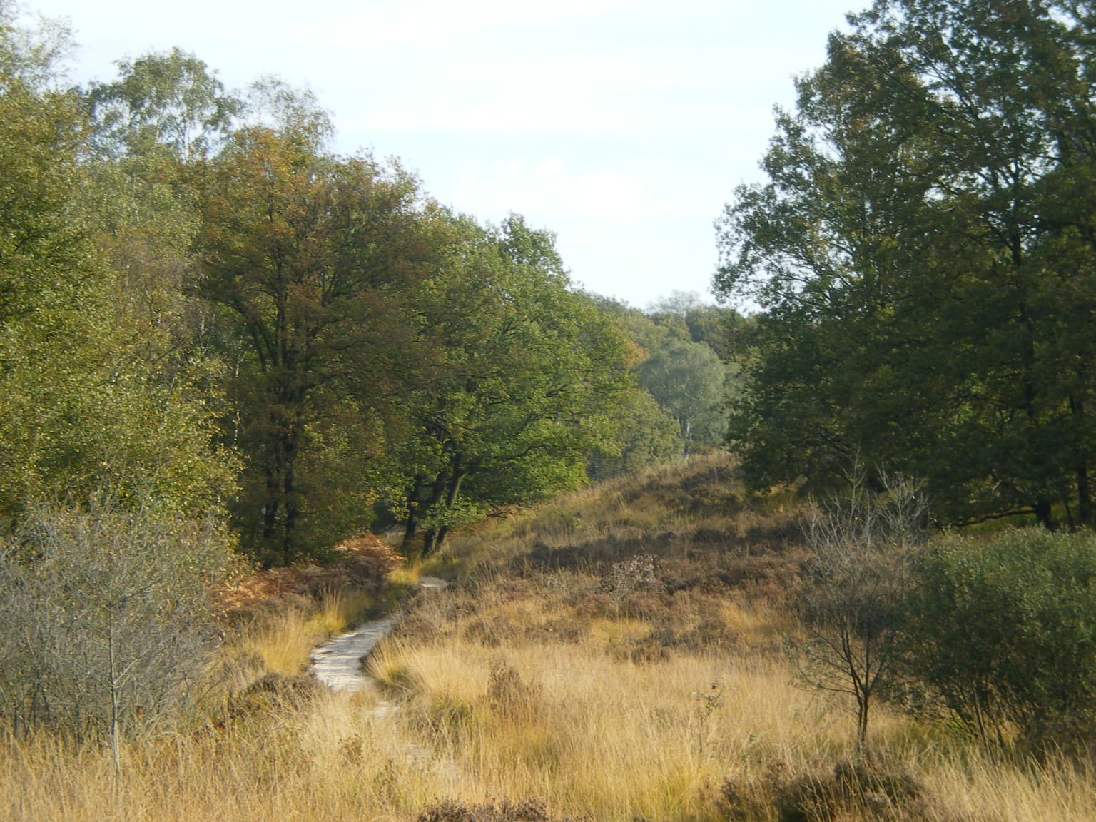
The landscape of De Meinweg is defined by its exceptional terraced topography, a rarity in the Netherlands. The park features a series of river terraces that step down from the higher ground near the German border toward the lower-lying areas in the east. Steep transitions between these terraces create a varied terrain quite unlike the typical flat Dutch countryside. The highest point, the Wolfsplateau, reaches approximately 80 meters above sea level and provides the park's most elevated terrain. Two streams, the Rode Beek and Boschbeek, originate in the higher areas and flow eastward, carving small valleys as they descend toward the Roer River. The park contains numerous vennen (pools and small lakes) scattered across the heathlands, many of which are now showing signs of ecological recovery as restoration projects bring back raised bog conditions. The combination of slopes, terraces, streams, and pools creates a mosaic of habitats that supports the park's remarkable biodiversity.

Natural landscape featuring a small pond surrounded by dry grass and scattered birch trees under a clear blue sky
Heathland landscape with pond and birch trees in De Meinweg National Park

De Meinweg National Park ecosystems, habitats, and plant life

The ecological character of De Meinweg encompasses a diverse range of habitats including oak-birch forests, pine woodlands, brook forests, dry and wet heathlands, pools, and stream valleys. This habitat diversity supports a remarkably rich flora and fauna for the Netherlands. The wet heath areas and pools contain especially notable plant species including round-leaved sundew, small sundew, bog asphodel, bog myrtle, and gentian—all species associated with nutrient-poor, acidic conditions that have become increasingly rare in the Dutch landscape. The pine and oak woodlands provide cover for numerous species, while the open heathlands support specialized insects and reptiles. The restoration of raised bogs in the vennen areas represents an ongoing ecological project, with non-native pine and tree species being progressively removed to restore native peat-forming vegetation. This work is creating new habitat for specialized bog species and improving the water retention capacity of the landscape.

Narrow path through grassy fields with trees showing autumn colors in De Meinweg National Park.
Autumn foliage along a trail in De Meinweg National Park, Netherlands.

De Meinweg National Park wildlife and species highlights

De Meinweg supports an exceptional diversity of wildlife, particularly notable for the Netherlands. The reptile community includes five species—adders, smooth snakes, sand lizards, viviparous lizards, and slow worms—making the park one of the most reptile-rich areas in the country. The amphibian population is equally impressive, with seven species recorded including pool frogs, moor frogs, garlic toads, natterjack toads, Alpine newts, great crested newts, and smooth newts. The garlic toad, the rarest of these species, has unfortunately declined significantly in recent years. Mammal species present include wild boars, foxes, polecats, stone martens, roe deer, and weasels. Birdlife is abundant with approximately 110 species observed and at least 60 confirmed as breeding within the park, including regular sightings of cranes. The invertebrate fauna is particularly noteworthy: 50 butterfly species, 340 moth species, and an impressive diversity of dragonflies have been recorded. In 2023, the park made a significant ecological observation when young European mantises and eggs were discovered—the first evidence of mantis reproduction in the Netherlands.

De Meinweg National Park conservation status and protection priorities

De Meinweg holds significant conservation status as a Natura 2000 site, designated in 2013 under both the EU Habitats Directive and Birds Directive. This designation reflects the presence of priority habitats and species protected under European environmental legislation. The park is actively managed by Staatsbosbeheer with a focus on restoring natural processes and improving habitat quality. A major conservation project has targeted the regeneration of raised bogs in the pool areas, where non-native pines and trees are being progressively removed to restore the peat-forming conditions that once characterized these wetlands. For more than a decade, conservation work has focused on creating connectivity between wet heath areas to benefit the adder population, including the construction of a wildlife passage under the Boslaan road in 2014. The park faces external conservation pressures, most notably from groundwater extraction associated with German brown coal mining operations, which could affect the delicate water balance that sustains the raised bogs and wet heathlands.

De Meinweg National Park cultural meaning and human context

The cultural history of De Meinweg reflects the long human presence in this border region. The area was historically held in common by fourteen surrounding villages, a system of communal land use that persisted for centuries and gave the area its name—"mein" being the local dialect word for shared or communal. This traditional use created the open heathland and grassland character that still defines much of the park today. The landscape also bears traces of more recent industrial history, including the remains of the Staatsmijn Beatrix coal mine from the 1950s and 1960s. The former Kolleg St. Ludwig monastery, located within the forest, includes a historic cemetery and the Sint-Ludwigkapel that remain preserved. From 1990 to 2015, the monastery housed Maharishi Mahesh Yogi, founder of Transcendental Meditation, and was subsequently replaced by the Maharishi European Research University settlement in an Indian architectural style.

Top sights and standout views in De Meinweg National Park

The terraced landscape of De Meinweg is its most distinctive physical feature, offering terrain variation rarely seen in the Netherlands. The park's reptile and amphibian communities are exceptional, with five reptile species and seven amphibian species making it one of the most species-rich areas in the country for these groups. The raised bog restoration in the vennen areas demonstrates active ecological management and creates unique wetland habitat. The park's position as part of a transboundary protected area with Germany emphasizes its international conservation importance. The presence of the European mantis reproduction, confirmed for the first time in the Netherlands in 2023, demonstrates the park's ongoing ecological significance. The visitor center De Boshut provides year-round access to educational resources and serves as a gateway to the extensive walking trail network.

Best time to visit De Meinweg National Park

De Meinweg can be enjoyed throughout the year, with each season offering a different character. Spring brings the emergence of amphibians and the first butterflies, while the heathlands bloom with purple heather in late summer. Autumn offers atmospheric landscapes as the heath turns gold and the forests display seasonal colors. Winter can be particularly evocative in the bare heathlands and provides opportunities to spot reptiles basking on warmer days. The visitor center De Boshut is open year-round and provides information about current conditions and wildlife viewing opportunities. The network of walking routes allows visitors to explore different habitats regardless of the season.

Park location guide

Geography guide, regional context, and park location map for De Meinweg National Park

De Meinweg National Park park geography, regions, and map view in Netherlands
Understand where De Meinweg National Park sits in Netherlands through a broader geographic reading of the surrounding landscape, nearby location context, and its mapped position within the national park landscape.

How De Meinweg National Park fits into Netherlands

The Netherlands is a low-lying coastal country in Northwestern Europe, famous for its extensive dike and canal systems that reclaim land from the sea. It consists of twelve provinces and is known for tulips, windmills, and cycling culture. The country is a founding member of the European Union with Amsterdam as its capital and The Hague as the seat of government.

Wider geography shaping De Meinweg National Park in Netherlands

The Netherlands is located in Northwestern Europe along the North Sea coastline to the north and west. It borders Germany to the east and Belgium to the south. The country is notably flat, with a significant portion of its territory lying below sea level, protected by dikes and dune systems. It consists of twelve provinces and also includes overseas municipalities in the Caribbean.

Map view of De Meinweg National Park

Use this park location map to pinpoint De Meinweg National Park in Netherlands, understand its exact geographic position, and read its mapped placement within the surrounding landscape more clearly.

Pigeon | © OpenStreetMap contributors

Location context for De Meinweg National Park

LimburgRoerdalen

Discover the Terraced Topography, Heathland Environments, and Diverse Habitats of this Dutch Protected Area

Visual Exploration: De Meinweg National Park Landscape and Scenery Photos
Visually explore the distinct landscapes of De Meinweg National Park through these images, revealing its rare terraced topography, expansive heathlands, and unique regenerating bog areas. This visual evidence offers critical insight into the park's geological formations, diverse reptile and amphibian habitats, and the overall environmental character of this vital protected area within the Dutch province of Limburg.

A calm pond reflecting trees and sky surrounded by green vegetation and trees in a national park setting

Modern visitor center building with sloped roof on grassy hill, people seated at outdoor tables, grassy landscape with trees in background

Natural landscape featuring a small pond surrounded by dry grass and scattered birch trees under a clear blue sky

Narrow path through grassy fields with trees showing autumn colors in De Meinweg National Park.

Park atlas

Browse adjacent national parks and protected areas in Limburg, extending your geographic exploration beyond De Meinweg's unique terraced landscape.

Continue Park Discovery: Explore National Parks and Protected Areas Near De Meinweg National Park
After exploring De Meinweg National Park, you can discover other national parks and diverse protected areas that share the unique regional geography of Limburg. Compare their distinctive terraced landscapes, heathlands, and transboundary conservation efforts to gain a deeper understanding of the Low Countries' natural heritage.
Watercolor painting of a peat bog ecosystem featuring green trees, pink and yellow vegetation, a body of water, and distant mountains
National park

De Groote Peel National Park: Mapped Boundaries of a Unique Raised Bog & Wetland

Protected area with exceptional birdlife and peat landscape.

De Groote Peel National Park represents a crucial protected landscape in the Netherlands, renowned as one of the last substantial raised bogs in Western Europe. Its terrain is characterized by a distinct blend of open lakes formed by historical peat extraction, heathland expanses, and sensitive peat swamps. This Ramsar-designated wetland is a vital habitat for numerous bird species, offering unique opportunities for landscape context and atlas exploration of its ecological significance and mapped geographic features.

Area
13.4 km²
Established
1993
IUCN
II
Relief
Lowland
National parkLimburg

Hoge Kempen National Park: National Park Protected Landscape and Limburg Geographic Context

Explore mapped boundaries within the Limburg region.

Gain a comprehensive understanding of Hoge Kempen National Park as a distinct protected national park. This resource provides critical insights into its geographic setting within the Limburg region, detailing its mapped boundaries and overall landscape context. It serves as an essential point for atlas exploration, allowing users to appreciate the park's role as a protected natural area and its place within the regional geography of Belgium.

Area
67 km²
Established
2006
IUCN
II
National parkLimburg

De Maasduinen National Park: Mapping the Longest River Dune System in the Netherlands

Protected Landscape and Dune Terrain in Limburg

Delve into the geographic identity of De Maasduinen National Park, a vital protected area in Limburg. This page offers detailed insights into its remarkable dune landscape, heathlands, and forests, emphasizing its role within the Dutch natural atlas and its connections to surrounding conservation areas.

Area
45 km²
Established
1996
IUCN
II
Watercolor illustration of rolling green hills and meadows with patches of pink and yellow flowers
National parkNorth Rhine-Westphalia

Eifel National Park: North Rhine-Westphalia Protected Area Atlas

Explore mapped boundaries and regional geography.

Gain a structured understanding of Eifel National Park, a key protected area within Germany's North Rhine-Westphalia region. This page focuses on its geographic identity, detailing mapped boundaries and offering context within the state's broader natural landscapes. MoriAtlas enhances your exploration by presenting Eifel National Park as a distinct entity within a larger geographic framework, ideal for atlas-based research and understanding protected land distribution.

Area
107 km²
Established
2004
IUCN
II
Relief
Upland
Watercolor illustration of rolling hills, a winding river, and fields with distant mountains
National parkNorth Brabant

Van Gogh National Park: National Park in North Brabant with Dune Landscapes

Explore mapped protected areas and regional geography.

Van Gogh National Park is a significant protected landscape in North Brabant, Netherlands, covering approximately 1,200 square kilometers. This national park is distinguished by its extensive drift sand dune systems, notable heathlands, and wooded valleys, offering a diverse terrain within the Dutch context. Named in tribute to Vincent van Gogh, it merges rich natural landscapes with cultural heritage, serving as a model for collaborative conservation and regional development, all mapped for detailed atlas exploration.

Area
1,200 km²
Established
2024
IUCN
II
Relief
Lowland
Watercolor artwork showing sand dunes, scattered trees, distant mountains, and soft sky
National park

De Loonse en Drunense Duinen National Park: Explore Dutch Protected Sand Drift Landscapes and Heathlands

National Park with unique living sand drift and dune terrain.

Navigate the geographic contours and protected land boundaries of De Loonse en Drunense Duinen National Park, a premier Dutch natural area. This national park is celebrated for its extensive living sand drift, one of the largest in Northern Europe, alongside significant heathlands and coniferous forests. Gain a structured understanding of its landscape character and its role within regional geography through detailed map context and atlas exploration tools.

Area
35 km²
Established
2002
IUCN
II
Relief
Lowland
Protected areaBelgium

Burdinale Protected Area: Explore its Mapped Landscape and Geographic Context in Belgium

Mapped protected area discovery within Belgium's geography.

Burdinale Protected Area serves as a key point for understanding Belgium's protected lands from an atlas perspective. This page details the park's specific geographic setting and mapped natural landscape, providing essential context for regional geography exploration. Discover the protected boundaries and terrain features that define Burdinale, contributing to a structured overview of conservation areas.

Scope
Mixed
Water
Major water bodies
Watercolor illustration of a park landscape with a winding stream, grassy fields, and distant hills
National parkGelderland

Veluwezoom National Park: Protected Landscape Atlas and Gelderland Geography

Explore oldest Dutch national park, heathlands, and glacial terrain.

Veluwezoom National Park is the Netherlands' inaugural national park, located in Gelderland. This page provides an atlas-driven exploration of its protected landscape, characterized by rolling heathlands, ancient forests, and dramatic glacial push moraines. Users can discover the park's geographical features, mapped boundaries, and its significance as a conserved natural area within the Veluwe region.

Area
50 km²
Established
1930
IUCN
II

Common questions about visiting, size, designation, and location context for De Meinweg National Park

De Meinweg National Park FAQs for park facts, access, geography, and protected area context
Find quick answers about De Meinweg National Park, including protected-area facts, park geography, trail and visitor context, and how the park fits into its surrounding country and regional landscape.
MoriAtlas Explorer

Continue Your Protected Areas Search Across the Global Atlas

Deepen your exploration by continuing the structured search for national parks and protected areas worldwide. Utilize the comprehensive filtering capabilities to compare different conservation landscapes and refine your understanding of global park geography. Discover more about the distribution and characteristics of protected natural areas.

Global natural geography