Mori Atlas logo
Nature reserveRéserve naturelle régionale des coteaux du Chemin des Dames

Examining the fragmented mosaic of limestone hillslopes and calcareous grassland ecosystems

Réserve naturelle régionale des coteaux du Chemin des Dames: A Protected Landscape Map

(Réserve naturelle régionale des coteaux du Chemin des Dames (RNR305))

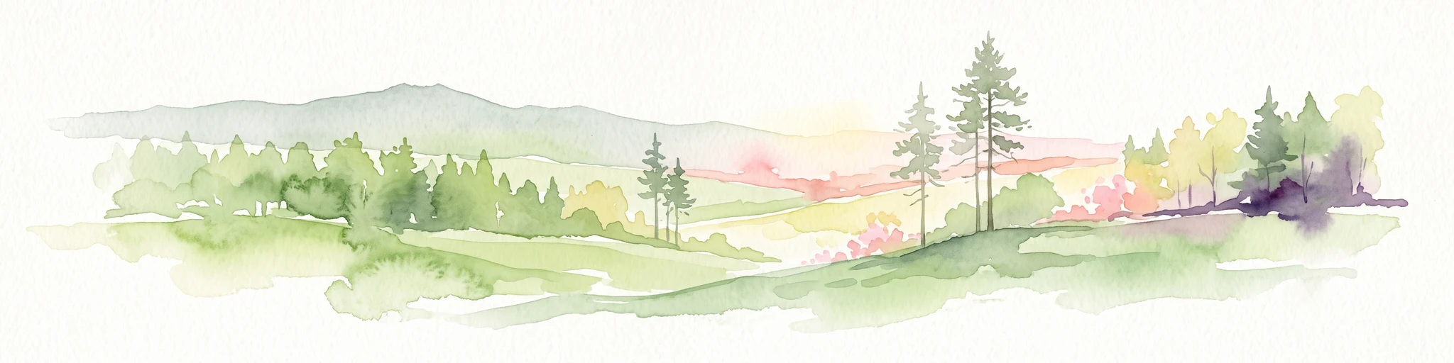
The Réserve naturelle régionale des coteaux du Chemin des Dames consists of a distinctive network of calcareous hillslopes spanning the Aisne department of Hauts-de-France. This protected area safeguards a fragmented mosaic of dry grasslands, scrubland, and woodland patches that mirror the historic terrain of the region. Through this geographic lens, observe how natural conservation overlays the topography of these limestone coteaux to preserve rare ecological habitats.

calcareous grasslandcoteauxlimestone hillslopesdry grasslandscrublandfragmented habitat mosaic

Réserve naturelle régionale des coteaux du Chemin des Dames

Nature reserve

Park overview

Structured park overview, official facts, and landscape profile for Réserve naturelle régionale des coteaux du Chemin des Dames

Réserve naturelle régionale des coteaux du Chemin des Dames park facts, protected area profile, and essential visitor context

Review the core facts for Réserve naturelle régionale des coteaux du Chemin des Dames, including designation, size, terrain, visitor scale, habitats, and operating context in one park-focused overview.

About Réserve naturelle régionale des coteaux du Chemin des Dames

The Réserve naturelle régionale des coteaux du Chemin des Dames occupies a distinctive position within the regional nature reserve network of Hauts-de-France. Rather than a single continuous territory, it assembles a network of hillside parcels along the Chemin des Dames ridge in the Aisne department, creating a composite reserve that reflects the patchy nature of remaining semi-natural habitat in this part of northern France.

The coteaux of the Chemin des Dames have long been recognised for their ecological interest. Limestone and chalk substrates support a characteristic suite of dry calcareous grasslands, scrub transitions and woodland patches that are unusual in an otherwise heavily farmed region. By grouping multiple sites under one classification, the reserve seeks to anchor the long-term protection of these habitats in a landscape that is otherwise under pressure from agricultural intensification, woodland closure and past wartime disturbance.

Administratively, the reserve is managed by the Conservatoire d'espaces naturels de Picardie, an experienced regional body that oversees habitat management across the historic Picardy region. Its IUCN Category IV designation underlines the reserve's role as a habitat and species management area, which is consistent with active management of open coteaux habitat, grazing patterns and scrub control.

Although modest in size and relatively recent in legal terms, the reserve reflects a broader French strategy of building fine-grained protected area networks in working agricultural landscapes. It complements other regional nature reserves in the former Picardy region and contributes to maintaining the ecological coherence of the Coteaux calcaires du Nord-Pas-de-Calais-Picardie system at a much larger scale.

Quick facts and research context for Réserve naturelle régionale des coteaux du Chemin des Dames

The reserve is situated in the Aisne department of the Hauts-de-France region in northern France. It was classified as a régionale naturelle on 13 November 2015 and covers approximately 47.59 hectares across several separate sites.

The territory spans nine communes: Aizelles, Chermizy-Ailles, Chevregny, Montchâlons, Moulins, Neuville-sur-Ailette, Œuilly, Paissy and Sainte-Croix. It is administered by the Conservatoire d'espaces naturels de Picardie and is classified as IUCN Category IV, recognising it as a habitat and species management area.

Protection and recognition

Documented terrestrial protection scope and administrative recognition records

Réserve naturelle régionale des coteaux du Chemin des Dames Protection Status and Recognition

Terrestrial protection status records outline the administrative boundaries and official conservation framework governing Réserve naturelle régionale des coteaux du Chemin des Dames. Structured data entries compile available designation details and regulatory identifiers to support accurate geographic analysis.

Protection details

Protection scope
Terrestrial
WDPA ID
555597291
Park context

Deeper park guide and search-rich context for Réserve naturelle régionale des coteaux du Chemin des Dames

Réserve naturelle régionale des coteaux du Chemin des Dames history, landscape, wildlife, and travel context

Explore Réserve naturelle régionale des coteaux du Chemin des Dames through its history, landscape character, ecosystems, wildlife, conservation priorities, cultural context, and seasonal travel timing in a structured park guide built for atlas discovery and search intent.

Why Réserve naturelle régionale des coteaux du Chemin des Dames stands out

The reserve is known for protecting a fragmented mosaic of coteaux habitats along the Chemin des Dames ridge, including dry calcareous grasslands, scrubland and associated woodland mosaics that are characteristic of the Picardy hillslopes. It also stands out for layering ecological conservation onto one of the most historically charged landscapes in France, where the natural heritage of the limestone coteaux coexists with the cultural memory of the area's wartime history.

Réserve naturelle régionale des coteaux du Chemin des Dames history and protected-area timeline

The reserve is a relatively new addition to France's network of regional nature reserves. Its classification was formalised by a délibération, or formal decision, of the Conseil régional on 13 November 2015, establishing the protected area under the regional nature reserve regime.

Its creation built on prior recognition of the ecological value of the coteaux du Chemin des Dames by conservationists, particularly the Conservatoire d'espaces naturels de Picardie, which subsequently became the managing authority. The reserve emerged from ongoing efforts across the former Picardy region to preserve remnant calcareous grassland habitat in a landscape where centuries of cultivation had reduced such habitat to small, scattered fragments.

Although the natural history of the coteaux deepens much further back into the agricultural and pastoral history of the region, the reserve itself represents a contemporary moment in that longer story: an attempt to consolidate the protection of these hillslope habitats in legal form during the 2010s.

Réserve naturelle régionale des coteaux du Chemin des Dames landscape and geographic character

The landscape of the reserve is defined by the coteaux, or hillslopes, that flank the Chemin des Dames ridge in the Aisne department. These slopes rise above the surrounding plateau and valleys, with exposed limestone and chalk substrates that shape both the topography and the vegetation cover.

The reserve's territory is deliberately patchy, comprising multiple parcels scattered across several communes rather than a single contiguous block. This fragmented pattern mirrors the way in which remnant semi-natural habitat survives in the region: as islands of hillside pasture, scrub and woodland embedded within a wider agricultural matrix.

Characteristic landforms include the steep midslope sections where thin, stony soils limit cultivation and allow open grassland communities to persist. The mosaic of dry slopes, field margins, scrubby corners and small woodland patches gives the area a varied microtopography, despite the reserve's modest overall size.

Réserve naturelle régionale des coteaux du Chemin des Dames ecosystems, habitats, and plant life

The reserve's ecological value centres on the calcareous hillside habitats that are typical of the Picardy coteaux. Thin chalky and limestone-derived soils on south- and west-facing slopes support open dry calcareous grassland communities, a habitat type that has become scarce across much of northern France due to conversion to arable land, abandonment or woodland encroachment.

These open grasslands are typically bordered by scrub transitions, where hawthorn, blackthorn, dogwood and similar shrubs colonise abandoned sections, and by small patches of broadleaf woodland occupying slightly deeper soils on parts of the slope. The intricate mixture of open, edge and shaded habitats creates the structural diversity that allows a wide range of plants and invertebrates associated with calcareous grassland systems to persist.

Because the reserve is composed of several separate sites distributed along the ridge, it partly functions as a stepping-stone network for species that rely on these habitat mosaics, helping to maintain connectivity between populations across the broader coteaux landscape of the Aisne.

Réserve naturelle régionale des coteaux du Chemin des Dames wildlife and species highlights

The coteaux habitats assembled in the reserve support a characteristic fauna of French calcareous hillside systems. Open dry grasslands are typically inhabited by grasshoppers, butterflies and other invertebrates that depend on warm, floristically rich swards, while scrub edges provide nesting sites and cover for small passerines, common reptiles of dry slopes and a variety of pollinators.

Small mammals, bats and a range of breeding birds are expected to use the woodland patches and hedgerow elements scattered across the reserve's different sites. Although the compact size of individual parcels limits very large or wide-ranging species, the network of sites increases the overall functional habitat available within a managed agricultural landscape.

The mosaic of open and shaded microhabitats is also important for invertebrates, which in turn support insectivorous birds and contribute to the broader food web of the coteaux.

Réserve naturelle régionale des coteaux du Chemin des Dames conservation status and protection priorities

The reserve was created to consolidate the long-term protection of calcareous hillside habitats in a part of northern France where such habitat is highly vulnerable to loss or degradation. Its IUCN Category IV status reflects an active conservation approach aimed at maintaining the open character of the grasslands and preventing scrub encroachment that would otherwise reduce botanical diversity over time.

By bringing together fragmented coteaux sites into a single classified reserve, the protection also strengthens the broader conservation network across the historic Picardy region. The reserve contributes at a sub-regional scale to the conservation of calcareous grassland complexes that have been highlighted in European ecological assessments as priority habitats.

Management by the Conservatoire d'espaces naturels de Picardie brings experienced stewardship in habitat restoration, grazing management and ecological monitoring, all of which are central to maintaining the conservation value of these hillside ecosystems over the long term.

Réserve naturelle régionale des coteaux du Chemin des Dames cultural meaning and human context

The Coteaux du Chemin des Dames carry an exceptionally strong cultural and historical resonance in France. The Chemin des Dames ridge is closely associated with major battles of the First World War, including offensives that profoundly shaped the collective memory of the Aisne department and the Picardy region more broadly.

In addition to this wartime heritage, the coteaux have a long agricultural and pastoral history, with traditional grazing and hay-cutting shaping the open grassland character that today supports the area's biodiversity. The reserve therefore sits at the intersection of natural heritage and a layered cultural landscape where ecological and historical values are tightly interwoven.

This dual significance, natural and historical, adds a particular dimension to conservation work in the reserve, where protecting habitat also means working within a landscape that is read by many visitors primarily through the lens of its wartime past.

Top sights and standout views in Réserve naturelle régionale des coteaux du Chemin des Dames

AClassified IUCN Category IV regional nature reserve covering about 47.59 hectares of calcareous coteaux along the Chemin des Dames ridge.

AFederated mosaic of habitat sites spanning nine communes in the Aisne department of Hauts-de-France.

AHabitat focus on dry calcareous grasslands, scrub transitions and small woodland patches typical of historic Picardy coteaux.

AManaged by the Conservatoire d'espaces naturels de Picardie, an experienced regional conservation body.

AOverlay of contemporary biodiversity conservation onto one of the most historically significant landscapes in northern France.

Best time to visit Réserve naturelle régionale des coteaux du Chemin des Dames

Late spring and early summer tend to be the most rewarding periods for visiting dry calcareous coteaux habitats in northern France, when the wildflower-rich swards of the open grasslands are at their peak and invertebrates, including butterflies and bees, are most active.

Late summer and early autumn can also offer pleasant conditions, with warmer weather still allowing good insect and bird activity, though some grassland species may be past their floral peak by this point. Winter visits are generally quieter, with reduced wildlife activity but clearer views of the underlying hillside topography and scrub structure once deciduous leaves have fallen.

As the reserve is fragmented across multiple sites, season matters more for what visitors may see in terms of flowers, insects and birds than for accessibility, which is generally governed by the small paths and field margins that link the various parcels.


Monthly climate preview

Long-term climate data and monthly temperature ranges for protected Hauts-de-France terrain

Annual Temperature and Precipitation Normals for Réserve naturelle régionale des coteaux du Chemin des Dames

Representative coordinates record measured monthly temperature swings from winter lows to summer highs alongside steady precipitation rates across the year. Reviewing twelve-month climate normals provides exact statistical context for regional conservation analysis and ecological studies.
Annual mean10 °C
2 °C19 °C
Jan
Feb
Mar
Apr10°
May13°
Jun17°
Jul19°
Aug19°
Sep15°
Oct11°
Nov
Dec
Warmest month
July

18.9 °C

Coolest month
January

2.2 °C

Wettest month
December

2.7 mm/day

Driest month
April

1.6 mm/day

Park location guide

Geography guide, regional context, and park location map for Réserve naturelle régionale des coteaux du Chemin des Dames

Réserve naturelle régionale des coteaux du Chemin des Dames park geography, regions, and map view in France

Understand where Réserve naturelle régionale des coteaux du Chemin des Dames sits in France through a broader geographic reading of the surrounding landscape, nearby location context, and its mapped position within the national park landscape.

How Réserve naturelle régionale des coteaux du Chemin des Dames fits into France

France is a unitary semi-presidential republic and one of the world's largest economies. It borders Belgium, Luxembourg, Germany, Switzerland, Italy, Monaco, Andorra, and Spain, with a maritime border to the United Kingdom. The country is known for its cultural influence, art, cuisine, and political history spanning centuries.

Wider geography shaping Réserve naturelle régionale des coteaux du Chemin des Dames in France

France is located in Western Europe. Metropolitan France extends from the Rhine to the Atlantic Ocean and from the Mediterranean Sea to the English Channel and North Sea. The country borders Belgium, Luxembourg, Germany, Switzerland, Italy, Monaco, Andorra, Spain, and has a maritime border with the United Kingdom.

Map view of Réserve naturelle régionale des coteaux du Chemin des Dames

Use this park location map to pinpoint Réserve naturelle régionale des coteaux du Chemin des Dames in France, understand its exact geographic position, and read its mapped placement within the surrounding landscape more clearly.

Pigeon | © OpenStreetMap contributors

Location context for Réserve naturelle régionale des coteaux du Chemin des Dames

Hauts-de-France
Park atlas

Compare surrounding regional protected areas and limestone hillside habitats.

Parks Near Réserve Naturelle Régionale des Coteaux du Chemin des Dames

Browse protected areas and natural reserves located near Réserve naturelle régionale des coteaux du Chemin des Dames. Expanding the regional comparison reveals connected limestone landscapes and protected habitats across northern France.
A horizontal watercolor illustration showing a serene wetland landscape with a winding stream, soft green grassy banks, and distant tree lines in light pastels.
Nature reserveGrand Est
About 31 km away#1 closest

Southeast

Réserve naturelle régionale du marais « Les trous de Leu » Protected Area Map

Wetland geography and alluvial habitats in Grand Est, France

Investigate the layered terrain and diverse marshland habitats of Réserve naturelle régionale du marais « Les trous de Leu ». This regional reserve showcases the importance of base-rich alkaline peatlands and alluvial woodlands situated between the Vesle river and the historic Aisne-à-la-Marne canal.

Area
0.33 km²
Established
2014
IUCN
IV
Nature reserveHauts-de-France
53 km away#2 closest

Northeast

Réserve naturelle régionale des prairies humides de la ferme du Moulin Fontaine Protected Area

Wet meadow conservation in the Hauts-de-France region

Spanning 38 hectares in the Aisne department, this nature reserve focuses on the protection of humid grasslands. The site exemplifies regional efforts to maintain semi-natural habitats through a mosaic of hedgerows, moist meadows, and historic farm architecture in the Thiérache landscape.

Area
0.381 km²
Established
2014
IUCN
IV
A soft watercolor illustration of a wetland scene with a small pool of water in the foreground, grassy meadows, and distant hills and trees in the background.
Nature reserveGrand Est
About 66 km away#3 closest

South

Réserve naturelle régionale du marais de Reuves: Protected Wetland and Geography

A vital ecological enclave within the Grand Est region of France.

The Réserve naturelle régionale du marais de Reuves provides a detailed look at the hydrology and terrain of the Marais de Saint-Gond. This nature reserve protects varied habitats including open ponds, peatlands, and alluvial forests. Understanding its boundaries reveals how localized conservation efforts preserve essential wetland character against surrounding intensive agricultural development.

Area
0.64 km²
Established
2008
IUCN
IV
Relief
Lowland
A horizontal watercolor illustration depicting rolling green hills, scattered evergreen trees, and distant ridgelines in a soft, light-filled style.
Protected landscapeNamur
67 km away#4 closest

Northeast

Parc naturel Viroin-Hermeton: Protected Landscape and Geographic Atlas for Namur, Belgium

Karst geology, limestone tienne hills, and river valley terrain

Parc naturel Viroin-Hermeton covers a vast area in Namur province, defined by its geological contrast and biodiversity. The landscape features deep karst fissures known as fondrys, sunny limestone tienne hills, and dramatic river valleys where the Eau Noire and Eau Blanche meet. This atlas entry provides a structured look at the terrain, mapping the transition from agricultural plateau to forest ecosystems within this significant protected area.

Area
480 km²
Established
1998
IUCN
V
Relief
Mixed relief
Nature reserveGrand Est
About 68 km away#5 closest

Southeast

Réserve naturelle régionale du Savart de la Folie: Regional Protected Landscape Analysis

Tracing the dry grassland ecosystems of the Grand Est region

Deep dive into the geography of the Réserve naturelle régionale du Savart de la Folie in France. This site highlights the preservation of steppe-like savart habitats within the Champagne region, showcasing the importance of regional nature reserves in protecting specific dry, chalky grasslands.

Area
0.636 km²
Established
2026
IUCN
IV
Scope
Terrestrial
Nature reserveHauts-de-France
68 km away#6 closest

Northeast

Réserve naturelle régionale des monts de Baives: Protected Limestone and Calcareous Landscapes

Ecological geography and regional conservation map context

Encompassing roughly 19 hectares, the Réserve naturelle régionale des monts de Baives protects a specialized ecosystem at the edge of the Ardennes foothills. The site is recognized for its south-facing limestone slopes, orchid-rich grasslands, and historical quarry habitats that support regional bat colonies and unique botanical species.

Area
0.188 km²
Established
1996
IUCN
IV
Relief
Upland
A watercolor painting showing a soft, panoramic landscape with green hills in the distance, a meandering stream in the foreground, and grassy banks with subtle pink floral highlights.
Nature reserveHauts-de-France
69 km away#7 closest

North

Réserve naturelle régionale des Prairies du Val de Sambre: Regional Nature Reserve Atlas

Wetland floodplain meadows in the middle Sambre valley

The Réserve naturelle régionale des Prairies du Val de Sambre protects essential wet grassland habitats in northern France. Spanning approximately 49 hectares along the canalised Sambre, this protected area maintains traditional meadow systems that support wetland-dependent species; it represents a key junction in the regional landscape between the Mormal forest and Thiérache bocage.

Area
0.494 km²
Established
2012
IUCN
IV
Protected areaHauts-de-France
About 71 km away#8 closest

North

Neuvilly Protected Area: Geography, Mapped Boundaries, and Regional Landscape Context

A detailed geographic overview of protected lands in Hauts-de-France.

Gain insights into the Neuvilly protected area through detailed mapping and geographic analysis. This resource provides a clear breakdown of the site footprint and its place within the Hauts-de-France landscape, ensuring a structured understanding of its ecological boundaries and regional significance for mapping and environmental study.

Area
0.193 km²
Established
1990
Climate
Temperate
Scope
Terrestrial

Common questions about visiting, size, designation, and location context for Réserve naturelle régionale des coteaux du Chemin des Dames

Réserve naturelle régionale des coteaux du Chemin des Dames FAQs for park facts, access, geography, and protected area context

Find quick answers about Réserve naturelle régionale des coteaux du Chemin des Dames, including protected-area facts, park geography, trail and visitor context, and how the park fits into its surrounding country and regional landscape.
MoriAtlas Explorer

Continue Your Protected Areas Search Across the Global Atlas

Deepen your exploration by continuing the structured search for national parks and protected areas worldwide. Utilize the comprehensive filtering capabilities to compare different conservation landscapes and refine your understanding of global park geography. Discover more about the distribution and characteristics of protected natural areas.

Global natural geography