Mori Atlas logo
Wildlife reserveRock Creek Wilderness

Examining the rugged ridge topography, old growth forest corridors, and salmon bearing watersheds

Rock Creek Wilderness: A Protected Coastal Temperate Rainforest in Oregon

Rock Creek Wilderness encompasses 7,486 acres of protected land within the Siuslaw National Forest. This coastal terrain features a primitive, trail-free landscape of steep slopes and dense old growth Douglas-fir and Sitka Spruce. The area functions as a vital salmon-bearing watershed system, providing essential undisturbed habitat for diverse species, including the Oregon silverspot butterfly, between its deep forest stream corridors.

Oregon Coasttemperate rainforestold-growth forestcongressionally designated wildernesswilderness areacoastal forest

Rock Creek Wilderness

Wildlife reserve

Park overview

Structured park overview, official facts, and landscape profile for Rock Creek Wilderness

Rock Creek Wilderness park facts, protected area profile, and essential visitor context

Review the core facts for Rock Creek Wilderness, including designation, size, terrain, visitor scale, habitats, and operating context in one park-focused overview.

About Rock Creek Wilderness

Rock Creek Wilderness occupies a compact but ecologically important stretch of the central Oregon Coast within the Siuslaw National Forest. Although it covers only a few thousand acres, the wilderness represents a continuously forested landscape that extends uninterrupted from steep ridge tops down to Pacific-bound stream corridors. Its inland proximity to Yachats, its coastal orientation, and the absence of any developed trail infrastructure combine to give the area a strongly undisturbed character.

Designated as wilderness in 1984, Rock Creek is one of three coastal Oregon wildernesses created that year through federal legislation, alongside Drift Creek Wilderness and Cummins Creek Wilderness. Its establishment was a recognition that even small, trail-less coastal forest tracts play a meaningful role in maintaining regional ecological integrity. Because no roads, trailheads, or maintained trails lead into the interior of the wilderness, the area has remained relatively resistant to recreational fragmentation, leaving the forest cover, hydrology, and wildlife patterns substantially less altered than in adjacent managed forest land.

The wilderness is administered by the U.S. Forest Service and managed under the standards of a congressionally designated wilderness area as reflected in its IUCN Category Ib classification. The protected status of Rock Creek is central to its identity: the land is preserved not merely for scenery but for the ecological processes that depend on minimal human intervention, including undisturbed watershed function, unlogged old-growth forest stands, and habitat continuity for sensitive species. The result is a small but characteristic representation of the kind of rugged, mossy, rain-soaked coastal rainforest for which the Oregon Coast is widely known.

For visitors and researchers, Rock Creek Wilderness offers a quiet, demanding environment rather than a destination with amenities. Its value lies less in accessibility than in the intactness of its forests, the persistence of its salmon and trout streams, and the refuge it provides for one of the Pacific Northwest's most distinctive endangered species.

Quick facts and research context for Rock Creek Wilderness

Rock Creek Wilderness is a congressionally designated wilderness of approximately 7,486 acres located within the Siuslaw National Forest along the Oregon Coast in Lane County. It was established in 1984 and is administered by the United States Forest Service.

The area is classified as IUCN Category Ib (wilderness area) and contains no developed trails or trailheads. Its defining features are steep forested slopes, two westward-flowing creeks (Rock Creek and Big Creek), old-growth conifer stands, and habitat for anadromous fish and the endangered Oregon silverspot butterfly.

Protection and recognition

Examine terrestrial protection metrics and official designation records for Rock Creek Wilderness.

Rock Creek Wilderness Protection Status and Documented Conservation Scope

Terrestrial protection status and documented conservation boundaries outline the official management scope established for Rock Creek Wilderness. Verified records provide essential baseline data for analyzing protected area designation frameworks without external assumptions.

Protection details

Protection scope
Terrestrial
Transboundary protection
No
Park context

Deeper park guide and search-rich context for Rock Creek Wilderness

Rock Creek Wilderness history, landscape, wildlife, and travel context

Explore Rock Creek Wilderness through its history, landscape character, ecosystems, wildlife, conservation priorities, cultural context, and seasonal travel timing in a structured park guide built for atlas discovery and search intent.

Why Rock Creek Wilderness stands out

Rock Creek Wilderness is known for being one of Oregon's trail-free congressionally designated wildernesses, set aside to preserve an unbroken block of coastal temperate rainforest. Its defining features are old-growth Douglas-fir stands transitioning to old-growth Sitka Spruce near the ocean, dense understory thickets of salal, salmonberry, swordfern, and rhododendron, and the presence of the federally threatened Oregon silverspot butterfly in unlogged habitat on the ridge between its two main creeks. The wilderness is also recognized as an intact salmon-bearing watershed system. Both Rock Creek and Big Creek support runs of salmon, steelhead, and coastal cutthroat trout that migrate upstream annually from the Pacific Ocean to spawn.
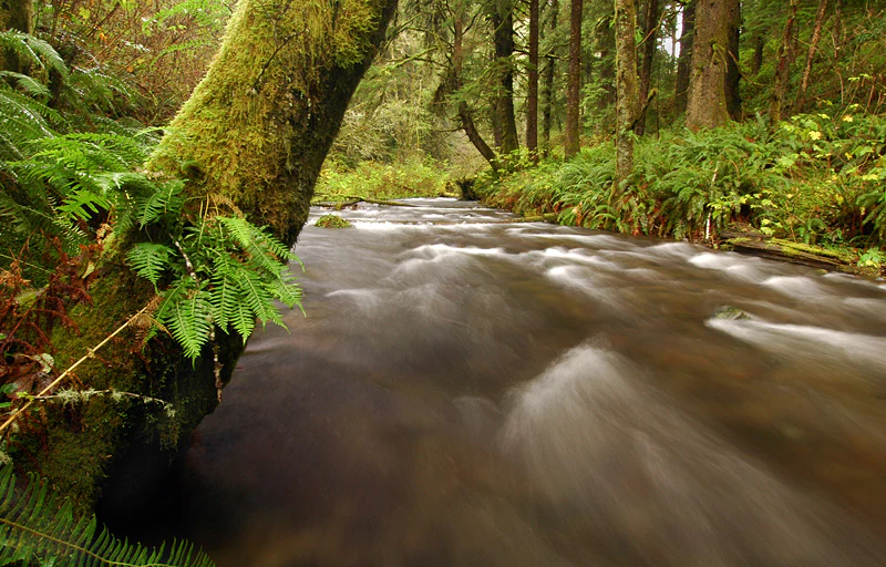
A long exposure photograph of a small stream flowing through a lush, mossy rainforest.
A forested stream flowing through Rock Creek Wilderness.

Rock Creek Wilderness landscape and geographic character

The physical landscape of Rock Creek Wilderness is shaped by the meeting of steep coastal terrain with the maritime climate of the Oregon Coast. The topography features rugged slopes, dense forest cover, and a heavily vegetated understory that gives the interior a sheltered, enclosed feel. The area's drainage is organized around two main streams: Rock Creek and Big Creek, which flow generally westward toward the Pacific Ocean and are separated by a broad forested ridge that runs through the center of the wilderness.

Because the wilderness lies along the coast, its terrain grades from inland ridges down toward ocean-influenced valleys. The streams have carved narrow corridors through the forests, producing a landscape pattern of alternating upland ridges and sheltered riparian bottomlands. The result is an environment with frequent elevation change, locally thick brush, and few natural travel routes, all of which contribute to the wilderness's character as a place that resists easy human passage.

The absence of developed trails, trailheads, or roads within the wilderness boundary reinforces the primitive, largely unaltered nature of the landscape. Rock Creek Wilderness functions visually and physically as a continuous block of coastal forest rather than as a landscape shaped by recreation infrastructure.
A small stream with motion-blurred water flows through a temperate rainforest, with moss-covered logs and lush ferns in the foreground.
A small, forested creek flows through the dense, mossy vegetation of the Rock Creek Wilderness.

Rock Creek Wilderness ecosystems, habitats, and plant life

Rock Creek Wilderness is an expression of the central Oregon Coast's temperate coniferous rainforest ecosystem. The forest is defined by a layered structure: a tall conifer canopy, a mid-canopy of hardwoods concentrated along the creeks, and an unusually dense ground cover of evergreen shrubs and ferns that thrives under the wet maritime climate of the coast.

The coniferous matrix is the most distinctive ecological feature of the wilderness. In its eastern portion, where conditions are slightly more inland, the canopy is dominated by old-growth Douglas-fir. As elevation decreases and conditions become more coastal toward the Pacific, this composition shifts toward old-growth Sitka Spruce, reflecting the natural transition between inland and coastal rainforest communities along the central Oregon Coast. Hardwood elements include Bigleaf Maple and Red Alder, which line both Rock Creek and Big Creek and give the riparian corridors a distinctive texture against the surrounding conifer stands.

The understory is thick and botanically diverse. Salal, salmonberry, Western Swordfern, and rhododendron form a continuous ground layer that contributes to the dense, almost impenetrable undergrowth that characterizes the wilderness interior. This dense ground cover is more than a visual feature: it is part of a coastal rainforest system that depends on persistent moisture, mild temperatures, and minimal disturbance. The combination of old-growth conifers, hardwood-lined creeks, and a lush evergreen understory places Rock Creek Wilderness firmly within the regional identity of Oregon's coastal temperate rainforest.
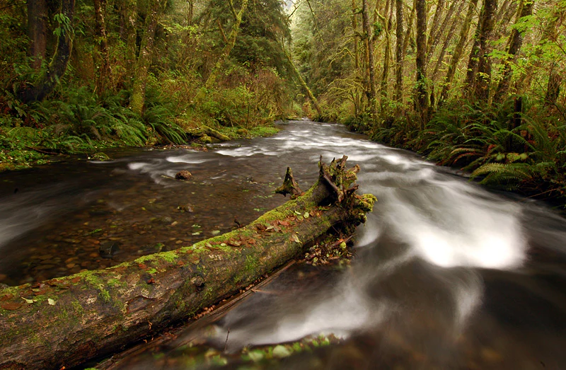
A long exposure photograph of a small forest stream flowing past a large mossy log, surrounded by dense green ferns and tall coniferous trees.
A moss-covered log rests in a rushing stream flowing through the temperate rainforest of Rock Creek Wilderness.

Rock Creek Wilderness wildlife and species highlights

Wildlife in Rock Creek Wilderness reflects both the intact condition of the forest and the connectivity of its creeks to the Pacific Ocean. The most distinctive single species is the Oregon silverspot butterfly, a federally threatened subspecies whose habitat requirements make undisturbed coastal meadows and ridge habitats especially important. Within the wilderness, the broad ridge separating Rock Creek and Big Creek provides the kind of open, sunny, brush-and-meadow mosaic this butterfly depends on, which is why Rock Creek is considered a meaningful refugium for the species despite its relatively small size.

The wilderness's two main creeks support anadromous fish life cycles that connect the Pacific Ocean to the forested interior. Salmon, steelhead, and coastal cutthroat trout migrate upstream along both Rock Creek and Big Creek each year, returning to spawn in the gravel beds of these small coastal streams. The persistence of these runs depends on cold, clean water, intact riparian forest cover, and minimal human disturbance along the creek corridors, all of which are protected by the wilderness designation.

In addition to these signature species, the broader forest habitat supports the diverse wildlife communities typical of mature coastal rainforest: songbirds, small mammals, amphibians adapted to wet conditions, and invertebrates that depend on undisturbed leaf litter and decaying wood. The combination of rare butterflies, migratory salmonids, and connected old-growth forest makes the wildlife profile of Rock Creek Wilderness much richer than its modest acreage would suggest.
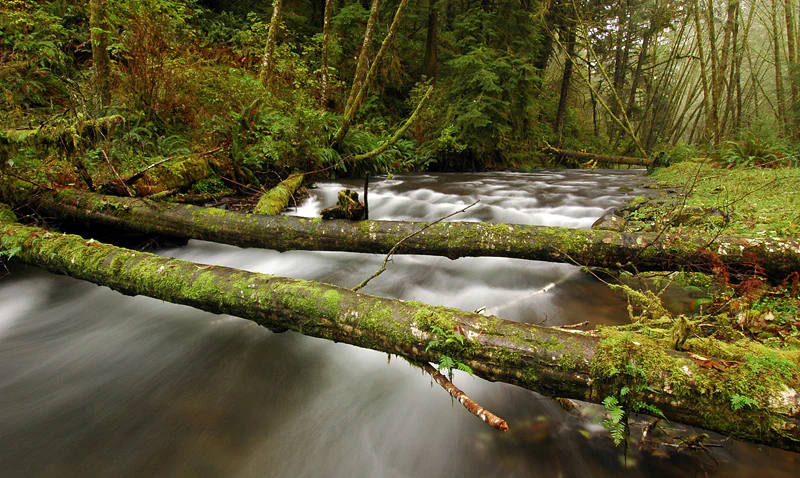
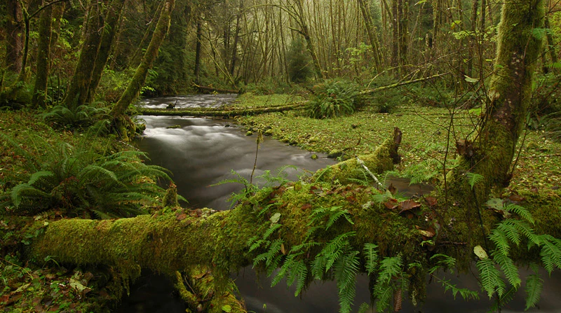
A long exposure photograph of a forest stream flowing past two fallen moss-covered logs.
A moss-covered log rests over a rushing stream in the Rock Creek Wilderness.

Rock Creek Wilderness conservation status and protection priorities

The conservation significance of Rock Creek Wilderness rests on three interconnected elements: the preservation of old-growth coastal forest, the protection of intact salmon-bearing watersheds, and the safeguarding of habitat for the threatened Oregon silverspot butterfly. Although the wilderness is small, its strict protection status, its trail-free condition, and its ecological character give it an outsized role in regional biodiversity conservation.

By limiting road-building, logging, and trail development, the wilderness designation maintains continuous forest cover across the ridges and the two creek corridors. This continuity is important not only for old-growth-dependent species but also for the hydrological processes that sustain salmonid spawning habitat. Protecting the water quality, sediment dynamics, and shade along Rock Creek and Big Creek directly supports the survival of the migratory salmon, steelhead, and coastal cutthroat trout that depend on these streams.

The presence of the Oregon silverspot butterfly adds an additional layer of conservation importance. Because the species is federally listed and because its habitat is restricted to specific coastal meadow and ridge environments, the undisturbed ridge between Rock Creek and Big Creek is ecologically valuable well beyond its physical size. The wilderness's management under the standards of a congressionally designated wilderness area ensures that these values are preserved with minimal active intervention, allowing ecological processes to function as naturally as possible.

Top sights and standout views in Rock Creek Wilderness

Rock Creek Wilderness stands out as a small but exceptionally intact piece of Oregon Coast temperate rainforest, protected since 1984 and managed with virtually no developed recreational infrastructure. Its 7,486 acres of steep, densely forested terrain hold a continuous ecological gradient, from inland old-growth Douglas-fir in the east to coastal old-growth Sitka Spruce near the Pacific.

Two defining qualities make the wilderness noteworthy: its trail-free, road-free character, which gives the interior a primitive and undisturbed feel, and the ecological richness packed into its small footprint, including salmon-bearing creeks, old-growth forests, and habitat for the endangered Oregon silverspot butterfly. Together these qualities make Rock Creek a quiet but meaningful component of the Siuslaw National Forest and of Oregon's broader system of coastal wilderness areas.
Monthly climate preview

Long term monthly averages for temperature and precipitation in Oregon

Rock Creek Wilderness Climate Normals and Annual Temperature Patterns

Historical data records monthly temperature and precipitation variations across representative coordinates in Rock Creek Wilderness. Examining the complete twelve month profile reveals detailed long term meteorological patterns for this Oregon protected area.
Annual mean11 °C
6 °C17 °C
Jan
Feb
Mar
Apr
May12°
Jun14°
Jul16°
Aug17°
Sep15°
Oct11°
Nov
Dec
Warmest month
August

16.6 °C

Coolest month
December

5.5 °C

Wettest month
December

8.7 mm/day

Driest month
July

0.4 mm/day

Park location guide

Geography guide, regional context, and park location map for Rock Creek Wilderness

Rock Creek Wilderness park geography, regions, and map view in United States of America

Understand where Rock Creek Wilderness sits in United States of America through a broader geographic reading of the surrounding landscape, nearby location context, and its mapped position within the national park landscape.

How Rock Creek Wilderness fits into United States of America

The United States of America is a federal presidential republic and one of the world's largest countries by area and population. It consists of 50 states across a vast territory spanning multiple time zones, with its capital in Washington, D.C. and largest city in New York City. The nation has a diverse economy, influential political system, and significant cultural and military presence globally.

Wider geography shaping Rock Creek Wilderness in United States of America

The United States occupies a vast territory in North America, bordered by Canada to the north and Mexico to the south. The 48 contiguous states stretch from the Atlantic to the Pacific Ocean, while Alaska occupies the northwestern region and Hawaii is an archipelago in the Pacific. The country encompasses diverse terrain including the Rocky Mountains, Appalachian Mountains, Great Plains, and extensive river systems.

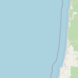
Map view of Rock Creek Wilderness

Use this park location map to pinpoint Rock Creek Wilderness in United States of America, understand its exact geographic position, and read its mapped placement within the surrounding landscape more clearly.

Pigeon | © OpenStreetMap contributors

Location context for Rock Creek Wilderness

Oregon

Explore protected area views, old growth canopy structure, and rugged wilderness terrain.

Rock Creek Wilderness Photos and Scenery: Visualizing Coastal Forest Landscapes

Visual documentation captures the dense temperate rainforest ecosystems and steep coastal topography defining Rock Creek Wilderness. Examining authentic park imagery reveals the undisturbed old growth tree stands, shaded creek corridors, and protected watershed environments that shape the region.

A long exposure photograph of a small stream flowing through a lush, mossy rainforest.

A small stream with motion-blurred water flows through a temperate rainforest, with moss-covered logs and lush ferns in the foreground.

A long exposure photograph of a small forest stream flowing past a large mossy log, surrounded by dense green ferns and tall coniferous trees.

A long exposure photograph of a forest stream flowing past two fallen moss-covered logs.

Park atlas

Compare adjacent temperate rainforests, coastal watersheds, and regional protected landscapes

Explore Other Parks Near Rock Creek Wilderness and Surrounding Coastal Protected Areas

Browse nearby national parks and protected areas sharing the rugged coastal terrain and temperate rainforest ecosystems of Rock Creek Wilderness. Comparing these adjacent regional landscapes reveals broader ecological patterns across the Pacific Northwest timberlands.
Watercolor painting of a coastal landscape with sandy dunes, beach grasses in the foreground, and a dense treeline in the background.
Protected landscapeOregon
Mapped location lies within the park boundary#1 closest

Northeast

Siuslaw National Forest: Oregon Coast Range and Protected Landscape Geography

Coastal dunes, temperate rainforests, and river networks

Explore the mapped boundaries and natural geography of Siuslaw National Forest. This protected landscape highlights the ecological transition from Pacific shorelines to the high-elevation forests of the Oregon Coast Range, encompassing sand dune systems, salmon-supporting streams, and significant wilderness refuges.

Area
2,566.54 km²
Established
1908
Visitors
1M annual
Climate
Temperate
A soft watercolor painting of a coastal landscape with pale sandy dunes, patches of green grasses, and distant hills under a white background.
Protected landscapeOregon
About 19 km away#2 closest

South

Oregon Dunes National Recreation Area: Mapped Geography and Coastal Landscape Atlas

Protected temperate sand dunes along the Pacific coast

Examine the expansive dune fields and aquatic habitats within the Oregon Dunes National Recreation Area. This atlas provides a detailed look at the geographic distribution of wetlands, coastal forests, and massive sand formations that shape this unique protected landscape in Oregon.

Area
127.74 km²
Established
1972
Visitors
1.5M annual
Relief
Lowland
Wildlife reserveOregon
About 33 km away#3 closest

North

Drift Creek Wilderness: Protected Wildlife Reserve and Old Growth Geography in Oregon

Mapping the old growth forests and stream corridors of the Coast Range.

Deep within Oregon's Coast Range, Drift Creek Wilderness stands as a significant protected landscape known for its intact old growth Sitka spruce and western hemlock stands. The terrain is characterized by steep, dissected slopes and narrow valleys that form a complex, moss-heavy temperate rainforest ecosystem. This area provides essential habitat for Roosevelt elk, northern spotted owls, and wild salmon populations, offering a compact yet dense look at the region's unique coastal wilderness geography.

Area
23.46 km²
Established
1984
IUCN
Ib
Relief
Upland
Protected landscapeOregon
About 111 km away#4 closest

East

Willamette National Forest: Geography and Protected Landscapes of the Central Oregon Cascades

Mapped terrain, old-growth forests, and protected wilderness boundaries.

Explore the expansive territory of Willamette National Forest, a primary protected area extending over 100 miles along Oregon's Cascade Range. This region features volcanic peaks exceeding 10,000 feet, extensive old-growth Douglas-fir stands, and a dense network of Wild and Scenic rivers, providing a detailed look at the geographic character and ecological heritage of the Pacific Northwest.

Area
6,790.75 km²
Established
1933
Visitors
1.7M annual
Relief
Mountain
Watercolor painting of a rolling mountain landscape with coniferous trees in the foreground and a hazy range of hills in the background.
Wildlife reserveOregon
About 142 km away#5 closest

East

Menagerie Wilderness Wildlife Reserve: Oregon Cascade Range Geography and Rock Pinnacles

Protected Cascade mountain terrain and unique crag clusters

Situated in the central Cascade Range of Oregon, Menagerie Wilderness provides a compact, highly defined landscape of rising rock pinnacles and lush coniferous forest. This resource traces the unique topography and protected boundaries of this specialized wilderness area, offering insight into the geological features and forest ecosystems that distinguish it from surrounding mountainous terrain.

Area
20.37 km²
Established
1984
IUCN
Ib
Relief
Mountain
An artistic watercolor illustration showing a line of green evergreen trees in the foreground with hazy, distant mountains in the background against a light, neutral sky.
Protected landscapeOregon
About 144 km away#6 closest

South

Rogue River, Siskiyou National Forest: Mapped Geography and Protected Area Overview

Tracing volcanic peaks and river-carved mountain terrain in Oregon

Spanning nearly 7,300 square kilometers, the Rogue River, Siskiyou National Forest acts as a crucial ecological anchor in the Pacific Northwest. This overview details its unique mountain geography, the extensive wilderness tracts within its boundaries, and the river systems that define its mountainous character.

Area
6,973.46 km²
Established
2004
Visitors
915K annual
Relief
Mountain
Wildlife reserveOregon
About 147 km away#7 closest

East

Middle Santiam Wilderness: Geographic Atlas and Protected Landscape Overview of the Oregon Cascades

Old-growth forest basins and volcanic landmarks in the Willamette National Forest.

Middle Santiam Wilderness represents a distinct segment of the central Oregon Cascades. The area is defined by its substantial old-growth coniferous forests, including 450-year-old Douglas-fir and western hemlock stands, alongside the striking 4,965-foot volcanic plug known as Chimney Peak. This map-focused record traces the river-cut valleys and high-ridge topography that shape this protected habitat.

Area
34.57 km²
Established
1984
IUCN
Ib
Relief
Mountain
A watercolor painting showing a snowy mountain peak in the background rising above rolling green hills and pine forests in the foreground.
Protected landscapeOregon
About 164 km away#8 closest

Northeast

Mount Hood National Forest: Atlas of Protected Landscapes and Volcanic Geography

Exploring the Cascade Range terrain and wilderness boundaries in Oregon.

Mount Hood National Forest encompasses a vast, rugged expanse of the Oregon Cascades, anchored by the iconic, glacier-clad Mount Hood. This protected landscape contains extensive old-growth forests, high-alpine lakes, and deep river canyons. Discover the geographic extent of these wilderness areas and mountain terrain within the MoriAtlas database of protected lands.

Area
4,318.17 km²
Established
1908
Visitors
4.4M annual
Relief
Mountain

Common questions about visiting, size, designation, and location context for Rock Creek Wilderness

Rock Creek Wilderness FAQs for park facts, access, geography, and protected area context

Find quick answers about Rock Creek Wilderness, including protected-area facts, park geography, trail and visitor context, and how the park fits into its surrounding country and regional landscape.
MoriAtlas Explorer

Continue Your Protected Areas Search Across the Global Atlas

Deepen your exploration by continuing the structured search for national parks and protected areas worldwide. Utilize the comprehensive filtering capabilities to compare different conservation landscapes and refine your understanding of global park geography. Discover more about the distribution and characteristics of protected natural areas.

Global natural geography