Mori Atlas logo
Nature reserveS.A. Lombard Nature Reserve

Geographic boundaries and ecological characteristics of a key South African nature reserve

S.A. Lombard Nature Reserve: Analyzing Protected Grassland Landscapes in North West

S.A. Lombard Nature Reserve represents a critical protected area within the North West province of South Africa. Spanning 46 square kilometers on the flat interior plateau at 1,200 meters, this landscape is defined by its distinct Cymbopogon-Themeda grassland terrain and varied soil profiles ranging from brackish eastern floodplains to western sandy loam.

grasslanddry veldCymbopogon-Themeda veldblack wildebeestantelope conservationinterior plateau

S.A. Lombard Nature Reserve

Nature reserve

Park overview

Structured park overview, official facts, and landscape profile for S.A. Lombard Nature Reserve

S.A. Lombard Nature Reserve park facts, protected area profile, and essential visitor context

Review the core facts for S.A. Lombard Nature Reserve, including designation, size, terrain, visitor scale, habitats, and operating context in one park-focused overview.

About S.A. Lombard Nature Reserve

S.A. Lombard Nature Reserve is a compact protected grassland in the North West province of South Africa, situated about twenty kilometers west of Bloemhof and named in honor of the conservation figure after whom it is titled. It sits on the relatively flat interior plateau at around 1,200 meters in elevation, and its geography mirrors the wider semi-arid Highveld margin where grassland gradually gives way to drier shrub-influenced vegetation.

At roughly 46 square kilometers, the reserve is modest in size, yet it carries meaningful conservation weight. The land was once worked by mules as a farm during the Second World War and then absorbed under the management of the Nature Conservation Branch. In 1954 it was officially declared a reserve, formalizing its shift from working farmland to protected habitat. A historical element remains visible in the landscape: an older diamond-mining zone from the 1920s sits along the boundary between the reserve's western and eastern halves, a reminder that even this quiet corner of the North West has a layered human past.

Ecologically, the reserve is characterized by open, almost treeless terrain covered primarily in Cymbopogon-Themeda veld. Differences in soils across the property create subtle but distinct habitat zones, with the eastern half rooted in brackish soil prone to seasonal flooding and the western half dominated by sandy loam. These conditions support a mosaic of grass species and small shrubs that together form a representative sample of the region's dry grassland character.

Quick facts and research context for S.A. Lombard Nature Reserve

S.A. Lombard Nature Reserve lies in the North West province of South Africa, near the town of Bloemhof, at roughly 1,200 meters above sea level on the flat interior plateau. The reserve covers about 46 square kilometers of dry grassland and is managed by the Nature Conservation Branch.

Annual rainfall in the area is relatively low, generally between 380 and 500 millimeters and concentrated between November and April, with summer highs near 27°C and winter lows around 10°C. Occasional winter frosts occur in June and July. The reserve was established in 1954 on land that had previously been used for mule farming during the Second World War and earlier for small-scale diamond mining.

Protection and recognition

Examine terrestrial protection scope and documented conservation status details.

S.A. Lombard Nature Reserve Protection Status and Recognized Protected Area Data

Terrestrial protection status for S.A. Lombard Nature Reserve outlines the documented framework governing this protected area. Official designation records provide a factual foundation for examining management scope and recognized conservation boundaries.

Protection details

Protection scope
Terrestrial
Park context

Deeper park guide and search-rich context for S.A. Lombard Nature Reserve

S.A. Lombard Nature Reserve history, landscape, wildlife, and travel context

Explore S.A. Lombard Nature Reserve through its history, landscape character, ecosystems, wildlife, conservation priorities, cultural context, and seasonal travel timing in a structured park guide built for atlas discovery and search intent.

Why S.A. Lombard Nature Reserve stands out

The reserve is best known for its role in saving the black wildebeest, a once-endangered antelope that recovered thanks in part to populations maintained at S.A. Lombard. It is also recognized as a representative example of the dry, flat Cymbopogon-Themeda grassland of the North West, with a distinctive split character between brackish eastern turf and sandy western loam. The presence of older diamond diggings on its boundary gives the landscape a subtle human history that sets it apart from purely wild contexts.

S.A. Lombard Nature Reserve history and protected-area timeline

The reserve's modern history is rooted in mid-twentieth century conservation policy in South Africa. Before its protection, the land was used as a working farm, operated with mules during the years of the Second World War, and was administered by the Nature Conservation Branch until it was formally redesignated.

In 1954, the area became an official nature reserve, giving it long-term legal protection and a clear management mandate. A further piece of older local history is embedded in the landscape itself: between the western and eastern halves of the property lies a zone where diamonds were once mined around 1920, leaving a physical scar on the terrain that persists within the protected area.

S.A. Lombard Nature Reserve landscape and geographic character

The landscape of S.A. Lombard Nature Reserve is defined by its flatness, its openness, and the near-total absence of trees. The reserve sits on a broad stretch of the interior plateau at roughly 1,200 meters, and visually it reads as an expansive, low horizon line of grass and shrubland rather than a dramatic or mountainous setting.

The terrain is divided into two contrasting halves by soil type. The eastern half rests on brackish soil that is prone to flooding during the wetter months, giving it a wetter, more salt-tolerant character. The western half is built on sandy loam and carries a drier vegetation profile, including small shrubs reminiscent of the Karoo. Between the two halves, an older diamond diggings area from the 1920s introduces a slightly uneven, worked quality to the otherwise smooth plains. Overall, the impression is of an austere, semi-arid steppe that is heavily shaped by seasonal rainfall rather than by topography.

S.A. Lombard Nature Reserve ecosystems, habitats, and plant life

Ecologically, the reserve is dominated by grassland, specifically the Cymbopogon-Themeda veld that is characteristic of the drier interior of the North West. This is not tall, lush Highveld grass but rather a tougher, drier matrix of grass species adapted to low rainfall and periodic drought-like conditions.

Habitat diversity at S.A. Lombard is driven less by elevation changes than by soil differences. The brackish eastern turf periodically floods and supports grass communities built around Sporobolus species, along with Lycium hirsutum shrubs that tolerate saline conditions. The higher-lying areas carry classic Cymbopogon-Themeda grasses and small Karoo-like shrubs collectively referred to locally as ganna. The western loam supports its own suite of grasses, including Themeda triandra and Cymbopogon plurinodis, along with woody species such as Rhus lancea, Ziziphus mucronata, Diospyros lycioides, and Grewia flava. In the northern section, aquatic and semi-aquatic vegetation, including the water plant Marsilea macrocarpa and the grass Diplachne fusca, contributes a wetter micro-habitat that contrasts with the surrounding dry veld.

S.A. Lombard Nature Reserve wildlife and species highlights

S.A. Lombard Nature Reserve functions primarily as a refuge for grazing antelope that have adapted to the dry, open grassland. The species most closely associated with the reserve is the black wildebeest, a once-vulnerable South African endemic whose numbers were badly reduced in earlier decades and whose recovery was supported by protected populations such as the one maintained here.

Alongside black wildebeest, the reserve supports blesbok, common eland, impala, and springbok, forming a community of plains game that suits the open, treeless conditions of the property. This concentration of grazers reflects the reserve's design as a low-density, grass-dominated habitat in which anti-predator visibility and wide ranging space are more important than cover. Birdlife and smaller fauna are present within the area as part of the broader regional ecosystem, although the reserve is especially valued for its ungulate populations.

S.A. Lombard Nature Reserve conservation status and protection priorities

The conservation significance of S.A. Lombard Nature Reserve is closely tied to black wildebeest. At a time when this antelope was being lost from much of its former range, the protected herd at S.A. Lombard played a major role in maintaining a viable breeding population and contributed to the broader national effort to stabilize the species.

Managed by the Nature Conservation Branch under formal reserve status granted in 1954, the area functions as a working protected site rather than a public-access park. By keeping ecological conditions appropriate for native grazers and by safeguarding the habitat mosaic of brackish turf, sandy loam, and seasonal wet patches, the reserve contributes to representation of the dry North West grassland within South Africa's broader protected-area network.

S.A. Lombard Nature Reserve cultural meaning and human context

The cultural context of the reserve is modest and primarily shaped by twentieth century land use rather than deep indigenous heritage. Its modern identity is rooted in mid-century conservation administration, with mules used for farming here during the Second World War and the land eventually absorbed into the formal reserve system.

The earlier diamond-mining activity of the 1920s, marks of which are still visible in the ground between the western and eastern halves of the reserve, hints at an older layer of informal prospecting in the wider Bloemhof region. The South African naming convention of the reserve reflects the common twentieth century practice of dedicating nature reserves to individual conservation administrators or naturalists.

Top sights and standout views in S.A. Lombard Nature Reserve

S.A. Lombard Nature Reserve stands out for the combination of a small protected footprint and an outsized role in South African black wildebeest conservation. Its flat, treeless Cymbopogon-Themeda grassland and the contrast between brackish eastern turf and sandy western loam give it strong ecological representativeness for the dry North West.

The reserve also offers a tangible link to earlier rural and mining land use in the region, including mule farming during the Second World War and 1920s diamond workings that now lie within the protected boundary. Together these features make it a quietly distinctive element of the country's protected-area mosaic, even though it is not open to general public visitation.

Best time to visit S.A. Lombard Nature Reserve

Because S.A. Lombard Nature Reserve is not open to the public, ordinary visit-timing advice is not applicable in the traditional sense. From a purely ecological and seasonal standpoint, however, the reserve is most ecologically active during the warmer and wetter months between November and April, when nearly all of the year's roughly 380 to 500 millimeters of rainfall arrives and the grasslands respond with summer growth.

Winter, by contrast, brings cooler temperatures that can drop below freezing in June and July, slowing plant growth and producing a quiescent period for grazing animals. For someone interested in the reserve solely as a subject of study or conservation interest, the late summer months correspond with the period of greatest ecological vitality in the area.
Monthly climate preview

Long-term temperature ranges and monthly precipitation distributions for S.A. Lombard Nature Reserve

S.A. Lombard Nature Reserve Climate Normals and Annual Weather Patterns

Representative coordinate measurements reveal distinct seasonal temperature shifts alongside measurable variations in monthly precipitation rhythm. Opening the complete twelve-month profile provides comprehensive long-term data for S.A. Lombard Nature Reserve.
Annual mean19 °C
10 °C25 °C
Jan25°
Feb24°
Mar23°
Apr18°
May14°
Jun10°
Jul10°
Aug13°
Sep18°
Oct21°
Nov23°
Dec25°
Warmest month
January

25.2 °C

Coolest month
July

10.1 °C

Wettest month
January

2.9 mm/day

Driest month
July

0.1 mm/day

Park location guide

Geography guide, regional context, and park location map for S.A. Lombard Nature Reserve

S.A. Lombard Nature Reserve park geography, regions, and map view in South Africa

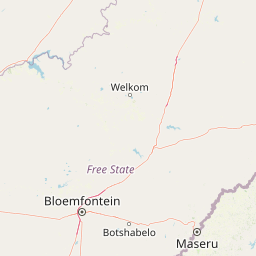
Understand where S.A. Lombard Nature Reserve sits in South Africa through a broader geographic reading of the surrounding landscape, nearby location context, and its mapped position within the national park landscape.

How S.A. Lombard Nature Reserve fits into South Africa

South Africa is the southernmost country in Africa, spanning 1.22 million km² with a population of over 63 million. The country operates with three capital cities, Pretoria (executive), Cape Town (legislative), and Bloemfontein (judicial), and is renowned for its biodiversity, national parks, and multicultural society.

Wider geography shaping S.A. Lombard Nature Reserve in South Africa

South Africa occupies the southernmost region of Africa, with coastline along both the Atlantic Ocean to the west and the Indian Ocean to the east. The interior features elevated plateaus including the Highveld, with the Drakensberg escarpment marking the eastern highlands. The country shares borders with Namibia, Botswana, Zimbabwe, Mozambique, Eswatini, and Lesotho.

Map view of S.A. Lombard Nature Reserve

Use this park location map to pinpoint S.A. Lombard Nature Reserve in South Africa, understand its exact geographic position, and read its mapped placement within the surrounding landscape more clearly.

Pigeon | © OpenStreetMap contributors

Location context for S.A. Lombard Nature Reserve

North West
Park atlas

Compare regional grassland reserves and adjacent conservation landscapes across South Africa

Explore Other Parks Near S.A. Lombard Nature Reserve and Surrounding Protected Areas

Browse protected areas surrounding S.A. Lombard Nature Reserve to examine similar semi-arid interior habitats and regional grassland ecosystems. Expanding the geographic comparison reveals broader patterns within the wider South African conservation network.
National parkNorthern Cape
About 182 km away#1 closest

Southwest

Mokala National Park: Protected Landscape within South Africa's Northern Cape Region

Discover its geographic context and mapped park boundaries.

Mokala National Park stands as a notable protected area within the expansive Northern Cape province of South Africa. This national park provides a focal point for understanding regional geography and landscape context, enabling users to explore its mapped terrain and protected boundaries. Engage with detailed geographic information to appreciate its role in the broader conservation atlas and discover the unique attributes of this natural landscape.

Area
196.11 km²
Established
2007
IUCN
II
Relief
Mixed relief
Nature reserveGauteng
About 235 km away#2 closest

Northeast

Abe Bailey Nature Reserve: Geographic Profile and Highveld Protected Area Atlas

Mapped wetlands and grassland ecosystems in Gauteng, South Africa

Spanning 4,200 hectares, Abe Bailey Nature Reserve provides a vital green refuge on the West Rand. This protected area features a unique combination of highveld grassland, seasonal wetlands, and rocky ridges that support rich birdlife and antelope populations, standing as a significant conservation feature within an urbanized province.

Area
42 km²
Relief
Upland
Climate
Temperate
Access
Access unknown
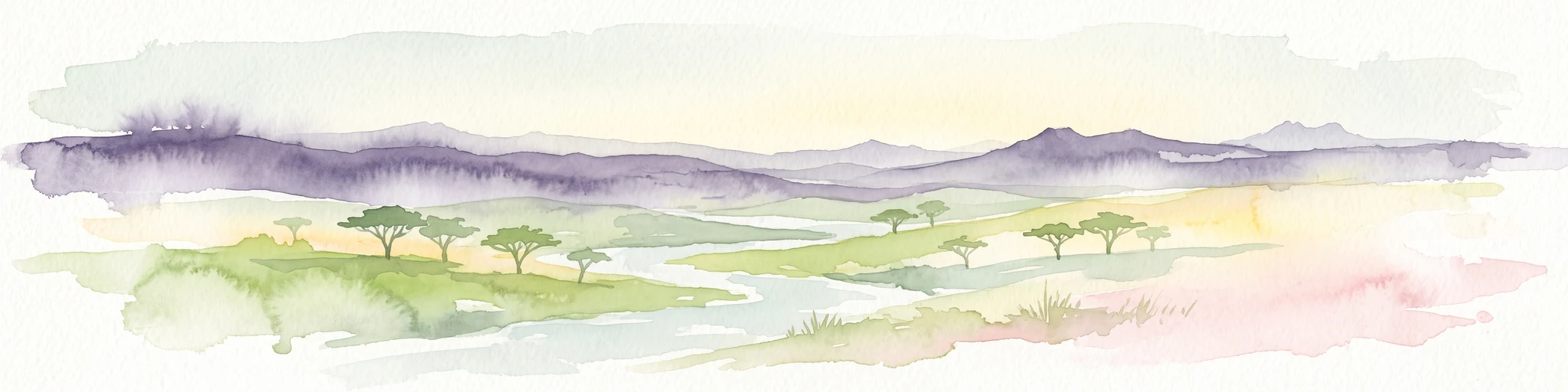
A watercolor painting showing a wide, panoramic view of rolling green and yellow hills, scattered acacia-like trees, and a distant purple mountain range under a light sky.
Nature reserveNorth West
About 268 km away#3 closest

Northeast

Kgaswane Mountain Reserve: Map and Geographic Profile of the Magaliesberg Range

A protected nature reserve in the North West province of South Africa.

Kgaswane Mountain Reserve stands as a pivotal protected landscape within the Magaliesberg Biosphere. This atlas record provides insights into its quartzitic ridges, complex grassland and woodland ecosystems, and status as a Ramsar wetland site, offering a clear view of its geographic and conservation significance.

Area
53 km²
Established
1967
Watercolor painting of a river flowing through a hilly, green valley with rocky cliffs on the right.
Biosphere reserveNorth West
About 289 km away#4 closest

Northeast

Magaliesberg Biosphere Reserve: Geographic Overview and Protected Area Landscape Mapping

Ancient mountain ranges in South Africa

The Magaliesberg Biosphere Reserve features a rugged terrain of high ridges and deep kloofs that support a vast array of bird species and vegetation. As a significant conservation area in North West, it preserves geological history alongside critical transitional ecosystems. Discover the mapped boundaries and natural features of this protected region that bridges urban centers and wilderness.

Area
3,578.7 km²
Established
2015
Relief
Mountain
Climate
Subtropical
Natural monumentMaseru District
About 290 km away#5 closest

Southeast

Thaba Bosiu Natural Monument: Mapping the Plateau Geography in Maseru District

A fortified sandstone landscape with deep cultural roots

Thaba Bosiu remains one of the most recognizable geographic landmarks in Lesotho, featuring a flat-topped sandstone summit surrounded by sheer cliffs. This natural monument provides a unique window into the regional terrain, tracing the intersection of river valley systems, basalt formations, and historical mountain refuge sites that define the Maseru District.

Area
2 km²
Established
1967
Relief
Mountain
Access
Easy access
A watercolor illustration of rolling green hills, distant mountains, and a pale sky.
Protected landscapeNorth West
About 291 km away#6 closest

Northeast

Magaliesberg Protected Natural Environment: Mapped Geography and Protected Landscape Context

Ancient mountain ridges between Rustenburg and Pretoria

Spanning a long quartzite ribbon, the Magaliesberg Protected Natural Environment represents a sophisticated model of private land conservation. The geography reveals a dramatic elevation gradient where Highveld plateaus meet lower-lying bushveld terrain. This atlas entry details the protected boundaries and the integrated landscape connection between surrounding nature reserves.

Area
343.56 km²
Established
1994
Relief
Mountain
Scope
Terrestrial
A pale, minimalist watercolor painting depicting rolling green hills in the distance with a winding dirt path leading through grassy plains in the foreground.
National parkNorth West Province
About 307 km away#7 closest

Northeast

Pilanesberg National Park: Geologic Mapping of a South African Alkaline Ring Complex

Explore concentric volcanic terrain and protected bushveld landscapes

Pilanesberg National Park covers the eroded root of a massive 1.2 billion year old volcano. Its defining feature is a series of concentric hills and basins that rise from the flat bushveld plains of South Africa. This protected area offers a distinct geographic study in volcanic topography, featuring rocky syenite outcrops, open savanna, and varied water sources that define the ecological character of this significant regional landscape.

Area
572 km²
Established
1984
Relief
Mountain
Climate
Subtropical
Nature reserveNorthern Cape
About 310 km away#8 closest

West

Witsand Nature Reserve: Protected Sand Dunes and Northern Cape Regional Geography

A remote arid plateau and singing sand landscape

Witsand Nature Reserve encompasses a 3,500 hectare protected area set atop a rocky plateau in the Northern Cape. Known for its distinctive red Kalahari-style dunes that produce acoustic booming sounds, the reserve offers a unique look at the arid interior of South Africa through a lens of quiet, expansive geography and remote terrain.

Area
31.7 km²
Established
1994
Relief
Upland
Climate
Arid

Common questions about visiting, size, designation, and location context for S.A. Lombard Nature Reserve

S.A. Lombard Nature Reserve FAQs for park facts, access, geography, and protected area context

Find quick answers about S.A. Lombard Nature Reserve, including protected-area facts, park geography, trail and visitor context, and how the park fits into its surrounding country and regional landscape.
MoriAtlas Explorer

Continue Your Protected Areas Search Across the Global Atlas

Deepen your exploration by continuing the structured search for national parks and protected areas worldwide. Utilize the comprehensive filtering capabilities to compare different conservation landscapes and refine your understanding of global park geography. Discover more about the distribution and characteristics of protected natural areas.

Global natural geography