Mori Atlas logo
Nature reserveWitsand Nature Reserve

Discover the red sand plateau and unique acoustic desert terrain of South Africa.

Witsand Nature Reserve: Mapped Protected Landscapes and Geographic Features in Northern Cape

(Witsand Provincial Nature Reserve)

Witsand Nature Reserve defines a distinct protected enclave in the Northern Cape province, characterized by a sweeping plateau at 1,200 meters elevation. This landscape features expansive red sand dunes influenced by the Kalahari fringe, creating a singular arid environment known for the acoustic resonance of its dry sand. The reserve offers a quiet, remote encounter with the open, semi-arid interior of South Africa, providing a focused view of the region's unique sandveld and arid woodland ecosystems.

Northern Capesand dunessinging sandsemi-aridKalahari fringeplateau

Witsand Nature Reserve

Nature reserve

Park overview

Structured park overview, official facts, and landscape profile for Witsand Nature Reserve

Witsand Nature Reserve park facts, protected area profile, and essential visitor context

Review the core facts for Witsand Nature Reserve, including designation, size, terrain, visitor scale, habitats, and operating context in one park-focused overview.

About Witsand Nature Reserve

Witsand Nature Reserve is a compact provincial protected area in the Northern Cape province of South Africa, sitting on a sand-covered plateau in a transition zone between the Kalahari sandveld and the drier interior of the country. The reserve spans roughly 3,500 hectares and is positioned about 80 km southwest of Postmasburg and 59 km northeast of Groblershoop, two small towns that serve as practical reference points for reaching the area.

The defining feature of the landscape is the belt of active red sand dunes that sweeps across the plateau surface. These dunes are not merely decorative scenery; they give the reserve its name, as 'Witsand' reflects the distinctive pale coloration of the sand grains in certain light conditions. The dunes are also the source of the reserve's most celebrated natural phenomenon, the so-called 'singing sand'. Under the right conditions of dryness, grain size, and movement, walking or sliding down the dune slopes can set the sand vibrating in a way that produces a low, resonant roar that carries across the reserve.

Beyond its dunes, Witsand sits in a semi-arid climate zone with hot summers, mild winters, and a short, concentrated rainfall season. Vegetation reflects the broader Kalahari-influenced environment, with scattered hardy trees adapted to sandy, low-moisture substrates. Because the reserve is small and its setting is relatively quiet, it offers an experience of the South African interior that is quite different from the more visited parks and reserves nearer the coast or the major flagship reserves.

Quick facts and research context for Witsand Nature Reserve

Witsand Nature Reserve lies in the Northern Cape of South Africa, on a plateau of red sand dunes at around 1,200 m elevation in a semi-arid region that receives between 150 and 300 mm of rain per year, most of it falling between February and March.

The reserve covers about 3,500 hectares and was formally designated as a provincial nature reserve in 1994. It is managed by the Northern Cape Department of Nature Conservation and sits within a sparsely populated landscape historically linked to mining towns such as Postmasburg and Groblershoop.

Protection and recognition

Documented terrestrial protection scope and historical designation data

Witsand Nature Reserve Protection Status and Designation History

Witsand Nature Reserve holds a documented terrestrial protection status established in 1994 without transboundary status or imported international recognition sources. Reviewing these verified records provides clear insight into the management scope and formal establishment timeline for the protected area.

Protection details

Protection scope
Terrestrial
Designated year
1994
Transboundary protection
No
Park context

Deeper park guide and search-rich context for Witsand Nature Reserve

Witsand Nature Reserve history, landscape, wildlife, and travel context

Explore Witsand Nature Reserve through its history, landscape character, ecosystems, wildlife, conservation priorities, cultural context, and seasonal travel timing in a structured park guide built for atlas discovery and search intent.

Why Witsand Nature Reserve stands out

Witsand is best known for its 'singing sand', an acoustic phenomenon in which moving across the dry dunes during the summer months produces a resonant booming or roaring sound. The reserve is also recognized for its dramatic setting of red Kalahari-type sand dunes perched on a rocky plateau, and for offering a quiet, remote encounter with the arid northern interior of South Africa away from the country's better-known parks.

Witsand Nature Reserve history and protected-area timeline

Witsand Nature Reserve was formally designated as a nature reserve in 1994, bringing an existing area of unusual red sand dunes under formal provincial protection. The reserve is managed by the Northern Cape Department of Nature Conservation.

While the dunes themselves have a much older natural history, the surrounding region carries significant human history. About 70 km to the north lies Postmasburg, a regional centre historically known for manganese, asbestos, and diamond mining. Within that wider mining landscape, sites such as Gatkoppies Mine, roughly 5 km north of Postmasburg, have yielded evidence that the Khoisan were working the deposits as early as around 700 CE, using a red powder derived from iron ore, known locally as 'blinkklip' or hematite, in ritual anointing practices. Witsand itself sits at the edge of this same regional context, though its modern identity is shaped far more by natural heritage than by mining.

Witsand Nature Reserve landscape and geographic character

The landscape of Witsand Nature Reserve is built around a plateau at roughly 1,200 m above sea level, capped by a sweeping belt of red sand dunes. These dunes form the visual and experiential heart of the reserve, with their warm colour, softly sculpted slopes, and shifting surface patterns contrasting sharply with the surrounding semi-arid bushveld.

The reserve lies in a relatively flat to gently undulating interior of the Northern Cape, well away from any major mountain ranges. Drainage is limited and rainfall is low, so the dunes remain dry and active through much of the year. The combination of dune and plateau setting produces an open, expansive scenery with long sightlines and a strong sense of isolation, framed by the broader Kalahari-style sandy terrain extending beyond the reserve's boundaries.

Witsand Nature Reserve ecosystems, habitats, and plant life

Witsand occupies a semi-arid ecological niche typical of the transition between the Kalahari sandveld and the drier interior regions of the Northern Cape. The reserve's vegetation is adapted to sandy substrates, low and highly seasonal rainfall, and strong seasonal temperature swings between warm summers and mild winters.

Plant communities in and around the reserve are shaped by the dune environment, with hardy tree species able to anchor their roots in loose sand and tolerate periodic drought. The fauna is similarly adapted to arid conditions, with species patterns reflecting the broader Kalahari-influenced ecosystems of the region rather than the wetter habitats found closer to South Africa's coast or escarpment. The reserve's small size and clear habitat boundaries make it an unusually focused setting in which to observe these semi-arid sandveld systems.

Witsand Nature Reserve wildlife and species highlights

While Witsand is primarily celebrated for its dunes and acoustic phenomenon rather than for large mammal sightings, the reserve's sandveld environment supports wildlife typical of the semi-arid Northern Cape interior. The mix of dune and surrounding bushveld provides habitat suited to species adapted to dry, open landscapes rather than to high-density game viewing.

Because the reserve is relatively compact and quiet, wildlife observation here tends to be incidental to the broader experience of the dunes and the natural sound of the landscape. The reserve's value for wildlife is closely tied to its role within the wider Kalahari-influenced ecosystem of the region.

Witsand Nature Reserve conservation status and protection priorities

Witsand Nature Reserve plays a focused role within the Northern Cape's network of provincial protected areas, safeguarding a small but distinctive patch of red sand dune habitat on a semi-arid plateau. The reserve's conservation significance lies less in its size than in the particular combination of features it preserves: an active dune system, an unusual acoustic phenomenon tied to specific sand conditions, and a representative sample of Kalahari-influenced sandveld vegetation.

Formal designation in 1994 and management under the Northern Cape Department of Nature Conservation provide the institutional framework for protection. Continued protection of the dune system is particularly important because the 'singing sand' effect depends on maintaining the dry, undisturbed character of the sand surface, which is sensitive to major changes in land use.

Witsand Nature Reserve cultural meaning and human context

Witsand sits within a region whose cultural and historical identity is closely tied to semi-arid land use and mineral extraction. The nearby town of Postmasburg and the broader mining landscape of the Northern Cape have shaped the regional economy, while archaeological evidence from sites such as Gatkoppies Mine, roughly 70 km north of the reserve, shows that the Khoisan were working local mineral deposits, including the use of red iron oxide powder for body anointment, as early as around 700 CE.

The reserve's Afrikaans name, Witsand-natuurreservaat, and the English translation 'white sand', reflect the linguistic and cultural landscape of the Northern Cape. The reserve itself, however, is primarily a natural heritage site rather than a site of direct historical settlement, and its cultural context is best understood as part of the wider regional tapestry rather than as a memorial or historical site in its own right.

Top sights and standout views in Witsand Nature Reserve

The standout feature of Witsand Nature Reserve is the experience of the dunes themselves: long slopes of red sand across which, in the dry months, the phenomenon of 'singing sand' produces a resonant roar that gives the experience a memorable sensory element beyond ordinary dune scenery.

Equally striking is the reserve's sense of remoteness. Set on a plateau amid the Northern Cape's open semi-arid landscapes, with characteristic camel thorn and shepherd's tree vegetation across the surrounding sandveld, Witsand offers a quiet, focused encounter with the Kalahari-influenced edge of South Africa's interior, anchored by its small area, easy reach from regional towns such as Postmasburg and Groblershoop, and unusual acoustic character.

Best time to visit Witsand Nature Reserve

The reserve's climate and defining acoustic phenomenon both strongly favour a summer visit. The 'singing sand' effect depends on the sand being thoroughly dry and loose, conditions most reliably met during the hot, dry summer months when average daytime temperatures are around 28°C, occasionally reaching 40°C. Visiting in summer offers the best chance to hear the dunes roar.

The main rainfall arrives between February and March, when surfaces become wet and the acoustic phenomenon is unlikely to occur. Winters are mild, with average temperatures around 20°C, and can offer more comfortable walking conditions for visitors more concerned with cooler weather than with experiencing the singing sand, though at the cost of the reserve's most distinctive feature.
Monthly climate preview

Long-term temperature ranges and monthly precipitation averages for Northern Cape terrain

Witsand Nature Reserve Climate Normals and Annual Weather Patterns

Representative coordinate measurements reveal significant thermal variation across the annual cycle, spanning from freezing winter minimums to high summer maximums alongside minimal daily rainfall totals. Reviewing the complete twelve-month meteorological record provides deeper insight into long-term climate normals and regional weather patterns.
Annual mean19 °C
11 °C27 °C
Jan27°
Feb26°
Mar24°
Apr19°
May15°
Jun11°
Jul11°
Aug13°
Sep17°
Oct21°
Nov23°
Dec26°
Warmest month
January

26.8 °C

Coolest month
July

10.7 °C

Wettest month
January

1.6 mm/day

Driest month
July

0.1 mm/day

Park location guide

Geography guide, regional context, and park location map for Witsand Nature Reserve

Witsand Nature Reserve park geography, regions, and map view in South Africa

Understand where Witsand Nature Reserve sits in South Africa through a broader geographic reading of the surrounding landscape, nearby location context, and its mapped position within the national park landscape.

How Witsand Nature Reserve fits into South Africa

South Africa is the southernmost country in Africa, spanning 1.22 million km² with a population of over 63 million. The country operates with three capital cities, Pretoria (executive), Cape Town (legislative), and Bloemfontein (judicial), and is renowned for its biodiversity, national parks, and multicultural society.

Wider geography shaping Witsand Nature Reserve in South Africa

South Africa occupies the southernmost region of Africa, with coastline along both the Atlantic Ocean to the west and the Indian Ocean to the east. The interior features elevated plateaus including the Highveld, with the Drakensberg escarpment marking the eastern highlands. The country shares borders with Namibia, Botswana, Zimbabwe, Mozambique, Eswatini, and Lesotho.

Map view of Witsand Nature Reserve

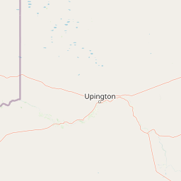
Use this park location map to pinpoint Witsand Nature Reserve in South Africa, understand its exact geographic position, and read its mapped placement within the surrounding landscape more clearly.

Pigeon | © OpenStreetMap contributors

Location context for Witsand Nature Reserve

Northern Cape
Park atlas

Continue comparing regional protected landscapes and arid terrain across the Northern Cape

Explore Parks Near Witsand Nature Reserve and Surrounding Protected Areas

Browsing other parks near Witsand Nature Reserve reveals connected regional geography, semi-arid sandveld terrain, and neighboring provincial protected areas. Comparing these surrounding conservation landscapes provides broader context for the distinct acoustic dunes and plateaus of the interior.
National parkNorthern Cape
About 181 km away#1 closest

East

Mokala National Park: Protected Landscape within South Africa's Northern Cape Region

Discover its geographic context and mapped park boundaries.

Mokala National Park stands as a notable protected area within the expansive Northern Cape province of South Africa. This national park provides a focal point for understanding regional geography and landscape context, enabling users to explore its mapped terrain and protected boundaries. Engage with detailed geographic information to appreciate its role in the broader conservation atlas and discover the unique attributes of this natural landscape.

Area
196.11 km²
Established
2007
IUCN
II
Relief
Mixed relief
National parkNorthern Cape
About 204 km away#2 closest

West

Augrabies Falls National Park: A South African National Park Defined by Granite Gorge and Semi-Desert Terrain

Explore the mapped natural landscape and protected boundaries.

Augrabies Falls National Park in South Africa's Northern Cape Province is a key protected area known for its thundering waterfall on the Orange River and the profound granite gorge carved over millennia. The park's semi-desert environment showcases the distinctive quiver trees and geological landmarks like Moon Rock, offering a unique landscape context. Understand its protected status and geographic significance within the arid Nama-Karoo biome through detailed mapping and landscape information.

Area
820 km²
Established
1966
IUCN
II
Relief
Upland
Watercolor illustration of rolling hills and scattered trees under a pale sky
National parkNorthern Cape
About 260 km away#3 closest

Southwest

Meerkat National Park National Park: Geographic Atlas and Protected Landscape Details

Explore the mapped boundaries and regional geography of Meerkat National Park.

Meerkat National Park is a significant protected area identified as a national park within the expansive Northern Cape region of South Africa. This detail page offers insight into its specific landscape character and mapped geographic extent, serving as a crucial node for atlas-based exploration. Understand the park's role as a protected national landscape and its relationship to the broader regional geography of Northern Cape, contributing to a structured understanding of conservation areas.

Area
1,352.45 km²
Established
2020
IUCN
II
Relief
Lowland
National parkKgalagadi District
About 278 km away#4 closest

Northwest

Kgalagadi Transfrontier Park National Park: Explore Its Mapped Protected Landscape

Discover the desert geography and unique terrain of the southern Kalahari.

Kgalagadi Transfrontier Park is a monumental protected area within the Kgalagadi District, embodying the vastness and stark beauty of the Kalahari Desert. This national park page offers an atlas-centric view of its sweeping red dunes, sparse vegetation, and the crucial dry river systems that shape its arid environment. Understand the geographic scope and the protected landscape character of this significant cross-border conservation area, perfect for detailed map exploration and understanding regional desert ecosystems.

Area
38,000 km²
Established
2000
IUCN
II
Visitors
52.5K annual
Nature reserveNorth West
About 310 km away#5 closest

East

S.A. Lombard Nature Reserve: Mapping Protected Grasslands in North West South Africa

A critical study of semi-arid veld and grassland conservation zones

Situated on the arid North West plains, S.A. Lombard Nature Reserve occupies a distinct geographic role as a protected enclave. The site features a flat, treeless interior plateau characterized by the transition between brackish turf and sandy veld, serving as a vital sanctuary for historically vulnerable antelope populations.

Area
46 km²
Established
1954
Relief
Lowland
Scope
Terrestrial
Wildlife reserveWestern Cape
About 397 km away#6 closest

South

Karoo National Park Wildlife Reserve: Mapped Boundaries and Geographic Context

Explore the protected landscape of this Western Cape wildlife reserve.

Karoo National Park stands as a protected wildlife reserve, offering insights into the natural geography of South Africa's Western Cape. This detail page provides an atlas view of its protected landscape, mapping its boundaries and situating it within its regional context. Engage with the park's identity as a conservation area and understand its geographic significance for dedicated exploration.

Area
767.9 km²
Established
1979
Relief
Mountain
Climate
Arid
National parkEastern Cape
About 445 km away#7 closest

Southeast

Camdeboo National Park: Protected Landscape Atlas and Eastern Cape Geographic Context

Discover the mapped geography and protected area identity of this Eastern Cape national park.

Camdeboo National Park represents a key protected landscape within the Eastern Cape province of South Africa. This entry provides essential details for understanding its protected-area status, geographic footprint, and its role within the regional atlas. Examine its mapped boundaries and explore the unique natural terrain it encompasses, gaining specific insight into its protected landscape characteristics.

Area
194.05 km²
Established
2005
Relief
Mountain
Climate
Arid
Watercolor illustration showing a mountain range with green hills and pink flowers
National parkNorthern Cape
About 445 km away#8 closest

Southwest

Tankwa Karoo National Park National Park: Mapped Protected Landscape in Northern Cape

Explore regional geography and protected area boundaries.

Tankwa Karoo National Park is a key protected area situated in the vast Northern Cape region of South Africa. This entry provides a detailed atlas perspective, focusing on the park's mapped geography and its significance as a national park. Understand the park's landscape context and its position within the broader regional geography for informed exploration and geographic discovery.

Area
1,436 km²
Established
1986
Relief
Upland
Climate
Arid

Common questions about visiting, size, designation, and location context for Witsand Nature Reserve

Witsand Nature Reserve FAQs for park facts, access, geography, and protected area context

Find quick answers about Witsand Nature Reserve, including protected-area facts, park geography, trail and visitor context, and how the park fits into its surrounding country and regional landscape.
MoriAtlas Explorer

Continue Your Protected Areas Search Across the Global Atlas

Deepen your exploration by continuing the structured search for national parks and protected areas worldwide. Utilize the comprehensive filtering capabilities to compare different conservation landscapes and refine your understanding of global park geography. Discover more about the distribution and characteristics of protected natural areas.

Global natural geography