

Mori Atlas logo
National parkCamdeboo National Park

Explore the mapped boundaries and regional context of this national park in the Eastern Cape.

Camdeboo National Park: Eastern Cape Protected Landscape Geography and Atlas Exploration

Camdeboo National Park stands as a significant protected area within South Africa's Eastern Cape province. This page offers detailed insights into its geographic scope, mapped boundaries, and the broader natural landscape context it occupies. Users can explore the specific protected area characteristics of Camdeboo National Park, understanding its role within the Eastern Cape's regional geography through an atlas-driven lens.

Karoo BiomeValley of DesolationEastern CapeMountain LandscapesDolerite FormationsSemi-Arid Wilderness

Camdeboo National Park

National park

Park overview

Structured park overview, official facts, and landscape profile for Camdeboo National Park

Camdeboo National Park park facts, protected area profile, and essential visitor context

Review the core facts for Camdeboo National Park, including designation, size, terrain, visitor scale, habitats, and operating context in one park-focused overview.

About Camdeboo National Park

Camdeboo National Park occupies a remarkable position in South Africa's protected area network as a showcase of Karoo wilderness nearly surrounding the historic town of Graaff-Reinet in the Eastern Cape. The park's establishment as the nation's 22nd national park represented a significant milestone in South Africa's conservation history, transforming what was previously the Karoo Nature Reserve into a fully-fledged national park managed by South African National Parks. The park's terrain is dominated by the southern foothills of the Sneeuberg Mountain ranges, where elevation differences of more than 700 metres create diverse ecological niches across the protected area. The landscape transitions from steep mountain slopes and rocky ridges to broader valley floors and plains, all characteristic of the Karoo's varied topography. Water features include the Nqweba Dam, which provides crucial habitat and water resources in this otherwise dry landscape. The park offers visitors opportunities to experience the Karoo's stark beauty, from the dramatic rock formations of the Valley of Desolation to more gentle landscapes where small streams and vegetation create pockets of green amid the generally brown and grey terrain. The proximity to Graaff-Reinet allows visitors to easily access the park while also exploring one of South Africa's oldest towns, established in 1786.

Quick facts and research context for Camdeboo National Park

Camdeboo National Park is situated in the Eastern Cape, South Africa, nearly surrounding the town of Graaff-Reinet. The park protects a portion of the Karoo biome, a semi-arid ecological region known for its distinctive flat-topped mountains, succulent vegetation, and exceptional biodiversity. The Valley of Desolation represents the park's most dramatic geological feature, with dolerite pillars and cliffs reaching impressive heights. The park was formally proclaimed on 30 October 2005 under South African National Parks management, though it builds upon the earlier Karoo Nature Reserve established in 1979. Elevation ranges from 740 to 1,480 metres, creating diverse habitats across the mountainous terrain.

Protection and recognition

Tracking the terrestrial conservation scope and official designation timeline

Camdeboo National Park Protection Status and Protected Area Designation

Geographic records outline the terrestrial protection status and conservation boundaries established for Camdeboo National Park in 2005. Tracking official designation timelines and boundary frameworks helps researchers verify the regional management history of South African protected landscapes.

Protection details

Protection scope
Terrestrial
Designated year
2005
Transboundary protection
No
Park context

Deeper park guide and search-rich context for Camdeboo National Park

Camdeboo National Park history, landscape, wildlife, and travel context

Explore Camdeboo National Park through its history, landscape character, ecosystems, wildlife, conservation priorities, cultural context, and seasonal travel timing in a structured park guide built for atlas discovery and search intent.

Why Camdeboo National Park stands out

Camdeboo National Park is best known for the Valley of Desolation, a striking geological formation where erosion has carved dramatic dolerite pillars, cliffs, and amphitheatre-like structures from the ancient sediment. This iconic landscape provides the park with its most visually spectacular scenery and serves as a major visitor attraction. Beyond this geological wonder, the park is renowned for protecting a representative portion of the Karoo biome, a globally significant semi-arid ecosystem that supports remarkable plant diversity, particularly in succulent and scrubland vegetation. The park's unique setting, almost completely surrounding the historic town of Graaff-Reinet, creates a distinctive relationship between protected wilderness and human settlement.

Camdeboo National Park history and protected-area timeline

The path to Camdeboo's establishment as a national park began decades earlier with the creation of the Karoo Nature Reserve in 1979. At that time, the International Union for the Conservation of Nature and the World Wildlife Fund recognized the urgent need for conservation measures in the Karoo biome, listing the establishment of protected areas in this region as a world conservation priority. The Karoo, despite its apparent aridity, supports remarkable biodiversity that was increasingly threatened by human activity and development pressures. The World Wide Fund for Nature in South Africa played a crucial role in the park's eventual formation by donating the 14,500-hectare Karoo Nature Reserve to serve as the centrepiece of the national park project. Following extensive negotiations between government, conservation groups, and other stakeholders, Marthinus van Schalkwyk, then Minister of Environmental Affairs and Tourism, announced the intention to proclaim South Africa's 22nd national park in the area surrounding Graaff-Reinet. A public consultation process was conducted to determine the new park's name, with participants selecting Camdeboo from the Khoi language, specifically the word !Xamdeboo, which translates to 'green valley'. The formal proclamation occurred on 30 October 2005, marking the culmination of more than two decades of conservation effort.

Camdeboo National Park landscape and geographic character

The landscape of Camdeboo National Park is defined by its position in the Karoo, a vast semi-arid region characterized by flat-topped mesas, rugged mountain ranges, and extensive plains. The park sits on the southern foothills of the Sneeuberg, a mountain range that rises prominently from the surrounding lower-lying terrain. The most spectacular geological feature is the Valley of Desolation, where geological forces have sculpted a remarkable landscape of vertical dolerite cliffs, free-standing rock pillars, and steep-sided amphitheatres. These formations create an almost otherworldly scenery unlike typical Karoo terrain, with the contrast between the dark rock and the open sky creating dramatic visual impact. The elevation range of 740 to 1,480 metres above sea level creates significant topographical variation across the park, with higher areas featuring rocky outcrops and steeper slopes while lower elevations contain valley bottoms and more gently undulating terrain. The Nqweba Dam adds a significant water feature to the landscape, its banks providing different scenery and habitat from the surrounding arid terrain.

Camdeboo National Park ecosystems, habitats, and plant life

The Karoo biome represents one of South Africa's most distinctive and ecologically important environments, and Camdeboo National Park protects a valuable representative sample of this ecosystem. The biome is characterized by succulent-dominated vegetation, with plants adapted to survive in conditions of low rainfall and extreme temperature variation between seasons. Despite the apparent harshness of the environment, the Karoo supports remarkable plant diversity, with numerous endemic species found nowhere else on Earth. The park's varied elevation creates multiple habitat types, from lower-lying plains where drought-resistant shrubs and grasses dominate to higher elevations where different plant communities thrive. The Nqweba Dam creates an artificial but important wetland habitat, attracting different bird species and providing water for wildlife throughout the year. The transition between different vegetation types across the park's elevation gradient contributes to the ecological richness of the protected area.

Camdeboo National Park wildlife and species highlights

The Karoo supports a distinctive fauna adapted to the region's challenging conditions, and Camdeboo National Park provides protected habitat for many of these species. The park is home to a variety of small mammals, including species of mongoose, rodent species, and the distinctive aardvark, which feeds on termites in the nocturnal hours. Reptile enthusiasts may encounter various snake species, lizards including the famous Netted Rock monitor, and tortoises adapted to the arid environment. Birdlife is particularly diverse, with the dam and water points attracting numerous species including waterfowl, raptors, and seed-eating birds that thrive in the Karoo's open landscapes. Larger mammals present in the park include springbok, which are well-adapted to the arid conditions and often seen in small herds moving across the landscape. The rock formations of the Valley of Desolation provide nesting habitat for cliff-nesting bird species, while the more vegetated areas support a range of smaller birds.

Camdeboo National Park conservation status and protection priorities

Camdeboo National Park plays a significant role in protecting the Karoo biome, an ecosystem that faces numerous pressures from agricultural development, mining, and other human activities. The establishment of the park built upon the earlier recognition by international conservation bodies that the Karoo required formal protection to preserve its unique biodiversity. The Karoo is considered globally significant for its plant diversity, with numerous species endemic to the region facing potential threats from habitat loss. By protecting a substantial area of Karoo terrain, the park helps ensure that representative examples of the biome's different habitats and ecological processes remain intact for future generations. The park's integration into South African National Parks' management system ensures ongoing resources for conservation, research, and visitor education. The park also contributes to the broader conservation network in the Eastern Cape, connecting with other protected areas in the region.

Camdeboo National Park cultural meaning and human context

The park's name carries significant cultural heritage, derived from the Khoi language of the indigenous peoples who historically inhabited this region of South Africa. The word !Xamdeboo, meaning 'green valley', reflects both the physical characteristics of certain areas within the park and the cultural significance of the landscape to the Khoi people. Graaff-Reinet, the town that the park nearly surrounds, is itself one of South Africa's oldest settlements, established in 1786 and featuring numerous heritage sites and preserved historical architecture. The relationship between the town and the protected area creates a unique situation where a national park exists in intimate connection with a historic urban centre. This proximity has implications for both conservation management and visitor experience, as the town provides access to the park while the park contributes to the regional identity and economy. The public consultation process that led to the selection of Camdeboo as the park's name demonstrates the importance of incorporating local community input in the establishment of protected areas.

Top sights and standout views in Camdeboo National Park

The Valley of Desolation stands as Camdeboo's most compelling highlight, a dramatic geological wonder where dolerite pillars and cliffs create a landscape of exceptional visual impact. The area offers several viewpoints and trails that allow visitors to experience this remarkable formation up close, with the changing light throughout the day creating different moods across the rock faces. The park's location surrounding Graaff-Reinet provides a unique opportunity to combine wilderness exploration with visiting one of South Africa's historically significant towns, where Cape Dutch architecture and museum collections tell the story of the region's colonial past. The Nqweba Dam provides a different park experience, with water-based recreation and birdwatching opportunities complementing the more arid landscape's attractions. The hiking trails, including the Crag Lizard Trail, offer visitors the chance to explore the park's varied terrain and observe wildlife, particularly during the cooler morning and evening hours when animals are most active.

Best time to visit Camdeboo National Park

The Karoo experiences extreme seasonal variation in temperature, with hot summers and cold winters that significantly affect the visitor experience. The summer months from November to March can bring very high daytime temperatures, though the park's higher elevation provides some moderation compared to lower-lying Karoo areas. Winter months from June to August bring colder conditions, including occasional frost on cold nights, but typically feature pleasant daytime temperatures and clear skies. The shoulder seasons of spring and autumn often provide the most comfortable conditions for outdoor activities, with moderate temperatures and the possibility of seeing the landscape at its most verdant after rainfall. Wildlife viewing can be productive throughout the year, though animals are most easily observed around water sources during the drier winter months. The Valley of Desolation is visually striking in any season, though the contrast between the dark rock formations and green vegetation after rainfall creates particularly memorable scenery.
Monthly climate preview

Map the seasonal temperature ranges and precipitation trends in this Eastern Cape landscape

Camdeboo National Park Average Temperatures and Monthly Climate Patterns

Long term measurements at a representative highland coordinate show hot summer peaks reaching over 35 degrees Celsius alongside winter lows that dip below freezing. Accessing the full monthly climate profile reveals the exact distribution of the park's light precipitation and helps compare historical weather by month.
Annual mean15 °C
8 °C21 °C
Jan21°
Feb21°
Mar19°
Apr15°
May11°
Jun
Jul
Aug10°
Sep13°
Oct16°
Nov18°
Dec20°
Warmest month
January

21.5 °C

Coolest month
July

7.8 °C

Wettest month
February

2.3 mm/day

Driest month
July

0.4 mm/day

Park location guide

Geography guide, regional context, and park location map for Camdeboo National Park

Camdeboo National Park park geography, regions, and map view in South Africa

Understand where Camdeboo National Park sits in South Africa through a broader geographic reading of the surrounding landscape, nearby location context, and its mapped position within the national park landscape.

How Camdeboo National Park fits into South Africa

South Africa is the southernmost country in Africa, spanning 1.22 million km² with a population of over 63 million. The country operates with three capital cities, Pretoria (executive), Cape Town (legislative), and Bloemfontein (judicial), and is renowned for its biodiversity, national parks, and multicultural society.

Wider geography shaping Camdeboo National Park in South Africa

South Africa occupies the southernmost region of Africa, with coastline along both the Atlantic Ocean to the west and the Indian Ocean to the east. The interior features elevated plateaus including the Highveld, with the Drakensberg escarpment marking the eastern highlands. The country shares borders with Namibia, Botswana, Zimbabwe, Mozambique, Eswatini, and Lesotho.

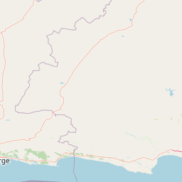
Map view of Camdeboo National Park

Use this park location map to pinpoint Camdeboo National Park in South Africa, understand its exact geographic position, and read its mapped placement within the surrounding landscape more clearly.

Pigeon | © OpenStreetMap contributors

Location context for Camdeboo National Park

Eastern Cape
Natural feature types

Explore the Named Natural Features and Geological Landmarks of Camdeboo National Park

Continue geographic discovery by browsing the formal catalog of named features across Camdeboo National Park. MoriAtlas provides a structured path to examine the dolerite pillars, mountain ranges, and water bodies that define this essential Karoo landscape through an atlas-focused lens.
Park atlas

Compare the diverse protected landscapes of the Eastern Cape and broader Karoo biome

Discover More National Parks and Protected Areas Near Camdeboo National Park

Browse national parks and protected areas geographically close to Camdeboo National Park, encompassing the distinctive Karoo biome and varied Eastern Cape landscapes. Compare these diverse conservation areas to understand regional protected-area distribution, contrasting terrains, and ecological significance across South Africa's arid regions.
National parkEastern Cape
39 km away#1 closest

East

Mountain Zebra National Park: A National Park within Eastern Cape's Geography

Explore its mapped protected boundaries and regional landscape context.

Mountain Zebra National Park serves as a key protected area within South Africa's Eastern Cape region. This page offers an atlas-driven perspective, detailing the park's geographic scope and mapped boundaries. Understand its role as a national park and its contribution to the regional landscape context, providing structured data for those interested in protected land distribution and natural terrain.

Area
284 km²
Established
1937
IUCN
II
Visitors
31.2K annual
National parkEastern Cape
91 km away#2 closest

Southeast

Addo Elephant National Park: South African National Park with Diverse Protected Landscapes

Explore its geographic context and unique Big Seven megafauna habitats.

Addo Elephant National Park is a crucial protected landscape within South Africa's Eastern Cape, covering approximately 1,640 square kilometers of varied terrain including karoo plains, coastal dunes, and marine protected areas. Its identity is deeply tied to the successful recovery of elephant populations and its distinction as the only African national park where all Big Seven megafauna can be observed in their natural surroundings. Discover the park's geographic spread, landscape diversity, and its role as a premier conservation area.

Area
1,640 km²
Established
1931
IUCN
II
Visitors
305.5K annual
Nature reserveEastern Cape
About 172 km away#3 closest

East

Tsolwana Nature Reserve: Geographic Profile and Protected Landscape Boundaries

Eastern Cape, South Africa Mountain and Karoo Transition

Tsolwana Nature Reserve protects a 8,500 hectare landscape on the Winterberg slopes. This region serves as a vital ecological bridge, blending semi-arid Karoo vegetation with high-altitude grasslands. Explore the map to understand the intersection of river corridors, mountain ridgelines, and plains habitat that define this South African reserve.

Area
85 km²
Established
1979
Wildlife reserveWestern Cape
173 km away#4 closest

West

Karoo National Park Wildlife Reserve: Mapped Boundaries and Geographic Context

Explore the protected landscape of this Western Cape wildlife reserve.

Karoo National Park stands as a protected wildlife reserve, offering insights into the natural geography of South Africa's Western Cape. This detail page provides an atlas view of its protected landscape, mapping its boundaries and situating it within its regional context. Engage with the park's identity as a conservation area and understand its geographic significance for dedicated exploration.

Area
767.9 km²
Established
1979
Relief
Mountain
Climate
Arid
Wildlife reserveEastern Cape
About 182 km away#5 closest

Southeast

Shamwari Game Reserve: An Atlas View of Restored Bushveld and Conservation Landscapes

Examining protected terrain within South Africa's Eastern Cape

Shamwari Game Reserve occupies approximately 250 square kilometers of restored Eastern Cape terrain. As a focal point of the Indalo Protected Environment, the reserve provides a structured habitat for diverse wildlife species and represents a significant case study in regional land reclamation and conservation mapping.

Area
250 km²
Established
1992
Relief
Upland
Scope
Terrestrial
Nature reserveEastern Cape Province
About 184 km away#6 closest

East

Mpofu Nature Reserve: Mapping the Ecological Diversity of the Amatole Mountains

Protected escarpment terrain and South African biome transitions

Located in the Eastern Cape, Mpofu Nature Reserve is a significant protected landscape known for the meeting of Grassland, Forest, and Albany Thicket biomes. The terrain ranges from low valley floors to high escarpment plateaus, providing a complex habitat for diverse mammals and endemic flora in a malaria-free setting.

Area
75 km²
Established
1985
Relief
Mountain
Climate
Subtropical
National parkSouth Africa
187 km away#7 closest

Southwest

Garden Route National Park: South Africa's Protected Landscape and Forest Atlas

Explore indigenous forests, coastal cliffs, and lake systems.

Garden Route National Park is a key national park in South Africa, celebrated for its rich indigenous forests and dramatic coastline. As a protected landscape, it offers a unique geographic profile, blending ancient woodlands with rugged coastal terrain and interconnected lake systems. This page serves as an atlas entry, detailing the park's spatial extent and its significance as a conservation area within the broader geography of South Africa.

Area
1,210 km²
Established
2009
IUCN
II
Relief
Mixed relief
National parkSouth Africa
About 198 km away#8 closest

South

Tsitsikamma National Park: South Africa's Protected Coastal Forest and Terrain

Explore the unique mapped landscape and protected area boundaries.

Tsitsikamma National Park in South Africa is defined by its striking coastal geography, where ancient indigenous forests descend towards rugged shores. This national park is a prime example of a protected landscape that showcases the dynamic interface between land and sea, featuring dramatic cliffs and iconic river mouths. Understanding its mapped boundaries and diverse terrain provides critical context for regional geographic exploration and the study of conservation areas within South Africa.

Established
2009
IUCN
II
Relief
Mixed relief
Climate
Mediterranean

Common questions about visiting, size, designation, and location context for Camdeboo National Park

Camdeboo National Park FAQs for park facts, access, geography, and protected area context

Find quick answers about Camdeboo National Park, including protected-area facts, park geography, trail and visitor context, and how the park fits into its surrounding country and regional landscape.
MoriAtlas Explorer

Continue Your Protected Areas Search Across the Global Atlas

Deepen your exploration by continuing the structured search for national parks and protected areas worldwide. Utilize the comprehensive filtering capabilities to compare different conservation landscapes and refine your understanding of global park geography. Discover more about the distribution and characteristics of protected natural areas.

Global natural geography