Mori Atlas logo
National parkGrassland National Park

Discover the mapped boundaries and natural terrain of this significant national park.

Grassland National Park: Protected Landscape and National Park Geography in Eastern Cape

Grassland National Park stands as a key protected area within the Eastern Cape province of South Africa, offering a distinct national park experience. This page provides a geographic anchor for understanding the park's location, its mapped boundaries, and its role as a protected landscape. Engage with the atlas context of Grassland National Park to explore its natural terrain and regional geographic significance within the Eastern Cape.

National ParkGrassland EcosystemEastern CapeWitteberg MountainsMontane HabitatNew Park 2025

Grassland National Park

National park

Park overview

Structured park overview, official facts, and landscape profile for Grassland National Park

Grassland National Park park facts, protected area profile, and essential visitor context

Review the core facts for Grassland National Park, including designation, size, terrain, visitor scale, habitats, and operating context in one park-focused overview.

About Grassland National Park

Grassland National Park represents a significant expansion of South Africa's protected area network, established specifically to address the conservation gap in the country's montane grassveld habitats. Located in the Eastern Cape Highlands along the southwestern border with Lesotho, the park encompasses portions of the Witteberg mountain range, a region characterized by rolling high-altitude plateaus, steep escarpment slopes, and extensive grassland plains. The establishment of this park in October 2025 marked a collaborative achievement between South African National Parks and WWF-South Africa, combining institutional conservation authority with the resources and engagement strategies of a major international conservation organization. The park's creation responds to the recognized under-protection of grassveld vegetation communities across South Africa, where these biologically diverse grassland ecosystems have historically received less formal protection than forest or savanna habitats. The management approach adopted for Grassland National Park emphasizes landscape-scale conservation through voluntary stewardship agreements, seeking to integrate private and communal landholdings into a coherent protected landscape rather than relying solely on state-owned territory.

Quick facts and research context for Grassland National Park

Grassland National Park spans roughly 102.25 square kilometers in the Eastern Cape Highlands of South Africa, positioned along the southwestern border with Lesotho adjacent to the Witteberge mountain range. The nearest communities include Lady Grey to the west and Elliot to the south. The park was established in mid-October 2025 as a joint initiative between SANParks and WWF-South Africa, specifically designed to protect under-protected grassveld vegetation types. The management model incorporates a long-term vision to expand from approximately 10,000 hectares of currently protected private land toward a target of 30,000 hectares through voluntary stewardship agreements with private and communal landowners.

Protection and recognition

Documenting terrestrial protection scope, transboundary status, and global atlas records

Grassland National Park Protection Status and Terrestrial Boundary Designations

Geographic records detail the terrestrial protection framework and transboundary connectivity defining Grassland National Park as a significant conservation zone. Accessing verified administrative designations helps researchers and conservationists map protected terrestrial grassland ecosystems across international jurisdictions.

Protection details

Protection scope
Terrestrial
Transboundary protection
Yes
Park context

Deeper park guide and search-rich context for Grassland National Park

Grassland National Park history, landscape, wildlife, and travel context

Explore Grassland National Park through its history, landscape character, ecosystems, wildlife, conservation priorities, cultural context, and seasonal travel timing in a structured park guide built for atlas discovery and search intent.

Why Grassland National Park stands out

Grassland National Park is principally known for its protection of South Africa's montane grassveld ecosystems, a vegetation type that has been significantly under-represented in the national protected area network. The park occupies a strategic position along the Witteberge, preserving critical high-altitude grassland habitat in a region where agricultural conversion has historically pressured these ecosystems. Its recent establishment through the SANParks-WWF partnership also represents a novel conservation model emphasizing collaborative land stewardship across private and communal properties.

Grassland National Park history and protected-area timeline

Grassland National Park was officially established on 17 October 2025, making it one of South Africa's most recently declared national parks. The park emerged from a partnership initiative between South African National Parks (SANParks) and WWF-South Africa, combining the institutional framework and management capacity of the national parks authority with the conservation resources and strategic guidance of the World Wide Fund for Nature. The establishment responded to longstanding conservation priorities around protecting grassveld vegetation communities that remain under-represented in South Africa's protected area network. A central component of the park's conservation model involves expanding the protected area through voluntary land stewardship agreements, with an initial focus on incorporating approximately 10,000 hectares of existing private protected land with the ambitious longer-term goal of reaching 30,000 hectares of collectively managed conservation territory.

Grassland National Park landscape and geographic character

The physical landscape of Grassland National Park is defined by its position within the Witteberg mountain range, a prominent geological feature in the Eastern Cape that forms part of the greater Drakensberg escarpment system. The terrain encompasses rolling high-altitude grasslands interspersed with steeper slope sections where the mountain terrain rises more dramatically. The area lies at elevations suitable for montane grassland ecosystems, with the landscape characterized by open grass-covered plains and ridges that provide sweeping views across the surrounding countryside. The proximity to the Lesotho border places the park in a transitional zone between South African and Lesotho highland environments, where the Witteberge forms a natural boundary feature. The vegetation pattern across this landscape is dominated by grassveld communities that give the park its name and conservation purpose.

Grassland National Park ecosystems, habitats, and plant life

The ecological character of Grassland National Park centers on its preservation of montane grassveld vegetation, a habitat type that supports distinctive plant communities adapted to high-altitude conditions in the eastern Cape region. These grasslands represent some of South Africa's less formally protected ecosystems, making the park's conservation mandate particularly significant for regional biodiversity. The grassveld communities found in the Witteberg area are characterized by a mix of grass species adapted to cooler temperatures and seasonal variations typical of high-altitude environments. Beyond the grassland matrix, the landscape supports associated habitats including rocky outcrops and drainage corridors that add ecological diversity to the protected area. The park's establishment aims to safeguard these vegetation communities from ongoing pressures related to agricultural expansion and overgrazing that have historically degraded similar grassland habitats across the region.

Grassland National Park conservation status and protection priorities

Grassland National Park addresses a meaningful gap in South Africa's protected area network by focusing conservation attention on grassveld vegetation communities that have been historically under-represented in formal protection regimes. The park's creation represents a strategic response to the limited coverage of montane grassland ecosystems within existing national parks and nature reserves, particularly in the eastern Cape region where agricultural conversion has placed pressure on these habitats. The SANParks-WWF partnership model employed for this park introduces an innovative approach to expanding conservation coverage beyond traditional state-owned protected areas, utilizing voluntary stewardship agreements to incorporate private and communal lands into the protected landscape. This model aims to scale the effective conservation area from an initial 10,000 hectares toward a target of 30,000 hectares, significantly amplifying the ecological impact of the protected area designation. The emphasis on collaborative land management reflects evolving approaches in South African conservation that recognize the importance of working across property boundaries to achieve meaningful landscape-scale protection.

Top sights and standout views in Grassland National Park

The park's defining highlight is its mission to protect montane grassveld ecosystems in a region where these habitats have been significantly under-represented in formal conservation areas. The Witteberg mountain setting provides a striking visual backdrop of rolling high-altitude grasslands and dramatic escarpment terrain along the South Africa-Lesotho border. The innovative conservation model developed through the SANParks-WWF partnership, emphasizing voluntary stewardship agreements to expand protection across private and communal lands, represents a forward-thinking approach to landscape-scale conservation in South Africa.

Best time to visit Grassland National Park

As a newly established park with limited operational history, specific seasonal visit guidance remains developing. The Eastern Cape Highlands generally experience mild summer conditions and cold winter months, with the highest visitation typically occurring during the warmer spring and summer seasons from September through March when outdoor exploration is most comfortable. Visitors interested in experiencing the grassland ecosystems at their greenest would find the post-rainfall period from October through April particularly appealing, though the park's recent establishment means visitors should check current access arrangements and facilities directly with SANParks.

Monthly climate preview

Long-term climate averages and precipitation trends at high-elevation terrain

Grassland National Park Climate Normals and Monthly Weather Profiles

Long-term measurements at the Eastern Cape coordinate reveal a distinct annual pattern of warm, wetter months followed by colder, dry periods with freezing average minimum temperatures. Accessing the complete climatology dataset provides a detailed month-by-month breakdown of temperature ranges and precipitation rates for Grassland National Park.
Annual mean13 °C
6 °C19 °C
Jan19°
Feb18°
Mar16°
Apr13°
May10°
Jun
Jul
Aug
Sep12°
Oct15°
Nov16°
Dec18°
Warmest month
January

18.5 °C

Coolest month
July

6.4 °C

Wettest month
January

4.6 mm/day

Driest month
June

0.5 mm/day

Park location guide

Geography guide, regional context, and park location map for Grassland National Park

Grassland National Park park geography, regions, and map view in South Africa

Understand where Grassland National Park sits in South Africa through a broader geographic reading of the surrounding landscape, nearby location context, and its mapped position within the national park landscape.

How Grassland National Park fits into South Africa

South Africa is the southernmost country in Africa, spanning 1.22 million km² with a population of over 63 million. The country operates with three capital cities, Pretoria (executive), Cape Town (legislative), and Bloemfontein (judicial), and is renowned for its biodiversity, national parks, and multicultural society.

Wider geography shaping Grassland National Park in South Africa

South Africa occupies the southernmost region of Africa, with coastline along both the Atlantic Ocean to the west and the Indian Ocean to the east. The interior features elevated plateaus including the Highveld, with the Drakensberg escarpment marking the eastern highlands. The country shares borders with Namibia, Botswana, Zimbabwe, Mozambique, Eswatini, and Lesotho.

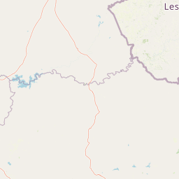
Map view of Grassland National Park

Use this park location map to pinpoint Grassland National Park in South Africa, understand its exact geographic position, and read its mapped placement within the surrounding landscape more clearly.

Pigeon | © OpenStreetMap contributors

Location context for Grassland National Park

Eastern Cape
Natural feature types

Explore the Geographic Features and Natural Landscapes of Grassland National Park

Navigate the complete dataset of named natural landforms and highland features across Grassland National Park. MoriAtlas provides detailed geographic context for the montane terrain and ecosystems of this Eastern Cape protected area, ensuring a thorough understanding of its physical environment.
Recorded earthquake history

Explore Recorded Earthquake History near Grassland National Park

Review documented seismic events associated with the geography of Grassland National Park through an organized historical archive. MoriAtlas provides detailed access to geological records including event magnitude and location, supporting a clearer understanding of regional seismic activity.

Grassland National Park Earthquake History

Catalogued events

3 events

Strongest magnitude

Magnitude 5.4

Most recent event

Aug 18, 2016

This history includes earthquakes recorded inside the park or within 50 km of its borders

Park atlas

Map the Regional Park Geography and Protected Landscapes of South Africa's Eastern Cape

Discover Related National Parks and Protected Areas Near Grassland National Park

Browse other national parks and protected areas in South Africa's Eastern Cape Highlands, extending the geographic context from Grassland National Park to adjacent montane grassveld ecosystems and diverse protected landscapes. Compare conservation efforts and regional variations in terrain and habitat across the Witteberge mountain range and surrounding highland environments through this focused atlas view.
Protected areaQuthing District
About 11 km away#1 closest

North

Lake Letsie Protected Area and Highland Wetland Geography in Quthing District

Mapping a unique Afroalpine reservoir and its surrounding catchment

Situated in the Quthing District of Lesotho, Lake Letsie is an essential protected landscape characterized by its shallow freshwater basin and high-altitude wetland habitat. This site provides critical insights into Afromontane biodiversity, regional water management, and the ecological impact of transboundary environmental factors on highland terrain.

Area
4.34 km²
Established
2001
Relief
Mountain
Climate
Alpine
National parkQacha's Nek District
82 km away#2 closest

Northeast

Sehlabathebe National Park: Mapped Protected Landscape in Lesotho's Maloti Mountains

Explore high-altitude terrain, waterfalls, and ancient rock art sites.

Sehlabathebe National Park stands as a protected national park within the rugged Maloti Mountains of Lesotho's Qacha's Nek District. This destination is vital for understanding the geographic context of protected areas, featuring dramatic cliffs, iconic waterfalls like Tsoelikana, and numerous rock art sites that speak to its cultural and historical significance. Its high-altitude Afro-Alpine and sub-alpine ecosystems offer unique landscape characteristics and support notable biodiversity, making it a key point of interest for atlas-driven exploration of natural and protected terrains.

Area
69.5 km²
Established
1969
IUCN
IV
Relief
Mountain
Protected areaKwaZulu-Natal
91 km away#3 closest

Northeast

Maloti-Drakensberg Park Geography: Mountain Escarpments and Alpine Plateau Exploration

A transboundary protected landscape spanning South Africa and Lesotho

Spanning the core of the Drakensberg mountain system, Maloti-Drakensberg Park provides a unique window into high-altitude biodiversity and geological drama. The protected area features basalt cliffs, rolling valleys, and an extensive plateau, forming a critical ecological and cultural corridor. This atlas entry covers the topographic features and spatial distribution of one of southern Africa's most significant protected landscapes.

Area
2,493.13 km²
Established
2001
Relief
Mountain
Climate
Alpine
Protected areaKwaZulu-Natal
91 km away#4 closest

Northeast

uKhahlamba-Drakensberg Park: Protected Mountain Landscapes and Escarpment Geography in South Africa

Exploring the basalt cliffs and alpine plateau of KwaZulu-Natal.

uKhahlamba-Drakensberg Park encompasses an expansive protected region where the Drakensberg escarpment rises sharply from the foothills of KwaZulu-Natal. This atlas record details the park landscape, including its transition from sandstone terraces to high-altitude basalt, its extensive river gorges, and the concentration of archaeological cave sites. Use this resource to understand the geographic scale of this transboundary conservation area.

Area
2,429.13 km²
Relief
Mountain
Climate
Temperate
Access
Access unknown
Nature reserveKwaZulu-Natal
101 km away#5 closest

Northeast

Ntsikeni Nature Reserve: High-Elevation Wetland Geography and Protected Landscape Atlas

A remote Drakensberg foothills wetland and montane grassland reserve.

Ntsikeni Nature Reserve is recognized as the largest and one of the highest wetlands in South Africa. Located in the KwaZulu-Natal province, this protected area features a unique, misty plateau landscape that sustains diverse orchid flora and essential headwater ecosystems. Use these geographic maps to examine the terrain, park boundaries, and the ecological transition between rolling foothills and the Drakensberg escarpment.

Area
92.87 km²
Established
1978
Relief
Upland
Climate
Temperate
Nature reserveKwaZulu-Natal
About 102 km away#6 closest

East

Mount Currie Nature Reserve: A Detailed Geographic Atlas of KwaZulu-Natal Mountains

High-altitude wetlands and protected Drakensberg foothills

Mount Currie Nature Reserve encompasses a rugged expanse of Drakensberg foothills characterized by sharp dolerite cliffs and expansive central wetland systems. This protected area acts as a crucial ecological intersection, bridging montane grassland and Afromontane forest patches while providing a sanctuary for diverse avian life and significant cultural heritage sites.

Area
17.77 km²
Established
1980
IUCN
IV
Relief
Mountain
Nature reserveKwaZulu-Natal
About 114 km away#7 closest

Northeast

Coleford Nature Reserve: Protected Grasslands and Wetlands in KwaZulu-Natal

Tracing the landscape of a key Drakensberg foothill reserve

The Coleford Nature Reserve represents a critical protected area in the Southern Drakensberg, featuring threatened Drakensberg Foothill Moist Grassland. Its landscape is defined by the Ngwagwane River valley and diverse wetland systems, providing essential habitat for endangered bird species. This reserve functions as a gateway to the broader montane geography of the southwestern KwaZulu-Natal region.

Area
12.72 km²
Established
1948
IUCN
IV
Relief
Highland
Natural monumentMaseru District
About 126 km away#8 closest

North

Thaba Bosiu Natural Monument: Mapping the Plateau Geography in Maseru District

A fortified sandstone landscape with deep cultural roots

Thaba Bosiu remains one of the most recognizable geographic landmarks in Lesotho, featuring a flat-topped sandstone summit surrounded by sheer cliffs. This natural monument provides a unique window into the regional terrain, tracing the intersection of river valley systems, basalt formations, and historical mountain refuge sites that define the Maseru District.

Area
2 km²
Established
1967
Relief
Mountain
Access
Easy access

Common questions about visiting, size, designation, and location context for Grassland National Park

Grassland National Park FAQs for park facts, access, geography, and protected area context

Find quick answers about Grassland National Park, including protected-area facts, park geography, trail and visitor context, and how the park fits into its surrounding country and regional landscape.
MoriAtlas Explorer

Continue Your Protected Areas Search Across the Global Atlas

Deepen your exploration by continuing the structured search for national parks and protected areas worldwide. Utilize the comprehensive filtering capabilities to compare different conservation landscapes and refine your understanding of global park geography. Discover more about the distribution and characteristics of protected natural areas.

Global natural geography