Mori Atlas logo
National parkGolden Gate Highlands National Park

Discover the mapped boundaries and natural terrain of this significant national park.

Golden Gate Highlands National Park: Protected Landscape & Geographic Context in Free State

Golden Gate Highlands National Park stands as a notable protected area within the Free State region of South Africa. This page provides an atlas-style exploration of its mapped landscape, helping you understand its geographic setting and the extent of its protected boundaries. Investigate the natural terrain and regional context that define this national park.

sandstone cliffshighveld ecosystemsdinosaur fossilstransfrontier conservationmountain landscaperock art sites

Golden Gate Highlands National Park

National park

Park overview

Structured park overview, official facts, and landscape profile for Golden Gate Highlands National Park

Golden Gate Highlands National Park park facts, protected area profile, and essential visitor context
Review the core facts for Golden Gate Highlands National Park, including designation, size, terrain, visitor scale, habitats, and operating context in one park-focused overview.

About Golden Gate Highlands National Park

Golden Gate Highlands National Park occupies a distinctive place in South Africa's protected area network as the sole national park in the Free State province. The park's landscape is characterized by spectacular deeply eroded golden sandstone cliffs, dramatic rock formations, and mountain peaks rising from high-altitude grasslands. The name Golden Gate refers specifically to the sandstone cliffs flanking the valley at the Golden Gate dam, a naming moment that occurred in 1875 when farmer J.N.R. van Reenen and his wife stopped at this location and named it after witnessing the last rays of the setting sun illuminate the cliffs in golden light. The park is situated in the upper regions of the Little Caledon River system, with the Caledon River marking the international border between South Africa and Lesotho. The area's geological significance is extraordinary, with the park providing accessible exposures of geological formations deposited during the Triassic Period when the region transitioned from wetter conditions to increasingly arid desert environments. The park's ecological diversity spans highveld grasslands, montane grasslands, Afromontane forests, and scarce high-altitude Austro-Alpine grasslands, creating a mosaic of habitats that supports remarkable biodiversity despite the relatively harsh high-altitude environment.

Quick facts and research context for Golden Gate Highlands National Park

Golden Gate Highlands National Park spans 340 square kilometers in the Free State province of South Africa, near the Lesotho border. The park sits in the Rooiberge foothills of the Maluti Mountains, with the Caledon River forming its southern boundary. Elevation ranges from 1,800 meters on northern plateaus to 2,700 meters in southern areas, with Ribbokkop at 2,829 meters being the highest peak in the Free State. Established in 1963, the park was significantly expanded in 1981, 1988, and again in 2007 following the amalgamation with QwaQwa National Park. The region experiences a high-altitude climate with summer thunderstorms and winter snowfalls, receiving approximately 800 millimeters of rainfall annually.

Park context

Deeper park guide and search-rich context for Golden Gate Highlands National Park

Golden Gate Highlands National Park history, landscape, wildlife, and travel context
Explore Golden Gate Highlands National Park through its history, landscape character, ecosystems, wildlife, conservation priorities, cultural context, and seasonal travel timing in a structured park guide built for atlas discovery and search intent.

Why Golden Gate Highlands National Park stands out

Golden Gate Highlands is renowned for its dramatic golden sandstone cliff formations, particularly the Brandwag Buttress, which displays striking ochre and orange hues created by geological erosion over millions of years. The park is world-famous in paleontological circles for the discovery of the oldest dinosaur embryos known to science, found in Triassic-period eggs containing Massospondylus fossils dating back 220 to 195 million years. The park also preserves an exceptional sequence of geological formations from the Karoo Supergroup, including the Molteno, Elliott, Clarens, and Drakensberg formations, providing visible textbook examples of southern Africa's geological history. Additionally, the park contains numerous San rock art sites in caves and shelters, representing thousands of years of human cultural history.

Golden Gate Highlands National Park history and protected-area timeline

Golden Gate Highlands National Park was established in 1963 when an initial area of 47.92 square kilometers was proclaimed as a national park with the specific purpose of preserving the scenic beauty of the golden sandstone cliffs. The park underwent significant expansion in 1981 to 62.41 square kilometers and again in 1988 to 116.33 square kilometers. A major milestone occurred in 2004 when the park was announced to merge with the neighboring QwaQwa National Park, with the amalgamation completed in 2007 and resulting in the park's current size of 340 square kilometers. The park is managed by South African National Parks (SANParks) and is slated for inclusion in the Maloti-Drakensberg Transfrontier Conservation Area, a peace park initiative that will connect protected areas across the South Africa-Lesotho border. The area has a longer human history evidenced by San rock paintings in caves and shelters throughout the park, representing thousands of years of indigenous occupation before European settlement of the region.

Golden Gate Highlands National Park landscape and geographic character

The landscape of Golden Gate Highlands National Park is dominated by spectacular golden and ochre-hued sandstone cliffs, dramatic rock outcrops, and mountain peaks that define the visual character of the area. The Brandwag Buttress stands as the most iconic geological feature, its deeply eroded sandstone walls rising dramatically above the surrounding terrain. The park sits at elevations ranging from 1,800-meter plateaus in the northern reaches to peaks approaching 2,700 meters in the south, with Ribbokkop at 2,829 meters standing as both the highest point in the park and the highest peak in the entire Free State province. The landscape is carved by the Ribbokspruit valley and other watercourses that drain into the Caledon River system, which forms the park's southern boundary and the international border with Lesotho. The geological foundation consists of a clearly visible sequence of formations including the yellow-brown Clarens Formation that creates the distinctive golden cliff colors, the red mudstone Elliott Formation where significant paleontological discoveries have been made, and the Drakensberg Formation's basaltic lava flows that cap the mountain summits, reaching 600 meters thickness on Ribbokkop.

Golden Gate Highlands National Park ecosystems, habitats, and plant life

Golden Gate Highlands National Park preserves an impressive diversity of high-altitude ecosystems spanning highveld grasslands, montane grasslands, Afromontane forests, and rare Austro-Alpine grassland zones. The park supports more than 60 grass species and a large variety of flowering bulbs and herbs that create seasonal displays throughout the summer months. The ouhout tree (Leucosidea sericea) is the most common woody species in the park, forming an important habitat that supports 117 beetle species recorded on these trees alone. The park contains introduced species including Lombardi poplars and weeping willows that are maintained for their cultural and historical connection to the eastern Free State, while invasive exotics like wattle and bluegum are systematically eradicated. The high-altitude Austro-Alpine grassland found in the park is considered a scarce habitat type within South Africa, making the park's preservation of this ecosystem particularly significant for conservation.

Golden Gate Highlands National Park wildlife and species highlights

Despite not containing any of Africa's traditional big five game species, Golden Gate Highlands National Park supports a diverse mammalian fauna including eland, Burchell's zebra, springbok, black wildebeest, blesbok, mountain reedbuck, grey rhebok, oribi, and Chacma baboons. The park has reintroduced the sungazer lizard (giant girdled lizard) and water mongoose as flagship conservation species. Avian diversity is exceptional with more than 210 bird species recorded, including significant populations of the endangered Cape vulture, rare bearded vulture, Verreaux's eagle, blue crane, and secretary bird. The park's reptile fauna includes seven snake species such as puff adder, mountain adder, and rinkhals, while fish species including rainbow trout and chubbyhead barb inhabit the park's rivers and dams. This wildlife community exists within a landscape more famous for its geological and scenic beauty than for large mammal populations, giving the park a distinct character within South Africa's national park system.

Golden Gate Highlands National Park conservation status and protection priorities

Golden Gate Highlands National Park plays a crucial conservation role as the only national park in South Africa's Free State province, preserving representative samples of highveld and montane grassland ecosystems that have been heavily transformed by agriculture across the broader region. The park's geological formations are of international scientific importance, with the visible sequence of Karoo Supergroup strata providing accessible education about southern Africa's geological history. The park's paleontological significance is exceptional, with the discovery of the oldest known dinosaur embryos representing a globally important scientific find that continues to yield new information about early dinosaur development. The park is slated for integration into the Maloti-Drakensberg Transfrontier Conservation Area, which will establish a transboundary protected area connecting South African and Lesotho conservation lands. Bird conservation is particularly significant, with the park providing protected habitat for endangered Cape vulture and bearded vulture populations that rely on the cliff formations for nesting sites.

Golden Gate Highlands National Park cultural meaning and human context

The Golden Gate Highlands area contains significant evidence of San (Bushmen) occupation through numerous rock paintings preserved in caves and shelters throughout the park. These artworks represent thousands of years of indigenous human presence in the highveld region, providing cultural heritage value that complements the park's geological and ecological significance. The park lies in a region historically associated with Basotho peoples, as evidenced by the nearby Basotho Cultural Village that operates within the park boundaries. The landscape holds cultural significance for the local Basotho community, with the park's integration into the Maloti-Drakensberg Transfrontier Conservation Area reflecting broader regional efforts to recognize and preserve cultural connections to the landscape across international boundaries.

Top sights and standout views in Golden Gate Highlands National Park

The park's golden sandstone cliffs illuminated at sunset, the Brandwag Buttress as an iconic geological landmark, the world's oldest dinosaur embryos discovered in the Elliott Formation, over 210 bird species including endangered vultures, the Montane grassland ecosystems with seasonal wildflower displays, Ribbokkop peak as the highest point in the Free State, San rock art sites in ancient caves and shelters, the clear geological sequence showing 190 million years of depositional history, the merging of QwaQwa National Park in 2007 expanding protection to 340 square kilometers, and the park's role in the emerging Maloti-Drakensberg Transfrontier Conservation Area.

Best time to visit Golden Gate Highlands National Park

The park can be visited throughout the year, though different seasons offer distinct experiences. Summer months from October to April bring regular afternoon showers, hail, and thunderstorms that refresh the landscape and create lush green grasslands dotted with flowering species. Winter from June to August offers dry, sunny conditions with thick snowfalls that transform the high-altitude terrain into a dramatic winter landscape, though temperatures can be very cold. The golden sandstone cliffs are particularly striking during winter when snow contrasts with the warm ochre colors of the rock faces. Spring and early summer offer excellent birdwatching opportunities as migrant species arrive, while the veld flowers are visible throughout the summer months thanks to the diversity of flowering times among the park's plant species. The park's location at high elevation means that weather can change rapidly and visitors should be prepared for varying conditions regardless of season.
Park location guide

Geography guide, regional context, and park location map for Golden Gate Highlands National Park

Golden Gate Highlands National Park park geography, regions, and map view in South Africa
Understand where Golden Gate Highlands National Park sits in South Africa through a broader geographic reading of the surrounding landscape, nearby location context, and its mapped position within the national park landscape.

How Golden Gate Highlands National Park fits into South Africa

South Africa is the southernmost country in Africa, spanning 1.22 million km² with a population of over 63 million. The country operates with three capital cities, Pretoria (executive), Cape Town (legislative), and Bloemfontein (judicial), and is renowned for its biodiversity, national parks, and multicultural society.

Wider geography shaping Golden Gate Highlands National Park in South Africa

South Africa occupies the southernmost region of Africa, with coastline along both the Atlantic Ocean to the west and the Indian Ocean to the east. The interior features elevated plateaus including the Highveld, with the Drakensberg escarpment marking the eastern highlands. The country shares borders with Namibia, Botswana, Zimbabwe, Mozambique, Eswatini, and Lesotho.

Map view of Golden Gate Highlands National Park

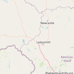
Use this park location map to pinpoint Golden Gate Highlands National Park in South Africa, understand its exact geographic position, and read its mapped placement within the surrounding landscape more clearly.

Pigeon | © OpenStreetMap contributors

Location context for Golden Gate Highlands National Park

Free State
Park atlas

Explore the surrounding protected landscapes and regional park geography of South Africa's highveld

Discover Other National Parks Near Golden Gate Highlands National Park and the Maluti Mountains
Browse national parks and protected areas situated near Golden Gate Highlands National Park, encompassing distinct highveld ecosystems and the dramatic Maluti Mountain foothills. Compare their unique geological features, conservation landscapes, and regional context to enhance your atlas-style discovery of southern Africa's diverse protected heritage.
State or regional parkKwaZulu-Natal

Royal Natal National Park: State or Regional Park in KwaZulu-Natal's Geography

Mapped boundaries and landscape context for South African protected areas.

Royal Natal National Park serves as a vital protected landscape within the diverse geography of KwaZulu-Natal, South Africa. This state or regional park offers a focused point for atlas exploration, allowing for a detailed understanding of its mapped boundaries and regional significance. By examining Royal Natal National Park, users can gain specific insights into South Africa's network of protected natural areas and their distribution, enriching overall geographic comprehension.

Area
80.94 km²
Established
1916
Relief
Mountain
Access
Moderate access
National parkLeribe District

Ts'ehlanyane National Park: Indigenous Forest & Maloti Mountain Protected Landscape

Explore unique terrain and endemic plant habitats.

Ts'ehlanyane National Park is a vital protected area in Lesotho's Leribe District, distinguished by its rare indigenous forest and the prevalence of berg bamboo. This national park offers insight into unique altitudinal landscapes and botanically significant ecosystems, situated within the expansive Maloti Mountains. Its protected status makes it a key destination for understanding the regional geography and the conservation of specialized natural habitats.

IUCN
II
Relief
Mountain
Climate
Temperate
Access
Moderate access
National parkQacha's Nek District

Sehlabathebe National Park: Mapped Protected Landscape in Lesotho's Maloti Mountains

Explore high-altitude terrain, waterfalls, and ancient rock art sites.

Sehlabathebe National Park stands as a protected national park within the rugged Maloti Mountains of Lesotho's Qacha's Nek District. This destination is vital for understanding the geographic context of protected areas, featuring dramatic cliffs, iconic waterfalls like Tsoelikana, and numerous rock art sites that speak to its cultural and historical significance. Its high-altitude Afro-Alpine and sub-alpine ecosystems offer unique landscape characteristics and support notable biodiversity, making it a key point of interest for atlas-driven exploration of natural and protected terrains.

Area
69.5 km²
Established
1969
IUCN
IV
Relief
Mountain
National parkEastern Cape

Grassland National Park National Park: Exploring Protected Landscapes and Regional Geography

Mapped boundaries and natural terrain context for an Eastern Cape protected area.

Grassland National Park represents a crucial protected area within South Africa's Eastern Cape province. As a national park, it offers significant insights into the region's natural landscapes and geographic character. This atlas perspective focuses on understanding the park's mapped scope, its terrain features, and its place within the broader provincial geography. Discover the unique protected landscape identity of Grassland National Park and how it contributes to the mapped natural heritage of the Eastern Cape.

Area
102.25 km²
Established
2025
IUCN
II
Relief
Mountain
Nature reserveKwaZulu-Natal

Hluhluwe, Imfolozi Park Nature Reserve: Detailed Protected Area and Regional Geography

Explore mapped boundaries and landscape context in KwaZulu-Natal.

Hluhluwe, Imfolozi Park, designated as a nature reserve, offers a distinct protected landscape within KwaZulu-Natal, South Africa. This entity page provides an atlas-focused view, emphasizing the park's mapped boundaries and its contribution to the region's protected area network. Understand its geographic setting and unique landscape character through structured data, essential for any explorer keen on mapping protected lands.

Area
960 km²
Established
1895
Relief
Mountain
Climate
Subtropical
National parkEswatini

Hlane Royal National Park: Eswatini's Vast Protected Savanna Woodland Landscape

Mapped geography and protected area context in northeastern Eswatini.

Delve into Hlane Royal National Park, Eswatini's most extensive protected territory, a prime example of lowland bushveld savanna. This national park is defined by its expansive woodland terrain, dotted with ancient trees and seasonal water pans, creating a dynamic landscape. It is an essential component for understanding the regional geography and the distribution of protected areas within Southern Africa, offering significant opportunities for landscape exploration.

Area
300 km²
IUCN
VI
Relief
Lowland
Climate
Subtropical
National parkLimpopo Province

Marakele National Park: National Park Protected Landscape and Geographic Context

Explore its Limpopo Province regional setting and mapped boundaries.

Marakele National Park represents a vital protected national park within the diverse geography of Limpopo Province, South Africa. This entry provides detailed atlas-style information on its protected landscape, focusing on mapped geographic boundaries and its context within the regional natural terrain. It serves as a key resource for understanding the park's specific role as a conservation area and its place within the broader atlas of South African protected lands.

Area
670 km²
Established
1994
Relief
Mountain
Climate
Subtropical
National parkEastern Cape

Mountain Zebra National Park: A National Park within Eastern Cape's Geography

Explore its mapped protected boundaries and regional landscape context.

Mountain Zebra National Park serves as a key protected area within South Africa's Eastern Cape region. This page offers an atlas-driven perspective, detailing the park's geographic scope and mapped boundaries. Understand its role as a national park and its contribution to the regional landscape context, providing structured data for those interested in protected land distribution and natural terrain.

Area
284 km²
Established
1937
IUCN
II
Visitors
31.2K annual

Common questions about visiting, size, designation, and location context for Golden Gate Highlands National Park

Golden Gate Highlands National Park FAQs for park facts, access, geography, and protected area context
Find quick answers about Golden Gate Highlands National Park, including protected-area facts, park geography, trail and visitor context, and how the park fits into its surrounding country and regional landscape.
MoriAtlas Explorer

Continue Your Protected Areas Search Across the Global Atlas

Deepen your exploration by continuing the structured search for national parks and protected areas worldwide. Utilize the comprehensive filtering capabilities to compare different conservation landscapes and refine your understanding of global park geography. Discover more about the distribution and characteristics of protected natural areas.

Global natural geography