Mori Atlas logo
National parkTankwa Karoo National Park

Discover the mapped boundaries and regional geography of this national park in the Northern Cape.

Tankwa Karoo National Park: South African National Park & Protected Landscape

Tankwa Karoo National Park represents a significant protected area within South Africa's expansive Northern Cape province. This page offers an atlas-centric view of the park, detailing its geographic scope and its place within the regional landscape. Users can explore the mapped protected boundaries and understand the park's natural terrain, contributing to a structured understanding of conservation lands in the area.

National ParkSucculent KarooSemi-DesertBiodiversity HotspotSouth AfricaNorthern Cape
Illustration of a desert landscape with a large flat-topped mountain, sparse succulent plants, and a clear sky

Tankwa Karoo National Park

National park

Park overview

Structured park overview, official facts, and landscape profile for Tankwa Karoo National Park

Tankwa Karoo National Park park facts, protected area profile, and essential visitor context
Review the core facts for Tankwa Karoo National Park, including designation, size, terrain, visitor scale, habitats, and operating context in one park-focused overview.

About Tankwa Karoo National Park

Tankwa Karoo National Park represents South Africa's commitment to preserving one of the most ecologically distinctive yet vulnerable biomes in southern Africa. Located in the remote northwestern corner of the country, the park occupies a vast valley floor flanked by impressive mountain ranges that define its boundaries and shape its extreme environmental character. The Succulent Karoo biome, which encompasses the entire park, is recognized internationally as a biodiversity hotspot due to its extraordinary concentration of endemic species, particularly its remarkable succulent flora adapted to survive in conditions of profound aridity. The landscape presents visitors with sweeping vistas of sparse shrubland and dwarf shrubland vegetation, where resilient plants have evolved remarkable strategies for water conservation and temperature regulation. The park's expansion over the years, particularly the significant 1998 land acquisition that added nearly 300 square kilometers to its territory, has strengthened the ecological integrity of this protected area and created meaningful connectivity for wildlife movement across this challenging terrain.

Quick facts and research context for Tankwa Karoo National Park

Tankwa Karoo National Park lies approximately 70 kilometers west of Sutherland in the Northern Cape, with its headquarters at Roodewerf. The park occupies an extensive valley surrounded by the Roggeveld Mountains to the east, the Cederberg to the west, the Kouebokkeveld Mountains to the north, and the scattered foothills of the Koedoesberg and Klein Roggeveld Mountains to the south. Established in 1986 and significantly expanded in 1998 through the purchase of 280 square kilometers of former sheep farmland, the park now encompasses roughly 1,463 square kilometers of protected terrain. The region experiences extreme temperature variations, with mean maximum temperatures reaching 38.9 degrees Celsius in January and winter minimums between 5 and 7 degrees Celsius. Some portions of the park receive less than 100 millimeters of average annual rainfall, making it one of the most arid protected landscapes in South Africa.

Park context

Deeper park guide and search-rich context for Tankwa Karoo National Park

Tankwa Karoo National Park history, landscape, wildlife, and travel context
Explore Tankwa Karoo National Park through its history, landscape character, ecosystems, wildlife, conservation priorities, cultural context, and seasonal travel timing in a structured park guide built for atlas discovery and search intent.

Why Tankwa Karoo National Park stands out

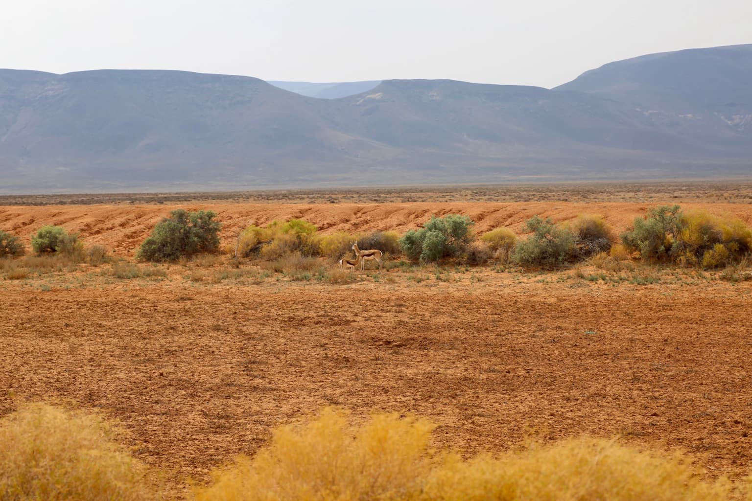
Tankwa Karoo is best known for its extraordinary biodiversity within an intensely arid landscape, representing one of the most species-rich desert ecosystems on Earth. The park protects the distinctive Succulent Karoo biome, which supports an exceptional concentration of endemic succulent plants, including rare genera such as Tanquana, Braunsia, and Didymaotus that occur nowhere else on the planet. The park also serves as a refuge for remarkable desert-adapted wildlife, including the springbok, caracal, bat-eared fox, aardvark, and brown hyena. With approximately 188 bird species recorded, the park provides critical habitat for specialized desert birds such as Ludwig's bustard, black-headed canary, and the black-eared sparrow-lark, with peak birding season occurring from August through October. The dramatic mountainous boundaries and sparse shrubland create a starkly beautiful landscape of remarkable ecological significance.

Dry reddish-brown plains with scattered bushes, distant mountains, and two springboks in the midground
Springboks grazing in the arid plains of Tankwa Karoo National Park

Tankwa Karoo National Park history and protected-area timeline

Tankwa Karoo National Park was established in 1986 as a protected area dedicated to preserving the Succulent Karoo biome, which at that time was almost entirely unprotected outside of the tiny Gamkaberg Nature Reserve. The creation of the park marked a recognition of the global significance of this semi-desert region and the urgent need to safeguard its unique biodiversity. A pivotal moment in the park's development occurred in 1998 when landowner Conrad Strauss sold 280 square kilometers of sheep farming land to South African National Parks, enabling a major expansion of the protected area. Prior to this acquisition, the park encompassed approximately 270 square kilometers; following the purchase, total area expanded to roughly 1,463 square kilometers. This expansion not only increased the territory available for wildlife but also helped buffer the protected ecosystem against the pressures of agricultural land use that had historically impacted the region. The park headquarters were established at Roodewerf, serving as the administrative center for park operations and visitor services.

Tankwa Karoo National Park landscape and geographic character

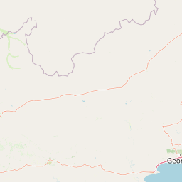
The landscape of Tankwa Karoo National Park is defined by its mountainous boundaries and vast arid plains that create one of South Africa's most visually striking protected environments. The park is naturally enclosed by the Roggeveld Mountains along its eastern edge, the Cederberg range to the west, the Kouebokkeveld Mountains to the north, and the scattered foothills of the Koedoesberg and Klein Roggeveld Mountains to the south. The Tankwa River traverses the southern portion of the park, providing a vital watercourse in this extremely arid environment. The terrain consists predominantly of open valley floors characterized by sparse shrubland and dwarf shrubland vegetation, interspersed with rocky outcrops and occasional elevation changes that create visual variety across the expanse. The stark, semi-desert scenery presents a palette of earth tones, muted greens from drought-resistant vegetation, and dramatic sky transitions that emphasize the sense of isolation and scale that defines this remote protected area.

Tankwa Karoo National Park ecosystems, habitats, and plant life

The nature of Tankwa Karoo National Park centers on the extraordinary Succulent Karoo biome, one of only two arid biodiversity hotspots in the world and the only one located entirely within a single country. This biome supports an exceptional level of plant endemism, with numerous succulent genera found nowhere else on Earth, including Tanquana, Braunsia, and Didymaotus that have evolved specialized adaptations to survive in extreme aridity. The vegetation throughout the park consists primarily of very sparse shrubland and dwarf shrubland, where plants have developed remarkable water-storing capabilities and reflective leaf surfaces to cope with intense solar radiation. The park sits in the rain shadow of the Cederberg Mountains, which intercept moisture-laden clouds from the Atlantic Ocean, resulting in annual precipitation below 100 millimeters in some areas and rarely exceeding 180 millimeters even at the wettest stations. This profound aridity shapes every aspect of the ecosystem, from plant morphology to animal behavior, creating a unique ecological community of remarkable resilience and specialization.

Tankwa Karoo National Park wildlife and species highlights

Tankwa Karoo National Park supports a diverse mammalian fauna adapted to arid conditions, including species such as the springbok, caracal, leopard, brown hyena, bat-eared fox, aardvark, aardwolf, and various smaller carnivores including the Cape fox, black-backed jackal, and small-spotted genet. The park provides habitat for antelopes including kudu, grey duiker, steenbok, and grey rhebok, while the rock hyrax and Cape porcupine occupy rocky areas throughout the reserve. The avifauna is particularly notable, with approximately 188 bird species recorded within the park boundaries. Notable species include Ludwig's bustard, black-headed canary, black-eared sparrow-lark, karoo korhaan, and birds of prey such as the martial eagle, Verreaux's eagle, and secretarybird. Seasonal water bodies attract greater flamingos and various waterfowl, while the arid plains support specialized desert birds adapted to open shrubland habitats. The park has undertaken efforts to reintroduce native game species that historically occurred in the area, with research conducted to ensure introduced animals can survive on the historically overgrazed veld.

Tankwa Karoo National Park conservation status and protection priorities

Tankwa Karoo National Park plays a critical role in conserving one of the world's most significant yet threatened biomes. The Succulent Karoo, together with the Cape Floral Kingdom, was declared a biodiversity hotspot by Conservation International, recognizing its extraordinary concentration of endemic species and the urgent threats it faces. Prior to the park's establishment, protection of this biome was virtually nonexistent outside of the minuscule Gamkaberg Nature Reserve, making Tankwa Karoo's creation a landmark achievement in South African conservation. The park addresses threats including historical overgrazing by livestock and the broader pressures of agricultural expansion in semi-arid rangelands. Ongoing conservation efforts include the reintroduction of native wildlife species that were historically present but had been eliminated from the region, with careful research guiding these restoration initiatives. The park's large area and mountain boundaries help provide meaningful protection for a suite of endemic species that occur nowhere else on the planet.

Tankwa Karoo National Park cultural meaning and human context

Tankwa Karoo National Park occupies a remote region of South Africa's Northern and Western Cape that has historically been used for extensive sheep farming rather than intensive agriculture or permanent human settlement. The area's extreme aridity limited agricultural development while creating a landscape of sparse vegetation suitable only for low-intensity livestock grazing. The park's expansion in 1998 through the purchase of former sheep farming land represents a transition from agricultural use to conservation protection, reflecting broader shifts in South African land management priorities. The indigenous San peoples have historical connections to arid lands throughout southern Africa, though specific cultural heritage within Tankwa Karoo is not extensively documented in available sources. The park name derives from the Tankwa River that flows through the southern portion of the reserve.

Top sights and standout views in Tankwa Karoo National Park

Tankwa Karoo National Park offers exceptional opportunities to experience one of Earth's most distinctive arid ecosystems within a protected landscape of impressive scale. The Succulent Karoo biodiversity hotspot provides unparalleled botanical interest, with endemic succulents and drought-adapted flora creating remarkable plant communities found nowhere else. The park's mountainous boundaries, including the Roggeveld and Cederberg ranges, create dramatic backdrops for exploration and photography. Wildlife viewing opportunities include springbok, caracal, bat-eared fox, and the chance to spot brown hyena and leopard in their desert habitat. The birdlife, with nearly 190 species including Ludwig's bustard, secretarybird, and various raptors, attracts dedicated birdwatchers, particularly during the peak August-to-October season. The sense of isolation and vast open spaces provides a wilderness experience distinct from South Africa's more famous savanna parks.

Best time to visit Tankwa Karoo National Park

The optimal time to visit Tankwa Karoo National Park depends on visitor interests, though the park's extreme climate significantly influences the experience. Summer months from November to March bring very hot conditions, with daytime temperatures frequently exceeding 38 degrees Celsius in the hottest areas, making early morning and late afternoon activities essential. Winter months from June to August offer more moderate temperatures and the peak birding season, when many species are most active and visible. The August-to-October period represents the best time for birdwatching, coinciding with spring conditions and the peak of avian activity in the Succulent Karoo. Rainfall is minimal throughout the year, though any precipitation dramatically affects landscape appearance, temporarily greening the sparse vegetation. Visitors should be prepared for cold winter nights with temperatures potentially dropping to around 5 degrees Celsius and very hot summer days requiring appropriate hydration and sun protection.

Park location guide

Geography guide, regional context, and park location map for Tankwa Karoo National Park

Tankwa Karoo National Park park geography, regions, and map view in South Africa
Understand where Tankwa Karoo National Park sits in South Africa through a broader geographic reading of the surrounding landscape, nearby location context, and its mapped position within the national park landscape.

How Tankwa Karoo National Park fits into South Africa

South Africa is the southernmost country in Africa, spanning 1.22 million km² with a population of over 63 million. The country operates with three capital cities, Pretoria (executive), Cape Town (legislative), and Bloemfontein (judicial), and is renowned for its biodiversity, national parks, and multicultural society.

Wider geography shaping Tankwa Karoo National Park in South Africa

South Africa occupies the southernmost region of Africa, with coastline along both the Atlantic Ocean to the west and the Indian Ocean to the east. The interior features elevated plateaus including the Highveld, with the Drakensberg escarpment marking the eastern highlands. The country shares borders with Namibia, Botswana, Zimbabwe, Mozambique, Eswatini, and Lesotho.

Map view of Tankwa Karoo National Park

Use this park location map to pinpoint Tankwa Karoo National Park in South Africa, understand its exact geographic position, and read its mapped placement within the surrounding landscape more clearly.

Pigeon | © OpenStreetMap contributors

Location context for Tankwa Karoo National Park

Northern CapeWestern Cape

Visualizing the Arid Succulent Karoo Biome: Habitats, Terrain, and Unique Conservation Landscape Character

Explore Tankwa Karoo National Park Through Striking Landscape Photos and Protected Area Scenery
Browse comprehensive imagery of Tankwa Karoo National Park to understand its unique arid landscapes, stark semi-desert scenery, and specialized Succulent Karoo biome habitats. These protected area views offer essential visual context for appreciating the park's distinct terrain, diverse flora, and profound ecological significance.

Dry reddish-brown plains with scattered bushes, distant mountains, and two springboks in the midground

Park atlas

Compare adjacent protected landscapes and their unique geographic spread across South Africa's arid Karoo biome.

Explore Other National Parks and Protected Areas Near Tankwa Karoo National Park
After exploring Tankwa Karoo National Park's unique Succulent Karoo biome, discover other national parks and protected areas that share similar arid landscapes and ecological significance. Trace the regional spread of conservation efforts, compare distinct protected-area geographies, and understand the broader context of southern African desert ecosystems.
National parkWestern Cape

Bontebok National Park: A Unique Protected Landscape in South Africa's Western Cape

Mapping the endemic bontebok's habitat and diverse fynbos.

Bontebok National Park represents a singular achievement in conservation, dedicated to protecting the rare bontebok antelope and showcasing the extraordinary biodiversity of the Cape Floristic Region. Located in the Western Cape, this smallest of South Africa's national parks features a landscape of fynbos-covered foothills beneath the Langeberg Mountains, with the Breede River defining its southern edge. Explore its mapped boundaries and unique ecosystems, offering a concentrated natural discovery experience within a UNESCO World Heritage Site.

Area
27.86 km²
Established
1931
IUCN
II
Relief
Mixed relief
Watercolor illustration of rolling hills and scattered trees under a pale sky
National parkNorthern Cape

Meerkat National Park National Park: Geographic Atlas and Protected Landscape Details

Explore the mapped boundaries and regional geography of Meerkat National Park.

Meerkat National Park is a significant protected area identified as a national park within the expansive Northern Cape region of South Africa. This detail page offers insight into its specific landscape character and mapped geographic extent, serving as a crucial node for atlas-based exploration. Understand the park's role as a protected national landscape and its relationship to the broader regional geography of Northern Cape, contributing to a structured understanding of conservation areas.

Area
1,352.45 km²
Established
2020
IUCN
II
Relief
Lowland
Wildlife reserveWestern Cape

Karoo National Park Wildlife Reserve: Mapped Boundaries and Geographic Context

Explore the protected landscape of this Western Cape wildlife reserve.

Karoo National Park stands as a protected wildlife reserve, offering insights into the natural geography of South Africa's Western Cape. This detail page provides an atlas view of its protected landscape, mapping its boundaries and situating it within its regional context. Engage with the park's identity as a conservation area and understand its geographic significance for dedicated exploration.

Area
767.9 km²
Established
1979
Relief
Mountain
Climate
Arid
National parkWestern Cape

Agulhas National Park: National Park Protected Landscape and Geographic Atlas

Mapped boundaries and regional geography in Western Cape.

Agulhas National Park is a protected national park in South Africa's Western Cape, vital for understanding regional geography and mapped landscape features. This entry focuses on its identity as a conservation area, detailing its protected landscape context and geographic setting within the broader atlas of Southern Africa. Explore the specific park boundaries and the unique terrain that defines this significant natural area.

Area
209.59 km²
Established
1998
IUCN
II
Relief
Lowland
National parkNorthern Cape

Namaqua National Park: Protected Landscape and Geographic Atlas Details

Explore Northern Cape's National Park mapped context.

Gain insight into Namaqua National Park, a protected national park situated in the expansive Northern Cape region of South Africa. This resource provides detailed geographic context, focusing on its mapped protected landscape and unique regional features. Understand its role as a distinct natural area for atlas-based exploration and geographic discovery within South Africa's diverse terrain.

Area
1,368.18 km²
Established
2001
Climate
Arid
Access
Moderate access
National parkSouth Africa

Garden Route National Park: South Africa's Protected Landscape and Forest Atlas

Explore indigenous forests, coastal cliffs, and lake systems.

Garden Route National Park is a key national park in South Africa, celebrated for its rich indigenous forests and dramatic coastline. As a protected landscape, it offers a unique geographic profile, blending ancient woodlands with rugged coastal terrain and interconnected lake systems. This page serves as an atlas entry, detailing the park's spatial extent and its significance as a conservation area within the broader geography of South Africa.

Area
1,210 km²
Established
2009
IUCN
II
Relief
Mixed relief
National parkWestern Cape

Wilderness National Park: National Park in Western Cape Province, South Africa

Explore mapped protected areas and regional geography.

Wilderness National Park stands as a significant protected area within the Western Cape province of South Africa. This page provides a detailed view of its role as a national park, emphasizing its geographic placement and mapped boundaries. Understand the park's contribution to the region's natural landscape and its significance within the broader atlas of protected lands.

Area
1,210 km²
Established
2009
Relief
Lowland
Access
Easy access
National parkNorthern Cape

Augrabies Falls National Park: A South African National Park Defined by Granite Gorge and Semi-Desert Terrain

Explore the mapped natural landscape and protected boundaries.

Augrabies Falls National Park in South Africa's Northern Cape Province is a key protected area known for its thundering waterfall on the Orange River and the profound granite gorge carved over millennia. The park's semi-desert environment showcases the distinctive quiver trees and geological landmarks like Moon Rock, offering a unique landscape context. Understand its protected status and geographic significance within the arid Nama-Karoo biome through detailed mapping and landscape information.

Area
820 km²
Established
1966
IUCN
II
Relief
Upland

Common questions about visiting, size, designation, and location context for Tankwa Karoo National Park

Tankwa Karoo National Park FAQs for park facts, access, geography, and protected area context
Find quick answers about Tankwa Karoo National Park, including protected-area facts, park geography, trail and visitor context, and how the park fits into its surrounding country and regional landscape.
MoriAtlas Explorer

Continue Your Protected Areas Search Across the Global Atlas

Deepen your exploration by continuing the structured search for national parks and protected areas worldwide. Utilize the comprehensive filtering capabilities to compare different conservation landscapes and refine your understanding of global park geography. Discover more about the distribution and characteristics of protected natural areas.

Global natural geography