
Mori Atlas logo
Nature reserveSchönerlinder Teiche

Mapping the protected landscape, reed-bed habitats, and conservation grazing terrain of this unique Brandenburg site

Schönerlinder Teiche Nature Reserve: A Detailed Geographic Atlas of the Brandenburg Wetland Mosaic

(Naturschutzgebiet Schönerlinder Teiche)

Schönerlinder Teiche represents a compact, ecologically vital nature reserve situated on the northern outskirts of Berlin within the Brandenburg region. This site preserves a distinct mosaic of ponds, reed belts, and damp meadows that have evolved from former irrigation land into a managed habitat for rare birdlife and grazing animals. Through this detailed atlas entry, uncover the geographic character of the reserve, its integration into the Barnim Nature Park, and the structured management of its wetland terrain.

wetlandnature reserveponds and reed bedsbirdwatchingurban-edge conservationBarnim Nature Park
Vector-style flat illustration showing a pond with a wooden bridge platform, cattails in the foreground, coniferous trees, a waterfall, and mountains under a pastel sky.

Schönerlinder Teiche

Nature reserve

Park overview

Structured park overview, official facts, and landscape profile for Schönerlinder Teiche

Schönerlinder Teiche park facts, protected area profile, and essential visitor context

Review the core facts for Schönerlinder Teiche, including designation, size, terrain, visitor scale, habitats, and operating context in one park-focused overview.

About Schönerlinder Teiche

Schönerlinder Teiche occupies a quiet but ecologically significant corner of the Barnim landscape, just north of Berlin's urban edge. Although small in size, the reserve carries an outsized role as a refuge for wetland biodiversity in a heavily populated region. Its ponds are surrounded by reed beds, wet meadows, and scrubby transitions into woodland, and the entire site functions as a managed mosaic of open water, marsh, and pasture. This combination supports a wide variety of bird species and creates an unusually rich habitat complexity for an area of this scale.

The reserve sits administratively in the district of Oberhavel in Brandenburg and is part of the wider Barnim Nature Park, allowing its management to fit into regional conservation goals for lakes, ponds, and historical irrigation landscapes. As a Category IV protected area under IUCN standards, the site is actively managed for habitat and species conservation, which in practice means ongoing efforts to maintain water levels, control succession, and use livestock grazing to keep the landscape open.

What makes the area especially appealing to visitors is its accessibility. Located only about 300 meters from the S-Bahn station Mühlenbeck-Mönchmühle, Schönerlinder Teiche is one of the few nature reserves in Germany reachable directly by suburban rail. The combination of easy access, a circular trail, observation platforms, and an observation tower make it a frequent destination for families, school excursions, and ornithologists looking for a convenient slice of wetland nature close to the capital. Its character is shaped by contrast: a peaceful wetland landscape tucked behind a suburban S-Bahn stop, evidence of how former industrial or agricultural infrastructure can evolve into valuable habitat when left undisturbed long enough.

Quick facts and research context for Schönerlinder Teiche

Schönerlinder Teiche is a protected nature reserve (Naturschutzgebiet) in the state of Brandenburg, just outside Berlin's city limits. It covers approximately 40.76 hectares and was officially designated on 26 June 1997. The reserve is classified under IUCN Category IV, reflecting its role as a habitat and species management area, and forms part of the broader Barnim Nature Park. Its defining features include a network of small ponds, reed-fringed water bodies, traditional grazing with water buffalo and Konik horses, and a circular discovery trail known as the Löwenzahnpfad that links the reserve directly to Berlin's S-Bahn network.

Protection and recognition

Documented terrestrial protection scope, designation history, and records

Schönerlinder Teiche Protection Status and International Recognition Data

Schönerlinder Teiche maintains a recorded terrestrial protection scope within official conservation inventories. Structured records detail the documented protection status and associated registry data without imported international recognition sources.

Protection details

Protection scope
Terrestrial
Transboundary protection
No
WDPA ID
165461
Park context

Deeper park guide and search-rich context for Schönerlinder Teiche

Schönerlinder Teiche history, landscape, wildlife, and travel context

Explore Schönerlinder Teiche through its history, landscape character, ecosystems, wildlife, conservation priorities, cultural context, and seasonal travel timing in a structured park guide built for atlas discovery and search intent.

Why Schönerlinder Teiche stands out

Schönerlinder Teiche is best known for its mosaic of small ponds and reed habitats that have developed on a former agricultural and wastewater irrigation site. The reserve has become a quiet refuge for waterbirds and reed-dwelling songbirds, and it is unusual among German nature reserves for being directly accessible by S-Bahn, making it a popular spot for urban naturalists and school groups from Berlin. Grazing by water buffalo and Konik horses is another distinctive element, using traditional large-grazing animals to keep meadows open around the ponds and maintain habitat diversity. The reserve is also associated with the Löwenzahnpfad, an educational discovery trail themed around the German television program Löwenzahn, which introduces visitors to bees, grazing animals, hedges, and waterbird observation.
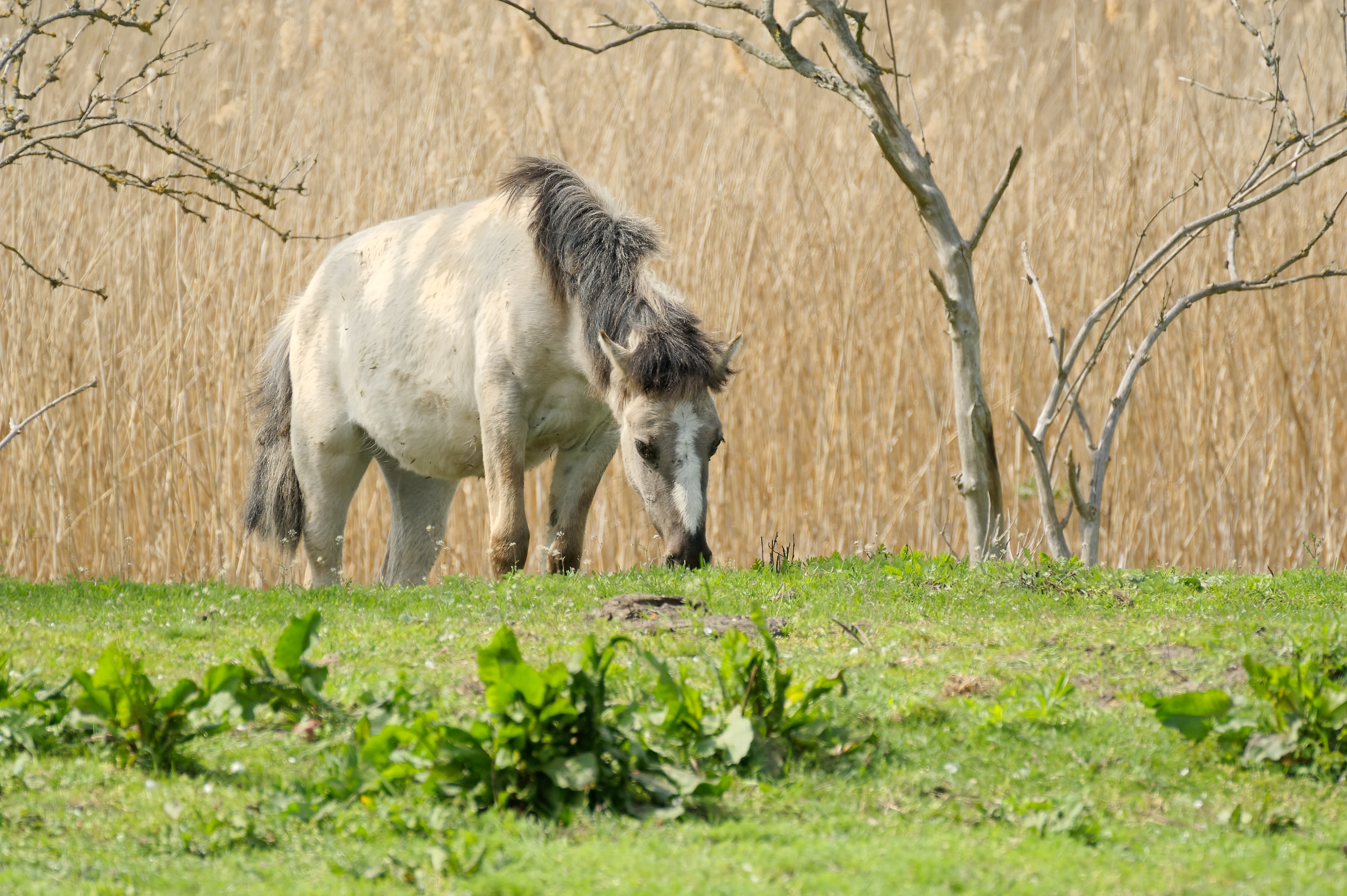
A pale Konik horse grazing on green grass with a background of dry reeds.
A Konik horse grazing in the Schonerlinder Teiche nature reserve.

Schönerlinder Teiche history and protected-area timeline

The ponds that define Schönerlinder Teiche have a layered history that reflects the changing relationship between Berlin and its surrounding landscape. In 1908, the pond system was created as part of a Verrieselung, an irrigation-based system in which Berlin's municipal wastewater was distributed across fields to filter and purify it naturally. Within this broader area of Rieselfelder, the small ponds served a dual agricultural purpose until 1977, supporting carp farming and duck husbandry alongside their role in wastewater treatment.

When a modern wastewater treatment plant was opened in nearby Schönerlinde in the mid-1980s, the irrigation system became obsolete and the fields and ponds were abandoned. With their working function gone, the ponds gradually silted up and the surrounding fields were left to develop more or less on their own terms. Because the area lay somewhat off the beaten path, it drew little public attention for several decades, an unintentional but consequential absence that allowed uncommon plants and threatened animal species to establish populations without disturbance.

The informal quiet ended in 1997, when the area was officially placed under nature protection as a Naturschutzgebiet, securing its future as a managed wetland reserve. A walking path was built around the ponds and a wooden observation tower was constructed for waterbird viewing. After the original tower was destroyed by arson, it was rebuilt in 2010 with funding from the Berliner Stadtgüter, the municipal entity that still owns the surrounding land. In the same period, the Löwenzahnpfad discovery trail was opened in cooperation with the Association of German Nature Parks and the Berliner Stadtgüter, transforming the reserve into a popular educational destination rather than just a quiet biological refuge.

Schönerlinder Teiche landscape and geographic character

The landscape of Schönerlinder Teiche is shaped by water rather than relief. Rather than dramatic terrain, the reserve presents a subtle pattern of small ponds set among reed belts, damp meadows, and hawthorn or scrub-rich transitions, with gentle elevation changes typical of the Barnim plateau to the north of Berlin. The ponds vary in size and condition; some remain relatively open, while others have become partially overgrown by reeds and aquatic vegetation through natural succession.

Around the water bodies, the terrain alternates between wet grassland, taller reed fringes, and lower scrubby zones. Grazing by water buffalo and Konik horses has helped maintain open meadow character in parts of the reserve, preventing complete shrub encroachment and preserving the patchwork structure that is essential for the area's biodiversity. The walking path around the reserve passes viewpoints that frame the water and the surrounding mosaic, making the landscape legible even to visitors who are not naturalists.

Although the reserve is small, its visual character is strongly defined by its wetland setting. The combination of still water, vertical reed structure, low meadows, and grazing animals gives the area an atmospheric quality that contrasts sharply with the suburban fabric of nearby Mühlenbeck and the urban outskirts of Berlin. An observation tower and viewing platform along the trail allow visitors to take in this landscape from above, particularly during the bird-heavy spring and early summer seasons.
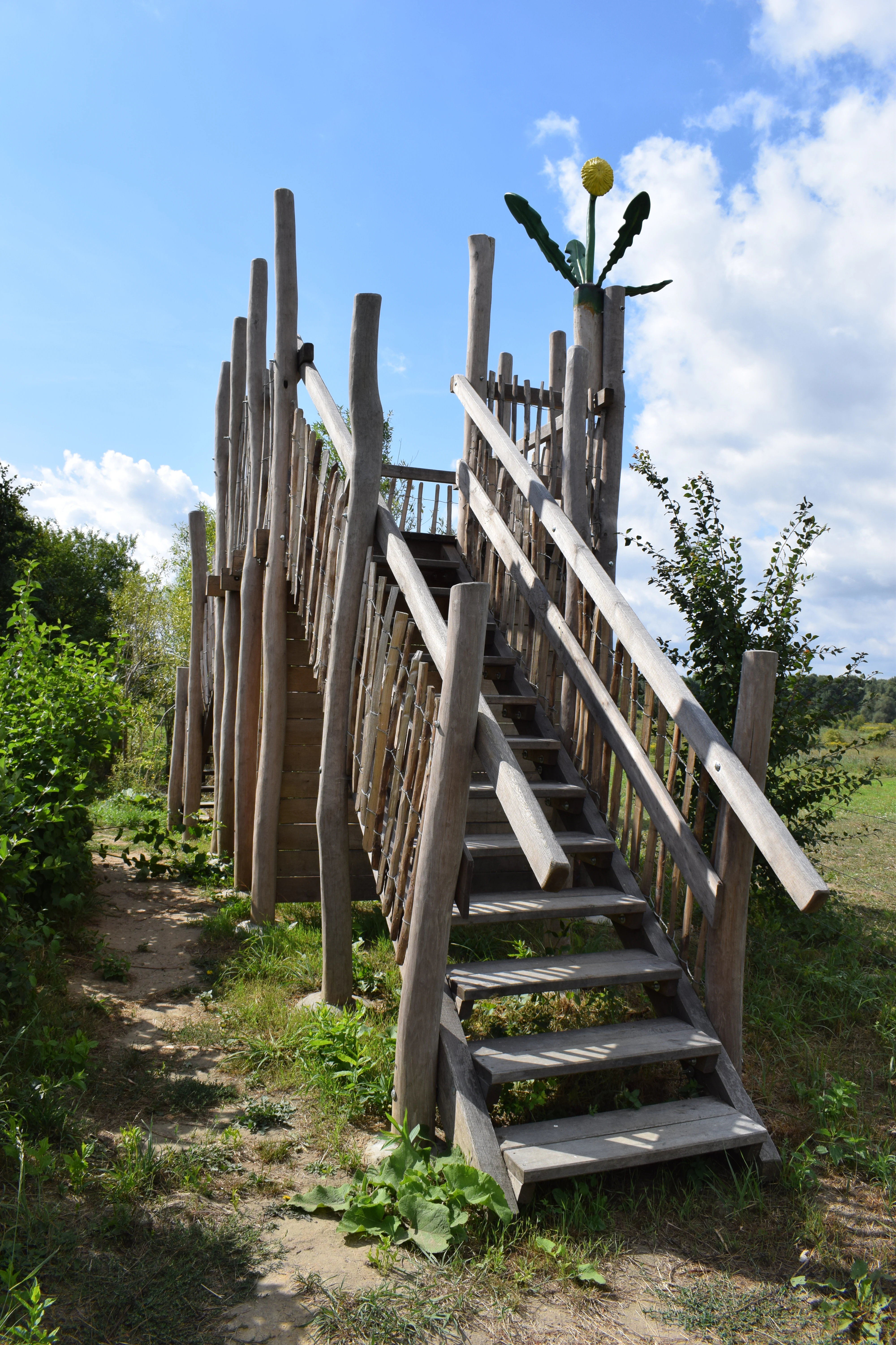
A rustic wooden staircase and raised observation deck made of unpeeled logs, situated in a green nature reserve with a small yellow decorative flower feature at the top.
A wooden observation platform at the Schönerlinder Teiche nature reserve.

Schönerlinder Teiche ecosystems, habitats, and plant life

Ecologically, Schönerlinder Teiche functions as a managed wetland patchwork in a region that has otherwise lost much of its natural water surface. The ponds and their reed borders support a community of aquatic and semi-aquatic plants, while the surrounding wet meadows and scrub margins host a different set of species adapted to transitional habitats. The mosaic of open water, reed, meadow, and grazed pasture is intentionally maintained because each of these habitat types contributes different species and ecological functions.

The site's history has unexpectedly shaped its ecological value. Because the ponds went through cycles of carp farming, duck keeping, abandonment, and partial silting, the area now combines features of older, more established wetlands with younger successional habitat. This complexity is reflected in the variety of plants and animals recorded during surveys such as the 2009 Day of Biodiversity, which confirmed healthy populations of several notable species.

By being integrated into the Barnim Nature Park, the reserve also benefits from regional conservation strategies that link it to other protected sites in Brandenburg. This network character means that species can move between Schönerlinder Teiche and broader landscapes in the Barnim region, strengthening long-term ecological resilience in an area otherwise fragmented by agriculture, infrastructure, and the expanding edge of Berlin.
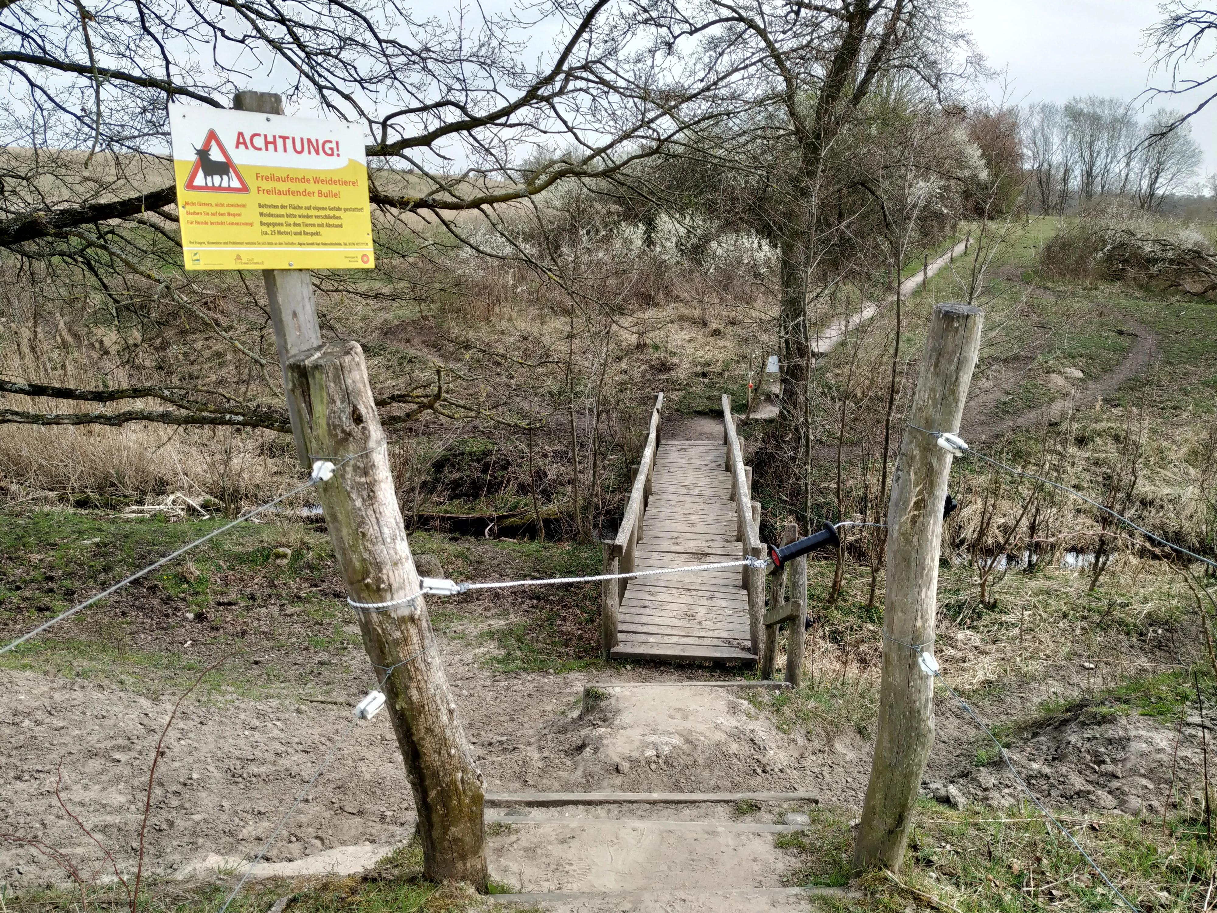
A small wooden footbridge crossing a stream in a nature reserve, with a yellow warning sign attached to a wooden post in the foreground.
A wooden footbridge and warning sign at the Schönerlinder Teiche nature reserve.

Schönerlinder Teiche wildlife and species highlights

The wildlife profile of Schönerlinder Teiche is dominated by birds, particularly species associated with reed beds, wet meadows, and open countryside. During inventory events such as the 2009 Day of Biodiversity, observers recorded typical wetland and farmland-edge species including reed bunting, marsh warbler, great reed warbler, yellowhammer, red-backed shrike, whinchat, and little grebe.

Beyond these recorded species, the reserve's structure suggests a broader community that includes common waterbirds using the open pond surfaces, raptors hunting over the meadows, and various passerines nesting in the reed and scrub fringes. The presence of grazing animals, especially water buffalo, also shapes the wildlife community indirectly. By keeping parts of the meadow open, they create habitat for ground-nesting birds and invertebrates that depend on shorter vegetation.

Mammals and herptiles are not described in detail in the source material, but the protected, lightly visited character of the reserve makes it plausible habitat for species adapted to quiet wetland edges, although firm claims cannot be made without further sources. The strongest wildlife signal remains ornithological, with the reserve playing a role as an urban-proximate refuge for both breeding and passage bird species in the Berlin-Brandenburg region.
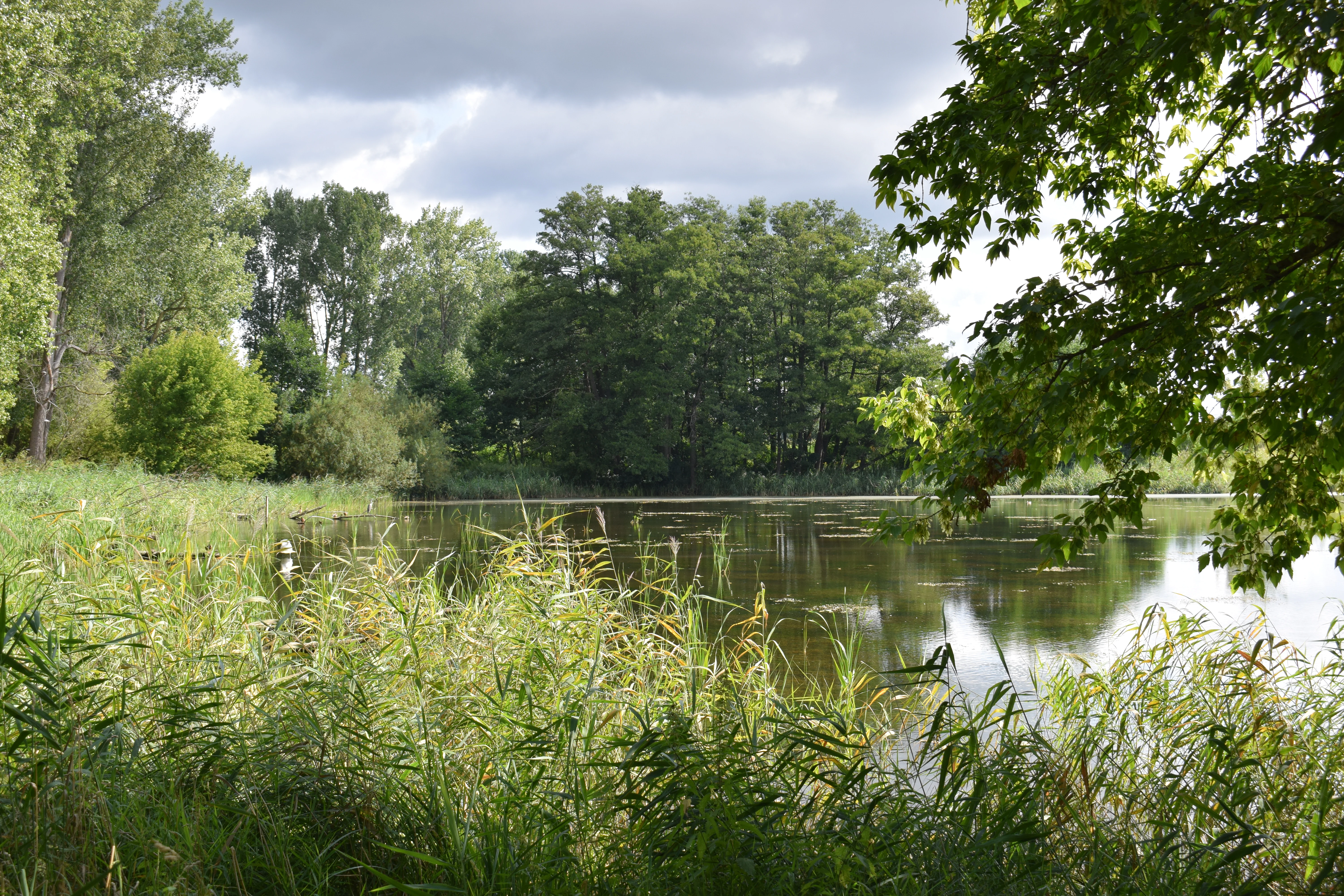
A calm, tree-lined pond surrounded by dense green reeds and deciduous forest under a partly cloudy sky.
A peaceful view of the ponds at the Schönerlinder Teiche nature reserve.

Schönerlinder Teiche conservation status and protection priorities

The conservation value of Schönerlinder Teiche rests on three pillars: its wetland habitat in a heavily populated region, its unusual origin as a self-restored former irrigation site, and its active management to preserve open habitat conditions. The reserve's IUCN Category IV designation means it is managed explicitly for habitat and species objectives rather than as a strict wilderness area, allowing interventions such as grazing and water level management to maintain ecological targets.

Protection status has been in place since 1997, providing long-term legal security for the site despite its proximity to Berlin. Ownership by the Berliner Stadtgüter creates an unusual urban-rural crossover: a piece of municipal agricultural land that has been deliberately allowed to develop into a biodiversity refuge.

Grazing with water buffalo and Konik horses is one of the most visible conservation tools used here. These hardy breeds help suppress scrub encroachment, maintain meadow structure, and add ecological value through their dung and the disturbance patterns they create. Combined with the path network, observation facilities, and educational programming around the Löwenzahnpfad, conservation at Schönerlinder Teiche is closely tied to public engagement, reinforcing the idea that the reserve is both a refuge for wildlife and a place for people to learn about wetland ecology near a major European capital.

Schönerlinder Teiche cultural meaning and human context

Schönerlinder Teiche carries a cultural dimension that is unusual for a small wetland reserve. The Löwenzahnpfad, opened in 2010 to mark the 30th anniversary of the German children's television program Löwenzahn, links the reserve directly to popular culture and educational traditions in the Berlin-Brandenburg region. The trail introduces schoolchildren to themes such as bees, grazing animals, hedges, and waterbird observation, positioning nature education as part of a wider cultural experience.

The reserve also reflects the layered rural-urban identity of the Barnim landscape to the north of Berlin. The ponds originated as part of Berlin's wastewater management and agricultural provisioning, and the land is still owned by the Berliner Stadtgüter. This means the site embodies a long-running relationship between the capital and its surrounding countryside, in which urban needs for water treatment and food production gave rise to a landscape that has now become a natural and recreational asset.

The mention of a hidden geocache treasure linked to the Barnim Nature Park adds a modern, playful layer to its cultural profile, blending nature experience with outdoor recreation traditions.

Top sights and standout views in Schönerlinder Teiche

The standout qualities of Schönerlinder Teiche centre on its compact but rich wetland mosaic, its accessible location near Berlin, and its blend of conservation with community-oriented learning. A handful of features define the visitor experience: a circular trail around the ponds, a wooden observation tower for waterbird viewing, grazing water buffalo and Konik horses in the meadows, and the Löwenzahnpfad discovery trail aimed especially at primary school groups.

Equally important is the reserve's role within the Barnim Nature Park, which connects it to a wider regional conservation network and strengthens its long-term ecological significance. Its history as a former sewage irrigation site turned nature reserve is, in itself, one of its most compelling highlights, illustrating how abandoned agricultural infrastructure can transform into valuable wildlife habitat if left undisturbed long enough.

Best time to visit Schönerlinder Teiche

Schönerlinder Teiche rewards visits whenever wetland birdlife and open water are at their most active. Late spring and early summer tend to be the strongest periods for observing breeding songbirds in the reed beds, including species such as reed bunting, marsh warbler, and great reed warbler. These months also bring the freshest meadow and reed vegetation, making the trail scenery especially lush.

Early morning typically offers the quietest conditions and the most likelihood of encountering active birdlife, while the observation tower provides a useful vantage point regardless of season. Cooler months can also be rewarding for waterbird viewing and for experiencing the reserve in a more subdued, atmospheric state, although visitors should expect fewer species showing without a dedicated birding focus.


Monthly climate preview

Long-term representative temperature and precipitation averages for Brandenburg

Schönerlinder Teiche Climate Normals and Annual Weather by Month

Schönerlinder Teiche records average monthly temperatures ranging from sub-zero winter lows to warm summer peaks alongside steady year-round precipitation rates. Examining the full twelve-month profile provides complete historical climate data and detailed monthly patterns for this location.
Annual mean9 °C
-1 °C20 °C
Jan-1°
Feb
Mar
Apr
May14°
Jun18°
Jul20°
Aug20°
Sep15°
Oct
Nov
Dec
Warmest month
July

20.3 °C

Coolest month
January

-0.7 °C

Wettest month
July

2.4 mm/day

Driest month
April

1 mm/day

Park location guide

Geography guide, regional context, and park location map for Schönerlinder Teiche

Schönerlinder Teiche park geography, regions, and map view in Germany

Understand where Schönerlinder Teiche sits in Germany through a broader geographic reading of the surrounding landscape, nearby location context, and its mapped position within the national park landscape.

How Schönerlinder Teiche fits into Germany

Germany is a federal republic in Western and Central Europe with a population of over 83 million across sixteen constituent states. It is Europe's largest economy by nominal GDP and a major global exporter and importer. The capital is Berlin, and the country borders Denmark, Poland, Czech Republic, Austria, Switzerland, France, Luxembourg, Belgium, and the Netherlands.

Wider geography shaping Schönerlinder Teiche in Germany

Germany is located in Western and Central Europe, spanning 357,022 km². It borders Denmark to the north, Poland and the Czech Republic to the east, Austria and Switzerland to the south, and France, Luxembourg, Belgium, and the Netherlands to the west. The country has coastlines on the Baltic Sea and North Sea to the north, with the Alps located in the southern region.

Map view of Schönerlinder Teiche

Use this park location map to pinpoint Schönerlinder Teiche in Germany, understand its exact geographic position, and read its mapped placement within the surrounding landscape more clearly.

Pigeon | © OpenStreetMap contributors

Location context for Schönerlinder Teiche

Brandenburg

Visual exploration of ponds, reed belts, and wetland habitats within the Brandenburg reserve.

Schönerlinder Teiche Photos: Landscapes, Wetland Scenery, and Protected Habitats

Visual documentation captures the wetland terrain, open meadow mosaic, and aquatic habitats defining Schönerlinder Teiche. Detailed photography illustrates the protected landscape character, waterbird refuges, and grazing zones across the northern edge of Berlin.

A pale Konik horse grazing on green grass with a background of dry reeds.

A wide view of a grassy field leading toward a cluster of ponds surrounded by trees under a partly cloudy sky.

A rustic wooden staircase and raised observation deck made of unpeeled logs, situated in a green nature reserve with a small yellow decorative flower feature at the top.

A small wooden footbridge crossing a stream in a nature reserve, with a yellow warning sign attached to a wooden post in the foreground.

A calm, tree-lined pond surrounded by dense green reeds and deciduous forest under a partly cloudy sky.

Park atlas

Compare nearby wetland reserves and connected nature parks across Brandenburg

Exploring Parks Near Schönerlinder Teiche and Surrounding Regional Protected Areas

Visitors exploring Schönerlinder Teiche can browse adjacent wetland reserves and regional conservation areas across the surrounding northern plateau. Comparing these connected protected landscapes reveals broader patterns in regional wildlife habitats and urban-edge conservation zones.
Watercolor painting of bare trees in a misty, marshy landscape with soft pastel colors.
Nature reserveBrandenburg
About 4.5 km away#1 closest

West

Kindelsee-Springluch Nature Reserve: A Detailed Geographic Atlas of Brandenburg Wetlands

Restored post-glacial lake and wetland landscape in East Brandenburg

Located in the state of Brandenburg, Kindelsee-Springluch represents a refined example of a protected wetland mosaic. The reserve encompasses the Kindelsee lake, sediment-filled meltwater channels, and diverse swamp forests. This site provides a critical window into regional post-glacial geography, featuring a well-defined sequence of mire, sedge meadows, and mixed oak woodlands that have undergone extensive ecological restoration.

Area
0.69 km²
Established
2001
IUCN
IV
A horizontal watercolor painting depicting a marshy landscape with ponds, green vegetation, and soft distant hills against a light background.
Nature reserveBerlin
About 5.1 km away#2 closest

Southeast

Karower Teiche Nature Reserve: Mapped Protected Wetland Geography in Northeast Berlin

Transitional lowland fen and pond mosaic

Karower Teiche protects a unique 128 hectare wetland mosaic in the Pankow district of Berlin. Centered on four shallow ponds and extensive reedbeds, the reserve maintains a vital ecological corridor between the Barnim plateau and the Berlin glacial valley. This site provides essential habitat for amphibians and reed-specialist birds within an urban setting.

Area
1.286 km²
Established
1994
IUCN
IV
Relief
Lowland
Watercolor illustration showing a soft landscape with a pond, marsh vegetation, and a background of rolling hills or meadows.
Nature reserveBerlin
About 6.3 km away#3 closest

East

Mittelbruch Nature Reserve: Mapped Wetland Geography and Protected Landscape in Berlin

Examining lowland peat diggings and protected moorland ecosystems

Mittelbruch stands as a compact nature reserve in northeastern Berlin, featuring a layered landscape of former peat diggings and open moor meadows. This area plays a critical role in urban conservation by providing essential refuge for waterbirds and diverse meadow flora. Utilize the atlas to study the reserve's internal geography, including its managed reed belts and surrounding forest edges that form a distinct ecological mosaic within the city landscape.

Area
0.282 km²
Established
1997
IUCN
IV
Relief
Lowland
A horizontal watercolor illustration showing a pinkish-purple foreground of heathland vegetation transitioning into a line of light green trees against a pale, washed-out hilly background.
Nature reserveBrandenburg
About 7 km away#4 closest

Northeast

Schönower Heide Nature Reserve: An Atlas View of Brandenburg Protected Heathlands

A restored landscape of glacial dunes and sandy heath

Schönower Heide stands as a significant nature reserve in Brandenburg, Germany. The area protects a unique combination of open sand heath, pine woodland, and wetland meadows formed on post-glacial outwash plains. This protected landscape is recognized for its successful transition from former military terrain into a vibrant habitat for diverse flora and fauna, including managed populations of red deer and mouflon within its fenced boundaries.

Area
5.334 km²
Established
2000
IUCN
V
Relief
Lowland
A horizontal watercolor illustration of a wetland scene with soft pink and green tones, showing sparse trees on the banks of a shallow, marshy water area under a pale sky.
Nature reserveBrandenburg
About 7.1 km away#5 closest

East

Ausstichgelände Röntgental: Brandenburg Nature Reserve and Protected Wetland Atlas

Mapped ecological landscapes on the Berlin metropolitan fringe

Investigate the detailed geography of Ausstichgelände Röntgental, a compact nature reserve in Brandenburg. Formed from nineteenth-century railway sand quarries, this protected area features a diverse mosaic of reed beds, open water, and alder carr forest. The site provides a compelling case study of post-industrial ecological recovery within the broader Barnim Nature Park landscape.

Area
0.248 km²
Established
1990
IUCN
IV
A watercolor illustration of a rural landscape with low hills, trees, and grassy meadow areas.
Nature reserveBrandenburg
About 9.3 km away#6 closest

East

Faule Wiesen bei Bernau Nature Reserve: Mapped Landscapes and Geography of Brandenburg

A vital Panke river corridor protecting rare meadow and woodland biomes.

Spanning 37 hectares near the northern edge of Berlin, Faule Wiesen bei Bernau offers a study in contrasting landscapes. The reserve features open wet meadows and small ponds alongside sandy dry grasslands and oak woodlands. It remains an essential ecological link within the Barnim district, preserving critical habitats for amphibians and orchids within the broader Brandenburg geography.

Area
0.37 km²
Established
2000
Relief
Lowland
Scope
Terrestrial
Watercolor painting of a peaceful wetland landscape with lush green trees, reeds, and soft hills in the background under a light sky.
Nature reserveBerlin
About 9.8 km away#7 closest

Southeast

Malchower Aue Nature Reserve: A Detailed Atlas of Urban Protected Landscapes in Berlin

Wetland habitats and glacial terrain within the Berlin city limits.

Malchower Aue stands as a protected enclave of wetland diversity featuring a system of reed-fringed peat-cutting ponds, wet meadows, and rare dry-grassland vegetation on historical soil mounds. This site provides a vital geographic perspective on how post-glacial relief and human land-use history shape protected areas within the modern urban landscape of Berlin.

Area
0.222 km²
Established
1995
Relief
Lowland
Climate
Temperate
A watercolor painting of a flat, marshy landscape with soft green trees in the midground and pale hills under a light sky in the background.
Nature reserveBerlin
About 12 km away#8 closest

Southeast

Falkenberger Rieselfelder Nature Reserve: A Detailed Atlas of Berlin Protected Lands

Reclaimed wetland geography and urban conservation habitats

Falkenberger Rieselfelder acts as an ecologically rich refuge where former industrial irrigation fields have been repurposed into a mosaic of seasonal pools and meadows. Located on the urban fringe of Berlin, this nature reserve offers a unique look at how conservation grazing and habitat management support species like the great crested newt within a dense metropolitan region.

Area
0.881 km²
Established
1995
IUCN
IV
Relief
Lowland

Common questions about visiting, size, designation, and location context for Schönerlinder Teiche

Schönerlinder Teiche FAQs for park facts, access, geography, and protected area context

Find quick answers about Schönerlinder Teiche, including protected-area facts, park geography, trail and visitor context, and how the park fits into its surrounding country and regional landscape.
MoriAtlas Explorer

Continue Your Protected Areas Search Across the Global Atlas

Deepen your exploration by continuing the structured search for national parks and protected areas worldwide. Utilize the comprehensive filtering capabilities to compare different conservation landscapes and refine your understanding of global park geography. Discover more about the distribution and characteristics of protected natural areas.

Global natural geography