
Mori Atlas logo
Nature reserveKarower Teiche

Examining the geographic transition between the Barnim plateau and the Berlin glacial valley

Karower Teiche Nature Reserve: A Mapped Atlas of Protected Wetland Landscapes in Berlin, Germany

(Naturschutzgebiet Karower Teiche)

Karower Teiche stands as a significant protected nature reserve on the northeastern outskirts of Berlin. This 128 hectare landscape encompasses a distinct mosaic of shallow ponds, dense reedbeds, and wet meadows formed within historical meltwater channels. The site serves as a vital refuge for waterbirds, amphibians, and dragonflies, illustrating the ecological restoration of urban land transitions near the Barnim Nature Park.

wetlandspondsreedbedsnature reserveurban biodiversitybirdwatching
Stylized vector illustration of a mountain valley featuring a prominent waterfall flowing down cliffs into a river, surrounded by pine trees, rendered in a geometric color palette.

Karower Teiche

Nature reserve

Park overview

Structured park overview, official facts, and landscape profile for Karower Teiche

Karower Teiche park facts, protected area profile, and essential visitor context

Review the core facts for Karower Teiche, including designation, size, terrain, visitor scale, habitats, and operating context in one park-focused overview.

About Karower Teiche

Karower Teiche is a compact but ecologically rich nature reserve located on the northeastern edge of Berlin, within the district of Pankow. Although it lies only a short walk from Berlin-Karow station and is bordered on one side by the busy A10 autobahn, the reserve preserves an exceptionally diverse wetland mosaic in the middle of a major European capital. It is part of the larger Naturpark Barnim and represents one of the most important inland freshwater habitats for biodiversity within Berlin's city limits.

The protected area is shaped by four shallow ponds; the Inselteich (Island Pond) and Weidenteich (Willow Pond) trace their origins to nineteenth century peat digging, while the Ententeich (Duck Pond) and Schilfteich (Reed Pond) were excavated in 1911 for fish farming. Today these ponds, together with their reedbelts, fens, wet meadows, willow and alder thickets, and old sewage-field parcels, provide habitats for many species that would otherwise be absent from a dense urban region. The reserve also buffers important hydrological connections between the Lietzengraben stream and the Panke river.

For visitors, Karower Teiche offers an unusual experience of stepping from suburban streets directly into a landscape of open water, marsh birds, calling amphibians, and grazing Konik horses. A perimeter trail links several viewing platforms that allow quiet observation without disturbing the wildlife, while the intersecting Pankeweg and Barnimer Dörferweg long-distance trails pass along the edges of the reserve.

Quick facts and research context for Karower Teiche

Karower Teiche is a Berlin nature reserve (Naturschutzgebiet) formally designated on 20 June 1994 under the designation NSG 21. It lies within the Naturpark Barnim and is bordered by the Panke river, the Pankgrafenstraße, the Bucher Straße, and the A10 Berlin ring motorway.

The 128.6 hectare area contains four shallow ponds totaling roughly 14.6 hectares, with an average depth of only about one meter. The site is managed by Berlin's urban development administration under IUCN category IV habitat and species management. Bird surveys began in the 1960s, and the reserve now hosts the majority of Berlin's breeding bird species along with several rare amphibians and dragonflies.

Protection and recognition

Examine documented protection metrics and official registry records for Karower Teiche

Karower Teiche Protection Status, Terrestrial Scope, and Designated Records

Karower Teiche maintains a terrestrial protection scope within global conservation databases, capturing formal administrative records without international designation entries. Reviewing these verified entries provides clear insight into the official regulatory framework governing the protected landscape.

Protection details

Protection scope
Terrestrial
Transboundary protection
No
WDPA ID
164028
Park context

Deeper park guide and search-rich context for Karower Teiche

Karower Teiche history, landscape, wildlife, and travel context

Explore Karower Teiche through its history, landscape character, ecosystems, wildlife, conservation priorities, cultural context, and seasonal travel timing in a structured park guide built for atlas discovery and search intent.

Why Karower Teiche stands out

Karower Teiche is best known for its four interconnected shallow ponds and their surrounding reedbeds, which together form one of the most significant amphibian breeding areas and waterbird refuges within the city of Berlin. The reserve combines open water, emergent vegetation, wet meadows, and semi-open ruderal landscapes in a compact urban setting. The site is particularly valued for breeding and resting ducks, reed-specialist birds such as bitterns and bearded tits, and large amphibian populations that cross surrounding roads through dedicated toad tunnels. The mosaic of ponds, fens, scrub, and recovering forest makes it a textbook example of how a heavily manipulated urban landscape can be reclaimed for wildlife.
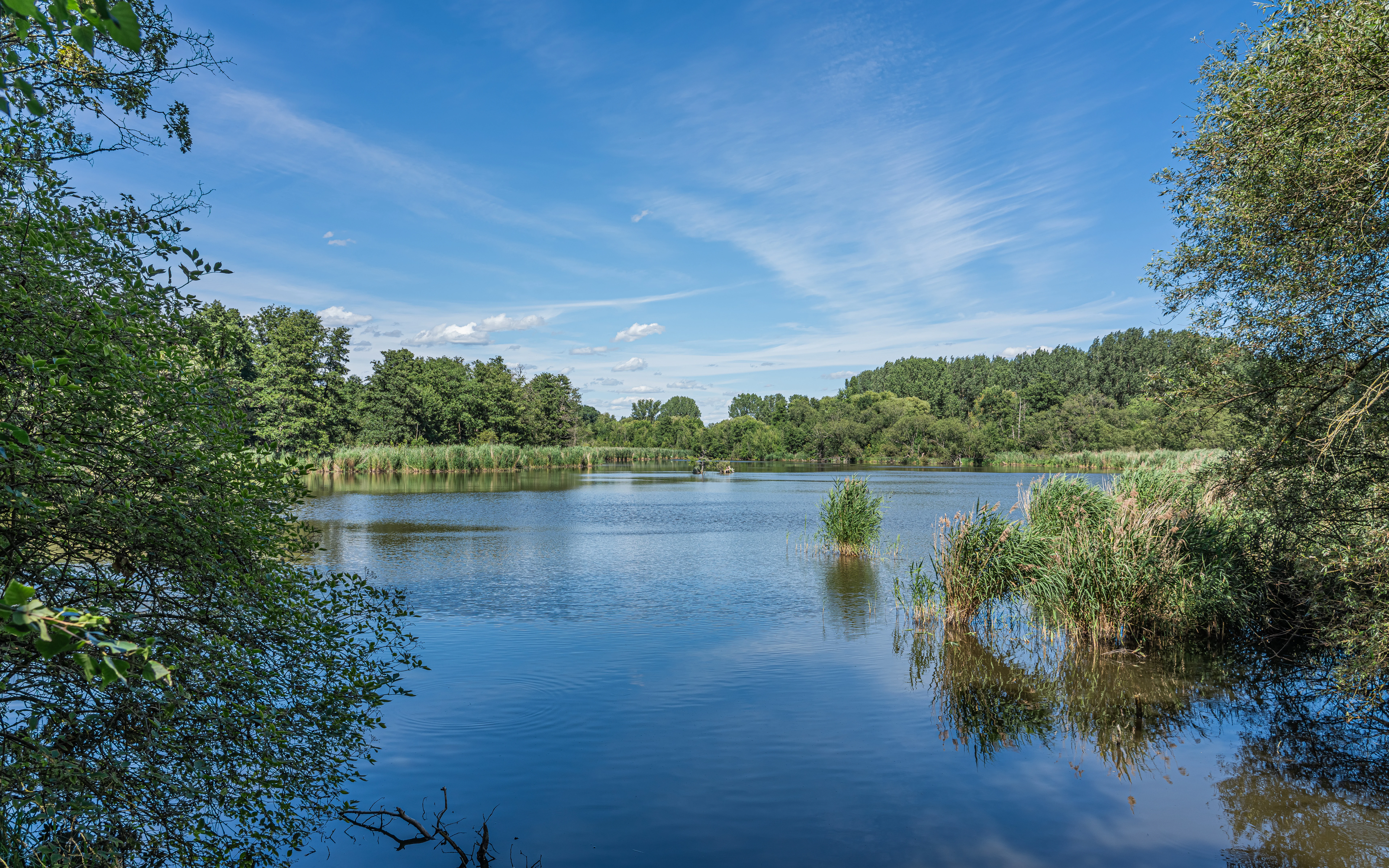
A calm pond surrounded by dense green vegetation and trees under a clear blue sky with light clouds.
A peaceful view of the Inselteich at Karower Teiche.

Karower Teiche history and protected-area timeline

The landscape of Karower Teiche originated after the last ice age, when meltwater from the Barnim plateau cut channels through glacial sands as deep as ten meters. Over time these channels silted up, forming lowland fens that were gradually shaped by human activity. In the nineteenth century the Panke and the Lietzengraben were straightened, and peat cutting began, producing the Inselteich in the northwest and the Weidenteich in the southwest.

Significant transformation came with the development of Berlin's sewage irrigation system. Between 1890 and 1898 the Berliner Rieselgüter (Berlin sewage estates) were established in nearby Blankenfelde and Buch, and the Karower area became part of the Rieselfeld irrigation landscape, with the ponds used for clarifying or directly receiving wastewater. By the 1920s pollution levels had risen so high that fish farming had to be abandoned, and in 1980 the inflow from the Lietzengraben was blocked. The resulting reliance on rainfall and groundwater caused water levels to drop, and when irrigation farming finally stopped in 1985 some ponds temporarily dried out. To save the wetlands, the Lietzengraben was dammed in 1986 so a partial flow again fed the ponds.

Bird recording began in the mid 1960s under the work of the local nature society in Pankow, and in 1984 the East Berlin administration decided to convert large parts of the former sewage fields into recreational forests, including the Karower site, ahead of Berlin's 750th anniversary celebrations. Heavy metal contamination in the soils and poor tree species selection meant most plantings failed. After reunification the focus shifted decisively toward conservation: formal nature reserve protection followed on 20 June 1994, with an additional care and development plan adopted in 1997. Since then, treated water inflow from the Schönerlinde treatment plant has improved the water balance, and the ongoing challenge of nutrient-rich sapropel sediment remains an open management issue.

Karower Teiche landscape and geographic character

Karower Teiche occupies a transitional zone between the Barnim plateau to the north and the broad Berlin glacial valley (Berliner Urstromtal) to the south. The reserve sits on late glacial sand deposits, locally up to about ten meters thick, which were incised by the Panke and Lietzengraben streams after the Weichselian glaciation. Today this geological setting produces a flat to gently undulating terrain below 60 meters in elevation, where former meltwater channels now appear as chains of ponds and fens.

The four ponds together cover roughly 14.6 hectares but are only about a meter deep on average, giving the site a strikingly open and shallow character. East of the reserve the Panke forms a natural boundary, while the south, west, and north are framed by roads and the A10 motorway embankment. Despite being fully surrounded by urban infrastructure, the reserve retains the tranquil feel of a lowland wetland landscape, with open water, reed-lined shores, scrub, and recovering woodland visible from the perimeter trail.
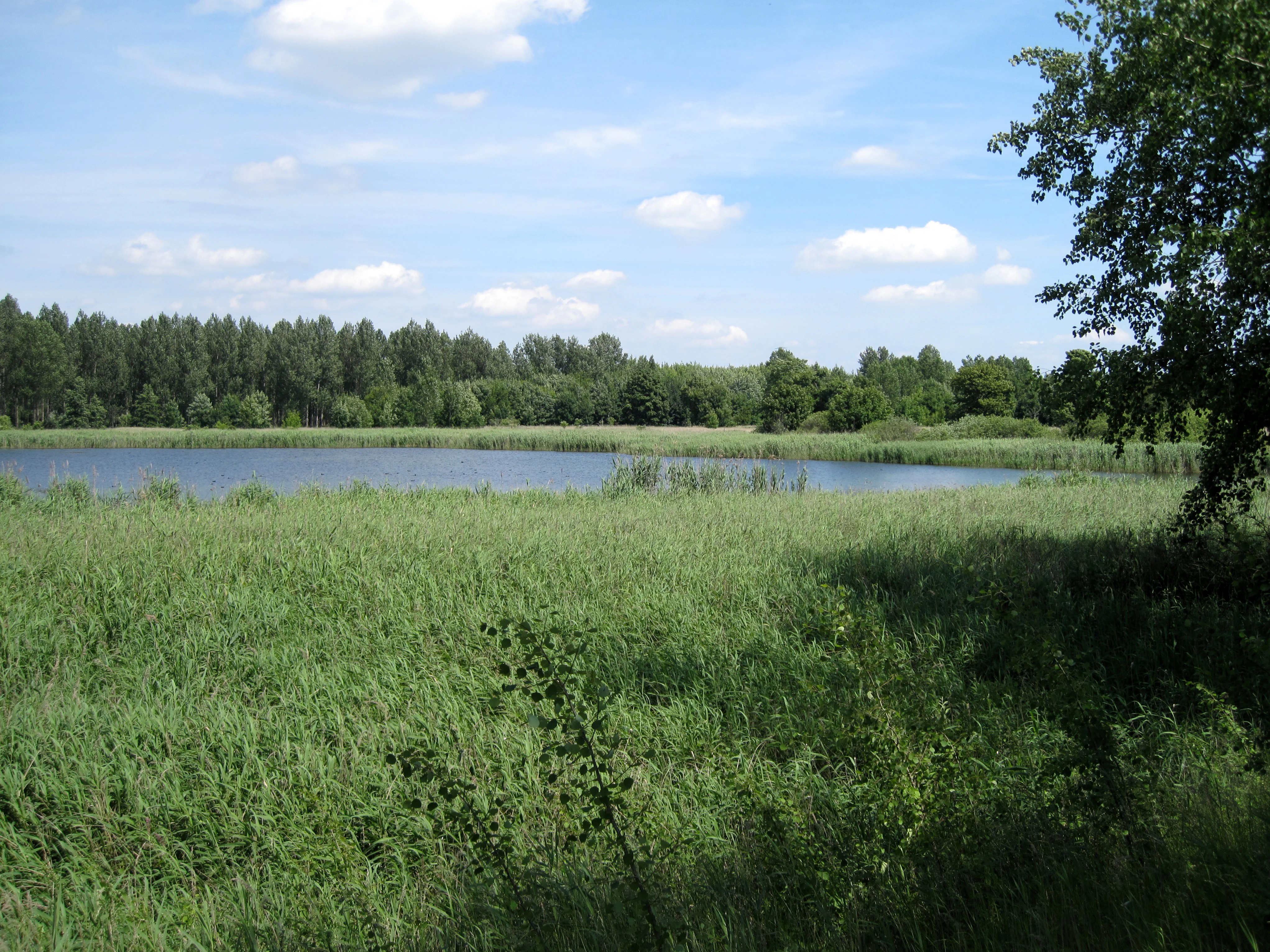
A peaceful pond surrounded by tall green reeds and a lush forest under a partly cloudy sky.
A view of the duck pond at the Karower Teiche nature reserve.

Karower Teiche ecosystems, habitats, and plant life

The ecological core of Karower Teiche is its combination of open shallow water with extensive reedbeds of broadleaf cattail, common reed, and water grass (sweet grass). These are fringed by characteristic high-stamen wet and dry communities, including hedge bindweed, common hemp agrimony, cuckoo flower, marsh marigold, marsh sow thistle, meadow sorrel, and meadow foam cress, giving the reserve considerable botanical variety.

Around the ponds and especially near the western water bodies, wet and waterlogged ground supports alder stands, gray willow scrub, and alder swamp forests, while on the formerly irrigated sewage-field parcels, semi-dry grasslands of couch grass and windhalm have developed alongside increasingly rich false oat meadows. The regeneration areas present a mosaic of small groves of native and fruit trees, hedges, tall herbs, and meadows; only north-east of the Ententeich has a cohesive woodland re-established, containing a mix of locally appropriate sessile oak and non-native ash maple and poplar hybrids. As of mid 2009, 334 wild plant species had been documented, including 44 species listed on Berlin's Red List.
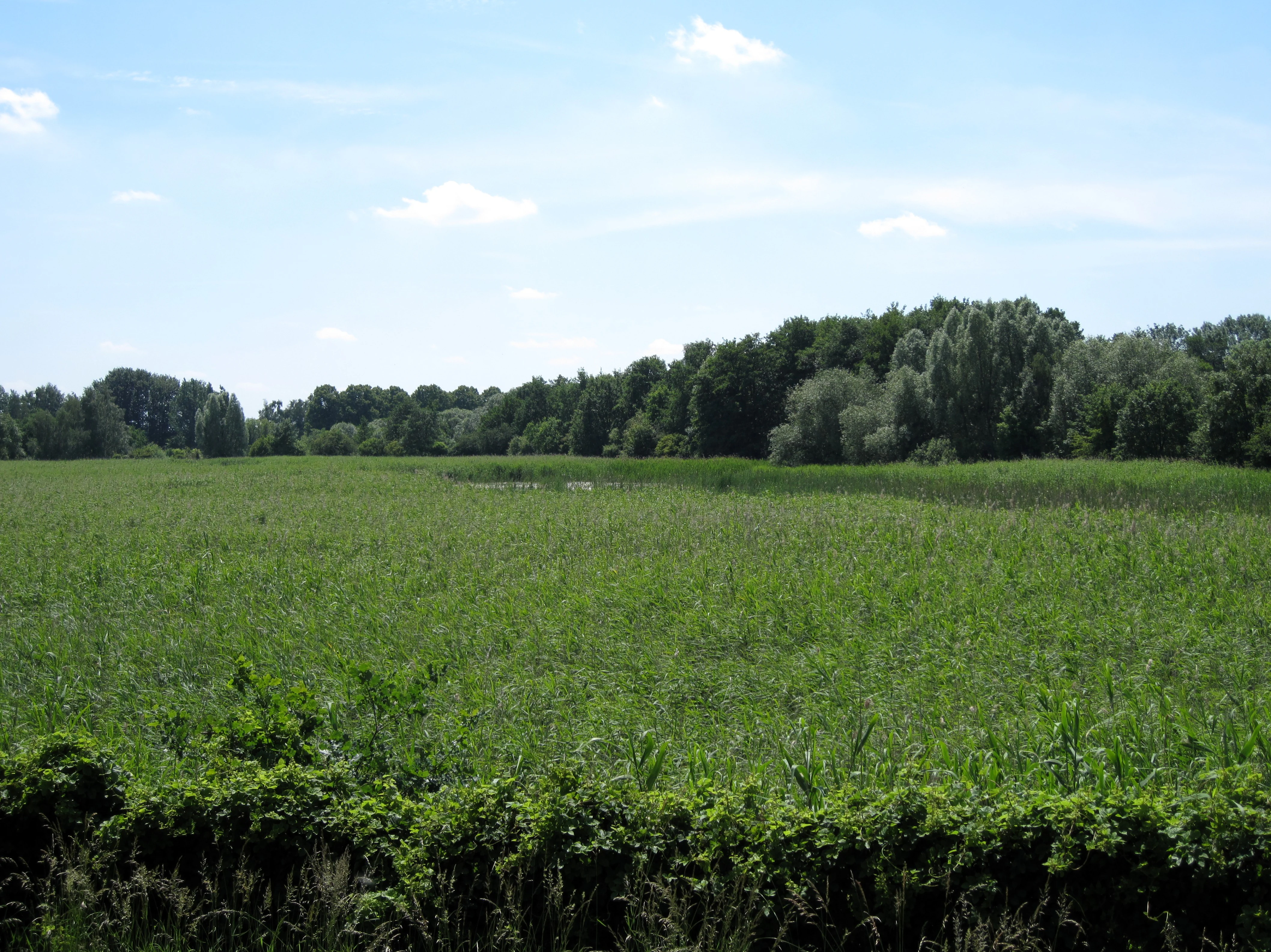
A wide view of a green, reed-filled wetland or pond landscape under a bright, partly cloudy sky, with a line of dense deciduous trees in the background.
The Schilfteich pond area within the Karower Teiche nature reserve.

Karower Teiche wildlife and species highlights

Karower Teiche is renowned for its birdlife: the reserve hosts 90 of Berlin's 151 regularly breeding bird species, including many threatened taxa. Waterbirds and reed specialists are particularly well represented, with breeding or resting populations of bearded reedling, shoveler, ferruginous duck, garganey, common pochard, greylag goose, mute swan, bittern, little bittern, reed warblers, marsh harrier, great crested grebe, red-necked grebe, little grebe, spotted crake, and water rail. Penduline tits nest in waterside trees, while thousands of swallows and starlings use the reedbeds as a late summer roost during migration. Semi-open areas host various raptors, red-backed shrikes, and barred warblers, and dry embankments along the Bucher Straße support common tree pipit, garden warbler, and golden oriole.

The ponds are equally important for amphibians, with Karower Teiche recognized as a breeding site of regional significance. Common toad (with up to 2,500 individuals during the breeding season), garlic toad, natterjack toad, common frog, moor frog (with a small population of 20 to 50 individuals), and pool frog all occur regularly, supported by toad tunnels under the Pankgrafenstraße. Reptile presence is more modest but includes regular grass snake and sand lizard sightings, the latter favored by dry slopes and blackberry scrub. The reserve also supports a rich dragonfly fauna of at least 22 recorded species, including banded demoiselle, common winter damselfly, emperor dragonfly, and migrant hawker, and the Weidenteich is the most important nursery for dragonfly larvae.
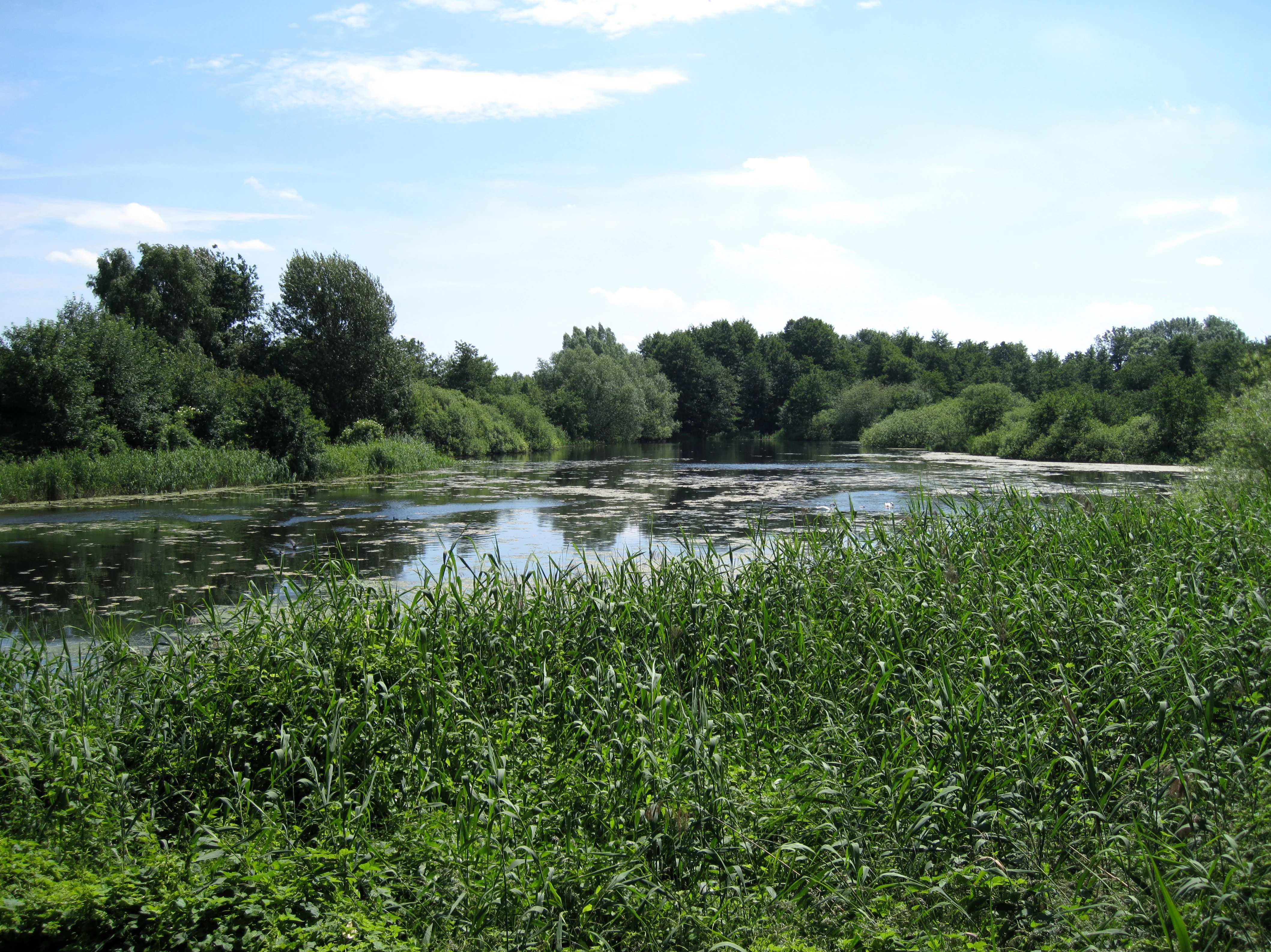
A calm pond surrounded by dense green reeds and trees under a partly cloudy blue sky.
The Weidenteich pond within the Karower Teiche nature reserve.

Karower Teiche conservation status and protection priorities

Karower Teiche holds formal protected-area status as a Berlin Naturschutzgebiet (officially designated NSG 21), classified within the IUCN framework as a Category IV Habitat and Species Management Area. Its conservation significance lies primarily in preserving a functioning wetland complex, including shallow ponds, reedbeds, and fens, within one of the most heavily built-up cities in Europe. The reserve is integral to the Naturpark Barnim and supports waterbird and amphibian populations that are increasingly rare across the surrounding region.

Management history reflects the broader European story of recovering urban industrial wetlands. Protection in 1994 followed decades of peat digging, fish farming, and sewage irrigation; subsequent restoration, including restoring stream inflow from the Lietzengraben, replanting site-native trees in buffer zones, and accepting treated wastewater from the Schönerlinde plant, has slowly improved water quality and habitat structure. Konik horses are used as part of the conservation grazing program to maintain the open character of the landscape. Despite these efforts, the reserve still faces unresolved ecological challenges, particularly the buildup of nutrient-rich sapropel sediment and the legacy contamination of soils.

Karower Teiche cultural meaning and human context

Although Karower Teiche is primarily valued as a natural refuge, its identity is closely tied to the layered cultural and industrial landscape of northeastern Berlin. The area's peat cutting, fish farming, and role within the Berliner Rieselgüter sewage irrigation system mark it as a product of more than a century of urban resource use. Surrounding localities, Französisch Buchholz to the south, Buch to the north, and the nearby Karow district, give the reserve its name and connect it to a long tradition of rural villages that were absorbed into greater Berlin through twentieth century administrative expansions.

Bird monitoring partnerships dating back to the 1960s and continued through East German conservation groups laid the foundation for the site's eventual protection and reflect a strong local civic engagement with nature. The reserve also fits into Berlin's larger network of pedestrian and cycling routes, including the Berlin–Usedom long-distance cycle path and the Barnimer Dörferweg, integrating the area into regional recreation and outdoor culture.
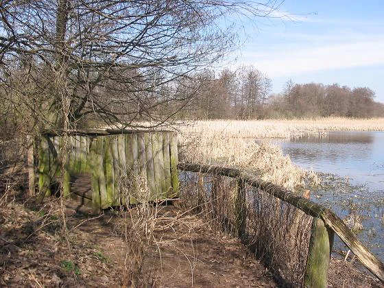
A weathered wooden wildlife observation structure sits on the bank of a pond, surrounded by bare trees, reeds, and a simple wooden fence.
A wooden observation platform at the edge of the Inselteich pond within the Karower Teiche nature reserve.

Top sights and standout views in Karower Teiche

Karower Teiche's main appeal lies in its combination of four shallow ponds surrounded by dense reedbelts and recovering wetland habitats, all within an easy walk of Berlin-Karow station. The reserve is one of the city's most important sites for waterbirds, reed-specialist birds, dragonflies, and amphibians, including large breeding populations of common toad and several rare ducks and grebes.

Quiet viewing platforms along the perimeter trail allow visitors to observe wildlife without disturbing it, while the surrounding Pankeweg and Barnimer Dörferweg trails link the reserve to the broader Naturpark Barnim landscape. The use of Konik horses for conservation grazing and the ongoing transformation of former sewage fields into biodiverse open country make Karower Teiche a striking example of urban wetland restoration.

Best time to visit Karower Teiche

Karower Teiche can be visited year-round, but the reserve is at its most lively during the warmer months. Late spring and early summer are the prime period for amphibian activity, when large numbers of common toads and other frogs move toward the breeding ponds and can sometimes be observed near the toad tunnels along the Pankgrafenstraße. Late summer brings large flocks of swallows and starlings using the reedbeds as roosting sites during migration.

Late autumn and winter deliver their own appeal, with ducks, grebes, and swans gathering on the open water and occasional sightings of black stork and great egret when water levels are low. Bird activity is generally easier to observe during the cooler months because foliage is reduced, and the open semi-open landscape offers long sightlines from the viewing platforms.

Monthly climate preview

Analysis of measured monthly temperature and precipitation patterns from 1991 to 2020

Karower Teiche Climate Normals and Long Term Temperature Records

Historical temperature and precipitation data captured at representative park coordinates reveal a distinct annual rhythm with measured monthly variations. Reviewing the complete twelve-month climatology profile provides deeper insight into long-term environmental patterns across the protected area.
Annual mean9 °C
-1 °C20 °C
Jan-1°
Feb
Mar
Apr
May14°
Jun18°
Jul20°
Aug20°
Sep15°
Oct
Nov
Dec
Warmest month
July

20.3 °C

Coolest month
January

-0.9 °C

Wettest month
July

2.4 mm/day

Driest month
April

1.1 mm/day

Park location guide

Geography guide, regional context, and park location map for Karower Teiche

Karower Teiche park geography, regions, and map view in Germany

Understand where Karower Teiche sits in Germany through a broader geographic reading of the surrounding landscape, nearby location context, and its mapped position within the national park landscape.

How Karower Teiche fits into Germany

Germany is a federal republic in Western and Central Europe with a population of over 83 million across sixteen constituent states. It is Europe's largest economy by nominal GDP and a major global exporter and importer. The capital is Berlin, and the country borders Denmark, Poland, Czech Republic, Austria, Switzerland, France, Luxembourg, Belgium, and the Netherlands.

Wider geography shaping Karower Teiche in Germany

Germany is located in Western and Central Europe, spanning 357,022 km². It borders Denmark to the north, Poland and the Czech Republic to the east, Austria and Switzerland to the south, and France, Luxembourg, Belgium, and the Netherlands to the west. The country has coastlines on the Baltic Sea and North Sea to the north, with the Alps located in the southern region.

Map view of Karower Teiche

Use this park location map to pinpoint Karower Teiche in Germany, understand its exact geographic position, and read its mapped placement within the surrounding landscape more clearly.

Pigeon | © OpenStreetMap contributors

Location context for Karower Teiche

Berlin

Explore protected area views, shallow ponds, and reedbed terrain across the reserve

Karower Teiche Photos and Landscape Scenery: Visualizing Urban Wetland Habitats

Photographic visual records illustrate the shallow ponds, dense reedbeds, and wet meadows that define the protected landscape character of Karower Teiche. Reviewing these field images helps observers understand local terrain transitions, waterbird habitats, and the visual environment of the urban nature reserve.

A calm pond surrounded by dense green vegetation and trees under a clear blue sky with light clouds.

Three tan Konik horses in a grassy field with trees in the background, one drinking from a large metal trough.

A peaceful pond surrounded by tall green reeds and a lush forest under a partly cloudy sky.

A wide view of a green, reed-filled wetland or pond landscape under a bright, partly cloudy sky, with a line of dense deciduous trees in the background.

A calm pond surrounded by dense green reeds and trees under a partly cloudy blue sky.

A narrow dirt trail follows a grassy bank next to a small, tree-lined river segment, under bright daylight.

A weathered wooden wildlife observation structure sits on the bank of a pond, surrounded by bare trees, reeds, and a simple wooden fence.

Park atlas

Compare regional wetland habitats and connected conservation landscapes

Explore Other Parks Near Karower Teiche and Surrounding Protected Areas

Visitors exploring Karower Teiche can continue browsing adjacent nature reserves and regional wetland habitats across the surrounding landscape. Comparing nearby protected areas reveals wider patterns in local lowland geography and urban biodiversity preservation.
Watercolor illustration showing a soft landscape with a pond, marsh vegetation, and a background of rolling hills or meadows.
Nature reserveBerlin
About 3.8 km away#1 closest

Northeast

Mittelbruch Nature Reserve: Mapped Wetland Geography and Protected Landscape in Berlin

Examining lowland peat diggings and protected moorland ecosystems

Mittelbruch stands as a compact nature reserve in northeastern Berlin, featuring a layered landscape of former peat diggings and open moor meadows. This area plays a critical role in urban conservation by providing essential refuge for waterbirds and diverse meadow flora. Utilize the atlas to study the reserve's internal geography, including its managed reed belts and surrounding forest edges that form a distinct ecological mosaic within the city landscape.

Area
0.282 km²
Established
1997
IUCN
IV
Relief
Lowland
A horizontal watercolor illustration of a wetland scene with soft pink and green tones, showing sparse trees on the banks of a shallow, marshy water area under a pale sky.
Nature reserveBrandenburg
About 4.6 km away#2 closest

Northeast

Ausstichgelände Röntgental: Brandenburg Nature Reserve and Protected Wetland Atlas

Mapped ecological landscapes on the Berlin metropolitan fringe

Investigate the detailed geography of Ausstichgelände Röntgental, a compact nature reserve in Brandenburg. Formed from nineteenth-century railway sand quarries, this protected area features a diverse mosaic of reed beds, open water, and alder carr forest. The site provides a compelling case study of post-industrial ecological recovery within the broader Barnim Nature Park landscape.

Area
0.248 km²
Established
1990
IUCN
IV
Watercolor painting of a peaceful wetland landscape with lush green trees, reeds, and soft hills in the background under a light sky.
Nature reserveBerlin
About 5 km away#3 closest

Southeast

Malchower Aue Nature Reserve: A Detailed Atlas of Urban Protected Landscapes in Berlin

Wetland habitats and glacial terrain within the Berlin city limits.

Malchower Aue stands as a protected enclave of wetland diversity featuring a system of reed-fringed peat-cutting ponds, wet meadows, and rare dry-grassland vegetation on historical soil mounds. This site provides a vital geographic perspective on how post-glacial relief and human land-use history shape protected areas within the modern urban landscape of Berlin.

Area
0.222 km²
Established
1995
Relief
Lowland
Climate
Temperate
A soft watercolor painting featuring green grasses in the foreground, calm water, and a tree line along the horizon.
Nature reserveBrandenburg
About 5.1 km away#4 closest

Northwest

Schönerlinder Teiche Nature Reserve in Brandenburg: Protected Landscape and Geographic Atlas

Explore the wetland mosaic, bird-rich ponds, and grazing conservation areas

Schönerlinder Teiche offers a rare look at post-agricultural land transformation, featuring ponds, meadows, and reed habitats in the Brandenburg region. This nature reserve serves as an essential bird sanctuary and educational site, with water buffalo and Konik horses contributing to ongoing habitat maintenance. View the detailed geography of this protected area and its role within the wider Barnim Nature Park network.

Area
0.408 km²
Established
1997
IUCN
IV
Relief
Lowland
A horizontal watercolor illustration showing a pinkish-purple foreground of heathland vegetation transitioning into a line of light green trees against a pale, washed-out hilly background.
Nature reserveBrandenburg
About 6.8 km away#5 closest

Northeast

Schönower Heide Nature Reserve: An Atlas View of Brandenburg Protected Heathlands

A restored landscape of glacial dunes and sandy heath

Schönower Heide stands as a significant nature reserve in Brandenburg, Germany. The area protects a unique combination of open sand heath, pine woodland, and wetland meadows formed on post-glacial outwash plains. This protected landscape is recognized for its successful transition from former military terrain into a vibrant habitat for diverse flora and fauna, including managed populations of red deer and mouflon within its fenced boundaries.

Area
5.334 km²
Established
2000
IUCN
V
Relief
Lowland
A watercolor painting of a flat, marshy landscape with soft green trees in the midground and pale hills under a light sky in the background.
Nature reserveBerlin
About 6.9 km away#6 closest

Southeast

Falkenberger Rieselfelder Nature Reserve: A Detailed Atlas of Berlin Protected Lands

Reclaimed wetland geography and urban conservation habitats

Falkenberger Rieselfelder acts as an ecologically rich refuge where former industrial irrigation fields have been repurposed into a mosaic of seasonal pools and meadows. Located on the urban fringe of Berlin, this nature reserve offers a unique look at how conservation grazing and habitat management support species like the great crested newt within a dense metropolitan region.

Area
0.881 km²
Established
1995
IUCN
IV
Relief
Lowland
A watercolor illustration of a rural landscape with low hills, trees, and grassy meadow areas.
Nature reserveBrandenburg
About 7.2 km away#7 closest

Northeast

Faule Wiesen bei Bernau Nature Reserve: Mapped Landscapes and Geography of Brandenburg

A vital Panke river corridor protecting rare meadow and woodland biomes.

Spanning 37 hectares near the northern edge of Berlin, Faule Wiesen bei Bernau offers a study in contrasting landscapes. The reserve features open wet meadows and small ponds alongside sandy dry grasslands and oak woodlands. It remains an essential ecological link within the Barnim district, preserving critical habitats for amphibians and orchids within the broader Brandenburg geography.

Area
0.37 km²
Established
2000
Relief
Lowland
Scope
Terrestrial
Watercolor painting of bare trees in a misty, marshy landscape with soft pastel colors.
Nature reserveBrandenburg
About 8.2 km away#8 closest

West

Kindelsee-Springluch Nature Reserve: A Detailed Geographic Atlas of Brandenburg Wetlands

Restored post-glacial lake and wetland landscape in East Brandenburg

Located in the state of Brandenburg, Kindelsee-Springluch represents a refined example of a protected wetland mosaic. The reserve encompasses the Kindelsee lake, sediment-filled meltwater channels, and diverse swamp forests. This site provides a critical window into regional post-glacial geography, featuring a well-defined sequence of mire, sedge meadows, and mixed oak woodlands that have undergone extensive ecological restoration.

Area
0.69 km²
Established
2001
IUCN
IV

Common questions about visiting, size, designation, and location context for Karower Teiche

Karower Teiche FAQs for park facts, access, geography, and protected area context

Find quick answers about Karower Teiche, including protected-area facts, park geography, trail and visitor context, and how the park fits into its surrounding country and regional landscape.
MoriAtlas Explorer

Continue Your Protected Areas Search Across the Global Atlas

Deepen your exploration by continuing the structured search for national parks and protected areas worldwide. Utilize the comprehensive filtering capabilities to compare different conservation landscapes and refine your understanding of global park geography. Discover more about the distribution and characteristics of protected natural areas.

Global natural geography