
Mori Atlas logo
Nature reserveStintgraben

Understanding the mapped boundaries and glacial landscape context of this Dahme-Spreewald reserve.

Stintgraben Nature Reserve: A Protected Stream and Wetland Corridor in Brandenburg, Germany

(Naturschutzgebiet Stintgraben)

Stintgraben serves as a critical nature reserve within the state of Brandenburg, protecting a vital lowland stream corridor that connects the Klein Köriser See with the Dahme river. This 109 hectare protected area illustrates the characteristic glacial topography of southern Germany, where small watercourses and forested ridges form essential transitional habitats. By examining the mapped boundaries and terrain, visitors can trace the ecological connectivity of this Dahme-Heideseen managed landscape.

wetlandsriparian habitatlowland streammixed forestlake marginbirdwatching
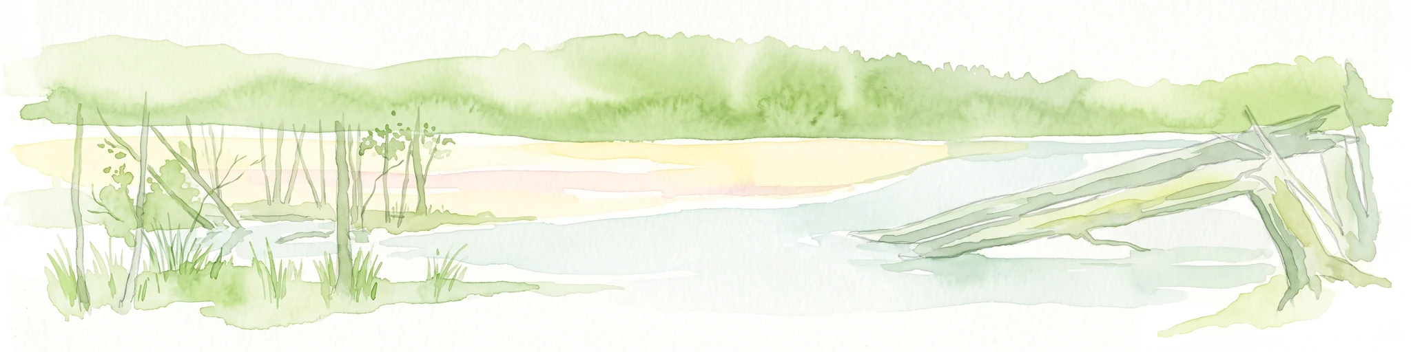
A graphic illustration of a sunny meadow surrounded by birch trees with a colorful sunset sky in the background.

Stintgraben

Nature reserve

Park overview

Structured park overview, official facts, and landscape profile for Stintgraben

Stintgraben park facts, protected area profile, and essential visitor context

Review the core facts for Stintgraben, including designation, size, terrain, visitor scale, habitats, and operating context in one park-focused overview.

About Stintgraben

Stintgraben is a designated nature reserve, or Naturschutzgebiet, in the German state of Brandenburg. Although small, it plays a defined role within the regional conservation framework of the Dahme-Spreewald district, where numerous reserves work together to protect characteristic lowland habitats of eastern Germany.

Geographically, the reserve lies northeast of Löpten, a village that forms part of the municipality of Groß Köris. Its territory stretches along the Stintgraben, a small watercourse that ultimately drains toward the Klein Köriser See. To the northwest, the boundary of the reserve is close to that lake, while to the east the Dahme river runs broadly parallel to the protected area, connecting Stintgraben to the larger Spree river system downstream.

The landscape around the reserve reflects the post-glacial character of southern Brandenburg, with sandy soils, mixed pine and broadleaf forest, scattered glacial lakes, and gently meandering lowland streams. Roads bound the area in several directions: federal route B 179 runs along parts of the northeastern and southeastern edge, while state road L 742 crosses the northern part of the reserve. Despite these transport corridors, the core of the protected landscape remains a quiet habitat mosaic dominated by watercourses, riparian vegetation, and adjacent woodland.

Established in 1995, Stintgraben continues to serve as a habitat and species management area under both German nature protection law and the international IUCN framework. Its value lies less in visibility and more in the ecological function it performs as part of a wider lake-and-stream landscape within the Naturpark Dahme-Heideseen.

Quick facts and research context for Stintgraben

Stintgraben lies in Brandenburg, Germany, within the Landkreis Dahme-Spreewald and is part of the municipality of Groß Köris. It is administratively integrated into the Naturpark Dahme-Heideseen, a regional nature park that links many smaller protected sites across the area.

The reserve was designated on 28 June 1995 and carries the official nature reserve identification number 1130. Its footprint is around 109 hectares, and it follows the Stintgraben stream as it moves between the Klein Köriser See to the northwest and the Dahme river to the east. In international databases it is recorded with WDPA ID 165742 and is classified as an IUCN Category IV area, indicating a habitat and species management focus.

Protection and recognition

Examining documented designation history and administrative records

Stintgraben Protection Status and International Recognition Records

Stintgraben holds verified protection data alongside recorded Natura 2000 framework designations. Official records catalog international recognition sources, management scope, and administrative classification for this protected natural area.
Park context

Deeper park guide and search-rich context for Stintgraben

Stintgraben history, landscape, wildlife, and travel context

Explore Stintgraben through its history, landscape character, ecosystems, wildlife, conservation priorities, cultural context, and seasonal travel timing in a structured park guide built for atlas discovery and search intent.

Why Stintgraben stands out

Stintgraben is best known for protecting a lowland stream corridor in southern Brandenburg, where the small Stintgraben waterway connects lake, forest, and river landscapes. The reserve is valued for the wetland and riparian habitats along this drainage, rather than for dramatic scenery or large charismatic species. Its setting between the Klein Köriser See and the upper Dahme river gives it an important role as a transitional habitat in a region shaped by glacial lakes, mixed forests, and slow-moving lowland rivers. Within the Dahme-Spreewald district, Stintgraben represents the kind of modest but ecologically meaningful stream-side reserve that contributes to the wider network of protected areas in the Naturpark Dahme-Heideseen.
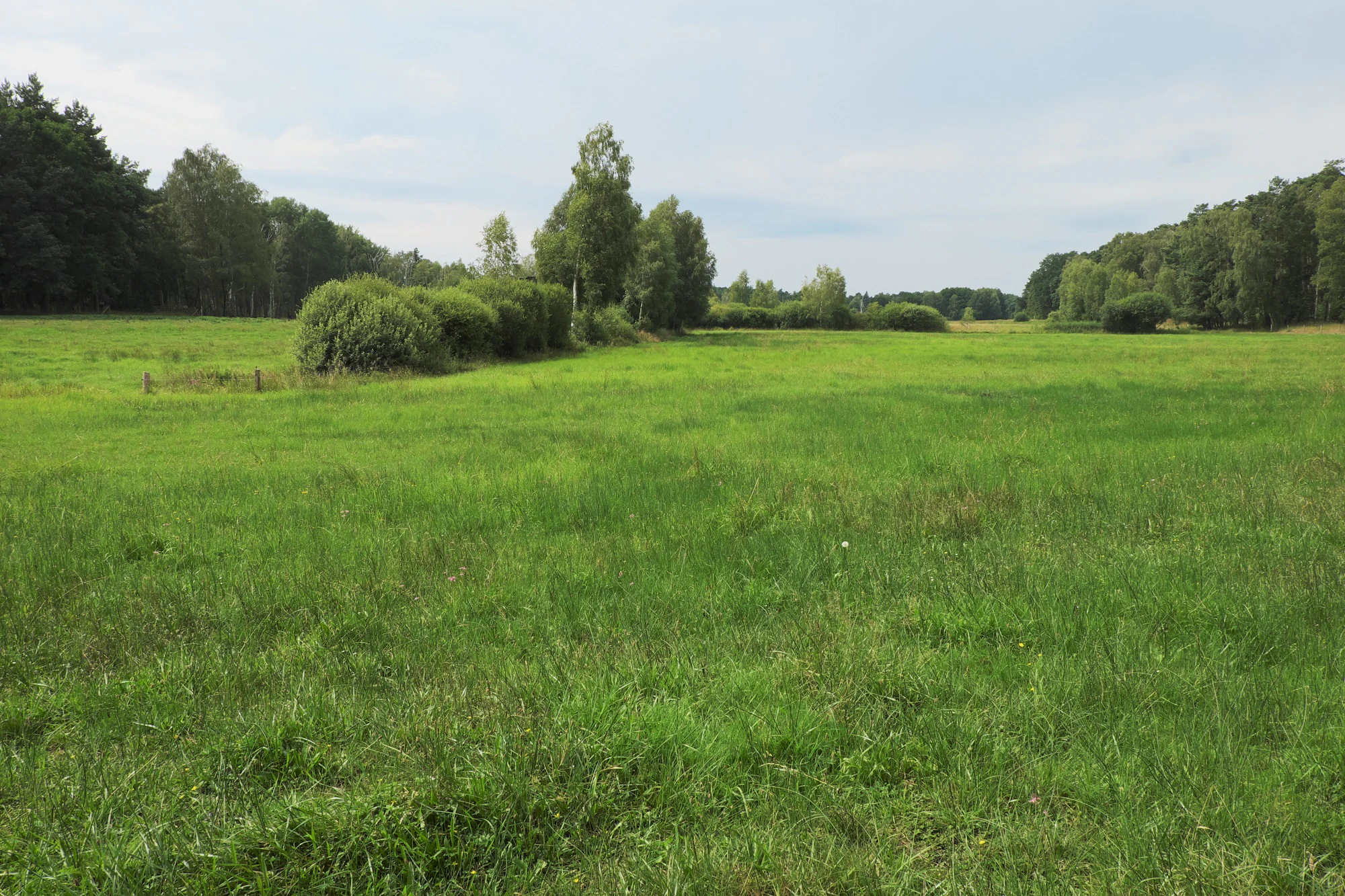
A wide, grassy meadow stretches across the foreground, leading to a line of trees and bushes in the midground, with a light blue, cloudy sky above.
A wide view of the green meadows and surrounding forest borders within the Stintgraben nature reserve.

Stintgraben history and protected-area timeline

Stintgraben was placed under formal nature protection on 28 June 1995 through a dedicated ordinance issued under Brandenburg conservation law. The designation gave the area the official nature reserve number 1130 and established it as a protected site within the administrative framework of the Landkreis Dahme-Spreewald.

The reserve was created at a time when Brandenburg, having recently been reconstituted as a German state after reunification, was actively building up its network of nature reserves. Many of the protected sites still in force there today were established during this period, when the state sought to formalise protection for ecologically valuable habitats shaped by glacial history, lowland rivers, and former agricultural use.

In the years since its designation, Stintgraben has continued to be administered as part of the Naturpark Dahme-Heideseen, and it is recognised in international databases such as the World Database on Protected Areas. Its history is therefore one of administrative recognition of an already ecologically meaningful lowland landscape rather than of dramatic transformation through restoration efforts.

Stintgraben landscape and geographic character

The landscape of Stintgraben is a typical example of the lowland scenery of southern Brandenburg, shaped by the glacial processes that left behind the lakes, sandy ridges, and broad wetland corridors of the region. The protected area follows the course of the Stintgraben, a small, slow-moving watercourse that gives the reserve its name and forms the central feature of the terrain.

To the northwest, the Klein Köriser See forms a substantial lake margin, with the reserve's boundary drawing close to its shore. To the east, the broader Dahme valley runs past the site; the Dahme is a tributary of the Spree and contributes to the wider drainage pattern of the region. Between these two water bodies, the reserve occupies a transitional zone where small watercourses, damp depressions, and forested higher ground alternate.

The terrain is generally flat to very gently undulating, reflecting the flat depositional plains of the Brandenburg landscape. Sandy soils and glacial deposits dominate, and vegetation patterns shift between riparian woodland along the streams, more open wetland margins near the lakes, and mixed forest on slightly higher ground. Human infrastructure is present but limited: federal route B 179 borders parts of the area, and state road L 742 crosses its northern section, yet much of the reserve retains a quiet, fragmented natural character typical of the Dahme-Heideseen region.

Stintgraben ecosystems, habitats, and plant life

Ecologically, Stintgraben belongs to the network of lowland habitats that define the Dahme-Heideseen Nature Park. Its nature is strongly tied to the stream corridor it protects, as well as to the transition zones between still water, flowing water, wet ground, and forest. This small-scale mosaic makes the reserve more ecologically interesting than its modest size might suggest.

Riparian vegetation along the Stintgraben forms the heart of the reserve, with moisture-loving plants colonising the stream banks and the damp zones that border it. Where the watercourse approaches the lake and the broader floodplain influences of the Dahme, wetland species become more prominent. Slightly drier areas support mixed forest typical of the Brandenburg lowlands, often dominated by pine alongside birch and other broadleaf species.

The reserve's designation as an IUCN Category IV Habitat/Species Management Area reflects this ecological profile. Category IV status is given to areas where the primary aim is to maintain, restore, or develop particular habitats or species, which matches Stintgraben's role in protecting a defined stream and its associated habitat complex rather than an entire ecosystem.

Stintgraben wildlife and species highlights

Stintgraben's wildlife patterns are shaped by its mosaic of stream, wetland margin, lake-edge, and forest habitats. While the reserve is not known for large, high-profile mammals, it provides conditions suitable for the typical species associated with lowland Brandenburg waterscapes and mixed forest corridors.

The watercourses and lake margins create habitat for fish, amphibians, and aquatic invertebrates, while the riparian and wet forest bands offer shelter for small mammals and breeding sites for a range of bird species typical of lowland Brandenburg. The mixed forest on drier ground provides additional habitat structure and supports woodland birdlife, contributing to the broader biodiversity network of the Naturpark Dahme-Heideseen.

Rather than being associated with rare flagship species, Stintgraben's wildlife value is best understood in terms of habitat connectivity. As a small protected site between the Klein Köriser See and the Dahme river system, it contributes to the continuity of natural habitat across the region, allowing species to move and ecological processes to function across a wider landscape.

Stintgraben conservation status and protection priorities

Stintgraben was specifically designated to protect the ecological character of the Stintgraben stream and its surrounding habitat mosaic. Since its establishment in 1995, it has functioned as a habitat and species management area, with conservation actions aimed at preserving the existing lowland habitats rather than undertaking large-scale landscape transformation.

Its location between the Klein Köriser See and the Dahme river gives Stintgraben a broader conservation relevance beyond its own boundaries. By safeguarding a small but ecologically important segment of the regional drainage network, the reserve contributes to the integrity of the larger Dahme-Spreewald lake and river system, which is itself protected through the umbrella of the Naturpark Dahme-Heideseen.

At the international level, Stintgraben is recorded in the World Database on Protected Areas with WDPA ID 165742 and is classified under IUCN Category IV. This classification places it among areas that are actively managed to maintain particular habitats and species, fitting its role as a small but targeted reserve within a much larger regional conservation network.

Stintgraben cultural meaning and human context

Stintgraben does not have a strong, distinct cultural narrative of its own, and its identity is primarily natural rather than cultural. The landscape in which it sits, however, is part of a region with a long history of lowland rural settlement, fishing, forestry, and small-scale agriculture associated with the villages of the Dahme-Spreewald area.

The municipality of Groß Köris and its constituent village of Löpten represent the typical dispersed settlement pattern of southern Brandenburg, where small communities are set among forests and lakes. The proximity of the reserve to the Dahme river and to lake systems historically used for transport, fishing, and local resource extraction gives the wider region a cultural context rooted in the interplay between human communities and water.

Within the reserve itself, cultural activity is minimal, and the primary land uses in the surrounding area remain those of forestry, some agriculture, and recreation. The reserve's own cultural value lies mainly in its existence as a formally recognised piece of regional natural heritage rather than in any specific cultural site or tradition.

Top sights and standout views in Stintgraben

Stintgraben offers a compact lowland experience defined by its stream corridor, its location between a glacial lake and a major Brandenburg river, and its administrative role within the Dahme-Heideseen Nature Park. Its strongest points of interest are the riparian and wetland habitats along the Stintgraben, the quiet mixed forest that fringes the watercourse, and the broader setting of the Dahme-Spreewald lake landscape.

For visitors interested in protected areas of Brandenburg, Stintgraben is most meaningful as one of many small reserves that collectively shape the regional conservation framework. Its position along the connecting line between the Klein Köriser See and the Dahme river gives it a quiet but clear sense of place in the geography of southern Brandenburg.

Best time to visit Stintgraben

Stintgraben is a lowland reserve without dramatic seasonal extremes, so it can be visited across much of the year. Spring and early summer are often the most rewarding seasons, when wetland vegetation along the Stintgraben is fully developed and water levels tend to be favourable for observing stream-side habitats and associated birdlife.

Late spring through summer also brings the full development of riparian plant communities, making the green corridor along the stream particularly visible. Autumn highlights the mixed forest on slightly drier ground, with seasonal colour change in the broadleaf component of the woodland.

Winter visits are possible, though some surrounding rural roads may be less actively used and conditions can be quieter; the bare season can make it easier to see the structure of the stream corridor and the surrounding landscape, though it is generally less rewarding for wildlife observation.

Monthly climate preview

Long term average temperature and monthly precipitation patterns for Brandenburg

Stintgraben Climate Normals and Annual Weather by Month Profile

Stintgraben records measured temperature extremes and precipitation rates across twelve distinct intervals based on historical coordinates at sixty eight meters elevation. Examining the complete monthly climate normals reveals full baseline variations in seasonal weather rhythms.
Annual mean10 °C
-1 °C21 °C
Jan-1°
Feb
Mar
Apr
May14°
Jun18°
Jul21°
Aug20°
Sep15°
Oct
Nov
Dec
Warmest month
July

20.6 °C

Coolest month
January

-0.8 °C

Wettest month
July

2.5 mm/day

Driest month
April

1.1 mm/day

Park location guide

Geography guide, regional context, and park location map for Stintgraben

Stintgraben park geography, regions, and map view in Germany

Understand where Stintgraben sits in Germany through a broader geographic reading of the surrounding landscape, nearby location context, and its mapped position within the national park landscape.

How Stintgraben fits into Germany

Germany is a federal republic in Western and Central Europe with a population of over 83 million across sixteen constituent states. It is Europe's largest economy by nominal GDP and a major global exporter and importer. The capital is Berlin, and the country borders Denmark, Poland, Czech Republic, Austria, Switzerland, France, Luxembourg, Belgium, and the Netherlands.

Wider geography shaping Stintgraben in Germany

Germany is located in Western and Central Europe, spanning 357,022 km². It borders Denmark to the north, Poland and the Czech Republic to the east, Austria and Switzerland to the south, and France, Luxembourg, Belgium, and the Netherlands to the west. The country has coastlines on the Baltic Sea and North Sea to the north, with the Alps located in the southern region.

Map view of Stintgraben

Use this park location map to pinpoint Stintgraben in Germany, understand its exact geographic position, and read its mapped placement within the surrounding landscape more clearly.

Pigeon | © OpenStreetMap contributors

Location context for Stintgraben

Brandenburg

Explore photographic records of stream corridors, glacial lake margins, and riparian habitats.

Stintgraben Photos and Protected Area Scenery: Visualizing Brandenburg Lowland Landscapes

Visual documentation captures the flat lowland terrain, sandy ridges, and wetland vegetation defining the protected stream corridor. Detailed imagery reveals how glacial geology shapes the mixed forests and transitional waterways characteristic of the regional nature park.

A wide, grassy meadow stretches across the foreground, leading to a line of trees and bushes in the midground, with a light blue, cloudy sky above.

Park atlas

Compare regional wetland reserves and connected glacial waterways across southern Brandenburg.

Exploring Parks Near Stintgraben and Surrounding Protected Landscapes

Continue browsing other parks near Stintgraben to examine similar lowland stream corridors and protected wetland habitats. Expanding the geographic comparison reveals the broader network of regional nature reserves embedded within the surrounding Brandenburg lake landscape.
Nature reserveBrandenburg
1.7 km away#1 closest

North

Katzenberge Nature Reserve: An Atlas of Glacial Moraine Woodlands in Brandenburg Germany

Protected oak forest habitats within the Dahme-Spreewald landscape

Katzenberge offers a focused look at the conservation of mature deciduous forest environments on sandy moraine soils. As a designated nature reserve within the Brandenburg region, the area serves as a primary reference point for studying habitat continuity and the unique glacial terrain that defines the south-eastern lowlands near the Dahme river.

Area
1.44 km²
Established
2004
IUCN
IV
Relief
Upland
Nature reserveBrandenburg
1.9 km away#2 closest

West

Naturschutzgebiet Löptener Fenne, Wustrickwiesen: Mapped Geography and Protected Landscapes

Glacial mire and wetland systems in Brandenburg, Germany

The Naturschutzgebiet Löptener Fenne, Wustrickwiesen nature reserve provides a critical look at terrestrialized mire landscapes. Beneath its surface lie deep layers of lake-derived mud, marking this site as a key reference for understanding glacial meltwater history in eastern Germany. Today, the area serves as a focal point for active peatland renaturation and habitat management within the Dahme-Spreewald district.

Area
2.18 km²
Established
1998
IUCN
IV
Relief
Lowland
Nature reserveBrandenburg
About 3.7 km away#3 closest

Northeast

Streganzsee-Dahme Nature Reserve: Mapping Brandenburg Protected River Landscapes and Dunes

An ecological mosaic in the Dahme-Spreewald river corridor

Streganzsee-Dahme represents an intact Brandenburg riverine corridor characterized by sharply varied topography. The reserve encompasses water bodies, floodplain forests, fens, and dry sandland heaths. Its protected boundaries connect various biotopes, offering an essential look at the region's diverse lowland ecology and the structured geography of the local conservation network.

Area
4.36 km²
Established
1999
IUCN
IV
Relief
Lowland
Nature reserveBrandenburg
6.8 km away#4 closest

West

Töpchiner Seen Nature Reserve: Geographic Overview of Brandenburg Protected Landscapes

A glacial landscape mosaic of lakes, fens, and woodlands

Located in the Dahme-Spreewald district, Töpchiner Seen is a vital nature reserve showcasing deep peat deposits and diverse wetland vegetation. The protected area features a layered terrain, where open water connects to transition mires, calcareous meadows, and mature oak and pine forests, providing a stable habitat for specialized flora and fauna within the broader Brandenburg geography.

Area
3.75 km²
Established
1988
Nature reserveBrandenburg
7.6 km away#5 closest

North

Dolgensee Nature Reserve: Mapped Protected Landscapes and Wetland Geography in Brandenburg, Germany

Protected lake basin, reedbeds, and inland dune grassland

Located in the Brandenburg state of Germany, Dolgensee Nature Reserve offers a rare mosaic of wetland and dry grassland habitats. The site centers on a nutrient-rich lake basin featuring extensive reedbeds and alder swamp, which transitions into open inland dune ecosystems. This protected area represents a significant example of natural lake basin preservation within the larger Dahme-Heideseen landscape, providing a crucial habitat for various waterbird and aquatic wildlife species.

Area
3.085 km²
Established
1995
IUCN
IV
Relief
Lowland
A wide panoramic watercolor illustration showing a lake landscape with green trees and a soft pink and yellow sky.
Nature reserveBrandenburg
8.6 km away#6 closest

Southwest

Briesensee und Klingeberg Nature Reserve: Mapped Landscapes and Glacial Terrain in Brandenburg

Protected glacial lakes and old-growth forest geography

Situated in the Dahme-Spreewald district, Briesensee und Klingeberg stands as a testament to Brandenburg's glacial past. The reserve protects complex aquatic and forest ecosystems, including genetically documented pine stands over 220 years old and the active Klingespring seepage site. Learn about the interaction between sandy moraine ridges and water-retaining depressions that sustain these rare mire and spring habitats within the German Natura 2000 network.

Area
0.799 km²
Established
2002
IUCN
IV
Nature reserveBrandenburg
9.5 km away#7 closest

Northeast

Groß Schauener Seenkette Nature Reserve: Mapped Wetlands and Brandenburg Lake Geography

An undisturbed chain of shallow lakes and protected fen landscapes

This protected nature reserve in Brandenburg preserves a vital chain of six interconnected lakes. The geography is defined by extensive reedbeds, sedge stands, and rare inland saline meadows, providing a crucial habitat mosaic. Learn how these wetlands connect to the surrounding Dahme-Heideseen region through a network of terrain-focused conservation areas and historic trails.

Area
21.249 km²
Established
2000
Relief
Lowland
Climate
Temperate
A horizontal watercolor painting showing a soft, fading line of forest trees, including conifers and yellow-leaved deciduous trees against a plain white background.
Nature reserveBrandenburg
11 km away#8 closest

West

Kleine und Mittelleber Nature Reserve: Brandenburg Wetland and Mire Landscape Mapping

Ecological terrain analysis of a protected post-glacial site

Kleine und Mittelleber is a significant nature reserve in Brandenburg that preserves a rare sequence of silted-up lake basins and active peat-forming bogs. The area provides a detailed window into the interplay of transitional mire systems, floating mat bogs, and pine-fringed woodlands. Through its status as a European FFH site, it serves as a vital case study for the conservation of wetland habitats and the restoration of natural hydrological processes in post-industrial forest landscapes.

Area
0.665 km²
Established
1995

Common questions about visiting, size, designation, and location context for Stintgraben

Stintgraben FAQs for park facts, access, geography, and protected area context

Find quick answers about Stintgraben, including protected-area facts, park geography, trail and visitor context, and how the park fits into its surrounding country and regional landscape.
MoriAtlas Explorer

Continue Your Protected Areas Search Across the Global Atlas

Deepen your exploration by continuing the structured search for national parks and protected areas worldwide. Utilize the comprehensive filtering capabilities to compare different conservation landscapes and refine your understanding of global park geography. Discover more about the distribution and characteristics of protected natural areas.

Global natural geography