
Why Szczebrzeszyn Landscape Park stands out
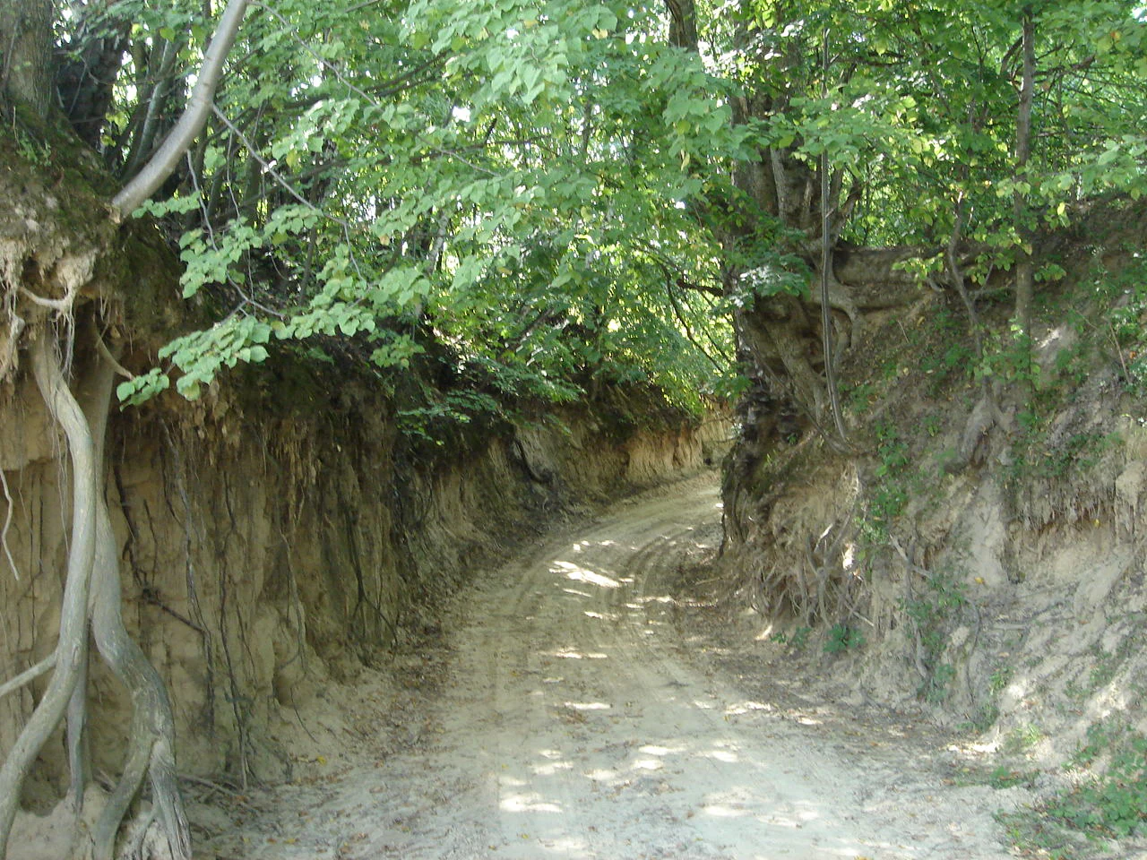
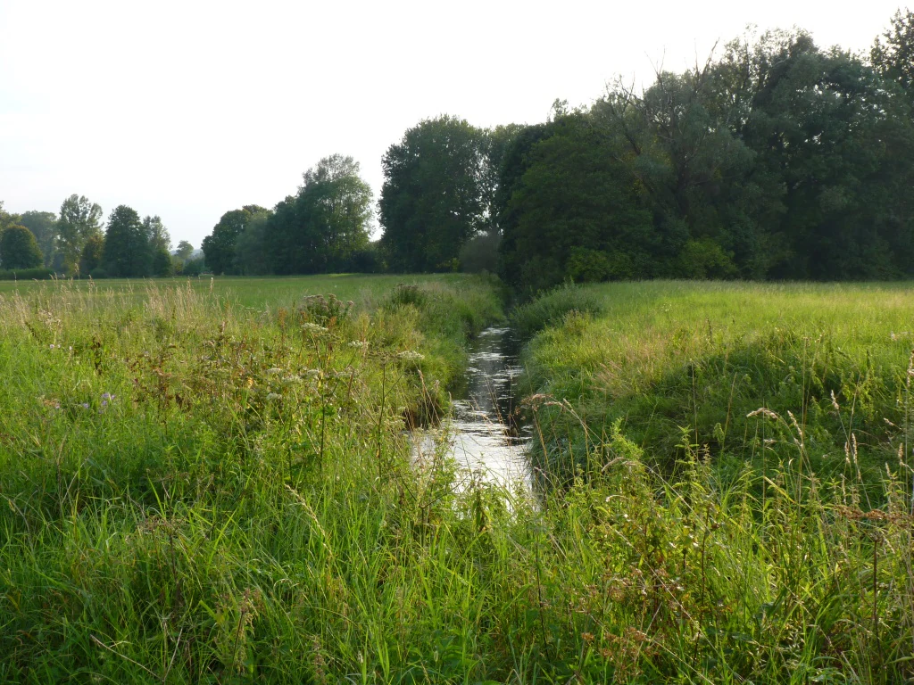
The park is most recognized for its dense network of loess gullies, including the Piekiełko nature locality, and for the combination of Carpathian beech forests, fir-dominated forests, and raised peat bog vegetation such as the bog woodland of Bagno Tałandy. The presence of the Gorajec River valley, which originates in the park and flows northward before joining the Por River, adds a defining hydrological feature to the protected landscape.
Szczebrzeszyn Landscape Park history and protected-area timeline
Szczebrzeszyn Landscape Park was established in 1991 under Regulation No. 3 of the Wojewoda of Zamość, dated January 22, 1991. At the time of its creation, the park covered approximately 20,209 hectares of land in what would become part of Lublin Voivodeship.
In 2017, the park's boundaries were revised and its total area was reduced to roughly 19,371 hectares. Throughout its history, the park has remained a category of protected area known in Polish law as a park krajobrazowy, a landscape-level designation focused on preserving scenic, natural, and cultural qualities rather than applying the stricter rules of a national park.
The park has functioned as a connector between broader regions of protected natural value, particularly through its adjacency to Roztoczański National Park along the southern portion of its boundary. By the standard of nature reserves, none were formally designated within the park itself, reflecting the broader landscape-protective rather than strict nature reserve model used here.
Szczebrzeszyn Landscape Park landscape and geographic character
The park occupies the most elevated portion of Western Roztocze, with terrain that reaches its maximum at Dąbrowa at 344 meters above sea level. From this high ground, the land descends northward into the valley of the Gorajec River. The landscape combines rolling hills, deeply carved loess gullies, raised peat bogs in the southern depression of Bagno Tałandy, and the long northward-running river corridor of the Gorajec.
The loess gullies, including the well-known locality at Piekiełko, fragment the upland surface into a network of narrow ravines separated by ridges and small plateaus. These landforms give the park some of its most distinctive scenery and contribute to its local name, Roztocze Szczebrzeszyńskie, as the area most strongly marked by this erosional pattern.
In the south, the wetland system of Bagno Tałandy provides a contrast to the surrounding forested hills, and from it the Gorajec River emerges to flow through the central part of the park before discharging into the Por River beyond the northern boundary. The combination of upland ridges, deeply cut ravines, open peatland, and forested valley defines the physical identity of the protected area.
Szczebrzeszyn Landscape Park ecosystems, habitats, and plant life
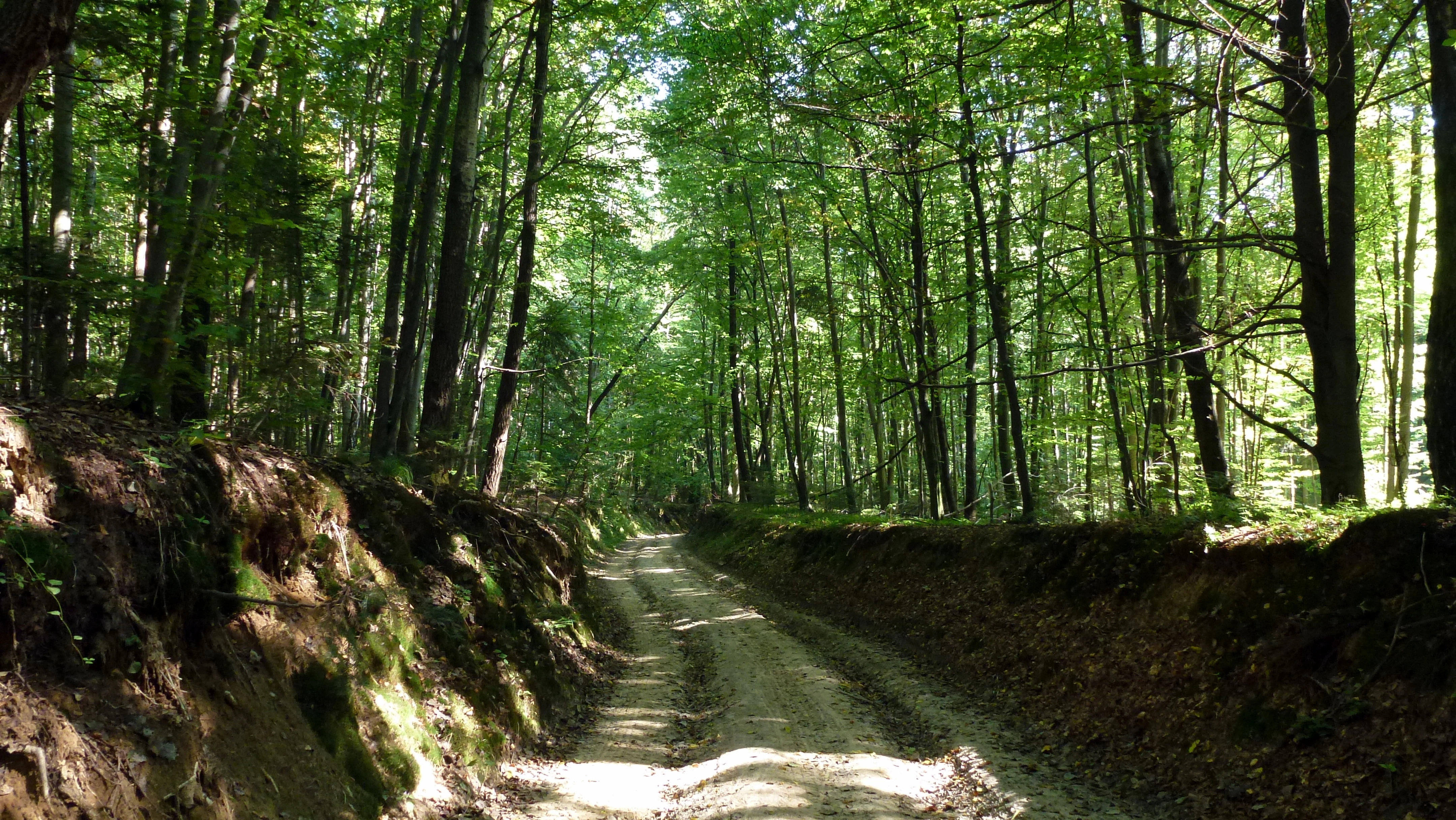
The park protects an ecologically varied mosaic set within the typical forest-dominated landscape of Western Roztocze. The principal forest communities are Carpathian beech forests and fir forests, which together cover most of the upland woodland and reflect the natural character expected of this part of Poland's transitional uplands.
In the southern part of the park, the open landscape is defined by Bagno Tałandy, where raised peat bog vegetation, dominated by dwarf pine and bog birch, indicates preserved peat-forming conditions. These bog habitats provide a strong ecological contrast to the surrounding deciduous and coniferous forests and contribute significantly to the park's overall habitat diversity.
The corridors of the loess gullies and the Gorajec River valley add transitional edge habitats that link the high forest communities with the peatland and aquatic systems. This mosaic of forest, peatland, gully, and river supports the ecological richness that defines the park's natural value.
Szczebrzeszyn Landscape Park wildlife and species highlights
The park hosts bird communities consistent with the structure of mixed and deciduous upland forests combined with peatland and river valley habitats, with around 80 bird species recorded across the protected area. These species inhabit the beech and fir forests of the uplands as well as the open bog vegetation of Bagno Tałandy and the riparian corridors along the Gorajec River.
The combination of mature forest stands, bog open areas, and river environments supports breeding and foraging birds associated with each of these habitat types, contributing to an avifaunal profile typical of the Western Roztocze and adjoining Solska Forest region.
Szczebrzeszyn Landscape Park conservation status and protection priorities
The park plays a meaningful role in protecting the highest and most topographically varied section of Western Roztocze, an area that contains the most diverse landforms of the entire Western Roztocze region. By conserving the dense network of loess gullies, the upland forest cover, and the raised peatland of Bagno Tałandy, the park safeguards a set of habitats not easily represented elsewhere in the regional landscape.
Its position adjacent to Roztoczański National Park enhances its conservation significance, forming part of a continuous protected zone across the boundary between Roztocze and the Solska Forest lowlands. Although there are no formally designated nature reserves within the park, the landscape-level protection regime ensures that the broader ecological character of the area is maintained at scale.
The protection of the Gorajec River headwaters and the Bagno Tałandy peatland system in particular represents an important contribution to hydrological and peatland conservation in eastern Poland, preserving the processes that shape the landscape and its ecological communities.
Szczebrzeszyn Landscape Park cultural meaning and human context
The only town within the park's boundaries is Szczebrzeszyn, a small town whose historical and cultural presence is closely associated with the Roztocze landscape. The park's landscape-scale protection framework reflects Poland's tradition of balancing natural and cultural heritage, with the surrounding region known for traditional rural settlements and the borderland character between the Roztocze uplands and the broader lowlands to the north and west.
Top sights and standout views in Szczebrzeszyn Landscape Park
The most striking features of Szczebrzeszyn Landscape Park are the deeply incised loess gullies such as those at Piekiełko, the Carpathian beech and fir forests that dominate the uplands, and the open raised peatland of Bagno Tałandy in the south. The Gorajec River valley provides a continuous natural corridor that ties these different habitats together, while the park's adjacency to Roztoczański National Park extends the regional network of protected landscapes along the Roztocze range.
Best time to visit Szczebrzeszyn Landscape Park
Late spring and early summer are well suited to appreciating both the forest cover and the birdlife of the park, while autumn brings visible seasonal change to the beech and mixed forest stands. The river valleys and peatlands retain their character across warmer months, and the open landscapes of Bagno Tałandy are particularly accessible when frost and snow are absent, allowing visitors to experience the gentle contrast between bog, valley, and upland forest.