Mori Atlas logo
National parkRoztocze National Park

Explore the mapped geography and ancient terrain of this significant Polish national park.

Roztocze National Park: Poland's Premier Forested Protected Landscape in Lublin Voivodeship

(Roztoczański Park Narodowy)

Roztocze National Park, situated within the distinctive rolling hills of Lublin Voivodeship, represents a pinnacle of Poland's protected natural heritage. As the nation's most heavily forested national park, it preserves extensive old-growth fir forests, some of the tallest in Europe, alongside the Wieprz River valley and unique upland terrain. This page serves as your atlas entry point to understand its geographic identity, mapped boundaries, and rich ecological context within the broader regional landscape.

national parkforest reserveold-growth forestEastern EuropeLublin VoivodeshipRoztocze

Roztocze National Park

National park

Park overview

Structured park overview, official facts, and landscape profile for Roztocze National Park

Roztocze National Park park facts, protected area profile, and essential visitor context
Review the core facts for Roztocze National Park, including designation, size, terrain, visitor scale, habitats, and operating context in one park-focused overview.

About Roztocze National Park

Roztocze National Park protects a distinctive landscape in southeastern Poland where the Roztocze upland creates a natural boundary between the Lublin Upland and the Sandomierz Basin. The park's terrain is characterized by undulating hills, steep-sided valleys carved by glacial and river processes, and a dense forest cover that makes it unique among Poland's protected areas. The forests here represent a transition zone between western European and eastern Carpathian forest types, creating exceptional biodiversity. The Wieprz River, one of Poland's notable eastern rivers, flows through the park and supports wetland ecosystems along its valley. The park's headquarters are located in Zwierzyniec, a settlement with deep historical roots in the Zamoyski family estate established in 1589. Five walking trails and one dedicated bicycle trail allow visitors to explore the park's natural wonders, while the educational center in Zwierzyniec provides interpretation of the park's ecology and conservation significance. The park's buffer zone extends into surrounding lands, creating ecological connectivity with the broader Roztocze landscape.

Quick facts and research context for Roztocze National Park

Roztocze National Park occupies 84.83 km² in southeastern Poland, making it the most forested national park in the country with 95.5% coverage (8,102 hectares). Located in the Roztocze Środkowe region within Lublin Voivodeship, the park was established in 1974 and is administered from Zwierzyniec. The Wieprz River, of notable water quality, flows through the park alongside two smaller streams. Strict protection covers 1,029 hectares, while active protection encompasses 7,242 hectares. The park contains five strict nature reserves and supports over 750 vascular plant species and 190 bird species.

Park context

Deeper park guide and search-rich context for Roztocze National Park

Roztocze National Park history, landscape, wildlife, and travel context
Explore Roztocze National Park through its history, landscape character, ecosystems, wildlife, conservation priorities, cultural context, and seasonal travel timing in a structured park guide built for atlas discovery and search intent.

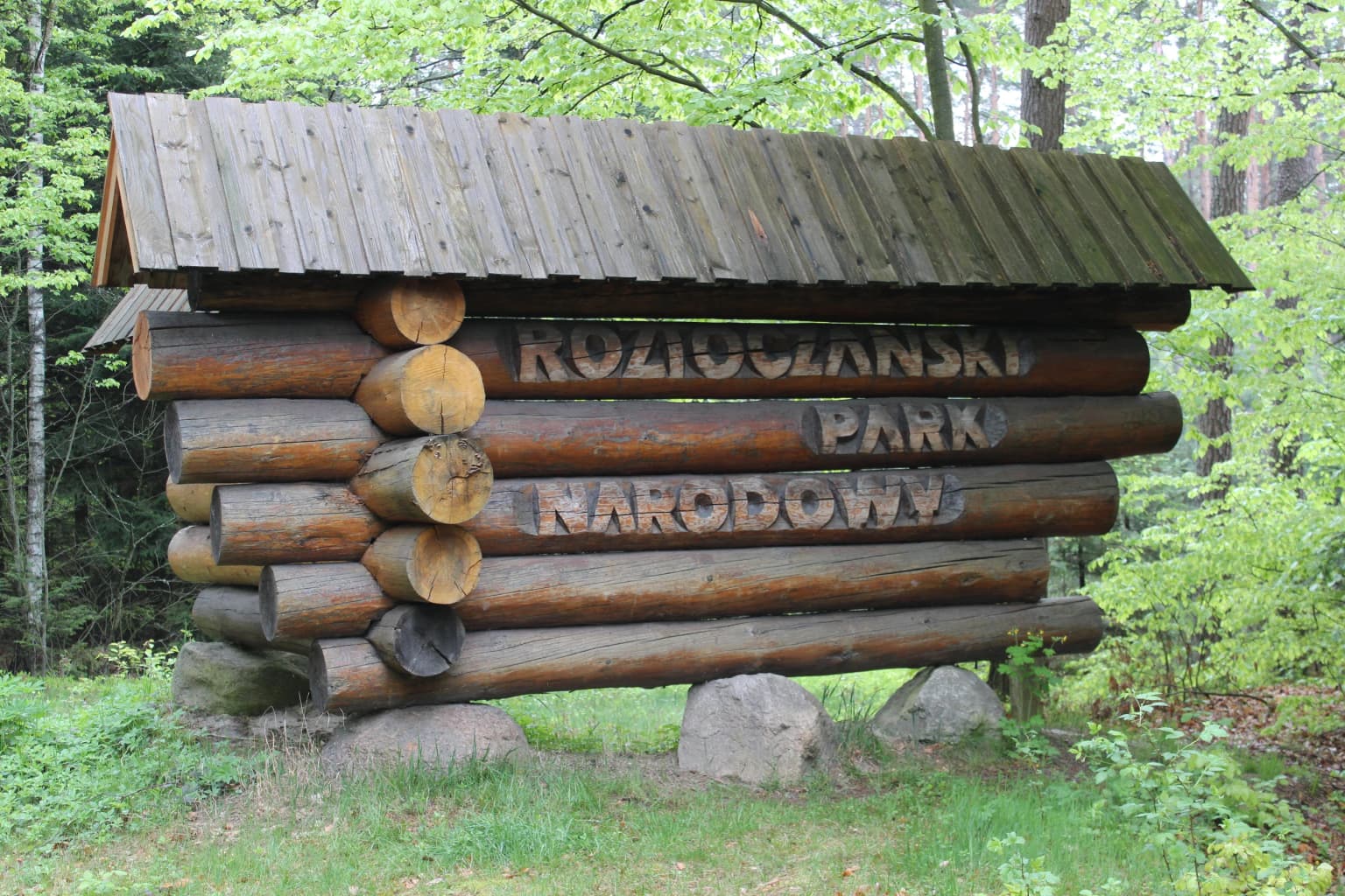
Why Roztocze National Park stands out

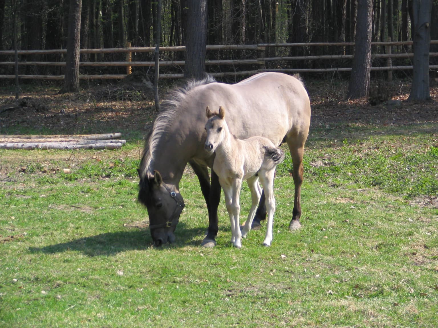
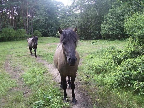
Roztocze National Park is best known for its extraordinary old-growth forests dominated by towering firs, some of the largest in Poland, and its designation as the nation's most heavily forested national park. The park preserves critical habitat for the Polish konik pony, a heritage breed reintroduced in 1982 that now roams freely in dedicated conservation areas near Echo Ponds. The ancient tree population, over 400 specimens designated as nature monuments, represents one of the most significant heritage tree collections in Central Europe. The park also protects the Wieprz river valley, a major waterway with relatively clean water, and serves as a critical corridor for European wildlife including wolves, beavers, and numerous bird species.

Roztocze National Park history and protected-area timeline

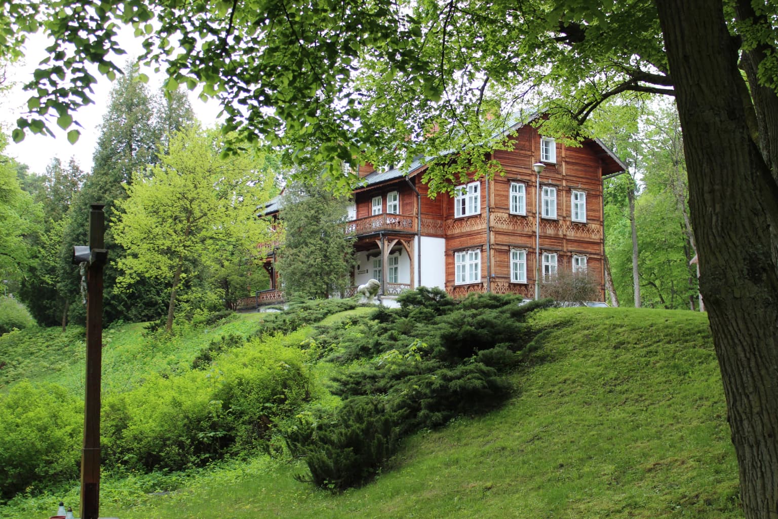
The history of Roztocze National Park is inseparable from the Zamoyski family estate, one of Poland's great aristocratic landholdings established in 1589 with its headquarters at Zwierzyniec. The estate maintained a fenced hunting area, known as a zwierzyniec, spanning approximately 30 kilometers that encompassed what is now the Bukowa Góra strict protection zone. This historical game preserve protected elk, lynx, wild boar, wolves, European wildcats, and tarpans. Nature protection in the region began in 1934 with the creation of the Bukowa Góra Preserve, and in 1938 the Zamoyski estate issued Poland's first law protecting birds of prey. Following World War II, the area came under state forest management, and Roztocze National Park was formally established in 1974 from state forest lands that had been part of the historic Zamoyski holdings. Initially covering 48.01 km², the park was expanded to its current size. The park's administration is housed in the restored palace that once served as the Zamoyski estate administrator's residence. The region witnessed numerous military conflicts during the Polish January Uprising and both World Wars, with memorial sites in Zwierzyniec and surrounding areas commemorating these turbulent periods.

Roztocze National Park landscape and geographic character

The Roztocze landscape within the park represents one of Poland's most distinctive upland environments. The terrain consists of rolling hills and valleys formed through Cretaceous chalk and Tertiary bedrock, with Quaternary sands filling the valley floors. Elevation reaches a maximum of 350 meters above sea level. The Wieprz River, flowing from east to west through the park, has carved a broad valley that supports wetland habitats and riparian forests. Two smaller streams, the Szum (2.5 km) and the Świerszcz (7.5 km), originate within the park boundaries. The park's forest matrix contains remarkable old-growth elements, with some of Poland's tallest fir trees reaching 50 meters in height. The combination of steep valley sides, flat valley bottoms, and the river corridor creates a diverse physical landscape that supports varied ecological communities.

Roztocze National Park ecosystems, habitats, and plant life

Roztocze National Park represents a critical biogeographic crossroads where western European forest species meet eastern Carpathian elements. The park's 95.5% forest coverage makes it Poland's most forested national park, with approximately 20 distinct forest communities identified. The dominant forest type is the upland fir-beech mixed forest, covering nearly one-third of the park area, followed by Carpathian beech forest. The park supports significant populations of fir, beech, sycamore maple, lime, spruce, and yew—species representing the western European forest boundary. Rich hornbeam-oak forests grow on the most fertile soils, while pine forests occupy sandy valley terraces. Wetland forests, alder carrs, and raised bogs occur in poorly drained areas, preserving glacial and subarctic relicts including dwarf birch, northern greenberry, and cord grass. The vascular plant flora comprises approximately 750 species, including such notable species as the large-flowered anemone, European black cohosh, soft-haired lungwort, and yellow scabious. Atlantic-influenced species such as intermediate sundew, brown beak sedge, and rigid sedge reach their eastern distribution limits here.

Roztocze National Park wildlife and species highlights

The mammalian fauna of Roztocze National Park includes red deer, roe deer, wild boar, red fox, grey wolf, and Eurasian badger. European beavers, reintroduced in 1979, have established thriving colonies along the Wieprz valley and now represent a successful conservation story. Polish konik ponies, a heritage breed descended from the extinct tarpan, were introduced in 1982 and now roam freely in a 180-hectare conservation area near Echo Ponds and Biała Góra, living without human intervention except for winter supplemental feeding. Bird diversity is exceptional, with approximately 190 species recorded, of which about 130 regularly nest within the park. Notable species include the lesser spotted eagle, common buzzard, black stork, white-backed woodpecker, grey-headed woodpecker, and thrush nightingale. The reptile community includes the European pond terrapin (a protected species), common adder, grass snake, and lizards. The invertebrate fauna is extraordinarily rich, with over 2000 insect species documented, particularly notable for beetles in the Carabidae and Cerambycidae families, as well as diverse populations of snails, millipedes, arachnids, and orthopterans.

Roztocze National Park conservation status and protection priorities

Roztocze National Park plays a vital role in conserving Poland's forest biodiversity and serves as a flagship for the broader Roztocze region. The park's strict protection zones—Bukowa Góra, Czerkies, Jarugi, Międzyrzeki, and Nart—preserve old-growth forest ecosystems that have become rare in lowland Poland. The protection of ancient trees, including over 400 designated nature monuments, maintains ecological continuity and habitat for specialized species. The reintroduction of European beavers demonstrates successful conservation management, while the Polish konik pony breeding program preserves genetic diversity of this heritage breed. The Wieprz River, maintained in good water quality, supports aquatic and riparian ecosystems. The park's buffer zone of approximately 381 km² extends protection into the surrounding landscape, maintaining ecological connectivity. The park also serves as a living laboratory for forest ecology research and environmental education, with dedicated facilities in Zwierzyniec and Florianka.

Roztocze National Park cultural meaning and human context

The Roztocze landscape has been shaped by centuries of human presence, most notably through the Zamoyski family estate established in 1589. The town of Zwierzyniec served as the administrative center for this vast landholding, which maintained a protected game preserve—a zwierzyniec—enclosing the core of what is now the national park. This historical hunting ground represented an early form of wildlife protection, preserving large mammals including elk, lynx, and tarpans. The current park headquarters occupy the restored palace of the former estate administrator, connecting modern conservation to this aristocratic heritage. In 1990, part of the park (24 hectares) was incorporated into Zwierzyniec when the settlement gained town status. The Polish konik pony has become the park's symbolic animal, representing both the region's cultural heritage and successful conservation breeding programs.

Top sights and standout views in Roztocze National Park

Roztocze National Park stands as Poland's most forested protected area, with ancient fir forests reaching 50 meters in height. The park preserves over 400 monument trees and supports the only wild population of Polish konik ponies, a heritage breed descended from the extinct tarpan. The Wieprz River valley provides habitat for reintroduced European beavers, while the forest supports grey wolf packs and over 190 bird species. Five strict nature reserves protect old-growth forest communities, and the park serves as a biogeographic crossroads where western European and eastern Carpathian species meet. The historical connection to the Zamoyski family estate and the restored administrator's palace add cultural depth to the natural landscape.

Best time to visit Roztocze National Park

The park offers distinct seasonal experiences throughout the year. Spring brings forest wildflower blooms and active wildlife as species emerge from winter, making April and May excellent for botanical observation and birdwatching. Summer offers warm conditions ideal for hiking the five marked trails, with lush green forest coverage and longer daylight hours. Autumn transforms the forests with color changes, particularly in the beech-dominated areas, and offers excellent mushroom foraging opportunities while quieter visitor numbers persist. Winter provides a different perspective on the landscape, though some trails may have limited accessibility. The Polish konik ponies are most easily observed in their designated areas during spring and summer when they graze openly. The park's educational center in Zwierzyniec operates year-round and provides orientation regardless of season.

Park location guide

Geography guide, regional context, and park location map for Roztocze National Park

Roztocze National Park park geography, regions, and map view in Poland
Understand where Roztocze National Park sits in Poland through a broader geographic reading of the surrounding landscape, nearby location context, and its mapped position within the national park landscape.

How Roztocze National Park fits into Poland

Poland, officially the Republic of Poland, is a Central European country spanning from the Baltic Sea in the north to the Carpathian Mountains in the south. It borders Germany, Czech Republic, Slovakia, Ukraine, Belarus, Lithuania, and Kaliningrad Oblast. The country has a temperate climate, diverse landscapes, and is known for its rich history, cultural heritage, and strong economic position within the EU.

Wider geography shaping Roztocze National Park in Poland

Poland occupies 312,696 km2 in Central Europe, extending from the Baltic Sea coast in the north to the Sudetes and Carpathian Mountains in the south. It borders Germany to the west, Czech Republic and Slovakia to the south, Ukraine and Belarus to the east, and Lithuania and Kaliningrad Oblast to the northeast. The landscape includes lowland plains, uplands, and mountain ranges.

Map view of Roztocze National Park

Use this park location map to pinpoint Roztocze National Park in Poland, understand its exact geographic position, and read its mapped placement within the surrounding landscape more clearly.

Pigeon | © OpenStreetMap contributors

Location context for Roztocze National Park

Lublin Voivodeship
Park atlas

Trace the unique Roztocze range and surrounding protected lands across Poland and Eastern Europe.

Explore Nearby Protected Areas, Forests, and Upland Landscapes near Roztocze National Park
Discover other national parks and protected areas showcasing upland geographies, old-growth forests, and river valleys found near Roztocze National Park. Compare these nearby protected landscapes to understand regional conservation patterns and the spread of diverse ecosystems across Poland.
National parkLviv Oblast

Yavoriv National Nature Park: Protected Landscape and Regional Geography in Lviv Oblast

Mapped protected area boundaries and natural terrain context.

Yavoriv National Nature Park is a designated national park within Lviv Oblast, Ukraine. This page provides detailed geographic information, focusing on the park's protected landscape identity and its mapped terrain. Understanding its location in Western Ukraine, near the Carpathian gateway, offers valuable context for atlas-based exploration of protected areas and natural features within the region.

Area
71.08 km²
Established
1998
IUCN
II
Relief
Highland
National parkSubcarpathian Voivodeship

Bieszczady National Park: A Protected Landscape of the Eastern Carpathians

Explore mapped terrain, alpine meadows, and old-growth forests.

Discover Bieszczady National Park, a significant national park located in the Subcarpathian Voivodeship of Poland, within the Eastern Carpathian mountain range. This protected area is renowned for its vast expanses of old-growth beech forests, the characteristic połoniny alpine meadows, and its status as a UNESCO World Heritage Site, underscoring its global conservation importance. The park's wild character and dramatic mountain geography make it a key destination for atlas-driven exploration of protected landscapes.

Area
292.02 km²
Established
1973
IUCN
II
Relief
Mountain
Watercolor illustration showing a landscape with rolling hills, green trees, and distant mountains under a light sky
National parkSubcarpathian Voivodeship

Magura National Park: Mapped Protected Landscape & Carpathian Geography Atlas

Explore unique sandstone formations and mapped natural terrain.

Magura National Park, located in the Subcarpathian Voivodeship of Poland, offers a rich focus for protected-area exploration and geographic discovery. This national park is distinguished by its dramatic sandstone rock formations, forested Carpathian ridges, and its ecological importance as a transitional zone. Users engaging with Magura National Park can examine its mapped boundaries, understand its specific landscape context, and appreciate its role within the broader regional geography.

Area
194.39 km²
Established
1995
IUCN
II
Visitors
40K annual
Watercolor illustration of rolling hills with green forests in the foreground and purple, green, pink, and yellow mountain ranges in the background
National parkŚwiętokrzyskie Voivodeship

Świętokrzyski National Park: Protected Landscape and Mapped Terrain of Poland's Ancient Mountains

Discover the unique gołoborze and ancient forests of this national park.

Świętokrzyski National Park in Poland's Świętokrzyskie Voivodeship offers a unique geographic discovery experience. Explore the park's mapped boundaries, characterized by its distinctive gołoborze rock rubble fields, ancient silver fir trees, and endemic Polish larch forests. This protected area within the Holy Cross Mountains provides a prime example of ancient landscape evolution and protected forest ecosystems, ideal for atlas-based exploration and understanding regional geography.

Area
76.26 km²
Established
1950
IUCN
II
Visitors
168K annual
National park

Polesie National Park: Protected National Park in Poland's Eastern Lowlands

Explore its mapped wetland geography and unique glacial terrain.

Polesie National Park represents a key protected landscape within eastern Poland, notable for its vast wetland complexes, including extensive peat bogs and marshes interspersed with pine forests on sandy dunes. This national park showcases a distinct geography shaped by glacial processes, offering a unique perspective on lowland ecosystems and their conservation. MoriAtlas allows for a structured discovery of its protected boundaries and the surrounding regional context, providing an atlas-driven understanding of this vital natural territory.

Area
97.52 km²
Established
1979
IUCN
II
National parkUkraine

Skole Beskids National Nature Park: Protected Landscape Atlas and Geographic Context in Ukraine

Explore the mapped boundaries and regional geography of this Ukrainian national park.

Delve into the specifics of Skole Beskids National Nature Park, a designated national park contributing to Ukraine's protected lands. This detail page offers a structured atlas view, focusing on the park's geographic positioning, its mapped natural landscape features, and its significance within the regional context. Understand the core identity of this protected area through detailed geographic and landscape data, enabling focused map exploration.

Area
357 km²
Established
1999
IUCN
II
Relief
Mountain
Watercolor illustration of green and purple mountains with pine trees and flowering shrubs in the foreground
National parkLviv Oblast

Boikivshchyna National Nature Park: National Park Protected Landscape Exploration

Lviv Oblast geographic context and mapped terrain

Dive into the protected landscape of Boikivshchyna National Nature Park, a key national park located in Lviv Oblast. MoriAtlas facilitates structured discovery of its mapped boundaries, regional geography, and the unique natural terrain it encompasses. This entry is designed for users interested in the specific park identity, its geographic setting within Ukraine, and detailed atlas-based understanding of protected natural areas.

Area
317 km²
Established
2019
IUCN
II
Relief
Mountain
Watercolor illustration of a mountainous landscape with forests, lakes, and rolling hills under a light sky
National parkUkraine

Uzh National Nature Park: Primeval Beech Forests and Protected Landscape in Ukraine

Explore its mapped boundaries and Carpathian geography.

Uzh National Nature Park, a protected national park in Ukraine's Carpathian Mountains, safeguards a crucial segment of the Primeval Beech Forests of the Carpathians, a UNESCO World Heritage site. This atlas-focused exploration reveals the park's mapped terrain, defined by river valleys and ancient forest ecosystems, offering essential geographic context for this significant protected landscape. Discover the natural heritage preserved within its boundaries, showcasing exceptional biodiversity and the unique character of the Eastern Carpathians.

Area
391.593 km²
Established
1999
IUCN
II

Common questions about visiting, size, designation, and location context for Roztocze National Park

Roztocze National Park FAQs for park facts, access, geography, and protected area context
Find quick answers about Roztocze National Park, including protected-area facts, park geography, trail and visitor context, and how the park fits into its surrounding country and regional landscape.
MoriAtlas Explorer

Continue Your Protected Areas Search Across the Global Atlas

Deepen your exploration by continuing the structured search for national parks and protected areas worldwide. Utilize the comprehensive filtering capabilities to compare different conservation landscapes and refine your understanding of global park geography. Discover more about the distribution and characteristics of protected natural areas.

Global natural geography