Mori Atlas logo
National parkYavoriv National Nature Park

Discover the mapped boundaries and natural terrain of this Ukrainian national park.

Yavoriv National Nature Park: Protected Landscape and Geographic Context in Lviv Oblast

(Яворівський національний природний парк)

Yavoriv National Nature Park represents a significant protected landscape within Lviv Oblast, Ukraine, serving as a key entity for geographic discovery. This national park offers a detailed view of mapped natural terrain and protected area boundaries, situated in a region known as a gateway to the Carpathian Mountains. Explore its specific contribution to the protected lands of Western Ukraine and understand its place in the broader atlas of natural landscapes.

national parkforest landscapewatershedRoztoczeWestern Ukraineprotected area

Yavoriv National Nature Park

National park

Park overview

Structured park overview, official facts, and landscape profile for Yavoriv National Nature Park

Yavoriv National Nature Park park facts, protected area profile, and essential visitor context
Review the core facts for Yavoriv National Nature Park, including designation, size, terrain, visitor scale, habitats, and operating context in one park-focused overview.

About Yavoriv National Nature Park

Yavoriv National Nature Park protects a remarkable segment of the Ukrainian Roztocze, a physiographic region that stands out as one of western Ukraine's most unusual landscapes. The Roztocze forms a narrow, elongated band of hills that rises prominently above the surrounding Lowland Polissia, creating a distinct topographic feature that influences both climate and ecological patterns across the region. The park's position along the main European watershed adds particular significance, as water falling on its slopes ultimately reaches two different seas, making this a hydrologically meaningful boundary in the European landscape.

The protected area was created in 1998 through the expansion of the earlier Yavoriv Regional Landscape Park, which had been established in 1996. The national park incorporated not only the core protected landscape but also surrounding territories from the Yavoriv military base area and Maherivskoho forestry enterprises, creating a unified conservation entity of more than 7,100 hectares. The park maintains a scientific division and visitor services, though its primary function is the preservation of the Roztocze's distinctive natural character.

The forest ecosystems within the park represent some of the most intact woodland in the region, with the combination of deciduous and coniferous species creating a complex and varied landscape. The presence of relict tree species at their range limits indicates the park's importance as a refugium for species with restricted distributions in this part of Europe.

Quick facts and research context for Yavoriv National Nature Park

Yavoriv National Nature Park occupies 7,108 hectares in the Roztocze region of western Ukraine, approximately 49.98°N 23.73°E. The park protects a forested landscape at the boundary of two major European watershed systems. The region experiences a moderately humid climate with average annual precipitation of 700mm and mean temperatures around 7.5°C. The area features high forest cover with hornbeam-oak and pine forests as the dominant vegetation types, along with notable relict populations of spruce, fir, and sycamore at their northeastern range limits.

Park context

Deeper park guide and search-rich context for Yavoriv National Nature Park

Yavoriv National Nature Park history, landscape, wildlife, and travel context
Explore Yavoriv National Nature Park through its history, landscape character, ecosystems, wildlife, conservation priorities, cultural context, and seasonal travel timing in a structured park guide built for atlas discovery and search intent.

Why Yavoriv National Nature Park stands out

The park is distinguished by its location along the main European watershed, a rare geographic feature where drainage systems split between the Black Sea and Baltic Sea basins. The Roztocze landscape within the park supports exceptional forest diversity, including relict pockets of spruce, fir, and sycamore that represent the northeastern limits of these species' ranges. The area also contains beech forests near the eastern border of the Roztocze range, adding to the ecological significance of the protected landscape.

Yavoriv National Nature Park history and protected-area timeline

Yavoriv National Nature Park traces its institutional roots to the establishment of the Yavoriv Regional Landscape Park in 1996, which initially protected an area of 4,190 hectares. This earlier protected area recognized the ecological and landscape value of the Roztocze terrain in this location. On July 4, 1998, the President of Ukraine elevated the protection status by establishing the national nature park and expanding the protected boundaries to encompass a larger territory. The expansion incorporated surrounding areas from the Yavoriv military base territory and the Maherivskoho forestry enterprise, bringing the total protected area to 7,108 hectares. Of this total, 2,915 hectares were designated for permanent use by the park institution, while an additional 4,193 hectares were incorporated into the park structure without removal from existing land use designations. The park operates with a staff of approximately 44 personnel, including 4 scientists and 16 service workers.

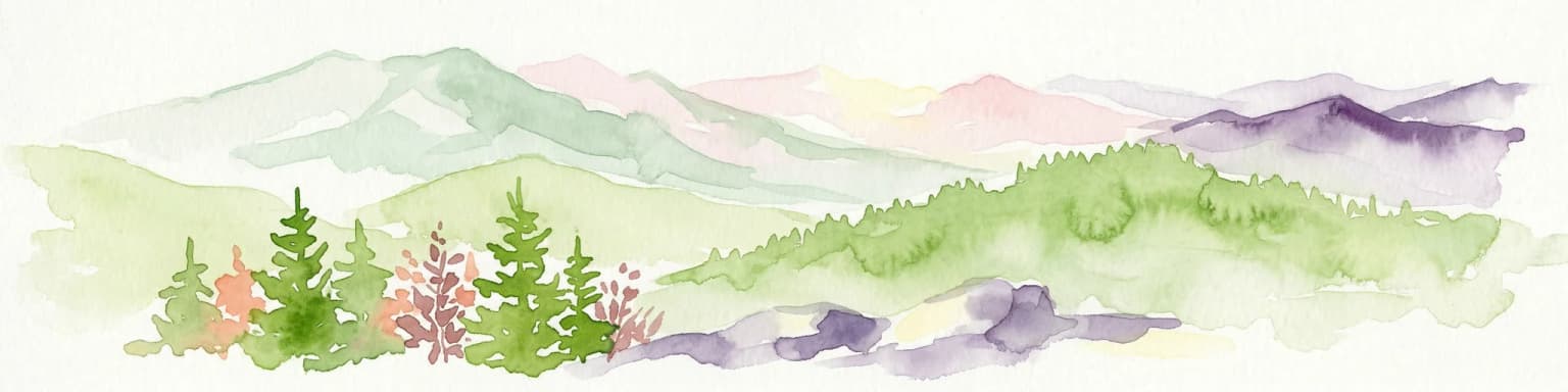
Yavoriv National Nature Park landscape and geographic character

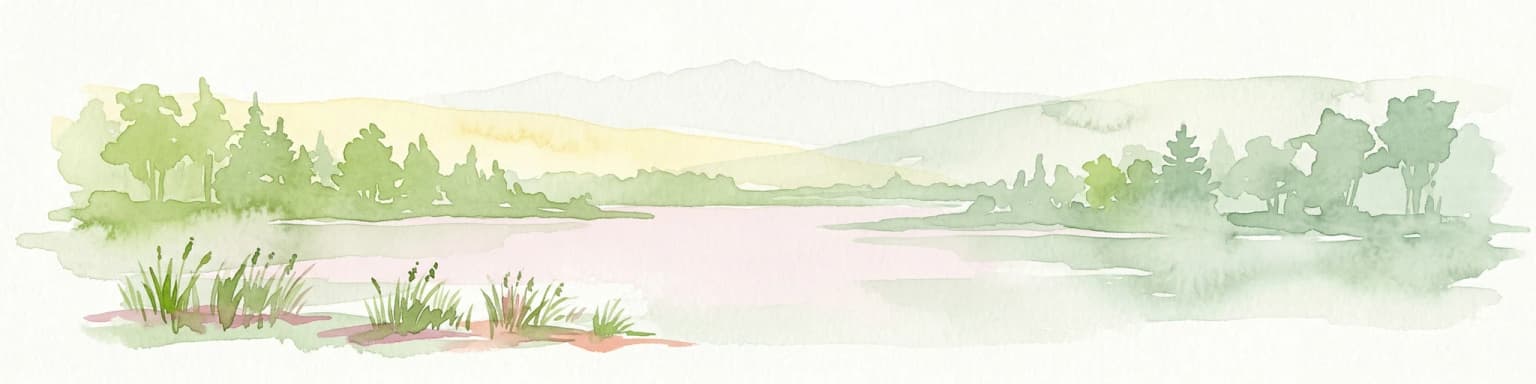
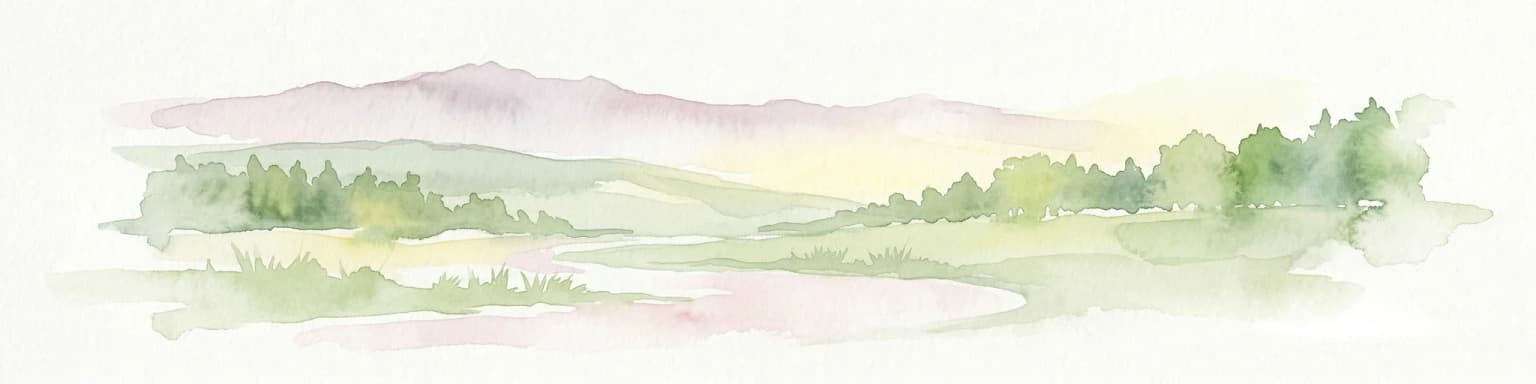
The landscape of Yavoriv National Nature Park is defined by the characteristic topography of the Roztocze, a narrow range of hills that rises abruptly from the surrounding lowlands. The terrain varies from gentle slopes to more pronounced undulations, creating a hilly landscape that contrasts sharply with the extensive lowland areas of Lesser Polissia to the south. The elevation changes and varied aspects of the hillsides contribute to habitat diversity across the park.

The forest-covered hillsides dominate the visual character of the protected area, with the tree canopy covering the majority of the terrain. In the depressions between hills and along watercourses, different vegetation communities emerge, with alder groves occupying the wetter valley positions. The forest composition changes across the park in response to slope aspect, soil conditions, and moisture availability, creating a mosaic of vegetation types that reflects the underlying environmental gradients.

Yavoriv National Nature Park ecosystems, habitats, and plant life

The ecological character of Yavoriv National Nature Park centers on its diverse forest communities, which represent some of the finest woodland in the Ukrainian Roztocze. Hornbeam-oak forests form the primary deciduous woodland type, while pine-oak and pure pine forests occupy drier or poorer soils. This mix of forest types creates a structurally diverse landscape that supports varied ecological communities. The presence of beech forests near the eastern border of the Roztocze within the park marks an important ecological transition zone, as beech reaches the eastern edge of its optimum distribution range in this area.

Of particular significance are the relict islands of spruce, fir, and sycamore that survive within the park. These stands represent the northeastern limits of these species' European ranges, making them botanically notable for their biogeographic importance. The survival of these relict populations through the Holocene period indicates the long continuity of suitable habitat in this part of the Roztocze. Herbaceous vegetation occupies smaller areas, primarily in natural meadows, former pasturelands, and along river corridors.

Yavoriv National Nature Park wildlife and species highlights

While the source material provides limited specific information about fauna, the diverse forest ecosystems of Yavoriv National Nature Park support typical woodland wildlife communities of the Roztocze region. The mix of deciduous and coniferous forest types, combined with the presence of old-growth relict stands, provides habitat structure for various bird and mammal species associated with mature forest environments. The watershed location and the variety of forest communities create conditions that support biodiversity across multiple taxonomic groups.

Yavoriv National Nature Park conservation status and protection priorities

Yavoriv National Nature Park plays an important role in protecting the distinctive Roztocze landscape and its associated biodiversity. The protected area preserves relict forest communities that represent the northeastern limits of several tree species, making it significant for European biogeography. By protecting the main European watershed divide, the park also contributes to water resource conservation across a broader geographic scale. The establishment of the national park status elevated protection of this landscape beyond the earlier regional landscape park designation, reflecting recognition of its national-level conservation importance.

Yavoriv National Nature Park cultural meaning and human context

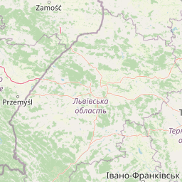
The park is situated near the towns of Novoiavorivsk and Ivano-Frankove in Lviv Oblast, within a region of western Ukraine that has a complex historical landscape. The incorporation of areas from the Yavoriv military base into the park boundaries reflects the particular land use history of this area. The Roztocze region has historically been a zone of cultural transition between different populations and traditions, though the park itself focuses primarily on natural landscape preservation.

Top sights and standout views in Yavoriv National Nature Park

The European watershed divide passing through the park represents a rare geographic feature of continental significance. The forest diversity, including relict spruce, fir, and sycamore stands at their northeastern range limits, distinguishes this area botanically. The Roztocze landscape itself, with its characteristic hilly terrain rising from the surrounding lowlands, provides the scenic and ecological context that makes this protected area distinctive within Ukraine's protected area network.

Best time to visit Yavoriv National Nature Park

The park can be visited throughout the year, with each season offering different aspects of the Roztocze landscape. The summer months of June and July bring the highest precipitation, creating lush vegetation conditions. Winter months of January and February are driest but also coldest, with January averaging -4.2°C. The moderate continental climate means that spring and autumn provide pleasant conditions for forest exploration, with the changing seasons bringing visible shifts in forest appearance and atmosphere.

Park location guide

Geography guide, regional context, and park location map for Yavoriv National Nature Park

Yavoriv National Nature Park park geography, regions, and map view in Ukraine
Understand where Yavoriv National Nature Park sits in Ukraine through a broader geographic reading of the surrounding landscape, nearby location context, and its mapped position within the national park landscape.

How Yavoriv National Nature Park fits into Ukraine

Ukraine is a sovereign nation in Eastern Europe, bordered by Russia, Belarus, Poland, Slovakia, Hungary, Romania, Moldova, and the Black Sea. It is the second-largest country in Europe by area. Kyiv is the capital and largest city, followed by Kharkiv, Odesa, and Dnipro. The official language is Ukrainian. Ukraine has a population of approximately 32.9 million and operates as a unitary semi-presidential republic.

Wider geography shaping Yavoriv National Nature Park in Ukraine

Ukraine occupies 603,628 km² in Eastern Europe, making it the second-largest country in Europe. It shares borders with Russia, Belarus, Poland, Slovakia, Hungary, Romania, and Moldova. The country has a southern coastline along the Black Sea and Sea of Azov. The terrain includes plains, steppes, and the Carpathian Mountains in the west.

Map view of Yavoriv National Nature Park

Use this park location map to pinpoint Yavoriv National Nature Park in Ukraine, understand its exact geographic position, and read its mapped placement within the surrounding landscape more clearly.

Pigeon | © OpenStreetMap contributors

Location context for Yavoriv National Nature Park

Lviv Oblast
Park atlas

Browse additional national parks and protected areas in western Ukraine, tracing the unique Roztocze physiographic region and its watershed features.

Discover Other Protected Areas Near Yavoriv National Nature Park and the Ukrainian Roztocze Landscape
After exploring Yavoriv National Nature Park, continue your geographic discovery by mapping adjacent protected areas and comparing their distinct forest ecosystems across the western Ukrainian landscape. Compare how the Roztocze hills, European watershed, and diverse woodlands shape other conservation landscapes in the surrounding region.
National parkLublin Voivodeship

Roztocze National Park: Ancient Forested Landscape and Protected Area Geography

Discover its role in Lublin Voivodeship's natural atlas.

Roztocze National Park stands as a remarkable example of a heavily forested protected area, showcasing some of Poland's largest fir trees and ancient forest ecosystems. Located in Lublin Voivodeship, this national park offers a distinct upland landscape characterized by rolling hills and river valleys. Explore its mapped boundaries, ecological significance, and geographic context as a key component of the regional natural atlas, providing deep insights into its protected terrain.

Area
84.83 km²
Established
1974
IUCN
II
Visitors
134K annual
National parkUkraine

Skole Beskids National Nature Park: Protected Landscape Atlas and Geographic Context in Ukraine

Explore the mapped boundaries and regional geography of this Ukrainian national park.

Delve into the specifics of Skole Beskids National Nature Park, a designated national park contributing to Ukraine's protected lands. This detail page offers a structured atlas view, focusing on the park's geographic positioning, its mapped natural landscape features, and its significance within the regional context. Understand the core identity of this protected area through detailed geographic and landscape data, enabling focused map exploration.

Area
357 km²
Established
1999
IUCN
II
Relief
Mountain
Watercolor painting showing green hills, pink fields, and purple mountains under a pale sky
National parkLviv Oblast

Northern Podillia National Nature Park: Protected Area Mapping and Regional Geography

Explore unique karst features and ancient forests in Lviv Oblast.

Northern Podillia National Nature Park is a protected national park in Lviv Oblast, Ukraine, safeguarding a significant area of the Podolian Upland. The park is distinguished by its ancient beech forests, rare karst lakes known as the Blue Windows, and geological formations reflecting ancient sea reefs. This page serves as a dedicated atlas entry for understanding the park's mapped boundaries, its ecological significance, and its place within the regional geography of western Ukraine.

Area
156 km²
Established
2009
IUCN
II
Relief
Highland
Watercolor illustration of green and purple mountains with pine trees and flowering shrubs in the foreground
National parkLviv Oblast

Boikivshchyna National Nature Park: National Park Protected Landscape Exploration

Lviv Oblast geographic context and mapped terrain

Dive into the protected landscape of Boikivshchyna National Nature Park, a key national park located in Lviv Oblast. MoriAtlas facilitates structured discovery of its mapped boundaries, regional geography, and the unique natural terrain it encompasses. This entry is designed for users interested in the specific park identity, its geographic setting within Ukraine, and detailed atlas-based understanding of protected natural areas.

Area
317 km²
Established
2019
IUCN
II
Relief
Mountain
National parkSubcarpathian Voivodeship

Bieszczady National Park: A Protected Landscape of the Eastern Carpathians

Explore mapped terrain, alpine meadows, and old-growth forests.

Discover Bieszczady National Park, a significant national park located in the Subcarpathian Voivodeship of Poland, within the Eastern Carpathian mountain range. This protected area is renowned for its vast expanses of old-growth beech forests, the characteristic połoniny alpine meadows, and its status as a UNESCO World Heritage Site, underscoring its global conservation importance. The park's wild character and dramatic mountain geography make it a key destination for atlas-driven exploration of protected landscapes.

Area
292.02 km²
Established
1973
IUCN
II
Relief
Mountain
National parkIvano-Frankivsk Oblast

Halych National Nature Park: Ivano-Frankivsk Oblast National Park Atlas & Geography

Mapped protected boundaries and landscape context.

Halych National Nature Park is a vital protected area situated in the Ivano-Frankivsk Oblast of Ukraine, characterized by its transitional landscape where Carpathian foothills merge with the East European Plain. This national park offers a rich tapestry of environments, including oak-hornbeam and oak-beech forests, vital wetlands, and scarce steppe remnants, creating a mosaic of habitats mapped meticulously within the MoriAtlas platform. Explore the park's geographic identity, its diverse terrain, and its significance as a conservation landscape for understanding regional biodiversity.

Area
147 km²
Established
2004
IUCN
II
Relief
Lowland
Watercolor illustration of a mountainous landscape with forests, lakes, and rolling hills under a light sky
National parkUkraine

Uzh National Nature Park: Primeval Beech Forests and Protected Landscape in Ukraine

Explore its mapped boundaries and Carpathian geography.

Uzh National Nature Park, a protected national park in Ukraine's Carpathian Mountains, safeguards a crucial segment of the Primeval Beech Forests of the Carpathians, a UNESCO World Heritage site. This atlas-focused exploration reveals the park's mapped terrain, defined by river valleys and ancient forest ecosystems, offering essential geographic context for this significant protected landscape. Discover the natural heritage preserved within its boundaries, showcasing exceptional biodiversity and the unique character of the Eastern Carpathians.

Area
391.593 km²
Established
1999
IUCN
II
Watercolor illustration of a landscape with rolling hills, a river, scattered trees, and distant mountains.
National parkTernopil Oblast

Kremenets Mountains National Nature Park National Park: Geographic and Protected Landscape Atlas

Mapped boundaries and regional natural terrain context.

Delve into the specifics of Kremenets Mountains National Nature Park, a protected area designated as a national park in Ukraine's Ternopil Oblast. This MoriAtlas entry focuses on its role as a distinct geographic entity, providing mapped boundaries and context within the regional landscape. Understand its protected status and how it contributes to the natural geography of western Ukraine, offering a structured point for atlas-based discovery.

Area
162 km²
Established
1999
IUCN
II
Relief
Mixed relief

Common questions about visiting, size, designation, and location context for Yavoriv National Nature Park

Yavoriv National Nature Park FAQs for park facts, access, geography, and protected area context
Find quick answers about Yavoriv National Nature Park, including protected-area facts, park geography, trail and visitor context, and how the park fits into its surrounding country and regional landscape.
MoriAtlas Explorer

Continue Your Protected Areas Search Across the Global Atlas

Deepen your exploration by continuing the structured search for national parks and protected areas worldwide. Utilize the comprehensive filtering capabilities to compare different conservation landscapes and refine your understanding of global park geography. Discover more about the distribution and characteristics of protected natural areas.

Global natural geography