Mori Atlas logo
National parkPoloniny National Park

Discover the mapped terrain and unique polonina meadows of Slovakia's easternmost national park.

Poloniny National Park: Protected Landscape and Carpathian Geography in the Prešov Region

(Národný park Poloniny)

Poloniny National Park represents a significant protected landscape within Slovakia's Prešov Region, nestled in the Bukovské vrchy mountains. This national park is recognized globally for its ancient beech forests, a vital component of the UNESCO World Heritage 'Primeval Beech Forests of the Carpathians'. As a key area within the East Carpathian Biosphere Reserve, Poloniny offers rich opportunities for exploring its mountainous terrain, unique montane meadows, and extensive forest ecosystems from an atlas perspective.

National ParkOld-Growth ForestsEastern CarpathiansUNESCO World Heritage SitePrimeval Beech ForestsBukovské vrchy Mountains

Poloniny National Park

National park

Park overview

Structured park overview, official facts, and landscape profile for Poloniny National Park

Poloniny National Park park facts, protected area profile, and essential visitor context

Review the core facts for Poloniny National Park, including designation, size, terrain, visitor scale, habitats, and operating context in one park-focused overview.

About Poloniny National Park

Poloniny National Park represents one of Slovakia's most significant protected areas, preserving a remarkable diversity of forest ecosystems, montane meadows, and wildlife within the Eastern Carpathians. The park's terrain is characterized by the parallel ridges and valleys of the Bukovské vrchy, with elevations ranging from approximately 400 meters in the lower valleys to 1,208 meters at Kremenec, the tripoint where Slovakia, Poland, and Ukraine meet. This location at the crossroads of three countries has shaped both the ecological character and human history of the region.

The park's establishment in 1997 reflected a growing recognition of the outstanding natural value of this easternmost corner of Slovakia. Prior to national park status, the area had been protected through various designations since the 1960s, with reserves such as Stužica (established 1965) and Havešová (established 1964) preserving the old-growth forests that would later become part of the World Heritage Site. The park's buffer zone encompasses additional territory, allowing for the protection of ecological processes beyond the core protected area.

Access to the park's interior is primarily through several villages that serve as trailheads, including Nová Sedlica (the most commonly used), Runina, Topoľa, and Uličské Krivé. These settlements, some of which maintain traditional wooden churches dating to the 18th century, reflect the human dimension of this mountainous border region.

Quick facts and research context for Poloniny National Park

Poloniny National Park lies in northeastern Slovakia within the Bukovské vrchy range, part of the Eastern Carpathians. The park spans approximately 40,688 hectares with a buffer zone of 109.73 km². Its highest point is Kremenec at 1,208 meters, marking the tripoint of three countries. About 80% of the area is covered by forests, with beech and beech-fir forests dominating. The park contains Slovakia's highest concentration of old-growth forests, with three areas—Havešová, Stužica, and Rožok—forming part of the UNESCO World Heritage Site of Primeval Beech Forests of the Carpathians designated in 2007. The park is managed by Správa NP Poloniny based in Stakčín.

Protection and recognition

Mapping terrestrial boundaries and transboundary protection frameworks for regional conservation

Poloniny National Park Protection Status and Transboundary Protected Area Designation

National park datasets provide verified insight into the terrestrial protection scope and boundary designations of Poloniny National Park. Explorers can examine the documented transboundary status and management frameworks that define coordinate conservation across European borders.

Protection details

Protection scope
Terrestrial
Transboundary protection
Yes
Buffer area
109.73 km²
Park context

Deeper park guide and search-rich context for Poloniny National Park

Poloniny National Park history, landscape, wildlife, and travel context

Explore Poloniny National Park through its history, landscape character, ecosystems, wildlife, conservation priorities, cultural context, and seasonal travel timing in a structured park guide built for atlas discovery and search intent.

Why Poloniny National Park stands out

Poloniny National Park is best known for its exceptional old-growth beech forests that comprise part of the UNESCO World Heritage Site "Primeval Beech Forests of the Carpathians." The park protects some of the most pristine and ecologically significant forest ecosystems in Slovakia, with Stužica being the only area accessible to the public among the World Heritage components. The park is also renowned for its traditional polonina meadows, open montane grasslands situated along the main ridge of the Bukovské vrchy, that represent a cultural and ecological landscape element unique to this region of the Eastern Carpathians. The presence of large mammals including Eurasian lynx, brown bear, and a reintroduced herd of European bison (wisent) adds to the park's ecological significance.

Poloniny National Park history and protected-area timeline

Poloniny National Park was officially established on October 1, 1997, with an initial protected area of 298.05 km² and a buffer zone of 109.73 km². The park's creation represented the culmination of decades of conservation efforts in the Bukovské vrchy region, where individual protected areas had been designated since the 1960s. The national park status provided a comprehensive framework for protecting the interconnected ecosystems of this transboundary region.

Prior to the park's establishment, several key reserves had already been protected. The national nature reserves of Stužica (1965), Havešová (1964), Rožok (1965), and Jarabá skala (1964) preserved the old-growth forest communities that distinguish this area. These reserves, along with others added in subsequent decades, formed the ecological foundation upon which the national park was built. The management of the park is handled by Správa NP Poloniny, based in the village of Stakčín.

A significant milestone for the park came in 2007 when three areas within the Bukovské vrchy—Havešová, Stužica, and Rožok—were inscribed as part of the "Primeval Beech Forests of the Carpathians" UNESCO World Heritage Site. This international recognition acknowledged the outstanding universal value of these forest ecosystems. The World Heritage Site was later expanded in 2011 and 2017 to include additional components in Slovakia and Ukraine.

Poloniny National Park landscape and geographic character

The landscape of Poloniny National Park is defined by the mountainous terrain of the Bukovské vrchy, a range within the Eastern Carpathians characterized by parallel ridges, steep-sided valleys, and distinctive geological formations. The predominant rock types include flysch and sandstone, which influence soil development and the general topography of the area. Elevations range from around 400 meters in the valley bottoms to 1,208 meters at Kremenec, the highest point in the park and the meeting point of three national borders.

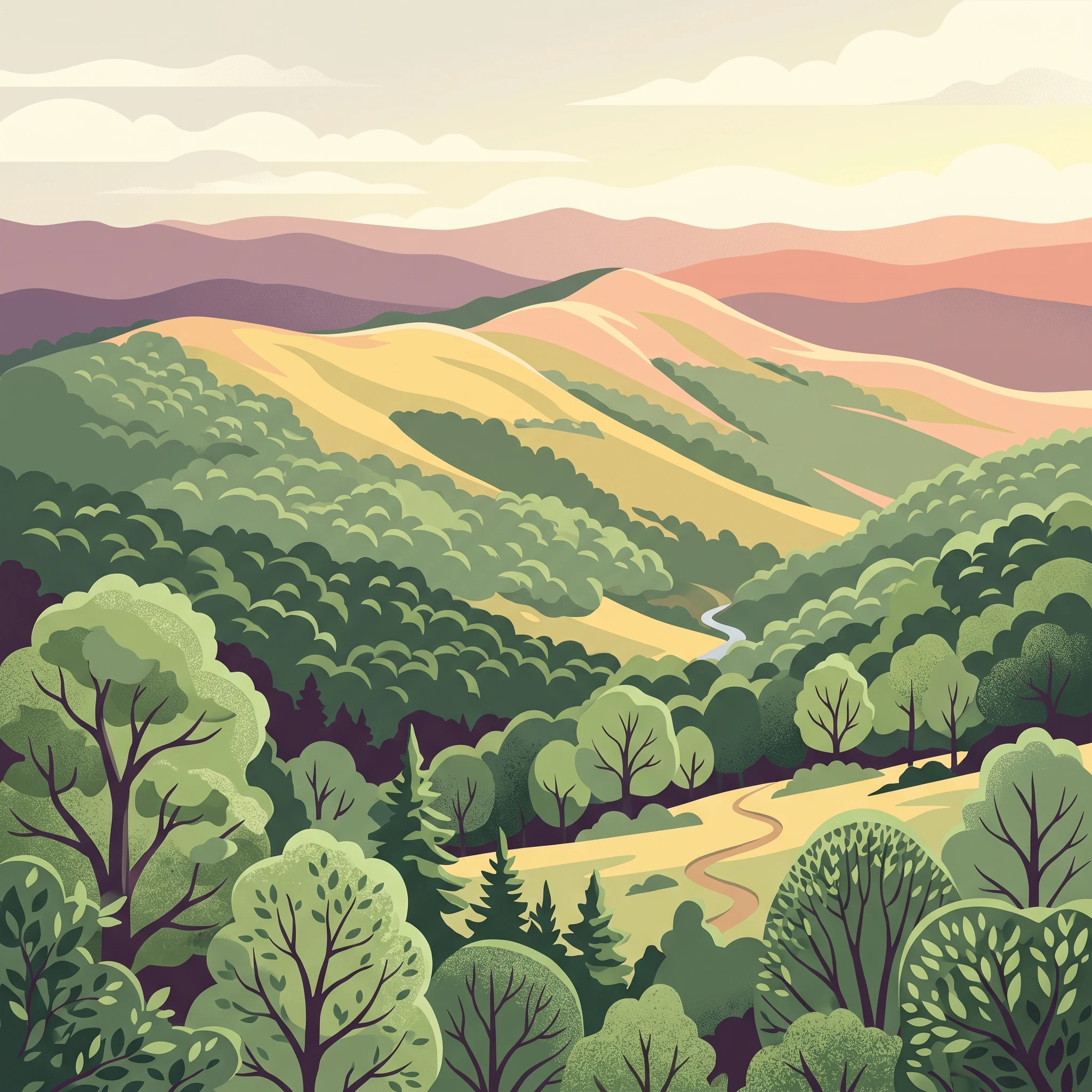
The most distinctive landscape feature of the park is the chain of polonina meadows along the main ridge of the Bukovské vrchy. These open montane grasslands, maintained through traditional pastoral practices, create a characteristic mosaic of forest and open meadow that distinguishes this Carpathian landscape. The meadows provide sweeping views across the mountainous terrain and support unique ecological communities adapted to these open, often exposed positions.

Forests dominate approximately 80% of the park's area, covering the slopes and valleys with continuous tree cover. The combination of forested ridges, open meadow corridors, and the geometric pattern created by the underlying geology produces a landscape of considerable visual diversity and ecological complexity.

Poloniny National Park ecosystems, habitats, and plant life

The ecological character of Poloniny National Park is defined by its extensive forest cover and the presence of some of the most intact old-growth forest ecosystems in Slovakia. Beech and beech-fir forests dominate the woodland, representing the natural forest type of the Eastern Carpathians at these elevations. These forests contain trees of considerable age and size, with the oldest specimens in the primeval reserves exhibiting the structural complexity characteristic of unmodified forest ecosystems—dead standing and fallen wood, multiple canopy layers, and a mix of species ages.

The park supports an exceptional diversity of organisms, with approximately 5,981 known species of invertebrates and 294 vertebrate species recorded within its boundaries. Among the invertebrates, particular richness is found in groups such as butterflies (819 species), true bugs (1,472 species), and spiders (403 species). The fungal community is equally remarkable, with around 800 species of fungi and 100 species of lichens documented. About 1,000 species of vascular plants have been identified, including many that are endangered and legally protected.

The park contains the highest concentration of old-growth forests in Slovakia, protected within a network of national nature reserves and nature reserves. These include the primeval forests of Havešová, Stužica, and Rožok, which were designated as a UNESCO World Heritage Site in 2007 due to their comprehensive and undisturbed ecological patterns and processes. The conservation of these forests is considered essential for maintaining the ecological integrity of the broader Carpathian mountain system.

Poloniny National Park wildlife and species highlights

Poloniny National Park supports populations of large mammals that are characteristic of intact Carpathian forest ecosystems. The Eurasian lynx (Lynx lynx) and brown bear (Ursus arctos) are present throughout the forested terrain, representing apex predators and megafauna that require extensive wilderness areas. These species benefit from the park's extensive forest cover and its connection to adjacent protected areas in Poland and Ukraine, which together form the East Carpathian Biosphere Reserve.

A notable conservation success story in the park is the reintroduction of the European bison (wisent, Bison bonasus). A small herd was established in 2004, and by 2016 the population had grown to approximately 25 individuals. The population is augmented by individuals that migrate from Poland, maintaining genetic connectivity across the transboundary landscape.

The bird community includes 198 species, reflecting the diversity of forest habitats, open meadows, and the mosaic of different successional stages present in the park. Among the vertebrates, 13 species of amphibians and 8 species of reptiles have been recorded, indicating the presence of suitable aquatic and terrestrial habitats for these groups. The combination of old-growth forest, montane meadows, and the relatively limited human disturbance contributes to the wildlife significance of this protected area.

Poloniny National Park conservation status and protection priorities

Poloniny National Park holds exceptional conservation significance as Slovakia's repository of the most pristine old-growth beech forests in the country. The inclusion of three forest reserves—Havešová, Stužica, and Rožok—within the UNESCO World Heritage Site "Primeval Beech Forests of the Carpathians" recognizes these ecosystems as having outstanding universal value. This designation reflects the forests' comprehensive representation of natural ecological processes and their absence of significant human modification.

The park forms a critical component of the East Carpathian Biosphere Reserve, a transboundary protected area that includes Slovakia's Poloniny, Poland's Bieszczady National Park, and Ukraine's Uzhanskyj National Park. This international cooperation ensures the protection of ecological processes that cross national borders, particularly for wide-ranging species such as lynx and bear that require large contiguous territories.

The network of protected areas within the park includes multiple national nature reserves and nature reserves that protect specific ecological communities, geological features, and habitats. The designation of several areas as Natura 2000 sites further reinforces the protection of species and habitats of European importance. The park's protection level is classified as IUCN Category II (National Park), reflecting its primary objective of protecting natural ecosystems while allowing for limited public use.

Poloniny National Park cultural meaning and human context

The cultural landscape of Poloniny reflects centuries of human presence in this mountainous border region. The traditional settlements within and adjacent to the park maintain elements of the distinctive cultural heritage of the Slovak and Rusyn communities of the Eastern Carpathians. The region has historically been characterized by pastoral activities, with the maintenance of polonina meadows representing a traditional land use that shaped the landscape over generations.

Of particular note are the wooden churches found in several villages within the park's vicinity. The churches in Topoľa, Uličské Krivé, and Ruský Potok date to the 18th century and represent traditional Carpathian wooden architecture. These structures, dedicated to various saints, function as both religious venues and cultural landmarks that connect the human history of the region to its natural landscape.

The park remains one of the least populated areas of Slovakia, with the sparse settlement pattern contributing to the preservation of natural conditions. Some villages within and around the park maintain traditional building practices and cultural traditions, providing a cultural context that complements the outstanding natural values of the area.

Top sights and standout views in Poloniny National Park

Poloniny National Park offers visitors access to one of Europe's most significant forest wilderness areas, with the primeval beech forests of Stužica providing the only publicly accessible component of the UNESCO World Heritage Site. The network of marked hiking trails connects the park's interior with trailheads in villages such as Nová Sedlica, Runina, and Uličské Krivé, with the red-marked trail to Kremenec offering the experience of reaching the tripoint of three countries. The traditional wooden churches in the surrounding villages provide cultural interest complementary to the natural attractions. The opportunity to observe large mammals such as European bison, Eurasian lynx, and brown bear in their natural Carpathian forest habitat distinguishes this park as a destination for wildlife enthusiasts.

Best time to visit Poloniny National Park

Poloniny National Park is accessible year-round, with each season offering distinct experiences. Summer months (June through September) provide the most comfortable conditions for hiking, with warm temperatures and long daylight hours allowing for exploration of the trail network. The polonina meadows are at their most colorful during this period, and wildlife activity is high during the longer days. Autumn brings the opportunity to witness the spectacular display of beech forests turning gold and amber, while the reduced visitor numbers create a more solitary wilderness experience. Winter transforms the landscape into a cross-country skiing destination, with the snow-covered ridges and forest providing a different perspective on this Carpathian environment. Spring offers the renewal of vegetation and the emergence of wildlife, though trail conditions may be affected by snowmelt and higher water levels in the streams.

Park guides

Targeted resources for exploring mountain terrain and protected forests

Poloniny National Park Published Guides and Focused Park Questions

Focused reference materials help answer specific questions about regional geography and protected-area planning. Readers can consult dedicated materials covering visitor timing considerations for the Bukovské vrchy mountain range.
Monthly climate preview

Long-term temperature averages and monthly precipitation cycles in Prešov Region

Poloniny National Park Monthly Weather Normals and Climate Patterns

Climatological records from a representative elevation of 527 meters show a pronounced temperature span in Poloniny National Park, featuring cold winters and temperate summers with peak precipitation during the warmer months. Analyzing the full monthly climate profile provides comprehensive historical averages for comparing precipitation trends and extreme temperature variations across the entire year.
Annual mean7 °C
-6 °C18 °C
Jan-6°
Feb-4°
Mar
Apr
May13°
Jun16°
Jul18°
Aug18°
Sep13°
Oct
Nov
Dec-4°
Warmest month
July

18.2 °C

Coolest month
January

-5.5 °C

Wettest month
July

3.3 mm/day

Driest month
March

1.7 mm/day

Park location guide

Geography guide, regional context, and park location map for Poloniny National Park

Poloniny National Park park geography, regions, and map view in Slovakia

Understand where Poloniny National Park sits in Slovakia through a broader geographic reading of the surrounding landscape, nearby location context, and its mapped position within the national park landscape.

How Poloniny National Park fits into Slovakia

Slovakia is a landlocked Central European country with a population of over 5.4 million. It became independent from Czechoslovakia in 1993 and is a member of the European Union. The country features mountainous terrain, with the Carpathian Mountains running through its territory. Bratislava serves as the capital and largest city, while Košice is the second-largest city.

Wider geography shaping Poloniny National Park in Slovakia

Slovakia is located in Central Europe, landlocked between Poland to the north, Ukraine to the east, Hungary to the south, Austria to the west, and the Czech Republic to the northwest. The territory is mostly mountainous, with the Carpathian Mountains, including the High Tatras, dominating the northern region. The Danube River forms part of the southern border with Hungary.

Map view of Poloniny National Park

Use this park location map to pinpoint Poloniny National Park in Slovakia, understand its exact geographic position, and read its mapped placement within the surrounding landscape more clearly.

Pigeon | © OpenStreetMap contributors

Location context for Poloniny National Park

Prešov RegionSnina District
Natural feature types

Explore the Full Range of Natural Features in Poloniny National Park

Examine the detailed registry of geographic sites and natural landmarks situated within the Bukovské vrchy mountain range. MoriAtlas provides this structured overview to assist in the analysis of park terrain, mapping, and the distribution of natural features across the broader landscape context.
Recorded earthquake history

Explore the Historical Earthquake Catalogue for Poloniny National Park

Review documented seismic events associated with the geography of Poloniny National Park through this structured catalogue. MoriAtlas provides a clear view of historical records, including magnitude and epicentre distance data, to support geographic and environmental context for the region.

Poloniny National Park Earthquake History

Catalogued events

5 events

Strongest magnitude

Magnitude 5

Most recent event

Oct 9, 2023

This history includes earthquakes recorded inside the park or within 50 km of its borders

Park atlas

Trace the mapped geography and compare protected landscapes across the Eastern Carpathians, including transboundary reserves adjacent to Poloniny National Park.

Explore Other National Parks and Protected Areas Near Poloniny National Park

Continue your park discovery beyond Poloniny National Park by exploring other national parks and protected areas across the Eastern Carpathians. Compare their unique landscapes, conservation priorities, and geographic spread to understand regional protected-area contexts.
National parkSubcarpathian Voivodeship
Park boundaries overlap#1 closest

North

Bieszczady National Park: A Protected Landscape of the Eastern Carpathians

Explore mapped terrain, alpine meadows, and old-growth forests.

Discover Bieszczady National Park, a significant national park located in the Subcarpathian Voivodeship of Poland, within the Eastern Carpathian mountain range. This protected area is renowned for its vast expanses of old-growth beech forests, the characteristic połoniny alpine meadows, and its status as a UNESCO World Heritage Site, underscoring its global conservation importance. The park's wild character and dramatic mountain geography make it a key destination for atlas-driven exploration of protected landscapes.

Area
292.02 km²
Established
1973
IUCN
II
Relief
Mountain
A horizontal watercolor painting depicting a soft, layered landscape of green rolling hills and mountain ridges under a bright, clear sky.
National parkPodkarpackie Voivodeship
Park boundaries overlap#2 closest

Northeast

Bieszczadzki Park Narodowy: Geographic Atlas of Poland's High Carpathian Grasslands and Forests

Protected mountain terrain in the Podkarpackie Voivodeship

Bieszczadzki Park Narodowy represents one of Poland's most significant protected landscapes, encompassing the unique połoniny highland plateaus and extensive tracts of old-growth forest. This detailed overview traces the park boundaries, mapping the transitions between forested valleys and the treeless summits that characterize this distinctive Carpathian region.

Area
292.02 km²
Established
1973
Visitors
388K annual
Relief
Mountain
Protected landscapePodkarpackie Voivodeship
Park boundaries overlap#3 closest

Northwest

Ciśniańsko-Wetliński Park Krajobrazowy: Geography and Protected Area Landscape Context

A vital Carpathian conservation corridor in Podkarpackie Voivodeship.

Spanning heavily forested peaks and deeply incised river gorges, Ciśniańsko-Wetliński Park Krajobrazowy functions as a core refuge for large carnivores and rare yew populations. Its distinct flysch geology and altitudinal vegetation sequences establish it as an essential component of the international Eastern Carpathians ecological network.

Area
514.61 km²
Established
1992
Relief
Mountain
Climate
Temperate
A soft watercolor painting of a mountain landscape with rolling green hills and a pinkish sky.
Biosphere reservePoland
Mapped location lies within the park boundary#4 closest

Southeast

East Carpathian Biosphere Reserve: Mapping the Protected Landscapes of the Eastern Carpathians

Transboundary protected area and mountain ridge geography

The East Carpathian Biosphere Reserve represents a critical junction of mountain geography and protected-area cooperation. Spanning significant forest ecosystems and ridgelines in the Bieszczady mountains, this reserve functions as a continuous environmental corridor. Access detailed insights into its terrain, from high-altitude polonyna meadows to the dense beech forests that define its protected status.

Area
2,080.89 km²
Established
1992
Watercolor illustration of a mountainous landscape with forests, lakes, and rolling hills under a light sky
National parkUkraine
Park boundaries overlap#5 closest

East

Uzh National Nature Park: Primeval Beech Forests and Protected Landscape in Ukraine

Explore its mapped boundaries and Carpathian geography.

Uzh National Nature Park, a protected national park in Ukraine's Carpathian Mountains, safeguards a crucial segment of the Primeval Beech Forests of the Carpathians, a UNESCO World Heritage site. This atlas-focused exploration reveals the park's mapped terrain, defined by river valleys and ancient forest ecosystems, offering essential geographic context for this significant protected landscape. Discover the natural heritage preserved within its boundaries, showcasing exceptional biodiversity and the unique character of the Eastern Carpathians.

Area
391.593 km²
Established
1999
IUCN
II
Relief
Mountain
Protected areaPodkarpackie Voivodeship
13 km away#6 closest

Northwest

Ostoja Jaśliska Protected Area: Carpathian Forest Landscapes and Ecological Geography

Exploring Natura 2000 boundaries in Podkarpackie Voivodeship

The Ostoja Jaśliska protected area sits within the Beskid Niski range, offering a deep look into Carpathian beech forest communities and rare peatland habitats. The region holds nine distinct nature reserves and provides essential connectivity for apex predator populations. This geographic profile details the terrain and environmental importance of this expansive protected polygon in southeastern Poland.

Area
292.521 km²
Established
2009
Relief
Mountain
Climate
Temperate
Watercolor illustration of green and purple mountains with pine trees and flowering shrubs in the foreground
National parkLviv Oblast
14 km away#7 closest

East

Boikivshchyna National Nature Park: National Park Protected Landscape Exploration

Lviv Oblast geographic context and mapped terrain

Dive into the protected landscape of Boikivshchyna National Nature Park, a key national park located in Lviv Oblast. MoriAtlas facilitates structured discovery of its mapped boundaries, regional geography, and the unique natural terrain it encompasses. This entry is designed for users interested in the specific park identity, its geographic setting within Ukraine, and detailed atlas-based understanding of protected natural areas.

Area
317 km²
Established
2019
IUCN
II
Relief
Mountain
Protected areaPodkarpackie Voivodeship
28 km away#8 closest

North

Ostoja Góry Słonne: Geographic Analysis of Protected Carpathian Forest and Foothills

Mapping natural boundaries in the Podkarpackie Voivodeship

Ostoja Góry Słonne represents a significant protected area within the Polish Carpathians, characterized by its dense beech forest cover and high biodiversity. This site serves as a vital refuge for large mammals and diverse riparian species, with its landscape of forested ridges and river valleys providing essential habitat connectivity across the Słonne Mountains and Przemyskie Foothills.

Area
460.715 km²
Established
2009
Relief
Mountain
Climate
Temperate

Common questions about visiting, size, designation, and location context for Poloniny National Park

Poloniny National Park FAQs for park facts, access, geography, and protected area context

Find quick answers about Poloniny National Park, including protected-area facts, park geography, trail and visitor context, and how the park fits into its surrounding country and regional landscape.
MoriAtlas Explorer

Continue Your Protected Areas Search Across the Global Atlas

Deepen your exploration by continuing the structured search for national parks and protected areas worldwide. Utilize the comprehensive filtering capabilities to compare different conservation landscapes and refine your understanding of global park geography. Discover more about the distribution and characteristics of protected natural areas.

Global natural geography