Mori Atlas logo
National parkŚwiętokrzyski National Park

Discover the mapped terrain and protected landscape of Poland's oldest mountain range.

Świętokrzyski National Park: Unique Gołoborze Landscapes and Ancient Forests in Central Poland

(Świętokrzyski Park Narodowy)

Świętokrzyski National Park, nestled within the Świętokrzyskie Voivodeship of central Poland, preserves the distinct geography of the ancient Świętokrzyskie Mountains. This protected area is celebrated for its striking gołoborze—extensive boulder fields blanketing the ridgelines—and its rare endemic species like the Polish larch. As a key component of the region's natural heritage, the park offers a unique opportunity to explore mapped terrain and understand the evolution of Central European landscapes and forest ecosystems through a structured atlas lens.

national parkancient mountainsbeech forestsfir forestsgołoborzerock rubble fields
Stylized illustration of a mountainous landscape with valleys, forests, a waterfall, and a sun in the sky

Świętokrzyski National Park

National park

Park overview

Structured park overview, official facts, and landscape profile for Świętokrzyski National Park

Świętokrzyski National Park park facts, protected area profile, and essential visitor context
Review the core facts for Świętokrzyski National Park, including designation, size, terrain, visitor scale, habitats, and operating context in one park-focused overview.

About Świętokrzyski National Park

Świętokrzyski National Park represents one of Poland's oldest and most ecologically significant protected areas, established in 1950 as the third national park in the country. The park guards the geological heart of the Świętokrzyskie Mountains, a range that predates all other mountain systems in Poland by hundreds of millions of years. The mountains formed during three separate tectonic episodes, resulting in a complex geological foundation that yields diverse soil types and microhabitats supporting unusual vegetation patterns. The park's landscape is defined by its rounded, soft-contoured ridgelines contrasting sharply with the exposed gołoborze fields—bare expanses of angular granite blocks that accumulated through frost weathering during the last Ice Age. These rock rubbles, particularly extensive on Łysa Góra where the largest example covers nearly four hectares, create a distinctive visual identity that sets this park apart from Poland's more forested lowland reserves. Beyond the gołoborze, the park encompasses forested valleys, rocky outcrops, and several distinct enclaves including Chełmowa Góra, Serwis Forest, and the Skarpa Zapusty area added in 1996. The park's location on the main ridgeline places it at an ecological crossroads, with species from both lowland Polish forests and higher-elevation Carpathian communities coexisting in the varied microclimates created by the terrain.

Quick facts and research context for Świętokrzyski National Park

The park protects Poland's oldest mountain range, formed through three distinct tectonic events and situated in the Małopolska Upland between the Pilica and Vistula rivers. Nearly all of the park's area—approximately 95 percent—is forested, with mixed pine and beech woodlands dominating, along with significant fir forests and smaller areas of oak-fir mixed character. The park contains over 670 trees designated as natural monuments, including a remarkable 270-year-old silver fir standing 51 meters tall, recognized as Poland's tallest conifer. Five strictly protected zones totaling 17.31 square kilometers form the core of the park's conservation framework, while the surrounding buffer zone extends protection across an additional 207.86 square kilometers.

Park context

Deeper park guide and search-rich context for Świętokrzyski National Park

Świętokrzyski National Park history, landscape, wildlife, and travel context
Explore Świętokrzyski National Park through its history, landscape character, ecosystems, wildlife, conservation priorities, cultural context, and seasonal travel timing in a structured park guide built for atlas discovery and search intent.

Why Świętokrzyski National Park stands out

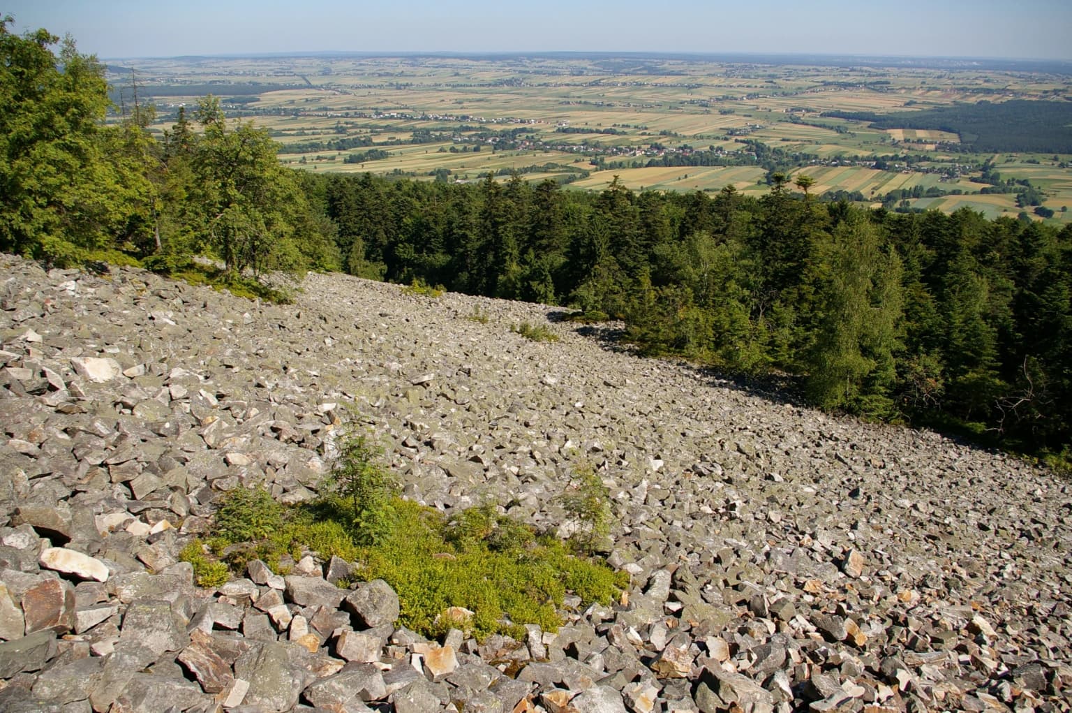
Świętokrzyski National Park is best known for its gołoborze, extensive boulder and rock rubble fields that blanket the mountain ridgelines, particularly on Łysa Góra and Łysica, creating an almost alpine landscape atypical of Poland's low-elevation mountains. The park also preserves Poland's most significant remaining populations of silver fir in relatively natural forest ecosystems, along with remarkable examples of Polish larch on Chełmowa Góra, representing a relict subspecies found nowhere else in the world. The distinctive rock-strewn summits, dense beech and fir forests, and the presence of endemic forest communities make this park a living museum of Central European forest ecology.

Wooden chapel with statue in gable, surrounded by trees
Chapel of St. Francis in Świętokrzyski National Park, Poland

Świętokrzyski National Park history and protected-area timeline

The protection of this region's natural heritage predates the establishment of the national park by several decades. In 1921, Józef Kostyrko established the first forest reserve in the Świętokrzyskie Mountains on Chełmowa Góra, covering 1.63 square kilometers. Two years later, in 1922, additional areas on the Łysogóry range totaling 3.11 square kilometers received protection. The reserves were formally expanded in 1932 to cover 13.47 square kilometers, but the national park itself was not created until 1950, on May 1, becoming only the third such protected area in Poland after the Pieniny and Białowieża parks. The initial park area covered 60.54 square kilometers but was later expanded to the present 76.26 square kilometers, of which 72.12 square kilometers remains forested. The park was originally named the Świętokrzyski National Park named after Stanisław Żeromski, honoring the famous Polish writer, though this designation is now less commonly used. Five strictly protected zones were established within the park, covering 17.31 square kilometers where human intervention is minimized to allow natural ecological processes to proceed. In 1996, the park was expanded to include the Klonowski Ridge, adding to its ecological diversity. More recently, boundary adjustments occurred in 2022 involving the temporary removal and subsequent restoration of an enclave around the Holy Cross Abbey, with the monastery territory returned to the park in 2025.

Świętokrzyski National Park landscape and geographic character

The physical landscape of Świętokrzyski National Park is defined by its position on the highest ridgeline of Poland's oldest mountain system. The Świętokrzyskie Mountains emerged through three distinct tectonic episodes and represent a geological heritage far older than the Carpathians or Sudetes. Despite their relatively modest elevations—Łysica at 612 meters and Łysa Góra at 595 meters being the highest points—the mountains present a distinctive topography of rounded, elongated ridges separated by narrow valleys. The most striking landscape feature is the gołoborze, extensive boulder fields that cover the exposed ridge crests. These formations developed during periglacial conditions when frequent freeze-thaw cycles shattered the bedrock, creating fields of angular granite fragments that remain largely unvegetated today. The largest gołoborze covers nearly four hectares on Łysa Góra, while similar but smaller fields occur on Łysica and other summits. The terrain transitions from these exposed, rocky ridgelines through slopes covered in dense forest to the valley floors where streams have cut shallow channels. The park's elevation range, while modest by mountain standards, creates distinct microclimatic zones with varying moisture, temperature, and exposure that influence vegetation patterns across the protected area.

Rocky slope covered in scattered stones with patches of green vegetation, surrounded by dense forest, overlooking a vast valley with rolling hills
Stone run on the slope of Łysa Góra with forested hills and distant valley view in Świętokrzyski National Park

Świętokrzyski National Park ecosystems, habitats, and plant life

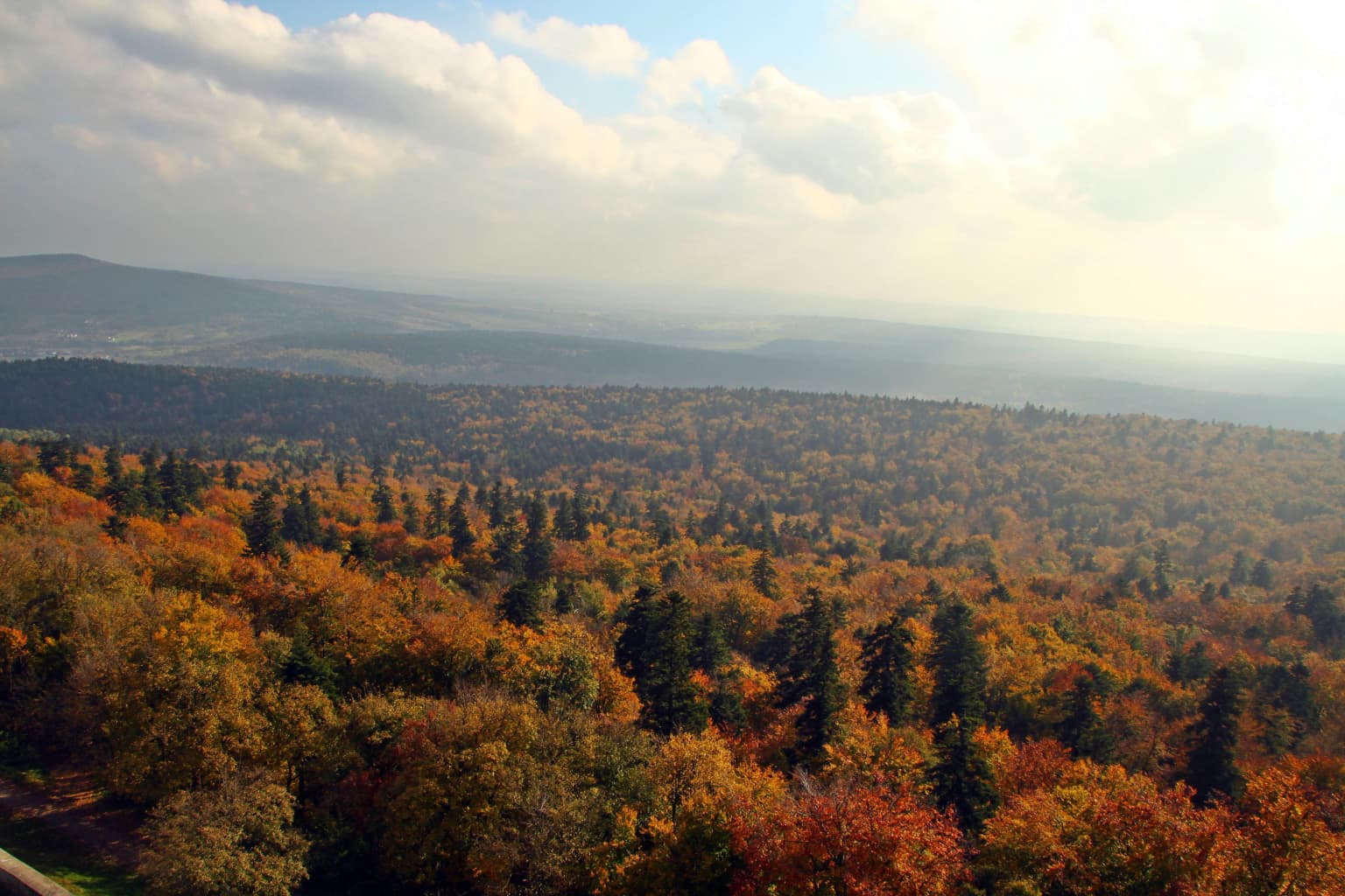
The ecological character of Świętokrzyski National Park centers on its extensive forest cover—approximately 95 percent of the park area—and the remarkable diversity of forest types preserved within its boundaries. Mixed forests of pine and beech dominate the lower slopes and valleys, while the more characteristic upland forests feature silver fir growing in association with beech, creating dense, shaded woodlands where canopy closure limits understory development. The park preserves one of Poland's most significant examples of the wyżynny jodłowy bór mieszany (upland mixed fir forest) ecosystem, a community that has largely disappeared from lowland Poland. Perhaps most remarkable is the preservation of the endemic fir wilderness and the unique Świętokrzyski rowan community (Sorbus aria × aucuparia) found only in this region. On Chełmowa Góra, forests dominated by Polish larch (Larix decidua ssp. polonica), a relict subspecies, represent an ecological rarity of international significance. The park contains over 670 trees designated as natural monuments, including ancient beech, fir, and pine specimens, while successful reintroduction efforts have established approximately 1,300 yew trees throughout the area. More than 1,000 species of vascular plants have been recorded within the park and its buffer zone, with 128 species found exclusively within the park itself—underscoring the ecological uniqueness of this mountain enclave.

A wide view of a forested landscape with autumn-colored trees under a partly cloudy sky
Autumn forest landscape in the Lysogory region of Świętokrzyski National Park

Świętokrzyski National Park wildlife and species highlights

The wildlife communities of Świętokrzyski National Park reflect both the mountain setting and the extensive forest cover that dominates the protected area. Mammal populations include approximately 45 species, with roe deer, red deer, and wild boar being the most commonly encountered. Pine marten, red-backed vole, and wood mouse represent the smaller mammalian fauna, while the diverse forest structure provides habitat for species requiring older, more complex woodland environments. Birdlife is particularly well-represented, with 150 species documented including 118 breeding species—indicating successful reproduction and suitable habitat conditions. The avifauna includes great spotted woodpecker, nuthatch, chaffinch, wren, buzzard, and tawny owl, among others, with the older fir and beech forests providing nesting opportunities for species requiring large, mature trees. Invertebrate diversity is extraordinary: more than 3,000 insect species have been recorded, including approximately 1,500 beetle species and nearly 1,000 butterfly species. Among these, the marsh fritillary butterfly and the alcimonia glandon moth (a tiger moth) are protected under the European Union's Habitat Directive as priority species within the Natura 2000 site. The park also supports 66 snail species and 187 spider species, contributing to an overall invertebrate tally exceeding 4,000 species—a remarkable density for a relatively small protected area.

Wooden entrance gate with roof, adjacent building, benches, paved path, and forest background
Entrance gate and visitor center at Łysa Góra within Świętokrzyski National Park

Świętokrzyski National Park conservation status and protection priorities

Świętokrzyski National Park serves as a core protected area within the broader Natura 2000 network, specifically designated as a Special Area of Conservation (SAC) under the name Łysogóry. The park's conservation significance derives from its preservation of Europe's old-growth forest communities, particularly the upland mixed silver fir forests that once covered much of the Polish uplands but have been largely eliminated by centuries of forest management. The park's forest ecosystems function at a very high level of naturalness, with the core strictly protected zones requiring no active management interventions to maintain their ecological integrity—a testament to the effectiveness of long-term protection. The presence of endemic species and communities found nowhere else in the world—including the Świętokrzyski rowan and Polish larch—adds global significance to the park's conservation value. The five strictly protected zones covering 17.31 square kilometers form the ecological backbone of the reserve, while the surrounding buffer zone of nearly 208 square kilometers provides essential ecological connectivity and allows ecological processes to operate at a landscape scale. Species of European conservation concern, including marsh fritillary and several rare beetle species protected under the Habitats Directive, depend on the park's habitats for their survival in Poland.

Świętokrzyski National Park cultural meaning and human context

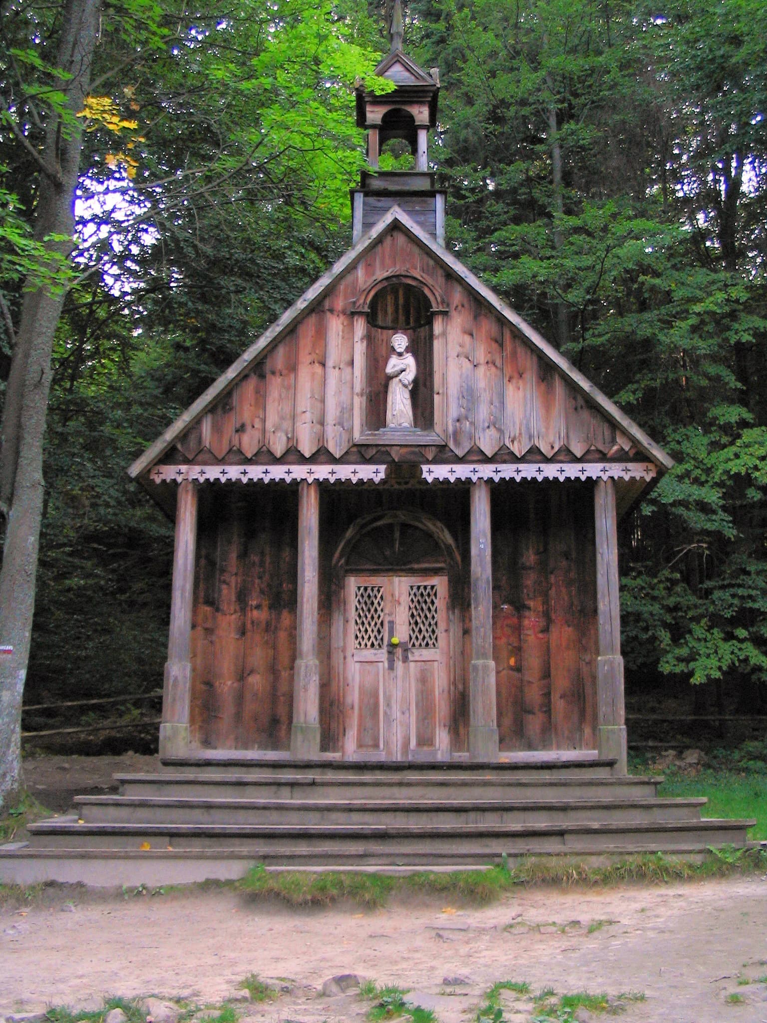
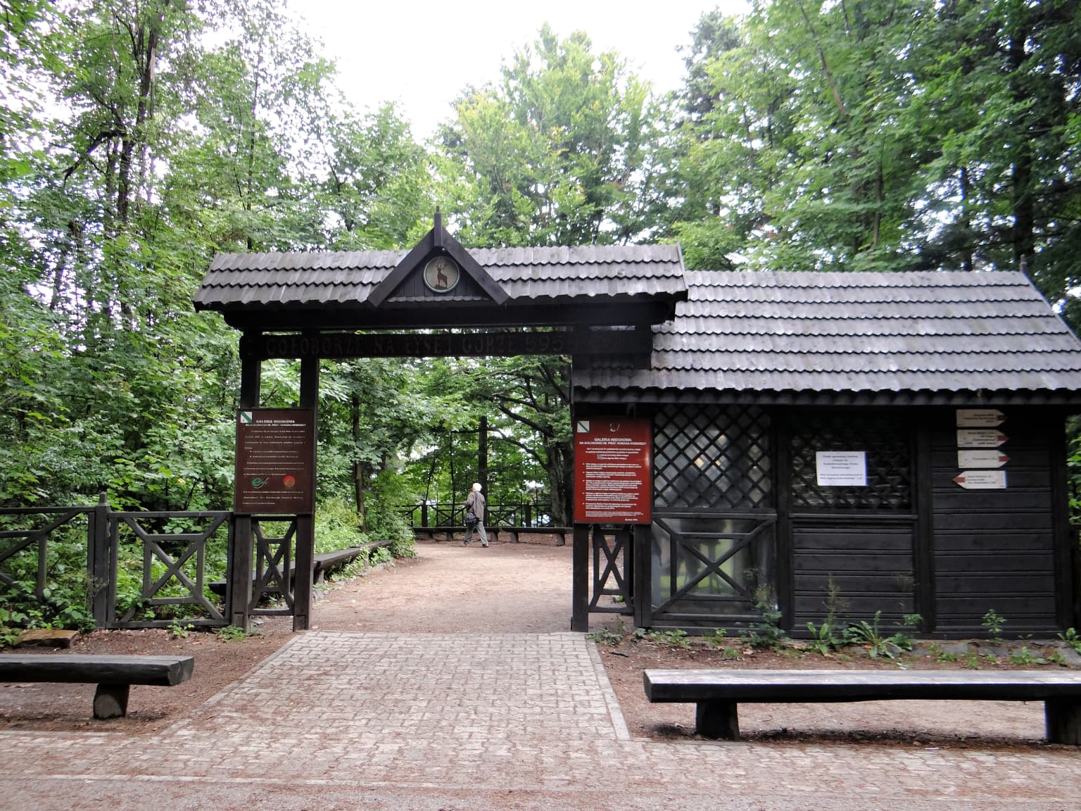
The cultural landscape of Świętokrzyski National Park is deeply intertwined with Poland's historical and religious heritage. The Holy Cross Mountains take their name from the Benedictine Holy Cross Abbey (Opactwo na Świętym Krzyżu) established on the summit of Łysa Góra in the first half of the 12th century. This monastery, still operating today under the care of the Missionary Oblates of Mary Immaculate, became one of the most important religious centers in medieval Poland and is associated with the probable origin of the oldest surviving example of Polish writing—the Holy Cross Sermons (Kazania Świętokrzyskie). The abbey's buildings occupy an enclave within what would otherwise be the park boundary, and this unusual situation led to boundary adjustments in 2022-2025 before the monastery territory was restored to the protected area. The surrounding landscape contains numerous roadside chapels and religious monuments reflecting the strong traditional связь between local communities and this sacred mountain. Beyond the abbey, the region contains additional architectural heritage including the 17th-century female monastery at Święta Katarzyna, 15th-century churches at Bodzentyn, ruins of a 14th-century castle at Bodzentyn, and remnants of 9th-century ramparts around Łysa Góra. The area also holds significance for Polish national history, with numerous monuments connected to historic uprisings and the Nazi occupation period.

Wooden signpost with multiple directional trail signs showing names and distances in a forested area
Wooden signpost with directional trail signs in Świętokrzyski National Park forest

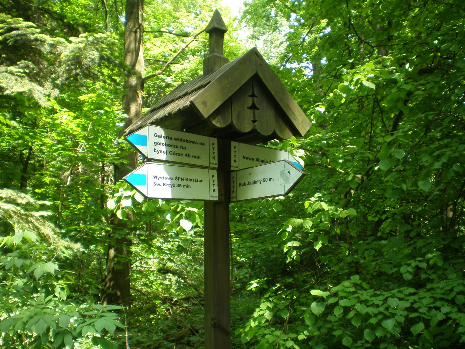
Top sights and standout views in Świętokrzyski National Park

The distinctive gołoborze rock rubble fields on Łysa Góra and Łysica, creating an almost alpine landscape unique among Poland's low mountains. The ancient 270-year-old silver fir standing 51 meters tall, recognized as Poland's tallest conifer tree. The endemic Polish larch forests on Chełmowa Góra, representing a subspecies found nowhere else in the world. The historic Holy Cross Abbey from the 12th century, one of Poland's oldest and most significant religious monuments. The extensive strictly protected forest zones allowing natural ecological processes to proceed without intervention. The remarkable biodiversity including over 4,000 invertebrate species and 150 bird species within a relatively compact 76 square kilometer area.

Wooden bridge trail with stone steps covered in fallen leaves surrounded by autumn trees, a person walking in the distance
Wooden bridge trail through autumn forest with hikers

Best time to visit Świętokrzyski National Park

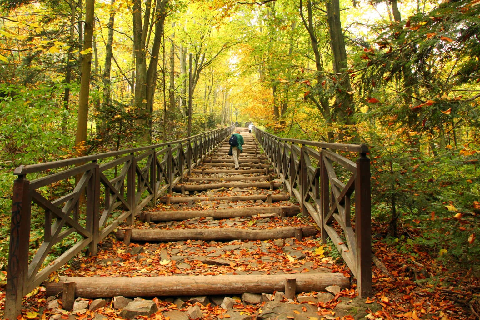
The park can be visited throughout the year, with each season offering a distinct experience. Spring brings fresh forest growth and the emergence of wildflowers in the forest understory, while summer provides warm conditions ideal for hiking the mountain trails and exploring the gołoborze fields. Autumn transforms the beech and fir forests with spectacular color, while winter offers a quieter, more austere landscape—the bare rock fields often covered in snow creating a dramatically different atmosphere. The spring and autumn seasons may offer the most comfortable hiking conditions, though the park's relatively low elevation means it can be enjoyed in any season without extreme weather concerns. The park remains less crowded than Poland's more famous mountain destinations, allowing for a more contemplative experience of its ancient landscapes.

Park location guide

Geography guide, regional context, and park location map for Świętokrzyski National Park

Świętokrzyski National Park park geography, regions, and map view in Poland
Understand where Świętokrzyski National Park sits in Poland through a broader geographic reading of the surrounding landscape, nearby location context, and its mapped position within the national park landscape.

How Świętokrzyski National Park fits into Poland

Poland, officially the Republic of Poland, is a Central European country spanning from the Baltic Sea in the north to the Carpathian Mountains in the south. It borders Germany, Czech Republic, Slovakia, Ukraine, Belarus, Lithuania, and Kaliningrad Oblast. The country has a temperate climate, diverse landscapes, and is known for its rich history, cultural heritage, and strong economic position within the EU.

Wider geography shaping Świętokrzyski National Park in Poland

Poland occupies 312,696 km2 in Central Europe, extending from the Baltic Sea coast in the north to the Sudetes and Carpathian Mountains in the south. It borders Germany to the west, Czech Republic and Slovakia to the south, Ukraine and Belarus to the east, and Lithuania and Kaliningrad Oblast to the northeast. The landscape includes lowland plains, uplands, and mountain ranges.

Map view of Świętokrzyski National Park

Use this park location map to pinpoint Świętokrzyski National Park in Poland, understand its exact geographic position, and read its mapped placement within the surrounding landscape more clearly.

Pigeon | © OpenStreetMap contributors

Location context for Świętokrzyski National Park

Świętokrzyskie Voivodeship

Gain Visual Insights into the Park's Mountain Terrain, Silver Fir Forests, and Unique Protected-Area Environment

Świętokrzyski National Park: Discover Visuals of Its Gołoborze Rock Fields and Ancient Forests
Visually explore Świętokrzyski National Park through a curated gallery showcasing its distinctive gołoborze rock rubble fields, ancient silver fir forests, and unique mountain terrain. These detailed images offer a comprehensive understanding of the park's diverse habitats, ecological character, and the specific landscapes it protects within Poland's oldest mountain range.

Wooden chapel with statue in gable, surrounded by trees

Gravelly and rocky terrain surrounded by dense evergreen forest with distant hills and valleys visible

Rocky slope covered in scattered stones with patches of green vegetation, surrounded by dense forest, overlooking a vast valley with rolling hills

A wide view of a forested landscape with autumn-colored trees under a partly cloudy sky

Wooden entrance gate with roof, adjacent building, benches, paved path, and forest background

Wide aerial view of dense forest with autumn foliage showing mixed green and orange-brown trees under a hazy sky

Wooden signpost with multiple directional trail signs showing names and distances in a forested area

Wooden bridge trail with stone steps covered in fallen leaves surrounded by autumn trees, a person walking in the distance

Stone gatehouse with snow-covered roof and cross, snow-covered ground, distant hills, and a person walking

A scree field of large rocks and boulders with scattered trees and forested background

A landscape view showing a plowed field in the foreground, scattered trees, and a distant mountain range with a tall tower on the horizon under a clear sky

Stone-lined spring with floating leaves, surrounded by trees and a wooden fence

Tall beech and fir trees in a dense forest with sunlight filtering through the canopy

Park atlas

Compare diverse protected landscapes and map the regional spread of parks near Świętokrzyski National Park.

Discover Other National Parks and Protected Areas Near Świętokrzyski National Park
After discovering Świętokrzyski National Park's unique gołoborze and ancient fir forests, explore additional national parks and protected areas within Poland's central region. Compare diverse protected landscapes, mapping their geographic spread and regional conservation significance across the Świętokrzyskie Mountains and wider Central European terrain.
National parkLesser Poland Voivodeship

Ojców National Park: Karst Geography and Protected Landscape Atlas Entry

Explore the mapped terrain and unique geology of this national park.

Ojców National Park, situated in Lesser Poland Voivodeship, offers a concentrated display of dramatic karst topography. This protected national park is renowned for its towering limestone cliffs, intricate ravines, and over 400 caves, showcasing a unique Jurassic geology. As a vital protected area, its mapped boundaries encompass distinctive rock formations like Hercules' Club and the historic Trail of the Eagles' Nests, providing rich context for landscape discovery and atlas exploration.

Area
21.46 km²
Established
1956
IUCN
II
Relief
Upland
National parkLublin Voivodeship

Roztocze National Park: Ancient Forested Landscape and Protected Area Geography

Discover its role in Lublin Voivodeship's natural atlas.

Roztocze National Park stands as a remarkable example of a heavily forested protected area, showcasing some of Poland's largest fir trees and ancient forest ecosystems. Located in Lublin Voivodeship, this national park offers a distinct upland landscape characterized by rolling hills and river valleys. Explore its mapped boundaries, ecological significance, and geographic context as a key component of the regional natural atlas, providing deep insights into its protected terrain.

Area
84.83 km²
Established
1974
IUCN
II
Visitors
134K annual
Watercolor illustration showing a landscape with rolling hills, green trees, and distant mountains under a light sky
National parkSubcarpathian Voivodeship

Magura National Park: Mapped Protected Landscape & Carpathian Geography Atlas

Explore unique sandstone formations and mapped natural terrain.

Magura National Park, located in the Subcarpathian Voivodeship of Poland, offers a rich focus for protected-area exploration and geographic discovery. This national park is distinguished by its dramatic sandstone rock formations, forested Carpathian ridges, and its ecological importance as a transitional zone. Users engaging with Magura National Park can examine its mapped boundaries, understand its specific landscape context, and appreciate its role within the broader regional geography.

Area
194.39 km²
Established
1995
IUCN
II
Visitors
40K annual
Watercolor painting showing rolling green hills, forests, and distant mountains under a pale sky
National parkLesser Poland Voivodeship

Gorce National Park: Carpathian Forest Ecosystems and Mapped Terrain in Lesser Poland

Protected landscape discovery within the Western Beskids.

Delve into the protected landscape of Gorce National Park, a key national park situated in Poland's Lesser Poland Voivodeship. This atlas entry focuses on its mapped geography, highlighting the characteristic Carpathian mountain terrain, extensive old-growth forests, and unique alpine meadows. Understand the park's protected boundaries and its significance within the regional landscape context of the Western Beskids, providing a foundation for structured geographic exploration.

Area
70.3 km²
Established
1981
IUCN
II
Visitors
80K annual
National park

Polesie National Park: Protected National Park in Poland's Eastern Lowlands

Explore its mapped wetland geography and unique glacial terrain.

Polesie National Park represents a key protected landscape within eastern Poland, notable for its vast wetland complexes, including extensive peat bogs and marshes interspersed with pine forests on sandy dunes. This national park showcases a distinct geography shaped by glacial processes, offering a unique perspective on lowland ecosystems and their conservation. MoriAtlas allows for a structured discovery of its protected boundaries and the surrounding regional context, providing an atlas-driven understanding of this vital natural territory.

Area
97.52 km²
Established
1979
IUCN
II
National parkMasovian Voivodeship

Kampinos National Park: Mapped Protected Landscape of Inland Sand Dunes

Discover Masovian Voivodeship's unique geography and park boundaries.

Kampinos National Park is a nationally significant protected area within the Masovian Voivodeship, celebrated for its extensive and well-preserved inland sand dune formations, a rarity in European geography. This park offers a distinct mapped landscape where pine-covered dunes intermingle with wetland ecosystems, supporting a unique biodiversity that includes a notable moose population. Explore the park's protected boundaries and understand its position as a vital natural and historical asset with detailed geographic context.

Area
385.44 km²
Established
1959
IUCN
II
Relief
Lowland
Watercolor illustration of a river flowing through a forested valley with rolling hills and scattered trees
National parkPrešov Region

Pieniny National Park: Slovakia's Distinctive Protected Landscape and Dunajec River Gorge

Explore mapped boundaries, regional geography, and protected karst terrain.

Pieniny National Park offers a focused exploration of dramatic limestone gorges and unique Carpathian mountain geography within Slovakia's Prešov Region. This national park is celebrated for the spectacular Dunajec River Gorge, a feature that defines its protected landscape and provides a profound example of natural terrain shaping. Understanding Pieniny National Park involves appreciating its specific mapped boundaries and its role as a significant protected area within the broader atlas of European natural wonders and conservation territories.

Area
37.5 km²
Established
1967
IUCN
II
Relief
Mountain
Watercolor painting of mountain ranges, forests, and a winding river
National parkLesser Poland Voivodeship

Tatra National Park: Poland's Premier Alpine National Park and Protected Landscape

Explore dramatic glacial terrain, mountain lakes, and regional geography.

Tatra National Park is the definitive Alpine protected area in Poland, located in Lesser Poland Voivodeship. It showcases unique glacial landforms, including over 30 mountain lakes and dramatic peaks like Rysy. This national park serves as a crucial habitat for endemic species and offers unparalleled opportunities for atlas exploration of its rugged, mapped terrain. Understand its geographic significance as part of the Carpathian Mountains and its role as a protected landscape.

Area
211.64 km²
Established
1954
IUCN
II
Visitors
3.9M annual

Common questions about visiting, size, designation, and location context for Świętokrzyski National Park

Świętokrzyski National Park FAQs for park facts, access, geography, and protected area context
Find quick answers about Świętokrzyski National Park, including protected-area facts, park geography, trail and visitor context, and how the park fits into its surrounding country and regional landscape.
MoriAtlas Explorer

Continue Your Protected Areas Search Across the Global Atlas

Deepen your exploration by continuing the structured search for national parks and protected areas worldwide. Utilize the comprehensive filtering capabilities to compare different conservation landscapes and refine your understanding of global park geography. Discover more about the distribution and characteristics of protected natural areas.

Global natural geography