Mori Atlas logo
National parkBabia Góra National Park

Discover the altitudinal vegetation zones and mapped terrain of this significant Carpathian national park.

Babia Góra National Park: Protected Landscape and Geographic Context in Lesser Poland Voivodeship

(Babiogórski Park Narodowy)

Babia Góra National Park represents a crucial protected landscape within Poland's Carpathian Mountains, situated in the Lesser Poland Voivodeship. This national park preserves a remarkable altitudinal zonation of terrain, showcasing diverse ecosystems from dense forests to alpine meadows on its prominent massif. Its designation as a UNESCO biosphere reserve underscores the global importance of its well-preserved natural patterns and unique flora, offering a distinct point of atlas exploration for understanding regional geography and protected areas.

National ParkCarpathian MountainsBiosphere ReserveEndemic SpeciesMountain EcosystemsAlpine Meadows
Illustration of a mountain landscape with cliffs, green valleys, a river, and a waterfall

Babia Góra National Park

National park

Park overview

Structured park overview, official facts, and landscape profile for Babia Góra National Park

Babia Góra National Park park facts, protected area profile, and essential visitor context
Review the core facts for Babia Góra National Park, including designation, size, terrain, visitor scale, habitats, and operating context in one park-focused overview.

About Babia Góra National Park

Babia Góra National Park is located in the Orava Beskids, a mountain range forming part of the Western Carpathians along the Polish-Slovak border. The park's territory encompasses the northern slopes and part of the southern slopes of the Babia Góra massif, a prominent Carpathian mountain whose main summit, Diablak, rises to 1,725 meters and represents the highest point in the Beskid Żywiecki mountain range. The landscape is characterized by steep slopes, rocky ridges, and debris-covered summit zones, shaped by ancient glacial processes and ongoing weathering. The area belongs to the Beskid Żywiecko-Orawski mesoregion and forms part of a larger transboundary ecological corridor with Slovakia's Horná Orava Protected Landscape Area on the southern side of the massif. The park's headquarters in Zawoja serves as the administrative center and base for visitor education programs. The park's ecological significance stems from its relatively undisturbed state, with extensive forest complexes preserving representative Carpathian biodiversity and serving as habitat for species that have been largely displaced from other parts of the Carpathians.

Quick facts and research context for Babia Góra National Park

Babia Góra National Park occupies 33.92 km² in the Orava Beskids mountain range along the Polish-Slovak border. The park's centerpiece is Diablak (1,725 m), the highest peak in the range and the highest point in the Beskid Żywiecki. The area is distinguished by its classic altitudinal vegetation zonation, displaying four distinct ecological belts from the lower mountain forest through subalpine zones to alpine meadow. The park serves as a critical habitat for large Carpathian predators including brown bear, wolf, and lynx, and protects unique endemic plant species found nowhere else in Poland.

Park context

Deeper park guide and search-rich context for Babia Góra National Park

Babia Góra National Park history, landscape, wildlife, and travel context
Explore Babia Góra National Park through its history, landscape character, ecosystems, wildlife, conservation priorities, cultural context, and seasonal travel timing in a structured park guide built for atlas discovery and search intent.

Why Babia Góra National Park stands out

Babia Góra National Park is renowned for its exceptional altitudinal vegetation zones, which display a complete sequence from lower mountain forests through spruce-dominated upper forest, dwarf pine shrubland, to alpine meadows at the summit. The park protects unique endemic plant species, most notably the rare Laserpitium archangelica, which serves as the park's emblem and was long known only from this location in Poland. The park also preserves Poland's only occurrence of alpine catchfly (Silene alpina) and other Carpathian endemics. Its status as a UNESCO biosphere reserve since 1976 reflects the global significance of its well-preserved Carpathian ecosystems and the presence of large predatory mammals.

Grassy hillside in foreground with forested slopes and mountain peaks labeled Słopik, Kopan, Czerna, Babia Góra, Rudnica under clear blue sky.
Panoramic view of the Babia Góra massif from Mała Babia Góra, featuring labeled peaks including Słopik, Kopan, Czerna, Babia Góra, and Rudnica.

Babia Góra National Park history and protected-area timeline

The protected area that would become Babia Góra National Park was first established as a nature reserve in 1933, covering roughly the same territory as the modern national park. This early protection recognized the area's outstanding natural values and the need to preserve its unique Carpathian ecosystems. The national park was officially established on October 30, 1954, by regulation of the Council of Ministers, with the regulation taking effect on January 1, 1955. At its founding, the park covered 16.37 km², with a strict nature reserve (rezerwat ścisły) comprising 1,049.89 hectares and a partial reserve (rezerwat częściowy) covering 624.89 hectares. The decision to establish the park was influenced by the classically developed altitudinal vegetation zones, the unique rock-dwelling plant communities, and the presence of plant species found only in Babia Góra in Poland, specifically Laserpitium archangelica and alpine catchfly. After more than two decades of efforts to expand the park's territory, the park was enlarged in 1997 to 3,391.55 hectares by another Council of Ministers regulation. A protective buffer zone (otulina) of 8,437 hectares was also created around the park. In 1977, the park received additional recognition when Babia Góra was designated as a UNESCO biosphere reserve and included in the UNESCO Man and the Biosphere (MAB) Program.

Babia Góra National Park landscape and geographic character

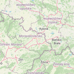
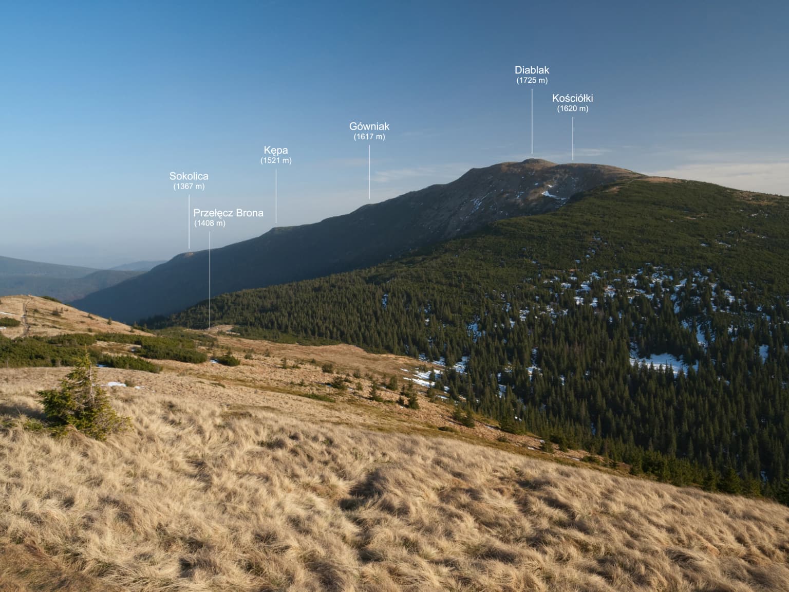
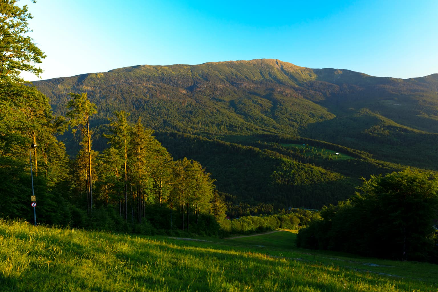
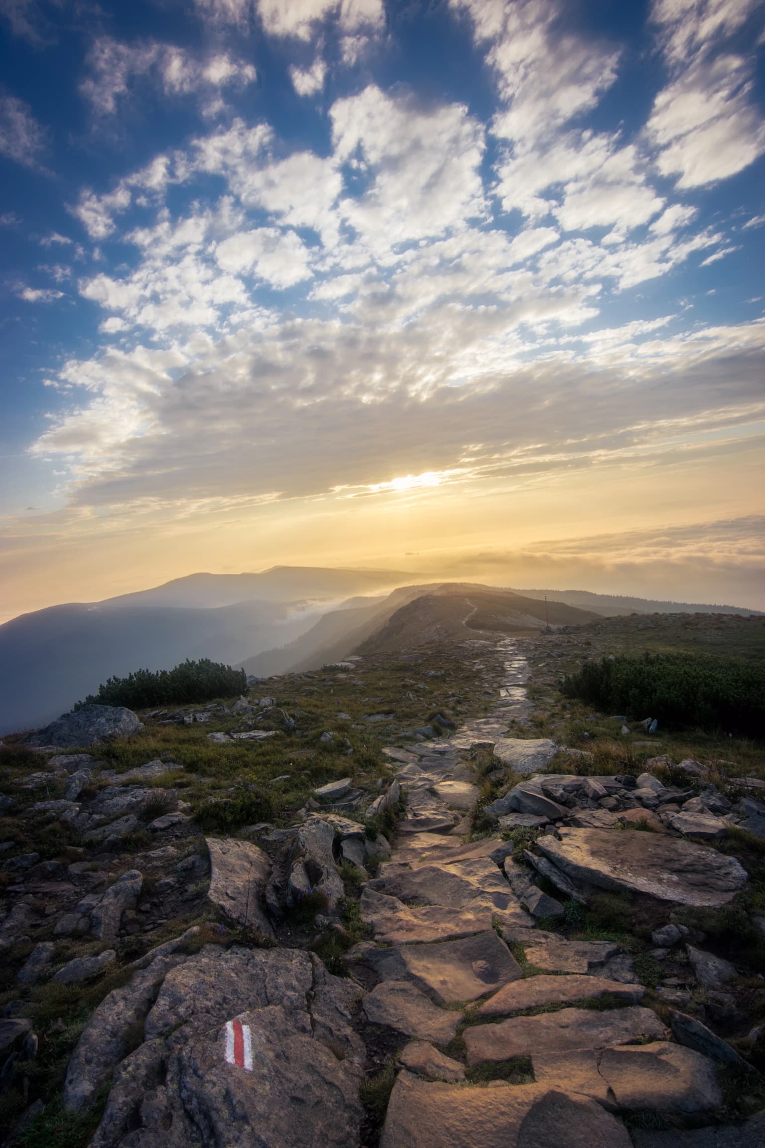
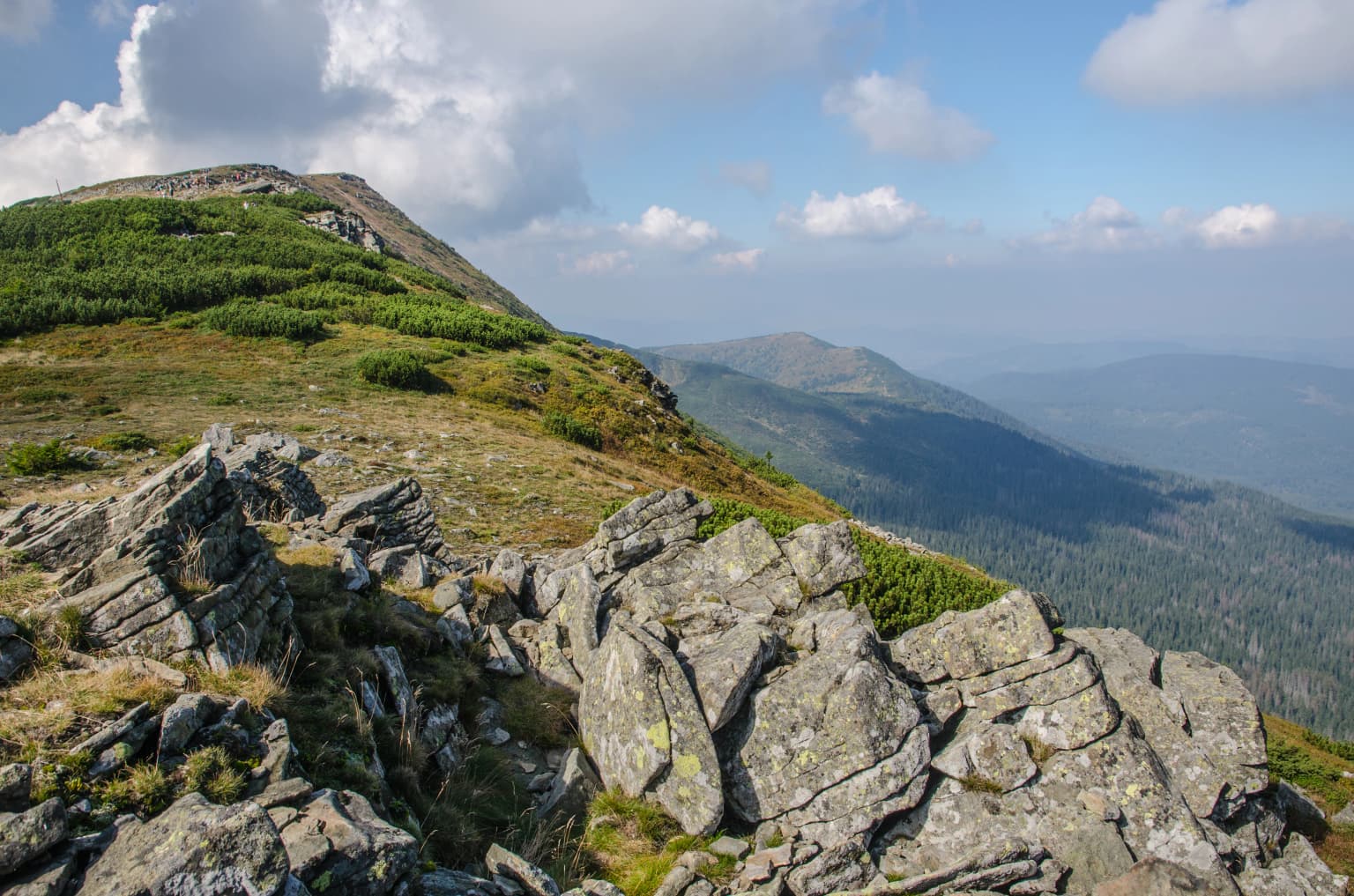
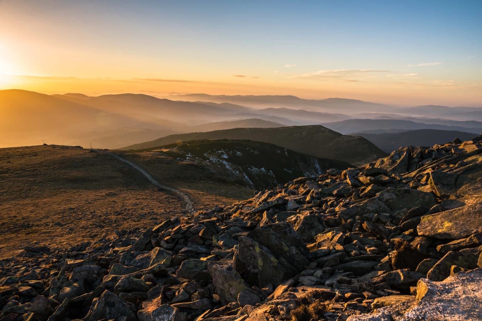
The landscape of Babia Góra National Park is dominated by the Babia Góra massif, a prominent Carpathian mountain whose steep slopes rise dramatically from the surrounding lower terrain. The mountain's main summit, Diablak (1,725 m), is the highest peak in the Orava Beskids and the Beskid Żywiecki ranges. The terrain is characterized by rocky ridges, steep forested slopes, and a distinctive summit zone with alpine meadows and boulder fields. The geology consists primarily of Carpathian flysch, with sandstone and shale formations contributing to the mountain's rugged character. Glacial processes have left their mark on the landscape, particularly in the upper zones where cirques and moraines are visible. The mountain displays a classic example of altitudinal zonation, with distinct vegetation belts visible as one ascends from the lower forests to the summit. The Slovak side of the massif is protected as the Horná Orava Protected Landscape Area, creating a transboundary conservation framework.

Mountain landscape showing Babia Góra with forested slopes and grassy foreground under clear blue sky
Scenic view of Babia Góra mountain within Babia Góra National Park

Babia Góra National Park ecosystems, habitats, and plant life

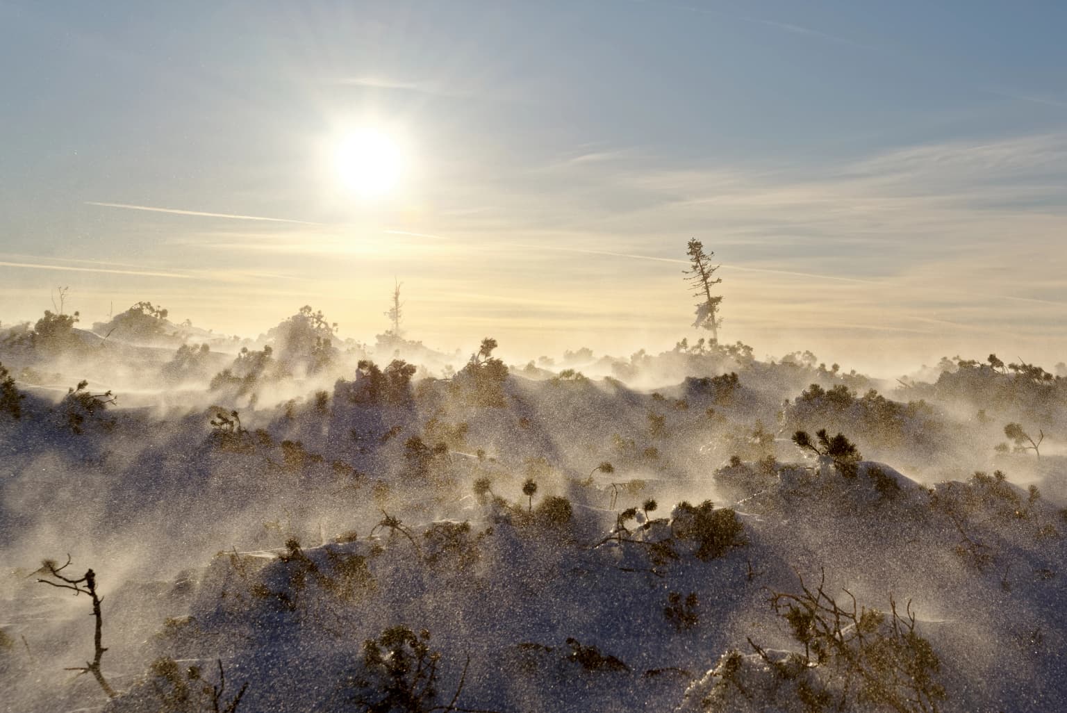
The vegetation of Babia Góra National Park exemplifies the classic altitudinal zonation of the Carpathian Mountains, displaying four distinct vegetation floors. The lower forest zone (regiel dolny) spans from 700 to 1,150 meters and features beech, Norway spruce, and silver fir forests with trees reaching up to 45 meters in height and 350 centimeters in trunk circumference. The upper forest zone (regiel górny), from 1,150 to 1,350 meters, is dominated by Norway spruce. The dwarf pine zone (piętro kosodrzewiny), from 1,350 to 1,650 meters, features mountain pine (kosodrzewina) formations with characteristic alpine flora including lily of the valley, pink dianthus, and yellow alpine rose. The alpine zone (piętro halne), from 1,650 to 1,725 meters, represents the highest vegetation in the Beskids and supports alpine meadow communities with species such as wolly grass and purple moor grass. The park protects approximately 650 species of vascular plants, nearly 280 moss species, and numerous lichens, algae, and liverworts. Of particular significance are 70 high-mountain species and 54 species protected under Polish law. Several species are endemic to Babia Góra or the Western Carpathians, making the park globally significant for biodiversity conservation.

Stone trail with red and white trail marker on rocky terrain, mountain landscape with distant peaks and sunset sky
Stone trail with red and white marker ascending a mountain slope at sunset

Babia Góra National Park wildlife and species highlights

Babia Góra National Park supports a rich and diverse fauna representing the higher mountain ranges of the Western Carpathians that have retained relatively intact ecosystems. The mammal fauna includes 38 species, with large predators prominently represented by brown bear, gray wolf, and Eurasian lynx, which maintain viable populations in the park's extensive forest complexes. The park also hosts deer, wild boar, and in rare cases, elk (moose) entering from the Orawa-Nowy Targ Basin. The mustelid family is well represented with European badger, European otter, polecat, beech marten, stone marten, and least weasel. Birdlife is exceptionally diverse, with over 100 species recorded, including approximately 80 breeding species. Notable birds include capercaillie and black grouse in the coniferous forests, Tengmalm's owl, Ural owl, and eagle owl among the raptors and owls. Woodpeckers are well represented, including rare species such as the three-toed woodpecker and white-backed woodpecker. The park supports typical Carpathian reptile and amphibian communities, with 6 reptile species, 7 amphibian species, and 2 fish species (brown trout and bullhead) in the stream ecosystems. Invertebrates are exceptionally diverse, with approximately 3,500 species identified, including about 1,500 beetle species and 92 mollusk species.

Rocky terrain with scattered boulders and patches of grass and shrubs, mountain peaks in the background under a blue sky with clouds
Rocky mountain slopes and distant peaks under a partly cloudy sky in Babia Góra National Park

Babia Góra National Park conservation status and protection priorities

Babia Góra National Park serves as a crucial conservation area within the Carpathian mountain chain, one of Europe's most significant biodiversity hotspots. The park's designation as a UNESCO biosphere reserve since 1976 reflects its international importance for preserving representative Carpathian ecosystems. The protection of endemic plant species, particularly those found only in the Babia Góra region, makes the park globally significant for botanical conservation. The forest ecosystems, covering approximately 85% of the park's area, serve as habitat for viable populations of large Carpathian predators including brown bear, wolf, and lynx, species that have been greatly reduced across much of their European range. The well-developed altitudinal vegetation zones provide a living laboratory for studying Carpathian ecology and climate-related vegetation shifts. The park's relatively small size belies its ecological importance, as it forms part of a larger transboundary conservation network with Slovakia's Horná Orava Protected Landscape Area. Ongoing management includes visitor education, trail maintenance, and research programs to monitor ecosystem health and species populations.

Babia Góra National Park cultural meaning and human context

The Babia Góra area has been part of the traditional cultural landscape of the Orava region, which spans both Polish and Slovak territory. The mountain and its surrounding area have been inhabited for centuries by local communities engaged in pastoral activities and forestry. The village of Zawoja, where the park's headquarters are located, serves as the main access point and has developed a relationship with the protected area over generations. The park has established an Education Center that presents the natural values of Babia Góra to visitors in an accessible format. A network of educational trails has been created throughout the park to enhance visitor understanding of the local ecology and conservation significance. The mountain itself holds cultural significance in the local traditions, with the peak historically serving as a landmark for regional navigation and identity.

Rocky mountain landscape at sunset with rolling hills and a winding path in the distance
Sunset view of Babia Góra mountain in Babia Góra National Park

Top sights and standout views in Babia Góra National Park

Babia Góra National Park offers exceptional ecological diversity within a compact area, with its complete altitudinal vegetation zonation providing a visible representation of Carpathian ecological patterns. The summit of Diablak (1,725 m) provides panoramic views across the Beskid Żywiecki and into the Slovak Carpathians. The park protects several plant species found nowhere else in Poland, with Laserpitium archangelica serving as the park's official emblem. The presence of viable populations of brown bear, wolf, and lynx makes the park significant for large predator conservation in Central Europe. The UNESCO biosphere reserve status since 1976 reflects over seven decades of dedicated conservation management.

Snow-covered mountain slope with blowing snow and crepuscular rays from the sun in early morning
Crepuscular rays and ground blizzard on Babia Góra slope, early morning

Best time to visit Babia Góra National Park

The most favorable time to visit Babia Góra National Park is during the summer months from June through September, when all trails are accessible and the alpine zones display their full floral variety. Spring and early summer bring spectacular displays of mountain flora as the vegetation zones bloom in succession. Autumn offers golden foliage in the forest zones and clear visibility from the summit. Winter access is limited to marked trails, and the park has recently opened select routes for skiing under controlled conditions when adequate snow cover exists. The shoulder seasons provide excellent opportunities for wildlife observation and experiencing the park's changing moods without the peak summer crowds.

Park location guide

Geography guide, regional context, and park location map for Babia Góra National Park

Babia Góra National Park park geography, regions, and map view in Poland
Understand where Babia Góra National Park sits in Poland through a broader geographic reading of the surrounding landscape, nearby location context, and its mapped position within the national park landscape.

How Babia Góra National Park fits into Poland

Poland, officially the Republic of Poland, is a Central European country spanning from the Baltic Sea in the north to the Carpathian Mountains in the south. It borders Germany, Czech Republic, Slovakia, Ukraine, Belarus, Lithuania, and Kaliningrad Oblast. The country has a temperate climate, diverse landscapes, and is known for its rich history, cultural heritage, and strong economic position within the EU.

Wider geography shaping Babia Góra National Park in Poland

Poland occupies 312,696 km2 in Central Europe, extending from the Baltic Sea coast in the north to the Sudetes and Carpathian Mountains in the south. It borders Germany to the west, Czech Republic and Slovakia to the south, Ukraine and Belarus to the east, and Lithuania and Kaliningrad Oblast to the northeast. The landscape includes lowland plains, uplands, and mountain ranges.

Map view of Babia Góra National Park

Use this park location map to pinpoint Babia Góra National Park in Poland, understand its exact geographic position, and read its mapped placement within the surrounding landscape more clearly.

Pigeon | © OpenStreetMap contributors

Location context for Babia Góra National Park

Lesser Poland Voivodeship

Gain a visual understanding of the park's altitudinal vegetation zones, mountain terrain, and key habitats.

Babia Góra National Park Photos: Visual Guide to its Carpathian Landscapes and Scenery
Visually explore Babia Góra National Park's diverse mountain scenery, distinct altitudinal vegetation zones, and pristine Carpathian ecosystems through a curated image collection. These images provide essential visual context, helping users understand the park's rugged terrain, unique habitats, and overall protected landscape character, supporting deeper geographic discovery.

Grassy hillside in foreground with forested slopes and mountain peaks labeled Słopik, Kopan, Czerna, Babia Góra, Rudnica under clear blue sky.

Rock debris field below Diablak with alpine vegetation, featuring rocky terrain and pink alpine flowers against a mountainous backdrop

Mountain landscape showing Babia Góra with forested slopes and grassy foreground under clear blue sky

Stone trail with red and white trail marker on rocky terrain, mountain landscape with distant peaks and sunset sky

Rocky terrain with scattered boulders and patches of grass and shrubs, mountain peaks in the background under a blue sky with clouds

Forest-covered mountain slopes with patches of snow under a clear blue sky

Rocky mountain landscape at sunset with rolling hills and a winding path in the distance

Snow-covered mountain slope with blowing snow and crepuscular rays from the sun in early morning

Hikers walking on a rocky mountain trail surrounded by low-growing vegetation with a mountain peak in the background

Blue bell-shaped flowers with a bumblebee and small insects

Grassy meadow with patches of shrubs, surrounded by dense forest and mountains under a partly cloudy sky

Rocky mountain peak with grassy slope and trail leading to summit under dark clouds with patches of blue sky

Stone path winding through a misty forest with tall trees and dense underbrush.

A forest trail with gravel and wooden planks, surrounded by dense trees and fallen leaves under misty conditions

Stone steps and dirt path leading uphill through a forest with tall trees and green foliage

Rocky mountain terrain with scattered vegetation and a small wooden shelter structure on the left side under a partly cloudy sky.

Park atlas

Explore the National Parks and Protected Landscapes Across the Lesser Poland Voivodeship and Carpathians

Discover Related Protected Areas Near Babia Góra National Park
After exploring Babia Góra National Park, continue your geographic discovery by browsing other national parks and protected areas located nearby within the Lesser Poland Voivodeship. Compare diverse mountain ecosystems, altitudinal zonation, and key conservation landscapes across the Polish Carpathians and neighboring regions to expand your atlas view.
Watercolor painting showing rolling green hills, forests, and distant mountains under a pale sky
National parkLesser Poland Voivodeship

Gorce National Park: Carpathian Forest Ecosystems and Mapped Terrain in Lesser Poland

Protected landscape discovery within the Western Beskids.

Delve into the protected landscape of Gorce National Park, a key national park situated in Poland's Lesser Poland Voivodeship. This atlas entry focuses on its mapped geography, highlighting the characteristic Carpathian mountain terrain, extensive old-growth forests, and unique alpine meadows. Understand the park's protected boundaries and its significance within the regional landscape context of the Western Beskids, providing a foundation for structured geographic exploration.

Area
70.3 km²
Established
1981
IUCN
II
Visitors
80K annual
Watercolor painting of mountain ranges, forests, and a winding river
National parkLesser Poland Voivodeship

Tatra National Park: Poland's Premier Alpine National Park and Protected Landscape

Explore dramatic glacial terrain, mountain lakes, and regional geography.

Tatra National Park is the definitive Alpine protected area in Poland, located in Lesser Poland Voivodeship. It showcases unique glacial landforms, including over 30 mountain lakes and dramatic peaks like Rysy. This national park serves as a crucial habitat for endemic species and offers unparalleled opportunities for atlas exploration of its rugged, mapped terrain. Understand its geographic significance as part of the Carpathian Mountains and its role as a protected landscape.

Area
211.64 km²
Established
1954
IUCN
II
Visitors
3.9M annual
Watercolor painting showing layered mountains and green forests
National park

Malá Fatra National Park National Park: Geographic Context and Protected Area Mapping

Explore the mapped terrain and regional geography.

Malá Fatra National Park serves as a cornerstone for understanding Slovakia's protected landscapes. This dedicated park page provides crucial geographic context, detailing its national park designation and the extent of its protected area boundaries. Users can leverage MoriAtlas to visualize the park's location within the broader regional geography, facilitating a structured approach to discovering its natural landscape and terrain through map-based exploration.

Area
226.3 km²
Established
1988
IUCN
II
Relief
Mountain
National park

Veľká Fatra National Park: Slovakia's Premier Protected Landscape for Geographic Discovery

Explore the park's mapped boundaries and regional natural terrain.

Veľká Fatra National Park stands as a distinct protected area, offering critical insights into Slovakia's regional geography and landscape character. This entry provides an atlas-driven perspective on its mapped boundaries and its significance as a national park. Delve into the structured geographic details and protected land context that define Veľká Fatra National Park for comprehensive discovery.

Area
403.713 km²
Established
2002
IUCN
II
Relief
Mountain
Watercolor illustration of a river flowing through a forested valley with rolling hills and scattered trees
National parkPrešov Region

Pieniny National Park: Slovakia's Distinctive Protected Landscape and Dunajec River Gorge

Explore mapped boundaries, regional geography, and protected karst terrain.

Pieniny National Park offers a focused exploration of dramatic limestone gorges and unique Carpathian mountain geography within Slovakia's Prešov Region. This national park is celebrated for the spectacular Dunajec River Gorge, a feature that defines its protected landscape and provides a profound example of natural terrain shaping. Understanding Pieniny National Park involves appreciating its specific mapped boundaries and its role as a significant protected area within the broader atlas of European natural wonders and conservation territories.

Area
37.5 km²
Established
1967
IUCN
II
Relief
Mountain
Watercolor painting of rolling mountains in green, yellow, and pink tones
National park

Low Tatras National Park: Slovakia's Vast National Park and Carpathian Protected Landscape

Explore mapped terrain and regional geographic context.

The Low Tatras National Park represents Slovakia's largest protected area, encompassing the entirety of the Low Tatras mountain range. Its landscape is defined by dramatic altitudinal diversity, from alpine summits like Ďumbier to extensive forest zones and significant karst formations with notable cave systems. This page provides detailed geographic context and map-based discovery for the park's protected boundaries and its ecological significance within the Carpathian region.

Area
728 km²
Established
1978
IUCN
II
Relief
Mountain
Watercolor illustration showing green hills, scattered trees, and a light sky background
National parkLesser Poland Voivodeship

Ojców National Park: Karst Geography and Protected Landscape Atlas Entry

Explore the mapped terrain and unique geology of this national park.

Ojców National Park, situated in Lesser Poland Voivodeship, offers a concentrated display of dramatic karst topography. This protected national park is renowned for its towering limestone cliffs, intricate ravines, and over 400 caves, showcasing a unique Jurassic geology. As a vital protected area, its mapped boundaries encompass distinctive rock formations like Hercules' Club and the historic Trail of the Eagles' Nests, providing rich context for landscape discovery and atlas exploration.

Area
21.46 km²
Established
1956
IUCN
II
Relief
Upland
Watercolor illustration of a forested landscape with mountains, trees, and a river
National parkBanská Bystrica Region

Muránska planina National Park: Discover Slovakia's Karst Plateau and Protected Natural Landscape

Explore mapped boundaries, caves, and endemic flora in Banská Bystrica Region.

Muránska planina National Park represents a significant protected landscape in central Slovakia's Banská Bystrica Region, defined by its extensive karst topography. This national park encompasses a limestone and dolomite plateau rich with geological wonders, including over 150 caves, sinkholes, and karst springs. The unique contrast between the flat plateau surface and the sharp, rocky ravines showcases a dramatic natural terrain. Explore the park's mapped boundaries and its remarkable biodiversity, highlighted by 35 endemic species and rare Tertiary relict flora like Daphne arbuscula, making it a key destination for atlas-based geographic discovery.

Area
213.18 km²
Established
1997
IUCN
II
Relief
Mountain

Common questions about visiting, size, designation, and location context for Babia Góra National Park

Babia Góra National Park FAQs for park facts, access, geography, and protected area context
Find quick answers about Babia Góra National Park, including protected-area facts, park geography, trail and visitor context, and how the park fits into its surrounding country and regional landscape.
MoriAtlas Explorer

Continue Your Protected Areas Search Across the Global Atlas

Deepen your exploration by continuing the structured search for national parks and protected areas worldwide. Utilize the comprehensive filtering capabilities to compare different conservation landscapes and refine your understanding of global park geography. Discover more about the distribution and characteristics of protected natural areas.

Global natural geography