Mori Atlas logo
National parkMuránska planina National Park

Discover the extensive karst terrain, caves, and endemic flora within the Banská Bystrica Region.

Muránska planina National Park: Central Slovakia's Karst Plateau and Protected Landscape

(Národný park Muránska planina)

Muránska planina National Park, located in the Banská Bystrica Region of central Slovakia, stands as a testament to extraordinary karst topography. This protected national park safeguards a vast limestone and dolomite plateau, characterized by over 150 caves, numerous sinkholes, abysses, and springs, offering a unique window into geological processes. The park's landscape is further distinguished by steep ravines contrasting with the relatively flat plateau surface, creating dramatic natural scenery. As a key component of the Spišsko-gemerský kras, Muránska planina is a significant site for understanding regional geography and protected landscape preservation.

Karst landscapeLimestone plateauEndemic speciesCavesNature reservesCentral Slovakia

Muránska planina National Park

National park

Park overview

Structured park overview, official facts, and landscape profile for Muránska planina National Park

Muránska planina National Park park facts, protected area profile, and essential visitor context
Review the core facts for Muránska planina National Park, including designation, size, terrain, visitor scale, habitats, and operating context in one park-focused overview.

About Muránska planina National Park

Muránska planina National Park occupies a remarkable karst plateau in central Slovakia, representing one of the most geologically significant protected areas in the country. The park straddles the boundary between the Horehronie region to the north and the Gemer region to the south, spanning parts of three administrative districts within the Banská Bystrica Region. The geological character of the area dates to the Mesozoic era, when massive blocks of limestone and dolomite were thrust into their current position, forming a distinctive nappe structure that underlies the modern landscape. The resulting terrain is characterized by a relatively flat plateau surface situated between 900 and 1,400 meters above sea level, flanked by steep rocky ravines on the northwestern and southeastern edges. Water erosion over millions of years has carved deep furrows and valleys into the plateau, creating a wild and rugged character. The well-developed karst system has produced numerous caves, abysses, sinkholes, karrens, and springs that define the landscape. The park protects a complex of nested protected areas including ten national nature reserves, one national natural monument, and seven nature preserves, along with special protection areas for birds and sites of community importance for European Union habitat conservation. The administrative headquarters are located in the town of Revúca.

Quick facts and research context for Muránska planina National Park

Muránska planina National Park spans 213 square kilometers of core protected area plus a buffer zone of approximately 217 square kilometers. The park lies in the Banská Bystrica Region across three districts: Brezno in the north, Rimavská Sobota in the south, and Revúca in the southeast. The highest peak within the park is Fabova hoľa at 1,439 meters, while Stolica at 1,476 meters stands in the buffer zone. The park protects 10 national nature reserves, one national natural monument, and seven nature preserves, forming part of the larger Spišsko-gemerský karst system. The geological foundation dates to the Mesozoic era when massive limestone and dolomite blocks formed the distinctive plateau landscape.

Park context

Deeper park guide and search-rich context for Muránska planina National Park

Muránska planina National Park history, landscape, wildlife, and travel context
Explore Muránska planina National Park through its history, landscape character, ecosystems, wildlife, conservation priorities, cultural context, and seasonal travel timing in a structured park guide built for atlas discovery and search intent.

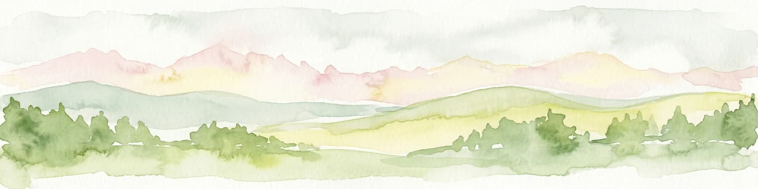
Why Muránska planina National Park stands out

Muránska planina is best known for its extensive karst landscape, a limestone and dolomite plateau riddled with caves, sinkholes, abysses, and karst springs. The area contains over 150 notable caves, with the most extensive being the Bobačka cave system stretching three kilometers in length. The park is also celebrated for its exceptional botanical significance, harboring 35 endemic and sub-endemic species including Daphne arboscula, a Tertiary relict plant found nowhere else in the world. The dramatic contrast between the flat plateau surface and the steep ravines that surround it creates a striking visual landscape. The medieval Muráň Castle, perched on a rocky outcrop in the heart of the plateau, adds historical intrigue to the natural environment.

Muránska planina National Park history and protected-area timeline

The territory that now comprises Muránska planina National Park first received formal protection in 1976, when it was designated as a protected scenic area. This initial protected status recognized the outstanding natural and landscape values of the karst plateau. Following nearly two decades of protection under this designation, the status was upgraded in October 1997 to full national park status, reflecting the heightened conservation importance of the area. The park was officially opened to the public on 27 May 1998, making it one of the youngest national parks in Slovakia. The establishment of the national park formalized protection for the geological formations, karst systems, endemic species, and cultural heritage that characterize the Muráň Plateau, while also providing a framework for sustainable management and public enjoyment of the area.

Muránska planina National Park landscape and geographic character

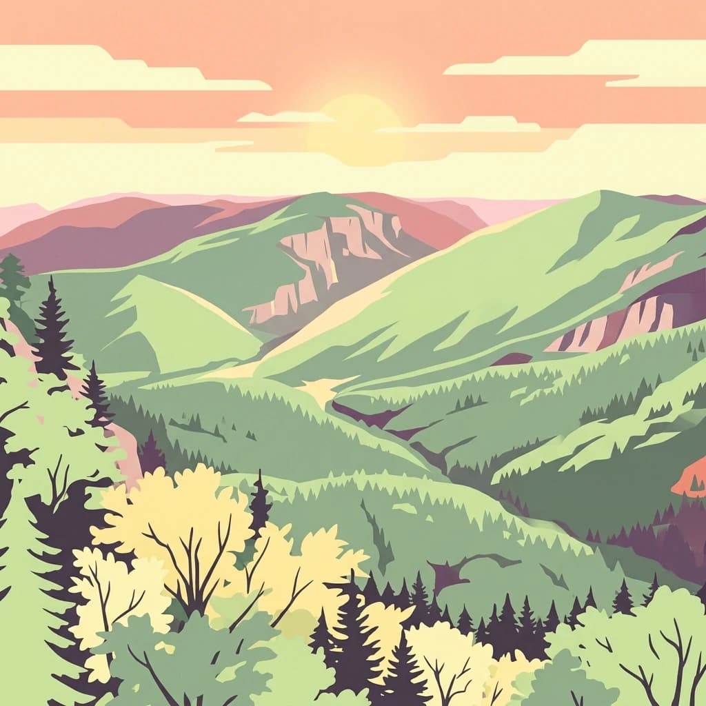
The landscape of Muránska planina National Park is defined by its distinctive karst topography. The central feature is a limestone and dolomite plateau that stretches approximately 25 kilometers from the settlement of Červená Skala in the east to the town of Tisovec in the west. The plateau surface is relatively flat, sitting between 900 and 1,400 meters above sea level, but is far from uniform—it's dotted with numerous abysses, caves, sinkholes, karrens, and springs that create a complex surface. The edges of the plateau feature steep rocky ravines, particularly along the northwestern and southeastern boundaries where the terrain drops away more dramatically. The lowest point in the park lies near the village of Muráň at approximately 400 meters elevation, creating a dramatic vertical range within the protected area. The highest point within the park boundaries is Fabova hoľa at 1,439 meters, while the buffer zone contains the even higher peak of Stolica at 1,476 meters, which is also the highest peak of the entire Slovak Ore Mountains. The park's location within the Spišsko-gemerský kras (Spiš-Gemer Karst) connects it to a broader regional karst landscape of significant geological importance.

Muránska planina National Park ecosystems, habitats, and plant life

The nature of Muránska planina is characterized by extensive forest coverage—approximately 90% of the park area is forested—and exceptional biodiversity. The park supports 35 endemic and sub-endemic species, representing a remarkable concentration of rare plants for such a relatively small area. The most famous of these is Daphne arbuscula, known commonly as the Muráň spurge laurel, which is a Tertiary relict species that has survived in this region for millions of years. This plant is particularly significant as a living remnant of ancient flora that predates the ice ages. The karst environment creates diverse microhabitats including caves, cliffs, forest openings, and damp ravines, each supporting specialized species communities. The combination of geological age, isolation, and varied topography has allowed evolutionary processes to produce a distinctive flora that cannot be found elsewhere on Earth.

Muránska planina National Park wildlife and species highlights

While detailed wildlife information is limited in the source material, the forest-dominant landscape of Muránska planina supports typical Central European forest fauna. The complex terrain—with its steep ravines, rocky outcrops, caves, and forest habitats—provides diverse living conditions for various animal species. The special protection area designation for Muránska planina - Stolica indicates the presence of significant bird species requiring conservation attention. The karst cave systems, while largely inaccessible to the public, provide habitat for specialized cave-dwelling organisms. The protected area network within the park helps preserve wildlife corridors and habitat continuity across the mountainous landscape.

Muránska planina National Park conservation status and protection priorities

Muránska planina National Park represents an important conservation area within Slovakia's protected lands. The park's karst landscape contains geological features of scientific significance, including over 150 notable caves that document millions of years of geological and hydrological processes. The exceptional concentration of endemic and sub-endemic plant species, including the Tertiary relict Daphne arbuscula, makes the area botanically irreplaceable. The park is integrated into broader European conservation frameworks through the Natura 2000 network, with both a special protection area for birds and a site of community importance designated under EU nature directives. The nested protected area system—with national nature reserves, national natural monuments, nature preserves, and protection zones—provides multiple levels of conservation intensity appropriate to different areas' sensitivity and significance.

Muránska planina National Park cultural meaning and human context

The cultural landscape of Muránska planina includes historical elements that predate the national park designation. Most prominently, Muráň Castle stands on a rocky outcrop in the middle of the plateau, a medieval fortress that speaks to the long human presence in this mountainous region. The park encompasses the cadastral territories of the town of Tisovec and eight villages, indicating ongoing human communities whose histories are intertwined with this landscape. Traditional settlements such as Muráň and Závadka nad Hronom provide access points to the park and represent local cultural connections to the land. The historical use of the area for pastoral activities and resource gathering has shaped the landscape over centuries, creating a cultural as well as natural heritage within the protected area.

Top sights and standout views in Muránska planina National Park

Muránska planina offers visitors an accessible wilderness experience on one of Slovakia's most geologically distinctive plateaus. The 300 kilometers of marked hiking trails provide opportunities to explore the karst landscape, with two educational trails offering interpretive information about the park's natural and cultural values. The striking contrast between the flat plateau top and the steep surrounding ravines creates dramatic viewpoints, particularly from peaks like Kľak at 1,409 meters. The extensive cave systems, though largely inaccessible, represent a hidden underworld of geological wonder. The botanical richness, with 35 endemic species including the rare Daphne arbuscula, makes the park significant for plant conservation. Medieval Muráň Castle adds a historical dimension to the natural landscape. The combination of geological, botanical, and cultural heritage within a relatively compact protected area makes Muránska planina a distinctive destination in Slovakia's network of national parks.

Best time to visit Muránska planina National Park

The summer months from June through September offer the most favorable conditions for exploring Muránska planina, when warm temperatures and longer daylight hours allow for comprehensive hiking across the plateau and into the surrounding valleys. Autumn brings colorful foliage across the forested slopes and typically stable weather, making it another excellent season for visitors. Winter conditions on the plateau can be harsh, with significant snow cover and cold temperatures limiting accessibility, though the landscape offers a different kind of stark beauty for winter enthusiasts prepared for challenging conditions. Spring brings new growth and flowering, particularly significant given the park's botanical importance, though trail conditions may be affected by snowmelt and increased precipitation. The higher elevations experience more extreme seasonal variations than the lower valleys, so visitors should prepare for changing weather regardless of the season chosen for exploration.

Park location guide

Geography guide, regional context, and park location map for Muránska planina National Park

Muránska planina National Park park geography, regions, and map view in Slovakia
Understand where Muránska planina National Park sits in Slovakia through a broader geographic reading of the surrounding landscape, nearby location context, and its mapped position within the national park landscape.

How Muránska planina National Park fits into Slovakia

Slovakia is a landlocked Central European country with a population of over 5.4 million. It became independent from Czechoslovakia in 1993 and is a member of the European Union. The country features mountainous terrain, with the Carpathian Mountains running through its territory. Bratislava serves as the capital and largest city, while Košice is the second-largest city.

Wider geography shaping Muránska planina National Park in Slovakia

Slovakia is located in Central Europe, landlocked between Poland to the north, Ukraine to the east, Hungary to the south, Austria to the west, and the Czech Republic to the northwest. The territory is mostly mountainous, with the Carpathian Mountains, including the High Tatras, dominating the northern region. The Danube River forms part of the southern border with Hungary.

Map view of Muránska planina National Park

Use this park location map to pinpoint Muránska planina National Park in Slovakia, understand its exact geographic position, and read its mapped placement within the surrounding landscape more clearly.

Pigeon | © OpenStreetMap contributors

Location context for Muránska planina National Park

Banská Bystrica Region
Park atlas

Compare the diverse protected landscapes and regional park geography surrounding this unique Slovakian karst plateau.

Explore More National Parks and Protected Areas Near Muránska planina National Park
After exploring Muránska planina National Park's distinctive karst plateau and rich biodiversity, continue your discovery of Slovakia's protected areas. Compare nearby national parks and regional protected landscapes to understand the broader geographic context and conservation efforts across central Europe.
Watercolor illustration of a winding river through rolling green hills with trees in the foreground
National parkKošice Region

Slovak Paradise National Park: Protected Area Mapping & Geographic Context in Košice Region

Explore the boundaries and terrain of this national park.

Investigate Slovak Paradise National Park, a designated national park situated within Slovakia's Košice Region. This detailed entry provides essential context for understanding its protected landscape features, mapped geographic distribution, and role within regional atlas exploration. Discover its unique terrain and boundaries to build a comprehensive view of Slovak conservation areas.

Area
197.63 km²
Established
1988
IUCN
II
Relief
Mountain
National park

Low Tatras National Park: Slovakia's Vast National Park and Carpathian Protected Landscape

Explore mapped terrain and regional geographic context.

The Low Tatras National Park represents Slovakia's largest protected area, encompassing the entirety of the Low Tatras mountain range. Its landscape is defined by dramatic altitudinal diversity, from alpine summits like Ďumbier to extensive forest zones and significant karst formations with notable cave systems. This page provides detailed geographic context and map-based discovery for the park's protected boundaries and its ecological significance within the Carpathian region.

Area
728 km²
Established
1978
IUCN
II
Relief
Mountain
National parkKošice Region

Slovak Karst National Park: Premier Central European Karst Landscape and Cave Systems

Explore protected terrain and mapped underground wonders in Košice Region.

Slovak Karst National Park offers an unparalleled glimpse into a dynamic karst environment. As a designated national park and UNESCO Biosphere Reserve, it preserves a significant concentration of caves, dramatic limestone formations, and rugged canyons within its territory in southeastern Slovakia. This atlas-focused presentation highlights the park's distinctive geology, mapped landscape features, and its importance as a protected natural area within the broader geography of the Košice Region. Understand the park's surface topography and its world-renowned subterranean realms.

Area
346.11 km²
Established
2002
IUCN
II
Relief
Mountain
Watercolor painting showing a winding river, green trees, distant hills, and grassy foreground
National park

Aggtelek National Park

Karst Landscape & Cave Systems

Explore the protected area of Aggtelek National Park, a UNESCO World Heritage site known for its extensive karst landscapes and significant cave systems. Understand its geographic setting and protected land status.

Area
198.92 km²
Established
1985
IUCN
II
Relief
Mixed relief
Watercolor painting of mountain ranges, forests, and a winding river
National parkLesser Poland Voivodeship

Tatra National Park: Poland's Premier Alpine National Park and Protected Landscape

Explore dramatic glacial terrain, mountain lakes, and regional geography.

Tatra National Park is the definitive Alpine protected area in Poland, located in Lesser Poland Voivodeship. It showcases unique glacial landforms, including over 30 mountain lakes and dramatic peaks like Rysy. This national park serves as a crucial habitat for endemic species and offers unparalleled opportunities for atlas exploration of its rugged, mapped terrain. Understand its geographic significance as part of the Carpathian Mountains and its role as a protected landscape.

Area
211.64 km²
Established
1954
IUCN
II
Visitors
3.9M annual
National park

Veľká Fatra National Park: Slovakia's Premier Protected Landscape for Geographic Discovery

Explore the park's mapped boundaries and regional natural terrain.

Veľká Fatra National Park stands as a distinct protected area, offering critical insights into Slovakia's regional geography and landscape character. This entry provides an atlas-driven perspective on its mapped boundaries and its significance as a national park. Delve into the structured geographic details and protected land context that define Veľká Fatra National Park for comprehensive discovery.

Area
403.713 km²
Established
2002
Relief
Mountain
Climate
Temperate
Watercolor illustration of a river flowing through a forested valley with rolling hills and scattered trees
National parkPrešov Region

Pieniny National Park: Slovakia's Distinctive Protected Landscape and Dunajec River Gorge

Explore mapped boundaries, regional geography, and protected karst terrain.

Pieniny National Park offers a focused exploration of dramatic limestone gorges and unique Carpathian mountain geography within Slovakia's Prešov Region. This national park is celebrated for the spectacular Dunajec River Gorge, a feature that defines its protected landscape and provides a profound example of natural terrain shaping. Understanding Pieniny National Park involves appreciating its specific mapped boundaries and its role as a significant protected area within the broader atlas of European natural wonders and conservation territories.

Area
37.5 km²
Established
1967
IUCN
II
Relief
Mountain
National park

Malá Fatra National Park National Park: Geographic Context and Protected Area Mapping

Explore the mapped terrain and regional geography.

Malá Fatra National Park serves as a cornerstone for understanding Slovakia's protected landscapes. This dedicated park page provides crucial geographic context, detailing its national park designation and the extent of its protected area boundaries. Users can leverage MoriAtlas to visualize the park's location within the broader regional geography, facilitating a structured approach to discovering its natural landscape and terrain through map-based exploration.

Area
226.3 km²
Established
1988
IUCN
II
Relief
Mountain

Common questions about visiting, size, designation, and location context for Muránska planina National Park

Muránska planina National Park FAQs for park facts, access, geography, and protected area context
Find quick answers about Muránska planina National Park, including protected-area facts, park geography, trail and visitor context, and how the park fits into its surrounding country and regional landscape.
MoriAtlas Explorer

Continue Your Protected Areas Search Across the Global Atlas

Deepen your exploration by continuing the structured search for national parks and protected areas worldwide. Utilize the comprehensive filtering capabilities to compare different conservation landscapes and refine your understanding of global park geography. Discover more about the distribution and characteristics of protected natural areas.

Global natural geography