Mori Atlas logo
National parkAggtelek National Park

Discover mapped boundaries and geological formations of this UNESCO World Heritage karst region.

Aggtelek National Park: Hungary's Premier Karst Protected Landscape

(Aggteleki Nemzeti Park)

Aggtelek National Park safeguards a unique karst landscape in Northern Hungary, globally recognized for its extensive cave systems and remarkable limestone terrain. This page serves as your atlas gateway to understanding the park's protected boundaries, its complex geology, and its place within the surrounding geographic context.

karst landscapecave systemsUNESCO World Heritage Sitelimestone formationsspeleologytransboundary protected area
Watercolor illustration showing a river, stone structures, and cliffs in a forested landscape

Aggtelek National Park

National park

Park overview

Structured park overview, official facts, and landscape profile for Aggtelek National Park

Aggtelek National Park park facts, protected area profile, and essential visitor context
Review the core facts for Aggtelek National Park, including designation, size, terrain, visitor scale, habitats, and operating context in one park-focused overview.

About Aggtelek National Park

Aggtelek National Park occupies a unique position in Hungary's protected areas as the nation's first national park specifically created to safeguard geological values. The park lies within the Aggtelek Karst, a landscape shaped over millions of years by the dissolution of limestone, creating one of the most complex and important karst regions in Central Europe. The terrain is characterized by relatively low mountain to hilly elevations, with the main karst plateau interrupted by deep valleys and sinkhole fields. The geological history dates back to the late Perm period around 250 million years ago, with the primary limestone formations developing during the Triassic period approximately 210-240 million years ago. Subsequent tectonic movements, sea transgressions, and volcanic activity further shaped the landscape, resulting in the rich variety of karst forms visible today. The park's management operates from Jósvafő, with an operational territory that has expanded over the years to encompass over 433,000 hectares including additional protected areas. The park serves dual purposes of geological conservation and ecological protection, preserving not only the caves and surface karst features but also the diverse habitats they support.

Quick facts and research context for Aggtelek National Park

Aggtelek National Park is located in Northern Hungary within the Aggtelek Karst region of the Gömör-Tornai Karst, spanning approximately 198.92 square kilometers. The park was established on January 1, 1985, and was Hungary's first national park created specifically to protect geological values rather than scenic or ecological features. It holds IUCN Category II protection status and was inscribed on the UNESCO World Heritage List in 1995 as part of a transboundary site shared with Slovakia. The park contains 280 caves, of which 25 are strictly protected, with the Baradla cave system being the standout natural monument. The park's headquarters are located in Jósvafő, and the area experiences a typical karst hydrology with numerous springs and sinkholes.

Park context

Deeper park guide and search-rich context for Aggtelek National Park

Aggtelek National Park history, landscape, wildlife, and travel context
Explore Aggtelek National Park through its history, landscape character, ecosystems, wildlife, conservation priorities, cultural context, and seasonal travel timing in a structured park guide built for atlas discovery and search intent.

Why Aggtelek National Park stands out

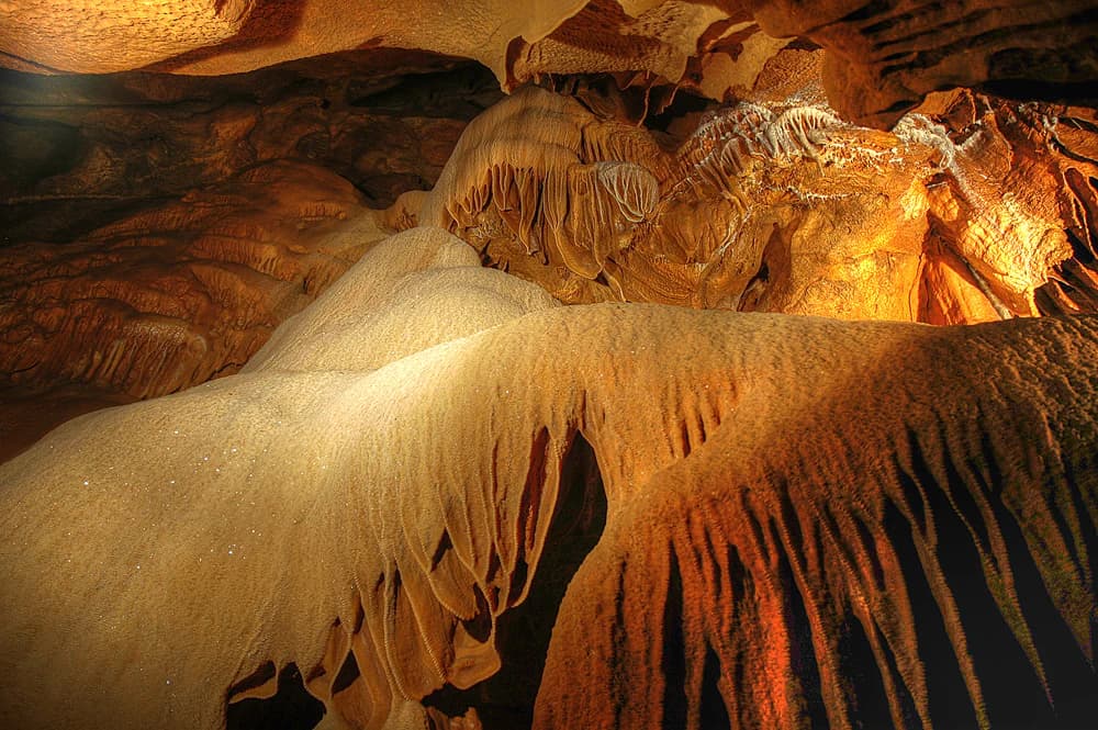
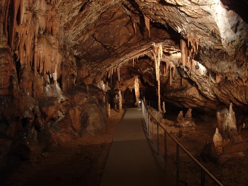
Aggtelek National Park is best known for its exceptional cave systems and karst geological formations. The Baradla-Domica cave system represents the crown jewel, being the longest active stream cave in the temperate zone of Europe at 26 kilometers, with Hungarian and Slovak sections connected underground. The park features remarkable speleothems including stalactites, stalagmites, flowstone formations, helictites, and even rare aragonite bushes. The Szilicei Ice Cave at 503 meters elevation holds the distinction of being the world's lowest-lying ice cave. The surface karst phenomena are equally impressive, with diverse dolines, karst fields, and the distinctive karrmeadows known as 'ördögszántás' (devil's ploughing). The Peace Cave contains a sanatorium used for treating asthma patients, utilizing the unique microclimate of the underground environment.

Vass Imre Cave stalactite
Orange waterfall stalactite formation in Vass Imre Cave, Jósvafő, Hungary.

Aggtelek National Park history and protected-area timeline

The history of Aggtelek National Park traces back to the earliest documented exploration of its caves in 1549, though the region's underground wonders have been known to local populations for centuries. The Baradla cave opened to tourists in 1920, marking the beginning of organized visitation to the karst region. Formal protection began in 1940 when the surface of the Baradla-Domica cave system was declared a protected area, followed by the Béke Cave in 1953, Szabadság Cave in 1956, and Vass Imre Cave in 1958. In 1962, all caves within the karst area received legal protection under Hungary's nature conservation legislation. The Aggtelek Landscape Protection Area was established in 1978, operating within the Bükk National Park administration. The area was designated a UNESCO MAB Biosphere Reserve in 1979, with core areas at Haragistya and Nagyoldal totaling approximately 2.35 square kilometers. The national park itself was formally established on January 1, 1985, covering 19,708 hectares. The Esztramos-hegy area was added to the park in 1983 and fully protected in 2001, bringing the total area to approximately 20,182 hectares.

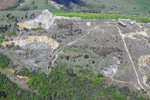
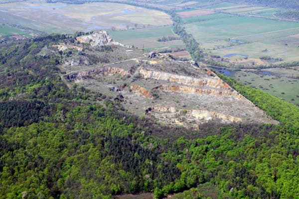
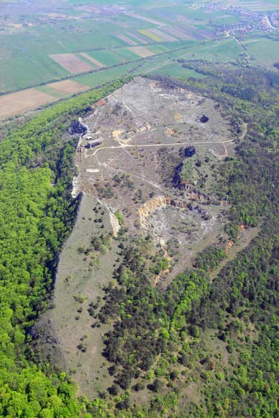
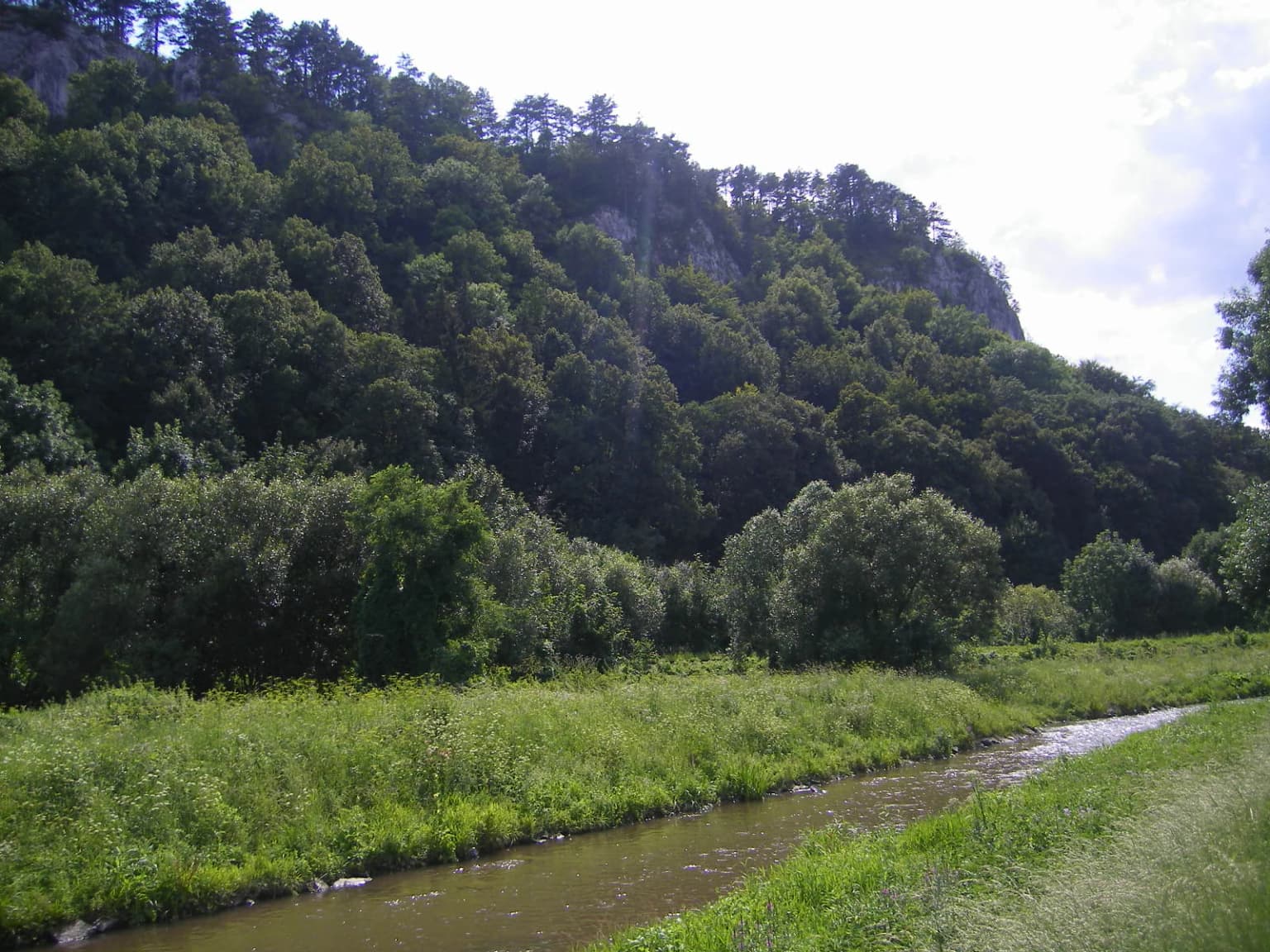
Aggtelek National Park landscape and geographic character

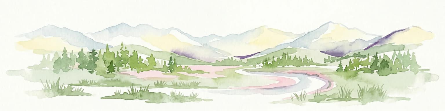
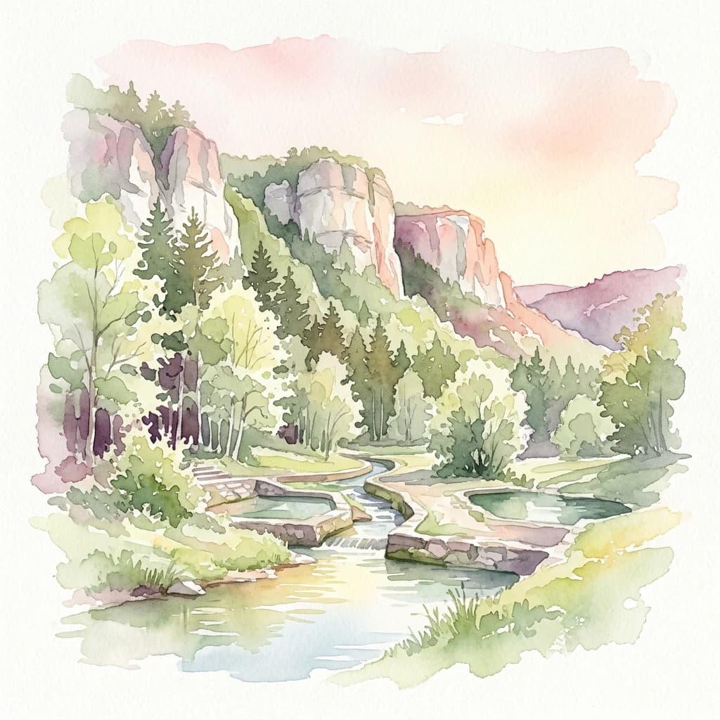
The Aggtelek Karst landscape represents one of Europe's most complete karst ecosystems, characterized by its distinctive limestone plateaus, sinkhole fields, and the extensive cave systems that have formed within the rock mass over millions of years. The terrain consists predominantly of Triassic limestone and dolomite formations that have been extensively karstified, creating a complex underground drainage system. The surface displays classic karst topography including dolines (sinkholes), karst valleys, and the characteristic karrmeadows where the limestone has been dissected by solution into intricate knife-edge ridges. The highest points reach middle mountain elevations while the valleys contain the park's main watercourses including the Jósva stream, fed by the largest karst springs in the region. The Bódva river and its tributaries drain the eastern portions of the park. Several natural and artificial lakes occur within the park boundaries, including the popular Tengerszem-tó (Sea Eye Lake), reflecting the complex hydrology of the karst system.

Aerial photograph showing a mountainous landscape with dense forests and open fields in Aggtelek National Park.
Aerial view of Esztramos mountain within Aggtelek National Park, Hungary.

Aggtelek National Park ecosystems, habitats, and plant life

The Aggtelek Karst supports remarkable ecological diversity despite its relatively limited surface area, positioned at the boundary between the Pannonian and Carpathian floristic regions. The park contains a dedicated forest reserve of 1,327 hectares with a core protected area of 596 hectares. The predominant forest type is oak-hornbeam forest, with beech forests in deeper valleys and rocky steppe forests on the plateaus. The varied topography creates multiple microhabitats, from the sunny southern slopes hosting warm-adapted species to the cool, humid sinkholes supporting specialized flora. The vegetation includes several endemic and protected species, most notably the Tornai bloodyword (Tornai vérfű), a strictly protected endemic species considered one of the park's most precious botanical treasures. Other significant species include Austrian dragonhead and various orchids adapted to the specific karst habitats. The park's position at the biogeographic boundary results in a mixing of species from different regional faunas, creating an exceptionally biodiverse environment.

Aerial view of Esztramos Hill surrounded by green forests and agricultural fields, with rocky terrain visible.
Aerial view of Esztramos Hill in Aggtelek National Park, Hungary.

Aggtelek National Park wildlife and species highlights

Aggtelek National Park supports impressive faunal diversity with 413 protected and strictly protected animal species recorded within its boundaries. The large mammal community includes red deer, wild boar, roe deer, and the return of large predators including gray wolf and Eurasian lynx to the Northern Hungarian Mountains in recent decades. The Hucul horse, a traditional mountain pony breed, is kept in the park's state-owned stud farm representing one of Hungary's only publicly owned horse herds. The avifauna is particularly rich, featuring birds of prey such as the eastern imperial eagle and common buzzard, along with species like the hazel grouse representing the only Hungarian breeding population of this bird family. The cave systems support an exceptional troglobitic fauna with over 500 cave-dwelling and cave-preferring species, including several endemic and rare species such as the Hungarian blind ground beetle and the Aggtelek blind freshwater crayfish. Twenty-one of Europe's 28 bat species occur in the park's caves, making it significant for bat conservation. The fish community in the karst waters is remarkably diverse with 42 species recorded, including 13 protected species.

Aerial view of Esztramos Hill showing rocky terrain, sparse vegetation, a small building, and a dirt road.
Aerial view of Esztramos Hill in Aggtelek National Park, Hungary.

Aggtelek National Park conservation status and protection priorities

Aggtelek National Park holds exceptional conservation significance as one of Europe's most important karst protection areas and a UNESCO World Heritage Site. The park was designated specifically to protect geological values, representing a pioneering approach in Hungarian conservation. The transboundary World Heritage Site with the Slovak Karst caves was only the third cave system to be inscribed on the UNESCO list, following Mammoth Cave in the USA and Skocjan Caves in Slovenia. The park protects representative examples of nearly two-thirds of all known international speleothem types, including stalactites, stalagmites, flowstone columns, cave pearls, and rare aragonite formations. The surface karst ecosystems support numerous protected species and habitats, while the forest reserves contribute to broader forest conservation in the region. The park serves as a crucial corridor for returning large predators and functions as a biodiversity hotspot at the meeting point of multiple biogeographic regions.

Aggtelek National Park cultural meaning and human context

The Aggtelek region contains significant cultural and historical heritage spanning prehistoric through modern periods. The Rudabánya area within the park's territory is world-renowned for its paleontological significance, where hominid fossils (Rudapithecus hungaricus) dated to 11.5-10 million years ago were discovered, representing some of the earliest human ancestors in Europe. Human occupation since the Stone Age is evidenced by artifacts from the Bükk culture andBronze Age finds including gold objects and decorated ceramics. Medieval villages with church ruins and castle remains dot the landscape, including the 13th-century Szádvár, one of Hungary's largest medieval castles. The park contains various Romanesque and Gothic churches in villages like Rakacaszend, Zubogy, and Ragály, as well as a 14th-century Pauline monastery near Martonyi still under restoration. Traditional Palóc architectural features characterize the surrounding villages with their distinctive decorative porches and facades. The former village of Derenk, abandoned in 1943 to create a hunting area, remains as ruins within the park. The region maintains strong traditional connections to horse breeding through the Hucul stud farm.

A river flowing through grassy terrain with dense forest on hills in the background
Bodva River flowing through lush green landscape with forested hills in the background

Top sights and standout views in Aggtelek National Park

Aggtelek National Park offers unparalleled karst exploration opportunities with its world-class cave systems, making it a premier destination for speleology and geological tourism. The Baradla cave system with its illuminated show passages provides accessible underground wonder, while the many strict protected caves preserve the most sensitive geological and biological features. The surface landscape provides excellent hiking through karst plateaus, past sinkholes, and along the Bódva valley, with seven established educational trails offering interpretive guidance. The presence of returning wolves and lynx adds wildlife watching potential, while the Hucul horse breeding operation provides cultural heritage programming. The transboundary World Heritage designation underscores the international significance of this karst landscape that represents one of the world's most complete temperate karst systems.

Stalactites hanging from cave ceiling, metal railing, stone pathway in Aggtelek National Park's Baradla Cave
Interior of Baradla Cave with stalactites and walkway

Best time to visit Aggtelek National Park

The park can be visited year-round, though the cave systems maintain relatively constant temperatures making them suitable for exploration in any season. Summer offers the best conditions for surface hiking and trail exploration, with warm temperatures on the southern slopes and full trail accessibility. The spring and autumn seasons provide particularly pleasant conditions for walking tours and offer opportunities to observe wildlife activity during migration periods. Winter visits to the caves offer a unique experience with reduced visitor numbers and the possibility of seeing ice formations in some caves. The park's educational center at Jósvafő operates throughout the year, and the various seasonal programs including the water world day, Earth Day, and bird and tree day provide themed visit opportunities.

Park location guide

Geography guide, regional context, and park location map for Aggtelek National Park

Aggtelek National Park park geography, regions, and map view in Hungary
Understand where Aggtelek National Park sits in Hungary through a broader geographic reading of the surrounding landscape, nearby location context, and its mapped position within the national park landscape.

How Aggtelek National Park fits into Hungary

Hungary is a landlocked Central European country occupying the Carpathian Basin, also known as the Pannonian Basin. It borders Slovakia, Ukraine, Romania, Serbia, Croatia, Slovenia, and Austria. Budapest serves as both the capital and largest city. The population is predominantly ethnic Hungarians (Magyars), with Hungarian as the official language.

Wider geography shaping Aggtelek National Park in Hungary

Hungary occupies the Carpathian Basin in Central Europe, a large lowland plain surrounded by the Carpathian Mountains. It is bordered by Slovakia to the north, Ukraine to the northeast, Romania to the east and southeast, Serbia to the south, Croatia and Slovenia to the southwest, and Austria to the west. The Danube River flows through the country, providing its primary drainage.

Map view of Aggtelek National Park

Use this park location map to pinpoint Aggtelek National Park in Hungary, understand its exact geographic position, and read its mapped placement within the surrounding landscape more clearly.

Pigeon | © OpenStreetMap contributors

Location context for Aggtelek National Park

Northern Hungary

Explore the striking visual identity of Aggtelek National Park's surface and subterranean protected landscapes through detailed photography.

Aggtelek National Park Photos: Visual Guide to its Karst Landscapes, Cave Systems, and Protected Terrain
Browse a comprehensive collection of Aggtelek National Park photos to visually grasp its unique karst topography, extensive cave systems, and diverse surface habitats. These images provide essential geographic context, helping users understand the park's characteristic protected-area environment, geological formations, and overall landscape character.

Vass Imre Cave stalactite

Black and yellow striped salamander on green grass

Aerial photograph showing a mountainous landscape with dense forests and open fields in Aggtelek National Park.

Aerial view of Esztramos Hill surrounded by green forests and agricultural fields, with rocky terrain visible.

Aerial view of Esztramos Hill showing rocky terrain, sparse vegetation, a small building, and a dirt road.

Tall white stalagmite in a dark cave with surrounding rock formations and dim artificial lighting

A river flowing through grassy terrain with dense forest on hills in the background

Stalactites hanging from cave ceiling, metal railing, stone pathway in Aggtelek National Park's Baradla Cave

Small concrete-lined stream with reflective water surrounded by wooded area and pathway

People walking toward a large rocky cliff face with a cave entrance visible

Aerial view showing an open-sided structure and smaller buildings on rocky terrain with dirt paths and sparse vegetation

Park atlas

Trace the regional spread of protected landscapes, comparing Aggtelek National Park's unique karst terrain with adjacent natural areas.

Compare National Parks and Protected Areas Near Aggtelek National Park's Karst Landscape
Explore other protected areas and national parks situated within the Central European karst region, offering diverse landscapes adjacent to Aggtelek National Park's famous cave systems. This geographic context allows for detailed comparison of conservation efforts and geological formations across a broader mapped territory.
National parkKošice Region

Slovak Karst National Park: Premier Central European Karst Landscape and Cave Systems

Explore protected terrain and mapped underground wonders in Košice Region.

Slovak Karst National Park offers an unparalleled glimpse into a dynamic karst environment. As a designated national park and UNESCO Biosphere Reserve, it preserves a significant concentration of caves, dramatic limestone formations, and rugged canyons within its territory in southeastern Slovakia. This atlas-focused presentation highlights the park's distinctive geology, mapped landscape features, and its importance as a protected natural area within the broader geography of the Košice Region. Understand the park's surface topography and its world-renowned subterranean realms.

Area
346.11 km²
Established
2002
IUCN
II
Relief
Mountain
National parkBanská Bystrica Region

Muránska planina National Park: Discover Slovakia's Karst Plateau and Protected Natural Landscape

Explore mapped boundaries, caves, and endemic flora in Banská Bystrica Region.

Muránska planina National Park represents a significant protected landscape in central Slovakia's Banská Bystrica Region, defined by its extensive karst topography. This national park encompasses a limestone and dolomite plateau rich with geological wonders, including over 150 caves, sinkholes, and karst springs. The unique contrast between the flat plateau surface and the sharp, rocky ravines showcases a dramatic natural terrain. Explore the park's mapped boundaries and its remarkable biodiversity, highlighted by 35 endemic species and rare Tertiary relict flora like Daphne arbuscula, making it a key destination for atlas-based geographic discovery.

Area
213.18 km²
Established
1997
IUCN
II
Relief
Mountain
Watercolor illustration of a winding river through rolling green hills with trees in the foreground
National parkKošice Region

Slovak Paradise National Park: Protected Area Mapping & Geographic Context in Košice Region

Explore the boundaries and terrain of this national park.

Investigate Slovak Paradise National Park, a designated national park situated within Slovakia's Košice Region. This detailed entry provides essential context for understanding its protected landscape features, mapped geographic distribution, and role within regional atlas exploration. Discover its unique terrain and boundaries to build a comprehensive view of Slovak conservation areas.

Area
197.63 km²
Established
1988
IUCN
II
Relief
Mountain
National park

Low Tatras National Park: Slovakia's Vast National Park and Carpathian Protected Landscape

Explore mapped terrain and regional geographic context.

The Low Tatras National Park represents Slovakia's largest protected area, encompassing the entirety of the Low Tatras mountain range. Its landscape is defined by dramatic altitudinal diversity, from alpine summits like Ďumbier to extensive forest zones and significant karst formations with notable cave systems. This page provides detailed geographic context and map-based discovery for the park's protected boundaries and its ecological significance within the Carpathian region.

Area
728 km²
Established
1978
IUCN
II
Relief
Mountain
Watercolor painting of mountain ranges, forests, and a winding river
National parkLesser Poland Voivodeship

Tatra National Park: Poland's Premier Alpine National Park and Protected Landscape

Explore dramatic glacial terrain, mountain lakes, and regional geography.

Tatra National Park is the definitive Alpine protected area in Poland, located in Lesser Poland Voivodeship. It showcases unique glacial landforms, including over 30 mountain lakes and dramatic peaks like Rysy. This national park serves as a crucial habitat for endemic species and offers unparalleled opportunities for atlas exploration of its rugged, mapped terrain. Understand its geographic significance as part of the Carpathian Mountains and its role as a protected landscape.

Area
211.64 km²
Established
1954
IUCN
II
Visitors
3.9M annual
Watercolor illustration of a river flowing through a forested valley with rolling hills and scattered trees
National parkPrešov Region

Pieniny National Park: Slovakia's Distinctive Protected Landscape and Dunajec River Gorge

Explore mapped boundaries, regional geography, and protected karst terrain.

Pieniny National Park offers a focused exploration of dramatic limestone gorges and unique Carpathian mountain geography within Slovakia's Prešov Region. This national park is celebrated for the spectacular Dunajec River Gorge, a feature that defines its protected landscape and provides a profound example of natural terrain shaping. Understanding Pieniny National Park involves appreciating its specific mapped boundaries and its role as a significant protected area within the broader atlas of European natural wonders and conservation territories.

Area
37.5 km²
Established
1967
IUCN
II
Relief
Mountain
National park

Hortobágy National Park: A UNESCO Protected Steppe Landscape in Eastern Hungary

Explore the unique geography and mapped park boundaries of Hungary's first national park.

Hortobágy National Park is a monumental protected area in Eastern Hungary, recognized globally as the first national park established in the country and a UNESCO World Heritage site. This vast expanse of semi-natural grassland, known as the puszta, stretches across approximately 74,820 hectares, embodying over four millennia of pastoral traditions. The park's landscape is characterized by alkaline soils and sweeping horizons, offering a unique ecosystem with significant avian populations and preserved cultural landmarks. MoriAtlas provides structured geographic context and mapped details to understand this exceptional protected landscape.

Area
748.2 km²
Established
1973
Relief
Lowland
Climate
Temperate
National park

Veľká Fatra National Park: Slovakia's Premier Protected Landscape for Geographic Discovery

Explore the park's mapped boundaries and regional natural terrain.

Veľká Fatra National Park stands as a distinct protected area, offering critical insights into Slovakia's regional geography and landscape character. This entry provides an atlas-driven perspective on its mapped boundaries and its significance as a national park. Delve into the structured geographic details and protected land context that define Veľká Fatra National Park for comprehensive discovery.

Area
403.713 km²
Established
2002
Relief
Mountain
Climate
Temperate

Common questions about visiting, size, designation, and location context for Aggtelek National Park

Aggtelek National Park FAQs for park facts, access, geography, and protected area context
Find quick answers about Aggtelek National Park, including protected-area facts, park geography, trail and visitor context, and how the park fits into its surrounding country and regional landscape.
MoriAtlas Explorer

Continue Your Protected Areas Search Across the Global Atlas

Deepen your exploration by continuing the structured search for national parks and protected areas worldwide. Utilize the comprehensive filtering capabilities to compare different conservation landscapes and refine your understanding of global park geography. Discover more about the distribution and characteristics of protected natural areas.

Global natural geography