Mori Atlas logo
National parkSlovak Paradise National Park

Discover the geographic boundaries and natural terrain of this national park.

Slovak Paradise National Park: A Mapped Protected Landscape in Slovakia's Košice Region

(Národný park Slovenský raj)

Slovak Paradise National Park stands as a significant protected area within the Košice Region of Slovakia. This page serves as your atlas entry point to understanding the park's unique protected landscape identity and its place within the regional geography. Explore its mapped boundaries, examine the surrounding natural terrain, and grasp its context for structured geographic discovery.

Karst landscapeGorges and canyonsWaterfallsCave systemsNational parkCarpathian Mountains
Illustration showing a waterfall cascading into a river with trees and mountains in the background

Slovak Paradise National Park

National park

Park overview

Structured park overview, official facts, and landscape profile for Slovak Paradise National Park

Slovak Paradise National Park park facts, protected area profile, and essential visitor context
Review the core facts for Slovak Paradise National Park, including designation, size, terrain, visitor scale, habitats, and operating context in one park-focused overview.

About Slovak Paradise National Park

Slovak Paradise National Park protects one of Slovakia's most geographically distinctive landscapes, where a relatively flat karst plateau has been deeply dissected by rivers into a labyrinth of gorges, canyons, and waterfalls. The park lies in the northern reaches of the Spiš-Gemer Karst, a geological region defined by its limestone and dolomite formations that have yielded hundreds of caves over millions of years. The Hornád River and its tributaries are the primary sculptors of the terrain, having cut through the plateau to create the steep-walled valleys that define the park's character. Visitors encounter a landscape where trail routes frequently follow river corridors, ascending via metal ladders and chain-assisted paths fixed to rock faces. The environment supports remarkably high biodiversity, particularly among invertebrates, with the park recording the highest concentration of butterfly species in Slovakia. Forest coverage dominates the terrain, predominantly beech, spruce, fir, and pine, creating a densely vegetated setting that hides the waterfalls and rock walls from casual observation until one enters the gorges themselves. The park offers roughly 300 kilometers of marked hiking trails, making it one of Slovakia's most extensively networked protected areas for pedestrian exploration.

Quick facts and research context for Slovak Paradise National Park

Slovak Paradise National Park is located in eastern Slovakia spanning portions of the Banská Bystrica, Prešov, and Košice administrative regions. The park protects a karst plateau landscape characterized by narrow gorges, waterfalls, and caves, with the Hornád River forming the primary drainage system. The highest point reaches 1,545 meters at Predná hoľa, while the lowest elevation follows the Hornád riverbed at 470 meters. About 350 caves exist within the park boundaries, though only the Dobšiná Ice Cave is open to the public. The park contains 930 documented plant species and approximately 200 vertebrate species, with forests covering roughly 90 percent of the territory.

Park context

Deeper park guide and search-rich context for Slovak Paradise National Park

Slovak Paradise National Park history, landscape, wildlife, and travel context
Explore Slovak Paradise National Park through its history, landscape character, ecosystems, wildlife, conservation priorities, cultural context, and seasonal travel timing in a structured park guide built for atlas discovery and search intent.

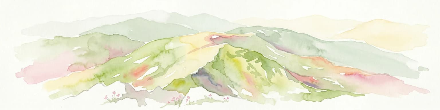
Why Slovak Paradise National Park stands out

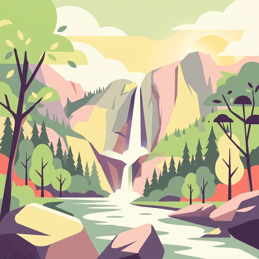
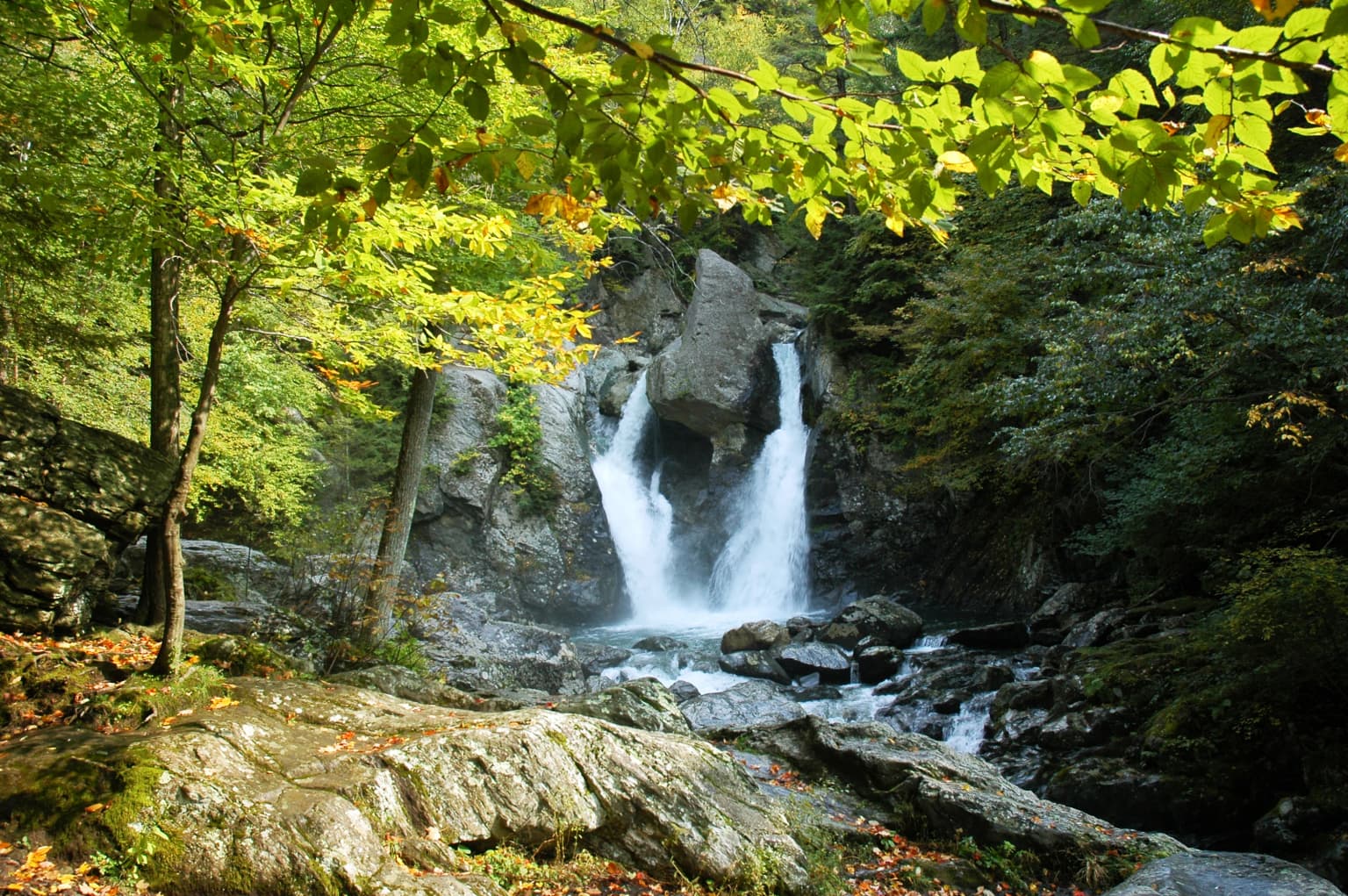
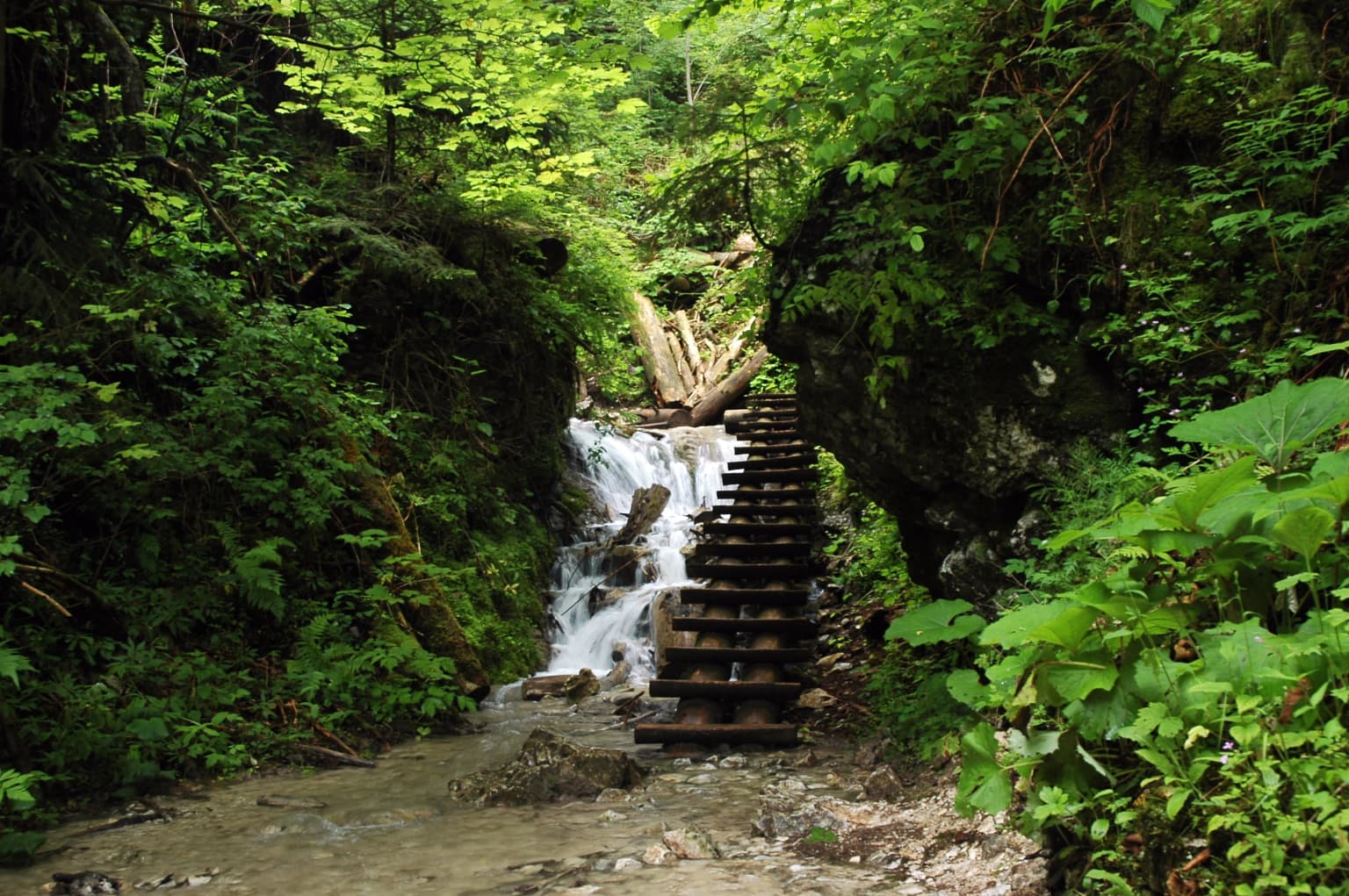
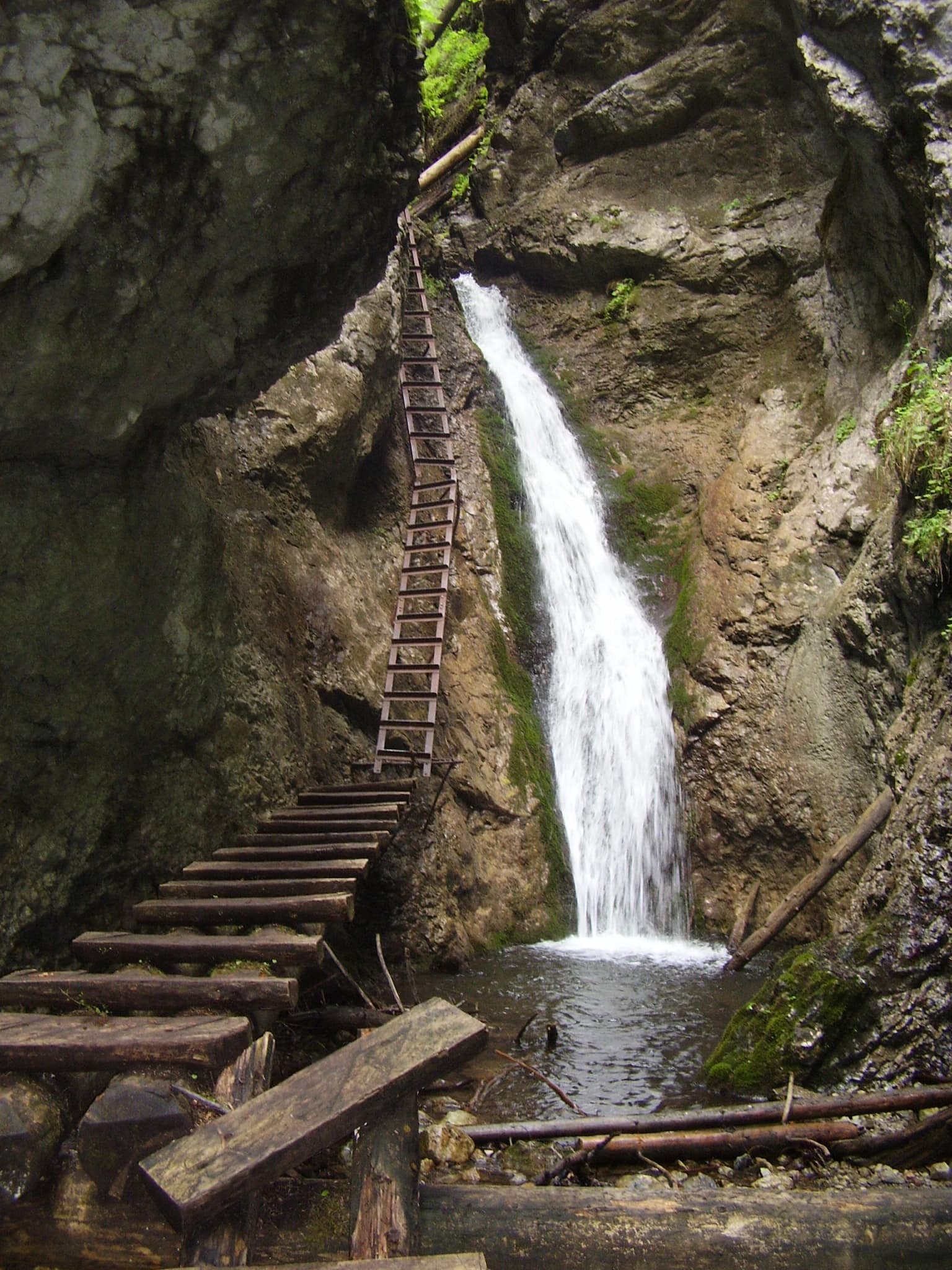
Slovak Paradise is renowned for its dramatic karst gorges and waterfalls that punctuate a relatively compact but exceptionally rugged landscape. The Suchá Belá, Veľký Sokol, Piecky, and Kyseľ gorges each contain multiple waterfalls accessible along maintained trails equipped with ladders and chains. The park's geology, characterized by soluble carbonate rocks, has produced an extensive cave system with about 350 documented cavities. The Dobšiná Ice Cave, featuring permanent ice formations, represents the only show cave in the park and holds UNESCO World Heritage status as part of the Aggtelek and Slovak Karst transboundary cave network. The Prielom Hornádu canyon, stretching 11.7 kilometers, offers the longest continuous gorge experience with remarkable biodiversity.

Waterfall cascading over rocks surrounded by dense green forest with autumn leaves
Waterfall flowing through rocky gorge in Slovak Paradise National Park

Slovak Paradise National Park history and protected-area timeline

The protection of Slovak Paradise territory began in 1890 with the establishment of the first reserved area, marking early recognition of the region's natural value. The iconic edelweiss became the first formally protected plant species in 1936, reflecting the alpine character of certain park habitats. The name Slovenský raj, meaning Slovak Paradise, first appeared in print in 1921 through the Krásy Slovenska magazine, replacing the various local names previously applied to the area. On 21 August 1964, the Slovak Paradise became the first protected landscape area in Slovakia, representing a pioneering step in the nation's conservation history. The designation was upgraded to national park status on 18 January 1988, providing stronger legal protection for the territory. In 2000, the Dobšiná Ice Cave achieved international recognition through inclusion on the UNESCO World Heritage List as part of the Aggtelek and Slovak Karst cave systems. The park joined the European Natura 2000 network in 2004, integrating its conservation framework with broader European habitat protection initiatives.

Slovak Paradise National Park landscape and geographic character

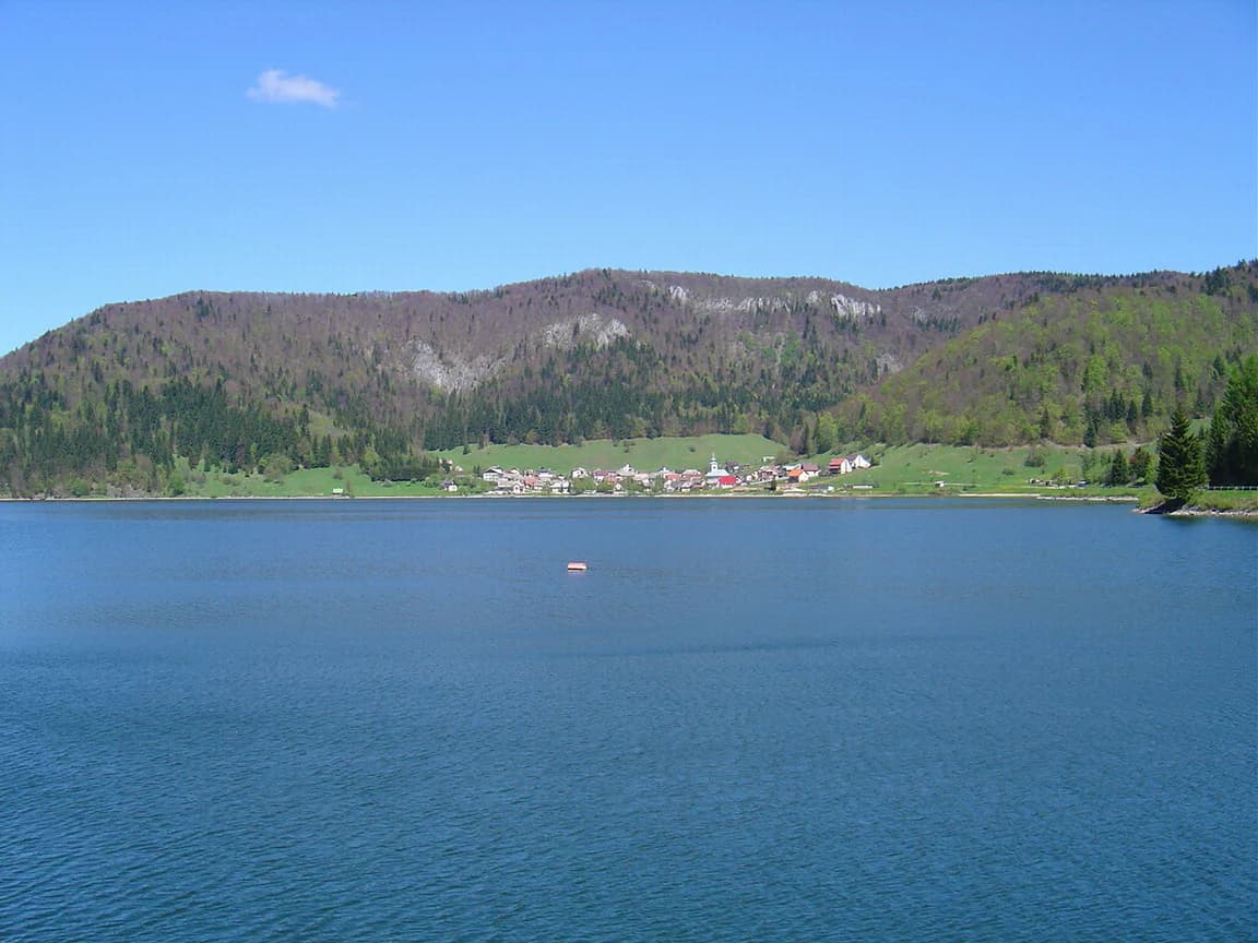
The physical landscape of Slovak Paradise centers on a karst plateau composed primarily of limestone and dolomite that has been extensively fractured and dissolved over geological time. The plateau surface appears relatively level from a distance but conceals the dramatic vertical relief created where rivers have cut through the rock mass. Deep gorges, locally called tiesňavy, form the most spectacular terrain features, with Veľký Sokol extending 4.5 kilometers as the longest while Suchá Belá, Piecky, and Kyseą represent other significant gorges containing numerous waterfalls. The Prielom Hornádu canyon stretches 11.7 kilometers and represents the park's most extensive continuous gorge system. Waterfalls are abundant throughout the gorge systems, with Závojový vodopád reaching 70 meters as the tallest. The Palcmanská Maša reservoir, completed in 1956 and covering 0.85 square kilometers, provides the largest standing water body within the park boundaries. The highest elevation point is Predná hoľa at 1,545 meters above sea level, while Havrania skala offers a panoramic viewpoint at 1,153 meters. The Tomášovský výhľad rock shelf at 680 meters is popular among both climbers and hikers for its exceptional views. Elevation ranges from 1,545 meters down to the Hornád river surface at 470 meters.

Waterfall flowing through a narrow gorge with dense green vegetation and a wooden staircase
Waterfall cascading through a narrow gorge surrounded by dense green foliage in Slovak Paradise National Park

Slovak Paradise National Park ecosystems, habitats, and plant life

The ecological character of Slovak Paradise reflects its position within the Carpathian mountain system and its complex karst geology. Forests dominate approximately 90 percent of the park's area, with beech, spruce, fir, and pine forming the primary tree communities. The park supports 930 documented plant species, of which 35 receive legal protection. Six plant species are endemic to the Slovak Paradise alone, existing nowhere else on Earth, while an additional 19 species are endemic to the broader West Carpathian region. The invertebrate fauna is exceptionally rich, with roughly 4,000 species recorded including more than 2,100 butterfly species representing the highest butterfly density in Slovakia at 6.06 individuals per square kilometer. Kopanecké meadows within the park exhibit remarkable vascular plant diversity with over 75 species per square meter. Vertebrates are represented by approximately 200 species, with 130 receiving protected status. The park provides habitat for 40 mammal species including brown bear, grey wolf, Eurasian lynx, and European wildcat, representing a significant population of large carnivores within Slovakia.

Large lake with small boat, surrounded by forested hills and village under clear blue sky
Landscape view of Dedinky and Palcmanska Masa within Slovak Paradise National Park

Slovak Paradise National Park wildlife and species highlights

The wildlife community in Slovak Paradise includes notable large mammals that roam the forest environments and alpine zones. Brown bears, grey wolves, Eurasian lynx, and European wildcats represent the apex predators present in meaningful populations. Red deer, roe deer, and European fallow deer populate the forested areas, while Alpine chamois inhabit higher rocky terrain. European wild boar and marmots are also present among the park's mammalian fauna. The park supports 65 endangered species including the saker falcon, European otter, and European ground squirrel, reflecting the conservation significance of the territory. Birdlife includes raptors and forest-dwelling species that utilize the diverse habitats from canyon floors to ridge tops. Reptiles include the European adder, one of few snake species in Europe represented in the park, though this venomous species generally avoids human contact.

Waterfall flowing down rocky cliffs into a pool with wooden ladder structure on left side
Waterfall with wooden ladder in rocky gorge

Slovak Paradise National Park conservation status and protection priorities

Slovak Paradise holds significant conservation value as Slovakia's first protected landscape area and as a national park providing the highest level of national protection. The inclusion of Dobšiná Ice Cave on the UNESCO World Heritage List in 2000 recognized the outstanding universal value of the region's karst cave systems. Integration into the Natura 2000 network in 2004 connected the park to Europe's broader conservation framework for habitats and species. The park contains eleven national nature reserves and eight additional nature reserves, creating layered protection for the most sensitive areas. High biodiversity metrics, including the highest butterfly density in Slovakia and significant populations of large carnivores, underscore the ecological importance of maintaining this protected landscape. The presence of endemic plant species restricted to the Slovak Paradise and the West Carpathians adds irreplaceable conservation value to the territory.

Slovak Paradise National Park cultural meaning and human context

The park contains cultural heritage elements that reflect human presence in this rugged landscape over centuries. The Kláštorisko tourist center, the only such facility located directly within the national park, occupies the site of a former Carthusian monastery whose ruins still stand. This monastic presence historically influenced the landscape and its use patterns. The name Slovenský raj, adopted in the early twentieth century, reflects the perception of the area as a place of natural beauty and wonder. Tourism has deep roots in the region, with the distinctive trail infrastructure featuring ladders, chains, and bridges reflecting decades of visitor access development. The communities surrounding the park, including Spišská Nová Ves which hosts the park administration, maintain connections to this landscape through recreation, traditional land use, and regional identity centered on the mountainous territory.

Top sights and standout views in Slovak Paradise National Park

The dramatic gorges of Slovak Paradise, particularly Suchá Belá and Veľký Sokol with their chain and ladder trail systems, represent the park's most distinctive recreational features. The Dobšiná Ice Cave provides the only accessible show cave experience and holds UNESCO World Heritage status for its exceptional ice formations. The Prielom Hornádu canyon offers an 11.7-kilometer through hike along the river with remarkable species diversity. The Závojový vodopád waterfall at 70 meters ranks among the tallest in the Slovak mountains. The network of approximately 300 kilometers of hiking trails provides extensive exploration opportunities through one of Slovakia's most scenic landscapes. The high density of butterfly species makes the park particularly significant for invertebrate conservation within the Carpathian region.

Best time to visit Slovak Paradise National Park

The summer months of June through September offer the most favorable conditions for hiking and exploring the gorges, though these periods also coincide with higher visitor numbers. Spring and early summer bring heightened waterfall flows as snowmelt and rain augment stream volumes, though trail conditions may be wetter and some routes potentially affected by seasonal closures. Autumn provides colorful forest displays and typically stable weather with fewer visitors, though daylight hours decrease. Winter access is limited primarily to lower elevation areas, with the gorge trails often closed or hazardous due to ice and snow. The shoulder seasons of May and September generally balance reasonable weather conditions with more manageable crowds for those seeking a quieter experience.

Park location guide

Geography guide, regional context, and park location map for Slovak Paradise National Park

Slovak Paradise National Park park geography, regions, and map view in Slovakia
Understand where Slovak Paradise National Park sits in Slovakia through a broader geographic reading of the surrounding landscape, nearby location context, and its mapped position within the national park landscape.

How Slovak Paradise National Park fits into Slovakia

Slovakia is a landlocked Central European country with a population of over 5.4 million. It became independent from Czechoslovakia in 1993 and is a member of the European Union. The country features mountainous terrain, with the Carpathian Mountains running through its territory. Bratislava serves as the capital and largest city, while Košice is the second-largest city.

Wider geography shaping Slovak Paradise National Park in Slovakia

Slovakia is located in Central Europe, landlocked between Poland to the north, Ukraine to the east, Hungary to the south, Austria to the west, and the Czech Republic to the northwest. The territory is mostly mountainous, with the Carpathian Mountains, including the High Tatras, dominating the northern region. The Danube River forms part of the southern border with Hungary.

Map view of Slovak Paradise National Park

Use this park location map to pinpoint Slovak Paradise National Park in Slovakia, understand its exact geographic position, and read its mapped placement within the surrounding landscape more clearly.

Pigeon | © OpenStreetMap contributors

Location context for Slovak Paradise National Park

Banská Bystrica RegionKošice RegionPrešov Region

Discover the unique protected-area character of Slovak Paradise through its stunning scenery, diverse habitats, and dramatic terrain.

Slovak Paradise National Park Photos: Visualizing Karst Landscapes, Gorges, and Waterfalls
Visually explore the dramatic karst landscapes of Slovak Paradise National Park, showcasing its renowned gorges, powerful waterfalls, and intricate cave systems. These images provide essential context for understanding the park's unique protected environment, diverse habitats, and the rugged, scenic terrain across this significant Carpathian region.

Waterfall cascading over rocks surrounded by dense green forest with autumn leaves

Calm river reflecting green hills and forested slopes under a clear blue sky with a small cabin visible on the hillside

Waterfall flowing through a narrow gorge with dense green vegetation and a wooden staircase

Large lake with small boat, surrounded by forested hills and village under clear blue sky

Waterfall flowing down rocky cliffs into a pool with wooden ladder structure on left side

Park atlas

Explore the Carpathian Mountains, tracing connected karst landscapes and a regional spread of protected terrain.

Discover National Parks and Protected Areas Adjacent to Slovak Paradise National Park
Browse other national parks and protected areas situated within or adjacent to the Carpathian Mountains, offering diverse landscapes from Slovak Paradise National Park. This curated selection allows for direct comparison of regional conservation efforts and distinct protected landscapes across the surrounding Eastern European geography.
National parkBanská Bystrica Region

Muránska planina National Park: Discover Slovakia's Karst Plateau and Protected Natural Landscape

Explore mapped boundaries, caves, and endemic flora in Banská Bystrica Region.

Muránska planina National Park represents a significant protected landscape in central Slovakia's Banská Bystrica Region, defined by its extensive karst topography. This national park encompasses a limestone and dolomite plateau rich with geological wonders, including over 150 caves, sinkholes, and karst springs. The unique contrast between the flat plateau surface and the sharp, rocky ravines showcases a dramatic natural terrain. Explore the park's mapped boundaries and its remarkable biodiversity, highlighted by 35 endemic species and rare Tertiary relict flora like Daphne arbuscula, making it a key destination for atlas-based geographic discovery.

Area
213.18 km²
Established
1997
IUCN
II
Relief
Mountain
National parkKošice Region

Slovak Karst National Park: Premier Central European Karst Landscape and Cave Systems

Explore protected terrain and mapped underground wonders in Košice Region.

Slovak Karst National Park offers an unparalleled glimpse into a dynamic karst environment. As a designated national park and UNESCO Biosphere Reserve, it preserves a significant concentration of caves, dramatic limestone formations, and rugged canyons within its territory in southeastern Slovakia. This atlas-focused presentation highlights the park's distinctive geology, mapped landscape features, and its importance as a protected natural area within the broader geography of the Košice Region. Understand the park's surface topography and its world-renowned subterranean realms.

Area
346.11 km²
Established
2002
IUCN
II
Relief
Mountain
Watercolor painting showing a winding river, green trees, distant hills, and grassy foreground
National park

Aggtelek National Park

Karst Landscape & Cave Systems

Explore the protected area of Aggtelek National Park, a UNESCO World Heritage site known for its extensive karst landscapes and significant cave systems. Understand its geographic setting and protected land status.

Area
198.92 km²
Established
1985
IUCN
II
Relief
Mixed relief
Watercolor painting of mountain ranges, forests, and a winding river
National parkLesser Poland Voivodeship

Tatra National Park: Poland's Premier Alpine National Park and Protected Landscape

Explore dramatic glacial terrain, mountain lakes, and regional geography.

Tatra National Park is the definitive Alpine protected area in Poland, located in Lesser Poland Voivodeship. It showcases unique glacial landforms, including over 30 mountain lakes and dramatic peaks like Rysy. This national park serves as a crucial habitat for endemic species and offers unparalleled opportunities for atlas exploration of its rugged, mapped terrain. Understand its geographic significance as part of the Carpathian Mountains and its role as a protected landscape.

Area
211.64 km²
Established
1954
IUCN
II
Visitors
3.9M annual
National park

Low Tatras National Park: Slovakia's Vast National Park and Carpathian Protected Landscape

Explore mapped terrain and regional geographic context.

The Low Tatras National Park represents Slovakia's largest protected area, encompassing the entirety of the Low Tatras mountain range. Its landscape is defined by dramatic altitudinal diversity, from alpine summits like Ďumbier to extensive forest zones and significant karst formations with notable cave systems. This page provides detailed geographic context and map-based discovery for the park's protected boundaries and its ecological significance within the Carpathian region.

Area
728 km²
Established
1978
IUCN
II
Relief
Mountain
Watercolor illustration of a river flowing through a forested valley with rolling hills and scattered trees
National parkPrešov Region

Pieniny National Park: Slovakia's Distinctive Protected Landscape and Dunajec River Gorge

Explore mapped boundaries, regional geography, and protected karst terrain.

Pieniny National Park offers a focused exploration of dramatic limestone gorges and unique Carpathian mountain geography within Slovakia's Prešov Region. This national park is celebrated for the spectacular Dunajec River Gorge, a feature that defines its protected landscape and provides a profound example of natural terrain shaping. Understanding Pieniny National Park involves appreciating its specific mapped boundaries and its role as a significant protected area within the broader atlas of European natural wonders and conservation territories.

Area
37.5 km²
Established
1967
IUCN
II
Relief
Mountain
Watercolor painting showing rolling green hills, forests, and distant mountains under a pale sky
National parkLesser Poland Voivodeship

Gorce National Park: Carpathian Forest Ecosystems and Mapped Terrain in Lesser Poland

Protected landscape discovery within the Western Beskids.

Delve into the protected landscape of Gorce National Park, a key national park situated in Poland's Lesser Poland Voivodeship. This atlas entry focuses on its mapped geography, highlighting the characteristic Carpathian mountain terrain, extensive old-growth forests, and unique alpine meadows. Understand the park's protected boundaries and its significance within the regional landscape context of the Western Beskids, providing a foundation for structured geographic exploration.

Area
70.3 km²
Established
1981
IUCN
II
Visitors
80K annual
National park

Veľká Fatra National Park: Slovakia's Premier Protected Landscape for Geographic Discovery

Explore the park's mapped boundaries and regional natural terrain.

Veľká Fatra National Park stands as a distinct protected area, offering critical insights into Slovakia's regional geography and landscape character. This entry provides an atlas-driven perspective on its mapped boundaries and its significance as a national park. Delve into the structured geographic details and protected land context that define Veľká Fatra National Park for comprehensive discovery.

Area
403.713 km²
Established
2002
Relief
Mountain
Climate
Temperate

Common questions about visiting, size, designation, and location context for Slovak Paradise National Park

Slovak Paradise National Park FAQs for park facts, access, geography, and protected area context
Find quick answers about Slovak Paradise National Park, including protected-area facts, park geography, trail and visitor context, and how the park fits into its surrounding country and regional landscape.
MoriAtlas Explorer

Continue Your Protected Areas Search Across the Global Atlas

Deepen your exploration by continuing the structured search for national parks and protected areas worldwide. Utilize the comprehensive filtering capabilities to compare different conservation landscapes and refine your understanding of global park geography. Discover more about the distribution and characteristics of protected natural areas.

Global natural geography