Mori Atlas logo
National parkTatra National Park

Explore the dramatic glacial terrain and mapped park boundaries of this unique protected landscape.

Tatra National Park: Poland's Sole Alpine National Park in Lesser Poland Voivodeship

(Tatrzański Park Narodowy)

Tatra National Park represents Poland's definitive Alpine protected area, situated within the Lesser Poland Voivodeship along the Slovak border. This national park encompasses approximately 212 square kilometers of striking high-mountain terrain, forming the only true Alpine-type landscape in the country. It is a vital refuge for endemic species and offers a unique opportunity for atlas-based exploration of dramatic glacial valleys, mountain lakes, and rocky peaks. Understand its geographic context and protected status within the broader Carpathian arc.

Alpine mountainsMountain lakesEndemic speciesGlacial valleysBiosphere reserveNational park
Illustration of mountain landscape with alpine lake, pine forests, wildflowers, and snow-capped peaks under clear sky

Tatra National Park

National park

Park overview

Structured park overview, official facts, and landscape profile for Tatra National Park

Tatra National Park park facts, protected area profile, and essential visitor context
Review the core facts for Tatra National Park, including designation, size, terrain, visitor scale, habitats, and operating context in one park-focused overview.

About Tatra National Park

Tatra National Park represents the pinnacle of Polish mountain conservation, protecting a landscape of extraordinary diversity and ecological significance. The Tatra Mountains, forming the natural border between Poland and Slovakia, constitute the most important Alpine-type ecosystem in Poland and one of the most significant mountain protected areas in Central Europe. The park's establishment reflects over a century of efforts to preserve this unique natural heritage, beginning with early conservation movements in the late 19th century and culminating in formal protection in 1954.

The geological foundation of the Tatras consists of crystalline granite rocks, with portions overlain by dolomite and limestone, creating diverse terrain including dramatic rock faces, deep valleys, and an extensive cave system. These granite mountains were shaped by glacial processes during the Pleistocene, leaving behind the characteristic U-shaped valleys, cirques, and moraines that define the contemporary landscape. The park contains Poland's only true high-mountain environment, with elevations ranging from approximately 773 meters in the Poroniec Valley to 2,499 meters at Rysy, the country's highest peak.

The ecological significance of the Tatras extends far beyond their aesthetic appeal. The mountains serve as a critical refuge for species found nowhere else in Poland, including the Tatra chamois and Tatra marmot, both representing endemic subspecies that evolved in isolation within this mountain island. The flora exhibits remarkable diversity, with approximately 200 species of vascular plants found only in the Tatras within Poland, highlighting the exceptional biogeographic importance of these mountains.

Management of the park involves balancing conservation objectives with the substantial visitor pressure it experiences. As Poland's most visited national park, the Tatra National Park faces ongoing challenges related to trail erosion, infrastructure development, and the ecological impacts of high visitor numbers. The transboundary cooperation with the Slovakian national park, formalized through the UNESCO biosphere reserve designation, enables coordinated conservation efforts across the entire Tatra ecosystem.

Quick facts and research context for Tatra National Park

Tatra National Park occupies 211.64 km² in the Tatra Mountains of southern Poland, established in 1954 and headquartered in Zakopane. The park protects the only Alpine-type mountain range in Poland, part of the Western Carpathians, featuring the High Tatras and Western Tatras sections. Key geographical features include over 30 mountain lakes, approximately 650 caves, and numerous waterfalls with Siklawa Falls at 70 meters being the tallest. The park contains Poland's highest point at Rysy (2,499m) and maintains strict protection over 115 km² of its territory. With over 270 kilometers of hiking trails, it is Poland's most visited national park, receiving approximately 3.9 million visitors annually.

Park context

Deeper park guide and search-rich context for Tatra National Park

Tatra National Park history, landscape, wildlife, and travel context
Explore Tatra National Park through its history, landscape character, ecosystems, wildlife, conservation priorities, cultural context, and seasonal travel timing in a structured park guide built for atlas discovery and search intent.

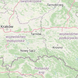
Why Tatra National Park stands out

Tatra National Park is renowned for its dramatic Alpine scenery, protecting the only mountains of true Alpine character in Poland. The park is famous for its iconic glacial lakes, particularly Morskie Oko and Wielki Staw Polski, which rank among the most beautiful mountain lakes in Europe. The Tatra chamois, a distinctive endemic subspecies of Alpine chamois, has become a symbol of the park and can often be spotted on rocky slopes. The extensive cave system, with over 650 documented caves including the 23.7-kilometer Wielka Śnieżna system, attracts speleologists and adventure seekers. The network of challenging hiking trails through dramatic terrain, including the popular routes to Morskie Oko and Dolina Pięciu Stawów, provides access to some of Poland's most spectacular mountain landscapes.

A panoramic alpine landscape featuring blue lakes nestled in mountain valleys with rocky peaks under a partly cloudy sky
View of the Five Polish Ponds Valley from Szpiglasowy Wierch

Tatra National Park history and protected-area timeline

The conservation movement in the Tatras began in the late 19th century as recognition grew that the mountains were suffering significant environmental degradation from mining, logging, pastoral activities, and unregulated hunting. In 1868, the Galician Sejm (regional parliament) passed pioneering legislation protecting Alpine chamois and marmots, making these among the earliest wildlife protection laws in Europe. The establishment of the Tatra Society (Towarzystwo Tatrzańskie) in 1873 expanded conservation efforts to include certain plant species and initiated efforts to acquire land for a future national park.

The first serious attempt to establish a national park came in 1925 through cooperation with Czechoslovakia, reflecting the shared nature of the Tatra ecosystem across the border. After years of effort, the park was formally created in 1937, though initial protection was limited. Following World War II, efforts to establish a comprehensive protected area resumed, and in 1947 a dedicated administrative unit called Tatra Park was created. The current Tatra National Park was established in 1954 by government decision, initially covering 215.56 km² and later reduced to the present 211.64 km².

A significant challenge involved resolving complex property rights issues, particularly regarding the alpine pastures (hale) traditionally owned by local Górale communities. In 1960, the government initiated compulsory purchase of private properties in the Tatras, completing the acquisition by 1964 and effectively consolidating the protected area. Currently, approximately 85% of the park territory is owned by the park administration, with smaller areas held by the Polish Tourist and Country Lovers' Society and the Forest Community of Eight Villages.

In 1992, the Polish and Slovakian national parks in the Tatras were jointly designated as a transboundary biosphere reserve by UNESCO under its Man and the Biosphere Programme, recognizing the ecological unity of the Tatra range and strengthening cooperation in conservation efforts.

Tatra National Park landscape and geographic character

The landscape of Tatra National Park exemplifies classic Alpine terrain shaped by glacial processes. The park encompasses two main sections of the Tatra Mountains: the High Tatras (Tatry Wysokie) characterized by sharp, craggy peaks and dramatic rock formations, and the Western Tatras (Tatry Zachodnie) featuring more rounded summits and extensive alpine meadows. The highest peak in Poland, Rysy, rises to 2,499 meters within the park and offers sweeping views of the glacial landscape below.

The park contains over 30 mountain lakes, locally called staw, which are among the most striking features of the Tatra landscape. These glacial lakes occupy cirques and valley floors, their deep blue waters contrasting with the surrounding granite walls. Morskie Oko, with an area of 349,000 m² and maximum depth of 50.8 meters, is the largest and most famous, while Wielki Staw Polski reaches 79.3 meters in depth, making it the deepest lake in the Polish Tatras. The Dolina Pięciu Stawów Polskich (Valley of Five Polish Lakes) contains a chain of lakes in a spectacular high glacial basin.

Waterfalls add to the dramatic scenery, with Siklawa Falls at 70 meters being the highest in the Polish Tatras, followed by Black Lake Falls at 40 meters and Siklawica Falls at 24 meters. The park contains approximately 650 caves, with the Wielka Śnieżna cave system being the longest at 23.7 kilometers and the deepest at 808 meters. Six caves are open to the public, offering visitors opportunities to explore the subterranean dimension of this mountain landscape.

The terrain features numerous streams and rivers, with the longest watercourse measuring approximately 20 kilometers. The landscape transitions from forested valleys through increasingly open terrain as elevation increases, with the characteristic zonation of vegetation reflecting the harsh high-mountain environment.

Stone path through a meadow with purple wildflowers leading to wooden cabins with mountain peaks in the background
A scenic meadow with purple wildflowers and wooden cabins with mountain peaks in the background

Tatra National Park ecosystems, habitats, and plant life

The ecology of Tatra National Park is defined by pronounced altitudinal zonation, creating distinct habitat bands from base to summit. The lower elevations up to 1,250 meters support silver fir and European beech forests, transitioning to European spruce-dominated forests in the upper forest zone up to 1,550 meters. Above the tree line, krummholz communities of dwarf pine (kosodrzewina) dominate from approximately 1,550 to 1,800 meters, above which alpine meadows and grasslands give way to bare rock and permanent snow at the highest elevations.

The flora of the Tatras exhibits exceptional biodiversity and endemism, with the mountains serving as the only Polish location for approximately 200 vascular plant species. Notable species include the Swiss pine (Pinus cembra), edelweiss (Leontopodium alpinum), and stemless carline thistle (Carlina acaulis). The spring bloom of giant crocus (Crocus vernus) in the Kościeliska Valley creates spectacular displays, while numerous gentian species color the alpine meadows during summer. The endemic Warzucha tatrzańska (Tatra wart-cress) represents one of several plant species found only in these mountains within Poland.

The cave system supports specialized subterranean ecosystems, while the various aquatic habitats host distinctive communities adapted to the cold, oligotrophic conditions. The combination of geological diversity, altitudinal range, and geographic isolation has produced an ecosystem of exceptional conservation importance, recognized through the UNESCO biosphere reserve designation and Ramsar wetland listings.

Snow-covered mountain peaks with rocky outcrops under a partly cloudy sky
Panoramic view of snow-covered mountain peaks in Tatra National Park

Tatra National Park wildlife and species highlights

Tatra National Park protects several endemic animal species that are found nowhere else in the world. The Tatra chamois (Rupicapra rupicapra tatrica), a subspecies of Alpine chamois, is perhaps the most iconic symbol of the park and can be observed on rocky slopes throughout the high mountains. The Tatra marmot (Marmota marmota latirostris), a distinct subspecies of Alpine marmot, inhabits alpine meadows and is protected in the park.

The mammalian fauna includes significant predator populations: brown bears (Ursus arctos), Eurasian lynx (Lynx lynx), and gray wolves (Canis lupus) maintain viable populations in this mountain environment, representing apex predators essential for ecosystem balance. The European otter (Lutra lutra) occupies aquatic habitats throughout the park. These large predators and the overall ecological integrity of the Tatra ecosystem depend on the transboundary connectivity with the Slovakian park.

Among birds, the lesser spotted eagle (Cliaetus pennatus) and the golden eagle (Aquila chrysaetos) are notable raptors nesting in the park. The snow finch (Montifringilla nivalis) and wallcreeper (Tephrophila pyrrhonota) are characteristic high-altitude bird species. The avifauna includes 192 species recorded in the park, with the first documented observation of an imperial eagle (Aquila heliaca) occurring in 2023.

The invertebrate fauna is equally significant, with numerous endemic species adapted to the specific conditions of this mountain environment. The park's wildlife reflects both the Alpine character of the ecosystem and the unique isolation of these mountains within the Carpathian arc.

Four hikers sitting on a snow-covered mountain peak with rocky outcrops and a valley view in the background
Hikers resting at the summit of Kościelec mountain in Tatra National Park

Tatra National Park conservation status and protection priorities

Tatra National Park serves as the centerpiece of conservation efforts for one of Europe's most significant mountain ecosystems. The park's protection status encompasses strict protection zones covering approximately 115 km², where human intervention is minimized to allow natural processes to proceed. The park is categorized as IUCN Level II (National Park), reflecting its primary purpose of protecting ecological processes and biodiversity.

The UNESCO transboundary biosphere reserve designation in 1992 recognized the ecological unity of the Tatra Mountains spanning the Polish-Slovak border. This international framework facilitates coordinated conservation efforts and enables wildlife movements across the border, which is essential for maintaining viable populations of large mammals including bears, lynx, and wolves. The biosphere reserve concept acknowledges both the strict protection core areas and the need for sustainable human use in surrounding buffer zones.

The Ramsar Convention designations for the park's glacial lakes and peat bogs, formalized in 2017, recognize the international importance of these wetland habitats. These high-mountain wetlands support distinctive ecological communities and play important roles in water regulation and carbon storage.

Contemporary conservation challenges include managing the intense visitor pressure on sensitive ecosystems, addressing trail erosion and habitat fragmentation, and mitigating threats from air pollution originating from industrial regions. The park also works to address historical conservation issues, including restoring native forest composition and managing populations of large herbivores whose numbers were reduced by historical overexploitation.

Tatra National Park cultural meaning and human context

The Tatra Mountains are intimately connected with the cultural heritage of the Górale, the highland people of the Podhale region. This distinctive ethnic group has maintained a unique cultural identity characterized by the Podhale dialect, traditional music, and artisan crafts that differ significantly from lowland Polish culture. The traditional wooden architecture known as Zakopane Style, developed in the late 19th century and inspired by Tatra mountain forms, represents a significant contribution to Polish architectural heritage.

Shepherding traditions have shaped the Tatra landscape for centuries, with the alpine pastures (hale) created through clearing of forest and maintained through grazing. The traditional practice of producing oscypek, a smoked cheese made from sheep's milk, remains culturally significant, though the scale of pastoral activity has declined from historical levels. The Górale historically passed their cultural knowledge through oral traditions, maintaining connection to the mountain environment that defined their lives.

Historical exploitation of the Tatras included mining for iron ore and timber harvesting for mining operations and ironworks in the 18th and 19th centuries. These activities caused significant environmental degradation, depleting the original beech forests that once covered the lower slopes and disrupting natural ecological processes. The conservation movement emerged partly in response to these impacts, reflecting recognition that the mountain environment required active protection from extractive uses. Today, the park represents both a natural preserve and a cultural landscape shaped by centuries of human interaction with the mountain environment.

Mountain landscape at dusk with forested hills, illuminated valley path, and mountain peaks
Dusk view of Tatra mountains with illuminated valley settlement

Top sights and standout views in Tatra National Park

Tatra National Park offers an exceptional combination of Alpine landscapes, endemic biodiversity, and cultural heritage within Poland's mountain environment. The glacial lakes, particularly Morskie Oko with its dramatic setting beneath towering cliffs, rank among Europe's most beautiful mountain lakes and attract visitors from around the world. The network of over 270 kilometers of hiking trails provides access to diverse terrain, from gentle valley walks to challenging alpine routes requiring scrambling equipment. The presence of the Tatra chamois, easily observed on rocky slopes, provides wildlife viewing opportunities found nowhere else in Poland. The transboundary biosphere reserve status connects the Polish park with its Slovakian counterpart, creating one of Europe's largest protected mountain areas. The park's cave system, with six caves open to the public, offers subterranean exploration opportunities. Spring crocus blooms in the valleys and diverse alpine flora throughout the summer months provide botanical interest, while the dramatic autumn colors of the mountain landscape offer yet another season of beauty.

Two hikers with backpacks walking on a stone trail through an alpine landscape with rocky terrain, green vegetation, and mountains in the background.
Hikers on a stone trail through the alpine landscape of Tatra National Park.

Best time to visit Tatra National Park

The Tatra Mountains can be visited throughout the year, each season offering distinct experiences and challenges. The summer months of July through September bring the highest visitor numbers and the most accessible trail conditions, with all routes generally open and favorable weather typical for mountain hiking. However, this period also corresponds with the busiest season, with Morskie Oko and other popular destinations experiencing significant crowding, particularly in August when visitor numbers can approach one million per month.

The shoulder seasons of spring and autumn offer more tranquil experiences and the opportunity to witness the landscape in different phases. May brings the spectacular crocus bloom in the Kościeliska Valley, while autumn colors transform the forest zones in September and October. These seasons can involve more variable weather and some trail closures, particularly at higher elevations where snow may persist into spring.

Winter transforms the Tatra National Park into a ski destination, with the Kasprowy Wierch area offering downhill skiing accessed by cable car from Zakopane. The winter landscape is spectacular but involves significant risks, including avalanche danger, extreme temperatures, and limited daylight. The park remains open in winter, but many trails are closed or dangerous, and backcountry travel requires appropriate skills and equipment. Regardless of season, visitors should be prepared for rapid weather changes and should check current conditions before setting out, as the high-mountain environment can become dangerous with little warning.

Park location guide

Geography guide, regional context, and park location map for Tatra National Park

Tatra National Park park geography, regions, and map view in Poland
Understand where Tatra National Park sits in Poland through a broader geographic reading of the surrounding landscape, nearby location context, and its mapped position within the national park landscape.

How Tatra National Park fits into Poland

Poland, officially the Republic of Poland, is a Central European country spanning from the Baltic Sea in the north to the Carpathian Mountains in the south. It borders Germany, Czech Republic, Slovakia, Ukraine, Belarus, Lithuania, and Kaliningrad Oblast. The country has a temperate climate, diverse landscapes, and is known for its rich history, cultural heritage, and strong economic position within the EU.

Wider geography shaping Tatra National Park in Poland

Poland occupies 312,696 km2 in Central Europe, extending from the Baltic Sea coast in the north to the Sudetes and Carpathian Mountains in the south. It borders Germany to the west, Czech Republic and Slovakia to the south, Ukraine and Belarus to the east, and Lithuania and Kaliningrad Oblast to the northeast. The landscape includes lowland plains, uplands, and mountain ranges.

Map view of Tatra National Park

Use this park location map to pinpoint Tatra National Park in Poland, understand its exact geographic position, and read its mapped placement within the surrounding landscape more clearly.

Pigeon | © OpenStreetMap contributors

Location context for Tatra National Park

Lesser Poland Voivodeship

Gain a deeper visual appreciation of Poland's only Alpine protected area, its dramatic glacial terrain, and endemic high-altitude habitats.

Tatra National Park Photos: Explore Alpine Landscapes, Glacial Lakes, and High-Mountain Scenery
Browse a comprehensive visual gallery showcasing Tatra National Park's iconic Alpine scenery, from towering granite peaks and deep glacial valleys to serene mountain lakes and diverse altitudinal habitats. These curated images provide essential visual context for appreciating the park's unique protected landscapes and understanding the ecological zonation of its high-mountain environment.

A panoramic alpine landscape featuring blue lakes nestled in mountain valleys with rocky peaks under a partly cloudy sky

Snow-covered meadow with purple crocuses, pine trees, small wooden hut, and snow-capped mountains in background

Stone path through a meadow with purple wildflowers leading to wooden cabins with mountain peaks in the background

Snow-covered mountain peaks with rocky outcrops under a partly cloudy sky

Four hikers sitting on a snow-covered mountain peak with rocky outcrops and a valley view in the background

Snowy mountain peaks with a valley and lake in the background

Mountain landscape at dusk with forested hills, illuminated valley path, and mountain peaks

Two hikers with backpacks walking on a stone trail through an alpine landscape with rocky terrain, green vegetation, and mountains in the background.

Mountain valley with two blue lakes surrounded by rocky peaks and green slopes under a partly cloudy sky

Wide mountain landscape showing multiple peaks with varied terrain, vegetation, and clear sky

Snow-covered valley with a wooden cabin, pine trees, and snow-capped mountains under a partly cloudy sky

A European red fox (Vulpes vulpes) standing on a rock with grassy background

Rocky mountain peaks and forested slopes under a clear blue sky

Grassy mountain slope overlooking a forested valley with distant mountain peaks

Blue flowers with white centers growing among green and brown grass

Hiker walking on a dirt trail through a grassy mountain slope with scattered bushes and distant peaks

Park atlas

Trace the Carpathian Mountain Range, Explore Related Alpine Landscapes, and Compare Regional Park Geography

Discover Nearby National Parks and Protected Areas Beyond Tatra National Park
Continue your protected area discovery from Tatra National Park by exploring an atlas of nearby national parks and related conservation landscapes across the Carpathian region. Trace the geographic spread of these high-mountain ecosystems and compare diverse park features, natural boundaries, and distinct protected area designations.
Watercolor illustration of a river flowing through a forested valley with rolling hills and scattered trees
National parkPrešov Region

Pieniny National Park: Slovakia's Distinctive Protected Landscape and Dunajec River Gorge

Explore mapped boundaries, regional geography, and protected karst terrain.

Pieniny National Park offers a focused exploration of dramatic limestone gorges and unique Carpathian mountain geography within Slovakia's Prešov Region. This national park is celebrated for the spectacular Dunajec River Gorge, a feature that defines its protected landscape and provides a profound example of natural terrain shaping. Understanding Pieniny National Park involves appreciating its specific mapped boundaries and its role as a significant protected area within the broader atlas of European natural wonders and conservation territories.

Area
37.5 km²
Established
1967
IUCN
II
Relief
Mountain
Watercolor painting showing rolling green hills, forests, and distant mountains under a pale sky
National parkLesser Poland Voivodeship

Gorce National Park: Carpathian Forest Ecosystems and Mapped Terrain in Lesser Poland

Protected landscape discovery within the Western Beskids.

Delve into the protected landscape of Gorce National Park, a key national park situated in Poland's Lesser Poland Voivodeship. This atlas entry focuses on its mapped geography, highlighting the characteristic Carpathian mountain terrain, extensive old-growth forests, and unique alpine meadows. Understand the park's protected boundaries and its significance within the regional landscape context of the Western Beskids, providing a foundation for structured geographic exploration.

Area
70.3 km²
Established
1981
IUCN
II
Visitors
80K annual
Watercolor illustration of a winding river through rolling green hills with trees in the foreground
National parkKošice Region

Slovak Paradise National Park: Protected Area Mapping & Geographic Context in Košice Region

Explore the boundaries and terrain of this national park.

Investigate Slovak Paradise National Park, a designated national park situated within Slovakia's Košice Region. This detailed entry provides essential context for understanding its protected landscape features, mapped geographic distribution, and role within regional atlas exploration. Discover its unique terrain and boundaries to build a comprehensive view of Slovak conservation areas.

Area
197.63 km²
Established
1988
IUCN
II
Relief
Mountain
National parkBanská Bystrica Region

Muránska planina National Park: Discover Slovakia's Karst Plateau and Protected Natural Landscape

Explore mapped boundaries, caves, and endemic flora in Banská Bystrica Region.

Muránska planina National Park represents a significant protected landscape in central Slovakia's Banská Bystrica Region, defined by its extensive karst topography. This national park encompasses a limestone and dolomite plateau rich with geological wonders, including over 150 caves, sinkholes, and karst springs. The unique contrast between the flat plateau surface and the sharp, rocky ravines showcases a dramatic natural terrain. Explore the park's mapped boundaries and its remarkable biodiversity, highlighted by 35 endemic species and rare Tertiary relict flora like Daphne arbuscula, making it a key destination for atlas-based geographic discovery.

Area
213.18 km²
Established
1997
IUCN
II
Relief
Mountain
National park

Veľká Fatra National Park: Slovakia's Premier Protected Landscape for Geographic Discovery

Explore the park's mapped boundaries and regional natural terrain.

Veľká Fatra National Park stands as a distinct protected area, offering critical insights into Slovakia's regional geography and landscape character. This entry provides an atlas-driven perspective on its mapped boundaries and its significance as a national park. Delve into the structured geographic details and protected land context that define Veľká Fatra National Park for comprehensive discovery.

Area
403.713 km²
Established
2002
Relief
Mountain
Climate
Temperate
National park

Malá Fatra National Park National Park: Geographic Context and Protected Area Mapping

Explore the mapped terrain and regional geography.

Malá Fatra National Park serves as a cornerstone for understanding Slovakia's protected landscapes. This dedicated park page provides crucial geographic context, detailing its national park designation and the extent of its protected area boundaries. Users can leverage MoriAtlas to visualize the park's location within the broader regional geography, facilitating a structured approach to discovering its natural landscape and terrain through map-based exploration.

Area
226.3 km²
Established
1988
IUCN
II
Relief
Mountain
National parkKošice Region

Slovak Karst National Park: Premier Central European Karst Landscape and Cave Systems

Explore protected terrain and mapped underground wonders in Košice Region.

Slovak Karst National Park offers an unparalleled glimpse into a dynamic karst environment. As a designated national park and UNESCO Biosphere Reserve, it preserves a significant concentration of caves, dramatic limestone formations, and rugged canyons within its territory in southeastern Slovakia. This atlas-focused presentation highlights the park's distinctive geology, mapped landscape features, and its importance as a protected natural area within the broader geography of the Košice Region. Understand the park's surface topography and its world-renowned subterranean realms.

Area
346.11 km²
Established
2002
IUCN
II
Relief
Mountain
Watercolor painting showing a winding river, green trees, distant hills, and grassy foreground
National park

Aggtelek National Park

Karst Landscape & Cave Systems

Explore the protected area of Aggtelek National Park, a UNESCO World Heritage site known for its extensive karst landscapes and significant cave systems. Understand its geographic setting and protected land status.

Area
198.92 km²
Established
1985
IUCN
II
Relief
Mixed relief

Common questions about visiting, size, designation, and location context for Tatra National Park

Tatra National Park FAQs for park facts, access, geography, and protected area context
Find quick answers about Tatra National Park, including protected-area facts, park geography, trail and visitor context, and how the park fits into its surrounding country and regional landscape.
MoriAtlas Explorer

Continue Your Protected Areas Search Across the Global Atlas

Deepen your exploration by continuing the structured search for national parks and protected areas worldwide. Utilize the comprehensive filtering capabilities to compare different conservation landscapes and refine your understanding of global park geography. Discover more about the distribution and characteristics of protected natural areas.

Global natural geography